Downloaden Sie, um offline zu lesen


![Indikatoren-basiertes
Bewertungsmodell
http://gicycle.wordpress.com [14.02.2014]](https://image.slidesharecdn.com/20140312vaoradverkehr-140409082957-phpapp02/85/GIcycle-presentation-VAO-meeting-8-320.jpg)
![Indikatoren-basiertes
Bewertungsmodell
http://gicycle.wordpress.com [14.02.2014]](https://image.slidesharecdn.com/20140312vaoradverkehr-140409082957-phpapp02/85/GIcycle-presentation-VAO-meeting-9-320.jpg)
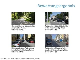
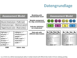
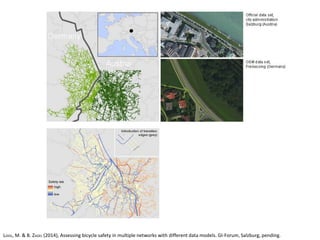
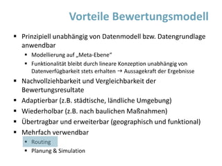
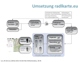
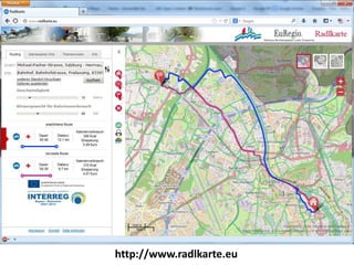
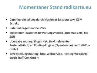
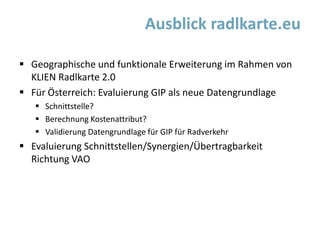


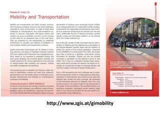
Das Dokument beschreibt ein indikatoren-basiertes Bewertungsmodell zur Entwicklung geeigneter Produkte für Radfahrer in Österreich durch die Integration von Geodaten und der Geographenintegrationsplattform. Es betont die Anwendbarkeit des Modells unabhängig von der Datengrundlage sowie die Vorteile für die Planung und Simulation von Radverkehr. Ziel ist eine Verbesserung der Radverkehrssicherheit und der Attraktivität von Radrouten.


