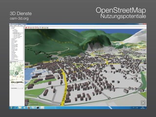
Als PDF, PPTX herunterladen


![„
Volunteered
Geographic
Information
[...] the widespread engagement of large numbers of private citizens,
often with little in the way of formal qualifications, in the creation of
geographic information, a function that for centuries has been
reserved to official agencies. They are largely untrained and their
actions are almost always voluntary, and the results may or may not
be accurate.
Goodchild, M. (2007): Citizens as sensors:
The world of volunteered geography.
GeoJournal, 69, 211-221.](https://image.slidesharecdn.com/preasentationkurz-110531103854-phpapp02/85/Volunteered-Geographic-Information-8-320.jpg)


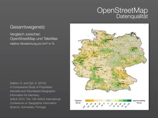
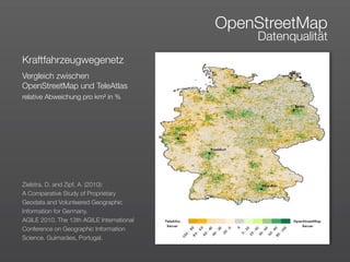
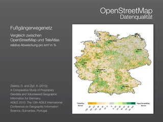
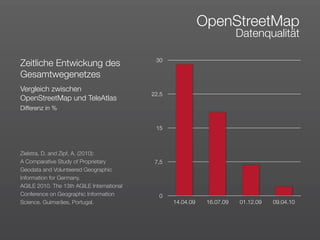
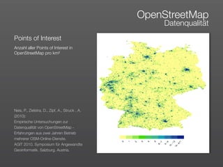

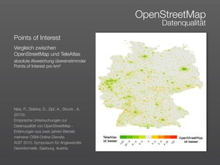
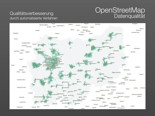
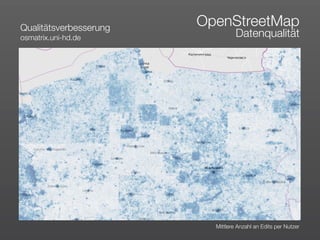

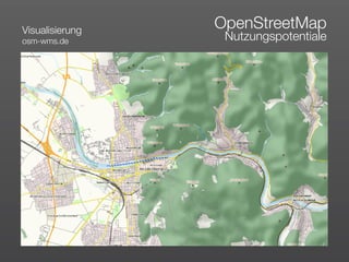
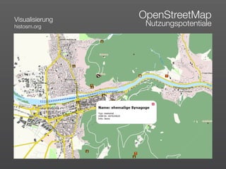
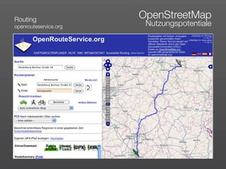
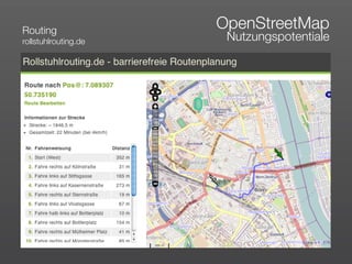
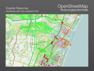
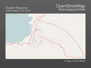
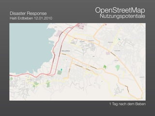
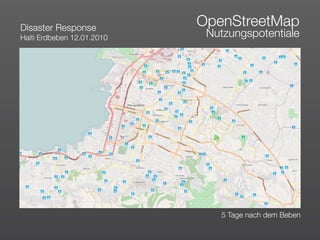
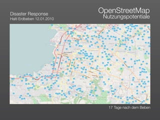


Das Dokument erörtert die Nutzung und Datenqualität von freiwilligen geographischen Informationen, insbesondere am Beispiel von OpenStreetMap, einer Plattform, die Bürger zur Erstellung geographischer Daten einlädt. Es werden Vergleiche zwischen OpenStreetMap und proprietären Geodaten sowie deren Anwendungsfälle in verschiedenen Bereichen, einschließlich Katastrophenreaktion und Routing, angesprochen. Eine Analyse der Datenqualität zeigt relative Abweichungen und Verbesserungspotentiale auf, die durch automatisierte Verfahren erzielt werden können.


