Presentación webinar 2017 Panamá
•Als PPTX, PDF herunterladen•
0 gefällt mir•341 views

Community monitoring of forests in indigenous territories in Panama

Empfohlen
Empfohlen
Weitere ähnliche Inhalte
Was ist angesagt?
Was ist angesagt? (20)
Ähnlich wie Presentación webinar 2017 Panamá
Ähnlich wie Presentación webinar 2017 Panamá (20)
Mehr von Centro de Excelencia Virtual en Monitoreo Forestal
Mehr von Centro de Excelencia Virtual en Monitoreo Forestal (20)
Kürzlich hochgeladen
Kürzlich hochgeladen (20)
Presentación webinar 2017 Panamá
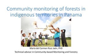
- 1. Community monitoring of forests in indigenous territories in Panama María del Carmen Ruiz Jaén, PhD Technical advisor in Community-based Monitoring and Forestry
- 2. Outline • Context • Community forest monitoring • Goals • Activities • Tools • Drones • Learned lessons
- 3. Population: 3.8 Millons Area: 74,491 km2 Forest cover: 60% 12 indigenous territories > 35% of the forests are in indigenous territories Forests and indigenous territories Indigenous territories Forest No forest Forest cover map of Panama for 2012., RapidEye Context
- 4. Context • Panama is advancing in the development of a National Forest Monitoring System (SNMB). • The SNMB was defined as a multipurpose system that provides key information for REDD + and for the monitoring of forest resources in general. • in conjunction with the National Coordinator of Indigenous Peoples of Panama (COONAPIP) and the Ministry of Environment of Panama (MIAMBIENTE), a project was carried out for the community management and monitoring of forests in indigenous territories
- 5. Community forest monitoring - Activities • Capacity development of indigenous technicians in the areas of remote sensing of geographic information systems (GIS) and forest and carbon inventories. • Generation of geo-referenced information among the different indigenous territories, using a standardized methodology and, at the same time, serving the specific needs of each territory. • Standardization of the storage of remote sensing data at different scales and processing of field-collected information that is reliable and truthful.
- 6. Community forest monitoring - Activities • Drafting of the first draft of the community intellectual property protocol on traditional knowledge of flora species and collecting reference plant material in indigenous territories. • Training on methodology and measurements for the National Forest and Carbon Inventory of Panama (INFC) and collection of forest data in indigenous territories.
- 7. Community forest monitoring - Tools • Open source software: Google Engine, QGIS, ODK • Georeferenced database with satellite information and forest inventories • Drones • Equipment for collecting forest information
- 8. Drones This technology allows: 1. The monitoring of areas with continuous cloud permanence 2. To be economically efficient for the monitoring of inaccessible areas and with little visual coverage 3. Be easy to learn and to generate reliable results 4. Empowering communities to use the tool from their own capacities, since it can be monitored when needed 5. Optimize surveillance: The evidence gathered can be useful for legal proceedings.
- 9. Drones - model chosen • Fixed Wing Equipment, Model E384 which is designed for photogrammetry and mapping applications and was chosen for: • being easy to use, • easy to repair and very light, and • can cover large distances in a single flight. • This model also makes it possible to carry out, specifically, flight plans and post-processing for the monitoring of the earth.
- 10. Drones - Main features Physical characteristics Operational characteristics Dimensions: 71 "(180cm) width of wings 51 "(129 cm) long Cruising speed: 27 mph (44Km / h) Weight: 5 lb (2.3 kg) Flight time: 100-120 minutes Maximum load capacity: 2.2 lb (1 kg) Range: 40-54 mi (64 to 85 km) Flight battery: 4 cells, 8.0 Ah Climate: autonomous operation up to 25 mph (40 km / h) Pixhawk autopilot, includes GPS Modes of operation: assisted, automatic and autonomous mode Remote control: Spektrum DX5e Real-time telemetry station on a laptop up to 10 km Telemetry Options: 433MHz and 915MHz Maps up to 960 acres (3.8 km2) per flight of 5 cm / pixel Wings and body can be assembled for easy portability Automatic camera control Canon S100 12.1 MP
- 11. Drones – How to prepare flights • Prepared forms: pre-flight / post-flight checklist and take-off supervision • Preparing the equipment • Assembly of the drone: assembly of fuselage, tail and elevator, wings, elastic bands to fix, camera, cable connections, battery of the drone and, finally, the motor propeller. • Connection to telemetry and flight mission planning • Create the flight plan: • search the site of interest, • create the polygon of the area to be flown and • generate flight lines (Software: The Mission Planner )
- 12. Drones – How to analyze data? • Process digital information, georeferenced orthomosaics (Software Agisoft) • Products preparation of maps for decision making (Software QGis, Google Earth Engine, etc)
- 13. Learned lessons - Limitations • there was an unanticipated limitation related to the participation of women in training activities. • The project also presented some challenges related to the forest monitoring system, such as: • System sustainability • Credibility of the information generated at community level for the national authorities • Comparability of information • Incorporation into the National Forest Monitoring System and Nationally Determined Contributions (NDC)
- 14. Learned lessons - Impact The monitoring component of forests in indigenous communities has greatly aided global monitoring and has helped meet the demands of the REDD program at the national level. Those areas of the forests that belonged to indigenous territories had not been covered by pre-project monitoring.
- 15. Learned lessons - Impact Communities can use data and information to dismantle and report illegal logging operations, but also to monitor fires, harvesting of crops, water resources, etc. The use of the data depends on the decisions of the indigenous authorities. Emphasis on the capacity development: Indigenous communities have been trained in the use of drones and other technologies to monitor changes in land use and coverage of all areas
- 16. Learned lessons - Innovation and success factors • With the new knowledge and equipment available, communities can generate very accurate data that help them make decisions and manage their territory. • But beyond technology, it has been the people involved in the project who have pulled it off. • The practice has had positive results, thanks to the close collaboration with COONAPIP and the technicians chosen by the traditional authorities of the indigenous territories.
- 17. Learned lessons • COONAPIP was the initial driver and focus at each stage of the project and the link between all the parties involved. They also supported the Prior Informed Consent (FPIC) process before starting any activity in indigenous communities. • Indigenous technicians also played a key role in the project. A bond and a network have been created, after having conducted various activities throughout the year.
- 18. Learned lessons • The continuity of the project with different sources of funding, created a favorable environment for the understanding and dialogue among stakeholders to identify issues in their territories. • Replicate and/or advance With the support of FAO, two indigenous technicians conducted two workshops on the use of drones in Guatemala. During 2017, a workshop will also be held in Paraguay, to share the experience with the indigenous communities of that country.
Hinweis der Redaktion
- According to FAO's 2015 Global Forest Resources Assessment, between 2010 and 2015, 16,400 hectares of forest per year were lost (equivalent to 90,000 soccer fields per year) Deforestation and the loss of ecosystem services associated with forests represent the loss of natural capital from which the livelihoods of local communities and indigenous peoples depend More than half of the Panamanian territory is covered by forests and indigenous peoples, the main inhabitants of these areas, play a vital role in the care and monitoring of this important resource for food security.
- based on parameters such as camera, flight altitude, desired resolution of images, 60% photo overlap (recommended), available battery time and others. manual describes in detail the procedures to follow with the application.
- based on parameters such as camera, flight altitude, desired resolution of images, 60% photo overlap (recommended), available battery time and others. manual describes in detail the procedures to follow with the application.
- At first there were women participating in the training, but at the end of the activities they had stopped attending. So far we have not identified the specific reasons why women left the project and how we could reverse the situation. What is clear is that the gender approach in the project was poorly developed and this should be prioritized in future actions.