Modern Surveying
•
115 gefällt mir•174,475 views

The document discusses the topic of surveying. It provides an overview of the history and evolution of surveying, from its beginnings in ancient Egypt to modern techniques using tools like total stations and GPS. Some key points covered include the various types and categories of surveying work, the traditional equipment used, and how modern digital instruments like total stations integrate distance measurement and angle measurement capabilities into one device.

Empfohlen
Weitere ähnliche Inhalte
Was ist angesagt?
Was ist angesagt? (20)
Andere mochten auch
Andere mochten auch (20)
Ähnlich wie Modern Surveying
Ähnlich wie Modern Surveying (20)
Mehr von Shanmugaraj M
Kürzlich hochgeladen
Kürzlich hochgeladen (20)
Modern Surveying
- 1. infinity-project.org The Caruth Institute for Engineering Education Engineering Education for today’s classroom. M.Shanmugaraj Lec/Civil VSVN POLYTECHNIC COLLEGE., VIRUDHUNAGAR DEPARTMENT OF CIVIL ENGINEERING MODERN SURVEYING
- 2. infinity-project.org The Caruth Institute for Engineering Education Engineering Education for today’s classroom. M.Shanmugaraj Lec/Civil VSVN POLYTECHNIC COLLEGE., VIRUDHUNAGAR DEPARTMENT OF CIVIL ENGINEERING SURVEYING Surveying is the science and art of determining the relative positions of points above, on, or beneath the earth’s surface and locating the points in the field.
- 3. infinity-project.org The Caruth Institute for Engineering Education Engineering Education for today’s classroom. M.Shanmugaraj Lec/Civil VSVN POLYTECHNIC COLLEGE., VIRUDHUNAGAR DEPARTMENT OF CIVIL ENGINEERINGThe work of the surveyor consists of 5 phases 1.Decision Making–selecting method, equipment and final point locations. 2.Fieldwork & Data Collection–making measurements and recording data in the field. 3.Computing & Data Processing–preparing calculations based upon the recorded data to determine locations in a useable form. 4.Mapping or Data Representation–plotting data to produce a map, plat, or chart in the proper form. 5.Stakeout –locating and establishing monuments or stakes in the proper locations in the field.
- 4. infinity-project.org The Caruth Institute for Engineering Education Engineering Education for today’s classroom. M.Shanmugaraj Lec/Civil VSVN POLYTECHNIC COLLEGE., VIRUDHUNAGAR DEPARTMENT OF CIVIL ENGINEERING Categories of Surveying 1.Plane Surveying–surveying with the reference base for fieldwork and computations are assumed to be a flat horizontal surface. 2.Geodetic Surveying–surveying technique to determine relative positions of widely spaced points, lengths, and directions which require the consideration of the size and shape of the earth. (Takes the earth’s curvature into account.)
- 5. infinity-project.org The Caruth Institute for Engineering Education Engineering Education for today’s classroom. M.Shanmugaraj Lec/Civil VSVN POLYTECHNIC COLLEGE., VIRUDHUNAGAR DEPARTMENT OF CIVIL ENGINEERING Types of Surveys 1.Photogrammetry–mapping utilizing data obtained by camera or other sensors carried in airplanes or satellites. 2.Boundary Surveying–establishing property corners, boundaries, and areas of land parcels. 3.Engineering Surveying–providing points and elevations for the building Civil Engineering projects 4.Topographic Surveying–collecting data and preparing maps showing the locations of natural man-made features and elevations of points of the ground. 5.Route Surveys–topographic and other surveys for long –narrow projects associated with Civil Engineering projects (Highways, railroads, pipelines) 6.Hydrographic Surveying–mapping of shorelines and the bottom of bodies of water.
- 6. infinity-project.org The Caruth Institute for Engineering Education Engineering Education for today’s classroom. M.Shanmugaraj Lec/Civil VSVN POLYTECHNIC COLLEGE., VIRUDHUNAGARDEPARTMENT OF CIVIL ENGINEERING Brief History of Surveying 1.Surveying had it’s beginning in Egypt about 1400 BC 2.Greeks: expanded Egyptian work and developed Geometry 3.Romans: developed surveying into a science to create the Roman roads, aqueducts, and land division systems. 4.Middle Ages: land division of Romans continued in Europe. 5.18th & 19th Century in the New World: the need for mapping and marking land claims caused extensive surveying, especially by the English. 6.20thCentury and Beyond: As technology advanced, population increased, and land value caused development of licensure for surveyors in all countries
- 7. infinity-project.org The Caruth Institute for Engineering Education Engineering Education for today’s classroom. M.Shanmugaraj Lec/Civil VSVN POLYTECHNIC COLLEGE., VIRUDHUNAGAR DEPARTMENT OF CIVIL ENGINEERING Old Equipments •Chain. •Ranging. •Cross Staff. •Steel band. •Tape. •Plane tables. •Compass. •Levelling. •Theodolites. (Vernier & Micrometer) •Tacheometer.
- 8. infinity-project.org The Caruth Institute for Engineering Education Engineering Education for today’s classroom. M.Shanmugaraj Lec/Civil VSVN POLYTECHNIC COLLEGE., VIRUDHUNAGAR DEPARTMENT OF CIVIL ENGINEERING Modern Surveying •By the 1970’s, relatively small, lightweight and easy-to-use electronic distance measuring devices, called EDM’s were in use. •The advance of technology and miniaturization of electronic components enabled the building of theodolites that measure angles electronically, called Electronic Theodolite •Combination of an electronic theodolite and electronic distance meter, and software running on an external laptop computer known as a data collector, called Total Station •The Global Positioning System (GPS)was designed for military applications. Its primary purpose was to allow soldiers to keep track of their position and to assist in guiding weapons to their targets •A computerized data base management system for capture, storage, retrieval, analysis, and display of spatial data, called GIS
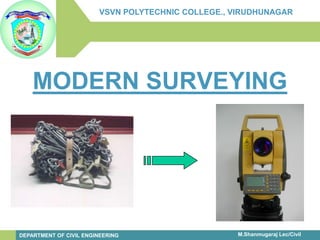
- 9. infinity-project.org The Caruth Institute for Engineering Education Engineering Education for today’s classroom. M.Shanmugaraj Lec/Civil VSVN POLYTECHNIC COLLEGE., VIRUDHUNAGAR DEPARTMENT OF CIVIL ENGINEERING Modern Surveying
- 10. infinity-project.org The Caruth Institute for Engineering Education Engineering Education for today’s classroom. M.Shanmugaraj Lec/Civil VSVN POLYTECHNIC COLLEGE., VIRUDHUNAGAR DEPARTMENT OF CIVIL ENGINEERING Modern Surveying
- 11. infinity-project.org The Caruth Institute for Engineering Education Engineering Education for today’s classroom. M.Shanmugaraj Lec/Civil VSVN POLYTECHNIC COLLEGE., VIRUDHUNAGAR DEPARTMENT OF CIVIL ENGINEERING Modern equipments •Electronic Theodolite •EDM –Electronic distance measurement eqp. •Auto Level. •Digital Level. •Laser Level. •Laser Distance meter •Total station. •GPS –global positioning system.
- 12. infinity-project.org The Caruth Institute for Engineering Education Engineering Education for today’s classroom. M.Shanmugaraj Lec/Civil VSVN POLYTECHNIC COLLEGE., VIRUDHUNAGAR DEPARTMENT OF CIVIL ENGINEERING Modern equipments
- 13. infinity-project.org The Caruth Institute for Engineering Education Engineering Education for today’s classroom. M.Shanmugaraj Lec/Civil VSVN POLYTECHNIC COLLEGE., VIRUDHUNAGAR DEPARTMENT OF CIVIL ENGINEERING Modern equipments
- 14. infinity-project.org The Caruth Institute for Engineering Education Engineering Education for today’s classroom. M.Shanmugaraj Lec/Civil VSVN POLYTECHNIC COLLEGE., VIRUDHUNAGAR DEPARTMENT OF CIVIL ENGINEERING Modern equipments
- 15. infinity-project.org The Caruth Institute for Engineering Education Engineering Education for today’s classroom. M.Shanmugaraj Lec/CivilVSVN POLYTECHNIC COLLEGE., VIRUDHUNAGAR DEPARTMENT OF CIVIL ENGINEERINGModern equipments
- 16. infinity-project.org The Caruth Institute for Engineering Education Engineering Education for today’s classroom. M.Shanmugaraj Lec/Civil VSVN POLYTECHNIC COLLEGE., VIRUDHUNAGAR DEPARTMENT OF CIVIL ENGINEERING Electronic Thoedolite •For precise surveys the vernier theodolites are replaced by modern theodolites such as optical and electronic theodolites. •The electronic theodolites have optical system to scan both horizontal and vertical circles and display them digitally on a screen
- 17. infinity-project.org The Caruth Institute for Engineering Education Engineering Education for today’s classroom. M.Shanmugaraj Lec/Civil VSVN POLYTECHNIC COLLEGE., VIRUDHUNAGAR DEPARTMENT OF CIVIL ENGINEERING EDM (Electronic Distance meter) 1.EDMis Electronic Distance meter 2.Measurement of distance is done by a modulated microwaveor infraredcarrier signal 3.The distance is determined by emitting and receiving multiple frequencies, and determining the integer number of wavelengthsto the target for each frequency
- 18. infinity-project.org The Caruth Institute for Engineering Education Engineering Education for today’s classroom. M.Shanmugaraj Lec/Civil VSVN POLYTECHNIC COLLEGE., VIRUDHUNAGAR DEPARTMENT OF CIVIL ENGINEERING Auto Level •Now most commonly used levelling instruments are -Auto level. •Auto level, as name sounds it has a auto level compensator and corrects automatically if instrument goes out of level within it’s range. •With auto level:- 1.Survey work can be done fast, 2.Less chances of error, 3.Magnification available is more, 4.Range is more, 5.Image is erect so less chances of error.
- 19. infinity-project.org The Caruth Institute for Engineering Education Engineering Education for today’s classroom. M.Shanmugaraj Lec/Civil VSVN POLYTECHNIC COLLEGE., VIRUDHUNAGAR DEPARTMENT OF CIVIL ENGINEERING Digital Level •They are not popular instead auto levels are more extensively used. •The Trimble DiNi Digital Level : Determine accurate height information 60% faster than with automatic leveling •Eliminate errors and reduce rework with digital readings •Transfer data to the office easily •Measure to a field of just 30 cm
- 20. infinity-project.org The Caruth Institute for Engineering Education Engineering Education for today’s classroom. M.Shanmugaraj Lec/Civil VSVN POLYTECHNIC COLLEGE., VIRUDHUNAGAR DEPARTMENT OF CIVIL ENGINEERINGLaser Level •The word laseris an acronym for Light Amplification by Stimulated Emission of Radiation and is the name applied to an intense beam of highly monochromatic, coherent light. •Laser rangefinders use these relationships to calculate Distance •Distance = speed of light * (time/2) •The time refers to time of pulse to go from the instrument to the tree and back again
- 21. infinity-project.org The Caruth Institute for Engineering Education Engineering Education for today’s classroom. M.Shanmugaraj Lec/Civil VSVN POLYTECHNIC COLLEGE., VIRUDHUNAGAR DEPARTMENT OF CIVIL ENGINEERING Laser Distance meter •By using this Laser distance meter we can calculate the distance, area and volume accurately •We can use this in night also
- 22. infinity-project.org The Caruth Institute for Engineering Education Engineering Education for today’s classroom. M.Shanmugaraj Lec/Civil VSVN POLYTECHNIC COLLEGE., VIRUDHUNAGAR DEPARTMENT OF CIVIL ENGINEERING GPS –Global Positioning System. What is GPS •GPS, which stands for Global Positioning System, is the only system today able to show you your exact position on the Earth anytime, in any weather, anywhere. •Global Positioning System –A network of satellites (24 total –21 in use, 3 spares) that continuously transmit coded information, which makes it possible to precisely identify locations on earth by measuring distance from the satellites.
- 23. infinity-project.org The Caruth Institute for Engineering Education Engineering Education for today’s classroom. M.Shanmugaraj Lec/CivilVSVN POLYTECHNIC COLLEGE., VIRUDHUNAGAR DEPARTMENT OF CIVIL ENGINEERINGGPS –Global Positioning System.
- 24. infinity-project.org The Caruth Institute for Engineering Education Engineering Education for today’s classroom. M.Shanmugaraj Lec/Civil VSVN POLYTECHNIC COLLEGE., VIRUDHUNAGAR DEPARTMENT OF CIVIL ENGINEERING
- 25. infinity-project.org The Caruth Institute for Engineering Education Engineering Education for today’s classroom. M.Shanmugaraj Lec/Civil VSVN POLYTECHNIC COLLEGE., VIRUDHUNAGAR DEPARTMENT OF CIVIL ENGINEERING
- 26. infinity-project.org The Caruth Institute for Engineering Education Engineering Education for today’s classroom. M.Shanmugaraj Lec/Civil VSVN POLYTECHNIC COLLEGE., VIRUDHUNAGARDEPARTMENT OF CIVIL ENGINEERING
- 27. infinity-project.org The Caruth Institute for Engineering Education Engineering Education for today’s classroom.
- 28. infinity-project.org The Caruth Institute for Engineering Education Engineering Education for today’s classroom.
- 29. infinity-project.org The Caruth Institute for Engineering Education Engineering Education for today’s classroom.
- 30. infinity-project.org The Caruth Institute for Engineering Education Engineering Education for today’s classroom.
- 31. infinity-project.org The Caruth Institute for Engineering Education Engineering Education for today’s classroom. M.Shanmugaraj Lec/Civil VSVN POLYTECHNIC COLLEGE., VIRUDHUNAGAR DEPARTMENT OF CIVIL ENGINEERING EDM + Theodolite •EDM is used to measure the horizontal distances. •Some EDM are attached with electronics theodolite which has the adapter system. •Some are advanced models which itself reads the distance without theodolite
- 32. infinity-project.org The Caruth Institute for Engineering Education Engineering Education for today’s classroom. M.Shanmugaraj Lec/Civil VSVN POLYTECHNIC COLLEGE., VIRUDHUNAGAR DEPARTMENT OF CIVIL ENGINEERING Total Station •A Total stationintegrates the functions of a Electronic theodolitefor measuring angles, an EDMfor measuring distances, digital data and a data recorder •Angles and distances, coordinates and height differences and many other items can be computed, displayed and stored into internal memory.
- 33. infinity-project.org The Caruth Institute for Engineering Education Engineering Education for today’s classroom. M.Shanmugaraj Lec/CivilVSVN POLYTECHNIC COLLEGE., VIRUDHUNAGAR DEPARTMENT OF CIVIL ENGINEERINGFeatures of Total Station •Total solution for surveying work, •Most accurate and user friendly, •Gives position of a point (x, y and z) w. r. t. known point (base point), •Compatibility with computers, •Measures distance and angles and displays coordinates, •Auto level compensator is available, •Can work in lesser visibility also, •Can measure distances even without prismatic target for lesser distances, •Is water proof, •On board software are available, •Can be used for curve layout after feeding data
- 34. infinity-project.org The Caruth Institute for Engineering Education Engineering Education for today’s classroom. M.Shanmugaraj Lec/Civil VSVN POLYTECHNIC COLLEGE., VIRUDHUNAGAR DEPARTMENT OF CIVIL ENGINEERING Features of Total Station •New total stationshave atmospheric correction, and auto-focus. •In addition, these series incorporates a quick distance measuring mode and a high data storage capacity for increased productivity. •The new Total stationgives the unique opportunity for long range distance monitoring of up to 9000m to a single prism. •Using the scan functionality of software allows fully automated monitoring of the prism in direction of the line of sight.
- 35. infinity-project.org The Caruth Institute for Engineering Education Engineering Education for today’s classroom. M.Shanmugaraj Lec/Civil VSVN POLYTECHNIC COLLEGE., VIRUDHUNAGAR DEPARTMENT OF CIVIL ENGINEERINGParts of Total Station
- 36. infinity-project.org The Caruth Institute for Engineering Education Engineering Education for today’s classroom. M.Shanmugaraj Lec/Civil VSVN POLYTECHNIC COLLEGE., VIRUDHUNAGAR DEPARTMENT OF CIVIL ENGINEERINGParts of Total Station
- 37. infinity-project.org The Caruth Institute for Engineering Education Engineering Education for today’s classroom. Parts of Total Station
- 38. infinity-project.org The Caruth Institute for Engineering Education Engineering Education for today’s classroom.
- 39. infinity-project.org The Caruth Institute for Engineering Education Engineering Education for today’s classroom. M.Shanmugaraj Lec/Civil VSVN POLYTECHNIC COLLEGE., VIRUDHUNAGAR DEPARTMENT OF CIVIL ENGINEERINGAccessories of Total Station
- 40. infinity-project.org The Caruth Institute for Engineering Education Engineering Education for today’s classroom. M.Shanmugaraj Lec/Civil VSVN POLYTECHNIC COLLEGE., VIRUDHUNAGAR DEPARTMENT OF CIVIL ENGINEERINGAccessories of Total Station
- 41. infinity-project.org The Caruth Institute for Engineering Education Engineering Education for today’s classroom. M.Shanmugaraj Lec/Civil VSVN POLYTECHNIC COLLEGE., VIRUDHUNAGAR DEPARTMENT OF CIVIL ENGINEERINGAccessories of Total Station
- 42. infinity-project.org The Caruth Institute for Engineering Education Engineering Education for today’s classroom. M.Shanmugaraj Lec/Civil VSVN POLYTECHNIC COLLEGE., VIRUDHUNAGAR DEPARTMENT OF CIVIL ENGINEERING Total Station Companies •Sokkia •Leica •Trimble •Pentax •Topcon •Nikon •Sanding •Focus •GeoMax Positioning •Kolida •CST •South •Ruide
- 43. infinity-project.org The Caruth Institute for Engineering Education Engineering Education for today’s classroom. M.Shanmugaraj Lec/Civil VSVN POLYTECHNIC COLLEGE., VIRUDHUNAGARDEPARTMENT OF CIVIL ENGINEERINGNormal Accuracy and ranges of total stations Angular accuracy up to 1” Distance measured with laser up to 2 KM Distance measured with infrared rays up to 4 KM.( with single prism) Capable of storing up to 20,000 points.
- 44. infinity-project.org The Caruth Institute for Engineering Education Engineering Education for today’s classroom. M.Shanmugaraj Lec/CivilVSVN POLYTECHNIC COLLEGE., VIRUDHUNAGAR DEPARTMENT OF CIVIL ENGINEERING Basic Principle of Total Stations 1.These instruments are measuring the distances of prism poles mounted with prisms with the help of Laser beam or Infrared rays. 2.These signals are emitted by the instrument EDM and reflected back to instruments by the prism mounted on the prism poles. 3.The time interval between emission and reception helps to calculate the distance as the speed of these signals are precisely known. D = (t/2) x v D-Distance, t-Total time taken, v-Velocity
- 45. The Caruth Institute for Engineering Education infinity-project.org Engineering Education for today’s classroom. M.Shanmugaraj Lec/Civil VSVN POLYTECHNIC COLLEGE., VIRUDHUNAGAR DEPARTMENT OF CIVIL ENGINEERING Inside Total Station
- 46. infinity-project.org The Caruth Institute for Engineering Education Engineering Education for today’s classroom. M.Shanmugaraj Lec/CivilVSVN POLYTECHNIC COLLEGE., VIRUDHUNAGARDEPARTMENT OF CIVIL ENGINEERINGInside Total Station
- 47. infinity-project.org The Caruth Institute for Engineering Education Engineering Education for today’s classroom. M.Shanmugaraj Lec/Civil VSVN POLYTECHNIC COLLEGE., VIRUDHUNAGAR DEPARTMENT OF CIVIL ENGINEERINGSetting up of Total Station Centering: •Place the legs at equal intervals and the head is approximately level •Fix the tripod shoes in the ground •Place the instrument on the tripod stand •Supporting the instrument with one hand, tighten the centering screw on the bottom of the unit •Looking through the optical plummet eye piece •focus on the Surveying point
- 48. infinity-project.org The Caruth Institute for Engineering Education Engineering Education for today’s classroom. M.Shanmugaraj Lec/CivilVSVN POLYTECHNIC COLLEGE., VIRUDHUNAGARDEPARTMENT OF CIVIL ENGINEERINGSetting up of Total Station Levelling: •Adjust the foot screws to center the surveying •point in the optical plummet reticule •Center the bubble in the circular level by shortening or by lengthening the tripod leg •Turn the leveling screws until the bubble is centered in the center circle •Loosen the horizontal clamp to turn the upper part of the instrument until the plate level is parallel to a line between leveling foot screws A & B •Center the air bubble using leveling foot screws A & Bsimultaneously •Turn the upper part of the instrument through 900 •The plate level is now perpendicular to the foot screws A & B •Center the air bubble using leveling foot screw C
- 49. infinity-project.org The Caruth Institute for Engineering Education Engineering Education for today’s classroom. M.Shanmugaraj Lec/CivilVSVN POLYTECHNIC COLLEGE., VIRUDHUNAGARDEPARTMENT OF CIVIL ENGINEERINGSetting up of Total Station Levelling the Screen: •Press [ON] to power on •Press [TILT]in the second page of Measmode to display the circular level on the screen •Center the bubble in the circular level •Set the tilt angle to 00 using foot screws A & B •for the Xdirection and leveling screw Cfor Y direction
- 50. infinity-project.org The Caruth Institute for Engineering Education Engineering Education for today’s classroom. M.Shanmugaraj Lec/CivilVSVN POLYTECHNIC COLLEGE., VIRUDHUNAGARDEPARTMENT OF CIVIL ENGINEERINGSetting up of Total Station Focusing and Target Sighting •Look through the telescope eyepiece at a •bright background •Turn the eyepiece clockwise, anticlockwise little by •little until just before the reticle image becomes •focused •Loosen the vertical and horizontal clamps, then use •the peep sight to bring the target in to the field of view. •Tight both clamps •Turn the telescope focusing ring to focus on the target •Turn the vertical and horizontal and vertical fine motion screws to align the target with the reticle •Readjust the focus with the focusing ring until there is no parallax between the target image and the reticle
- 51. infinity-project.org The Caruth Institute for Engineering Education Engineering Education for today’s classroom. M.Shanmugaraj Lec/CivilVSVN POLYTECHNIC COLLEGE., VIRUDHUNAGARDEPARTMENT OF CIVIL ENGINEERINGSetting up of Total Station Eliminating parallax •This is the relative displacement of the target image with respect to the reticle when the observer’s head is moved slightly before the eyepiece. •Parallax can be removed by focusing the reticle
- 52. infinity-project.org The Caruth Institute for Engineering Education Engineering Education for today’s classroom. M.Shanmugaraj Lec/CivilVSVN POLYTECHNIC COLLEGE., VIRUDHUNAGARDEPARTMENT OF CIVIL ENGINEERINGFormat of Storage in Total Station 1.Point Id 2.Easting (x –Coordinate) 3.Northing (y –Coordinate) 4.Elevation (z-Coordinate) 5.Point code [String like TR for tree CW for compound wall etc]
- 53. infinity-project.org The Caruth Institute for Engineering Education Engineering Education for today’s classroom. M.Shanmugaraj Lec/CivilVSVN POLYTECHNIC COLLEGE., VIRUDHUNAGARDEPARTMENT OF CIVIL ENGINEERINGFormat of Storage in Total Station The format of storage followed by the Instrument is as follows Point ID (May be Number or String), Easting (X_Coordinate), Northing (Y_Coordinate), Elevation (Z_Coordinate), Point Code (‘TR’ for Tree, etc,.)
- 54. infinity-project.org The Caruth Institute for Engineering Education Engineering Education for today’s classroom. M.Shanmugaraj Lec/CivilVSVN POLYTECHNIC COLLEGE., VIRUDHUNAGARDEPARTMENT OF CIVIL ENGINEERINGSoft key Allocation of Total Station
- 55. infinity-project.org The Caruth Institute for Engineering Education Engineering Education for today’s classroom. M.Shanmugaraj Lec/CivilVSVN POLYTECHNIC COLLEGE., VIRUDHUNAGARDEPARTMENT OF CIVIL ENGINEERING Soft key Allocation of Total Station
- 56. infinity-project.org The Caruth Institute for Engineering Education Engineering Education for today’s classroom. M.Shanmugaraj Lec/CivilVSVN POLYTECHNIC COLLEGE., VIRUDHUNAGARDEPARTMENT OF CIVIL ENGINEERINGSoft key Allocation of Total Station
- 57. infinity-project.org The Caruth Institute for Engineering Education Engineering Education for today’s classroom. M.Shanmugaraj Lec/Civil VSVN POLYTECHNIC COLLEGE., VIRUDHUNAGARDEPARTMENT OF CIVIL ENGINEERINGSoft key Allocation of Total Station
- 58. infinity-project.org The Caruth Institute for Engineering Education Engineering Education for today’s classroom. M.Shanmugaraj Lec/CivilVSVN POLYTECHNIC COLLEGE., VIRUDHUNAGARDEPARTMENT OF CIVIL ENGINEERINGSetting Horizontal Angle to a Required Value (Horizontal Angle Hold) Procedure 1.Sight the first target 2.Select (H.Angle)from (Meas)Mode 3.Press (H.Angle) select Angle 4.Enter the required angle then press OK 1.The input value is displayed 2.Sight the second target 3.The horizontal angle from the value set to the second target is displayed
- 59. infinity-project.org The Caruth Institute for Engineering Education Engineering Education for today’s classroom. M.Shanmugaraj Lec/CivilVSVN POLYTECHNIC COLLEGE., VIRUDHUNAGARDEPARTMENT OF CIVIL ENGINEERINGDistance and Angle Measurement By using (DIST)function angle, distance can be measured Procedure 1. Sight the target 2. In the first page of Measmode, press (DIST) to start distance measurement 3. When measurement starts, EDM information (distance mode, prism constant correction value, atmospheric correction factor) is represented by a flashing light. 4. A short beep sounds, and the measured distance data (S), vertical angle (ZA) and horizontal angle (HAR)are displayed 5. Press (STOP) to quit distance measurement. 6. Press (<SHV)S (slope dist.), H (horizontal dist.), V (ht diff) are displayed
- 60. infinity-project.org The Caruth Institute for Engineering Education Engineering Education for today’s classroom. M.Shanmugaraj Lec/CivilVSVN POLYTECHNIC COLLEGE., VIRUDHUNAGARDEPARTMENT OF CIVIL ENGINEERINGRemote Elevated Measurement (REM) An REMis a function used to measure the height to a point where a target cannot be directly installed such as power lines, overhead cables etc.,
- 61. infinity-project.org The Caruth Institute for Engineering Education Engineering Education for today’s classroom. M.Shanmugaraj Lec/CivilVSVN POLYTECHNIC COLLEGE., VIRUDHUNAGAR DEPARTMENT OF CIVIL ENGINEERINGMissing Line Measurement (MLM) Missing line measurement is used to measure the slope distance, horizontal distance, and horizontal angle from the target whish is the reference (starting point) without moving the instrument. It is possible to change the last measured point to the next starting position. Measurement result can be displayed as the gradient between two points.
- 62. infinity-project.org The Caruth Institute for Engineering Education Engineering Education for today’s classroom. M.Shanmugaraj Lec/Civil VSVN POLYTECHNIC COLLEGE., VIRUDHUNAGAR DEPARTMENT OF CIVIL ENGINEERINGCo-ordinate Measurement (COORD) By performing coordinate measurements it is possible to find the 3-dimensional coordinates of the target based on station point coordinates, instrument height, target height, and azimuth angles of the backsight which are entered in advance
- 63. infinity-project.org The Caruth Institute for Engineering Education Engineering Education for today’s classroom. M.Shanmugaraj Lec/Civil VSVN POLYTECHNIC COLLEGE., VIRUDHUNAGAR DEPARTMENT OF CIVIL ENGINEERINGResection Measurement Resection is used to determine the coordinates of an instrument station by performing multiple measurements of points whose values are known. Registered coordinate data can be recalled and set as known point data.
- 64. infinity-project.org The Caruth Institute for Engineering Education Engineering Education for today’s classroom. M.Shanmugaraj Lec/Civil VSVN POLYTECHNIC COLLEGE., VIRUDHUNAGAR DEPARTMENT OF CIVIL ENGINEERINGSetting –Out Measurement Setting out measurement is used to set out the required point The horizontal angle difference and distance difference are calculated and displayed using the following formulae. Horizontal angle difference dHA = Horizontal angle of setting–out data–measured horizontal angle Distance difference Sdist : S-O S = measured slope distance– slope distance of setting–out data Hdist : S-O H = measured horizontal distance- horizontal distance of S-O data Vdist : S-O V = measured height difference- height difference of S-O data
- 65. infinity-project.org The Caruth Institute for Engineering Education Engineering Education for today’s classroom. M.Shanmugaraj Lec/CivilVSVN POLYTECHNIC COLLEGE., VIRUDHUNAGAR DEPARTMENT OF CIVIL ENGINEERINGSetting-Out Line Setting out line is used for setting out a required point at a designated distance from the baseline and for finding the distance from the baseline to a measured point.
- 66. infinity-project.org The Caruth Institute for Engineering Education Engineering Education for today’s classroom. M.Shanmugaraj Lec/CivilVSVN POLYTECHNIC COLLEGE., VIRUDHUNAGAR DEPARTMENT OF CIVIL ENGINEERINGSetting –Out Arc This mode allows us to define an arc from various arc parameters, such as From Pt coordinates, and set out this arc as well as points (offsets) along
- 67. infinity-project.org The Caruth Institute for Engineering Education Engineering Education for today’s classroom. M.Shanmugaraj Lec/CivilVSVN POLYTECHNIC COLLEGE., VIRUDHUNAGAR DEPARTMENT OF CIVIL ENGINEERINGOffset Measurement Offset measurements are performed in order to find a point where a target cannot be installed directly or to find the distance and angle to a point which cannot be sighted
- 68. infinity-project.org The Caruth Institute for Engineering Education Engineering Education for today’s classroom. M.Shanmugaraj Lec/Civil VSVN POLYTECHNIC COLLEGE., VIRUDHUNAGAR DEPARTMENT OF CIVIL ENGINEERINGSurface Area Calculation This function can calculate the area of land enclosed by three or more known points on a line by inputting the coordinates of the points. Surface area is calculated by measuring the points on a line enclosing an area in order or reading in the previously registered coordinates in order
- 69. infinity-project.org The Caruth Institute for Engineering Education Engineering Education for today’s classroom. M.Shanmugaraj Lec/Civil VSVN POLYTECHNIC COLLEGE., VIRUDHUNAGAR DEPARTMENT OF CIVIL ENGINEERINGHard wares Total station with inbuilt programmes. Tribrach with adopter to hold prism. [Optional] Prism pole, prism and target. Mini prism for setting out. Down loading cable. Plotter [A0]
- 70. infinity-project.org The Caruth Institute for Engineering Education Engineering Education for today’s classroom. M.Shanmugaraj Lec/Civil VSVN POLYTECHNIC COLLEGE., VIRUDHUNAGAR DEPARTMENT OF CIVIL ENGINEERINGDownloading Total station data by Sokkia Link Software to PC It is possible to output data within a JOB to a host Computer or Printer
- 71. infinity-project.org The Caruth Institute for Engineering Education Engineering Education for today’s classroom. M.Shanmugaraj Lec/Civil VSVN POLYTECHNIC COLLEGE., VIRUDHUNAGAR DEPARTMENT OF CIVIL ENGINEERINGPlotting Software's Plotting software’s are capable of making •Contour •Layout •LS & CS •Road estimator •Volume cutting •Volume Embankment
- 72. infinity-project.org The Caruth Institute for Engineering Education Engineering Education for today’s classroom. M.Shanmugaraj Lec/Civil VSVN POLYTECHNIC COLLEGE., VIRUDHUNAGAR DEPARTMENT OF CIVIL ENGINEERINGPlotting Software's •Autoplotter •Pythagoras •AutoCAD Civil 3D •Foresight •CDS •Survey PRO
- 73. infinity-project.org The Caruth Institute for Engineering Education Engineering Education for today’s classroom. M.Shanmugaraj Lec/Civil VSVN POLYTECHNIC COLLEGE., VIRUDHUNAGAR DEPARTMENT OF CIVIL ENGINEERINGWhat way it is different from conventional methods? These instruments have detachable bases, which help to setup quickly over station. Stand leg heights to be adjusted while setting up. Prism pole with prism in place of leveling staff or ranging rod. No need for manual measurement except the measurement of height of instrument. Battery operated (Lasts up to 7 hours) Up to 4 Km measurement with single prism. Latitude and longitudes are considered for any survey in the name of easting and northings.
- 74. infinity-project.org The Caruth Institute for Engineering Education Engineering Education for today’s classroom. M.Shanmugaraj Lec/Civil VSVN POLYTECHNIC COLLEGE., VIRUDHUNAGAR DEPARTMENT OF CIVIL ENGINEERINGWhat way it is different from conventional methods? Each point will be named with its Id/Code. No paper work, as calculations are performed automatically. Combines the use of leveling instrument , Theodolite compass etc. and does boundless operations. Surveying can be done during night hours also if the prism pole is illuminated for emergency. More costly and self lubricated. Needs one surveyor and other two persons to hold prism. Person handling these instruments need not be conversant with survey theory but essentially a computer literate and must possess sufficient aptitude.
- 75. infinity-project.org The Caruth Institute for Engineering Education Engineering Education for today’s classroom. M.Shanmugaraj Lec/Civil VSVN POLYTECHNIC COLLEGE., VIRUDHUNAGAR DEPARTMENT OF CIVIL ENGINEERINGRefractorless Total StationFor those targets such as wire pole, wire, cliff, hill,earth,timber pile, etc which are not easy or even impossible to reach, reflectorless distance measurement can complete the measurement task easily
- 76. infinity-project.org The Caruth Institute for Engineering Education Engineering Education for today’s classroom. M.Shanmugaraj Lec/Civil VSVN POLYTECHNIC COLLEGE., VIRUDHUNAGAR DEPARTMENT OF CIVIL ENGINEERING Robotic Total Station The SRX from Sokkia is a fully- robotic, fully-tracking and auto- pointing robotic total station, with on- demand target reacquisition Sokkia’s SRX has Bluetooth wireless technology for cable-free use, making this single-operator total station even more convenient.
- 77. infinity-project.org The Caruth Institute for Engineering Education Engineering Education for today’s classroom. M.Shanmugaraj Lec/CivilVSVN POLYTECHNIC COLLEGE., VIRUDHUNAGAR DEPARTMENT OF CIVIL ENGINEERING Robotic Total Station Allow 1-person operation -follows prism automatically, controlled from the pole
- 78. The Caruth Institute for Engineering Education infinity-project.org Engineering Education for today’s classroom. M.Shanmugaraj Lec/Civil VSVN POLYTECHNIC COLLEGE., VIRUDHUNAGAR DEPARTMENT OF CIVIL ENGINEERING Smart Station
- 79. infinity-project.org The Caruth Institute for Engineering Education Engineering Education for today’s classroom. M.Shanmugaraj Lec/Civil VSVN POLYTECHNIC COLLEGE., VIRUDHUNAGAR DEPARTMENT OF CIVIL ENGINEERINGSmart Station Recent developments include a GPS unit with the total station Fully integrated data storage and data processing, Bluetooth data transfer or GPRS
- 80. infinity-project.org The Caruth Institute for Engineering Education Engineering Education for today’s classroom. M.Shanmugaraj Lec/CivilVSVN POLYTECHNIC COLLEGE., VIRUDHUNAGARDEPARTMENT OF CIVIL ENGINEERING Smart Station No need for control points, long traverses or resections. Just set up SmartStation and let GPS determine the position.Then measure and stake outwith the total station. SmartStation’s modular design gives you all the options. Undertake any type of job. Save time and money. Increase your productivityand profits.