SlideShare ist ein Scribd-Unternehmen logo
1 von 23
Towards more accurate predictions of
wildfire behavior
Modeling surface/atmosphere interactions
Mélanie ROCHOUX, Ph.D.
Postdoctoral fellow
Meteorological Research Division
Introductory seminar
13 June 2014
Environnement
Canada
Environment
Canada
①➀ INTRODUCTION: Regional-scale modeling viewpoint
• Fire danger
• Multi-physics multi-scale problem
• Regional-scale modeling viewpoint
➁ Ph.D. RESEARCH: How to address modeling uncertainties?
• Data assimilation at regional scale
• Multi-physics simulation at flame scale
➂ STATE-OF-THE-ART: Fire/atmosphere coupling
• Coupling strategy
• Atmospheric emissions
• Offline simulation case
OUTLINE
Introductory seminar 2
INTRODUCTORY SEMINAR June 13, 2014Mélanie ROCHOUX
INTRODUCTION ● ● ●
Fire danger at operational level
• Global viewpoint: about 400 million hectares burnt every year
➙3 % of the Earth’s vegetation area
© NASA
Active fire map by MODIS
over a 10-day period
9-18 August 2013
• Canadian Forest Fire Weather Index System
• Fire Weather Index (FWI) ➙ numerical rating of fire potential intensity
• Daily maps of fire weather
• Main limitation ➙ meteorological index
Canadian Wildland Fire Information
System, NRCan
INTRODUCTORY SEMINAR June 13, 2014Mélanie ROCHOUX
➙ modis-fire.umd.edu/
3
INTRODUCTION ● ● ●
Fire danger at operational level
Fine fuel moisture
code (FFMC)
Duff moisture
code (DMC)
Drought Code
(DC)
FUEL
MOISTURE
CODES
FIRE WEATHER
OBSERVATION
S
FIRE
BEHAVIOR
INDICES
Air temperature
and humidity,
wind, 24-h rainfall Wind
Air temperature
and humidity, 24-
h rainfall
Air temperature,
24-h rainfall
Initial spread
index (ISI)
Buildup index
(BUI)
Fire weather index (FWI)
4
INTRODUCTORY SEMINAR June 13, 2014Mélanie ROCHOUX
• Canadian Forest Fire Weather Index System
• Fire Weather Index (FWI) ➙ numerical rating of fire potential intensity
• Daily maps of fire weather
• Main limitation ➙ meteorological index
➙ cwfis.cfs.nrcan.gc.ca/home
INTRODUCTION ● ● ●
Fire danger at operational level
Fine fuel moisture
code (FFMC)
Duff moisture
code (DMC)
Drought Code
(DC)
FUEL
MOISTURE
CODES
FIRE WEATHER
OBSERVATION
S
FIRE
BEHAVIOR
INDICES
Air temperature
and humidity,
wind, 24-h rainfall Wind
Air temperature
and humidity, 24-
h rainfall
Air temperature,
24-h rainfall
Initial spread
index (ISI)
Buildup index
(BUI)
Fire weather index (FWI)
5
INTRODUCTORY SEMINAR June 13, 2014Mélanie ROCHOUX
• Canadian Forest Fire Weather Index System
• Fire Weather Index (FWI) ➙ numerical rating of fire potential intensity
• Daily maps of fire weather
• Main limitation ➙ meteorological index
DMC: loosely compacted decomposing matter
-nominal depth 7 cm
DC: deep compact organic matter
-nominal depth 18 cm
FFMC: litter and other fine fuels
-nominal depth 1.2 cm
From Chelene Krezek-Hanes,
Great Lakes Forestry Centre,
Canadian Forest Service
➙ cwfis.cfs.nrcan.gc.ca/home
INTRODUCTION ● ● ●
Multi-physics multi-scale problem
2009 Black Saturday
bushfires
▶ 450 000 ha (1/3 of
the annual burnt area
in Australia)
▶ 173 people died
▶ strong
fire/atmosphere
coupling
300 km
© NASA
Fire/Surface
➙ Vegetation
➙ Topography
Fire/Atmosphere
➙ Dynamics
➙ Chemistry
Turbulence
Gases
& Aerosols
Wind
Biomass
combustion
Surface-
to-canopy
• Complexity of wildfire behavior
• Wide range of length-scale (from mm to km)
• Poorly-defined biomass fuels
• Atmospheric external forcing
• Climate change (megafires)
➙ CHALLENGE:
How to accurately represent
surface/atmosphere interactions
in wildfires?
6
INTRODUCTORY SEMINAR June 13, 2014Mélanie ROCHOUX
INTRODUCTION ● ● ●
Multi-physics multi-scale problem
• Complexity of wildfire behavior
• Wide range of length-scale (from mm to km)
• Poorly-defined biomass fuels
• Atmospheric external forcing
• Climate change (megafires)
➙ CHALLENGE:
How to accurately represent
surface/atmosphere interactions
in wildfires?
Radiation
Wind
Flame Pyrolysis
Heat/mass fluxes
Terrain topography
EMISSIONS
PYROLYSI
S
COMBUSTION
FLUID DYNAMICS
HEAT TRANSFER
ATMOSPHERIC
PHYSICS
7
INTRODUCTORY SEMINAR June 13, 2014Mélanie ROCHOUX
INTRODUCTION ● ● ●
Regional-scale modeling viewpoint
© FOREFIRE, Favone wildfire (30 ha)© FOREFIRE, Favone wildfire (30 ha)
Regional-scale
viewpoint
FIRE FRONT
Burnt area
Fire front
Unburnt
vegetation
TOPOGRA
PHY
Terrain slope
BIOMASS FUEL
Moisture content
Packing ratio
Layer thickness
WEATHER
Wind magnitude
Wind direction
Rate Of
spread
• Front-tracking simulator
• Prediction of the location of the surface fire front on
horizontal plane
• Local evaluation of the ROS along the normal direction to the
fire front
➙ ROTHERMEL [1]
➙ BALBI [2]
• Examples of simulator
➙ FOREFIRE [3], asynchronous Lagrangian solver
➙ FIREFLY [4], level-set solver
[1] Rothermel, USDA Forest Service (1972)
[2] Balbi et al. Comb. Flame (2004)
[3] Filippi et al. Proc. Comb. Inst. (2013)
[4] Rochoux, Ph.D. Ecole Centrale Paris (2014)
8
INTRODUCTORY SEMINAR June 13, 2014Mélanie ROCHOUX
①➀ INTRODUCTION: Regional-scale modeling viewpoint
• Fire danger
• Multi-physics multi-scale problem
• Regional-scale modeling viewpoint
➁ Ph.D. RESEARCH: How to address modeling uncertainties?
• Data assimilation at regional scale
• Multi-physics simulation at flame scale
➂ STATE-OF-THE-ART: Fire/atmosphere coupling
• Coupling strategy
• Atmospheric emissions
• Offline simulation case
OUTLINE
Introductory seminar 9
INTRODUCTORY SEMINAR June 13, 2014Mélanie ROCHOUX
PH.D. RESEARCH ● ● ●
Modeling limitations
INTRODUCTORY SEMINAR June 13, 2014Mélanie ROCHOUX
• ISSUE: How to accurately describe wildfire spread?
10
Rochoux M.C., Ph.D.
Ecole Centrale Paris
(2014)
• OBJECTIVE: Quantify and reduce uncertainty in ROS modeling
Data assimilation for
REGIONAL-SCALE wildfire
spread forecast
Environmental conditions
Fire front locationPhysics-based modeling
FLAME-SCALE multi-physics
CFD simulations
PH.D. RESEARCH ● ● ●
Data assimilation for regional-scale forecast
INTRODUCTORY SEMINAR June 13, 2014Mélanie ROCHOUX
11
Environmental conditions
Fire front location
• Anisotropy in wildfire spread
➙ complex spatial correlations along the fireline
• Highly non-linear observation operator
➙ complex relationship between ROS model
parameters and model counterparts of
observations
Simulated
front
Observed
front
(x1
, y1
)
(x2
, y2
)
(x3
,y3
)
(x4
, y4
)
(x1
O
,y1
O
)
(x2
O
,y2
O
)
Distance
between fronts
FIREFLY
wildfire spread
simulator
Parameters
Initial condition
Boundary conditions
Comparison
Simulated fronts
Observations
PH.D. RESEARCH ● ● ●
Data assimilation for regional-scale forecast
INTRODUCTORY SEMINAR June 13, 2014Mélanie ROCHOUX
12
Environmental conditions
Fire front location
• Parameter estimation
➙ temporal variability of the errors in the ROS
model parameters (mid- to long-term)
➙ reduced-cost approach (Polynomial Chaos)
• State estimation
➙ persistence of the correction of the model initial
condition (short-term)
Simulated front
Observed
front
(x1
, y1
)
(x2
, y2
)
(x3
,y3
)
(x4
, y4
)
(x1
O
,y1
O
)
(x2
O
,y2
O
)
FIREFLY
wildfire spread
simulator
Parameters
Initial condition
Boundary conditions
Comparison
Simulated fronts
Observations
Ensemble Kalman filter
Parameter estimation
State estimation
Analysis
PH.D. RESEARCH ● ● ●
Data assimilation for regional-scale forecast
INTRODUCTORY SEMINAR June 13, 2014Mélanie ROCHOUX
13
EnKF analysis of synthetic observations + of fire front
FORECAST
True location
Ensemble members
ANALYSIS True location
Ensemble members
observations
Ensemble generation for state estimation
➙ Anisotropy in wildfire spread
➙ Selection of spatially-distributed biomass
fuel properties and distinct wind conditions
between the ensemble members.
Approach relevant for incomplete
observations due to:
➙ opacity of the thermal plume
➙ limited monitoring
PH.D. RESEARCH ● ● ●
Data assimilation for regional-scale forecast
INTRODUCTORY SEMINAR June 13, 2014Mélanie ROCHOUX
14
Controlled grassland fire experiment
x [m]
y [m]
Extraction of the 600 K
iso-temperature at 14-s
time intervals
1min32s50s 1min46s1min04s 1min28s
Time
FRONT
Wind 1m/s
PH.D. RESEARCH ● ● ●
Data assimilation for regional-scale forecast
INTRODUCTORY SEMINAR June 13, 2014Mélanie ROCHOUX
15
Controlled grassland fire experiment
state
parameter
state
parameter
state
parameter
• STATE ESTIMATION: non-uniform
correction of the fire front
• PARAMETER ESTIMATION: mean
correction along the fireline
ANALYSIS PERFORMANCE
ANALYSIS
FORECAST
①➀ INTRODUCTION: Regional-scale modeling viewpoint
• Fire danger
• Multi-physics multi-scale problem
• Regional-scale modeling viewpoint
➁ Ph.D. RESEARCH: How to address modeling uncertainties?
• Data assimilation at regional scale
• Multi-physics simulation at flame scale
➂ STATE-OF-THE-ART: Fire/atmosphere coupling
• Coupling strategy
• Atmospheric emissions
• Offline simulation case
OUTLINE
Introductory seminar 16
INTRODUCTORY SEMINAR June 13, 2014Mélanie ROCHOUX
➙ anridea.univ-corse.fr/
➙ OBJECTIVE: develop a
coupled fire-atmosphere
simulation prototype
Biomass thermal
degradation
VEGETATION
SCALES
Combustion
processes
Surface/atmosphe
re interactions
FLAME SCALE
ATMOSPHERIC
SCALES
Atmospheric
dynamics and
emissions
FIRE/ATMOSPHERE MODEL ● ● ●
Coupling strategy 17
INTRODUCTORY SEMINAR June 13, 2014Mélanie ROCHOUX
FIRE/ATMOSPHERE MODEL ● ● ●
Coupling strategy 18
• Lagrangian representation of the subgrid-scale fire front
Atmospheric
model grid size
(∼ 50 m)
VEGETATION
• Terrain data
• Distribution: using
CORINE ESA
database and forest
inventory (BDForêt)
➙ Sensible heat flux
➙ Water vapor flux
➙ Radiant temperature
➙WIND
•Interpolation at the
front markers
•assumed constant
over one model
time step
•1-D boundary
layer model (mid-
grid)
INTRODUCTORY SEMINAR May 2014Mélanie ROCHOUX
FIRE/ATMOSPHERE MODEL ● ● ●
Coupling strategy 19
• Introduction of a burning matrix
• Burning ratio Rb = ratio of the burning area over the atmospheric
grid area, ranging from 0 (no fire) to 1 (all burning).
• 1 value of burning ratio per atmospheric model grid box
SURFACE FLUXES REQUIRE:
• Nominal convection heat flux
• Nominal water loading
• Nominal flame temperature Tn (1000 K)
• Soil temperature from the atmospheric model Ts
➙ Sensible heat flux
➙ Water vapor flux
➙ Radiant temperature
FORMULATION OF THE EQUIVALENT RADIANT
TEMPERATURE Te:
Te
4 = (1 - Rb) Ts
4 + Rb Tn
4
INTRODUCTORY SEMINAR June 13, 2014Mélanie ROCHOUX
FIRE/ATMOSPHERE MODEL ● ● ●
Coupling strategy 20
• Limitations in surface wildfire spread modeling
• Physical modeling inaccuracies
➙ Heat transfer to vegetation
➙ Local and steady-state assumption (canyons)
• Absence of modeling for fire/atmosphere interactions
Favone wildfire (30 ha)
FOREFIRE
Coupled
Observed
Two-way fire/atmosphere coupling
FOREFIRE/MESO-NH
INTRODUCTORY SEMINAR June 13, 2014Mélanie ROCHOUX
FIRE/ATMOSPHERE MODEL ● ● ●
Atmospheric chemistry 21
• Emission sources
• Emissions during the biomass thermal degradation
(e.g. soot particles)
• Incomplete combustion
➙ Sensible heat flux
➙ Water vapor flux
➙ Radiant temperature
➙ Gas species emission
• Species emitted in the surface layer (injection model)
and mixed by the turbulence scheme (mainly CO)
• Distinction of flaming and smoldering modes of
combustion in the injection model
• Emission factor database still incomplete, in particular
for Mediterranean ecosystems
INTRODUCTORY SEMINAR June 13, 2014Mélanie ROCHOUX
FIRE/ATMOSPHERE MODEL ● ● ●
Atmospheric chemistry 22
• Transport and chemistry in the smoke plume
• No parameterization of the smoke injection height ➙ explicit calculation
• ReLACS chemical kinetic scheme used in MÉSO-NH (no aerosol scheme)
Fire/Surface
➙ Vegetation
➙ Topography
Fire/Atmosphere
➙ Dynamics
➙ Chemistry
Turbulence
Gases
& Aerosols
Wind
Case study : Lançon de Provence
(2005), Strada et al. 2012
SOURCES
➙ High-resolution biomass fuel
➙ Combustion
➙ Emission models
ATMOSPHERE
➙ Dynamics of the
smoke plume
➙ Chemistry (aerosols)
➙ Feedbacks on fire
Overview of fire research
OBSERVATIONS
➙ Detection
➙ Monitoring

Weitere ähnliche Inhalte

Was ist angesagt?

FR3.L10.4: SMOS SOIL MOISTURE VALUES EVALUATION OVER SAHELIAN AREA
FR3.L10.4: SMOS SOIL MOISTURE VALUES EVALUATION OVER SAHELIAN AREAFR3.L10.4: SMOS SOIL MOISTURE VALUES EVALUATION OVER SAHELIAN AREA
FR3.L10.4: SMOS SOIL MOISTURE VALUES EVALUATION OVER SAHELIAN AREAgrssieee
 
Use of UAV for Hydrological Monitoring
Use of UAV for Hydrological MonitoringUse of UAV for Hydrological Monitoring
Use of UAV for Hydrological MonitoringSalvatore Manfreda
 
DRI UAV Expertise and Related Interests
DRI UAV Expertise and Related InterestsDRI UAV Expertise and Related Interests
DRI UAV Expertise and Related InterestsDRIscience
 
Evapotranspiration estimation with remote sensing
Evapotranspiration estimation with remote sensingEvapotranspiration estimation with remote sensing
Evapotranspiration estimation with remote sensingIqura Malik
 
2006-10-16 U Wisconsin Seminar
2006-10-16 U Wisconsin Seminar2006-10-16 U Wisconsin Seminar
2006-10-16 U Wisconsin SeminarRudolf Husar
 
0507 Event Analysis 051101 Event Seminar2
0507 Event Analysis 051101 Event Seminar20507 Event Analysis 051101 Event Seminar2
0507 Event Analysis 051101 Event Seminar2Rudolf Husar
 
UAS based soil moisture monitoring
UAS based soil moisture monitoringUAS based soil moisture monitoring
UAS based soil moisture monitoringSalvatore Manfreda
 
Calibration of Physically based Hydrological Models
Calibration of Physically based Hydrological ModelsCalibration of Physically based Hydrological Models
Calibration of Physically based Hydrological ModelsSalvatore Manfreda
 
An integrative information aqueduct to close the gaps between global satellit...
An integrative information aqueduct to close the gaps between global satellit...An integrative information aqueduct to close the gaps between global satellit...
An integrative information aqueduct to close the gaps between global satellit...Salvatore Manfreda
 
Remote Sensing Based Soil Moisture Detection
Remote Sensing Based Soil Moisture DetectionRemote Sensing Based Soil Moisture Detection
Remote Sensing Based Soil Moisture DetectionCIMMYT
 
Natural Radioactivity Measurements of Basalt Rocks in Aden governorate, South...
Natural Radioactivity Measurements of Basalt Rocks in Aden governorate, South...Natural Radioactivity Measurements of Basalt Rocks in Aden governorate, South...
Natural Radioactivity Measurements of Basalt Rocks in Aden governorate, South...IOSR Journals
 
Measuring water from Sky: Basin-wide ET monitoring and application
Measuring water from Sky: Basin-wide ET monitoring and applicationMeasuring water from Sky: Basin-wide ET monitoring and application
Measuring water from Sky: Basin-wide ET monitoring and applicationIwl Pcu
 
Hankerson_2012_Estimation of evapotranspiration from fields with and without ...
Hankerson_2012_Estimation of evapotranspiration from fields with and without ...Hankerson_2012_Estimation of evapotranspiration from fields with and without ...
Hankerson_2012_Estimation of evapotranspiration from fields with and without ...Brett Hankerson
 
Use of UAS for hydraulic monitoring
Use of UAS for hydraulic monitoringUse of UAS for hydraulic monitoring
Use of UAS for hydraulic monitoringSalvatore Manfreda
 
From Global satellite water cycle products to field scale satellite water states
From Global satellite water cycle products to field scale satellite water statesFrom Global satellite water cycle products to field scale satellite water states
From Global satellite water cycle products to field scale satellite water statesSalvatore Manfreda
 

Was ist angesagt? (18)

FR3.L10.4: SMOS SOIL MOISTURE VALUES EVALUATION OVER SAHELIAN AREA
FR3.L10.4: SMOS SOIL MOISTURE VALUES EVALUATION OVER SAHELIAN AREAFR3.L10.4: SMOS SOIL MOISTURE VALUES EVALUATION OVER SAHELIAN AREA
FR3.L10.4: SMOS SOIL MOISTURE VALUES EVALUATION OVER SAHELIAN AREA
 
Use of UAV for Hydrological Monitoring
Use of UAV for Hydrological MonitoringUse of UAV for Hydrological Monitoring
Use of UAV for Hydrological Monitoring
 
DRI UAV Expertise and Related Interests
DRI UAV Expertise and Related InterestsDRI UAV Expertise and Related Interests
DRI UAV Expertise and Related Interests
 
Evapotranspiration estimation with remote sensing
Evapotranspiration estimation with remote sensingEvapotranspiration estimation with remote sensing
Evapotranspiration estimation with remote sensing
 
2006-10-16 U Wisconsin Seminar
2006-10-16 U Wisconsin Seminar2006-10-16 U Wisconsin Seminar
2006-10-16 U Wisconsin Seminar
 
0507 Event Analysis 051101 Event Seminar2
0507 Event Analysis 051101 Event Seminar20507 Event Analysis 051101 Event Seminar2
0507 Event Analysis 051101 Event Seminar2
 
UAS based soil moisture monitoring
UAS based soil moisture monitoringUAS based soil moisture monitoring
UAS based soil moisture monitoring
 
Calibration of Physically based Hydrological Models
Calibration of Physically based Hydrological ModelsCalibration of Physically based Hydrological Models
Calibration of Physically based Hydrological Models
 
An integrative information aqueduct to close the gaps between global satellit...
An integrative information aqueduct to close the gaps between global satellit...An integrative information aqueduct to close the gaps between global satellit...
An integrative information aqueduct to close the gaps between global satellit...
 
GSA_2015_Scott1
GSA_2015_Scott1GSA_2015_Scott1
GSA_2015_Scott1
 
Remote Sensing Based Soil Moisture Detection
Remote Sensing Based Soil Moisture DetectionRemote Sensing Based Soil Moisture Detection
Remote Sensing Based Soil Moisture Detection
 
CSU_Poster
CSU_PosterCSU_Poster
CSU_Poster
 
Natural Radioactivity Measurements of Basalt Rocks in Aden governorate, South...
Natural Radioactivity Measurements of Basalt Rocks in Aden governorate, South...Natural Radioactivity Measurements of Basalt Rocks in Aden governorate, South...
Natural Radioactivity Measurements of Basalt Rocks in Aden governorate, South...
 
Joint GWP CEE/DMCSEE training: Drought management by Gregor Gregorič and Andr...
Joint GWP CEE/DMCSEE training: Drought management by Gregor Gregorič and Andr...Joint GWP CEE/DMCSEE training: Drought management by Gregor Gregorič and Andr...
Joint GWP CEE/DMCSEE training: Drought management by Gregor Gregorič and Andr...
 
Measuring water from Sky: Basin-wide ET monitoring and application
Measuring water from Sky: Basin-wide ET monitoring and applicationMeasuring water from Sky: Basin-wide ET monitoring and application
Measuring water from Sky: Basin-wide ET monitoring and application
 
Hankerson_2012_Estimation of evapotranspiration from fields with and without ...
Hankerson_2012_Estimation of evapotranspiration from fields with and without ...Hankerson_2012_Estimation of evapotranspiration from fields with and without ...
Hankerson_2012_Estimation of evapotranspiration from fields with and without ...
 
Use of UAS for hydraulic monitoring
Use of UAS for hydraulic monitoringUse of UAS for hydraulic monitoring
Use of UAS for hydraulic monitoring
 
From Global satellite water cycle products to field scale satellite water states
From Global satellite water cycle products to field scale satellite water statesFrom Global satellite water cycle products to field scale satellite water states
From Global satellite water cycle products to field scale satellite water states
 

Ähnlich wie Fire/atmosphere interactions

Data-driven wildfire spread modeling
Data-driven wildfire spread modelingData-driven wildfire spread modeling
Data-driven wildfire spread modelingMélanie Rochoux
 
Quik et al. 2019 sb4 n comp to nf-wso_setac helsinki+
Quik et al. 2019 sb4 n comp to nf-wso_setac helsinki+Quik et al. 2019 sb4 n comp to nf-wso_setac helsinki+
Quik et al. 2019 sb4 n comp to nf-wso_setac helsinki+Anna Sapundzhieva
 
Using SAR Intensity and Coherence to Detect A Moorland Wildfire Scar
Using SAR Intensity and Coherence to Detect A Moorland Wildfire ScarUsing SAR Intensity and Coherence to Detect A Moorland Wildfire Scar
Using SAR Intensity and Coherence to Detect A Moorland Wildfire ScarGail Millin-Chalabi
 
Drought Assessment + Impacts: A Preview
Drought Assessment + Impacts: A PreviewDrought Assessment + Impacts: A Preview
Drought Assessment + Impacts: A PreviewJenkins Macedo
 
Conference on the Environment- GUERRA presentation Nov 19, 2014
Conference on the Environment- GUERRA presentation Nov 19, 2014Conference on the Environment- GUERRA presentation Nov 19, 2014
Conference on the Environment- GUERRA presentation Nov 19, 2014Sergio A. Guerra
 
MSc Project Presentation 2016
MSc Project  Presentation 2016MSc Project  Presentation 2016
MSc Project Presentation 2016Antonin Kusbach
 
Synthesising terrestrial and atmospheric data into national-scale estimates o...
Synthesising terrestrial and atmospheric data into national-scale estimates o...Synthesising terrestrial and atmospheric data into national-scale estimates o...
Synthesising terrestrial and atmospheric data into national-scale estimates o...Integrated Carbon Observation System (ICOS)
 
Storage Resource Estimates and Seal Evaluation of Cambrian-Ordovician Units i...
Storage Resource Estimates and Seal Evaluation of Cambrian-Ordovician Units i...Storage Resource Estimates and Seal Evaluation of Cambrian-Ordovician Units i...
Storage Resource Estimates and Seal Evaluation of Cambrian-Ordovician Units i...Cristian Medina
 
Upcoming Datasets: Global wind map, Jake Badger ( Risoe DTU)
Upcoming Datasets: Global wind map, Jake Badger ( Risoe DTU)Upcoming Datasets: Global wind map, Jake Badger ( Risoe DTU)
Upcoming Datasets: Global wind map, Jake Badger ( Risoe DTU)IRENA Global Atlas
 
The performance of portable mid-infrared spectroscopy for the prediction of s...
The performance of portable mid-infrared spectroscopy for the prediction of s...The performance of portable mid-infrared spectroscopy for the prediction of s...
The performance of portable mid-infrared spectroscopy for the prediction of s...ExternalEvents
 
Wildfire-Workshop-Presentation-Joaquìn-Bedia-Jiménez
Wildfire-Workshop-Presentation-Joaquìn-Bedia-JiménezWildfire-Workshop-Presentation-Joaquìn-Bedia-Jiménez
Wildfire-Workshop-Presentation-Joaquìn-Bedia-JiménezOECD Environment
 
Open Meteorological and Climate Data
Open Meteorological and Climate DataOpen Meteorological and Climate Data
Open Meteorological and Climate Dataplan4all
 
Quik et al. 2019 sb4_n comp to nf-wso_setac helsinki+
Quik et al. 2019 sb4_n comp to nf-wso_setac helsinki+Quik et al. 2019 sb4_n comp to nf-wso_setac helsinki+
Quik et al. 2019 sb4_n comp to nf-wso_setac helsinki+Anna Sapundzhieva
 

Ähnlich wie Fire/atmosphere interactions (20)

Data-driven wildfire spread modeling
Data-driven wildfire spread modelingData-driven wildfire spread modeling
Data-driven wildfire spread modeling
 
ICCC MRV Cluster Activities on Methodology Development
ICCC MRV Cluster Activities on Methodology DevelopmentICCC MRV Cluster Activities on Methodology Development
ICCC MRV Cluster Activities on Methodology Development
 
Innovation web-based modeling solutions for wildfires
Innovation web-based modeling solutions for wildfiresInnovation web-based modeling solutions for wildfires
Innovation web-based modeling solutions for wildfires
 
Quik et al. 2019 sb4 n comp to nf-wso_setac helsinki+
Quik et al. 2019 sb4 n comp to nf-wso_setac helsinki+Quik et al. 2019 sb4 n comp to nf-wso_setac helsinki+
Quik et al. 2019 sb4 n comp to nf-wso_setac helsinki+
 
Program on Mathematical and Statistical Methods for Climate and the Earth Sys...
Program on Mathematical and Statistical Methods for Climate and the Earth Sys...Program on Mathematical and Statistical Methods for Climate and the Earth Sys...
Program on Mathematical and Statistical Methods for Climate and the Earth Sys...
 
Using SAR Intensity and Coherence to Detect A Moorland Wildfire Scar
Using SAR Intensity and Coherence to Detect A Moorland Wildfire ScarUsing SAR Intensity and Coherence to Detect A Moorland Wildfire Scar
Using SAR Intensity and Coherence to Detect A Moorland Wildfire Scar
 
Program on Mathematical and Statistical Methods for Climate and the Earth Sys...
Program on Mathematical and Statistical Methods for Climate and the Earth Sys...Program on Mathematical and Statistical Methods for Climate and the Earth Sys...
Program on Mathematical and Statistical Methods for Climate and the Earth Sys...
 
Mauro Sulis
Mauro SulisMauro Sulis
Mauro Sulis
 
Drought Assessment + Impacts: A Preview
Drought Assessment + Impacts: A PreviewDrought Assessment + Impacts: A Preview
Drought Assessment + Impacts: A Preview
 
Conference on the Environment- GUERRA presentation Nov 19, 2014
Conference on the Environment- GUERRA presentation Nov 19, 2014Conference on the Environment- GUERRA presentation Nov 19, 2014
Conference on the Environment- GUERRA presentation Nov 19, 2014
 
MSc Project Presentation 2016
MSc Project  Presentation 2016MSc Project  Presentation 2016
MSc Project Presentation 2016
 
Sat fc j-intro_mw_remotesensing
Sat fc j-intro_mw_remotesensingSat fc j-intro_mw_remotesensing
Sat fc j-intro_mw_remotesensing
 
Synthesising terrestrial and atmospheric data into national-scale estimates o...
Synthesising terrestrial and atmospheric data into national-scale estimates o...Synthesising terrestrial and atmospheric data into national-scale estimates o...
Synthesising terrestrial and atmospheric data into national-scale estimates o...
 
Decision Support for Wildland Fire Management
Decision Support for Wildland Fire ManagementDecision Support for Wildland Fire Management
Decision Support for Wildland Fire Management
 
Storage Resource Estimates and Seal Evaluation of Cambrian-Ordovician Units i...
Storage Resource Estimates and Seal Evaluation of Cambrian-Ordovician Units i...Storage Resource Estimates and Seal Evaluation of Cambrian-Ordovician Units i...
Storage Resource Estimates and Seal Evaluation of Cambrian-Ordovician Units i...
 
Upcoming Datasets: Global wind map, Jake Badger ( Risoe DTU)
Upcoming Datasets: Global wind map, Jake Badger ( Risoe DTU)Upcoming Datasets: Global wind map, Jake Badger ( Risoe DTU)
Upcoming Datasets: Global wind map, Jake Badger ( Risoe DTU)
 
The performance of portable mid-infrared spectroscopy for the prediction of s...
The performance of portable mid-infrared spectroscopy for the prediction of s...The performance of portable mid-infrared spectroscopy for the prediction of s...
The performance of portable mid-infrared spectroscopy for the prediction of s...
 
Wildfire-Workshop-Presentation-Joaquìn-Bedia-Jiménez
Wildfire-Workshop-Presentation-Joaquìn-Bedia-JiménezWildfire-Workshop-Presentation-Joaquìn-Bedia-Jiménez
Wildfire-Workshop-Presentation-Joaquìn-Bedia-Jiménez
 
Open Meteorological and Climate Data
Open Meteorological and Climate DataOpen Meteorological and Climate Data
Open Meteorological and Climate Data
 
Quik et al. 2019 sb4_n comp to nf-wso_setac helsinki+
Quik et al. 2019 sb4_n comp to nf-wso_setac helsinki+Quik et al. 2019 sb4_n comp to nf-wso_setac helsinki+
Quik et al. 2019 sb4_n comp to nf-wso_setac helsinki+
 

Kürzlich hochgeladen

(May 9, 2024) Enhanced Ultrafast Vector Flow Imaging (VFI) Using Multi-Angle ...
(May 9, 2024) Enhanced Ultrafast Vector Flow Imaging (VFI) Using Multi-Angle ...(May 9, 2024) Enhanced Ultrafast Vector Flow Imaging (VFI) Using Multi-Angle ...
(May 9, 2024) Enhanced Ultrafast Vector Flow Imaging (VFI) Using Multi-Angle ...Scintica Instrumentation
 
FAIRSpectra - Enabling the FAIRification of Analytical Science
FAIRSpectra - Enabling the FAIRification of Analytical ScienceFAIRSpectra - Enabling the FAIRification of Analytical Science
FAIRSpectra - Enabling the FAIRification of Analytical ScienceAlex Henderson
 
Human & Veterinary Respiratory Physilogy_DR.E.Muralinath_Associate Professor....
Human & Veterinary Respiratory Physilogy_DR.E.Muralinath_Associate Professor....Human & Veterinary Respiratory Physilogy_DR.E.Muralinath_Associate Professor....
Human & Veterinary Respiratory Physilogy_DR.E.Muralinath_Associate Professor....muralinath2
 
Climate Change Impacts on Terrestrial and Aquatic Ecosystems.pptx
Climate Change Impacts on Terrestrial and Aquatic Ecosystems.pptxClimate Change Impacts on Terrestrial and Aquatic Ecosystems.pptx
Climate Change Impacts on Terrestrial and Aquatic Ecosystems.pptxDiariAli
 
Digital Dentistry.Digital Dentistryvv.pptx
Digital Dentistry.Digital Dentistryvv.pptxDigital Dentistry.Digital Dentistryvv.pptx
Digital Dentistry.Digital Dentistryvv.pptxMohamedFarag457087
 
development of diagnostic enzyme assay to detect leuser virus
development of diagnostic enzyme assay to detect leuser virusdevelopment of diagnostic enzyme assay to detect leuser virus
development of diagnostic enzyme assay to detect leuser virusNazaninKarimi6
 
Selaginella: features, morphology ,anatomy and reproduction.
Selaginella: features, morphology ,anatomy and reproduction.Selaginella: features, morphology ,anatomy and reproduction.
Selaginella: features, morphology ,anatomy and reproduction.Silpa
 
POGONATUM : morphology, anatomy, reproduction etc.
POGONATUM : morphology, anatomy, reproduction etc.POGONATUM : morphology, anatomy, reproduction etc.
POGONATUM : morphology, anatomy, reproduction etc.Silpa
 
GBSN - Biochemistry (Unit 1)
GBSN - Biochemistry (Unit 1)GBSN - Biochemistry (Unit 1)
GBSN - Biochemistry (Unit 1)Areesha Ahmad
 
module for grade 9 for distance learning
module for grade 9 for distance learningmodule for grade 9 for distance learning
module for grade 9 for distance learninglevieagacer
 
300003-World Science Day For Peace And Development.pptx
300003-World Science Day For Peace And Development.pptx300003-World Science Day For Peace And Development.pptx
300003-World Science Day For Peace And Development.pptxryanrooker
 
biology HL practice questions IB BIOLOGY
biology HL practice questions IB BIOLOGYbiology HL practice questions IB BIOLOGY
biology HL practice questions IB BIOLOGY1301aanya
 
Bacterial Identification and Classifications
Bacterial Identification and ClassificationsBacterial Identification and Classifications
Bacterial Identification and ClassificationsAreesha Ahmad
 
Biogenic Sulfur Gases as Biosignatures on Temperate Sub-Neptune Waterworlds
Biogenic Sulfur Gases as Biosignatures on Temperate Sub-Neptune WaterworldsBiogenic Sulfur Gases as Biosignatures on Temperate Sub-Neptune Waterworlds
Biogenic Sulfur Gases as Biosignatures on Temperate Sub-Neptune WaterworldsSérgio Sacani
 
Asymmetry in the atmosphere of the ultra-hot Jupiter WASP-76 b
Asymmetry in the atmosphere of the ultra-hot Jupiter WASP-76 bAsymmetry in the atmosphere of the ultra-hot Jupiter WASP-76 b
Asymmetry in the atmosphere of the ultra-hot Jupiter WASP-76 bSérgio Sacani
 
An introduction on sequence tagged site mapping
An introduction on sequence tagged site mappingAn introduction on sequence tagged site mapping
An introduction on sequence tagged site mappingadibshanto115
 
Bhiwandi Bhiwandi ❤CALL GIRL 7870993772 ❤CALL GIRLS ESCORT SERVICE In Bhiwan...
Bhiwandi Bhiwandi ❤CALL GIRL 7870993772 ❤CALL GIRLS  ESCORT SERVICE In Bhiwan...Bhiwandi Bhiwandi ❤CALL GIRL 7870993772 ❤CALL GIRLS  ESCORT SERVICE In Bhiwan...
Bhiwandi Bhiwandi ❤CALL GIRL 7870993772 ❤CALL GIRLS ESCORT SERVICE In Bhiwan...Monika Rani
 
Factory Acceptance Test( FAT).pptx .
Factory Acceptance Test( FAT).pptx       .Factory Acceptance Test( FAT).pptx       .
Factory Acceptance Test( FAT).pptx .Poonam Aher Patil
 
Grade 7 - Lesson 1 - Microscope and Its Functions
Grade 7 - Lesson 1 - Microscope and Its FunctionsGrade 7 - Lesson 1 - Microscope and Its Functions
Grade 7 - Lesson 1 - Microscope and Its FunctionsOrtegaSyrineMay
 

Kürzlich hochgeladen (20)

(May 9, 2024) Enhanced Ultrafast Vector Flow Imaging (VFI) Using Multi-Angle ...
(May 9, 2024) Enhanced Ultrafast Vector Flow Imaging (VFI) Using Multi-Angle ...(May 9, 2024) Enhanced Ultrafast Vector Flow Imaging (VFI) Using Multi-Angle ...
(May 9, 2024) Enhanced Ultrafast Vector Flow Imaging (VFI) Using Multi-Angle ...
 
FAIRSpectra - Enabling the FAIRification of Analytical Science
FAIRSpectra - Enabling the FAIRification of Analytical ScienceFAIRSpectra - Enabling the FAIRification of Analytical Science
FAIRSpectra - Enabling the FAIRification of Analytical Science
 
Human & Veterinary Respiratory Physilogy_DR.E.Muralinath_Associate Professor....
Human & Veterinary Respiratory Physilogy_DR.E.Muralinath_Associate Professor....Human & Veterinary Respiratory Physilogy_DR.E.Muralinath_Associate Professor....
Human & Veterinary Respiratory Physilogy_DR.E.Muralinath_Associate Professor....
 
Climate Change Impacts on Terrestrial and Aquatic Ecosystems.pptx
Climate Change Impacts on Terrestrial and Aquatic Ecosystems.pptxClimate Change Impacts on Terrestrial and Aquatic Ecosystems.pptx
Climate Change Impacts on Terrestrial and Aquatic Ecosystems.pptx
 
Digital Dentistry.Digital Dentistryvv.pptx
Digital Dentistry.Digital Dentistryvv.pptxDigital Dentistry.Digital Dentistryvv.pptx
Digital Dentistry.Digital Dentistryvv.pptx
 
development of diagnostic enzyme assay to detect leuser virus
development of diagnostic enzyme assay to detect leuser virusdevelopment of diagnostic enzyme assay to detect leuser virus
development of diagnostic enzyme assay to detect leuser virus
 
Selaginella: features, morphology ,anatomy and reproduction.
Selaginella: features, morphology ,anatomy and reproduction.Selaginella: features, morphology ,anatomy and reproduction.
Selaginella: features, morphology ,anatomy and reproduction.
 
Clean In Place(CIP).pptx .
Clean In Place(CIP).pptx                 .Clean In Place(CIP).pptx                 .
Clean In Place(CIP).pptx .
 
POGONATUM : morphology, anatomy, reproduction etc.
POGONATUM : morphology, anatomy, reproduction etc.POGONATUM : morphology, anatomy, reproduction etc.
POGONATUM : morphology, anatomy, reproduction etc.
 
GBSN - Biochemistry (Unit 1)
GBSN - Biochemistry (Unit 1)GBSN - Biochemistry (Unit 1)
GBSN - Biochemistry (Unit 1)
 
module for grade 9 for distance learning
module for grade 9 for distance learningmodule for grade 9 for distance learning
module for grade 9 for distance learning
 
300003-World Science Day For Peace And Development.pptx
300003-World Science Day For Peace And Development.pptx300003-World Science Day For Peace And Development.pptx
300003-World Science Day For Peace And Development.pptx
 
biology HL practice questions IB BIOLOGY
biology HL practice questions IB BIOLOGYbiology HL practice questions IB BIOLOGY
biology HL practice questions IB BIOLOGY
 
Bacterial Identification and Classifications
Bacterial Identification and ClassificationsBacterial Identification and Classifications
Bacterial Identification and Classifications
 
Biogenic Sulfur Gases as Biosignatures on Temperate Sub-Neptune Waterworlds
Biogenic Sulfur Gases as Biosignatures on Temperate Sub-Neptune WaterworldsBiogenic Sulfur Gases as Biosignatures on Temperate Sub-Neptune Waterworlds
Biogenic Sulfur Gases as Biosignatures on Temperate Sub-Neptune Waterworlds
 
Asymmetry in the atmosphere of the ultra-hot Jupiter WASP-76 b
Asymmetry in the atmosphere of the ultra-hot Jupiter WASP-76 bAsymmetry in the atmosphere of the ultra-hot Jupiter WASP-76 b
Asymmetry in the atmosphere of the ultra-hot Jupiter WASP-76 b
 
An introduction on sequence tagged site mapping
An introduction on sequence tagged site mappingAn introduction on sequence tagged site mapping
An introduction on sequence tagged site mapping
 
Bhiwandi Bhiwandi ❤CALL GIRL 7870993772 ❤CALL GIRLS ESCORT SERVICE In Bhiwan...
Bhiwandi Bhiwandi ❤CALL GIRL 7870993772 ❤CALL GIRLS  ESCORT SERVICE In Bhiwan...Bhiwandi Bhiwandi ❤CALL GIRL 7870993772 ❤CALL GIRLS  ESCORT SERVICE In Bhiwan...
Bhiwandi Bhiwandi ❤CALL GIRL 7870993772 ❤CALL GIRLS ESCORT SERVICE In Bhiwan...
 
Factory Acceptance Test( FAT).pptx .
Factory Acceptance Test( FAT).pptx       .Factory Acceptance Test( FAT).pptx       .
Factory Acceptance Test( FAT).pptx .
 
Grade 7 - Lesson 1 - Microscope and Its Functions
Grade 7 - Lesson 1 - Microscope and Its FunctionsGrade 7 - Lesson 1 - Microscope and Its Functions
Grade 7 - Lesson 1 - Microscope and Its Functions
 

Fire/atmosphere interactions

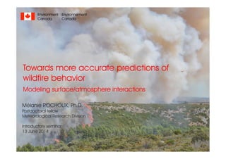
  • 1. Towards more accurate predictions of wildfire behavior Modeling surface/atmosphere interactions Mélanie ROCHOUX, Ph.D. Postdoctoral fellow Meteorological Research Division Introductory seminar 13 June 2014 Environnement Canada Environment Canada
  • 2. ①➀ INTRODUCTION: Regional-scale modeling viewpoint • Fire danger • Multi-physics multi-scale problem • Regional-scale modeling viewpoint ➁ Ph.D. RESEARCH: How to address modeling uncertainties? • Data assimilation at regional scale • Multi-physics simulation at flame scale ➂ STATE-OF-THE-ART: Fire/atmosphere coupling • Coupling strategy • Atmospheric emissions • Offline simulation case OUTLINE Introductory seminar 2 INTRODUCTORY SEMINAR June 13, 2014Mélanie ROCHOUX
  • 3. INTRODUCTION ● ● ● Fire danger at operational level • Global viewpoint: about 400 million hectares burnt every year ➙3 % of the Earth’s vegetation area © NASA Active fire map by MODIS over a 10-day period 9-18 August 2013 • Canadian Forest Fire Weather Index System • Fire Weather Index (FWI) ➙ numerical rating of fire potential intensity • Daily maps of fire weather • Main limitation ➙ meteorological index Canadian Wildland Fire Information System, NRCan INTRODUCTORY SEMINAR June 13, 2014Mélanie ROCHOUX ➙ modis-fire.umd.edu/ 3
  • 4. INTRODUCTION ● ● ● Fire danger at operational level Fine fuel moisture code (FFMC) Duff moisture code (DMC) Drought Code (DC) FUEL MOISTURE CODES FIRE WEATHER OBSERVATION S FIRE BEHAVIOR INDICES Air temperature and humidity, wind, 24-h rainfall Wind Air temperature and humidity, 24- h rainfall Air temperature, 24-h rainfall Initial spread index (ISI) Buildup index (BUI) Fire weather index (FWI) 4 INTRODUCTORY SEMINAR June 13, 2014Mélanie ROCHOUX • Canadian Forest Fire Weather Index System • Fire Weather Index (FWI) ➙ numerical rating of fire potential intensity • Daily maps of fire weather • Main limitation ➙ meteorological index ➙ cwfis.cfs.nrcan.gc.ca/home
  • 5. INTRODUCTION ● ● ● Fire danger at operational level Fine fuel moisture code (FFMC) Duff moisture code (DMC) Drought Code (DC) FUEL MOISTURE CODES FIRE WEATHER OBSERVATION S FIRE BEHAVIOR INDICES Air temperature and humidity, wind, 24-h rainfall Wind Air temperature and humidity, 24- h rainfall Air temperature, 24-h rainfall Initial spread index (ISI) Buildup index (BUI) Fire weather index (FWI) 5 INTRODUCTORY SEMINAR June 13, 2014Mélanie ROCHOUX • Canadian Forest Fire Weather Index System • Fire Weather Index (FWI) ➙ numerical rating of fire potential intensity • Daily maps of fire weather • Main limitation ➙ meteorological index DMC: loosely compacted decomposing matter -nominal depth 7 cm DC: deep compact organic matter -nominal depth 18 cm FFMC: litter and other fine fuels -nominal depth 1.2 cm From Chelene Krezek-Hanes, Great Lakes Forestry Centre, Canadian Forest Service ➙ cwfis.cfs.nrcan.gc.ca/home
  • 6. INTRODUCTION ● ● ● Multi-physics multi-scale problem 2009 Black Saturday bushfires ▶ 450 000 ha (1/3 of the annual burnt area in Australia) ▶ 173 people died ▶ strong fire/atmosphere coupling 300 km © NASA Fire/Surface ➙ Vegetation ➙ Topography Fire/Atmosphere ➙ Dynamics ➙ Chemistry Turbulence Gases & Aerosols Wind Biomass combustion Surface- to-canopy • Complexity of wildfire behavior • Wide range of length-scale (from mm to km) • Poorly-defined biomass fuels • Atmospheric external forcing • Climate change (megafires) ➙ CHALLENGE: How to accurately represent surface/atmosphere interactions in wildfires? 6 INTRODUCTORY SEMINAR June 13, 2014Mélanie ROCHOUX
  • 7. INTRODUCTION ● ● ● Multi-physics multi-scale problem • Complexity of wildfire behavior • Wide range of length-scale (from mm to km) • Poorly-defined biomass fuels • Atmospheric external forcing • Climate change (megafires) ➙ CHALLENGE: How to accurately represent surface/atmosphere interactions in wildfires? Radiation Wind Flame Pyrolysis Heat/mass fluxes Terrain topography EMISSIONS PYROLYSI S COMBUSTION FLUID DYNAMICS HEAT TRANSFER ATMOSPHERIC PHYSICS 7 INTRODUCTORY SEMINAR June 13, 2014Mélanie ROCHOUX
  • 8. INTRODUCTION ● ● ● Regional-scale modeling viewpoint © FOREFIRE, Favone wildfire (30 ha)© FOREFIRE, Favone wildfire (30 ha) Regional-scale viewpoint FIRE FRONT Burnt area Fire front Unburnt vegetation TOPOGRA PHY Terrain slope BIOMASS FUEL Moisture content Packing ratio Layer thickness WEATHER Wind magnitude Wind direction Rate Of spread • Front-tracking simulator • Prediction of the location of the surface fire front on horizontal plane • Local evaluation of the ROS along the normal direction to the fire front ➙ ROTHERMEL [1] ➙ BALBI [2] • Examples of simulator ➙ FOREFIRE [3], asynchronous Lagrangian solver ➙ FIREFLY [4], level-set solver [1] Rothermel, USDA Forest Service (1972) [2] Balbi et al. Comb. Flame (2004) [3] Filippi et al. Proc. Comb. Inst. (2013) [4] Rochoux, Ph.D. Ecole Centrale Paris (2014) 8 INTRODUCTORY SEMINAR June 13, 2014Mélanie ROCHOUX
  • 9. ①➀ INTRODUCTION: Regional-scale modeling viewpoint • Fire danger • Multi-physics multi-scale problem • Regional-scale modeling viewpoint ➁ Ph.D. RESEARCH: How to address modeling uncertainties? • Data assimilation at regional scale • Multi-physics simulation at flame scale ➂ STATE-OF-THE-ART: Fire/atmosphere coupling • Coupling strategy • Atmospheric emissions • Offline simulation case OUTLINE Introductory seminar 9 INTRODUCTORY SEMINAR June 13, 2014Mélanie ROCHOUX
  • 10. PH.D. RESEARCH ● ● ● Modeling limitations INTRODUCTORY SEMINAR June 13, 2014Mélanie ROCHOUX • ISSUE: How to accurately describe wildfire spread? 10 Rochoux M.C., Ph.D. Ecole Centrale Paris (2014) • OBJECTIVE: Quantify and reduce uncertainty in ROS modeling Data assimilation for REGIONAL-SCALE wildfire spread forecast Environmental conditions Fire front locationPhysics-based modeling FLAME-SCALE multi-physics CFD simulations
  • 11. PH.D. RESEARCH ● ● ● Data assimilation for regional-scale forecast INTRODUCTORY SEMINAR June 13, 2014Mélanie ROCHOUX 11 Environmental conditions Fire front location • Anisotropy in wildfire spread ➙ complex spatial correlations along the fireline • Highly non-linear observation operator ➙ complex relationship between ROS model parameters and model counterparts of observations Simulated front Observed front (x1 , y1 ) (x2 , y2 ) (x3 ,y3 ) (x4 , y4 ) (x1 O ,y1 O ) (x2 O ,y2 O ) Distance between fronts FIREFLY wildfire spread simulator Parameters Initial condition Boundary conditions Comparison Simulated fronts Observations
  • 12. PH.D. RESEARCH ● ● ● Data assimilation for regional-scale forecast INTRODUCTORY SEMINAR June 13, 2014Mélanie ROCHOUX 12 Environmental conditions Fire front location • Parameter estimation ➙ temporal variability of the errors in the ROS model parameters (mid- to long-term) ➙ reduced-cost approach (Polynomial Chaos) • State estimation ➙ persistence of the correction of the model initial condition (short-term) Simulated front Observed front (x1 , y1 ) (x2 , y2 ) (x3 ,y3 ) (x4 , y4 ) (x1 O ,y1 O ) (x2 O ,y2 O ) FIREFLY wildfire spread simulator Parameters Initial condition Boundary conditions Comparison Simulated fronts Observations Ensemble Kalman filter Parameter estimation State estimation Analysis
  • 13. PH.D. RESEARCH ● ● ● Data assimilation for regional-scale forecast INTRODUCTORY SEMINAR June 13, 2014Mélanie ROCHOUX 13 EnKF analysis of synthetic observations + of fire front FORECAST True location Ensemble members ANALYSIS True location Ensemble members observations Ensemble generation for state estimation ➙ Anisotropy in wildfire spread ➙ Selection of spatially-distributed biomass fuel properties and distinct wind conditions between the ensemble members. Approach relevant for incomplete observations due to: ➙ opacity of the thermal plume ➙ limited monitoring
  • 14. PH.D. RESEARCH ● ● ● Data assimilation for regional-scale forecast INTRODUCTORY SEMINAR June 13, 2014Mélanie ROCHOUX 14 Controlled grassland fire experiment x [m] y [m] Extraction of the 600 K iso-temperature at 14-s time intervals 1min32s50s 1min46s1min04s 1min28s Time FRONT Wind 1m/s
  • 15. PH.D. RESEARCH ● ● ● Data assimilation for regional-scale forecast INTRODUCTORY SEMINAR June 13, 2014Mélanie ROCHOUX 15 Controlled grassland fire experiment state parameter state parameter state parameter • STATE ESTIMATION: non-uniform correction of the fire front • PARAMETER ESTIMATION: mean correction along the fireline ANALYSIS PERFORMANCE ANALYSIS FORECAST
  • 16. ①➀ INTRODUCTION: Regional-scale modeling viewpoint • Fire danger • Multi-physics multi-scale problem • Regional-scale modeling viewpoint ➁ Ph.D. RESEARCH: How to address modeling uncertainties? • Data assimilation at regional scale • Multi-physics simulation at flame scale ➂ STATE-OF-THE-ART: Fire/atmosphere coupling • Coupling strategy • Atmospheric emissions • Offline simulation case OUTLINE Introductory seminar 16 INTRODUCTORY SEMINAR June 13, 2014Mélanie ROCHOUX
  • 17. ➙ anridea.univ-corse.fr/ ➙ OBJECTIVE: develop a coupled fire-atmosphere simulation prototype Biomass thermal degradation VEGETATION SCALES Combustion processes Surface/atmosphe re interactions FLAME SCALE ATMOSPHERIC SCALES Atmospheric dynamics and emissions FIRE/ATMOSPHERE MODEL ● ● ● Coupling strategy 17 INTRODUCTORY SEMINAR June 13, 2014Mélanie ROCHOUX
  • 18. INTRODUCTORY SEMINAR June 13, 2014Mélanie ROCHOUX FIRE/ATMOSPHERE MODEL ● ● ● Coupling strategy 18 • Lagrangian representation of the subgrid-scale fire front Atmospheric model grid size (∼ 50 m) VEGETATION • Terrain data • Distribution: using CORINE ESA database and forest inventory (BDForêt) ➙ Sensible heat flux ➙ Water vapor flux ➙ Radiant temperature ➙WIND •Interpolation at the front markers •assumed constant over one model time step •1-D boundary layer model (mid- grid)
  • 19. INTRODUCTORY SEMINAR May 2014Mélanie ROCHOUX FIRE/ATMOSPHERE MODEL ● ● ● Coupling strategy 19 • Introduction of a burning matrix • Burning ratio Rb = ratio of the burning area over the atmospheric grid area, ranging from 0 (no fire) to 1 (all burning). • 1 value of burning ratio per atmospheric model grid box SURFACE FLUXES REQUIRE: • Nominal convection heat flux • Nominal water loading • Nominal flame temperature Tn (1000 K) • Soil temperature from the atmospheric model Ts ➙ Sensible heat flux ➙ Water vapor flux ➙ Radiant temperature FORMULATION OF THE EQUIVALENT RADIANT TEMPERATURE Te: Te 4 = (1 - Rb) Ts 4 + Rb Tn 4
  • 20. INTRODUCTORY SEMINAR June 13, 2014Mélanie ROCHOUX FIRE/ATMOSPHERE MODEL ● ● ● Coupling strategy 20 • Limitations in surface wildfire spread modeling • Physical modeling inaccuracies ➙ Heat transfer to vegetation ➙ Local and steady-state assumption (canyons) • Absence of modeling for fire/atmosphere interactions Favone wildfire (30 ha) FOREFIRE Coupled Observed Two-way fire/atmosphere coupling FOREFIRE/MESO-NH
  • 21. INTRODUCTORY SEMINAR June 13, 2014Mélanie ROCHOUX FIRE/ATMOSPHERE MODEL ● ● ● Atmospheric chemistry 21 • Emission sources • Emissions during the biomass thermal degradation (e.g. soot particles) • Incomplete combustion ➙ Sensible heat flux ➙ Water vapor flux ➙ Radiant temperature ➙ Gas species emission • Species emitted in the surface layer (injection model) and mixed by the turbulence scheme (mainly CO) • Distinction of flaming and smoldering modes of combustion in the injection model • Emission factor database still incomplete, in particular for Mediterranean ecosystems
  • 22. INTRODUCTORY SEMINAR June 13, 2014Mélanie ROCHOUX FIRE/ATMOSPHERE MODEL ● ● ● Atmospheric chemistry 22 • Transport and chemistry in the smoke plume • No parameterization of the smoke injection height ➙ explicit calculation • ReLACS chemical kinetic scheme used in MÉSO-NH (no aerosol scheme) Fire/Surface ➙ Vegetation ➙ Topography Fire/Atmosphere ➙ Dynamics ➙ Chemistry Turbulence Gases & Aerosols Wind Case study : Lançon de Provence (2005), Strada et al. 2012
  • 23. SOURCES ➙ High-resolution biomass fuel ➙ Combustion ➙ Emission models ATMOSPHERE ➙ Dynamics of the smoke plume ➙ Chemistry (aerosols) ➙ Feedbacks on fire Overview of fire research OBSERVATIONS ➙ Detection ➙ Monitoring

Hinweis der Redaktion

  1. Qu’est-ce qui fait que de grands feux peuvent se développer ? Du feu de surface au feu de cimes Formation d’un panache s’étendant sur plusieurs dizaines voire centaines de km Difficile de stopper un très grand feu tel les megafires(favorisés par l’occurrence de plus en plus forte d’évènements extrêmes) Pour éviter que les feux atteignent des dimensions qui les rendent incontrôlables, il faut pouvoir prévoir rapidement où le feu va se propager et ainsi optimiser la stratégie de terrain. Des prévisions fiables de propagation à l’échelle régionale seraient nécessaires, en terme de comportement du feu et aussi de changement de comportement sous l’effet du changement climatique.
  2. the generation of the stochastic ensemble must represent the anisotropy in wildfire spread. This anisotropy was implicitly introduced in the SE ap- proach by selecting spatially-distributed biomass fuel properties and distinct wind conditions between the different members in the ensemble. The SE approach was shown to be successful at retrieving at low computational cost (i.e., with a relatively small number of members in the ensemble) the actual shape of the fire front in cases with strong anisotropic propagation conditions. This approach was also found relevant for observations made with significant errors and/or cases in which the observations are incomplete (e.g., when only a section of the fireline is informed), in order to reconstruct a complete, reliable initial condition for FIREFLY restart.
  3. ISBA est trop "grossier" les données en entrée font des km en résolution, du coup pas possible et distribution spécifique. Le faire en HR c'est l'objet principal de l'ANR firecaster. Pour la caractérisation: données terrain (surface/volume... humidité estimée (= f(humidité de l'air après 1 h pour le vegetal mort)) Pour la distribution spatiale : BDForêt / corine http://inventaire-forestier.ign.fr/spip/spip.php?rubrique53 Modèle 1D de couche limite, vent mi-maille << approx pourrie et injustifiable mais meilleure que la fausse hauteur de flamme que l'on peut diagnostiquer, c'était un des objectifs (trop audacieux) de l'étude AVBP/Firestar d'avoir une vue du volume de gaz pour une meilleure estimation.
  4. Equivalent heat flux (W/m2) ➙ Energy over the hot gaseous column ➙ Multiplication of the nominal convection heat flux by the burning ratio Rb Water vapor mass flux (kg/m2/s) ➙ Multiplication of the nominal water loading by the burning ratio Rb Equivalent radiant temperature ➙ Nominal flame temperature Tn (1000 K) ➙ Soil temperature from the atmospheric model Ts (day temperature at ground level) ➙ Formulation of the radiant temperature Te (K): Te4 = (1 - Rb) Ts4 + Rb Tn4
  5. - No anthropogenic emissions considered - No aerosol scheme - All species are emitted in the first surface level in the model and mixed in the boundary layer by the turbulence scheme. There is no a-priori injection height. A passive tracer (referred to as fire aerosol-like tracer) has been introduced to mimic fire-produced PM10 aerosols. The fire aerosol-like tracer is initialized to zero and has a deposition velocity of 3 cm/s (Seung-Muk et al. 2006); it is only emitted above the fire. - The simulated smoke plume was trapped within the boundary layer (injection height between 0.9 and 1.2km), a common feature of Mediterranean fires that mostly release emissions into the atmospheric boundary layer. - The coupled model with simplified assumptions concerning emissions and initialization simulated an sharp increase of O3 precursors near the fire and a subsequent O3 depletion in the fire plume (over 40km) as well as a strong increase of a fire aerosol-like tracer at the proper timing compared to the observations. Production of O3 (over the sea) was simulated several kilometers downwind of the fire as already observed in field campaigns.
  6. ISBA est trop "grossier" les données en entrée font des km en résolution, du coup pas possible et distribution spécifique. Le faire en HR c'est l'objet principal de l'ANR firecaster. Pour la caractérisation: données terrain (surface/volume... humidité estimée (= f(humidité de l'air après 1 h pour le vegetal mort)) Pour la distribution spatiale : BDForêt / corine http://inventaire-forestier.ign.fr/spip/spip.php?rubrique53 Modèle 1D de couche limite, vent mi-maille << approx pourrie et injustifiable mais meilleure que la fausse hauteur de flamme que l'on peut diagnostiquer, c'était un des objectifs (trop audacieux) de l'étude AVBP/Firestar d'avoir une vue du volume de gaz pour une meilleure estimation.
  7. - No anthropogenic emissions considered - No aerosol scheme - All species are emitted in the first surface level in the model and mixed in the boundary layer by the turbulence scheme. There is no a-priori injection height. A passive tracer (referred to as fire aerosol-like tracer) has been introduced to mimic fire-produced PM10 aerosols. The fire aerosol-like tracer is initialized to zero and has a deposition velocity of 3 cm/s (Seung-Muk et al. 2006); it is only emitted above the fire. - The simulated smoke plume was trapped within the boundary layer (injection height between 0.9 and 1.2km), a common feature of Mediterranean fires that mostly release emissions into the atmospheric boundary layer. - The coupled model with simplified assumptions concerning emissions and initialization simulated an sharp increase of O3 precursors near the fire and a subsequent O3 depletion in the fire plume (over 40km) as well as a strong increase of a fire aerosol-like tracer at the proper timing compared to the observations. Production of O3 (over the sea) was simulated several kilometers downwind of the fire as already observed in field campaigns.