SlideShare ist ein Scribd-Unternehmen logo
1 von 21
Downloaden Sie, um offline zu lesen
Remote sensing e-course
Geomorphology & Hydrology analysis
Fatwa Ramdani
Geoenvironment, Earth Science, Grad. School of Science
Outline
• This course will focus in geomorphology and hydrology analysis
based on remotely-sensed data, SRTM. The methods how to
analyze and exploit the SRTM information for geo-hydrology
mapping will be illustrated in open source software.
• In every section will be follow with the exercise and questions to
allow student expand their understanding.
Course Goal and Objectives
• Understand the concept of DEM, DTM, DSM
• Understand formula module function in open source software
• Understand the benefit of drainage pattern to identify
physical environment
• Understand the stream order
• Understand basic cartography design
Intended Audience
• University student with basic level of
knowledge in Remote Sensing studies
• Course Requirements:
–
–
–
–

Internet access
GRASS software (http://grass.osgeo.org/grass64/binary/mswindows/native/)
QuantumGIS software (http://www.qgis.org/en/site/forusers/download.html)
Download data here ()
1. Using DEM image for landscape
analysis
• This lesson will focus in DEM analysis based on remotely-sensed data,
SRTM. The methods how to analyze and exploit the DEM information for
geo-hydrology mapping will be illustrated.
Resources:
•
•

http://www.cgiar-csi.org/data/srtm-90m-digital-elevation-database-v4-1
http://f3.tiera.ru/2/Cs_Computer%20science/CsCg_Computational%20geometry/Li%20Z.,%2
0Zhu%20Q.,%20Gold%20C.%20Digital%20terrain%20modeling..%20principles%20and%20me
thodology%20(CRC,%202005)(ISBN%200415324629)(324s)_CsCg_.pdf
Activities!
• Import file using GRASS
• Explore basic statistics
• Displaying the data:
– Create shaded relief
– Blend two raster data
– Produce RGB of DEM
2. Generating watershed and streams
(hydrologic analysis)
•

This lecture will introduce the student to and will be follow with the exercise and
questions to allow student expand their understanding.
ACTIVITIES
• Filling the data
• Generating slope, aspect and drainage network
• Thinning the data, create contour, and convert to vector
• Working with low-pass and high-pass filter
• Analyzing the result associated with the physical environment
Resource
Drainage pattern associated with physical
environment (landscape & geology)
A dendritic drainage pattern is the most common form and
looks like the branching pattern of tree roots. It develops
in regions underlain by homogeneous material. That is, the
subsurface geology has a similar resistance to weathering
so there is no apparent control over the direction the
tributaries take. Tributaries joining larger streams at acute
angle (less than 90 degrees)
Landform based on
topographic
Resource:
http://www.sciencedirect.com/science/article/pii/
S0169555X06000791
http://www.sciencedirect.com/science/article/pii/
S0169555X09002189#

O.D.A. Prima et al. / Geomorphology 78 (2006) 373–386
Methodology for geomorphologic mapping analysis
Resource:
http://www.sciencedirect.com/science/article/pii/S0169555X090
02189#
Streams profiles
Streams profiles
Streams Order
Stream order is a method for classifying the relative location of a Reach within the
larger river system.

This system shown here is the Strahler (1957) modified Horton (1945) method for
Stream order, which assigns each headwater perennial Stream an order of 1, and then
at the confluence of two 1st-order Streams assigns the downstream Reach an order of
2. In this method, the confluence of two 2nd-order Streams results in a downstream
Reach of order 3, and so on, as illustrated by this picture.
Resources:
http://www.uvm.edu/~pdodds/files/papers/others/1968/scheidegger
1968b.pdf
http://www.uvm.edu/~pdodds/files/papers/others/1968/scheidegger
1968c.pdf

Source: http://www.fgmorph.com/fg_4_8.php
Addons installation
Result
Result
Result
Result
Stream
order based
on Horton
Quiz?
• Describe the DEM you use in this study. Write a well
structured paragraph or two on raster filtering to answer
the following:
– What is the difference between a low pass and a high pass
filter?
– Why would you want to run a low pass / high pass filter on a
DEM?
– Is slope a high pass or a low pass filter operation?
– Which basin or sub-basin are have different geomorphological
structure? Shows in map!
– Whay stream order is important?

• HOMEWORK!
– Do the same procedure to produce basins map, streams, etc
using ASTER GDEM data and compare the result
Thank you!
Questions?

Weitere ähnliche Inhalte

Was ist angesagt?

Feature Based Image Classification by using Principal Component Analysis
Feature Based Image Classification by using Principal Component AnalysisFeature Based Image Classification by using Principal Component Analysis
Feature Based Image Classification by using Principal Component AnalysisIT Industry
 
Spatial data mining
Spatial data miningSpatial data mining
Spatial data miningMITS Gwalior
 
Separability Analysis of Integrated Spaceborne Radar and Optical Data: Sudan ...
Separability Analysis of Integrated Spaceborne Radar and Optical Data: Sudan ...Separability Analysis of Integrated Spaceborne Radar and Optical Data: Sudan ...
Separability Analysis of Integrated Spaceborne Radar and Optical Data: Sudan ...rsmahabir
 
Cnn acuracia remotesensing-08-00329
Cnn acuracia remotesensing-08-00329Cnn acuracia remotesensing-08-00329
Cnn acuracia remotesensing-08-00329Universidade Fumec
 
A developed algorithm for automating the multiple bands multiple endmember se...
A developed algorithm for automating the multiple bands multiple endmember se...A developed algorithm for automating the multiple bands multiple endmember se...
A developed algorithm for automating the multiple bands multiple endmember se...Alexander Decker
 
Unsupervised Building Extraction from High Resolution Satellite Images Irresp...
Unsupervised Building Extraction from High Resolution Satellite Images Irresp...Unsupervised Building Extraction from High Resolution Satellite Images Irresp...
Unsupervised Building Extraction from High Resolution Satellite Images Irresp...CSCJournals
 
Active learning algorithms in seismic facies classification
Active learning algorithms in seismic facies classificationActive learning algorithms in seismic facies classification
Active learning algorithms in seismic facies classificationPioneer Natural Resources
 
Thesis Manuscript Final Draft
Thesis Manuscript Final DraftThesis Manuscript Final Draft
Thesis Manuscript Final DraftDerek Foster
 
A Survey on: Hyper Spectral Image Segmentation and Classification Using FODPSO
A Survey on: Hyper Spectral Image Segmentation and Classification Using FODPSOA Survey on: Hyper Spectral Image Segmentation and Classification Using FODPSO
A Survey on: Hyper Spectral Image Segmentation and Classification Using FODPSOrahulmonikasharma
 
Nonlinear filtering approaches to field mapping by sampling using mobile sensors
Nonlinear filtering approaches to field mapping by sampling using mobile sensorsNonlinear filtering approaches to field mapping by sampling using mobile sensors
Nonlinear filtering approaches to field mapping by sampling using mobile sensorsijassn
 
Irrera gold2010
Irrera gold2010Irrera gold2010
Irrera gold2010grssieee
 
A new approach of edge detection in sar images using
A new approach of edge detection in sar images usingA new approach of edge detection in sar images using
A new approach of edge detection in sar images usingeSAT Publishing House
 
CLUSTERING HYPERSPECTRAL DATA
CLUSTERING HYPERSPECTRAL DATACLUSTERING HYPERSPECTRAL DATA
CLUSTERING HYPERSPECTRAL DATAcsandit
 
A new approach of edge detection in sar images using region based active cont...
A new approach of edge detection in sar images using region based active cont...A new approach of edge detection in sar images using region based active cont...
A new approach of edge detection in sar images using region based active cont...eSAT Journals
 
Introduction to spatial data mining
Introduction to spatial data miningIntroduction to spatial data mining
Introduction to spatial data miningHoang Nguyen
 
Spatial Data Mining : Seminar
Spatial Data Mining : SeminarSpatial Data Mining : Seminar
Spatial Data Mining : SeminarIpsit Dash
 
Hyperspectral Data Compression Using Spatial-Spectral Lossless Coding Technique
Hyperspectral Data Compression Using Spatial-Spectral Lossless Coding TechniqueHyperspectral Data Compression Using Spatial-Spectral Lossless Coding Technique
Hyperspectral Data Compression Using Spatial-Spectral Lossless Coding TechniqueCSCJournals
 
An Automatic Neural Networks System for Classifying Dust, Clouds, Water, and ...
An Automatic Neural Networks System for Classifying Dust, Clouds, Water, and ...An Automatic Neural Networks System for Classifying Dust, Clouds, Water, and ...
An Automatic Neural Networks System for Classifying Dust, Clouds, Water, and ...Waqas Tariq
 
Bridging the Semantic Gap in Multimedia Information Retrieval: Top-down and B...
Bridging the Semantic Gap in Multimedia Information Retrieval: Top-down and B...Bridging the Semantic Gap in Multimedia Information Retrieval: Top-down and B...
Bridging the Semantic Gap in Multimedia Information Retrieval: Top-down and B...Jonathon Hare
 

Was ist angesagt? (20)

Feature Based Image Classification by using Principal Component Analysis
Feature Based Image Classification by using Principal Component AnalysisFeature Based Image Classification by using Principal Component Analysis
Feature Based Image Classification by using Principal Component Analysis
 
Spatial data mining
Spatial data miningSpatial data mining
Spatial data mining
 
Separability Analysis of Integrated Spaceborne Radar and Optical Data: Sudan ...
Separability Analysis of Integrated Spaceborne Radar and Optical Data: Sudan ...Separability Analysis of Integrated Spaceborne Radar and Optical Data: Sudan ...
Separability Analysis of Integrated Spaceborne Radar and Optical Data: Sudan ...
 
Cnn acuracia remotesensing-08-00329
Cnn acuracia remotesensing-08-00329Cnn acuracia remotesensing-08-00329
Cnn acuracia remotesensing-08-00329
 
A developed algorithm for automating the multiple bands multiple endmember se...
A developed algorithm for automating the multiple bands multiple endmember se...A developed algorithm for automating the multiple bands multiple endmember se...
A developed algorithm for automating the multiple bands multiple endmember se...
 
Unsupervised Building Extraction from High Resolution Satellite Images Irresp...
Unsupervised Building Extraction from High Resolution Satellite Images Irresp...Unsupervised Building Extraction from High Resolution Satellite Images Irresp...
Unsupervised Building Extraction from High Resolution Satellite Images Irresp...
 
Active learning algorithms in seismic facies classification
Active learning algorithms in seismic facies classificationActive learning algorithms in seismic facies classification
Active learning algorithms in seismic facies classification
 
Thesis Manuscript Final Draft
Thesis Manuscript Final DraftThesis Manuscript Final Draft
Thesis Manuscript Final Draft
 
FUTURE TRENDS OF SEISMIC ANALYSIS
FUTURE TRENDS OF SEISMIC ANALYSISFUTURE TRENDS OF SEISMIC ANALYSIS
FUTURE TRENDS OF SEISMIC ANALYSIS
 
A Survey on: Hyper Spectral Image Segmentation and Classification Using FODPSO
A Survey on: Hyper Spectral Image Segmentation and Classification Using FODPSOA Survey on: Hyper Spectral Image Segmentation and Classification Using FODPSO
A Survey on: Hyper Spectral Image Segmentation and Classification Using FODPSO
 
Nonlinear filtering approaches to field mapping by sampling using mobile sensors
Nonlinear filtering approaches to field mapping by sampling using mobile sensorsNonlinear filtering approaches to field mapping by sampling using mobile sensors
Nonlinear filtering approaches to field mapping by sampling using mobile sensors
 
Irrera gold2010
Irrera gold2010Irrera gold2010
Irrera gold2010
 
A new approach of edge detection in sar images using
A new approach of edge detection in sar images usingA new approach of edge detection in sar images using
A new approach of edge detection in sar images using
 
CLUSTERING HYPERSPECTRAL DATA
CLUSTERING HYPERSPECTRAL DATACLUSTERING HYPERSPECTRAL DATA
CLUSTERING HYPERSPECTRAL DATA
 
A new approach of edge detection in sar images using region based active cont...
A new approach of edge detection in sar images using region based active cont...A new approach of edge detection in sar images using region based active cont...
A new approach of edge detection in sar images using region based active cont...
 
Introduction to spatial data mining
Introduction to spatial data miningIntroduction to spatial data mining
Introduction to spatial data mining
 
Spatial Data Mining : Seminar
Spatial Data Mining : SeminarSpatial Data Mining : Seminar
Spatial Data Mining : Seminar
 
Hyperspectral Data Compression Using Spatial-Spectral Lossless Coding Technique
Hyperspectral Data Compression Using Spatial-Spectral Lossless Coding TechniqueHyperspectral Data Compression Using Spatial-Spectral Lossless Coding Technique
Hyperspectral Data Compression Using Spatial-Spectral Lossless Coding Technique
 
An Automatic Neural Networks System for Classifying Dust, Clouds, Water, and ...
An Automatic Neural Networks System for Classifying Dust, Clouds, Water, and ...An Automatic Neural Networks System for Classifying Dust, Clouds, Water, and ...
An Automatic Neural Networks System for Classifying Dust, Clouds, Water, and ...
 
Bridging the Semantic Gap in Multimedia Information Retrieval: Top-down and B...
Bridging the Semantic Gap in Multimedia Information Retrieval: Top-down and B...Bridging the Semantic Gap in Multimedia Information Retrieval: Top-down and B...
Bridging the Semantic Gap in Multimedia Information Retrieval: Top-down and B...
 

Ă„hnlich wie Remote sensing e course (Geohydrology)

The Development of a Catchment Management Modelling System for the Googong Re...
The Development of a Catchment Management Modelling System for the Googong Re...The Development of a Catchment Management Modelling System for the Googong Re...
The Development of a Catchment Management Modelling System for the Googong Re...GavanThomas
 
M.S. Capstone Seminar
M.S. Capstone SeminarM.S. Capstone Seminar
M.S. Capstone Seminarshirabay
 
Prioritizing watersheds
Prioritizing watershedsPrioritizing watersheds
Prioritizing watershedsMeer Raashid
 
ASEG-PESA-AIG_2016_Abstract_North West Shelf 3D Velocity Modeling_ESTIMAGES
ASEG-PESA-AIG_2016_Abstract_North West Shelf 3D Velocity Modeling_ESTIMAGESASEG-PESA-AIG_2016_Abstract_North West Shelf 3D Velocity Modeling_ESTIMAGES
ASEG-PESA-AIG_2016_Abstract_North West Shelf 3D Velocity Modeling_ESTIMAGESLaureline Monteignies
 
Morphometric Analysis and prioritization of watersheds of Mahanadi River Basi...
Morphometric Analysis and prioritization of watersheds of Mahanadi River Basi...Morphometric Analysis and prioritization of watersheds of Mahanadi River Basi...
Morphometric Analysis and prioritization of watersheds of Mahanadi River Basi...RINKU MEENA
 
Adv. Structral geolgy assignment.pptx
Adv. Structral geolgy assignment.pptxAdv. Structral geolgy assignment.pptx
Adv. Structral geolgy assignment.pptxDidhaaDirribaaHarmee
 
Physically Based Runoff and Sediment Modelling of Rawal Watershed
Physically Based Runoff and Sediment Modelling of Rawal WatershedPhysically Based Runoff and Sediment Modelling of Rawal Watershed
Physically Based Runoff and Sediment Modelling of Rawal WatershedIRJET Journal
 
7 srtm paleochannels_aeromagnetics data
7 srtm paleochannels_aeromagnetics data7 srtm paleochannels_aeromagnetics data
7 srtm paleochannels_aeromagnetics dataIUMA MARTINEZ
 
WATERSHED ANALYSIS .pptx
WATERSHED ANALYSIS .pptxWATERSHED ANALYSIS .pptx
WATERSHED ANALYSIS .pptxBIMALKUMARNAYAK2
 
Automatic Delineation of Grid based and Geo-Morphological Slope Units for Sus...
Automatic Delineation of Grid based and Geo-Morphological Slope Units for Sus...Automatic Delineation of Grid based and Geo-Morphological Slope Units for Sus...
Automatic Delineation of Grid based and Geo-Morphological Slope Units for Sus...Omar F. Althuwaynee
 
Multi-channel analysis of Surface Wave (MASW) profiling for delineation of su...
Multi-channel analysis of Surface Wave (MASW) profiling for delineation of su...Multi-channel analysis of Surface Wave (MASW) profiling for delineation of su...
Multi-channel analysis of Surface Wave (MASW) profiling for delineation of su...IRJET Journal
 
Osychny_Vladimir_resume_2017
Osychny_Vladimir_resume_2017Osychny_Vladimir_resume_2017
Osychny_Vladimir_resume_2017Vladimir Osychny
 
GMEX Introduction
GMEX IntroductionGMEX Introduction
GMEX Introductiongmex
 
Land cover and Land Use
Land cover and Land UseLand cover and Land Use
Land cover and Land UseDHANENDRA BAHEKAR
 
Easter Desert Project
Easter Desert ProjectEaster Desert Project
Easter Desert ProjectIwl Pcu
 
Remote sensing and GIS in the morphometric analysis of macro-watersheds for h...
Remote sensing and GIS in the morphometric analysis of macro-watersheds for h...Remote sensing and GIS in the morphometric analysis of macro-watersheds for h...
Remote sensing and GIS in the morphometric analysis of macro-watersheds for h...IRJET Journal
 
Remote sensing applications for seismic planning
Remote sensing applications for seismic planningRemote sensing applications for seismic planning
Remote sensing applications for seismic planningTTI Production
 

Ă„hnlich wie Remote sensing e course (Geohydrology) (20)

The Development of a Catchment Management Modelling System for the Googong Re...
The Development of a Catchment Management Modelling System for the Googong Re...The Development of a Catchment Management Modelling System for the Googong Re...
The Development of a Catchment Management Modelling System for the Googong Re...
 
M.S. Capstone Seminar
M.S. Capstone SeminarM.S. Capstone Seminar
M.S. Capstone Seminar
 
Prioritizing watersheds
Prioritizing watershedsPrioritizing watersheds
Prioritizing watersheds
 
ASEG-PESA-AIG_2016_Abstract_North West Shelf 3D Velocity Modeling_ESTIMAGES
ASEG-PESA-AIG_2016_Abstract_North West Shelf 3D Velocity Modeling_ESTIMAGESASEG-PESA-AIG_2016_Abstract_North West Shelf 3D Velocity Modeling_ESTIMAGES
ASEG-PESA-AIG_2016_Abstract_North West Shelf 3D Velocity Modeling_ESTIMAGES
 
Morphometric Analysis and prioritization of watersheds of Mahanadi River Basi...
Morphometric Analysis and prioritization of watersheds of Mahanadi River Basi...Morphometric Analysis and prioritization of watersheds of Mahanadi River Basi...
Morphometric Analysis and prioritization of watersheds of Mahanadi River Basi...
 
Swat model
Swat model Swat model
Swat model
 
Adv. Structral geolgy assignment.pptx
Adv. Structral geolgy assignment.pptxAdv. Structral geolgy assignment.pptx
Adv. Structral geolgy assignment.pptx
 
Physically Based Runoff and Sediment Modelling of Rawal Watershed
Physically Based Runoff and Sediment Modelling of Rawal WatershedPhysically Based Runoff and Sediment Modelling of Rawal Watershed
Physically Based Runoff and Sediment Modelling of Rawal Watershed
 
7 srtm paleochannels_aeromagnetics data
7 srtm paleochannels_aeromagnetics data7 srtm paleochannels_aeromagnetics data
7 srtm paleochannels_aeromagnetics data
 
WATERSHED ANALYSIS .pptx
WATERSHED ANALYSIS .pptxWATERSHED ANALYSIS .pptx
WATERSHED ANALYSIS .pptx
 
Automatic Delineation of Grid based and Geo-Morphological Slope Units for Sus...
Automatic Delineation of Grid based and Geo-Morphological Slope Units for Sus...Automatic Delineation of Grid based and Geo-Morphological Slope Units for Sus...
Automatic Delineation of Grid based and Geo-Morphological Slope Units for Sus...
 
Multi-channel analysis of Surface Wave (MASW) profiling for delineation of su...
Multi-channel analysis of Surface Wave (MASW) profiling for delineation of su...Multi-channel analysis of Surface Wave (MASW) profiling for delineation of su...
Multi-channel analysis of Surface Wave (MASW) profiling for delineation of su...
 
Final Ppt.pdf
Final Ppt.pdfFinal Ppt.pdf
Final Ppt.pdf
 
Osychny_Vladimir_resume_2017
Osychny_Vladimir_resume_2017Osychny_Vladimir_resume_2017
Osychny_Vladimir_resume_2017
 
GMEX Introduction
GMEX IntroductionGMEX Introduction
GMEX Introduction
 
Land cover and Land Use
Land cover and Land UseLand cover and Land Use
Land cover and Land Use
 
Easter Desert Project
Easter Desert ProjectEaster Desert Project
Easter Desert Project
 
Online Watershed Analysis Tool
Online Watershed Analysis Tool Online Watershed Analysis Tool
Online Watershed Analysis Tool
 
Remote sensing and GIS in the morphometric analysis of macro-watersheds for h...
Remote sensing and GIS in the morphometric analysis of macro-watersheds for h...Remote sensing and GIS in the morphometric analysis of macro-watersheds for h...
Remote sensing and GIS in the morphometric analysis of macro-watersheds for h...
 
Remote sensing applications for seismic planning
Remote sensing applications for seismic planningRemote sensing applications for seismic planning
Remote sensing applications for seismic planning
 

Mehr von Fatwa Ramdani

Management bencana
Management bencanaManagement bencana
Management bencanaFatwa Ramdani
 
Pelatihan menulis blog dan website
Pelatihan menulis blog dan websitePelatihan menulis blog dan website
Pelatihan menulis blog dan websiteFatwa Ramdani
 
Field excursion – the changes of old sendai
Field excursion – the changes of old sendaiField excursion – the changes of old sendai
Field excursion – the changes of old sendaiFatwa Ramdani
 
Could mount fuji erupt
Could mount fuji eruptCould mount fuji erupt
Could mount fuji eruptFatwa Ramdani
 
Disaster management and recovery in northeast japan
Disaster management and recovery in northeast japanDisaster management and recovery in northeast japan
Disaster management and recovery in northeast japanFatwa Ramdani
 

Mehr von Fatwa Ramdani (6)

Management bencana
Management bencanaManagement bencana
Management bencana
 
Yuk menulis
Yuk menulisYuk menulis
Yuk menulis
 
Pelatihan menulis blog dan website
Pelatihan menulis blog dan websitePelatihan menulis blog dan website
Pelatihan menulis blog dan website
 
Field excursion – the changes of old sendai
Field excursion – the changes of old sendaiField excursion – the changes of old sendai
Field excursion – the changes of old sendai
 
Could mount fuji erupt
Could mount fuji eruptCould mount fuji erupt
Could mount fuji erupt
 
Disaster management and recovery in northeast japan
Disaster management and recovery in northeast japanDisaster management and recovery in northeast japan
Disaster management and recovery in northeast japan
 

KĂĽrzlich hochgeladen

Separation of Lanthanides/ Lanthanides and Actinides
Separation of Lanthanides/ Lanthanides and ActinidesSeparation of Lanthanides/ Lanthanides and Actinides
Separation of Lanthanides/ Lanthanides and ActinidesFatimaKhan178732
 
The byproduct of sericulture in different industries.pptx
The byproduct of sericulture in different industries.pptxThe byproduct of sericulture in different industries.pptx
The byproduct of sericulture in different industries.pptxShobhayan Kirtania
 
Sanyam Choudhary Chemistry practical.pdf
Sanyam Choudhary Chemistry practical.pdfSanyam Choudhary Chemistry practical.pdf
Sanyam Choudhary Chemistry practical.pdfsanyamsingh5019
 
social pharmacy d-pharm 1st year by Pragati K. Mahajan
social pharmacy d-pharm 1st year by Pragati K. Mahajansocial pharmacy d-pharm 1st year by Pragati K. Mahajan
social pharmacy d-pharm 1st year by Pragati K. Mahajanpragatimahajan3
 
1029 - Danh muc Sach Giao Khoa 10 . pdf
1029 -  Danh muc Sach Giao Khoa 10 . pdf1029 -  Danh muc Sach Giao Khoa 10 . pdf
1029 - Danh muc Sach Giao Khoa 10 . pdfQucHHunhnh
 
POINT- BIOCHEMISTRY SEM 2 ENZYMES UNIT 5.pptx
POINT- BIOCHEMISTRY SEM 2 ENZYMES UNIT 5.pptxPOINT- BIOCHEMISTRY SEM 2 ENZYMES UNIT 5.pptx
POINT- BIOCHEMISTRY SEM 2 ENZYMES UNIT 5.pptxSayali Powar
 
Russian Call Girls in Andheri Airport Mumbai WhatsApp 9167673311 đź’ž Full Nigh...
Russian Call Girls in Andheri Airport Mumbai WhatsApp  9167673311 đź’ž Full Nigh...Russian Call Girls in Andheri Airport Mumbai WhatsApp  9167673311 đź’ž Full Nigh...
Russian Call Girls in Andheri Airport Mumbai WhatsApp 9167673311 đź’ž Full Nigh...Pooja Nehwal
 
mini mental status format.docx
mini    mental       status     format.docxmini    mental       status     format.docx
mini mental status format.docxPoojaSen20
 
Presentation by Andreas Schleicher Tackling the School Absenteeism Crisis 30 ...
Presentation by Andreas Schleicher Tackling the School Absenteeism Crisis 30 ...Presentation by Andreas Schleicher Tackling the School Absenteeism Crisis 30 ...
Presentation by Andreas Schleicher Tackling the School Absenteeism Crisis 30 ...EduSkills OECD
 
A Critique of the Proposed National Education Policy Reform
A Critique of the Proposed National Education Policy ReformA Critique of the Proposed National Education Policy Reform
A Critique of the Proposed National Education Policy ReformChameera Dedduwage
 
Activity 01 - Artificial Culture (1).pdf
Activity 01 - Artificial Culture (1).pdfActivity 01 - Artificial Culture (1).pdf
Activity 01 - Artificial Culture (1).pdfciinovamais
 
Measures of Central Tendency: Mean, Median and Mode
Measures of Central Tendency: Mean, Median and ModeMeasures of Central Tendency: Mean, Median and Mode
Measures of Central Tendency: Mean, Median and ModeThiyagu K
 
Grant Readiness 101 TechSoup and Remy Consulting
Grant Readiness 101 TechSoup and Remy ConsultingGrant Readiness 101 TechSoup and Remy Consulting
Grant Readiness 101 TechSoup and Remy ConsultingTechSoup
 
Q4-W6-Restating Informational Text Grade 3
Q4-W6-Restating Informational Text Grade 3Q4-W6-Restating Informational Text Grade 3
Q4-W6-Restating Informational Text Grade 3JemimahLaneBuaron
 
microwave assisted reaction. General introduction
microwave assisted reaction. General introductionmicrowave assisted reaction. General introduction
microwave assisted reaction. General introductionMaksud Ahmed
 
The basics of sentences session 2pptx copy.pptx
The basics of sentences session 2pptx copy.pptxThe basics of sentences session 2pptx copy.pptx
The basics of sentences session 2pptx copy.pptxheathfieldcps1
 
Sports & Fitness Value Added Course FY..
Sports & Fitness Value Added Course FY..Sports & Fitness Value Added Course FY..
Sports & Fitness Value Added Course FY..Disha Kariya
 
Software Engineering Methodologies (overview)
Software Engineering Methodologies (overview)Software Engineering Methodologies (overview)
Software Engineering Methodologies (overview)eniolaolutunde
 
SOCIAL AND HISTORICAL CONTEXT - LFTVD.pptx
SOCIAL AND HISTORICAL CONTEXT - LFTVD.pptxSOCIAL AND HISTORICAL CONTEXT - LFTVD.pptx
SOCIAL AND HISTORICAL CONTEXT - LFTVD.pptxiammrhaywood
 

KĂĽrzlich hochgeladen (20)

Separation of Lanthanides/ Lanthanides and Actinides
Separation of Lanthanides/ Lanthanides and ActinidesSeparation of Lanthanides/ Lanthanides and Actinides
Separation of Lanthanides/ Lanthanides and Actinides
 
The byproduct of sericulture in different industries.pptx
The byproduct of sericulture in different industries.pptxThe byproduct of sericulture in different industries.pptx
The byproduct of sericulture in different industries.pptx
 
Sanyam Choudhary Chemistry practical.pdf
Sanyam Choudhary Chemistry practical.pdfSanyam Choudhary Chemistry practical.pdf
Sanyam Choudhary Chemistry practical.pdf
 
social pharmacy d-pharm 1st year by Pragati K. Mahajan
social pharmacy d-pharm 1st year by Pragati K. Mahajansocial pharmacy d-pharm 1st year by Pragati K. Mahajan
social pharmacy d-pharm 1st year by Pragati K. Mahajan
 
1029 - Danh muc Sach Giao Khoa 10 . pdf
1029 -  Danh muc Sach Giao Khoa 10 . pdf1029 -  Danh muc Sach Giao Khoa 10 . pdf
1029 - Danh muc Sach Giao Khoa 10 . pdf
 
POINT- BIOCHEMISTRY SEM 2 ENZYMES UNIT 5.pptx
POINT- BIOCHEMISTRY SEM 2 ENZYMES UNIT 5.pptxPOINT- BIOCHEMISTRY SEM 2 ENZYMES UNIT 5.pptx
POINT- BIOCHEMISTRY SEM 2 ENZYMES UNIT 5.pptx
 
Russian Call Girls in Andheri Airport Mumbai WhatsApp 9167673311 đź’ž Full Nigh...
Russian Call Girls in Andheri Airport Mumbai WhatsApp  9167673311 đź’ž Full Nigh...Russian Call Girls in Andheri Airport Mumbai WhatsApp  9167673311 đź’ž Full Nigh...
Russian Call Girls in Andheri Airport Mumbai WhatsApp 9167673311 đź’ž Full Nigh...
 
mini mental status format.docx
mini    mental       status     format.docxmini    mental       status     format.docx
mini mental status format.docx
 
Presentation by Andreas Schleicher Tackling the School Absenteeism Crisis 30 ...
Presentation by Andreas Schleicher Tackling the School Absenteeism Crisis 30 ...Presentation by Andreas Schleicher Tackling the School Absenteeism Crisis 30 ...
Presentation by Andreas Schleicher Tackling the School Absenteeism Crisis 30 ...
 
A Critique of the Proposed National Education Policy Reform
A Critique of the Proposed National Education Policy ReformA Critique of the Proposed National Education Policy Reform
A Critique of the Proposed National Education Policy Reform
 
Activity 01 - Artificial Culture (1).pdf
Activity 01 - Artificial Culture (1).pdfActivity 01 - Artificial Culture (1).pdf
Activity 01 - Artificial Culture (1).pdf
 
Measures of Central Tendency: Mean, Median and Mode
Measures of Central Tendency: Mean, Median and ModeMeasures of Central Tendency: Mean, Median and Mode
Measures of Central Tendency: Mean, Median and Mode
 
Grant Readiness 101 TechSoup and Remy Consulting
Grant Readiness 101 TechSoup and Remy ConsultingGrant Readiness 101 TechSoup and Remy Consulting
Grant Readiness 101 TechSoup and Remy Consulting
 
Q4-W6-Restating Informational Text Grade 3
Q4-W6-Restating Informational Text Grade 3Q4-W6-Restating Informational Text Grade 3
Q4-W6-Restating Informational Text Grade 3
 
microwave assisted reaction. General introduction
microwave assisted reaction. General introductionmicrowave assisted reaction. General introduction
microwave assisted reaction. General introduction
 
The basics of sentences session 2pptx copy.pptx
The basics of sentences session 2pptx copy.pptxThe basics of sentences session 2pptx copy.pptx
The basics of sentences session 2pptx copy.pptx
 
Sports & Fitness Value Added Course FY..
Sports & Fitness Value Added Course FY..Sports & Fitness Value Added Course FY..
Sports & Fitness Value Added Course FY..
 
Mattingly "AI & Prompt Design: Structured Data, Assistants, & RAG"
Mattingly "AI & Prompt Design: Structured Data, Assistants, & RAG"Mattingly "AI & Prompt Design: Structured Data, Assistants, & RAG"
Mattingly "AI & Prompt Design: Structured Data, Assistants, & RAG"
 
Software Engineering Methodologies (overview)
Software Engineering Methodologies (overview)Software Engineering Methodologies (overview)
Software Engineering Methodologies (overview)
 
SOCIAL AND HISTORICAL CONTEXT - LFTVD.pptx
SOCIAL AND HISTORICAL CONTEXT - LFTVD.pptxSOCIAL AND HISTORICAL CONTEXT - LFTVD.pptx
SOCIAL AND HISTORICAL CONTEXT - LFTVD.pptx
 

Remote sensing e course (Geohydrology)

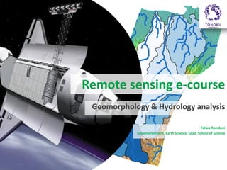
  • 1. Remote sensing e-course Geomorphology & Hydrology analysis Fatwa Ramdani Geoenvironment, Earth Science, Grad. School of Science
  • 2. Outline • This course will focus in geomorphology and hydrology analysis based on remotely-sensed data, SRTM. The methods how to analyze and exploit the SRTM information for geo-hydrology mapping will be illustrated in open source software. • In every section will be follow with the exercise and questions to allow student expand their understanding.
  • 3. Course Goal and Objectives • Understand the concept of DEM, DTM, DSM • Understand formula module function in open source software • Understand the benefit of drainage pattern to identify physical environment • Understand the stream order • Understand basic cartography design
  • 4. Intended Audience • University student with basic level of knowledge in Remote Sensing studies • Course Requirements: – – – – Internet access GRASS software (http://grass.osgeo.org/grass64/binary/mswindows/native/) QuantumGIS software (http://www.qgis.org/en/site/forusers/download.html) Download data here ()
  • 5. 1. Using DEM image for landscape analysis • This lesson will focus in DEM analysis based on remotely-sensed data, SRTM. The methods how to analyze and exploit the DEM information for geo-hydrology mapping will be illustrated. Resources: • • http://www.cgiar-csi.org/data/srtm-90m-digital-elevation-database-v4-1 http://f3.tiera.ru/2/Cs_Computer%20science/CsCg_Computational%20geometry/Li%20Z.,%2 0Zhu%20Q.,%20Gold%20C.%20Digital%20terrain%20modeling..%20principles%20and%20me thodology%20(CRC,%202005)(ISBN%200415324629)(324s)_CsCg_.pdf
  • 6. Activities! • Import file using GRASS • Explore basic statistics • Displaying the data: – Create shaded relief – Blend two raster data – Produce RGB of DEM
  • 7. 2. Generating watershed and streams (hydrologic analysis) • This lecture will introduce the student to and will be follow with the exercise and questions to allow student expand their understanding. ACTIVITIES • Filling the data • Generating slope, aspect and drainage network • Thinning the data, create contour, and convert to vector • Working with low-pass and high-pass filter • Analyzing the result associated with the physical environment Resource
  • 8. Drainage pattern associated with physical environment (landscape & geology) A dendritic drainage pattern is the most common form and looks like the branching pattern of tree roots. It develops in regions underlain by homogeneous material. That is, the subsurface geology has a similar resistance to weathering so there is no apparent control over the direction the tributaries take. Tributaries joining larger streams at acute angle (less than 90 degrees)
  • 10. Methodology for geomorphologic mapping analysis Resource: http://www.sciencedirect.com/science/article/pii/S0169555X090 02189#
  • 13. Streams Order Stream order is a method for classifying the relative location of a Reach within the larger river system. This system shown here is the Strahler (1957) modified Horton (1945) method for Stream order, which assigns each headwater perennial Stream an order of 1, and then at the confluence of two 1st-order Streams assigns the downstream Reach an order of 2. In this method, the confluence of two 2nd-order Streams results in a downstream Reach of order 3, and so on, as illustrated by this picture. Resources: http://www.uvm.edu/~pdodds/files/papers/others/1968/scheidegger 1968b.pdf http://www.uvm.edu/~pdodds/files/papers/others/1968/scheidegger 1968c.pdf Source: http://www.fgmorph.com/fg_4_8.php
  • 20. Quiz? • Describe the DEM you use in this study. Write a well structured paragraph or two on raster filtering to answer the following: – What is the difference between a low pass and a high pass filter? – Why would you want to run a low pass / high pass filter on a DEM? – Is slope a high pass or a low pass filter operation? – Which basin or sub-basin are have different geomorphological structure? Shows in map! – Whay stream order is important? • HOMEWORK! – Do the same procedure to produce basins map, streams, etc using ASTER GDEM data and compare the result