SlideShare ist ein Scribd-Unternehmen logo
1 von 9
Practical Report on,


    Geographical Information
           Systems


                           Precision Agriculture
                           32nd Batch

                       1
Page of contents


Introduction

What is Precision Agriculture?                  3

What is Geographical Information System?        3

What GPS can do?                                4

The Role of GIS in Agriculture                  4

Practical

Material and equipment                          5

Methodology                                     5

Data                                            5

Soil sampling and mapping                       6

Data analysis                                   7

References                                      9


                                 Introduction


                                      2
1. What is Precision Agriculture?
Precision Agriculture is the application of technologies and principals to manage spatial and
temporal variability associated with all aspects of agricultural production for the purpose of
improving crop performance and environmental quality.


   2. What is Geographical Information System?
    A geographic information system (GIS) integrates hardware, software, and data for
capturing, managing, analyzing, and displaying all forms of geographically referenced
information.GIS allows us to view, understand, question, interpret, and visualize data in
many ways that reveal relationships, patterns, and trends in the form of maps, globes, reports,
and charts.

    A GIS helps you answer questions and solve problems by looking at your data in a way
that is quickly understood and easily shared.GIS technology can be integrated into any
enterprise information system framework.
                                   GIS Map 1


                                                                    GPS receiver 1


                                               3
3. What GIS can do?
           Storage of data
           Display data
           Manipulation of data
           Statistical application
           Handling of missing data
           Comparison of maps

   4. The Role of GIS in Agriculture

Spatial analysis, the study of geographic features, and the relationships that exist between
them can be applied to many areas of the agriculture industry. By better understanding how
features within the landscape interact, decision makers can optimize operational efficiency
and improve economic returns. Regardless of scale-whether at the farm field level analyzing
crop yield information or across an entire country-GIS is becoming fully integrated and
widely accepted for assisting government agencies to manage programs that support farmers
and protect the environment. These are the agriculture GIS application in the field

       Combining agronomic and economic data sets

       Field data interpolation

       Decision support for farm management

       Farm asset allocation

       Field input reporting

       Regulatory compliance


                                             4
Practical
Material and equipments

        GPS receiver - to get positional coordinates
        Lord soil Sampler- to get soil samples
        Sampling bags- to collect soil samples
        pH meter –to measure the soil pH
        EC meter –to measure the soil EC
        GIS software/ computer/ user interface- to develop map


Methodology

        As a group all the students of precision agriculture went to a selected bare field of
faculty. Then we were separated to small groups. Soil samples with depth of 10 inches and 20
inches below from soil surface were taken. Meantime we collected the longitudinal and
latitudinal data of the positions which soil samples were taken.

       Then we went to the engineering department’s laboratory and measure the pH and EC
of the soil samples. These data were entered to database and also they feed to the GIS
software, ARC VIEW. Finally soil sample map was developed.


Data

                                        Arc view
     ID NO          N               E            pH10      EC10       PH20      EC20
1            0095897         0177419          5.88       22.7      5.50       17.4
2            0095903         0177429          6.02       18.0      6.04       12.8
3            0095899         0177432          7.50       20.7      6.40       19.7
4            0095904         0177426          6.18       16.3      6.28       12.7
5            0095912         0177420          6.55       26.9      7.65       18.4
6            0095927         0177445          7.74       28.0      7.75       24.0
7            0095925         0177433          8.13       30.0      7.83       29.0
8            0095910         0177446          8.90       23.6      8.60       18.6
9            0095929         0177461          8.13       31.3      7.93       38.3
10           0095950         0177444          8.13       39.7      7.73       28.8


                                             5
Soil sample mapping


        Elevation 1


EC-10                             EC-20


                              6
Data analyzing


          Arial Photograph of faculty

          Red circular area shows the field which practical was done.


Soil pH @ depth of 10cm                                       Soil pH @ depth of 20cm


                                                          7
DATA analysis
Importance of elevation

       This map shows the elevation of the site selected. If this is a large field we can select
the crops according to the elevation. But this selected area is very small and elevation only
varies between 27m-44m. Therefore we can select one common crop which is suitable for
low lands for the whole field.

      The importance of the elevation map of this small field is we can apply the
management practices according to the elevation. Specially we can apply soil conservation
measures in the areas where the contour lines are present in more closely.


Importance of soil pH

        A pH reading is a measurement that expresses the degree of acidity or alkalinity, very
much like heat and cold are expressed in degrees Centigrade or Fahrenheit. The pH scale has
14 units and is centered on 7, which is neutral. Levels below 7 are considered in the acid or
sour range and readings above 7 are alkaline or sweet. Soil nutrients are at their optimum
availability in the range between 6 and 7. Most plants grow best in this range, although some
type of plant growth can take place anywhere between 3.5 and 10. The pH level greatly
affects the fertility of soil and quality of plant growth.

        Under alkaline conditions, the solubility of minerals decrease to the point that nutrient
deficiencies occur. Plant growth is therefore limited by deficiencies in iron, manganese, zinc,
copper and boron. Phosphorus is also less available in alkaline soils and high levels of
calcium may inhibit the uptake of potassium and magnesium.

       Under acidic conditions, many soil minerals dissolve and increase the concentration
of metal ions to toxic levels. The primary toxic metal is aluminum, but high levels of
manganese and iron can also inhibit plant growth under these conditions. The nutrients
phosphorus and molybdenum are less available in acidic soils and calcium and/or magnesium
may also be deficient.

       In this field South area is more acidic and North area is more saline. Therefore we can
consider the most suitable crops for the field according to this ph map. Acid tolerance crops
are more suitable for south area and salinity tolerance crops are more suitable for north area.
Also if there is any crop available, we can manage soil ph according to that crop’s
requirements by changing soil ph. (by adding acids or bases.)


                                               8
Importance of soil EC

Soil electrical conductivity (EC) is a measurement that correlates with soil properties that
affect crop productivity, including soil texture, cation exchange capacity (CEC), drainage
conditions, organic matter level, salinity, and subsoil characteristics. By agricultural
standards, soils with an EC greater than 4 dS/m are considered saline.

We can clearly observe the variance of soil EC in this field with the maps developed.


                                         References

       Korte B. George, THE GIS BOOK, 5th Edition, 2001-by Onward press-Canada

              ISBN- 13: 978-0-7668-2820-9

                      -10:0-7688-2820-4

       http://www.gis.com/content/what-gis
       http://en.wikipedia.org/wiki/Geographic_information_system


Special Thanks for Mr. Amila Buddhika ( demonstrator of Agric Engineering dept) for his
kindness Guidance and cooperation throughout this practical as well as developing maps with
GIS.


                                               9

Weitere ähnliche Inhalte

Was ist angesagt?

Scope and importance, principles and concepts of precision horticulture
Scope and importance, principles and concepts of precision horticulture Scope and importance, principles and concepts of precision horticulture
Scope and importance, principles and concepts of precision horticulture Dr. M. Kumaresan Hort.
 
Global positioning system (gps) and its application in precision farming
Global positioning system (gps) and its application in precision farmingGlobal positioning system (gps) and its application in precision farming
Global positioning system (gps) and its application in precision farmingDr. M. Kumaresan Hort.
 
L12-Soil-Test-Crop-Response-PPT.pdf
L12-Soil-Test-Crop-Response-PPT.pdfL12-Soil-Test-Crop-Response-PPT.pdf
L12-Soil-Test-Crop-Response-PPT.pdfSayyedAadil1
 
GIS and Remote Sensing in Diagnosis and Management of Problem Soil with audio...
GIS and Remote Sensing in Diagnosis and Management of Problem Soil with audio...GIS and Remote Sensing in Diagnosis and Management of Problem Soil with audio...
GIS and Remote Sensing in Diagnosis and Management of Problem Soil with audio...KaminiKumari13
 
Precision farming
Precision farming Precision farming
Precision farming Anusha K R
 
Precision agriculture in relation to nutrient management by Dr. Tarik Mitran
Precision agriculture in relation to nutrient management by Dr. Tarik MitranPrecision agriculture in relation to nutrient management by Dr. Tarik Mitran
Precision agriculture in relation to nutrient management by Dr. Tarik MitranDr. Tarik Mitran
 
Soil mapping , remote sensing and use of sensors in precision farming
Soil mapping , remote sensing and use of  sensors in precision farmingSoil mapping , remote sensing and use of  sensors in precision farming
Soil mapping , remote sensing and use of sensors in precision farmingDr. M. Kumaresan Hort.
 
Ideotype and cropping system of rajul and arti ppt
Ideotype and cropping system of rajul and arti pptIdeotype and cropping system of rajul and arti ppt
Ideotype and cropping system of rajul and arti pptGovardhan Lodha
 
remote sensing in agriculture
remote sensing in agricultureremote sensing in agriculture
remote sensing in agricultureveerendra manduri
 
role of Geospatial technology in agriculture
role of Geospatial technology  in agriculturerole of Geospatial technology  in agriculture
role of Geospatial technology in agricultureDr. MADHO SINGH
 
Site Specific nutrient Management for Precision Agriculture - Anjali Patel (I...
Site Specific nutrient Management for Precision Agriculture - Anjali Patel (I...Site Specific nutrient Management for Precision Agriculture - Anjali Patel (I...
Site Specific nutrient Management for Precision Agriculture - Anjali Patel (I...Rahul Raj Tandon
 
Precision agriculture
Precision agriculturePrecision agriculture
Precision agricultureSuryaBv1
 
Application of gis and remote sensing in agriculture
Application of gis and remote sensing in agricultureApplication of gis and remote sensing in agriculture
Application of gis and remote sensing in agricultureRehana Qureshi
 
Crop Modeling - Types of crop growth models in agriculture
Crop Modeling - Types of crop growth models in agricultureCrop Modeling - Types of crop growth models in agriculture
Crop Modeling - Types of crop growth models in agricultureSREENIVASAREDDY KADAPA
 

Was ist angesagt? (20)

Scope and importance, principles and concepts of precision horticulture
Scope and importance, principles and concepts of precision horticulture Scope and importance, principles and concepts of precision horticulture
Scope and importance, principles and concepts of precision horticulture
 
Global positioning system (gps) and its application in precision farming
Global positioning system (gps) and its application in precision farmingGlobal positioning system (gps) and its application in precision farming
Global positioning system (gps) and its application in precision farming
 
L12-Soil-Test-Crop-Response-PPT.pdf
L12-Soil-Test-Crop-Response-PPT.pdfL12-Soil-Test-Crop-Response-PPT.pdf
L12-Soil-Test-Crop-Response-PPT.pdf
 
GIS and Remote Sensing in Diagnosis and Management of Problem Soil with audio...
GIS and Remote Sensing in Diagnosis and Management of Problem Soil with audio...GIS and Remote Sensing in Diagnosis and Management of Problem Soil with audio...
GIS and Remote Sensing in Diagnosis and Management of Problem Soil with audio...
 
Precision farming
Precision farming Precision farming
Precision farming
 
Precision agriculture in relation to nutrient management by Dr. Tarik Mitran
Precision agriculture in relation to nutrient management by Dr. Tarik MitranPrecision agriculture in relation to nutrient management by Dr. Tarik Mitran
Precision agriculture in relation to nutrient management by Dr. Tarik Mitran
 
Soil mapping , remote sensing and use of sensors in precision farming
Soil mapping , remote sensing and use of  sensors in precision farmingSoil mapping , remote sensing and use of  sensors in precision farming
Soil mapping , remote sensing and use of sensors in precision farming
 
Ideotype and cropping system of rajul and arti ppt
Ideotype and cropping system of rajul and arti pptIdeotype and cropping system of rajul and arti ppt
Ideotype and cropping system of rajul and arti ppt
 
remote sensing in agriculture
remote sensing in agricultureremote sensing in agriculture
remote sensing in agriculture
 
role of Geospatial technology in agriculture
role of Geospatial technology  in agriculturerole of Geospatial technology  in agriculture
role of Geospatial technology in agriculture
 
Site Specific nutrient Management for Precision Agriculture - Anjali Patel (I...
Site Specific nutrient Management for Precision Agriculture - Anjali Patel (I...Site Specific nutrient Management for Precision Agriculture - Anjali Patel (I...
Site Specific nutrient Management for Precision Agriculture - Anjali Patel (I...
 
Precision agriculture
Precision agriculturePrecision agriculture
Precision agriculture
 
Application of gis and remote sensing in agriculture
Application of gis and remote sensing in agricultureApplication of gis and remote sensing in agriculture
Application of gis and remote sensing in agriculture
 
Crop simulation model
Crop simulation modelCrop simulation model
Crop simulation model
 
Crop modelling.pptx
Crop modelling.pptxCrop modelling.pptx
Crop modelling.pptx
 
Precision farming
Precision farmingPrecision farming
Precision farming
 
Crop Modeling - Types of crop growth models in agriculture
Crop Modeling - Types of crop growth models in agricultureCrop Modeling - Types of crop growth models in agriculture
Crop Modeling - Types of crop growth models in agriculture
 
Precision Farming by Dr. Pooja Goswami
Precision Farming by Dr. Pooja GoswamiPrecision Farming by Dr. Pooja Goswami
Precision Farming by Dr. Pooja Goswami
 
CROP WEATHER MODELING
CROP WEATHER MODELINGCROP WEATHER MODELING
CROP WEATHER MODELING
 
Conservation agriculture
Conservation agricultureConservation agriculture
Conservation agriculture
 

Andere mochten auch

Precision agriculture
Precision agriculturePrecision agriculture
Precision agricultureHenk Hogeveen
 
Web Based Agriculture Information System
Web Based Agriculture Information SystemWeb Based Agriculture Information System
Web Based Agriculture Information SystemGihan Wikramanayake
 
Geographic information system
Geographic information systemGeographic information system
Geographic information systemSumanta Das
 

Andere mochten auch (8)

e-Agriculture
e-Agriculturee-Agriculture
e-Agriculture
 
Precision agriculture
Precision agriculturePrecision agriculture
Precision agriculture
 
PRECISION AGRICULTURE
PRECISION AGRICULTUREPRECISION AGRICULTURE
PRECISION AGRICULTURE
 
Web Based Agriculture Information System
Web Based Agriculture Information SystemWeb Based Agriculture Information System
Web Based Agriculture Information System
 
What Is Precision Farming
What Is Precision FarmingWhat Is Precision Farming
What Is Precision Farming
 
Precision Farming
Precision FarmingPrecision Farming
Precision Farming
 
Geographic information system
Geographic information systemGeographic information system
Geographic information system
 
E agriculture projects in turkey ertugrul akin
E agriculture projects in turkey ertugrul akinE agriculture projects in turkey ertugrul akin
E agriculture projects in turkey ertugrul akin
 

Ähnlich wie Geographical Information systems in Precision Agriculture

Introduction to soil property mapping
Introduction to soil property mappingIntroduction to soil property mapping
Introduction to soil property mappingExternalEvents
 
IRJET - Agrotech: Soil Analysis and Crop Prediction
IRJET - Agrotech: Soil Analysis and Crop PredictionIRJET - Agrotech: Soil Analysis and Crop Prediction
IRJET - Agrotech: Soil Analysis and Crop PredictionIRJET Journal
 
Soil & Landscape Mapping Technologies
Soil & Landscape Mapping TechnologiesSoil & Landscape Mapping Technologies
Soil & Landscape Mapping TechnologiesAmanda Woods
 
Geospatial Science and Technology Utilization in Agriculture
Geospatial Science and Technology Utilization in AgricultureGeospatial Science and Technology Utilization in Agriculture
Geospatial Science and Technology Utilization in Agricultureijtsrd
 
The effects of multiple layers feed-forward neural network transfer function ...
The effects of multiple layers feed-forward neural network transfer function ...The effects of multiple layers feed-forward neural network transfer function ...
The effects of multiple layers feed-forward neural network transfer function ...IJECEIAES
 
International Journal of Engineering Research and Development (IJERD)
International Journal of Engineering Research and Development (IJERD)International Journal of Engineering Research and Development (IJERD)
International Journal of Engineering Research and Development (IJERD)IJERD Editor
 
Land use land cover mapping for smart village using gis
Land use land cover mapping for smart village using gisLand use land cover mapping for smart village using gis
Land use land cover mapping for smart village using gisSumit Yeole
 
Precision farming/Agriculture.pptx
Precision farming/Agriculture.pptxPrecision farming/Agriculture.pptx
Precision farming/Agriculture.pptxSomeshDhongade1
 
Geographical Information System
Geographical Information SystemGeographical Information System
Geographical Information SystemDevegowda S R
 
IRJET- Soil Nutrients Analysis Using Colour Image Processing
IRJET-  	  Soil Nutrients Analysis Using Colour Image ProcessingIRJET-  	  Soil Nutrients Analysis Using Colour Image Processing
IRJET- Soil Nutrients Analysis Using Colour Image ProcessingIRJET Journal
 
Real Time soil fertility analyzer and crop prediction
Real Time soil fertility analyzer and crop predictionReal Time soil fertility analyzer and crop prediction
Real Time soil fertility analyzer and crop predictionIRJET Journal
 
上海必和 2009 july-spie_professional_agriphotonics超光谱高光谱多光谱
上海必和 2009 july-spie_professional_agriphotonics超光谱高光谱多光谱上海必和 2009 july-spie_professional_agriphotonics超光谱高光谱多光谱
上海必和 2009 july-spie_professional_agriphotonics超光谱高光谱多光谱algous
 
Mapping of Physical-Water Attributes in an Oxisol Under Sugarcane Cultivation...
Mapping of Physical-Water Attributes in an Oxisol Under Sugarcane Cultivation...Mapping of Physical-Water Attributes in an Oxisol Under Sugarcane Cultivation...
Mapping of Physical-Water Attributes in an Oxisol Under Sugarcane Cultivation...AI Publications
 
remote sensing and (GIS)
remote sensing and (GIS) remote sensing and (GIS)
remote sensing and (GIS) Anshul Phaugat
 
Soil mapping approach in gis
Soil mapping approach in gisSoil mapping approach in gis
Soil mapping approach in gisSakthivel R
 
Preparation of soil fertility maps
Preparation of soil fertility maps Preparation of soil fertility maps
Preparation of soil fertility maps dathan cs
 
Nhst 11 surat, Application of RS & GIS in urban waste management
Nhst 11 surat,  Application of RS  & GIS in urban waste managementNhst 11 surat,  Application of RS  & GIS in urban waste management
Nhst 11 surat, Application of RS & GIS in urban waste managementSamirsinh Parmar
 
2. Soil organic carbon - GSOCmap
2. Soil organic carbon - GSOCmap2. Soil organic carbon - GSOCmap
2. Soil organic carbon - GSOCmapExternalEvents
 

Ähnlich wie Geographical Information systems in Precision Agriculture (20)

Introduction to soil property mapping
Introduction to soil property mappingIntroduction to soil property mapping
Introduction to soil property mapping
 
IRJET - Agrotech: Soil Analysis and Crop Prediction
IRJET - Agrotech: Soil Analysis and Crop PredictionIRJET - Agrotech: Soil Analysis and Crop Prediction
IRJET - Agrotech: Soil Analysis and Crop Prediction
 
Soil & Landscape Mapping Technologies
Soil & Landscape Mapping TechnologiesSoil & Landscape Mapping Technologies
Soil & Landscape Mapping Technologies
 
Geospatial Science and Technology Utilization in Agriculture
Geospatial Science and Technology Utilization in AgricultureGeospatial Science and Technology Utilization in Agriculture
Geospatial Science and Technology Utilization in Agriculture
 
The effects of multiple layers feed-forward neural network transfer function ...
The effects of multiple layers feed-forward neural network transfer function ...The effects of multiple layers feed-forward neural network transfer function ...
The effects of multiple layers feed-forward neural network transfer function ...
 
International Journal of Engineering Research and Development (IJERD)
International Journal of Engineering Research and Development (IJERD)International Journal of Engineering Research and Development (IJERD)
International Journal of Engineering Research and Development (IJERD)
 
Land use land cover mapping for smart village using gis
Land use land cover mapping for smart village using gisLand use land cover mapping for smart village using gis
Land use land cover mapping for smart village using gis
 
Precision ag back to basics
Precision ag back to basicsPrecision ag back to basics
Precision ag back to basics
 
Precision farming/Agriculture.pptx
Precision farming/Agriculture.pptxPrecision farming/Agriculture.pptx
Precision farming/Agriculture.pptx
 
Geographical Information System
Geographical Information SystemGeographical Information System
Geographical Information System
 
IRJET- Soil Nutrients Analysis Using Colour Image Processing
IRJET-  	  Soil Nutrients Analysis Using Colour Image ProcessingIRJET-  	  Soil Nutrients Analysis Using Colour Image Processing
IRJET- Soil Nutrients Analysis Using Colour Image Processing
 
Real Time soil fertility analyzer and crop prediction
Real Time soil fertility analyzer and crop predictionReal Time soil fertility analyzer and crop prediction
Real Time soil fertility analyzer and crop prediction
 
上海必和 2009 july-spie_professional_agriphotonics超光谱高光谱多光谱
上海必和 2009 july-spie_professional_agriphotonics超光谱高光谱多光谱上海必和 2009 july-spie_professional_agriphotonics超光谱高光谱多光谱
上海必和 2009 july-spie_professional_agriphotonics超光谱高光谱多光谱
 
Mapping of Physical-Water Attributes in an Oxisol Under Sugarcane Cultivation...
Mapping of Physical-Water Attributes in an Oxisol Under Sugarcane Cultivation...Mapping of Physical-Water Attributes in an Oxisol Under Sugarcane Cultivation...
Mapping of Physical-Water Attributes in an Oxisol Under Sugarcane Cultivation...
 
remote sensing and (GIS)
remote sensing and (GIS) remote sensing and (GIS)
remote sensing and (GIS)
 
Soil mapping approach in gis
Soil mapping approach in gisSoil mapping approach in gis
Soil mapping approach in gis
 
Preparation of soil fertility maps
Preparation of soil fertility maps Preparation of soil fertility maps
Preparation of soil fertility maps
 
Nhst 11 surat, Application of RS & GIS in urban waste management
Nhst 11 surat,  Application of RS  & GIS in urban waste managementNhst 11 surat,  Application of RS  & GIS in urban waste management
Nhst 11 surat, Application of RS & GIS in urban waste management
 
2. Soil organic carbon - GSOCmap
2. Soil organic carbon - GSOCmap2. Soil organic carbon - GSOCmap
2. Soil organic carbon - GSOCmap
 
Using soil data to inform soil health
Using soil data to inform soil healthUsing soil data to inform soil health
Using soil data to inform soil health
 

Mehr von Chanuk Liyanage

Kamath basa indigenous language of paddy culture in sri lanka
Kamath basa indigenous language of paddy culture in sri lankaKamath basa indigenous language of paddy culture in sri lanka
Kamath basa indigenous language of paddy culture in sri lankaChanuk Liyanage
 
Land disposal of waste and Environmental pollution
Land disposal of waste and Environmental pollutionLand disposal of waste and Environmental pollution
Land disposal of waste and Environmental pollutionChanuk Liyanage
 
Water Related Institutional Bodies in Sri Lanka
Water Related Institutional Bodies in Sri LankaWater Related Institutional Bodies in Sri Lanka
Water Related Institutional Bodies in Sri LankaChanuk Liyanage
 
Water related institutional bodies In Sri Lanka
Water related institutional bodies In Sri LankaWater related institutional bodies In Sri Lanka
Water related institutional bodies In Sri LankaChanuk Liyanage
 
Proposed private sector employee pension benefit fund bill
Proposed private sector employee pension benefit fund billProposed private sector employee pension benefit fund bill
Proposed private sector employee pension benefit fund billChanuk Liyanage
 
Agicultural Istitutions of Sri Lanka
Agicultural Istitutions of Sri LankaAgicultural Istitutions of Sri Lanka
Agicultural Istitutions of Sri LankaChanuk Liyanage
 
A Silvicultural Glance on Matara district
A Silvicultural Glance on Matara districtA Silvicultural Glance on Matara district
A Silvicultural Glance on Matara districtChanuk Liyanage
 
OPERATOR’S FATIGUE OF HAND TRACTORS
OPERATOR’S FATIGUE OF  HAND TRACTORSOPERATOR’S FATIGUE OF  HAND TRACTORS
OPERATOR’S FATIGUE OF HAND TRACTORSChanuk Liyanage
 
Anthropometric data and analysis
Anthropometric data and analysisAnthropometric data and analysis
Anthropometric data and analysisChanuk Liyanage
 

Mehr von Chanuk Liyanage (14)

Kamath basa indigenous language of paddy culture in sri lanka
Kamath basa indigenous language of paddy culture in sri lankaKamath basa indigenous language of paddy culture in sri lanka
Kamath basa indigenous language of paddy culture in sri lanka
 
Land disposal of waste and Environmental pollution
Land disposal of waste and Environmental pollutionLand disposal of waste and Environmental pollution
Land disposal of waste and Environmental pollution
 
Water Related Institutional Bodies in Sri Lanka
Water Related Institutional Bodies in Sri LankaWater Related Institutional Bodies in Sri Lanka
Water Related Institutional Bodies in Sri Lanka
 
Water related institutional bodies In Sri Lanka
Water related institutional bodies In Sri LankaWater related institutional bodies In Sri Lanka
Water related institutional bodies In Sri Lanka
 
Indian dairy industry
Indian dairy industryIndian dairy industry
Indian dairy industry
 
Sigatoka disease
Sigatoka diseaseSigatoka disease
Sigatoka disease
 
Proposed private sector employee pension benefit fund bill
Proposed private sector employee pension benefit fund billProposed private sector employee pension benefit fund bill
Proposed private sector employee pension benefit fund bill
 
Human development index
Human development indexHuman development index
Human development index
 
Agicultural Istitutions of Sri Lanka
Agicultural Istitutions of Sri LankaAgicultural Istitutions of Sri Lanka
Agicultural Istitutions of Sri Lanka
 
Banks of Sri Lanaka
Banks of Sri LanakaBanks of Sri Lanaka
Banks of Sri Lanaka
 
Carbon foot print
Carbon foot printCarbon foot print
Carbon foot print
 
A Silvicultural Glance on Matara district
A Silvicultural Glance on Matara districtA Silvicultural Glance on Matara district
A Silvicultural Glance on Matara district
 
OPERATOR’S FATIGUE OF HAND TRACTORS
OPERATOR’S FATIGUE OF  HAND TRACTORSOPERATOR’S FATIGUE OF  HAND TRACTORS
OPERATOR’S FATIGUE OF HAND TRACTORS
 
Anthropometric data and analysis
Anthropometric data and analysisAnthropometric data and analysis
Anthropometric data and analysis
 

Kürzlich hochgeladen

Accessible design: Minimum effort, maximum impact
Accessible design: Minimum effort, maximum impactAccessible design: Minimum effort, maximum impact
Accessible design: Minimum effort, maximum impactdawncurless
 
Grant Readiness 101 TechSoup and Remy Consulting
Grant Readiness 101 TechSoup and Remy ConsultingGrant Readiness 101 TechSoup and Remy Consulting
Grant Readiness 101 TechSoup and Remy ConsultingTechSoup
 
Call Girls in Dwarka Mor Delhi Contact Us 9654467111
Call Girls in Dwarka Mor Delhi Contact Us 9654467111Call Girls in Dwarka Mor Delhi Contact Us 9654467111
Call Girls in Dwarka Mor Delhi Contact Us 9654467111Sapana Sha
 
BAG TECHNIQUE Bag technique-a tool making use of public health bag through wh...
BAG TECHNIQUE Bag technique-a tool making use of public health bag through wh...BAG TECHNIQUE Bag technique-a tool making use of public health bag through wh...
BAG TECHNIQUE Bag technique-a tool making use of public health bag through wh...Sapna Thakur
 
Disha NEET Physics Guide for classes 11 and 12.pdf
Disha NEET Physics Guide for classes 11 and 12.pdfDisha NEET Physics Guide for classes 11 and 12.pdf
Disha NEET Physics Guide for classes 11 and 12.pdfchloefrazer622
 
Arihant handbook biology for class 11 .pdf
Arihant handbook biology for class 11 .pdfArihant handbook biology for class 11 .pdf
Arihant handbook biology for class 11 .pdfchloefrazer622
 
Russian Call Girls in Andheri Airport Mumbai WhatsApp 9167673311 💞 Full Nigh...
Russian Call Girls in Andheri Airport Mumbai WhatsApp  9167673311 💞 Full Nigh...Russian Call Girls in Andheri Airport Mumbai WhatsApp  9167673311 💞 Full Nigh...
Russian Call Girls in Andheri Airport Mumbai WhatsApp 9167673311 💞 Full Nigh...Pooja Nehwal
 
BASLIQ CURRENT LOOKBOOK LOOKBOOK(1) (1).pdf
BASLIQ CURRENT LOOKBOOK  LOOKBOOK(1) (1).pdfBASLIQ CURRENT LOOKBOOK  LOOKBOOK(1) (1).pdf
BASLIQ CURRENT LOOKBOOK LOOKBOOK(1) (1).pdfSoniaTolstoy
 
A Critique of the Proposed National Education Policy Reform
A Critique of the Proposed National Education Policy ReformA Critique of the Proposed National Education Policy Reform
A Critique of the Proposed National Education Policy ReformChameera Dedduwage
 
The Most Excellent Way | 1 Corinthians 13
The Most Excellent Way | 1 Corinthians 13The Most Excellent Way | 1 Corinthians 13
The Most Excellent Way | 1 Corinthians 13Steve Thomason
 
9548086042 for call girls in Indira Nagar with room service
9548086042  for call girls in Indira Nagar  with room service9548086042  for call girls in Indira Nagar  with room service
9548086042 for call girls in Indira Nagar with room servicediscovermytutordmt
 
Separation of Lanthanides/ Lanthanides and Actinides
Separation of Lanthanides/ Lanthanides and ActinidesSeparation of Lanthanides/ Lanthanides and Actinides
Separation of Lanthanides/ Lanthanides and ActinidesFatimaKhan178732
 
SOCIAL AND HISTORICAL CONTEXT - LFTVD.pptx
SOCIAL AND HISTORICAL CONTEXT - LFTVD.pptxSOCIAL AND HISTORICAL CONTEXT - LFTVD.pptx
SOCIAL AND HISTORICAL CONTEXT - LFTVD.pptxiammrhaywood
 
1029 - Danh muc Sach Giao Khoa 10 . pdf
1029 -  Danh muc Sach Giao Khoa 10 . pdf1029 -  Danh muc Sach Giao Khoa 10 . pdf
1029 - Danh muc Sach Giao Khoa 10 . pdfQucHHunhnh
 
Student login on Anyboli platform.helpin
Student login on Anyboli platform.helpinStudent login on Anyboli platform.helpin
Student login on Anyboli platform.helpinRaunakKeshri1
 
microwave assisted reaction. General introduction
microwave assisted reaction. General introductionmicrowave assisted reaction. General introduction
microwave assisted reaction. General introductionMaksud Ahmed
 
Software Engineering Methodologies (overview)
Software Engineering Methodologies (overview)Software Engineering Methodologies (overview)
Software Engineering Methodologies (overview)eniolaolutunde
 
Measures of Dispersion and Variability: Range, QD, AD and SD
Measures of Dispersion and Variability: Range, QD, AD and SDMeasures of Dispersion and Variability: Range, QD, AD and SD
Measures of Dispersion and Variability: Range, QD, AD and SDThiyagu K
 

Kürzlich hochgeladen (20)

Accessible design: Minimum effort, maximum impact
Accessible design: Minimum effort, maximum impactAccessible design: Minimum effort, maximum impact
Accessible design: Minimum effort, maximum impact
 
Grant Readiness 101 TechSoup and Remy Consulting
Grant Readiness 101 TechSoup and Remy ConsultingGrant Readiness 101 TechSoup and Remy Consulting
Grant Readiness 101 TechSoup and Remy Consulting
 
Call Girls in Dwarka Mor Delhi Contact Us 9654467111
Call Girls in Dwarka Mor Delhi Contact Us 9654467111Call Girls in Dwarka Mor Delhi Contact Us 9654467111
Call Girls in Dwarka Mor Delhi Contact Us 9654467111
 
BAG TECHNIQUE Bag technique-a tool making use of public health bag through wh...
BAG TECHNIQUE Bag technique-a tool making use of public health bag through wh...BAG TECHNIQUE Bag technique-a tool making use of public health bag through wh...
BAG TECHNIQUE Bag technique-a tool making use of public health bag through wh...
 
Disha NEET Physics Guide for classes 11 and 12.pdf
Disha NEET Physics Guide for classes 11 and 12.pdfDisha NEET Physics Guide for classes 11 and 12.pdf
Disha NEET Physics Guide for classes 11 and 12.pdf
 
Arihant handbook biology for class 11 .pdf
Arihant handbook biology for class 11 .pdfArihant handbook biology for class 11 .pdf
Arihant handbook biology for class 11 .pdf
 
INDIA QUIZ 2024 RLAC DELHI UNIVERSITY.pptx
INDIA QUIZ 2024 RLAC DELHI UNIVERSITY.pptxINDIA QUIZ 2024 RLAC DELHI UNIVERSITY.pptx
INDIA QUIZ 2024 RLAC DELHI UNIVERSITY.pptx
 
Russian Call Girls in Andheri Airport Mumbai WhatsApp 9167673311 💞 Full Nigh...
Russian Call Girls in Andheri Airport Mumbai WhatsApp  9167673311 💞 Full Nigh...Russian Call Girls in Andheri Airport Mumbai WhatsApp  9167673311 💞 Full Nigh...
Russian Call Girls in Andheri Airport Mumbai WhatsApp 9167673311 💞 Full Nigh...
 
BASLIQ CURRENT LOOKBOOK LOOKBOOK(1) (1).pdf
BASLIQ CURRENT LOOKBOOK  LOOKBOOK(1) (1).pdfBASLIQ CURRENT LOOKBOOK  LOOKBOOK(1) (1).pdf
BASLIQ CURRENT LOOKBOOK LOOKBOOK(1) (1).pdf
 
A Critique of the Proposed National Education Policy Reform
A Critique of the Proposed National Education Policy ReformA Critique of the Proposed National Education Policy Reform
A Critique of the Proposed National Education Policy Reform
 
The Most Excellent Way | 1 Corinthians 13
The Most Excellent Way | 1 Corinthians 13The Most Excellent Way | 1 Corinthians 13
The Most Excellent Way | 1 Corinthians 13
 
9548086042 for call girls in Indira Nagar with room service
9548086042  for call girls in Indira Nagar  with room service9548086042  for call girls in Indira Nagar  with room service
9548086042 for call girls in Indira Nagar with room service
 
Separation of Lanthanides/ Lanthanides and Actinides
Separation of Lanthanides/ Lanthanides and ActinidesSeparation of Lanthanides/ Lanthanides and Actinides
Separation of Lanthanides/ Lanthanides and Actinides
 
Mattingly "AI & Prompt Design: The Basics of Prompt Design"
Mattingly "AI & Prompt Design: The Basics of Prompt Design"Mattingly "AI & Prompt Design: The Basics of Prompt Design"
Mattingly "AI & Prompt Design: The Basics of Prompt Design"
 
SOCIAL AND HISTORICAL CONTEXT - LFTVD.pptx
SOCIAL AND HISTORICAL CONTEXT - LFTVD.pptxSOCIAL AND HISTORICAL CONTEXT - LFTVD.pptx
SOCIAL AND HISTORICAL CONTEXT - LFTVD.pptx
 
1029 - Danh muc Sach Giao Khoa 10 . pdf
1029 -  Danh muc Sach Giao Khoa 10 . pdf1029 -  Danh muc Sach Giao Khoa 10 . pdf
1029 - Danh muc Sach Giao Khoa 10 . pdf
 
Student login on Anyboli platform.helpin
Student login on Anyboli platform.helpinStudent login on Anyboli platform.helpin
Student login on Anyboli platform.helpin
 
microwave assisted reaction. General introduction
microwave assisted reaction. General introductionmicrowave assisted reaction. General introduction
microwave assisted reaction. General introduction
 
Software Engineering Methodologies (overview)
Software Engineering Methodologies (overview)Software Engineering Methodologies (overview)
Software Engineering Methodologies (overview)
 
Measures of Dispersion and Variability: Range, QD, AD and SD
Measures of Dispersion and Variability: Range, QD, AD and SDMeasures of Dispersion and Variability: Range, QD, AD and SD
Measures of Dispersion and Variability: Range, QD, AD and SD
 

Geographical Information systems in Precision Agriculture

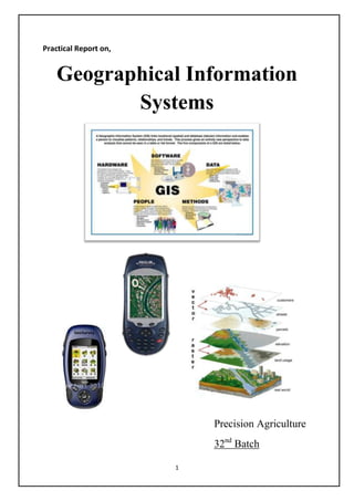
  • 1. Practical Report on, Geographical Information Systems Precision Agriculture 32nd Batch 1
  • 2. Page of contents Introduction What is Precision Agriculture? 3 What is Geographical Information System? 3 What GPS can do? 4 The Role of GIS in Agriculture 4 Practical Material and equipment 5 Methodology 5 Data 5 Soil sampling and mapping 6 Data analysis 7 References 9 Introduction 2
  • 3. 1. What is Precision Agriculture? Precision Agriculture is the application of technologies and principals to manage spatial and temporal variability associated with all aspects of agricultural production for the purpose of improving crop performance and environmental quality. 2. What is Geographical Information System? A geographic information system (GIS) integrates hardware, software, and data for capturing, managing, analyzing, and displaying all forms of geographically referenced information.GIS allows us to view, understand, question, interpret, and visualize data in many ways that reveal relationships, patterns, and trends in the form of maps, globes, reports, and charts. A GIS helps you answer questions and solve problems by looking at your data in a way that is quickly understood and easily shared.GIS technology can be integrated into any enterprise information system framework. GIS Map 1 GPS receiver 1 3
  • 4. 3. What GIS can do? Storage of data Display data Manipulation of data Statistical application Handling of missing data Comparison of maps 4. The Role of GIS in Agriculture Spatial analysis, the study of geographic features, and the relationships that exist between them can be applied to many areas of the agriculture industry. By better understanding how features within the landscape interact, decision makers can optimize operational efficiency and improve economic returns. Regardless of scale-whether at the farm field level analyzing crop yield information or across an entire country-GIS is becoming fully integrated and widely accepted for assisting government agencies to manage programs that support farmers and protect the environment. These are the agriculture GIS application in the field Combining agronomic and economic data sets Field data interpolation Decision support for farm management Farm asset allocation Field input reporting Regulatory compliance 4
  • 5. Practical Material and equipments GPS receiver - to get positional coordinates Lord soil Sampler- to get soil samples Sampling bags- to collect soil samples pH meter –to measure the soil pH EC meter –to measure the soil EC GIS software/ computer/ user interface- to develop map Methodology As a group all the students of precision agriculture went to a selected bare field of faculty. Then we were separated to small groups. Soil samples with depth of 10 inches and 20 inches below from soil surface were taken. Meantime we collected the longitudinal and latitudinal data of the positions which soil samples were taken. Then we went to the engineering department’s laboratory and measure the pH and EC of the soil samples. These data were entered to database and also they feed to the GIS software, ARC VIEW. Finally soil sample map was developed. Data Arc view ID NO N E pH10 EC10 PH20 EC20 1 0095897 0177419 5.88 22.7 5.50 17.4 2 0095903 0177429 6.02 18.0 6.04 12.8 3 0095899 0177432 7.50 20.7 6.40 19.7 4 0095904 0177426 6.18 16.3 6.28 12.7 5 0095912 0177420 6.55 26.9 7.65 18.4 6 0095927 0177445 7.74 28.0 7.75 24.0 7 0095925 0177433 8.13 30.0 7.83 29.0 8 0095910 0177446 8.90 23.6 8.60 18.6 9 0095929 0177461 8.13 31.3 7.93 38.3 10 0095950 0177444 8.13 39.7 7.73 28.8 5
  • 6. Soil sample mapping Elevation 1 EC-10 EC-20 6
  • 7. Data analyzing Arial Photograph of faculty Red circular area shows the field which practical was done. Soil pH @ depth of 10cm Soil pH @ depth of 20cm 7
  • 8. DATA analysis Importance of elevation This map shows the elevation of the site selected. If this is a large field we can select the crops according to the elevation. But this selected area is very small and elevation only varies between 27m-44m. Therefore we can select one common crop which is suitable for low lands for the whole field. The importance of the elevation map of this small field is we can apply the management practices according to the elevation. Specially we can apply soil conservation measures in the areas where the contour lines are present in more closely. Importance of soil pH A pH reading is a measurement that expresses the degree of acidity or alkalinity, very much like heat and cold are expressed in degrees Centigrade or Fahrenheit. The pH scale has 14 units and is centered on 7, which is neutral. Levels below 7 are considered in the acid or sour range and readings above 7 are alkaline or sweet. Soil nutrients are at their optimum availability in the range between 6 and 7. Most plants grow best in this range, although some type of plant growth can take place anywhere between 3.5 and 10. The pH level greatly affects the fertility of soil and quality of plant growth. Under alkaline conditions, the solubility of minerals decrease to the point that nutrient deficiencies occur. Plant growth is therefore limited by deficiencies in iron, manganese, zinc, copper and boron. Phosphorus is also less available in alkaline soils and high levels of calcium may inhibit the uptake of potassium and magnesium. Under acidic conditions, many soil minerals dissolve and increase the concentration of metal ions to toxic levels. The primary toxic metal is aluminum, but high levels of manganese and iron can also inhibit plant growth under these conditions. The nutrients phosphorus and molybdenum are less available in acidic soils and calcium and/or magnesium may also be deficient. In this field South area is more acidic and North area is more saline. Therefore we can consider the most suitable crops for the field according to this ph map. Acid tolerance crops are more suitable for south area and salinity tolerance crops are more suitable for north area. Also if there is any crop available, we can manage soil ph according to that crop’s requirements by changing soil ph. (by adding acids or bases.) 8
  • 9. Importance of soil EC Soil electrical conductivity (EC) is a measurement that correlates with soil properties that affect crop productivity, including soil texture, cation exchange capacity (CEC), drainage conditions, organic matter level, salinity, and subsoil characteristics. By agricultural standards, soils with an EC greater than 4 dS/m are considered saline. We can clearly observe the variance of soil EC in this field with the maps developed. References Korte B. George, THE GIS BOOK, 5th Edition, 2001-by Onward press-Canada ISBN- 13: 978-0-7668-2820-9 -10:0-7688-2820-4 http://www.gis.com/content/what-gis http://en.wikipedia.org/wiki/Geographic_information_system Special Thanks for Mr. Amila Buddhika ( demonstrator of Agric Engineering dept) for his kindness Guidance and cooperation throughout this practical as well as developing maps with GIS. 9