
Empfohlen
Empfohlen
Weitere ähnliche Inhalte
Was ist angesagt?
Was ist angesagt? (20)
Andere mochten auch
Andere mochten auch (20)
Ähnlich wie raiway
Ähnlich wie raiway (20)
Kürzlich hochgeladen
Kürzlich hochgeladen (20)
raiway
- 2. Course outline • Introduction • Highway Planning • An Approach to Urban Highway Planning • Location Survey in Rural & Urban Areas, Location Controls • Elements of a Typical Cross-Section of Road • Types of Cross-Section • Classification of Highways • Highway Materials, Types & Characteristics, Specification & tests. • Highway Drainage • Geometric Design
- 3. • Horizontal Curves • Vertical Curves • Grade Line • Super Elevation • Transition Curve • Curve Widening • Sight Distance Requirements
- 4. Traffic Engineering • Design Speed • Traffic Estimates • Traffic Lane Capacity • Traffic Survey • Road Signs & Signals • Channelization • Design of Intersection at Grade & Grade Separated Intersections • Drivers Characteristics • Traffic Control devices • Parking and Accident Studies • Traffic Management
- 5. Railway Engineering • Elements of Track. Types of Gauge; • Types of Rail Sections. Rail Joints. Creep and Wear of Rail • Fish Plate, Bearing Plates and Check Rails. • Types of Sleepers, their Merits and Demerits, Sleeper Density, • Spacing and Stiffness of Track • Types of Ballast. Requirements for a Good Ballast, Renewal of a Ballast. Formation of • Single and Double Track. • Selection of Site for a Railway Station. Layout of Stations and • Yards. Points and Crossings. Various Layouts Signaling and Inter-Locking. • Modem Methods for Construction of Tracks. Maintenance, Tools and Organization.
- 6. Recommended books Jason C., Yui, Transportation Engineering Introduction to Planning, Design and Operations, Elsevier, Latest Edition. 2. Horon Jeff, R. Planning and Design of Airports, McGraw Hill, Latest Edition. Gregory P. Tsinker, Port Engineering Planning Construction Maintenance and Security, John Wiley, 2004. 3., Gulf Publishing, Latest Edition. Per Bruun, Port Engineering
- 7. Definition of Transportation Planning • Transportation planning provides the information, tools, and public involvement needed for improving transportation system performance • Transportation planning is a continuous process that requires monitoring of the system’s performance and condition
- 8. Transportation Planning Affects… • Policies • Choices among alternative strategies • Priorities • Funding allocations
- 9. More than Transportation • Land Use • Clean Air Act / Air Quality Standards • National Environmental Policy Act (NEPA) • Disabilities Act (ADA) • Environmental Justice
- 10. Types of Plans • Long-Range • Strategic • Project/Facility • Implementation • Improvement (“program”) • Comprehensive • Site • Countrywide
- 11. Transportation Planning Process The transportation planning process almost always involves the following six steps (in some form or another): 1. Identification of goals/objectives (anticipatory planning) or problems (reactive planning) 2. Generation of alternative methods of accomplishing these objectives or solving these problems 3. Determination of the impacts of the different alternatives 4. Evaluation of different alternatives 5. Selection of one alternative 6. Implementation
- 12. Transportation Engineering • Transportation engineering is a sub-discipline of civil engineering which deals with the application of technology and scientific principles to the planning, functional design, operation and management of facilities for any mode of transportation in order to provide the safe, rapid, comfortable, convenient, economical, and environmentally compatible movement of people and goods (transport). • The planning aspects of transport engineering relate to urban planning, and involve technical forecasting decisions and political factors. • Transportation engineering, as practiced by civil engineers, primarily involves planning, design, construction, maintenance, and operation of transportation facilities
- 13. Highway Engineering • Highway engineering is an engineering discipline which involves the design, construction and maintenance of Highway Roads & Systems, urban streets as well as parking facilities. Important aspects of highway engineering include overall planning of routes, financing, environmental impact evaluation, and value engineering to compare alternatives.
- 14. Traffic Engineering • Traffic engineering involves planning for the volumes of traffic to be handled, the methods to accommodate these flows, the lighting and signing of highways, and general layout. • Older techniques include signs, signals, markings, and tolling. • Newer technologies involve intelligent transportation systems, including advanced traveler information systems (such as variable message signs), advanced traffic control systems (such as ramp meters), and vehicle infrastructure integration.
- 15. Railway Engineering • It is a branch of civil engineering concerned with the design, construction, maintenance, and operation of railways. • Railway engineering includes elements of civil, mechanical, industrial, and electrical engineering. • Railway engineers handle the design, construction, and operation of railroads and mass transit systems that use a fixed guideway (such as light rail or even monorails). • Typical tasks would include determining horizontal and vertical alignment design, station location and design, construction cost estimating, and establishment of signalling & controlling system. • Railroad engineers can also move into the specialized field of train dispatching which focuses on train movement control.
- 16. Port and Harbor Engineering • Port and harbor engineers handle the design, construction, and operation of ports, harbors, canals, and other maritime facilities. • A harbor (or haven) is a place for ships to enter and find shelter from storms or other natural phenomena. • The modern harbor is a place where ships are built, launched, and repaired, as well as a terminal for incoming and outgoing ships. • There are four principal classes of harbors; commercial, naval, fishery, and refuge for small craft. Harbor may be natural or artificial.
- 17. Airport Engineering • Airport Engineering encompasses the planning, design, and construction of terminals, runways, and navigation aids to provide for passenger and freight service. • Airport engineers design and construct airports. They must account for the impacts and demands of aircraft in their design of airport facilities. • These engineers must use the analysis of predominant wind direction to determine runway orientation, determine the size of runway border and safety areas, different wing tip to wing tip clearances for all gates and must designate the clear zones in the entire port.
- 18. TRANSPORT NETWORKTRANSPORT NETWORK MEANS OF TRANSPORT LAND WATER AIR ROADWAYS RAILWAYS PIPELINES INLAND WAYS OVERSEAS WAYS DOMESTIC AIRWAYS INTERNATIONAL AIRWAYS PUBLIC UNDERTAKING PRIVATE AIRLINES
- 19. The Role of Transport Network in the development 1. Lifelines of the Country- 2. Transportation 3. Turning of local market into national market 4. Help in the development of economy 5. National integration of the country 6. Cultural integration
- 20. Highway Transportation Engineering • Definition The application of technology and scientific principles to the planning, functional design, operation, and management of roads, streets and highways, their networks, terminals, abutting lands, and relationships with other modes of transportation. • Areas of highway transportation engineering: – Planning of streets and highways – Geometric design of road facilities – Traffic operations and control – Traffic safety – Maintenance of road facilities and controls
- 21. History of Road Construction
- 22. Roman Road Construction Basic cross section
- 23. History of Road Development in India • Ancient Period (3500 BC) • Mughul Period (15th Century) • British Period (17th & 18th Century) • Post Independence (1947 onwards)
- 24. Types of Ancient Indian Roads • Indus Valley Civilization : Roads with brick drains on both sides. • Mauryan rule in the 4th century constructed Rajpath (high roads) Banikpaths (merchant roads). • Ashoka Regime: Road networks with horticulture and rest houses at 4.8 – 6.4km along the roads. • Mughul Period Trunk roads between Northwest to Eastern part and also linking coastal and central part of India • British Period Trunk roads, bridges, PWD was formed, construction of Grand Trunk Road
- 25. Impact of Transportation • Economic Development • Social Development • Spatial Development • Cultural Development • Political Development
- 26. Classification of Highways National highway act ( 1956 ) Depending on weather All weather roads Fair weather roads Depending the type of Carriage way Paved roads Unpaved roads Depending upon the pavement surface Surfaced roads Un surfaced roads
- 27. Based on the Traffic Volume Heavy Medium Light Based on Load or Tonnage Class 1 or Class 2 etc or Class A , B etc Tonnes per day Based on location and function ( Nagpur road plan ) Classification of Highways
- 28. Based on modified system of Highways classification • Primary Expressways National Highways • Secondary SH MDR • Tertiary ODR VR
- 29. Road Patterns • Rectangular or Block patterns • Radial or Star block pattern • Radial or Star Circular pattern • Radial or Star grid pattern • Hexagonal Pattern • Minimum travel Pattern
- 30. Urban Road Classification • ARTERIAL ROADS • SUB ARTERIAL • COLLECTOR • LOCAL STREET • CUL-DE-SAC • PATHWAY • DRIVEWAY
- 32. ARTERIAL • No frontage access, no standing vehicle, very little cross traffic. • Design Speed : 80km/hr • Land width : 50 – 60m • Spacing 1.5km in congested areas & 8km or more in sparsely developed areas. • Divided roads with full or partial parking • Pedestrian allowed to walk only at intersection
- 33. SUB ARTERIAL • Bus stops but no standing vehicle. • Less mobility than arterial. • Spacing for congested areaa : 0.5km • Sub-urban fringes : 3.5km • Design speed : 60 km/hr • Land width : 30 – 40 m
- 34. Collector Street • Collects and distributes traffic from local streets • Provides access to arterial roads • Located in residential, business and industrial areas. • Full access allowed. • Parking permitted. • Design speed : 50km/hr • Land Width : 20-30m
- 35. Local Street • Design Speed : 30km/hr. • Land Width : 10 – 20m. • Primary access to residence, business or other abutting property • Less volume of traffic at slow speed • Origin and termination of trips. • Unrestricted parking, pedestrian movements. (with frontage access, parked vehicle, bus stops and no waiting restrictions)
- 36. CUL–DE- SAC • Dead End Street with only one entry access for entry and exit. • Recommended in Residential areas only
- 37. Factors Influencing Highway Alignment and Planning Requirements: Short Easy Safe Economical Factors controlling alignment : 1) Obligatory points A. Obligatory points through which alignment is to pass ( bridge site, intermediate town , Mountain pass etc B. Obligatory points through which alignment should not pass. 2) Traffic 3) Geometric design 4) Economics 5) Other considerations Additional care in hill roads Stability Drainage Geometric standards of hill roads Resisting length
- 40. Mobility vs. Accessibility Road Class Road Function Freeways Through movement exclusively Surface Arterials Through movement primary and some land access Collectors Traffic movement to higher rank roads, access to abutting properties Local Roads Access to abutting land and local traffic movement
- 41. Hierarchy of Movements and Roads • Trip Phases – origination (driveway) – access (local road) – collection (collector) – transition (ramp) – main movement (arterial highway) – transition (ramp) – distribution (collector) – access (local road) – termination (driveway)
- 42. Your house Your friend’s house Origination (driveway) Access (local) Collection (collector) Main movement (arterial) Distribution (collector) Access (local) Termination (driveway) Hierarchy of Movements and Roads Major Highway Local Roads & Streets
- 44. Expressways/Motorway • Heavy traffic at high speed (120km/hr) • Land Width (90m) • Full access control • Connects major points of traffic generation • No slow moving traffic allowed • No loading, unloading, parking except dedicated places.
- 45. National Highways • Pakistan has a huge network of national highways. • The national highways have a total length of 70,548 kms. Indian highways cover 2% of the total road network of India and carry 40% of the total traffic. • The entire highway network of India is managed by the National Highway Authority of India which is responsible for development and maintenance of highways. The longest highway in India is NH7 which stretches from Varansi in Uttar Pradesh to Kanyakumari in the southern most point of Indian mainland. • The shortest highway is NH47A which stretches from Ernakulam to Kochi and covers total length of 4 Kms.
- 46. National Highways • The National Highways of Pakistan are a network of highways in Pakistan that are distinct from its motorways. • The main difference between the two are that, unlike motorways, national highways are not controlled-access or limited access. As in the case of motorways, • Pakistan's National Highway Authority owns, maintains and operates all national highways. • Pakistan's National Highways include famous highways such as the Grand Trunk Road, the Indus Highway, the Karakoram Highway and the Makran Coastal Highway • All National Highways in Pakistan are pre-fixed with the letter 'N' (for "National") followed by the unique numerical designation of the specific highway (with a hyphen in the middle), e.g. "N-5". Each numerical designation is separated by five numerals, i.e. N-5, N-10, N-15, etc.
- 48. • The Motorways of Pakistan are a network of high-speed, limited-access or controlled-access highways in Pakistan, which are owned, maintained and operated federally by Pakistan's National Highway Authority
- 50. Highway Components Highway plan and profile
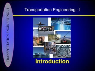
- 54. Urban Location Controls and Highway Classification Transportation Engineering - I
- 55. Urban Location Controls • Location controls are basically the factors which effects the selection of location of a highway. • In an urban area, it is almost impossible to locate a new major highway or improve an existing street/highway to carry out the required functions.
- 56. Urban Location Controls Factors which effects the location of a highway are summarized below: • The location of a new highway or the substantial improvement of an old one results in the elimination of , or change in, portions of the established city culture, which complicates the problem of finding a suitable location.
- 57. Urban Location Controls • Anticipated traffic is a major factor controlling the location of a highway as it effects the land use requirements. • Town planning considerations should also be evaluated for highway location. Town planning relates the present and future needs of the business, industrial, residential and recreational elements.
- 58. Urban Location Controls • In most cities, parking problem is acute, so it is desirable to locate a new highway as close as possible to the existing or potential parking areas. This is particularly important in central areas, where congestion is to be minimized. If the selected route location does not meet this criterion then congestion can be reduced by providing ramps at the locations which connects the major highway to the town streets.
- 59. Urban Location Controls • The most important controls effecting the location and type of urban arterial highways is the existing transportation system. Any new facility must be integrated with the existing road system for optimum usage. • Topography and physical features of a town can be the major controls influencing the location of a highway in ruralareas.
- 60. Urban Location Controls • Soil and ground water conditions also effect location, e.g. poor soil conditions, high water table and rock close to the subgrade effect the location. • In an urban area, existing public facilities (e.g. storm and sewer pipes, electric lines, gas and water lines etc.) can present many difficulties which may effect the location of a major highway.
- 61. Urban Location Controls • In the case of a specific highway the changes or need for complete utility relocation may make another site more attractive. So the highway engineer engaged in locating a new roadway must have sufficient information regarding utilities to assure that the plans being considered are practical and workable.
- 62. Rural Roads On the basis of functional classification system rural roads are divided into the following categories: • Rural principal arterial system • Rural principal and minor arterial system • Rural collector system • Rural local road system
- 63. Rural principal arterial system has the following characteristics: • substantial part of traffic are statewide and interstate trips • movements between urban areas with populations over 50,000 and majority of movements between areas with population over 25,000 • integrated connections within the system
- 64. Rural principal and minor arterial system has the following characteristics: • linkage of cities, larger towns, and other major traffic generators • integrated interstate and inter-county system • internal spacing consistent with population intensity • trip lengths and volumes greater than those served by rural collectors and local system
- 65. Major collector roads: • serve intra-county traffic generators • link these places with larger towns or other routes of higher classification
- 66. Minor collector roads: • accumulate traffic from local roads • serve locally important traffic generators (smaller communities)
- 67. Rural local road system • Rural local road system provides access to abutting land, individual farms, etc.
- 68. Schematic illustration of a functionally classified rural highway network
- 69. Pakistan Motorways • M1 is from Islamabad to Peshawar. It is a 155 km access-controlled motorway with 6 lanes. • M2 is from Lahore to Islamabad. It is a 367 km access-controlled motorway with 6 lanes. It was completed in November 1997. • M3 is from Pindi Bhattian to Faisalabad. It is a 53 km access-controlled motorway with 4 lanes, which, in future, can be increased to 6 lanes. • M4 is from Faisalabad to Multan with a total length of 200 km. It has 4 lanes, which, in future, can be increased to 6 lanes. • M5 is from Multan to Dera Ghazi Khan with a total length of 65 km and 4 lanes, which, in future, can be increased to 6 lanes. • M6 is from Dera Ghazi Khan to Ratodero with a total length of 450 km and 4 lanes, which, in future, can be increased to 6 lanes. • M7 is from Kakkar via Dureji to Karachi with a total length of 303 km and 2 lanes. • M8 is from Gwadar to Ratodero with a total length of 1072 km and 2 lanes. • M9 is from Karachi to Hyderabad with a length of 136 Km and 6 lanes. • M10 is the Karachi Northern Bypass, which has a total length of 56 km and 6
Hinweis der Redaktion
- The road building techniques used by the Romans is a good model for present techniques. The basic idea is to provide a structure that has successively stronger layers as we proceed from the sub grade to the surface. The major difference is in materials that were used. Present day surface materials like asphalt and concrete are superior in ease of construction compared to the rock slabs used by the Romans. In fact the major difference between then and now is in the amount of human labor where slave labor is used instead of Caterpillar excavators. The typical Roman road was a layered system as shown below and is described by (1,2)