SlideShare ist ein Scribd-Unternehmen logo
1 von 11
Downloaden Sie, um offline zu lesen
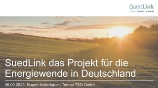
SuedLink das Projekt für die
Energiewende in Deutschland
06.09.2023, Rupert Kellerbauer, Tennet TSO GmbH
1. SuedLink – Projekt
2. Trassenprojekt
3. Digitale Systeme der Planung und die Rolle von FME
4. FME & Bohrprofile
30.08.2023
2
Inhaltsverzeichnis
SuedLink
» Deutschland muss bis 2045 klimaneutral werden
→ Umfangreicher Ausbau der erneuerbaren
Energien notwendig
» Energiewende erfordert überwiegend dezentrale Einspeisung
von Windenergie im Norden und Solarenergie im Süden
» Stromnetze müssen an veränderte Erzeugungsstruktur
angepasst werden, um weiter stabile Stromversorgung zu
gewährleisten
» Konventionelles Wechselstromnetz kann Spannungs- und
Frequenzhaltung über große Distanzen nur schlecht
bewältigen (Spannungseinbrüche, Frequenzhaltungs-
probleme)
» Leistungsstarke Gleichstromleitungen wie SuedLink sind
daher entscheidend für Umsetzung der Energiewende
30.08.2023
3
Strukturwandel der Energieversorgung
Veränderte Anforderungen an das Netz
SuedLink
700 km 10 Mio.
Haushalte
4 GW +/- 525 kV
Spannungs-
ebene
» SuedLink ist das zentrale Infrastrukturvorhaben
der Energiewende in Deutschland
» Flexible Übertragung von Nord nach Süd oder
Süd nach Nord
» Umsetzung als Gleichstrom-Kabel
SuedLink –
Die Windstromleitung
25.01.2023
SuedLink
4
SuedLink-
Geplanter Verlauf & Bestandteile
SuedLink hat 2 Trassenabschnitt Nord & Süd:
Nord − TenneT
7 Planfeststellungsabschnitte
3 Konverterstationen
1 Kabelabschnitts- &
2 Lichtwellenleiterzwischenstationen
1 Elbquerung
1 Freileitungsabschnitt
Süd − TransnetBW
8 Planfeststellungsabschnitte
1 Konverterstation
3 Kabelabschnittstationen &
2 Lichtwellenleiterzwischenstationen
1 Bergwerk
30.08.2023
SuedLink
5
30.08.2023
6
Rückblick Bundesfachplanung:
SuedLink-Korridor steht über 700km fest
SuedLink
30.08.2023
7
Trassenprojekt
Wo wir stehen & wie es weitergeht
SuedLink
TenneT und
TransnetBW
» Bauphase
SuedLink
TenneT und
TransnetBW
» Einreichung
Plan und
Unterlagen
nach §21
NABEG
Bundes-
netzagentur
» Planfest-
stellungs-
beschluss nach
§24 NABEG
TenneT und
TransnetBW
» Antrag auf
Planfest-
stellungs-
beschluss
nach §19
NABEG
Bundes-
netzagentur
» Antragskon-
ferenz /
Festlegung
» Untersuchungs-
rahmen nach
§20 NABEG
Bundes-
netzagentur
» Anhörungs-
verfahren
nach §22
NABEG
» Entscheidung
Bundesnetz-
agentur über
Korridor nach
§12 NABEG
Bundes-
netzagentur
25.01.2023
8 SuedLink
§21-Unterlagen – Themengebiete
» Erläuterung des Vorhaben
» Alternativenbetrachtung
» Technik & Trassierung
» Flächeninanspruchnahme & Rechtserwerb
» Gutachten & Immissionen (Lärm, elektr. & magnet. Felder, Erschütterung, Wärme, Licht, Luft)
» Umweltverträglichkeit und Auswirkungen auf die Schutzgüter (Mensch, Umwelt, Natur)
» Natura 2000 & Artenschutz
» Darstellung des Eingriffs in Natur & Landschaft und Bilanzierung des Kompensationsbedarfs
» EU Wasserschutz
» Mitzuentscheidende Genehmigungen, Zulassungen und Befreiungen (Denkmalschutz, Baurecht,
etc.)
» Weitere Gutachten (Logistik, Geotechnik, Kampfmittel, Archäologie, Bodenschutz, etc.)
Digitale Systeme:
» ArcGIS Enterprise & ArcGIS Pro
» Weboffice (siehe Online–Planungstool SuedLink)
» AutoCAD
» ProVI
» Lara / Lara Scoup
» GeODin
» MS Dynamics
» FME
30.08.2023
SuedLink
9
Digitale Systeme der Planung und die Rolle von FME
Zahlen:
» Mehr als 2100 Datensätze (Raster & Vektor)
» 129 betreute GIS Services
» Ca. 23 TB Geodaten
» seit 2019 4,5 TB empfangene Geodaten
» Mehr als 1 Million Flurstücke in 5 Bundesländern
» 12 Datenmodelle realisiert inkl. automatisierter
Prüfung von Qualitätskriterien
» 45 produktive Schnittstellen
→ Systemschnittstellen / Upload / Download
» 50-100 Schnittstellenaufrufe pro Tag
» Mehr als 200 registrierte User
» Ca. 20.000 BGU Punkte
Ablauf BGU
» Untersuchung vorh. Informationen
» Identifikation notwendiger BGUs
» Prüfen notwendiger Genehmigungen &
Beteiligter
» Einholen notw. Genehmigung & Absprachen
» Begehung
» Beauftragung Bohrfirma
» Info Bohrfirma bzgl. Auflagen
» Durchführung der Bohrung
» Auswertung Grundwasser-Messtellen
» Lieferung an geotechnische Labore
» Ergebnisse an RPB
» Geotechnische Berichte
» Lagerung der Proben
» Lieferung an Vorhabenträger
» Lieferung an Landesbehörden
30.08.2023
SuedLink
10
FME & Bohrprofile
Beteiligte:
» BGU Koordination
» Bodenkundliche
Baubegleitung
» Regionales Planungsbüro
» Wegerecht
» Tiefbauer
» Beweissicherung
» Geotechnisches Labor
» Landesbehörde
Beteiligte Systeme:
GIS & WebGIS, Lara / Lara
Scoup, GeODin, FME
Vielen Dank für
Ihre Aufmerksamkeit!

Weitere ähnliche Inhalte

Mehr von Safe Software

Cloud Frontiers: A Deep Dive into Serverless Spatial Data and FME
Cloud Frontiers:  A Deep Dive into Serverless Spatial Data and FMECloud Frontiers:  A Deep Dive into Serverless Spatial Data and FME
Cloud Frontiers: A Deep Dive into Serverless Spatial Data and FMESafe Software
 
Cloud Frontiers: A Deep Dive into Serverless Spatial Data and FME
Cloud Frontiers:  A Deep Dive into Serverless Spatial Data and FMECloud Frontiers:  A Deep Dive into Serverless Spatial Data and FME
Cloud Frontiers: A Deep Dive into Serverless Spatial Data and FMESafe Software
 
From Event to Action: Accelerate Your Decision Making with Real-Time Automation
From Event to Action: Accelerate Your Decision Making with Real-Time AutomationFrom Event to Action: Accelerate Your Decision Making with Real-Time Automation
From Event to Action: Accelerate Your Decision Making with Real-Time AutomationSafe Software
 
From Event to Action: Accelerate Your Decision Making with Real-Time Automation
From Event to Action:  Accelerate Your Decision Making with Real-Time AutomationFrom Event to Action:  Accelerate Your Decision Making with Real-Time Automation
From Event to Action: Accelerate Your Decision Making with Real-Time AutomationSafe Software
 
Beyond Boundaries: Leveraging No-Code Solutions for Industry Innovation
Beyond Boundaries: Leveraging No-Code Solutions for Industry InnovationBeyond Boundaries: Leveraging No-Code Solutions for Industry Innovation
Beyond Boundaries: Leveraging No-Code Solutions for Industry InnovationSafe Software
 
Powering Real-Time Decisions with Continuous Data Streams
Powering Real-Time Decisions with Continuous Data StreamsPowering Real-Time Decisions with Continuous Data Streams
Powering Real-Time Decisions with Continuous Data StreamsSafe Software
 
The Critical Role of Spatial Data in Today's Data Ecosystem
The Critical Role of Spatial Data in Today's Data EcosystemThe Critical Role of Spatial Data in Today's Data Ecosystem
The Critical Role of Spatial Data in Today's Data EcosystemSafe Software
 
Cloud Revolution: Exploring the New Wave of Serverless Spatial Data
Cloud Revolution: Exploring the New Wave of Serverless Spatial DataCloud Revolution: Exploring the New Wave of Serverless Spatial Data
Cloud Revolution: Exploring the New Wave of Serverless Spatial DataSafe Software
 
Igniting Next Level Productivity with AI-Infused Data Integration Workflows
Igniting Next Level Productivity with AI-Infused Data Integration WorkflowsIgniting Next Level Productivity with AI-Infused Data Integration Workflows
Igniting Next Level Productivity with AI-Infused Data Integration WorkflowsSafe Software
 
The Zero-ETL Approach: Enhancing Data Agility and Insight
The Zero-ETL Approach: Enhancing Data Agility and InsightThe Zero-ETL Approach: Enhancing Data Agility and Insight
The Zero-ETL Approach: Enhancing Data Agility and InsightSafe Software
 
Mastering MicroStation DGN: How to Integrate CAD and GIS
Mastering MicroStation DGN: How to Integrate CAD and GISMastering MicroStation DGN: How to Integrate CAD and GIS
Mastering MicroStation DGN: How to Integrate CAD and GISSafe Software
 
Geospatial Synergy: Amplifying Efficiency with FME & Esri
Geospatial Synergy: Amplifying Efficiency with FME & EsriGeospatial Synergy: Amplifying Efficiency with FME & Esri
Geospatial Synergy: Amplifying Efficiency with FME & EsriSafe Software
 
Introducing the New FME Community Webinar - Feb 21, 2024 (2).pdf
Introducing the New FME Community Webinar - Feb 21, 2024 (2).pdfIntroducing the New FME Community Webinar - Feb 21, 2024 (2).pdf
Introducing the New FME Community Webinar - Feb 21, 2024 (2).pdfSafe Software
 
Breaking Barriers & Leveraging the Latest Developments in AI Technology
Breaking Barriers & Leveraging the Latest Developments in AI TechnologyBreaking Barriers & Leveraging the Latest Developments in AI Technology
Breaking Barriers & Leveraging the Latest Developments in AI TechnologySafe Software
 
Best Practices to Navigating Data and Application Integration for the Enterpr...
Best Practices to Navigating Data and Application Integration for the Enterpr...Best Practices to Navigating Data and Application Integration for the Enterpr...
Best Practices to Navigating Data and Application Integration for the Enterpr...Safe Software
 
Cloud Revolution: Exploring the New Wave of Serverless Spatial Data
Cloud Revolution: Exploring the New Wave of Serverless Spatial DataCloud Revolution: Exploring the New Wave of Serverless Spatial Data
Cloud Revolution: Exploring the New Wave of Serverless Spatial DataSafe Software
 
New Year's Fireside Chat with Safe Software’s Founders
New Year's Fireside Chat with Safe Software’s FoundersNew Year's Fireside Chat with Safe Software’s Founders
New Year's Fireside Chat with Safe Software’s FoundersSafe Software
 
Taking Off with FME: Elevating Airport Operations to New Heights
Taking Off with FME: Elevating Airport Operations to New HeightsTaking Off with FME: Elevating Airport Operations to New Heights
Taking Off with FME: Elevating Airport Operations to New HeightsSafe Software
 
Initiating and Advancing Your Strategic GIS Governance Strategy
Initiating and Advancing Your Strategic GIS Governance StrategyInitiating and Advancing Your Strategic GIS Governance Strategy
Initiating and Advancing Your Strategic GIS Governance StrategySafe Software
 
Igniting Next Level Productivity with AI-Infused Data Integration Workflows
Igniting Next Level Productivity with AI-Infused Data Integration Workflows Igniting Next Level Productivity with AI-Infused Data Integration Workflows
Igniting Next Level Productivity with AI-Infused Data Integration Workflows Safe Software
 

Mehr von Safe Software (20)

Cloud Frontiers: A Deep Dive into Serverless Spatial Data and FME
Cloud Frontiers:  A Deep Dive into Serverless Spatial Data and FMECloud Frontiers:  A Deep Dive into Serverless Spatial Data and FME
Cloud Frontiers: A Deep Dive into Serverless Spatial Data and FME
 
Cloud Frontiers: A Deep Dive into Serverless Spatial Data and FME
Cloud Frontiers:  A Deep Dive into Serverless Spatial Data and FMECloud Frontiers:  A Deep Dive into Serverless Spatial Data and FME
Cloud Frontiers: A Deep Dive into Serverless Spatial Data and FME
 
From Event to Action: Accelerate Your Decision Making with Real-Time Automation
From Event to Action: Accelerate Your Decision Making with Real-Time AutomationFrom Event to Action: Accelerate Your Decision Making with Real-Time Automation
From Event to Action: Accelerate Your Decision Making with Real-Time Automation
 
From Event to Action: Accelerate Your Decision Making with Real-Time Automation
From Event to Action:  Accelerate Your Decision Making with Real-Time AutomationFrom Event to Action:  Accelerate Your Decision Making with Real-Time Automation
From Event to Action: Accelerate Your Decision Making with Real-Time Automation
 
Beyond Boundaries: Leveraging No-Code Solutions for Industry Innovation
Beyond Boundaries: Leveraging No-Code Solutions for Industry InnovationBeyond Boundaries: Leveraging No-Code Solutions for Industry Innovation
Beyond Boundaries: Leveraging No-Code Solutions for Industry Innovation
 
Powering Real-Time Decisions with Continuous Data Streams
Powering Real-Time Decisions with Continuous Data StreamsPowering Real-Time Decisions with Continuous Data Streams
Powering Real-Time Decisions with Continuous Data Streams
 
The Critical Role of Spatial Data in Today's Data Ecosystem
The Critical Role of Spatial Data in Today's Data EcosystemThe Critical Role of Spatial Data in Today's Data Ecosystem
The Critical Role of Spatial Data in Today's Data Ecosystem
 
Cloud Revolution: Exploring the New Wave of Serverless Spatial Data
Cloud Revolution: Exploring the New Wave of Serverless Spatial DataCloud Revolution: Exploring the New Wave of Serverless Spatial Data
Cloud Revolution: Exploring the New Wave of Serverless Spatial Data
 
Igniting Next Level Productivity with AI-Infused Data Integration Workflows
Igniting Next Level Productivity with AI-Infused Data Integration WorkflowsIgniting Next Level Productivity with AI-Infused Data Integration Workflows
Igniting Next Level Productivity with AI-Infused Data Integration Workflows
 
The Zero-ETL Approach: Enhancing Data Agility and Insight
The Zero-ETL Approach: Enhancing Data Agility and InsightThe Zero-ETL Approach: Enhancing Data Agility and Insight
The Zero-ETL Approach: Enhancing Data Agility and Insight
 
Mastering MicroStation DGN: How to Integrate CAD and GIS
Mastering MicroStation DGN: How to Integrate CAD and GISMastering MicroStation DGN: How to Integrate CAD and GIS
Mastering MicroStation DGN: How to Integrate CAD and GIS
 
Geospatial Synergy: Amplifying Efficiency with FME & Esri
Geospatial Synergy: Amplifying Efficiency with FME & EsriGeospatial Synergy: Amplifying Efficiency with FME & Esri
Geospatial Synergy: Amplifying Efficiency with FME & Esri
 
Introducing the New FME Community Webinar - Feb 21, 2024 (2).pdf
Introducing the New FME Community Webinar - Feb 21, 2024 (2).pdfIntroducing the New FME Community Webinar - Feb 21, 2024 (2).pdf
Introducing the New FME Community Webinar - Feb 21, 2024 (2).pdf
 
Breaking Barriers & Leveraging the Latest Developments in AI Technology
Breaking Barriers & Leveraging the Latest Developments in AI TechnologyBreaking Barriers & Leveraging the Latest Developments in AI Technology
Breaking Barriers & Leveraging the Latest Developments in AI Technology
 
Best Practices to Navigating Data and Application Integration for the Enterpr...
Best Practices to Navigating Data and Application Integration for the Enterpr...Best Practices to Navigating Data and Application Integration for the Enterpr...
Best Practices to Navigating Data and Application Integration for the Enterpr...
 
Cloud Revolution: Exploring the New Wave of Serverless Spatial Data
Cloud Revolution: Exploring the New Wave of Serverless Spatial DataCloud Revolution: Exploring the New Wave of Serverless Spatial Data
Cloud Revolution: Exploring the New Wave of Serverless Spatial Data
 
New Year's Fireside Chat with Safe Software’s Founders
New Year's Fireside Chat with Safe Software’s FoundersNew Year's Fireside Chat with Safe Software’s Founders
New Year's Fireside Chat with Safe Software’s Founders
 
Taking Off with FME: Elevating Airport Operations to New Heights
Taking Off with FME: Elevating Airport Operations to New HeightsTaking Off with FME: Elevating Airport Operations to New Heights
Taking Off with FME: Elevating Airport Operations to New Heights
 
Initiating and Advancing Your Strategic GIS Governance Strategy
Initiating and Advancing Your Strategic GIS Governance StrategyInitiating and Advancing Your Strategic GIS Governance Strategy
Initiating and Advancing Your Strategic GIS Governance Strategy
 
Igniting Next Level Productivity with AI-Infused Data Integration Workflows
Igniting Next Level Productivity with AI-Infused Data Integration Workflows Igniting Next Level Productivity with AI-Infused Data Integration Workflows
Igniting Next Level Productivity with AI-Infused Data Integration Workflows
 

SuedLink Das Projekt für Die Energiewende in Deutschland

  • 1. SuedLink das Projekt für die Energiewende in Deutschland 06.09.2023, Rupert Kellerbauer, Tennet TSO GmbH
  • 2. 1. SuedLink – Projekt 2. Trassenprojekt 3. Digitale Systeme der Planung und die Rolle von FME 4. FME & Bohrprofile 30.08.2023 2 Inhaltsverzeichnis SuedLink
  • 3. » Deutschland muss bis 2045 klimaneutral werden → Umfangreicher Ausbau der erneuerbaren Energien notwendig » Energiewende erfordert überwiegend dezentrale Einspeisung von Windenergie im Norden und Solarenergie im Süden » Stromnetze müssen an veränderte Erzeugungsstruktur angepasst werden, um weiter stabile Stromversorgung zu gewährleisten » Konventionelles Wechselstromnetz kann Spannungs- und Frequenzhaltung über große Distanzen nur schlecht bewältigen (Spannungseinbrüche, Frequenzhaltungs- probleme) » Leistungsstarke Gleichstromleitungen wie SuedLink sind daher entscheidend für Umsetzung der Energiewende 30.08.2023 3 Strukturwandel der Energieversorgung Veränderte Anforderungen an das Netz SuedLink
  • 4. 700 km 10 Mio. Haushalte 4 GW +/- 525 kV Spannungs- ebene » SuedLink ist das zentrale Infrastrukturvorhaben der Energiewende in Deutschland » Flexible Übertragung von Nord nach Süd oder Süd nach Nord » Umsetzung als Gleichstrom-Kabel SuedLink – Die Windstromleitung 25.01.2023 SuedLink 4
  • 5. SuedLink- Geplanter Verlauf & Bestandteile SuedLink hat 2 Trassenabschnitt Nord & Süd: Nord − TenneT 7 Planfeststellungsabschnitte 3 Konverterstationen 1 Kabelabschnitts- & 2 Lichtwellenleiterzwischenstationen 1 Elbquerung 1 Freileitungsabschnitt Süd − TransnetBW 8 Planfeststellungsabschnitte 1 Konverterstation 3 Kabelabschnittstationen & 2 Lichtwellenleiterzwischenstationen 1 Bergwerk 30.08.2023 SuedLink 5
  • 7. 30.08.2023 7 Trassenprojekt Wo wir stehen & wie es weitergeht SuedLink TenneT und TransnetBW » Bauphase SuedLink TenneT und TransnetBW » Einreichung Plan und Unterlagen nach §21 NABEG Bundes- netzagentur » Planfest- stellungs- beschluss nach §24 NABEG TenneT und TransnetBW » Antrag auf Planfest- stellungs- beschluss nach §19 NABEG Bundes- netzagentur » Antragskon- ferenz / Festlegung » Untersuchungs- rahmen nach §20 NABEG Bundes- netzagentur » Anhörungs- verfahren nach §22 NABEG » Entscheidung Bundesnetz- agentur über Korridor nach §12 NABEG Bundes- netzagentur
  • 8. 25.01.2023 8 SuedLink §21-Unterlagen – Themengebiete » Erläuterung des Vorhaben » Alternativenbetrachtung » Technik & Trassierung » Flächeninanspruchnahme & Rechtserwerb » Gutachten & Immissionen (Lärm, elektr. & magnet. Felder, Erschütterung, Wärme, Licht, Luft) » Umweltverträglichkeit und Auswirkungen auf die Schutzgüter (Mensch, Umwelt, Natur) » Natura 2000 & Artenschutz » Darstellung des Eingriffs in Natur & Landschaft und Bilanzierung des Kompensationsbedarfs » EU Wasserschutz » Mitzuentscheidende Genehmigungen, Zulassungen und Befreiungen (Denkmalschutz, Baurecht, etc.) » Weitere Gutachten (Logistik, Geotechnik, Kampfmittel, Archäologie, Bodenschutz, etc.)
  • 9. Digitale Systeme: » ArcGIS Enterprise & ArcGIS Pro » Weboffice (siehe Online–Planungstool SuedLink) » AutoCAD » ProVI » Lara / Lara Scoup » GeODin » MS Dynamics » FME 30.08.2023 SuedLink 9 Digitale Systeme der Planung und die Rolle von FME Zahlen: » Mehr als 2100 Datensätze (Raster & Vektor) » 129 betreute GIS Services » Ca. 23 TB Geodaten » seit 2019 4,5 TB empfangene Geodaten » Mehr als 1 Million Flurstücke in 5 Bundesländern » 12 Datenmodelle realisiert inkl. automatisierter Prüfung von Qualitätskriterien » 45 produktive Schnittstellen → Systemschnittstellen / Upload / Download » 50-100 Schnittstellenaufrufe pro Tag » Mehr als 200 registrierte User » Ca. 20.000 BGU Punkte
  • 10. Ablauf BGU » Untersuchung vorh. Informationen » Identifikation notwendiger BGUs » Prüfen notwendiger Genehmigungen & Beteiligter » Einholen notw. Genehmigung & Absprachen » Begehung » Beauftragung Bohrfirma » Info Bohrfirma bzgl. Auflagen » Durchführung der Bohrung » Auswertung Grundwasser-Messtellen » Lieferung an geotechnische Labore » Ergebnisse an RPB » Geotechnische Berichte » Lagerung der Proben » Lieferung an Vorhabenträger » Lieferung an Landesbehörden 30.08.2023 SuedLink 10 FME & Bohrprofile Beteiligte: » BGU Koordination » Bodenkundliche Baubegleitung » Regionales Planungsbüro » Wegerecht » Tiefbauer » Beweissicherung » Geotechnisches Labor » Landesbehörde Beteiligte Systeme: GIS & WebGIS, Lara / Lara Scoup, GeODin, FME
  • 11. Vielen Dank für Ihre Aufmerksamkeit!