Pgrouting_foss4guk_ross_mcdonald
•
1 gefällt mir•463 views

pgRouting presentation given at FOSS4G UK on 15 June 2016

Empfohlen
Empfohlen
Weitere ähnliche Inhalte
Was ist angesagt?
Was ist angesagt? (20)
Ähnlich wie Pgrouting_foss4guk_ross_mcdonald
Ähnlich wie Pgrouting_foss4guk_ross_mcdonald (20)
Mehr von Ross McDonald
Mehr von Ross McDonald (20)
Kürzlich hochgeladen
Kürzlich hochgeladen (20)
Pgrouting_foss4guk_ross_mcdonald
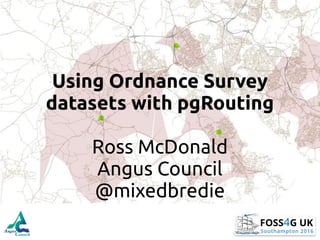
- 1. Using Ordnance Survey datasets with pgRouting Ross McDonald Angus Council @mixedbredie
- 2. “The person attempting to travel two roads at once will get nowhere.” - Xun Zi Contains OS Open Data Crown Copyright and Database Right 2016.
- 3. What is it? An extension to the PostGIS enabled PostgreSQL database to add geospatial routing functionality.
- 4. Why use it? • Free (as in freedom) • Flexible (as in open source) • Functional (as in fully featured) • Fun (if you’re that way inclined)
- 5. http://www.cartographicperspectives.org/index.php/journal/rt/printerFriendly/c What does it need?
- 6. CC-BY-NC-SAReproducedwiththepermissionoftheNationalLibraryofScotland Where can one get such things?
- 7. Data, data everywhere • OS Open Roads • OS Meridian2 • OS Strategi • OS ITN • OS Highways • OS Water Network
- 8. OpenStreetMap Metro extracts by Mapzen
- 9. "name1" IN ('Watling Street','Fosse Way', 'Ackling Dyke', 'Akeman Street', 'Cade''s Road', 'Dere Street', 'Ermin Way', 'Devil''s Causeway', 'Devil''s Highway', 'Ermine Street', 'Fen Causeway', 'Icknield Street', 'King Street', 'Maiden Way', 'Military Way', 'Peddars Way‘, …) https://dhs.stanford.edu /spatial- humanities/geographic- networks-pgrouting/ /en.wikipedia.org/wiki/Roman_roads_in_Britain#/media/File:Roman_Roads_in_Britannia.svg
- 10. But first you gotta be loaded • For OS data – Astun Loader! – Lutra’s OS Translator II – Ogr2ogr – Snowflake’s GoLoader* – Safe’s FME* • For OpenStreetMap – osm2pgrouting
- 11. There’s a plugin for that • How can I use it without writing SQL? • pgRouting Layer by Anita Graser and others in the pgRouting team
- 12. CC-BY-NC-SAReproducedwiththepermissionoftheNationalLibraryofScotland “Most roads lead men homewards, my road leads forth.” John Masefield
- 18. PostgreSQL function to loop through each input point and calculate Djikstra shortest path to every node on the network… pgRouting 1.0.7-dev
- 19. pgRouting 2.2.3 • Using pgr_drivingdistance and pgr_alphashape • Using an all-in-one function to process multiple input points IMPROVED
- 26. Performance Enhancements • Index your data • Add a Bounding Box to your query • Make it easier for the user
- 27. Vanilla Shortest Path SELECT seq, id1 AS node, id2 AS edge, cost FROM pgr_dijkstra(' SELECT gid AS id, source::integer, target::integer, cost_time::double precision AS cost, rcost_time::double precision AS reverse_cost FROM or_network', 100828, 1136587, false, true);
- 28. M&S Shortest Path SELECT seq, id1 AS node, id2 AS edge, cost FROM pgr_dijkstra(' SELECT gid AS id, source::integer, target::integer, cost_time::double precision AS cost, rcost_time::double precision AS reverse_cost FROM or_network WHERE geometry && ST_Expand( (SELECT ST_Collect(the_geom) FROM or_network_vertices_pgr WHERE id IN (100828, 1136587)),5000)', 100828, 1136587, false, true);
- 29. Making things even better! • Update the QGIS plugin to use new PGR functions • Update the plugin to use a bounding box • Add restrictions (e.g. closures, safe routes) • How does psycopg2 work? Is it a bottleneck?
- 30. Not Mrs Beeton’s recipes http://anitagraser.com https://georepublic.info/en/blog http://workshop.pgrouting.org/index.html http://ghost.mixedbredie.net/tag/pgrouting
- 31. CC-BY-NC-SAReproducedwiththepermissionoftheNationalLibraryofScotland Thank you Ross McDonald Angus Council mcdonaldr@angus.gov.uk @mixedbredie 01307476419