Gamification of Geoinformation in Swiss Education and Research
•Als PPTX, PDF herunterladen•
1 gefällt mir•8,328 views

The ubiquitous availability of mobile devices at the youth generation affords new concepts of education especially in the field of Geoinformation. Switzerlands' educators and researchers are very active providing new applications for K12 and higher Education. Gamification of such apps is increasing and impacts the GI Education in a positive way. This presentation was shared at Esri Education Userconference 2015 in San Diego.

Empfohlen
Empfohlen
Weitere ähnliche Inhalte
Was ist angesagt?
Was ist angesagt? (7)
Ähnlich wie Gamification of Geoinformation in Swiss Education and Research
Ähnlich wie Gamification of Geoinformation in Swiss Education and Research (20)
Mehr von Christian Sailer
Mehr von Christian Sailer (18)
Kürzlich hochgeladen
Kürzlich hochgeladen (20)
Gamification of Geoinformation in Swiss Education and Research
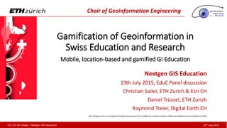
- 1. 19th July 2015Esri UC San Diego – Nextgen GIS Education Chair of Geoinformation Engineering Gamification of Geoinformation in Swiss Education and Research Mobile, location-based and gamified GI Education Nextgen GIS Education 19th July 2015, Panel discussion Christian Sailer, ETH Zurich & Esri CH Daniel Trüssel, ETH Zurich / Raymond Treier, Digital Earth CH http://webapps-cdn.esri.com/Apps/EventsAppCordova/www/?mm=true#@view=eventSessions@con=94@mode=list@dataset=sessions@feature=20541
- 9. Objective Research – Missing Data Data Collection Data Analysis Presentation
- 11. 2015 2016
- 12. http://www.esri.ch/branchen/bildung-und-forschung/sommercamps/2014?sc_lang=de-DE Objective Research – Missing Data Data Collection Data Analysis Presentation
- 13. http://www.egea.eu/activity/western-regional-congress-2014-2/workshops-trainings Objective Research – Missing Data Data Collection Data Analysis Presentation
- 14. http://mankindunplugged.com/2014/07/21/sponsored-post-roger-federer-lindsay-vonn-lindt-chocolateheaven-challenge-aletsch-glacier-switzerland/ Roger Federer and Lindsay Vonn Lindt Challenge Atop Aletsch Glacier in Switzerland
- 16. http://megageogame.herokuapp.com/ 3hrs Bern (CH) 6 classes 150 students Collector App Live Panel
- 17. Prof. Stefan Keller, Geometa Lab, University for Applied Sciences Rapperswil (CH), www.hsr.ch/geometalab
- 20. 19th July 2015Esri UC San Diego – Nextgen GIS Education Land Use Engineering Group GIS supported mobile outdoor experiments The GISsmox Project Monika Niederhuber – Daniel Trüssel – Urs Brändle
- 21. Wind speed Applications Wind direction Moortiefe Potential breeding grounds of tiger mosquitoes Neophyte Akebia quinata Depth of humus layer Funded by www.innovedum.ethz.ch
- 22. 19th July 2015Esri UC San Diego – Nextgen GIS Education Chair of Geoinformation Engineering Location-base mobile Learning Sustainable personal Mobility styles
- 23. 19th July 2015Esri UC San Diego – Nextgen GIS Education Chair of Geoinformation Engineering Funded by www.innovedum.ethz.ch omleth.ch
- 24. 19th July 2015Esri UC San Diego – Nextgen GIS Education Chair of Geoinformation Engineering GeoGames for Schools Game Goals Environment Learning Paradigm
- 28. Mobile Programming Learner- centred Nextgen GI Education #mLearning Mobile technology 21st Century Skills Location-based Education Learning like Gaming
- 29. Let’s talk the walk Thank you! @csailer80
Hinweis der Redaktion
- Thank you Esri Education Team and David for this invitation. Our title Gamification of Geoinformation in Swiss Education and Research are big words. Namely Raymond Treier and Daniel Trüssel could join and I will introduce them later. Our vision consits of the message about mobile, location-based and gamified learning and we want to show are current and future activities from Switzerland. Switzerland? Who know sth. about Switzerland?
- Of course, obviously many people thnk about chocolat, cows, or our red McGyver Swiss army knive… .. Or more in context of Geography..
- Our Swiss Montains with the famous Matterhorn… which you probably already have seen once when you were hiking?
- Sometimes you see also wandering people, but don’t think they are lost in space. They could be under «geostruction»
- Who knows Geocaching? The treasure hunting game? With the goal to find a tupperwear based on multi-million dollar satellites? Where people walking head-down around in the green? How do you it? Of course with a GPS Device? Oh GPS, these 1000 $ device just to receive 3 numbers? Once, 15 years ago, your are right. But now..
- Geochachers use Smartphones. And it’s for free. Everbody can participate. And there are 2.6 Mio. Caches worldwide. 24’00 in little Switzerland. And here more are coming…
- Because also of Raymond Treier students which have built an Multicache for the city of Grenchen. – severa single chaches which have to be passed to finish successfully the goal-target cache. The Tourism center of Grenchen is very porud to have such a multicache. But Raymond Treiers is not only since this activity famous in Switzerland. He is the founder of the GIS for Schools Training book which is sold in around 50 % of Swiss Schools! We have translated this book with Swiss Open GovData in four languages (German, French, Italian and English) to provide it everywhere. This success was honoroud by Esri 2007 by a Special Achivement Award and Raymonds college got the Centre of Excellence in Switzerland and is member of Digital Earth. Raymond school and Esri CH have a very good partnership with regular exchange.
- Esri Switzerland assist also other colleges on STEM days. Starting with a research question. We follow the roadmap of a typical GI project. For instance «How green is our school» students need the think about data collection. Trees and green areas are not exist as geodata, so student need to collect them. We model together the data structrure and let them in given sectors collecting the green areas. Turning back we continue with analysing the data and calculating the areas form the vegetation points and ist radius. Finally the produce a webmap wih their own cartographic representation and let the assess through the like… Students needs only to bring their own device and the colleag laptops. Everthing of this 3hrs. Project is made in ArcGIS Online.
- This concecpt was found in our Esri Summercamps which is very similar structures as this internship we heard yesterday at the plenary. The field work outside with the smartphone use plays a central role where student learn to compare the representation in the data model and the real world. This successfull concept…
- Applied also to higher Education. Last year the Western Congress of the European Geographers met in the Swiss Alps. They asked for a GI workshop and we teached them in the same way like in the Summercamp. Thanks to Collector Apps offline capability they could collect data on 3000 meters above sealevel on a beautiful Swiss glacier with their own smartphone and with using expensive roaming costs! The feedback was awesom! Tlaking always about glaciers? Our title mentioned also gamifciation!!
- Swiss likes gaming, especially professional sportsmen like our famous tennis star. Here together with the famous American ski star on the Aletschgletscher playing a charity game. Probably won in contrary to last weekends defeat in Wimbledon.
- During the Swiss GI Summit, we got asked to promote GIS to the next generation.->The mission was make GIS intersing. How do you interest the next generation? By games!! Many Swiss Edu Organziation have already done once a gamified application so we wanted to bring together it all and demonstrate item by item. The central part was the …
- MegaGeogame.. Which allowed for 150 students playing in classes with the Collector App this 6 level geogame in the swiss capital city Berne. Visitors of the GI Summit could follow each player in real-time over a self-made web – dashboard which was built with ArcGIS and OS Technology. The OS part made Hochschule Rapperswil which..
- Known by his Professor Stefan Keller for OpenStreetMAp. They built an gamified mobile app to contribute in Openstreetmap. They got many prizes for this game-App.
- A last gamified app we modeled for the 1. of May last year. This day is a political demostration day where police is often very busy. We used this exciting day to document the incidents and let student out in the battle depending on the where. We made this with Collector Apps data collecting and realtime analysis on different Operation dashboards. The experience as great and the impacts of servcie learning unique!
- So Mobile Learning or Mobile GIS is also under research!
- 20
- 21
- I’m also PhD student since one year at ETH Zurich in the GI Group where our focus is based on GIS and Mobility. We want to find out how we can peoples behavior in their mobility change to sustainable energy consumption. We build an app which is based on gamification elements. I’m personally payed and charged to build an LMS for location-based mobile learning.
- I propagate also with my Esri experience that situative, contextual learning improves the motivation and achievements of the learning goals. This tool calls OMLETH and lecturers or teachers can build their own fieldtrips with learning units in manner of geofences like in blackboard or Moodle. The produced module can students execute on their own mobile phones. If you are interested to test it, you can give me a call.
- Further because we argue the benefit of Geogames in the field of GI edcuation, we created a 6-step didactic planning framework For bridging the gap between location-based games and teaching. In this framework teachers syllabus and learning goals are fully embedded what often is missing in current serious game apps.
- So learning is changing! Nextgen Learning is gamified and mobile! Seamless learning that looks like gaming is the goal!
- In Switzerland, many partners are on this way. Often with Esri Tech, sometimes with Opensource. But partner see the value of Esri tech and asking for collaboration like recently for instance Swisstopos storymaps group.
- kids mobile phones! Mobile phones have also changed. There are packages of sensors. This location-based sensor mapping provide again new applications for nextgen GI Education. This devices are extremly smart and makes your kids very smart.
- Nextgen GI Education supports 21st century skills with Critical Thinking, Creative Thinking, Collaborating, Communicating. Nextgen geography is learner-centred and mobile technolog-based. The seamless-gaming approach shoul be adapated on learning. ->Serious gaming Education is more outside the school, location-based. With LMS teachers can control also spatially. And that Education is more LBS, Geography will profit with ist knowldge about spatial concepts Therefore Mobile Programming in Geography Education is essentially to generate such mobile apps and analytics to keep the lead of GIS!! 21st Century Skills: Critical thinking, process analytics, spatial analytics Learner-centred: Exploring, Surveying, Sensoring Mobile First: Anywhere, anytime, ubiquitios Learning like Gaming: Collaborative, informal, constructiviste, creative and seamless Location-based Education: Location-based mobile Games, Mobile Learning / In situ Learning / Geographical Learning Development: Process (Python) and App (HTML5, JS CSS3) Development, Android (Java) Learning Skills Critical Thinking Creative Thinking Collaborating Communicating Literacy Skills Information Literacy Media Literacy Technology Literacy Life Skills Flexibility Initiative Social Skills Productivity Leadership