Natural Disasters Topic 6 (Hydrologic System)
•Als PPTX, PDF herunterladen•
3 gefällt mir•2,242 views

Overview of the hydrologic system for a GE-level course in natural disasters.

Empfohlen
Empfohlen
Weitere ähnliche Inhalte
Was ist angesagt?
Was ist angesagt? (19)
Andere mochten auch
Andere mochten auch (6)
Ähnlich wie Natural Disasters Topic 6 (Hydrologic System)
Ähnlich wie Natural Disasters Topic 6 (Hydrologic System) (20)
Mehr von William W. Little
Mehr von William W. Little (20)
Kürzlich hochgeladen
Kürzlich hochgeladen (20)
Natural Disasters Topic 6 (Hydrologic System)
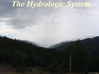
- 1. The Hydrologic System Photo by W. W. Little Photo by NASA
- 2. Hydrologic System From Okanagan University College, Department of Geography website • Combination of the atmosphere and the hydrosphere. • Driven by the Sun and modified by the earth’s rotation. • Responsible for storms, rivers, lakes, groundwater, sand dunes, glaciers, beaches, soil formation, oceanic currents, global circulation patterns, climatic belts, and anything thing else involving water or air. •Whereas the tectonic system builds things up; the hydrologic system wears them down. • Primary processes include weathering, erosion, sediment transport, deposition, and lithification
- 3. States of Matter Atoms are loosely packed and the substance conforms to the shape of its container. Atoms are closely packed and the substance maintains its own shape. Atoms arecompletely separated and expand to fill all available space. From Hamblin & Christiansen (2001) Matter exists in three forms (states) - solid, liquid, and gas. These represent the ability of atoms to vibrate and move about. The two primary controls are temperature and pressure. An increase in temperature adds energy, causing atoms to vibrate and move further apart, decreasing density. An increase in pressure forces atoms closer together, decreasing their ability to vibrate and increasing density.
- 4. Energy Transfer Conduction: Energy is transferred by direct contact as the vibration of atoms on the surface of one material is transmitted to those on the surface of a neighboring material. Convection: Energy is transferred as material moves from place to place due to differences in density, caused mostly by contrasts in temperature. When a material is heated, the atoms move farther apart, density decreases, and it rises. When the material is cooled, atoms move closer together, density increases, and it sinks. Radiation: Energy is transferred through space by electromagnetic waves. Most energy is transferred from one substance to another through three processes - conduction, convection, and radiation. This transfer can often be measured by changes in temperature.
- 5. Global Water Distribution Photo by W. W. Little Oceans = 97.2% Photo by Global Marine Drilling Ice = 2.15% Photo by W. W. Little Photo by W. W. Little Photo Photo by W. W. Little by W. W. Little Lakes, streams, ground water, and atmospheric water = 0.65%
- 6. The Sun The Sun is the energy source driving the hydrologic system. Photo by NASA
- 7. Weather can be though of as what’s happening right now. Climate deals with long-term weather patterns for a given area. The U.S. has the most diverse weather of any country on earth and the greatest number of severe-weather events. Photo by W. W. Little Weather vs. Climate The most important weather measurements include: • Air temperature • Air pressure • Relative humidity • Type and amount of precipitation • Type and amount of cloudiness •Wind velocity (speed & direction) and consistency
- 8. Atmospheric Compositions Earth’s present atmosphere is distinctly different from that of its nearest neighbors, Venus and Mars. Although, it is believed that at one time, the atmospheres of these three planets were much more alike.
- 9. Other Atmospheric Constituents Water vapor: Locally makes up 0 to 4% of atmospheric composition and is important in heat retention and transfer. Aerosols: Highly variable in concentration and consist of suspended particles (dust, ash, smoke, pollen, salt, etc.). Effective in filtering solar energy and provide nucleii for condensation. Contribute to colorful sunsets. Ozone: O3 particles located in the stratosphere as a result of the absorption of ultraviolate radiation by O2 molecules. Photo by W. W. Little
- 10. Photo by W. W. Little Colors in the Sky
- 11. Solar Radiation Solar energy moves through the atmosphere by radiation, only part of which is visible (wavelengths between the infrared and ultraviolate range). Gasses and aerosols in the atmosphere allow some of this radiation to reach the earth’s surface, while reflecting, absorbing, or scattering the rest.
- 12. Fate of Solar Radiation Photo by NASA Photo by W. W. Little Transmission: Radiation energy passes through the atmosphere, eventually reaching the earth’s surface. Absorption: Radiation energy is transferred to gasses within the atmosphere, increasing molecular activity and, therefore, temperature. Reflection: Radiation is “bounced” off the surface of gasses and aerosols, returning it to space. An objects reflectivity is referred to as its albedo. Scattering: Radiation is separated into different wavelengths. Leads to diffuse (indirect) lighting, soft shadows, blue to white daytime skies, and reddish sun rises and sunsets.
- 13. “Greenhouse Effect” About 50% of the solar radiation that reaches the atmosphere makes it to the earth’s surface The “greenhouse effect” refers to the trapping of solar radiation by atmospheric gases. Water vapor absorbs five times more radiation than all other gases combined. Without the “greenhouse effect,” the world would be a very cold place.
- 14. Atmospheric Pressure & Temperature Temperature increases due to absorption of very short-wave radiation by N and O at the outer edge of the atmosphere. Temperature decreases because of the thinness of the atmosphere and a lack of ozone. Temperature increases because of absorption of ultraviolate radiation by O3. Temperature decreases because of atmospheric thinning. High heat (energy) Low temperature Because of gravitational attraction, most of earth’s atmosphere is concentrated near the surface in the troposphere, causing both temperature and pressure to be greater at lower altitudes.
- 15. Climatic Belts & Temperature Earth’s surface temperature is greatest at the equator, decreasing to a minimum at the poles. This disparity in Solar energy distribution is responsible for the generation of atmospheric and oceanic currents.
- 16. Temperature and the Sun Because of earth’s spheroidal shape, a given amount of solar energy is spread over a larger area at the poles than along the equator.
- 17. Climatic Belts & Precipitation The amount of precipitation that falls is strongly tied to latitude. It is highest at the equator, very low just north and south of the equator, moderate in mid-latitude regions, and lowest at the poles.
- 18. Coriollis Effect Earth’s rotation causes an atmospheric deflection that is clockwise in the northern hemisphere and counterclockwise in the southern hemisphere. This creates distinct belts of atmospheric circulation.
- 19. Earth’s Seasons 24 hrs of light above the For Northern Hemisphere, day is 24 hrs of light below the For Northern Hemisphere, night is Equinox means “equal night” Sun directly “above” Equator Arctic Circle Sun directly “above” Tropic of Cancer (23.50 N) Antarctic Circle Sun directly “above” Tropic of Capricorn (23.50 S) longer than night. longer than day. Earth’s seasons are due to its axial tilt, causing each hemisphere to face the Sun during its summer and to face away from the Sun during its winter. The change in sun angle affects the amount of radiation reaching the surface at a given spot. The impact is least along the equator and greatest at the poles.
- 20. Surface Runoff Stream channels are the most pervasive surface characteristic of earth’s continental masses and transport the greatest amount of continental precipitation back to the sea. Photo by NASA Stream channels are to earth what craters are to the moon.
- 21. Surface Runoff (rivers) Rivers have a variety of shapes that are controlled by climatic factors and the nature of the sediment they are transporting.
- 22. Stream Deposition (deltas) Photo by W. K. Hamblin Streams carry both water and sediment (boulders to dissolved ions in size) from the land to the sea, where the sediment is ultimately deposited.
- 23. Glaciers represent a temporary disruption of normal surface runoff. Water is tied up in ice, which flows downhill in much the same manner as rivers but much more slowly. Glaciers
- 24. Lakes and Reservoirs Photo by W. K Hamblin Surface runoff can be temporarily impounded by lakes and reservoirs.
- 25. Landslides Landslides are typically caused by a high moisture content in earth’s surficial materials.
- 26. Deserts Photo by W. W. Little Deserts represent a disruption of the river system, which occurs when temperatures are sufficiently high so that the hydrologic system is partially shutoff due to a lack of precipitation. Eolian (wind) processes dominate and river systems can be completely overwhelmed by dune fields.
- 27. Changing Environments Photos by NASA Radar images taken through the dune fields of the Sahara Desert by the space shuttle reveal a well-developed drainage system.
- 28. Groundwater System Some precipitation seeps into the ground and flows through the subsurface. It can return to the surface through seeps and springs or flow directly into streams, lakes, or the sea.
- 29. Karst Topography Photo by W. W. Little Groundwater dissolves rock and produces karst (dissolved) features, including sink holes and caves.
- 30. Shoreline Systems Rocks are eroded and sediment is transported along shorelines by waves, tides, and submarine currents. •Waves: part of the hydrologic system driven by unequal solar heating (wind). • Tides: part of the hydrologic system modified by lunar gravitational attraction. • Submarine currents: part of the hydrologic system modified by water chemistry ,temperature, and earth’s rotation. Photo by W. W. Little
- 31. Temperature of Seawater Seawater is mostly cold, but above freezing. However, a thin layer of warmer water exists at the surface, where it is heated by solar radiation. This is particularly evident at the equator.
- 32. Oceanic Surface Currents As a result of the Coriollis Effect, ocean surface currents rotate clockwise in the northern hemisphere and counterclockwise in the southern hemisphere. These currents have important climatic implications.
- 33. Deep Ocean Circulation Cold, highly saline polar water sinks and moves along the seafloor, then slowly moves upward where it mixes with warmer water of mid and low latitudes.
- 34. Whole Ocean Circulation Oceanic circulation is very slow, but over time involves mixing of the entire volume of the sea.