Climate Green Maps 2014
•
1 gefällt mir•8,257 views

Putting climate change on the map! Green Map System has been highlighting solutionary projects across NYC and watching it spread throughout the 65 country Green Map network - now you can see it too.

Empfohlen
Empfohlen
Weitere ähnliche Inhalte
Was ist angesagt?
Was ist angesagt? (11)
Ähnlich wie Climate Green Maps 2014
Ähnlich wie Climate Green Maps 2014 (20)
Mehr von Wendy Brawer
Mehr von Wendy Brawer (9)
Kürzlich hochgeladen
Kürzlich hochgeladen (20)
Climate Green Maps 2014
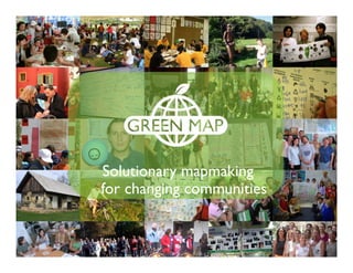
- 1. Solutionary mapmaking for changing communities …
- 2. Let’s start with one Green Map of NYC. This edition was inspired by 2003’s blackout and focuses on energy impacts and climate realities The ‘Powerful Green Map of NYC’ was published in Jan 2006 These 100,000 folding maps have 3 views: Dark sides of our energy choices • Everyday & easy • Energy investments
- 3. Its ‘Energy Dark Side’ shows true cost of our current choices and predicted storm surges and impacts on infrastructure Charting asthma, air quality, accidents, injustice and other impacts, along with climate projections from Columbia’s Earth Institute
- 4. In response to educators’ inquiries, teen modules and a Green Jobs deck were created.These free tools build awareness & skills GreenMapNYC.org/get-involved/students-teachers/
- 5. We also re-purposed the print map to impact more people, with print on demand posters,‘hot linked’ PDFs and more
- 6. This map’s data became part of our interactive map about renewables, conservation and climate OpenGreenMap.org/NYCenergy Download PDF
- 7. We share our mapping platform with local Green Mapmakers in 40 countries. Every site is open to public viewpoints, images, etc
- 8. All Green Maps share an icon set that highlights assets as well as what is at risk or already impacted – get posters at GreenMap.org/icons Climate Changed Vulnerable Site Disaster Area Habitat at Risk Blight Site Abandoned Contaminated Greenhouse Gas Reduc?on
- 9. Our newest mapmaking tool: Mobile Site Collector makes it easy to chart sites as you visit them, in 13 languages! United Na?ons Workshop 7/2014
- 10. Back to NYC: after Superstorm Sandy in Fall 2012, we added the flood’s highwater mark across the city and region Solar Empowerment Zones in Red. Purple is Sandy’s extent. Toggle sites and lines in map legend embed this map in your website or blog – see: GreenMap.org/nyc-energy
- 11. Our Adapting to Change cycling & walking tours reveal issues & opportunities in impacted Lower East Side areas Add sites to this map! Explore on our website or at Facebook.com/lower.east.ride Our Sandy history blog: bit.ly/sandy12
- 12. Our Green Maps, tours and mapmaking tools leverage change by sharing knowledge, awareness and experiences Municipal Art Society – Road to Resilence Tour
- 13. Spring 2013: Lower East Ride Green Map published as postcard and poster maps in Chinese, Spanish and English. Created with Partnerships for Parks, this map links impacts to community resilience sites, including 45 new Bike Share stations. Download at Facebook.com/lower.east.ride Tri-lingual print editions
- 14. Our NYC Climate Week Cycling Tour and maps received 2012 and 2013 Human Impacts Institute Creative Climate Action Awards To extend the community building value, we made a how to video for Green Map cycling tours – see it in English at bit.ly/howtourGM The project continues to draw attention as we model its elements to benefit more NYC communities & global partners
- 15. Our NYC climate mapping projects have helped to inspire other Green Mapmakers to illuminate the issue in their community, too Renewable Energy is on the Open Green Map by Clima of Girona Spain OpenGreenMap.org/ clima
- 16. 3 from Asia: Delta Electronics Workplace Green Maps (Taiwan) AnSan’s climate countermeasures map (Korea), and Mangrove maps (China) !""# ! # " $ # $%&'!() *+,-!./ 0123!%&'()*+(),-./!0123- 456789:;<= 4441,-((12( > ?@ AB !" C!DE FGHIJ # K" LMNOPQRSTU V# WX"YZ[]PQ^_`a b" cdefghNHiRSTL O# UVjRk"lRSmnop qP#UD!$rLstj"uv?q" whxyz{L|}% &~j•€U lfxyL{UQ|•‚5‚5Q" LNjYZ[QHƒ„i}RSQ i…mTU#U|sX†g‡ˆ‰L '' !$ C!Š‹ Œ•Ž•• v‘’•Ž••“”•}–— ˜™š›"œ•žŸ l¡¢£QŽ •to"¤¥¦štoQ¥§"¨© }5ª«¬-®¯#°Ž••±²Q ³´µ™š›¶•·¸Ž••¹1 PQŽ•º»¼½"€Ž••¾¿® ‡ÀÁ½QÂÃ"ÄÅžŸ Ælj Ž•j# !! ! % " #$% HÈÉ>ÊËÌ¿ !ÍÎÏÐ Ñ"#ÒÊÌ¿!ÓÒÔQÕÖ"#×Ì ¿!Ø×Ù"#HÚÛÛÌ¿!ÜÛB" $$ÖÝÞßà%&'(() *+,&#áâ ÞÃãäßà#åæfD#w•ß àa#lãäçèÓéêë'pì'í ÏQîB#”ïð•ŸQà¿-./0)1ñ ¿®f#”òóôõö÷ø‹ßù“ úû-üQßà( ê ý þ a ÿ H ! Þ ß à " 2334 !#ï$ãk#ÞßàQ%&w¥'(ý þ)*¥f# +,-~.~Š/Qïð0íÏä 1( 23%&Qßà455‡•õ†*~#678 9Qù:'߉';<rñ¿( °Þßà=•>fê ?ßQ@A BÀC5D-Q# iEFÙGõ'H IPQHãJKL'íÏ@A 'ê*MNO 'PQ ßùìR2SQprr( vTõ†UÌVWH X#BÀYZ®QÞßàá•[|ßUÌ?ß] ^Qãä÷ã_àî ( `acH! ßàg•bHcY # dej]fg ã_QŠhŠi( ad#)j]çk*lmï³no Ïpqrst#bOud-vw!Þ ßà#iE;<xFyÞßà 'z{ |}~•€•§³noêëÏ‚Ù ÞßàJ;<ƒ„FÙÞßà#…À X-vmï³noÏpqr{;< xFy†;<ƒ„FÙQ퇈‰ Š‹( aŒ•)j]çk*•!Ž-X !ß•HoX" íÏä1•kQ‘H íÏŒ1( Þßà…‡’’•H!ßà°“#á•ãämp ì'ã_'íÏ'”•Q–W( —˜tjL™ãämé QQš+( vT›œQx:#4••}žŸQÜ ¡# ¢£¤¥Q¦§#”(¨Q©ª#«¨¬-zLÖ Qgf( L™¦®#H!ÞßàQ鯡°#•[¤1p Q#4±Óö÷ôB²³´µ¶·Q¸>¹•( !"#$%&'() !à~º»mH¼YH ã½¾¿(À)JÁQÀ bÀHoÂ" ‹L™ü ¿Þßàïð•Ÿñ ¿# Á™Ã:mHãa çÄÄ-X…ÅÆjƒ „FÙÞßàQÇ4È 5# ?@ÉÊ Þßà &' !"#!$ (
- 17. Thai youth maps of 50 cities highlight climate issues & oppor- tunities, as seen in the free book at GreenMap.org/impacts
- 18. Co-creating Green Maps with other waterfront communities around NYC is in our future plans Youth Leaders on Staten Island’s Port Richmond, Summer 2014 More projects at GreenMap.org /news
- 19. Think Local, Map Social! Green Map System’s local NYC project created these maps. See more at GreenMapNYC.org Wendy Brawer, Director +1 212 674 1631 web@greenmap.org
- 20. Think Global, Map Local! 900 diverse cities in 65 countries use Green Map System’s engaging tools, icons and technologies GreenMap.org/join Climate health depends on all of us Be solutionary! Promote and connect green living in your hometown