2017 MAIREINFRA Conference, Seoul, South Korea, July 19-21.
•Als PPT, PDF herunterladen•
0 gefällt mir•51 views

Keynote Lecture, Waheed Uddin: Disaster Resilience Management and Flood Hazard Assessment of Infrastructure Using Computational Modeling and Geospatial Risk Mapping

Empfohlen
Empfohlen
Weitere ähnliche Inhalte
Was ist angesagt?
Was ist angesagt? (19)
Ähnlich wie 2017 MAIREINFRA Conference, Seoul, South Korea, July 19-21.
Ähnlich wie 2017 MAIREINFRA Conference, Seoul, South Korea, July 19-21. (20)
Kürzlich hochgeladen
Kürzlich hochgeladen (20)
2017 MAIREINFRA Conference, Seoul, South Korea, July 19-21.
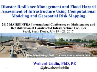
- 1. Floods, Utah & Arizona, 2015 Waheed Uddin, PhD, PE @drwaheeduddin 2017 MAIREINFRA International Conference on Maintenance and Rehabilitation of Constructed Infrastructure Facilities Seoul, South Korea, July 19 – 21, 2017 Disaster Resilience Management and Flood Hazard Assessment of Infrastructure Using Computational Modeling and Geospatial Risk Mapping 1
- 2. 2 • About 60% of all disasters costing one billion dollars or more in the United States were related to weather. Worldwide floods and storms accounted for 65% of total 13,757 natural disasters during 1900 to 2015. • Extreme weather events are occurring as devastating floods in recent years worldwide due to heavy rainfall, hurricanes/cyclones, and hydrological events of dam & levee breaks. • Extreme weather events caused $208 billion of economic cost in the United States with more than 1,200 casualties between 2011 & 2013. • 2005 Hurricane Katrina disaster on Louisiana and Mississippi Gulf Coast resulted in more than $100 billion in infrastructure and economic costs. • Critical transportation infrastructure assets are under a continuous risk of flood hazards and subject to significant damage, such as washing away of pavements and bridges. Background and Motıvatıon 2
- 3. 3 Gulfport, Mississippi Before Hurricane Katrina After Hurricane Katrina November 24, 2002 September 2, 2005 3 Scour failure
- 4. 4 Flood Destruction: Roadways and Bridges 2005 Mississippi Gulf Coast Hurricane Irene, 2011 4 I-10 Bridge, Arizona, Aug 2015 Scour failure 2005 Hurricane Katrina New Orleans
- 5. 5 Review natural disaster occurrences and their impacts on the built environment and communities Implement computational modeling and geospatial visualization technologies for extreme flood simulations and coastal disaster risk mapping. Discuss case studies of disaster vulnerability risk mapping and damage assessment for selected port cities. Results used to enhance decision support systems for safeguard of bridge and highway infrastructure from extreme weather related natural disasters such as floods. Objectives 5
- 6. 6 Natural Hazards and Declared Natural Disasters 6 • Geological disasters: volcanoes, earthquakes, tsunamis, landslides, land subsidence, cavities. • Meteorological disasters (including extreme weather and climate impacts): rainfall floods, storms, hail, coastal hurricanes and cyclones, snow, drought, famine. • Hydrological disasters: rainfall floods, flash floods, dam and levee breaks, river overflow, mudslide. • Environmental disasters: toxic spills, river and groundwater contamination, wetland pollution, air pollution, air quality degradation, nuclear radiation leaks, deforestation • Fire disasters: wildfire, forest fire, accidental industrial/chemical fire, terrorism • Epidemic disasters: epidemics and fatal diseases • Disaster incidents and/or accidental disasters: water pipeline breaks, gas pipeline explosions, oil spills
- 7. 7 Worldwide Natural Disasters, 2000 – 2011 ~ 2 million people killed
- 8. 8 Time Series of Global Disaster Occurrences 8 A rate of decrease in disasters of 2.2% per year was calculated in annual number of disasters from the peak in year 2000 to 2015 period
- 9. 9 ARIMA Model vs. the Observed Time Series 9 Worldwide floods and storms accounted for 65% of total 13,757 natural disasters during 1900 to 2015.
- 10. 10 10 This evidence contradicts the UN IPCC’s Carbon Dioxide (CO2)-Anthropogenic Global Warming (AGW) hypothesis of increasing number of weather and climate change related natural disaster predicted in 2015.
- 11. 11 11 Physical evidence: Global Warming is not caused by Anthropogenic Carbon Dioxide (CO2) as hypothesized by UN IPCC for 2015 Paris Climate deal, which was based on fabricated global temperature anomaly. Global Warming and Climate Change Hypothesis?
- 12. 12 12 Global Warming is not caused by Anthropogenic CO2 as hypothesized by IPCC for 2015 Paris Climate deal using fabricated global temperature anomaly.
- 13. 13 Spatial Map of Worldwide Natural Disasters, 2011 13 2011 Costliest Year: Recovery Effort over US$380 billion 242 Federally declared disasters in the United States including the Hurricane Irene disaster on the East coast
- 14. 14 Infrastructure Performance Curves for LCA Considering Catastrophic Disasters [used with permission (Uddin 2017)] 14
- 15. 15 15 An Enhanced BMS Framework (after Uddin et al. 2013) 15 • Vertical Underclearance • Flood Probability Flood Vulnerability Rating (FVR) Flood Disaster Resilience Analysis
- 16. 16 Infrastructure Disaster Resilience Improvement How to prioritize infrastructure asset groups for disaster resilience improvement? Goal – Measure Quantifiable Reduction Identify Risk Assess Risk Communicate Risk Mitigate Risk Continuous Renewal & Improvement Map Risk Data Assess Present & Future Risks Plan for Risk Reduce Risk Enhance Resilience: Hardening Infrastructure Disaster Resilience Rating
- 17. 17 Visualization of First Flood Inundation Simulation, and Calculated Flood Depth at Selected Feature Locations along River CL (10m Cell), Sardis, Mississippi Maximum Flood Depth Feature Number Hwy 315 Hwy 35 Infrastructure Feature CAIT / NCCHE Sardis Site 17
- 18. 18 Objective of 3D-FE Modeling of Bridge Structure Structural integrity analysis of US-51 Highway Bridge (Sardis, Mississippi) subjected to lateral floodwater force using 3D-FE modeling and simulation • Deck • Deck and Girders • Individual Girder • Bearings • Pile Caps • Piles • Foundation Soil 18
- 19. 19 3D-FE Modeling & Simulation: US-51 Bridge View of US-51 Bridge (Credit: MDOT) Lateral Hydrodynamic Force Acting on the Bridge 19
- 20. Highway US-51 Bridge: 3D-FE Simulation Results Subjected to Lateral Floodwater Force Maximum Lateral Displacement in Floodwater direction: 2.4 m 20
- 21. 21 21 Number of Bridges and Percentage of River Bridges by State, 2014 21
- 22. 22 22 Highway Bridges in Mississippi in Proximity to Major Rivers, 2014 Geospatial Analysis 22
- 23. 23 23 Data Used in Budget Optimization Problem and Value Engineering Analysis for Reconstruction or Hardening Case Study of Concrete Girder Bridge FVR Group Unit Cost of Reconstruction ($) Unit Cost of Hardening ($) Unit Cost Avoidance ($) Unit Net Benefit ($) Net Benefit ($) 1. Catastrophic Risk 10,000,000 - 15,000,000 5,000,000 5,400,000 2. Very High Risk 5,000,000 - 15,000,000 10,000,000 27,000,000 3. High Risk - 5,000,000 15,000,000 10,000,000 16,200,000 4. Moderate Risk - 1,000,000 4,000,000 3,000,000 1,620,000 5. Low Risk - 1,000,000 4,000,000 3,000,000 162,000 6. Very Low Risk - 1,000,000 4,000,000 3,000,000 81,000 n = Analysis period= 100 years, i = Annual Discount Rate= 5% ( ) ( ) ( ) + − + −+ += nn n i1 1 S i1i 1i1 MCP The present worth (P) of a flood resilience project for (n) years, with an initial cost C, a yearly maintenance cost M, and a salvage value S. 23 FVR = Flood Vulnerability Rating
- 24. 24 Extreme Flood Modeling and Simulation for Los Angeles 24 In recent years, 130 ports were struck by tropical cyclones each year.
- 25. 25 25 Extreme Flood Modeling and Simulation for Los Angeles 37% Area Inundated by extreme rainfall flood (using HEC-RAS Software)
- 26. 26 2m Seal Level Rise (SLR) Simulation and Visualization of Land Submerge, Projected by NOAA for Year 2100 26 1.68% Land Area Submerges (using CAIT Methodology)
- 27. 27 27 2m Seal Level Rise (SLR) Simulation and Visualization of Land Submerge 2m Peak Wave Height Tsunami simulation shows just 0.4 % less submerged land area than that by 2 m SLR. However, a tsunami can occur any time if there is a strong earthquake in Pacific ocean along the west coast.
- 28. 28 3D Feature Extraction for Visualization of Flood Inundation 28
- 29. 29 29 Better communications, emergency response management and natural disaster preparedness contributed to a lower number of annual disaster deaths worldwide. Thanks to Former Graduate Students: Dr. Alper Durmus Dr. Quang Nguyen W. Tucker Stafford, MS 2017 Book
Hinweis der Redaktion
- Traditional asset management systems do not consider failure and disruptions of service arising from catastrophic disasters.
- Goals and Policies (Reflect Customer Input) Short- and Long-Range Plans (Project Selection) Performance Monitoring (Feedback)
- All bridge parts modeled using “Elastic” material model.
- 8 states have more than 90% of their bridges on rivers/channels.
- Displays the number of bridges in Mississippi which are in 80-1,600 ft (approximately 25-500 m) proximity to major rivers.
- It is assumed that total 270 bridges identified in 160 ft (approximately 50 m) proximity to a river/channel are already prioritized in FVR groups. Total net benefit in the table (for all identified number of bridges in each FVR group) is based on the assumption that budget is not constrained. If a budget constraint of $15 million is considered, linear programming (LP) optimization Solver selects 15 bridges from FVR category 1 for reconstruction/hardening.