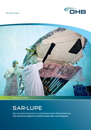
1. SAR-LUPE
Das innovative Programm zur satellitengestützten Radaraufklärung
The innovative program for satellite-based radar reconnaissance
space Systems
2. »There can be
no freedom
without security.«
Der Blick durch die Wolken
A view through the clouds
SAR-Lupe ist Deutschlands erstes satellitengestütztes Aufklä-
rungssystem. Für die Bundesregierung ist es unerlässlich,
krisenhafte Entwicklungen weltweit frühzeitig zu erkennen und
dabei einseitige Abhängigkeiten von Aufklärungsbildern Dritter
zu vermeiden. Deshalb hat sich das Bundesministerium der
Verteidigung (BMVg) für SAR-Lupe entschieden. Im Rahmen des
Programms hat OHB System AG als Hauptauftragnehmer fünf
baugleiche Satelliten entwickelt, ausgestattet mit höchst
auflösendem Radar, die bei allen Wetterverhältnissen weltweite
Informationen zu jeder Tages- und Nachtzeit liefern. Das System
ist vollständig ausgebaut und befindet sich seit Dezember 2007
im operationellen Betrieb.
Als Kernelement für eine europaweite strategische Aufklärung
können die Bodensegmente von SAR-Lupe und dem französi-
schen optischen Aufklärungssystem Helios II in einem System
verbund genutzt werden.
SAR-Lupe is Germany’s first satellite-based reconnaissance
system. It is essential for the Federal Government to identify and
monitor regions of latent crisis at an early stage and to avoid uni-
lateral dependencies in reconnaissance. Therefore the Federal
Ministry of Defence (BMVg) opted for SAR-Lupe. Within the scope
of the program OHB System AG as the prime contractor devel-
oped five identical satellites equipped with highest-resolution
radar systems for providing worldwide information under all
weather conditions and at day and night time. The system has
completely been built up and is in operational service since
December 2007.
The ground segments of SAR-Lupe and the French optical recon-
naissance system Helios II can be used jointly as the core element
of European-wide strategic reconnaissance operations.
Überblick Gesamtsystem
Das SAR-Lupe-Gesamtsystem umfasst
ein radargestütztes Aufklärungssystem
mit fünf Satelliten von ca. 720 kg und
ein entsprechendes Bodensegment zur
Satellitenkontrolle und zum Empfang
und zur Verarbeitung der Bilddaten. Das
System arbeitet wetterunabhängig bei
Tag und Nacht und liefert von praktisch
allen Gebieten der Erde aktuelle und
sehr detaillierte Bilder.
System overview
The SAR-Lupe system comprises a space-
borne radar reconnaissance system with
five satellites of approximately 720 kg
weight, and a ground segment for con
trolling the satellites and for receiving
and processing image data. The system
is independent of weather conditions
and operates day and night. It delivers
up-to-date and highly detailed images
from virtually all regions of the world.
User ground
segment
Satellite
ground
segment
Bildaufnahme
Image recording
Intersatellite-Link
Intersatellite link
Datenübertragung
Data download
Auftragsübermittlung
Command transmission
(Wilhelm von Humboldt)
3. Architektur des Raumsegments
Architecture of the space segment
Systemleistungen
System performance
Inverstest
The SAR-Lupe team, which comprises renowned European com-
panies, has developed a unique testing process known as Inverst-
est to demonstrate the capabilities of satellites on the ground.
For this purpose, the satellite is aligned to the International
Space Station ISS on the ground and produces high-resolution
images of the space station in orbit.
Inverstest
Um die Leistungsfähigkeit der Satelliten bereits am Boden zu
demonstrieren, hat das aus namhaften europäischen Unterneh-
men bestehende SAR-Lupe-Team ein bisher einmaliges Testver-
fahren entwickelt, den Inverstest. Hierbei werden die Satelliten am
Boden auf die Internationale Raumstation ISS ausgerichtet und
machen hochaufgelöste Radarbilder von der Station im Weltraum.
Anzahl der Satelliten: 5, identisch
Bahnebenen: 3
Mittlere Höhe: ca. 500 km, optimiert
für höhere Auflösung
Bahninklination: ca. Polar, alle
Anzahl der Satelliten in den Bahnebenen:
Orbit 1: 2 Satelliten
Orbit 2: 1 Satellit
Orbit 3: 2 Satelliten
Winkel zwischen den Bahnebenen
und Phasenwinkel der Satelliten
optimiert für eine kürzest mögliche
Systemantwortzeit
Number of satellites: 5, identical
Orbit planes: 3
Altitude: approx. 500 km, optimized
on high resolution
Inclination of orbits: approx. polar, all
Number of satellites in orbit plane:
Orbit 1: 2 satellites
Orbit 2: 1 satellite
Orbit 3: 2 satellites
Angle between orbit planes and
phase angles of the satellites
optimized a shortest possible system
response time
Haupteigenschaften eines SAR-Lupe-Satelliten
Main characteristics of a SAR-Lupe Satellite
Der Satellit besteht aus einem BUS und der SAR-Nutzlast.
BUS: Der spezielle BUS erlaubt den Satelliten durch ihre Drei-
achsenstabilisation eine hochpräzise Ausrichtung zur Bildauf-
nahme.
SAR: Die Gewinnung der Bilddaten erfolgt über eine fest instal-
lierte Parabolreflektorantenne auf jedem der baugleichen Satelli-
ten. Ein spezielles Aufnahmeverfahren, das so genannte Synthetic
Aperture Radar-, oder kurz SAR-Verfahren, ermöglicht die Gewin
nung hochaufgelöster Bilder aus einer Höhe von rund 500 km.
The satellite consists of a bus and the SAR payload.
BUS: The three-axis stabilizers which are unique to the special
BUS ensure high-precision alignment of the satellite for image-
capturing purposes.
SAR: The image data are generated by a fixed-installed parabolic
reflector antenna on each of the identical satellites. A special
imaging procedure, the Synthetic Aperture Radar-process, SAR
process for short, yields high-resolution images from a height of
approximately 500 km.
Größe: ca. 4 x 3 x 2 m
Gewicht: ca. 720 kg
Durchschn. Energieverbrauch: ca. 250 W
Lebensdauer: 10 Jahre
Zuverlässigkeit: besser als 97 % pro Jahr
Telemetrie: verschlüsselte X-Band
Datenübertragung, S-Band-Übertragung
von verschlüsselten Kommando- und
Telemetriedaten über die Bodenstation
und zwischen Satelliten
Lageregelung: Reaktionsräder und
Magnettorquer
Bahnkontrolle: Flüssiggas-Triebwerke
Intersatellite-Link: S-Band für Aufträge,
verschlüsselt
Size: approx. 4 x 3 x 2 m
Weight: ca. 720 kg
Average power comsumption: ca. 250 W
Life time: 10 years
Reliability: better than 97 % per year
Telemetry: encrypted X-Band for data
transmission, S-Band transmission
for encrypted commandand telemetry
via ground station and intersatellite-
link
Attitude control: by reaction wheels and
magnetic torquers
Orbit control: Liquid gas thrusters
Intersatellite link: S-Band for orders,
encrypted
SAR-Bildprodukte
SAR image products
Geometrische Auflösung <1 m
Spatial resolution <1 m
Spot-light Modus
Flugmanöver des Satelliten mit der fest
installierten Antenne zur Erhöhung der
Integrationszeit bei der SAR-Datenauf-
nahme. Die nominelle Geschwindigkeit
des Radarstrahls über dem Boden wird
reduziert. Dadurch wird die Auflösung in
Flugrichtung deutlich erhöht.
Strip-map Modus
Feste Antennenausrichtung.
Die Geschwindigkeit über dem Boden
beträgt ca. 7 km/s.
Spot-light mode
Flight maneuver of the whole satellite
with the fixed antenna to increase the
integration time at the scene.
The nominal ground velocity of the radar
beam scanning the ground surface is
reduced. This increases the resolution in
the flight direction significantly.
Strip-map mode
Fixed direction of the antenna.
The ground velocity is approx. 7 km/s.
4. AUSBLICK
VieW
SAR-Sat
Based on the technology developed for SAR-Lupe, a wide range of
terrestrial observation applications can be realised in addition to
military reconnaissance activities. The system features a modu-
lar structure which can be tailored to meet customers‘ specific
requirements and can be used for:
• Environmental protection
• Exploration of natural resources
• Disaster management
• Monitoring of assets
• Geodetic data
• Security applications
• Reconnaissance missions
SAR-Sat
Basierend auf der im Rahmen von SAR-Lupe entwickelten Tech-
nologie ist neben der militärischen Aufklärung ein breites Spekt-
rum an Erdbeobachtungsaufgaben realisierbar. Das System ist
den Kundenwünschen entsprechend modular aufgebaut und ist
u. a. einsetzbar für:
• Umweltschutz
• Erforschung natürlicher Ressourcen
• Katastrophenschutz
• Überwachung von Anlagen
• Geodätische Datenerfassung
• Sicherheitsanwendungen
• Aufklärungsmissionen
Das Bodensegment
The Ground Segment
Nutzer-Bodensegment
• Bildauswertung
• Schnittstelle zum Kunden
• Datenverarbeitung und
Auswertung
• Archivierung
• Bedienung durch Nutzer
User ground segment
• Image exploitation
• Interface to customer
• Data processing and
exploitation
• Archiving
• Operated by the user
Satelliten-Bodensegment
• Kontrolle des Raumsegments
• Planung der Aufnahmen und
Manöver der Satelliten
• Empfang und Verarbeitung
der Rohdaten
• Automatischer Betrieb
• Betriebsüberwachung
und Wartung durch die
OHB System AG
Satellite ground segment
• Control of space segment
• Planning of image recording
and satellite manouevers
• Reception and processing
of raw data
• Automatic operation
• Opteration, control
and maintenance by
OHB System AG
Customer
(military, other national, international)
Satellite
control
Satellite
mission
planning
Data
reception
Image
generation
SGS
control
Order-
control
Task
preparation
Training
Archive
Data pro-
cessing and
exploitation
Operation
Nutzer-Bodensegment
(Betreiber: Bundeswehr)
User ground segment
(Operator: German Federal
Armed Forces)
Satelliten-Bodensegment
(Betreiber: OHB System AG)
Satellite ground segment
(Operator: OHB System AG)
SAR-Lupe Betrieb
SAR-Lupe Operations
Seit Mitte 2013 arbeitet die OHB System AG an der Entwicklung
und der Realisierung des SAR-Lupe Nachfolgesystems SARah.
Dieser Auftrag umfasst zwei Reflektor-Satelliten und Elemente
des Bodensystems sowie zwei Bodenstationen. Airbus Defence
and Space liefert im Unterauftrag einen Phased-Array-Satelliten.
Kunde ist das Bundesministerium der Verteidigung durch BAAIN-
Bw (Bundesamt für Ausrüstung, Informationstechnik und Nut-
zung der Bundeswehr).
OHB System AG has been working on the design and the realiza-
tion of the SAR-Lupe successor, SARah, since mid 2013. The con-
tract comprises two reflector satellites and elements of the
ground system as well as two ground stations. The Phased-array
satellite was subcontracted to Airbus Defence and Space. Custo-
mer is the German Federal Ministry of Defense via BAANBw
(Federal Office of Bundeswehr Equipment, Information Technolo-
gy and In-Service Support).
Seit Oktober 2007 ist das SAR-Lupe System operativ. Alle fünf
Satelliten erfüllen ihre Funktion einwandfrei und liefern Bildpro-
dukte in gleichbleibender Qualität. Bereits nach knapp 8 Jahren
Betriebszeit kumuliert sich die fehlerfreie Betriebszeit der Satel-
litenkonstellation SAR-Lupe auf 38 Jahre.
Das Bodensegment in Gelsdorf dient der Satellitenkontrolle und
Bildauswertung. Damit die Satelliten auf der für die Radarfunktion
notwendigen Erdumlaufbahn bleiben, sind dort fünf Mitarbeiter-
Innen der OHB System AG mit der manuellen Planung von Manö-
vern zur Orbit-Erhaltung betraut. Mit Unterstützung des Welt-
raumlagezentrums erkennen sie mögliche Kollisionen rechtzeitig,
planen entsprechende Ausweichmanöver und führen diese aus.
SAR-Lupe has been in operation since October 2007. Each of the
5 satellites is performing as expected and is generating images
of consistent quality. The SAR-Lupe satellite constellation gener-
ated 38 cumulative years of error-free operation after barely
eight years.
Satellite control and image processing are performed at the sat-
ellite ground segment in Gelsdorf (Germany). There, five employ-
ees of OHB System AG plan manual maneuvers for orbit control in
order to ensure that the satellites remain in the orbit calculated
for radar operation. Supported by the Centre for Space Situational
Awareness they can identify elements on collision course in time
to plan and execute appropriate evasive maneuvers.
Follow-up system SARahNachfolgesystem SARah
5. Über OHB System AG
Die OHB System AG ist eines der drei führenden Raumfahrtunter-
nehmen Europas. Der Systemanbieter gehört zum börsennotierten
Hochtechnologiekonzern OHB SE, in dem rund 2000 Fach- und
Führungskräfte an zentralen europäischen Raumfahrtprogrammen
arbeiten. Mit zwei starken Standorten in Bremen und München und
mehr als drei Jahrzehnten Erfahrung ist OHB System spezialisiert
auf High-Tech-Lösungen für die Raumfahrt. Dazu zählen erdnahe
und geostationäre Satelliten für Erdbeobachtung, Navigation,
Telekommunikation, Wissenschaft und Exploration des Weltraums
ebenso wie Systeme für die Bemannte Raumfahrt, Luftaufklärung
und Prozessleittechnik.
About OHB System AG
OHB System AG is one of the three leading space companies in
Europe. It belongs to listed high-tech group OHB SE, where around
2,000 specialists and executives work on key European space pro-
grams. With two strong sites in Bremen and Munich and more than
three decades of experience, OHB System specializes in high-tech
solutions for space. These include low-orbiting and geostationary
satellites for earth observation, navigation, telecommunications,
science and space exploration as well as systems for manned space
flight, aerial reconnaissance and process control systems.
OHB System AG
Universitätsallee 27–29, 28359 Bremen, Germany
Phone +49 421 2020-8, Fax +49 421 2020-700
info@ohb.de / www.ohb-system.de
2015/05