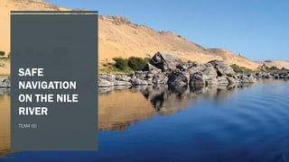
SAFE NAVIGATION ON THE NILE RIVER TEAM (6) MEMBERS AHMED YASSER AHMED MOHAMED NASSAR HOSSAM HASSAN RAMADAN HASSAN AHMED FAYEZ MOHAMED AHMED AHMED MOHAMED MESBAH ELSAYED AHMED ABDEL-RAHMAN GALAL ABSTRACT Millions of tons of cargo is transported over the Nile River yearly. Hundreds of Nile Cruises (Floating Hotels)operating between Luxor and Aswan. the Egyptian government gives a high priority to the improvement of safety of navigation on the Nile River. Cargo Ship Nile Cruise INTRODUCTION Transport on Nile River is for: Goods and Materials Tourists and Passengers INTRODUCTION SAFE VISUAL NAVIGATION implementation of hydrographic survey. cost effective solar-powered visual aids to navigation. Together with further development of infrastructure works along the Nile River. vessel tracking system for Nile cruise ships for lock passage planning and emergency cases. PROBLEMS OF Long duration of transport due to daylight navigation only NAVIGATION LOW FLOW OF CARGO REASONS: Unreliability of the river; no technical means for safe navigation in the navigable channel. Poor quality of services Unreliable delivery times due to grounding or technical failures of the barges. Poor quality of barges. AIM Is to define and design the main steps that should be followed now and, in the future, to achieve safe visual navigation on the Nile River. Considering (IHO) standards for hydrographic survey. HYDROGRAPHIC DATA ACQUISITION Data ACQUISITION Water level records Data Collection Vertical Position Horizontal Position Data Logging Data Processing Shoreline Survey Ortho-photos-Coordinates of First Order Points DATA ACQUISITION WATER LEVEL RECORDS Ministry of Public Works and Water Resources maintains a series of Staff Gauges along the Nile River from Aswan to the Mediterranean Sea. . The MPWWR can provide the water level reading daily. Overall, station readings are sufficient for the need of hydrographic survey. DATA ACQUISITION WATER LEVEL RECORDS Tide Guage DATA ACQUISITION VERTICAL (DEPTH) POSITION The flow depth is recorded referring to the bed level. The output data in form of chart . The output depth in the form of digital data is logged into data logger. DATA ACQUISITION HORIZONTAL POSITION boats are equipped with GPS antenna and controller. A reference installed GPS station is over a defined controlling point. Momentarily, The corrected horizontal position is logged into data logger to be integrated with vertical position. DATA ACQUISITION DATA LOGGING Data from DGPS system and digital depths from Echo sounder are logged in an ISAH data logging system (Integrated System for Hydrography). Automated DATA PROCESSING Sounding and position data are saved then processed workstation. then depths and positions are plotted on the screen and erroneous data are rejected. To produce navigation charts, depths were set to the chart datum .
2. TEAM (6) MEMBERS
AHMED YASSER AHMED MOHAMED NASSAR
HOSSAM HASSAN RAMADAN HASSAN
AHMED FAYEZ MOHAMED AHMED
AHMED MOHAMED MESBAH ELSAYED
AHMED ABDEL-RAHMAN GALAL
3. ABSTRACT
Millions of tons of cargo is transported
over the Nile River yearly.
Hundreds of Nile Cruises (Floating
Hotels) operating between Luxor and
Aswan.
the Egyptian government gives a high
priority to the improvement of safety of
navigation on the Nile River.
6. INTRODUCTION
SAFE VISUAL NAVIGATION
implementation
of hydrographic
survey.
cost effective
solar-powered
visual aids to
navigation.
vessel tracking
system for Nile
cruise ships for
lock passage
planning and
emergency
cases.
Together with
further
development of
infrastructure
works along the
Nile River.
7. PROBLEMS
OF
NAVIGATION
LOW FLOW OF CARGO
REASONS:
Long duration of transport due to daylight navigation only
Unreliability of the river; no technical means for safe
navigation in the navigable channel.
Poor quality of services
Unreliable delivery times due to grounding or technical
failures of the barges.
Poor quality of barges.
8. AIM
Is to define and design the
main steps that should be
followed now and, in the
future, to achieve safe visual
navigation on the Nile River.
Considering (IHO) standards
for hydrographic survey.
10. DATA ACQUISITION
WATER LEVEL
RECORDS
Ministry of Public Works and
Water Resources maintains a
series of Staff Gauges along the
Nile River from Aswan to the
Mediterranean Sea. . The
MPWWR can provide the water
level reading daily. Overall,
station readings are sufficient
for the need of hydrographic
survey.
12. DATA ACQUISITION
VERTICAL (DEPTH)
POSITION
The flow depth is recorded
referring to the bed level. The
output data in form of chart .
The output depth in the form of
digital data is logged into data
logger.
13. DATA ACQUISITION
HORIZONTAL
POSITION
boats are equipped with GPS
antenna and controller. A
reference GPS station is
installed over a defined
controlling point. Momentarily,
The corrected horizontal position
is logged into data logger to be
integrated with vertical position.
14. DATA ACQUISITION
DATA LOGGING
Data from DGPS system and
digital depths from Echo-
sounder are logged in an ISAH
data logging system (Integrated
System for Automated
Hydrography).
15. DATA PROCESSING
Sounding and position data are
saved then processed
workstation. then depths and
positions are plotted on the
screen and erroneous data are
rejected.
To produce navigation charts,
depths were set to the chart
datum .
17. CURRENT
SITUATION
BATHYMETRY
AND
NAVIGATIONAL
CHARTS
Hydrographic surveys have been executed by
NRI, over a total length of 25 km out a total
length of 953 km (Cairo- Aswan).
Use has been made of topographical maps,
produced by Kenting Earth Sciences,
Canada,1978. scale 1: 10,000. Datum: Helmert
1906, Transverse Mercator Projection.
No water depths are indicated on these maps.
All heights on these maps are relative to Lowest
Low Water Spring in Alexandria, Mediterranean
Sea.
20. CURRENT
SITUATION
RADIO
COMMUNICATION
Nile Cruise Ships communicate
on one channel (for security
reasons only) under the
responsibility of the Ministry of
Interior. Barges do not have any
communication facilities on
board
22. SAFE NAVIGATION PLAN
EXECUTION OF A
HYDROGRAPHIC SURVEY
PRODUCING
NAVIGATIONAL CHARTS
DESIGN OF THE
NAVIGATIONAL PATH
CONSTRUCTION, SUPPLY
AND INSTALLATION OF
NAVIGATION AIDS(BUOYS
AND BEACONS)
VESSEL TRAFFIC
MANAGEMENT AND
COMMUNICATION
MAINTAINING THE
SYSTEM
23. PLAN
EXECUTION OF A
HYDROGRAPHIC
SURVEY
Along of each cross section bathymetry
will be measured continuously by using
echo sounder.
The horizontal positioning of the
locations will be controlled by GPS with
the online PC hydrographic survey
software.
The actual survey has to be updated
continuously depending on the stability
of the river Long
24. PLAN
PRODUCING
NAVIGATIONAL
CHARTS
The (X,Y,Z) data will be used for producing
contour maps of 0.5 m interval. chart size:
70 x 50 cm at scale 1:2000.
A law has to be introduced to oblige the
vessels on the Nile River to have nautical
charts on board of the section of the river
were the vessel operates.
26. PLAN
DESIGN OF THE
NAVIGATIONAL PATH
1. Design the navigable cross
section.
2. width allowance for cross
section.
3. width allowance for bends.
4. space around the water way
cross section.
30. CONCLUSION
The development of the Nile navigable route will increase
safety of the cruise vessels sailing the Nile. It will enable
them to sail for a longer period per day and thereby increase
the efficiency at the river's bottlenecks.
the efficiency will improve in the general scheduling of the
cruise programs. A clear navigable channel with a secured
draft will increase the reliability. The Nile tourism
requirements, meaning a rise of the capacity with 25% in the
near future.
Cargo transport over water will increase from only 1% of the
local trade traffic to 8%.
31. CONCLUSION
the share of the trade traffic from and to the
seaports will increase from 4% at present to 15% in
the near future.
Finally, the navigation on the Nile River will be more
safe, efficient and the environmental pollution will be
reduced. The equipment and facilities necessary to
realise these objectives will make it possible to sail
during the night. This in turn will improve the
economics of the Nile River as a mean of transport.
32. REFERECNES
Abdelghany, S. and Kamaleldin, A., 2018. The Need for Nile River Vessel Traffic Services. Journal of Shipping and
Ocean Engineering, 8.
Abdel-aziz, T., 2004. Safe Visual Navigation on the Nile River. Nile Research Institute.
MBSHC, 2021. NATIONAL REPORT of EGYPT.
Nile Research Institute, 1998. Production of Navigational Charts for Rosetta Branch.