
Empfohlen
Weitere ähnliche Inhalte
Empfohlen
Empfohlen (20)
Heskamp radbahn Propuesta Ciclovía Berlin
- 2. Los Angeles Car traffic today, as a result of policy
- 3. Amsterdam Amount bicycles, as a result of policy
- 4. Berlin Traffic situation in Berlin, end of the 19th century
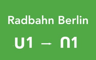
- 5. Building the U1 in 1998, to allow for independent traffic flow
- 6. Today
- 12. Source: Umweltbewusstseinstudie 2014, UBA 721 324 per 1000 inhabitants Users
- 13. Source: Flächen-Gerechtigkeits-Report, Agentur für clevere Städte, 2014 721 324 per 1000 inhabitants 58% 33% 6% 3% Area
- 14. Leere unter der Hochbahn
- 15. Radspur
- 16. Seitenflächen
- 17. Vorschlag
- 18. Kreuzungen
- 19. Lösung
- 20. dark
- 21. light
- 22. nothing
- 23. life
- 24. empty
- 25. Radbahn
- 26. Bahnhof Zoo Warschauer Straße Kottbusser Tor Gleisdreieck Nollendorfplatz Hallesches Tor
- 32. Möckernstraße The Feuerle Collection Deutsches Technikmuseum Trebbiner Straße Luckenwalder Straße Schöneberger Straße TempelhoferUfer Flottwellst Flottwellstraße Kurfürstenstraße Station Berlin event space Park am Gleisdreieck ICETrasse StreckenführungVariante1 Strecken- führung Variante3 HalleschesUfer Spectrum science center Bülowstraße Steinmetzstraße Blumenthalstraße Dennewitzstraße American Church Tempodrom VerlaufU7 VerlaufgeplanteS21Linie Verlauf U1 Verlauf U2 Beach Park Skate Park Quartiersentwicklung "Urbane Mitte" +100.000 m2 BGF Landwehrkanal Mö Streckenführung Variante 2 U-Bhf. Gleisdreieck Testfeld Energieerzeugung Energieerzeugung im Park Möckernstrand Mobile Gastronomie AnhalterSteg Hochbahnbrücke Radbahnbrücke Tempelhofer Ufer 0 50 100 200150 N 0 50 100 200150 Nfür 1_Promenade und 2_Unterm Dach für 3_Im Park, 4_Am Wasser und 5_Nadelöhr Under the viaduct Beside the columns T T B-A In the park On the road Bridge Under the viaduct Next to the train station 7.00 6.30 3.35 4.154.00Clearance width Course of the Radbahn Intersection Typologies (Page 51) After entering the park via Bülowstraße, the Radbahn leaves the covering of the railway viaduct and features solar roadways for absorbing solar energy. Electricity for the entire Radbahn could be generated using this infrastructure. Three suggestions for the Radbahn as it traverses the Landwehr Canal include: (1) a northern route over Schöneberger Bridge, (2) a new bicycle bridge and (3) a southern route that would utilize the Anhalter pedestrian bridge. The route in the park Seite 64 Page 71
- 33. VerlaufU6 VerlaufU6 Möckernstraße Tempodrom AlteJakobstraße Lindenstraße Waterloo Ufer Hallesches Ufer Tempelhofer Ufer Stresemannstraße Amerika Gedenkbibliothek Heilig-Kreuz Offene Kirche Blücherplatz Quartiersentwicklung 500 Wohnungen 20,000 m2 Gewerbe 700 Stellplätze Großbeerenstraße HAU 3 HAU 1 HAU 2 Mehringplatz Wilhelmstraße Mehringdamm VerlaufU7 Gitschiner StraßeLandwehrkanal U-Bhf. Möckernbrücke Verlauf U7 U-Bhf. Hallesches Tor Jüdisches Museum Friedrichstraße Franz-Klühs-Straße Möckernstrand Mobile Gastronomie Lastenradhafen Wiederbelebung des Ufers Lastenumschlag Fahrrad-Rastplatz Tempelhofer Ufer 0 50 100 200150 N 0 50 100 200150 N 0 50 100 200150 N h adelöhr 3.00 Under the Viaduct B-A Northern edge of the Station 3.00 B-A X-F B-A 1.502.85 Beside the Columns Next to the Stairs On the Street Beside the Columns On the Street next to the Station Beside the Columns 2.90 6.452.90 3.05 4.00 3.00Clearance width Course of the Radbahn Intersection Typologies (Page 51) The Radbahn runs along the Landwehr Canal for about 1 km. In this section, we will reserve the space below the viaduct and directly on the water for pedestrians. Cyclists will be allotted space along the road, separated from motorized traffic. The Radbahn runs along the north side of the U1 stations Möckernbrücke and Hallesches Tor, parallel to the road, before continuing onto Gitschiner Strasse. The route by the water Page 71 Page 76
- 34. Spree W arschauerStraße LübbenerStraße SorauerStraße Skalitzer Straße Oberbaumstraße Schlesische Straße KöpenickerStraße O ppelnerStraße Falckensteinstraße M ay-Ayim Ufer Stralauer Straße Mühlenstraße W rangelstraße Bevernstraße Cuvrystraße Pfuelstraße Oberbaumbrücke East Side Gallery Görlitzer Straße Zeughofstraße Skalitzer Straße U-Bhf. Schlesisches Tor U-Bhf. Warschauer Straße Erlebnis Gastronomie Oberbaum -Eck Fahrradstation & Info-Point 0 50 100 200150 N 0 50 100 200150 N 0 50 100 200150 N für 1_Promenade und 2_Unterm Dach für 3_Im Park, 4_Am Wasser und 5_Nadelöhr für 6_Hotspot und 7_Spreeluft Clearance width Course of the Radbahn Intersection Typologies (Page 51) On the median strip, Radbahn meanders down Skalitzer Straße, north of the Schlesisches Tor metro station and then back to the median after passing the renowned diner „Burgermeister“. On Oberbaumbrücke, we leave the beautiful brick viaduct to the pedestrians and rather ride along the street. By means of a two-lane cycle path, we finally reach the goal: the Oberbaum bike-station on the footprint of the former Stralauer Tor metro station. The route Spree feeling Under the Viaduct Next to Station TX-A 2.503.35 X-A T 6.253.00 3.00 4.25 3.25 4.45 X-A Under the Viaduct On the Street, Next to the Columns 3.00 7.15 8.45 8.00 4.50 Page 113 Page 118
- 35. Potentials
- 37. Kleiststraße M otzstraße Bülowstraße U1 / U2 U3 / U4 Bus 106 / 187 / M19 / M29 N2 / N1 / N26 Else-Lask Maaßenstraße Example Hub for Multimodality
- 39. 12 x 12 cm Rba_Grafik_3_Im Park_Energie kinetisch 1:100 12 x 12 cm Rba_Grafik_3_Im Park_Energie solar 1:100 Kinetik Solar Example renewable energies
- 41. 3020 25 2020 350 1500* 100 750* ≤ 50 51-100 101-200 201-300 301-500 501-1000 1001-2000 25 10 10 480 x 340 mm Rba_Grafik_5_Nadeloehr_Parken 40 100 10 800* 80 30 100 40150 500 available parking spots
- 42. 3020 25 2020 350 1500* 100 750* ≤ 50 51-100 101-200 201-300 301-500 501-1000 1001-2000 25 400 available parking spots
- 43. 15 x 15 cm Rba_Grafik_5_Nadeloehr_Parken Kategorien 1:100 1 50m 100m 200m 400m2 3 4 1 Kurzzeit-Parken 5-10 Minuten Bäcker, Coffee-to-go, Ein-und Ausladen vor der Haustür, Lieferung 2 Einkaufs-Parken 60-90 Minuten Wocheneinkauf, Shopping 3 Übernacht-Parken bis 15 Stunden längeren Fußweg, dafür keine Parkplatzsuche, geschützen Parkplatz 4 Langzeit-Parken über 15 Stunden selten genutztes Auto, keine Parkplatzsuche, Parkplatz sicher und geschützt Parking strategy Short parking 5 - 10 Minuten Shopping parking 60 - 90 Minuten Overnight parking bis 15 Stunden Long time parking über 15 Stunden
- 44. 18 parkende Autos 400 qm Straße 9 parkende Privatautos 125 qm Parkfläche Straße 1 parkendes Sharing-Auto 12,5 qm Parkfläche Flächengewinn: 112,5 qm 18 parkende selbstfahrende Autos 200 qm Flächengewinn: 200 qm Shared cars
- 45. Parkhaus 18 parkende Autos 400 qm Parkhaus 18 parkende selbstfahrende Autos 200 qm Flächengewinn: 200 qm Selfdriving cars
- 46. Pleasure – Durchgefärbter Belag – Reibungsarme Oberfläche – Angenehmes Licht – Seitlicher Grünstreifen – Sitzgelegenheiten – Fußstützen an Ampeln – geneigte Mülleimer – Fahrradabstellbügel – Kein Halten an Ampeln – Zeitanzeige Ampeln – Durch Lichtanzeige – Via Apps – Sensoren
- 47. Leisure
- 48. Möckernstrand
- 49. Landwehrkanal Mehringbrücke Hallesches Ufer Zoologischer Garten Schloss Charlottenburg Spree Treptow Neukölln Kreuzberg Charlottenburg Neuköllner Wochenmarkt Kulturforum TU Berlin Park am Gleisdreick Urbanhafen Spree Spree Platz für Fußgänger*innen Unter den Folgen der autogerechten Stadt, wie sie in den 1960er Jahren propagiert wurde, leiden nicht nur Radfahrer*innen, sondern auch Fußgänger*innen. Der derzeit bereits an vielen Stellen existierende Spazierweg nördlich des Landwehrkanals wird zu oft von kreu- zenden Straßen ohne Fußgängerüberweg unterbrochen, als dass Spaziergänger*innen und Jogger*innen diese Strecke nutzen könnten. Parallel zur Radbahn sehen wir deshalb das Potenzial, den Spazierweg wieder zu beleben. Ziel der Stadtplanung sollte es sein, den Ufer- weg bis nach Charlottenburg zu führen. An diesem Abschnitt legen wir den Grundstein dafür. Fußgänger*innen erhalten den attraktiveren Weg direkt am Ufer und die Radfahrer*innen ziehen an die Straße heran. Pedestrians
- 50. Logistics
- 52. Radbahn as a testbed for innovation
- 53. 7,7 8,9 7,9 7,8 9,1 8,7 8,3 9,4 9,1 8,7 9,3 8,9 8,3 8,9 8,3 8 8,3 8,1 8 8,9 8,3 8 6,4 6,7 7,5 6,9 7,2 7,47,7 Seven sections Szenario 1 : 13 Mio Euro: Funktionale Aktivierung der Strecke mit geringem Aufwand Szenario 2 : 27 Mio Euro: Variante mit gehobenem Standard bzw. Innovationsanspruch
- 54. Radbahn idea paper plane community engagement public/ private collaboration
- 55. Media
- 58. paper planes e.V. is a nonprofit organization and interdisciplinary think tank focused on the promotion of more livable cities, reactivation of urban space, and community engagement.
- 59. T h a n k y o u