
Empfohlen
Weitere ähnliche Inhalte
Ähnlich wie Cyclone Idai Exhibition Final - Re-living Disaster in Manicaland
Ähnlich wie Cyclone Idai Exhibition Final - Re-living Disaster in Manicaland (20)
Kürzlich hochgeladen
Kürzlich hochgeladen (20)
Cyclone Idai Exhibition Final - Re-living Disaster in Manicaland
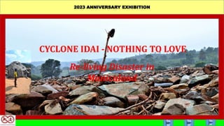
- 1. 2023 ANNIVERSARY EXHIBITION CYCLONE IDAI - NOTHING TO LOVE Re-living Disaster in Manicaland Go to Go to Go to
- 2. Zimbabwe experienced torrential rainfall caused by Tropical Cyclone Idai from the 15th to 17th of March 2019. Cyclone Idai is regarded as one of the worst tropical cyclones on record to affect Africa and the Southern Hemisphere as a whole. It left behind a trail of destruction of lives, livelihoods and the environment of a magnitude not recorded before in Madagascar, Malawi, Mozambique and Zimbabwe. This exhibition relives the disaster in Manicaland in memory of those who lost their lives and livelihoods. In addition it aims to raise awareness on the natural disasters and the need for preparedness to limit their impact. CYCLONE IDAI HITS Video
- 3. In Zimbabwe, Cyclone Idai caused high winds and high precipitation in the Eastern Districts of Chimanimani, Chipinge, Buhera, Nyanga, Makoni, Mutare, Bikita, Masvingo and Gutu. Chimanimani district received the heaviest rains that led to extensive tree falls, flooding and landslides which drastically altered the landscape. The event will therefore remain etched in the memories of the current generation.
- 4. About 50 000 households translating to 250 000 people (including 120 000 children) were affected by flooding and landslides in Zimbabwe. As of 20 June 2019, 347 people had been reported dead, 200 injured and 344 people were missing. The missing people are now presumed to be deceased. In Manicaland Province 59 125 people were internally displaced. Although in Shona language ‘Idai’ means ‘Love’, the devastation led the affected communities to conclude that ‘there was nothing to love’ in light of the negative impacts of the Cyclone.
- 5. More than hundred people in Ngangu lost their lives and severeal are still missing. Some of the missing people were presumed to have been covered by mud and massive rocks that were swept onto the settlement by torrential rains. Sniffer dogs handled by South African experts were deployed to search for the missing people. However, mechanical excavations failed to recover any bodies.
- 6. Chaotic scenes in Ngangu
- 8. At Kopa Settlement on the confluence of Nyahode and Rusitu Rivers approximately 147 households of about 1000 people were destroyed by a combination of floods and a deadly river load of massive rocks and uprooted trees that thundered along the river channels. At least 150 people were unaccounted for soon after the cyclone. KOPA DISASTER
- 9. A Zimbabwe Republic Police base at Kopa that acted as distress centre during the disaster was slept away together with inmates and people who were seeking shelter. Some bodies were washed away into Mozambique by the floodwaters and are believed to have seen buried along the Risutu River in the Dombe area. The search for missing persons at Kopa using sniffer dogs proved futile. The excavations using a mechanical excavator failed to reveal any bodies at sites identified by the cadaver sniffer dogs.
- 11. Houses and property at Kopa Settlement were destroyed.
- 12. Kopa, personal belongings lay strewn all over the flooded areas
- 13. The cyclone tore through the region on the eve of harvest, wiping out an already poor crop hit by an El Nino-induced drought. Thousands of people became food insecure.
- 14. At least 26 schools in Chimanimani and Chipinge reported destroyed building blocks, 44 schools reported blown off roofs and others lost learning materials. Among the schools with infrastructure destroyed is St Charles Lwanga Seminary and Secondary School that ended up suspending its boarding facilities. Two pupils and a security guard were killed by landslides. ST CHARLES LWANGA DISASTER
- 16. At Peacock Settlement near Machongwe Business Centre in Chimanimani an entire thriving business centre of 15-18 shops was washed away together with 18 people who lived there. PEACOCK DISASTER Z
- 17. Communication networks were damaged making it difficult to access or reach communities in the disaster areas. Roads and bridges were destroyed or temporalily blocked by fallen trees, rocks or landslides. COMMUNICATION NETWORKS
- 18. cv
- 19. Unfortunate travellors in vehicles were swept away by floods.
- 21. CULTURAL HERITAGE ASSETS NOT SPARED Cultural heritage sites were damaged by high winds, floods and landslides. Ritual hut, Chikukwa area Tsanza Old Settlement, Chikukwa area Rock art, in Chimanimani Mountains
- 22. Bridal Veil Falls survived by a whisker. Landslides affected the left side of the falls.
- 23. Sacred forests and pools were damaged or destroyed by the combined effects of strong winds, landslides and flooding. Sacred pools affected in Chikukwa aea.
- 24. The recovery from the impacts of Cyclone Idai has been slow but progressive. Through the Cyclone Idai Zimbabwe Idai Recovery Project (ZIRP) the recovery effort has registered significant successes in the social, infrastructure and productive sectors. The project is funded by the World Bank and is partnered by FAO, IOM, UNESCO, UNFPA, UNICEF, UNOPS, WFP and WHO. LONG WALK TO RECOVERY
- 25. The restoration of livelihoods took centre stage during the early stages of recovery from Cyclone Idai. All continents rallied behind southern Africa to support food security to vulnerable communities. The food distribution exercise had its problems though that included pilferage, unequal supplies and expired food staffs being released into the system. These issues were addressed through Government audits. The helping hand
- 26. The overall thrust by the Government of Zimbabwe and its development partners has been to restore what was lost and “build back better, smarter and stronger” so that communities are more resilient to future hazards.
- 27. Schools have been rehabilitated and new houses built. Although many people still leave in temporary shelter, construction of permanent houses for displaced persons in Ngangu Settlement has started at West End Farm in the Bumba area of Chimanimani. One hundred and fifty five housing units have been delivered to displaced persons. New school blocks and houses
- 28. Through the Cyclone Idai Zimbabwe Idai Recovery Project all road networks and telecommunications have been restored. Communications rehabilitation
- 29. Water supplies are being restored to communities for safe drinking and agricultural recovery.
- 30. The mitigation of the impact of Cyclone Idai on cultural heritage assets entailed documentation of affected and unaffected sites, artifacts rescue operations, stabilisation of cultural sites and community awareness building on natural hazards. Cultural heritage recovery
- 31. Cyclones are becoming frequent in the southern hemisphere. Experts say this is due to climate change. Since Cyclone idai, several cyclone induced storms have hit the sub- region, piling more misery on some communities. As cyclone related disasters increase, there is need to build resilience to absorb the shocks in our communities. Disaster Risk Management at a local level will therefore enhance our preparedness and quick recovery in the event of disasters. The future - be prepared
- 32. The Go to start
- 33. Exhibition Curator Profile Paul Mupira is the Regional Director of the Eastern Region of National Museums and Monuments of Zimbabwe based at Mutare Museum. He was one of the Post Cyclone Idai responders focusing on search and recovery of missing persons, mitigation of heritage assets and memorialisation. His research interests are in Archaeology and Heritage Management. Go back
- 34. Exhibition banner The main picture in the banner shows a stream east of Ngangu Village strewn with rocks. Along the course of the stream there was also other debris, including a lone shoe perched on a stick (centre). Insert is Mr Enock Makaza of Kopa standing close to a dwarfing boulder that was transported by the powerful floods. Photos by Paul Mupira
- 35. About exhibition navigation • Black – represents sadness arising from the catastrophic event. • Light blue – represents water the major agent of destruction in the catastrophy. • Brown – represents the rain fed mud that engulfed houses and people. • Yellow – represents the new dawn post cyclone Idai. • Green – represents regeneration of all forms of live after cyclone Idai. • Purple – represents hope for better future for communities. • Slides Navigation: Go Forward Go back Go to beginning Click for more infomation
- 36. About Cyclone Idai Named Idai by Zimbabwe. Idai is a Shona language word which means love Formed 4 March 2019 Dissipated 21 March 2019 Highest winds 195-280km/hr Photo: https:/www.usgs.gov/media/images/cyclone-idai.
- 37. Cyclone Idai in Southern Africa An aerial view of Mozambique’s Sofala Province shows settlements covered by floods. Sofala and Manica Provinces were hardest hit by Cyclone Idai. Photo link: worldvision.org/disaster-relief.
- 38. Cyclone Idai affected districts Images in this slide show: Left: the badly affected parts of southern Africa. Source: choleraalliance.com. • Right: Damaged bridge. Source: euronews.com.
- 39. Water supplies and shelter Left: Secure water supplies were disrupted and people were using unprotected water sources for drinking and other household needs. Source: AFP/Antony Zinyange. cbm.org/news/news/news/- 2019/tropical-cyclone-idai/. Right: People who lost their houses were temporarily sheltered in tents, Chimanimani Hotel or accommodated by friends and relatives. This photo was taken by Paul Mupira at Kopa.
- 40. Ngangu before and after Ngangu settlement before and after Cyclone Idai. These maps were developed by the Civil Protection Unit and show the extent of the damage. The blue lines show water old and new channels that were opened by the floods. The brown lines show the paths of the deadly mudslides. The centre picture was taken by Paul Mupira and shows the rocks and debris in the stream that passes east of Ngangu Primary school.
- 41. Ngangu houses damaged Scores of houses in Ngangu were damaged or destroyed by strong winds, debris rich floods and landslides. Photos were taken by Paul Mupira.
- 42. Loss of lives in Chimanimani More than hundred people were killed in Ngangu. In Ngangu the Roman Catholic Church (Centre image) acted as the temporary mortuary where community members came to identify their loved ones. Makeshift coffins were hurriedly made by relatives as authorities found it difficult to access the disaster area by road. Mass burials were conducted for most victims in a special section of the Chimanimani mortuary.
- 43. Search for missing persons Early search efforts were painstaking and used manual means employing bare hands, shovels, hoes and picks. Community members believed that the missing persons had either been swept away by the floods or had been covered by mud or rock debris. However, the manual search did not yield as many bodies of missing persons as expected. The South African Government offered “cadaver dogs” to try and identify human bodies suspected to be buried under rubble. 18 points were marked by cadaver dogs in Ngangu, but the mechanical excavations using an excavator did not yield any bodies. Sheep’s skin, chicken and cow head were found on some of the spots. At some of the marked points the bodies had already been removed having been close to the surface.
- 44. Chaotic scenes after Idai Pictures say thousand words. Ngangu Settlement showing the extent of destruction of property. Photos by Paul Mupira.
- 45. Personal belongings Many personal belongings were lost, including birth and school certificates, identity documents, household goods and clothes. • Photos by Paul Mupira.
- 46. Kopa Kopa was a sprawling unplanned settlement on the confluence of Nyahode and Risutu Rivers. When these two rivers flooded the Kopa settlement was wiped out. These maps developed by the Civil Protection Unit show the settlement before Cyclone Idai and the areas flooded. The blue shading on the bottom map show the extent of the floods and the marks in the blue shaded area show destroyed houses.
- 47. River transportation in action Huge boulders and trees were transported especially along Nyahode River by floods and deposited over the Kopa Settlement. The debris rich floods knocked down almost all houses and swept away hundreds of people. Photos by Paul Mupira
- 48. Survival rope This photo shows remains of the rope that the marooned Kopa community at the Gata Police Base (top photo) tried to use to escape imminent death as Nyahode River swelled and started bursting its banks. Unfortunately, the rope snapped during the rescue operation. It is said that only three people managed to use the rope to escape to safety before it snapped. The Gata Police Station and all the people sheltering there, including inmates in holding cells, disappeared in the floods. The photo by Paul Mupira shows the remaining piece of the rope tied to a mango tree.
- 49. Survival tree A survivor Mr Enock Makaza stands in front of a tree that he climbed during the flooding of Kopa Settlement. He stayed on the tree the whole night of 15 March 2019, but in the process lost his two wives and four children. Photo by Paul Mupira.
- 50. Search for missing persons Excavation of one of the points identified by cadaver dogs at Kopa. Paul Mupira searching with Mr Enock Makaza who lost his whole family. Photo by Stanley Nyamagodo.
- 51. Rescuing property A survivor at Kopa rescuing roofing sheets of his destroyed house. Photo by Paul Mupira.
- 52. Omnibus wreck This photo of a commuter omnibus was taken before the disaster by Munyaradzi Hamandishe of Mberengwa who lives at Kopa. Below this image is the photo (by Paul Mupira) of the omnibus after it was wrecked by the floods.
- 53. Missing persons - Kopa This list of missing persons was compiled by the Kopa Community and given to the authorities. There were complains that the lists that the authorities had compiled were not comprehensive enough hence the alternative list. According to the community list two hundred and one (201) persons are missing.
- 54. Kopa food insecurity People in this community survive on agriculture. The photos on this slide were taken at Kopa. The photo at the centre of the slide shows a healthy plantation of bananas, one of the major cash crops in the Risutu area near Kopa, that survived the floods. The photos on the flanks show Risutu villagers that were rendered food insecure by the Cyclone Idai storm carrying food from the Kopa distribution centre. Photos by Paul Mupira
- 55. St Charles Lwanga The photos in this slide show the destroyed dining hall (left) and dormitory where the two pupils that were killed were sleeping. A landslide from a nearby hill triggered rock and mud flows that caused the damage to buildings and human live. Photos by Paul Mupira
- 56. Heading home This photo shows pupils from St Charles Lwanga leaving behind destroyed buildings (left and right), moving to safety after rescuers failed to reach them for three days due to debris blocked roads and bad weather. They cross a stream using a three trunk felled by the strong winds accompanying Cyclone Idai. Their feet are covered with brown mud. They left all their belongings in the dormitories – books, clothes, blankets etc. Photo by the Zimeye – Zimeye.net/2019/03/18/ st-Charles-Lwanga-students-still- stranded/.
- 57. Peacock - an empty settlement The photos on this slide show the empty space where the makeshift Peacock shopping centre was located. The settlement was swept away when the confluence of Nyahode and Nyamarirwi Rivers was flooded. Most of the buildings here were made of prefabricated timber. Among the assets lost were a grinding mill, groceries and household belongings. Photos by Paul Mupira.
- 58. No way through? The photos in this slide show the bridge along the Nyahode River at Kopa before and after the flooding. Left – the bridge before the Idai floods (photo by Munyaradzi Hamandishe). During the Idai storm the bridge trapped a lot of the river’s load (rocks and vegetation) thereby blocking the river channel. This created a mini dam upstream that burst when the bridge finally gave in, releasing an avalanche of the debris rich floods onto the Kopa settlement. This was the main cause of the fatalities here. Right – the temporary crossing bridge across Nyahode (Photo by Paul Mupira.
- 59. No way through? The pictures in this slide show: Left – another makeshift bridge at Kopa across Risitu River (photo by Ashraf Hendricks. groundup.org.za/article/Zimbabweans-struggle- recover-cyclone-idai/). Centre – damaged Mvumvumvu bridge along Wengezi-Chimanimani Road (photo by Ashraf Hendricks. groundup.org.za/article/Zimbabweans- struggle-recover-cyclone-idai/). Right: damaged bridge along Nyahode River at Machonge Business Centre (Photo by Paul Mupira).
- 60. Traffic jam The photos in this slide show: Left: A lorry swept away by the floods along Nyahode River at a saw mill near Peacock Business Centre (Photo by Paul Mupira). Centre – A bus that had passengers on board swept away by floods near Skyline in Chimanimani. Some passengers were killed and one was swept as far as Nyanyadzi where the body was eventually recovered (Photo by Paul Mupira). Right – Commuter transport struggled to navigate the treacherous terrain and conditions (photo by the Sunday Mail. sundaymail.co.zw/cyclone-idai- wrecks-havoc).
- 61. Where did the rocks come from ? The photos in this slide show the extent of the damage to the landscape. The major question from the local communities was where did the large boulders that were exposed and transported in the river beds come from. There were many unscientific theories put forward. However the pictures in this slide show that the huge rocks lie beneath the ground surfaces and were exposed when the top soil layers were washed away. Left – Huge boulders on eroded banks of Zunguni River along the Chimanimani Charleshood road. Centre – Landslides at Skyline Junction. Right - Boulders dumped by floods at Kopa . Photos by Paul Mupira.
- 62. Even the ancestors were not spared This slide shows the damaged river courses with sacred pools in Chikukwa Communal Lands. Left: Musapa River on Chimanimani Gap where Dziva raTsangu sacred pool once existed. Right: Chitanda River showing the damaged sacred pools. Photos by Paul Mupira.
- 63. Rebuilding This photo shows elderly women walking out of a Mobile Clinic set up to ensure continued health services provision during the post Cyclone Idai phase. Photo by Tatenda Chimbwanda, World Health Organisation. afro.who.int/news/.
- 64. Assistance agreements This photo shows Zimbabwe’s Minister of Local Government, Public Works and National Housing July Moyo (Right front), Chinese Ambassador to Zimbabwe Guo Shaochun (Cente front) and the UNDP Resident Representative Georges van Montfort (Left front) posing for a photo with the agreements to provide recovery assistance to districtc affected by Cyclone Idai in Zimbabwe. Photo by Zhang Yuliang/Xinhua. xinhuanet.com/English/2020- 07/04/c_139188454.htm.
- 65. The helping hand Photos in this slide show the response to restore food security, especially among vulnerable groups. • Left: Various food staffs were donated by individual and institutional well wishers. In this photo displaced residents in Chimanimani wait for food aid distribution. Photo by Asraf Hendricks. radiovop.com. • Centre: Zimbabwe National Army was part of the relief effort. Here army officers distribute food relief packages to patiently waiting residents. Photo by Diamond FM. se.ke.facebook.com/diamondFMZim/posts/cyclone-idai-update/. • Right: The vulnerabe groups received priority in the restoration of food security. Photo by Tendai Marima/Aljazeera. aljazeera.com/economy/2019/3/29/cyclone-destroys- zimbabwe-farms-deepening-food-crisis.
- 66. Building back better The photos in this slide show some of the non-resilient structures in the villages in Chimanimani. • Left: A homestead in the mountain villages south of Kopa Settlement. This home survived Cyclone Idai but can easily be destroyed by storms. Photo by Paul Mupira. • Right: Homestead along Nyahode River north of Kopa Settlement, located in the river valley and poorly landscaped ground. This too survived Cyclone Idai landslides but faces a huge risk if similar events recur. Photos by Paul Mupira.
- 67. Building back better The photos in this slide shows climate resilient buildings that are being constructed for communities affected by Cyclone Idai. • Left: A school block at Brightstone Primary School built through sponsorship from IDBZ. Photo by Tinai Nyamadzayo. Manicapost.co.zw/cyclone/-idai-bank-rehabilitates-10-schools/. • Right: A house in the new Runyararo re-settlement village in the Bumba area of Chimanimani. Photo by The Herald. herald.co.zw.
- 68. Restoring road communication channels • Left: Bridge drain repairs. Photo by The standard. thestandard.newsday.co.zw/2022/03/05/. • Centre: Mvumvumvu Bridge between Wengezi and Nhedziwa settlements on the way to Chimanimani was repaired. • Right: A repaired bridge near Chimanimani. Photo by Munashe Chokodza. 263Chat.com. • Extreme right: Gravel road repairs. herald.co.zw. • Below: Power lines in Chimanimani. Photo by Paul Mupira.
- 69. Restoration of water supplies • Left: One of the boreholes drilled by UNOPs to provide safe drinking water. Photo by UNOPS-Zimbabwe. zimbabwe.un.org. • Centre: Bwerudza Irrigation Scheme canal rehabilitation in Chipinge, spearheaded by UNOPS. Photo by Paul Mupira. • Right: Dam weir repairs. Photo by UNOPS-Zimbabwe. zimbabwe.un.org.
- 70. Cultural Heritage recovery National Museums and Monuments of Zimbabwe (NMMZ) staff in the field during the cultural recovery project. • Top and bottom left: Rescue excavations at Tsanza Hill Old Settlement in Martin Forest, Chimanimani. Photos by Paul Mupira (top) and Biggie Chikwiramakomo (bottom). • Right top: Stabilisation of a rock shelter with Late Stone Age art, Outward Bound Outdoor Centre in Chimanimani Mountains. In the Picture is Takesure Chikukwa a community member, Kundishora Chipunza/NMMZ Chief Curator and Biggie Chikwiramakomo/NMMZ Surveyor.Photo by Paul Mupira. • Right Bottom: Community consultations on damaged dultural heritage assets in Chikukwa. Photo by Biggie Chikwiramakomo.
- 71. The future – be prepared • Left: Lucky survivors – three children joyfully playing on the eastern banks of Nyahode River at Kopa Settlement two months after the Cyclone Idai Disaster. Photo by Paul Mupira. • Centre: Contributing to immediate food recovery? Woman vending food at Kopa Settlement after Cyclone Idai. Photo by Paul Mupira. • Right: Tilling the land. A man hoeing his pineapple field that survived the landslides in a mountain settlement south of Rusitu River near Kopa. Photo by Paul Mupira.
- 72. Cultural Heritage Many cultural heritage sites were affected by the cyclone in Zimbabwe. A recovery project launched in Chimanimani noticed that cultural sites suffered impacts such as landslides, flooding, erosion of ground surfaces and sacred pools and rubble and vegetation cluttering. Left: A ritual hut destroyed at Chitekete Shrine in Chikukwa Communal Lands. At this site there are graves of four Chikukwa Chiefs dating back to the 1880s. Centre: A rock shelter with San Paintings in the Outward Bound area of Chimanimani Mountains. Its ground surface was sevevrely eroded, exposing some artifacts. Right: Tsanza Hill Old Settlement in Martin Forest was affected by landslides. A lot of archaeological materials were displaced and destroyed. Photos by Paul Mupira.