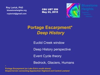
Portage Escarpment Deep History

The presentation lays a framework for understanding the evolution of the Portage Escarpment in the Cleveland area. On Lake Erie's south shore, the Portage Escarpment is the terrain transition between North America's Appalachian Highland and Central Lowland provinces. Lake Erie and its lake plain lie in the lowland province. Cleveland's East Side Heights lies on the escarpment. Portage, Summit, and Medina counties lie in the highland province. Euclid Creek window Our window into escarpment evolution is the stream-cut bedrock sequence at the Quarry Picnic Area of the Euclid Creek Reservation in South Euclid, Ohio. The sequence features two of the escarpment's three sandstone formations: the Berea Sandstone and, below, the Euclid bluestone (Bedford Formation). Deep History To comprehend the relationship between natural and anthropogenic terrain evolutions, the 'deep history' perspective is introduced. Deep history views urban landscapes as the weave of natural and cultural forces. The deep history perspectives of Daniel Lord Smail, David Christian, Edward O. Wilson and the Eco-Modernists are introduced. Event Cycles The deep history perspective views landscape evolution as a series of two-phased cycles. In deposition phase, landscape is built up as natural sediment and/or anthropogenic transformation. In erosion phase, landscape is torn down with stream cutting and/or urban abandonment. Bedrock Deposition The Euclid bluestone and Berea Sandstone were deposited ~350 Ma in a shallow sea fronting the rising Appalachian Mountains to the east. The sandstones typify deposits in a fold belt foreland basin. An analog can be found in the Persian Gulf, in the foreland basin fronting the Zagros Mountains fold belt in Iran and Iraq. Glacial Retreat and Stream Formation In terms of natural process, the current Portage Escarpment landscape took shape as the last glacier retreated northward and meltwater cut deep ravines into the local bedrock sequence. By about 16 ka, small streams began flowing southward to the Chagrin and Cuyahoga Rivers. After 16 ka, newer small streams, including Euclid Creek began flowing northward from current Shaker Heights. Anthropogenic Landscapes As we see evidence for Portage Escarpment terrain evolution at Euclid Creek, the human transformations loom large. The area was extensively quarried during the nineteenth century. Moreover, as urban development has paved much of the Euclid Creek watershed, the stream is subject to flood events which can quickly change the local stream bed. Many historic Metroparks infrastructure components are highly eroded.

Empfohlen
Empfohlen
Weitere ähnliche Inhalte
Was ist angesagt?
Was ist angesagt? (20)
Andere mochten auch
Andere mochten auch (8)
Ähnlich wie Portage Escarpment Deep History
Ähnlich wie Portage Escarpment Deep History (20)
Mehr von Bluestone Heights
Mehr von Bluestone Heights (20)
Kürzlich hochgeladen
Kürzlich hochgeladen (20)
Portage Escarpment Deep History
- 1. roylarick@gmail.com bluestoneheights.org Roy Larick, PhD Bluestone HeightsBluestone Heights Research Education Advocacy Chagrin Tinkers CSU UST 259 May 23, 2015 Portage Escarpment* Deep History Euclid Creek window Deep History perspective Bedrock, Glaciers, Humans Event Cycle theory * Portage Escarpment (on Lake Erie’s south shore): Sloped terrain connecting Appalachian Highland and Central Lowland
- 2. A A B B C C Euclid Falls Euclid Creek window Euclid Creek Reservation Quarry Picnic Area on the Portage Escarpment
- 3. History begins with the human brain Deep History perspective
- 4. Weave diverse fields of study into a unifying narrative of life on earth David Christian Big History Project world history: 8 thresholds Anthropocene Deep History perspective
- 5. Edward O. Wilson Comprehend history to rebalance natural & human forces No matter how dominant our species has become, we are still part of nature Deep History Inter-weaved human and natural history Helps us understand our place in nature Humans belong to nature Deep History perspective
- 6. Humans over-rely on natural ecosystems Decouple human welfare from environmental impacts Cities occupy 2% of the Earth’s surface April 15, 2015 Technology to stabilize the climate and protect nature Develop cities Deep History perspective
- 7. Landscapes grow and retreat in cycles Event Cycles time + event (action) = erosion to low peak Humans act upon landscape in cycles time + event (action) = deposition to high peak cycle
- 8. erode erode deposit t (action) deposit / erode x (amplitude) sediment volume deposit
- 9. years ago process phase era 40 a-? urban abandonment Post Industrial 210-40 a industrialization Anthropocene 16 Ka-present post-glacial erosion Holocene 23-16 Ka late glacial deposition Late Pleistocene 300 Ma-23 Ka hard rock erosion Mesozoic/Cenozoic 400-300 Ma hard rock deposition Paleozoic Portage Escarpment Event Cycles 1: 2: 3:
- 10. PS UC Cuyahoga Portage Escarpment, Chagrin to Cuyahoga, looking SE from above Lake Erie N Tri-C East A B Bedrock deposition Portage Escarpment Deep History
- 11. NE WA B Cuyahoga shale Cleveland shale Chagrin shale Sharon sandstone Cuyahoga R. Chagrin R. Tri-C East Lake Erie Berea Sandstone Euclid b’stone Bluestone Heights Portage Escarpment schematic view SE from Lake Erie exaggerated vertical scale
- 12. Tinkers Creek valley terrace terrace Tri-C East bedrock terraces PS UC Euclid Uplift: 300 Ma
- 13. Tinkers Creek valley 16 Ka - present Stream development Euclid PS UC 16 Ka – present plan view Final glacial retreat Glacial retreat & stream cutting Defiance ice front, 16 ka
- 14. Tinkers Creek valley 16 Ka - present Stream development Euclid PS UC Final glacial retreat Euclid ice front, 14 ka 16 Ka – present plan view
- 15. Tinkers Creek valley 16 Ka - present Stream development Euclid Gully Brook PS UC Final glacial retreat Painesville ice front, 13 ka 16 Ka – present plan view
- 16. Tinkers Creek valley Gully Brook Moraine PS UC Natural streams
- 17. Euclid & Nine Mile Upper Doan & Dugway Lower Doan & Dugway Euclid Creek Tunnel NEORSD Interceptor sewers Tinkers Creek valley Anthropogenic streams Tri-C East PS UC
- 18. Tri-C East Shaker Hts University Hts East Cleveland Bratenahl Lyndhurst Beechwood W’by Hills Wickliffe S. Euclid Euclid Collinwood/ Nottingham Glenville Shaker Hts Rich Hts Bratenahl Bratenahl Cleveland Heights Univer. Circle Cleveland Heights W’by Hills Flats Cuyahoga R. Chagrin R. Lake ErieEasterly, E 140th 16 Ka – present profile view Stream development Portage Escarpment municipalities Chagrin to Cuyahoga Rivers
- 19. Berea Sandstone Euclid b’stone Cuyahoga shale Cleveland shale Chagrin shale Cuyahoga R. Chagrin R. 16 Ka Sharon sandstone ~1200’ above sea level Defiance ice base 16 Ka – present profile view Stream development
- 20. Cuyahoga R. Lake Maumee Cuyahoga shale Cleveland shale Chagrin shale Chagrin R. Sharon sandstone ~800’ asl 14.5 Ka Berea Sandstone Euclid b’stone Euclid Nine Mile Shaw Dugway Blue Rock Doan Kingsbury 16 Ka – present profile view Stream development
- 21. Cuyahoga R. Lake Erie Cuyahoga shale Cleveland shale Chagrin shale Gullly Euclid Nine Mile Shaw Dugway Blue Rock Doan Kingsbury Chagrin R. Sharon sandstone 12 Ka (Niagara Falls opens) ~500’ asl Berea Sandstone Euclid b’stone 16 Ka – present profile view Stream development
- 22. Cuyahoga R. Lake Erie Cuyahoga shale Cleveland shale Chagrin shale Gully Euclid Nine Mile Shaw Dugway Blue Rock Doan Kingsbury Chagrin R. Sharon sandstone 600 BC (Lake Erie rises ~40’ to present level) ~570’ asl Berea Sandstone Euclid b’stone 16 Ka – present profile view Stream development
- 23. Tri-C East Cuyahoga R. Lake Erie Gully Euclid Nine Mile Shaw Dugway Blue Rock Doan Kingsbury Chagrin R. Shaker Hts University Hts East Cleveland Bratenahl Lyndhurst Beechwood W’by Hills Wickliffe S. Euclid Euclid Collinwood/ Nottingham Glenville Shaker Hts Rich Hts Bratenahl Bratenahl Cleveland Heights Univer. Circle ~570’ asl Cleveland Heights W’by Hills Flats 1850-2013 AD (Anthropogenic change) Heavily transformed 16 Ka – present profile view Stream development
- 24. Natural cave (Euclid Creek, Berea Sandstone)
- 25. Anthropogenic cave (Euclid Creek Tunnel)
- 26. Roy Larick Walk back in time Look to the Future Bluestone Heights © 2015 Bluestone Heights bluestoneheights.org roylarick@gmail.com Euclid bluestone outcrop Doan Brook, Cleveland OHR. Larick