Room Enough for Everyone? Understanding Human Uses & Interactions in RI Coastal Waters
•
1 gefällt mir•746 views

This document discusses understanding human uses and interactions in Rhode Island coastal waters through evaluating social carrying capacity. It begins with an introduction to social carrying capacity and its history. It then discusses mapping and modeling human uses through participatory mapping, aerial surveys, observational studies, and boat-based transect surveys. Lastly, it discusses evaluative studies of social carrying capacity through perceived impacts, standards, and indicators. The goal is to apply these frameworks to understand social carrying capacities related to shellfish aquaculture, harvest and restoration in Rhode Island.

Empfohlen
Empfohlen
Weitere ähnliche Inhalte
Was ist angesagt?
Was ist angesagt? (20)
Andere mochten auch
Ähnlich wie Room Enough for Everyone? Understanding Human Uses & Interactions in RI Coastal Waters
Ähnlich wie Room Enough for Everyone? Understanding Human Uses & Interactions in RI Coastal Waters (20)
Mehr von riseagrant
Mehr von riseagrant (20)
Kürzlich hochgeladen
Kürzlich hochgeladen (20)
Room Enough for Everyone? Understanding Human Uses & Interactions in RI Coastal Waters
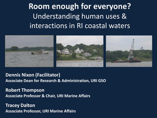
- 1. Room enough for everyone? Understanding human uses & interactions in RI coastal waters Dennis Nixon (Facilitator) Associate Dean for Research & Administration, URI GSO Robert Thompson Associate Professor & Chair, URI Marine Affairs Tracey Dalton Associate Professor, URI Marine Affairs
- 2. Overview (1) Introduction to social carrying capacity (2) Understanding social carrying capacities- Mapping and Spatial modeling (3) Understanding social carrying capacities- Evaluative studies
- 3. (1) Introduction to Social Carrying Capacity • Carrying capacity is not a new concept • Brief history – Human population – Wildlife and range management – Recreation and parks Manning (2007)
- 4. Different types of carrying capacity • Ecological • Production • Physical • Social
- 5. At what point, does the amount or type of impact become unacceptable? Social carrying capacity (SCC)
- 6. The level of use beyond which environmental & social impacts exceed acceptable levels specified by evaluative standards (Manning 2007; Shelby & Heberlein 1986) Social carrying capacity
- 7. Statements that define desired human and natural conditions Specific measures of conditions • Minimum acceptable quality of conditions • Acceptability levels of individuals are measured and aggregated Management objectives Indicators Standards
- 8. Management objectives Indicators Standards RI Aquaculture Policy 300.11(D)(1d) (1) compatibility of the proposal with other existing and potential uses of the area (7) impact of proposed activities on the scenic qualities of the area • Maps and models of how people are using coastal waters • Perceptions of interactions • Perceptions of scenic quality • What are acceptable levels of use interactions? • What are acceptable levels of scenic quality? • Is there shared agreement of acceptability? Or do acceptability levels vary by stakeholder characteristics? • How does acceptability vary by location?
- 9. (2) Mapping, Spatial Modeling and Social Carrying Capacity Could be thought of as a three-step process. First, determining what type of human uses are occurring and where are they occurring, Which typically is not a “hardline” boundary. Second, determining what the “behavioral” characteristics of different uses. Knowing how different uses “behave” is important for modeling and planning. What are the positive or negative externalities of the use. Third, determining what different user groups think about the behaviors of other uses within different planning scenarios.
- 10. Mapping and Modeling Human Uses What can be mapped and modeled? Spatial Basic physical footprint 2 dimensional or 3 dimensional Travel and operating patterns Intensity of the use Temporal Seasonality Hours Frequency of the use Behavioral attributes of the use Potential conflicts, Potential synergies Noise, lighting, smells Improved water quality Economic impact Visual amenity or disamenity?
- 11. Methods for Mapping “Participatory” mapping Aerial surveys Fixed point observations Boat based offset transect surveys Triangulation between methods
- 12. Methods Participatory mapping examples. Asking people to draw their past activities or valued places on a map. Asking people to record their last trip. E.g., mail or online survey. Asking people to keep a travel diary. Providing people with GPS and cameras. Clear instructions. Critical to carefully design study, e.g., what is mapped, how are definitions used. Understandable and feasible Fidelity by participants in following instructions
- 13. Methods Participatory mapping: Possible problems Participatory mapping is often binary: An activity is either there (or has been there) or it hasn't. But it tells us nothing about it’s intensity, frequency, duration, or variety of characteristics. Relative importance of areas within a category. Reliability Memories Might not be a random sample—bias.
- 14. Methods Participatory mapping: Potential benefits. Can be relatively inexpensive. Involves stakeholders in determining what should be mapped. Transparency Clear methods for collecting and processing. Objectives, indicators, standards. Information about attributes Very useful in informing mapping and modeling Stakeholders are experts in the functioning and important attributes of uses.
- 15. Methods Aerial surveys: Relatively inexpensive to take usable aerial photographs. More costly if professionally processed to remove distortion Accurately captures visible activities. Digitizing for use in GIS Can be time consuming. Accurately characterizing activities can be difficult. E.g., are occupants on a stationary boat fishing or not? Usually based on one or a relatively small number of samples. More of a snapshot, which may not be representative. Peak days and low days.
- 16. Methods Observational studies Observing, mapping, and characterizing activity from set observation points. Can make observations on many randomly selected days and at various times. Accurately mapping activity can be difficult. Markers can help On the water activities can be particularly problematic.
- 17. Boat-Based Offset Transect Surveys
- 18. Ran set transect lines on 30 randomly selected days in summer of 2006 and 28 days in 2007 The order of the runs each day were randomly selected Measure the straight line distance & angle to every observation Calculate position of each observation
- 19. Recording Attributes in ArcPad
- 20. Recording Attributes in ArcPad We developed a list of attributes based upon multiple sources. Created a series of drop down choice menus that would immediately appear when a record was created. The recorder would enter data by tapping.
- 21. The Database 14279 observations Bayscape in 2006-2007 3252 observations for NBNERR in 2007 Approximately 17,500 observations total. Points turned into density grids.
- 25. Modeling Indicators and Planning for Shellfish Management Developing impact relevant attributes. Noise, Light Hours Frequency E.g. daily or once a year. Seasonal activities Movement in and out of use areas Impacts into indicators and standards Perceptions of attributes by others Accuracy of perceptions Modeling possible impacts Mitigating impacts to maximize shellfish production
- 26. Chilling
- 27. Fishing
- 28. (3) Understanding social carrying capacities (Evaluative) Management objectives Indicators Standards
- 29. Acceptability of boat encounters in a Hawaiian marine park Needham et al. 2011
- 30. Diedrich et al. 2011 Preferences, well-being and crowding of recreational boaters in Spain
- 31. Inglis et al. 1999 Crowding of snorkelers on Great Barrier Reef
- 32. Scenic quality of coastal landscapes in RI Dalton & Thompson 2013
- 33. SCC studies for shellfish-related uses in RI? • Few (if any) studies estimate SCCs related to aquaculture, wild shellfish harvest, or ecological restoration • Findings from existing SCC studies may not easily transfer to RI (multi-use setting, diverse stakeholder interests) • Methods could be transferred and modified for shellfish-related uses and other uses in RI coastal waters
- 34. Studies of social carrying capacity can be useful to: (1) highlight areas of agreement or disagreement on SCCs (2) provide ranges of social carrying capacities (3) identify factors that affect SCCs, like stakeholder characteristics and environmental & cultural settings (4) inform planning and management activities