SlideShare ist ein Scribd-Unternehmen logo
1 von 19
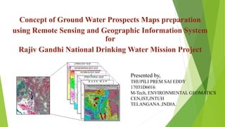
Concept of Ground Water Prospects Maps preparation
using Remote Sensing and Geographic Information System
for
Rajiv Gandhi National Drinking Water Mission Project
Presented by,
THUPILI PREM SAI EDDY
17031D6016
M-Tech, ENVIRONMENTAL GEOMATICS
CEN,IST,JNTUH
TELANGANA ,INDIA.
RAJIV GANDHI NATIONAL DRINKING WATER
MISSION PROJECT
The Government of India (Department of Drinking Water Supply), through
the Rajiv Gandhi National Drinking Water Mission (RGNDWM)
supplements the efforts of the State Governments to accelerate the pace of
coverage of drinking water supply to Non Covered (NC), Partially Covered
(PC) and quality affected rural habitations with mission approach by
providing Central assistance under the Accelerated Rural Water Supply
Program (ARWSP).
As part of supplying the drinking water to these habitations, the RGNDWM
has approached the NRSC/ISRO to provide scientific data on drinking water
sources (ground water source) to the non-covered (NC) and partially-covered
(PC) habitations, within the radius of 1.5 km in case of plain areas and within
100m elevation in case of hilly terrain, using the satellite data.
•WHAT is GROUND WATER PROSPECTS MAP?
•WHY do we need to prepare it?
•Need for scientific data base for the country!
INTRODUCTION
OBJECTIVES
The objective of the project is to prepare the ‘ground water
prospects maps’, corresponding to Survey of India topo-sheet on
1:50,000 scale, covering all the habitations. The map has to show
a) prospective zones for ground water occurrence
b) tentative locations for constructing recharge structures.
METHODS OF GROUND WATER EXPLORATION
A. Surface investigation
B. Geophysical measurements
C. Subsurface investigation
Geological formations have distinct physical properties that affect the flow of groundwater and
determine the yield of a well. These properties include;
Effective porosity – the percentage of interconnected space in rock and soil that can contain water.
Hydraulic conductivity (K) – indicates how easily water moves through the aquifer.
Transmissivity (T) – is the ability of the aquifer to transmit water (T = K * saturated thickness of
aquifer).
Storativity – the ability of a confined aquifer to take up or release water in response to a change in
head resulting from recharge or extraction.
GROUND WATER PROSPECTS MAPPING –
THE CONCEPT
1.Ground water controlling factors
2.Hydro-geomorphological units
3.Relevance of Satellite Data
The total methodology can be divided into two main parts:
•The first part deals with the delineation of hydro-geomorphic units considering
parameters influencing the hydro geological properties. It consists of a) creation of
individual thematic layers on lithology, geomorphology, structures, hydrology along
with base map details based on the visual interpretation of satellite data in
conjunction with limited field / existing data, and b) derivation of hydrogeomorphic
units by integrating the thematic data.
•The second part deals with the evaluation of hydrogeomorphic units based on
hydrogeological characteristics of controlling parameters. It consists of a) estimation
of ground water prospects by taking into account the well observatory data, and b)
identification of suitable locations for constructing recharge structures along with
prioritization of the units.
METHODOLOGY OF GROUND WATER PROSPECTS
MAPPING
CONCEPT OF THEMATIC LAYERS FOR MAPPING
BASE MAP LAYERS:
CONCEPT OF THEMATIC LAYERS FOR MAPPING
LITHOLOGY LAYERS:
CONCEPT OF THEMATIC LAYERS FOR MAPPING
STRUCTURAL LAYERS:
CONCEPT OF THEMATIC LAYERS FOR MAPPING
GEOMORPHOLOGY LAYERS:
CONCEPT OF THEMATIC LAYERS FOR MAPPING
HYDROLOGY LAYERS:
DELINEATION OF HYDRO-GEOMORPHIC UNITS
Apart from this, certain field studies are to be performed such
as:
•Evaluation of aquifer material
•Assessment of Recharge Conditions
•Types of wells suitable
•Expected Yield range
•Success rate of wells / Homogeneity of the map unit
•Water Quality
•Ground water irrigated area
•Selection of Sites for artificial recharge Structures
•Types of recharge structures
GENERATION OF GROUND WATER PROSPECTS MAP
• Map layouts
• Map composition
• Creation of Legend
• Classification Systems
SCOPE AND LIMITATIONS OF GROUND WATER
PROSPECTS MAPS
SCOPE:
• Ground water prospects maps may be used by the field Officers of the departments concerned in the
respective states to select the sites at appropriate places
• It helps mainly in identification of prospective locations for narrowing down target zones for follow-up
detailed hydro-geological and geophysical surveys at appropriate places for drilling.
• These maps are the good inputs for aquifer mapping.
• One of the input for resource estimation for future ground water development for the given area.
• The maps are prepared based on the availability recharge conditions i.e rainfall, depth to water table,
availability of water in the water bodies during the period of the mapping. Hence depth and yield will
vary.
• VIBGYOR colours scheme is maintained for indicating yield and hatching pattern for depth. In does not
mean that entire polygon gives the same yield but it varies within the unit due to heterogeneity. Hence
sometimes yield may go one step up or down. It is because of rain fall variations.
• Maps help in identifying the ground water exploitation areas (through ground water irrigated patches) for
addressing the suitable recharge structures for improving the ground water levels.
LIMITATIONS
• Limitations
• Pin pointing bore / tube well points (41/2” & 61/2” dia) may not be accurate.
• Depth variations
• Yield variations
• Variations in estimated success rate
• Low yields/poor yields along the fracture areas
Thank you 

Weitere ähnliche Inhalte

Was ist angesagt?

Iirs overview -Remote sensing and GIS application in Water Resources Management
Iirs overview -Remote sensing and GIS application in Water Resources ManagementIirs overview -Remote sensing and GIS application in Water Resources Management
Iirs overview -Remote sensing and GIS application in Water Resources ManagementTushar Dholakia
 
Groundwater Management
Groundwater ManagementGroundwater Management
Groundwater ManagementSean Carroll
 
REMOTE SENSING & GIS APPLICATIONS IN WATERSHED MANAGEMENT
REMOTE SENSING & GIS APPLICATIONS IN WATERSHED MANAGEMENT REMOTE SENSING & GIS APPLICATIONS IN WATERSHED MANAGEMENT
REMOTE SENSING & GIS APPLICATIONS IN WATERSHED MANAGEMENT Sumant Diwakar
 
Flood and Watershed Management: Dealing with Natural Disasters
Flood and Watershed Management: Dealing with Natural DisastersFlood and Watershed Management: Dealing with Natural Disasters
Flood and Watershed Management: Dealing with Natural Disasters2020resilience
 
ARTIFICIAL RECHARGE OF GROUNDWATER
ARTIFICIAL RECHARGE OF GROUNDWATERARTIFICIAL RECHARGE OF GROUNDWATER
ARTIFICIAL RECHARGE OF GROUNDWATERNamitha M R
 
Chapter 1 occurrence of groundwater
Chapter 1  occurrence of groundwaterChapter 1  occurrence of groundwater
Chapter 1 occurrence of groundwaterUsama Waly
 
LANDSLIDE HAZARD ZONATION MAPPING USING RS AND GIS
LANDSLIDE HAZARD ZONATION MAPPING USING RS AND GISLANDSLIDE HAZARD ZONATION MAPPING USING RS AND GIS
LANDSLIDE HAZARD ZONATION MAPPING USING RS AND GISAditya Ghumare
 
REMOTE SENSING IN GROUNDWATER.pptx
REMOTE SENSING IN GROUNDWATER.pptxREMOTE SENSING IN GROUNDWATER.pptx
REMOTE SENSING IN GROUNDWATER.pptxImposter7
 
Artificial groundwater recharging techniques
Artificial groundwater recharging techniquesArtificial groundwater recharging techniques
Artificial groundwater recharging techniquessaisrinivas gorugantula
 
GROUNDWATER QUALITY:- PROBLEMS CHALLENGES, & MANAGEMENT PROSPECTS IN INDIA
GROUNDWATER QUALITY:- PROBLEMS CHALLENGES, &  MANAGEMENT  PROSPECTS  IN  INDIA GROUNDWATER QUALITY:- PROBLEMS CHALLENGES, &  MANAGEMENT  PROSPECTS  IN  INDIA
GROUNDWATER QUALITY:- PROBLEMS CHALLENGES, & MANAGEMENT PROSPECTS IN INDIA Prashant Sharma
 
GIS application in Natural Resource Management
GIS application in Natural Resource ManagementGIS application in Natural Resource Management
GIS application in Natural Resource ManagementAchal Gupta
 
APPLICATIONS OF REMOTE SENSING AND GIS IN WATERSHED MANAGEMENT
APPLICATIONS OF REMOTE SENSING AND GIS IN WATERSHED MANAGEMENTAPPLICATIONS OF REMOTE SENSING AND GIS IN WATERSHED MANAGEMENT
APPLICATIONS OF REMOTE SENSING AND GIS IN WATERSHED MANAGEMENTSriram Chakravarthy
 
Ground Water Quality Monitoring Using Remote Sensing And GIS
Ground Water Quality Monitoring Using Remote Sensing And GIS Ground Water Quality Monitoring Using Remote Sensing And GIS
Ground Water Quality Monitoring Using Remote Sensing And GIS Nzar Braim
 
Artificial recharge of groundwater
Artificial recharge of groundwaterArtificial recharge of groundwater
Artificial recharge of groundwaterLakshmi K Suresh
 
Introduction to Groundwater Modelling
Introduction to Groundwater ModellingIntroduction to Groundwater Modelling
Introduction to Groundwater ModellingC. P. Kumar
 
Flood risk mapping using GIS and remote sensing
Flood risk mapping using GIS and remote sensingFlood risk mapping using GIS and remote sensing
Flood risk mapping using GIS and remote sensingRohan Tuteja
 
Image interpretation keys & image resolution
Image interpretation keys & image resolutionImage interpretation keys & image resolution
Image interpretation keys & image resolutionPramoda Raj
 
Remote sensing based water management from the watershed to the field level
Remote sensing based water management from the watershed to the field levelRemote sensing based water management from the watershed to the field level
Remote sensing based water management from the watershed to the field levelCIMMYT
 

Was ist angesagt? (20)

Iirs overview -Remote sensing and GIS application in Water Resources Management
Iirs overview -Remote sensing and GIS application in Water Resources ManagementIirs overview -Remote sensing and GIS application in Water Resources Management
Iirs overview -Remote sensing and GIS application in Water Resources Management
 
Groundwater Management
Groundwater ManagementGroundwater Management
Groundwater Management
 
REMOTE SENSING & GIS APPLICATIONS IN WATERSHED MANAGEMENT
REMOTE SENSING & GIS APPLICATIONS IN WATERSHED MANAGEMENT REMOTE SENSING & GIS APPLICATIONS IN WATERSHED MANAGEMENT
REMOTE SENSING & GIS APPLICATIONS IN WATERSHED MANAGEMENT
 
Flood and Watershed Management: Dealing with Natural Disasters
Flood and Watershed Management: Dealing with Natural DisastersFlood and Watershed Management: Dealing with Natural Disasters
Flood and Watershed Management: Dealing with Natural Disasters
 
ARTIFICIAL RECHARGE OF GROUNDWATER
ARTIFICIAL RECHARGE OF GROUNDWATERARTIFICIAL RECHARGE OF GROUNDWATER
ARTIFICIAL RECHARGE OF GROUNDWATER
 
Chapter 1 occurrence of groundwater
Chapter 1  occurrence of groundwaterChapter 1  occurrence of groundwater
Chapter 1 occurrence of groundwater
 
LANDSLIDE HAZARD ZONATION MAPPING USING RS AND GIS
LANDSLIDE HAZARD ZONATION MAPPING USING RS AND GISLANDSLIDE HAZARD ZONATION MAPPING USING RS AND GIS
LANDSLIDE HAZARD ZONATION MAPPING USING RS AND GIS
 
REMOTE SENSING IN GROUNDWATER.pptx
REMOTE SENSING IN GROUNDWATER.pptxREMOTE SENSING IN GROUNDWATER.pptx
REMOTE SENSING IN GROUNDWATER.pptx
 
Artificial groundwater recharging techniques
Artificial groundwater recharging techniquesArtificial groundwater recharging techniques
Artificial groundwater recharging techniques
 
Hydrological modelling
Hydrological modellingHydrological modelling
Hydrological modelling
 
GROUNDWATER QUALITY:- PROBLEMS CHALLENGES, & MANAGEMENT PROSPECTS IN INDIA
GROUNDWATER QUALITY:- PROBLEMS CHALLENGES, &  MANAGEMENT  PROSPECTS  IN  INDIA GROUNDWATER QUALITY:- PROBLEMS CHALLENGES, &  MANAGEMENT  PROSPECTS  IN  INDIA
GROUNDWATER QUALITY:- PROBLEMS CHALLENGES, & MANAGEMENT PROSPECTS IN INDIA
 
GIS application in Natural Resource Management
GIS application in Natural Resource ManagementGIS application in Natural Resource Management
GIS application in Natural Resource Management
 
APPLICATIONS OF REMOTE SENSING AND GIS IN WATERSHED MANAGEMENT
APPLICATIONS OF REMOTE SENSING AND GIS IN WATERSHED MANAGEMENTAPPLICATIONS OF REMOTE SENSING AND GIS IN WATERSHED MANAGEMENT
APPLICATIONS OF REMOTE SENSING AND GIS IN WATERSHED MANAGEMENT
 
Ground Water Quality Monitoring Using Remote Sensing And GIS
Ground Water Quality Monitoring Using Remote Sensing And GIS Ground Water Quality Monitoring Using Remote Sensing And GIS
Ground Water Quality Monitoring Using Remote Sensing And GIS
 
Hydrogeology
HydrogeologyHydrogeology
Hydrogeology
 
Artificial recharge of groundwater
Artificial recharge of groundwaterArtificial recharge of groundwater
Artificial recharge of groundwater
 
Introduction to Groundwater Modelling
Introduction to Groundwater ModellingIntroduction to Groundwater Modelling
Introduction to Groundwater Modelling
 
Flood risk mapping using GIS and remote sensing
Flood risk mapping using GIS and remote sensingFlood risk mapping using GIS and remote sensing
Flood risk mapping using GIS and remote sensing
 
Image interpretation keys & image resolution
Image interpretation keys & image resolutionImage interpretation keys & image resolution
Image interpretation keys & image resolution
 
Remote sensing based water management from the watershed to the field level
Remote sensing based water management from the watershed to the field levelRemote sensing based water management from the watershed to the field level
Remote sensing based water management from the watershed to the field level
 

Ähnlich wie Ground water prospects map

Potential Recharge Zones.pptx
Potential Recharge Zones.pptxPotential Recharge Zones.pptx
Potential Recharge Zones.pptxQasimHaider4
 
Identification of Groundwater Potential Zones in Vaippar Basin, Tamil Nadu, I...
Identification of Groundwater Potential Zones in Vaippar Basin, Tamil Nadu, I...Identification of Groundwater Potential Zones in Vaippar Basin, Tamil Nadu, I...
Identification of Groundwater Potential Zones in Vaippar Basin, Tamil Nadu, I...SagarChougule11
 
IRJET- Selection of Artificial Recharge Structures using GIS and GEO Physical...
IRJET- Selection of Artificial Recharge Structures using GIS and GEO Physical...IRJET- Selection of Artificial Recharge Structures using GIS and GEO Physical...
IRJET- Selection of Artificial Recharge Structures using GIS and GEO Physical...IRJET Journal
 
Estimation of Groundwater Potential
Estimation of Groundwater PotentialEstimation of Groundwater Potential
Estimation of Groundwater PotentialC. P. Kumar
 
Watershed delineation and LULC mapping
Watershed delineation and LULC mappingWatershed delineation and LULC mapping
Watershed delineation and LULC mappingKapil Thakur
 
Coupling of Surface water and Groundwater Models
Coupling of Surface water and Groundwater Models Coupling of Surface water and Groundwater Models
Coupling of Surface water and Groundwater Models TIPU SULTAN BADAGAN
 
Identification of Groundwater Potential Survey Using QGIS of DBATU campus, Ma...
Identification of Groundwater Potential Survey Using QGIS of DBATU campus, Ma...Identification of Groundwater Potential Survey Using QGIS of DBATU campus, Ma...
Identification of Groundwater Potential Survey Using QGIS of DBATU campus, Ma...IRJET Journal
 
Watershed management: Role of Geospatial Technology
Watershed management: Role of Geospatial TechnologyWatershed management: Role of Geospatial Technology
Watershed management: Role of Geospatial Technologyamritpaldigra30
 
Assesment of groundwater_potential_zones_for_bruhat_bangalore_mahanagara_pali...
Assesment of groundwater_potential_zones_for_bruhat_bangalore_mahanagara_pali...Assesment of groundwater_potential_zones_for_bruhat_bangalore_mahanagara_pali...
Assesment of groundwater_potential_zones_for_bruhat_bangalore_mahanagara_pali...Mohammed Badiuddin Parvez
 
REMOTE SENSING DATA FOR HYDROLOGICAL MODELING
REMOTE SENSING DATA FOR HYDROLOGICAL MODELINGREMOTE SENSING DATA FOR HYDROLOGICAL MODELING
REMOTE SENSING DATA FOR HYDROLOGICAL MODELINGShyam Mohan Chaudhary
 
Aquifer Mapping, Moni-ppt.pptx
Aquifer Mapping, Moni-ppt.pptxAquifer Mapping, Moni-ppt.pptx
Aquifer Mapping, Moni-ppt.pptxTejasKadam44
 
2007 hassan and islam - application of GIS for drinking water - paper_108
2007 hassan and islam - application of GIS for drinking water - paper_1082007 hassan and islam - application of GIS for drinking water - paper_108
2007 hassan and islam - application of GIS for drinking water - paper_108SM Tanvir Hassan
 
IRJET- Rainfall-Runoff Analysis of the Watershed for River AIE
IRJET-  	  Rainfall-Runoff Analysis of the Watershed for River AIEIRJET-  	  Rainfall-Runoff Analysis of the Watershed for River AIE
IRJET- Rainfall-Runoff Analysis of the Watershed for River AIEIRJET Journal
 
IRJET - Remote Sensing, GIS and Geophysical Techniques to Find Suitable Sites...
IRJET - Remote Sensing, GIS and Geophysical Techniques to Find Suitable Sites...IRJET - Remote Sensing, GIS and Geophysical Techniques to Find Suitable Sites...
IRJET - Remote Sensing, GIS and Geophysical Techniques to Find Suitable Sites...IRJET Journal
 
IRJET- Assessment of Reservoir Sedimentation using RS and GIS Techniques - A ...
IRJET- Assessment of Reservoir Sedimentation using RS and GIS Techniques - A ...IRJET- Assessment of Reservoir Sedimentation using RS and GIS Techniques - A ...
IRJET- Assessment of Reservoir Sedimentation using RS and GIS Techniques - A ...IRJET Journal
 
APPLICATIONS OF RS AND GIS FOR DEVELOPMENT OF SMALL HYDROPOWER PLANTS (SHP)
APPLICATIONS OF RS AND GIS  FOR DEVELOPMENT OF SMALL HYDROPOWER PLANTS (SHP)APPLICATIONS OF RS AND GIS  FOR DEVELOPMENT OF SMALL HYDROPOWER PLANTS (SHP)
APPLICATIONS OF RS AND GIS FOR DEVELOPMENT OF SMALL HYDROPOWER PLANTS (SHP)Abhiram Kanigolla
 

Ähnlich wie Ground water prospects map (20)

Online Watershed Analysis Tool
Online Watershed Analysis Tool Online Watershed Analysis Tool
Online Watershed Analysis Tool
 
Potential Recharge Zones.pptx
Potential Recharge Zones.pptxPotential Recharge Zones.pptx
Potential Recharge Zones.pptx
 
Identification of Groundwater Potential Zones in Vaippar Basin, Tamil Nadu, I...
Identification of Groundwater Potential Zones in Vaippar Basin, Tamil Nadu, I...Identification of Groundwater Potential Zones in Vaippar Basin, Tamil Nadu, I...
Identification of Groundwater Potential Zones in Vaippar Basin, Tamil Nadu, I...
 
IRJET- Selection of Artificial Recharge Structures using GIS and GEO Physical...
IRJET- Selection of Artificial Recharge Structures using GIS and GEO Physical...IRJET- Selection of Artificial Recharge Structures using GIS and GEO Physical...
IRJET- Selection of Artificial Recharge Structures using GIS and GEO Physical...
 
Aquifer Mapping Programme
Aquifer Mapping ProgrammeAquifer Mapping Programme
Aquifer Mapping Programme
 
Estimation of Groundwater Potential
Estimation of Groundwater PotentialEstimation of Groundwater Potential
Estimation of Groundwater Potential
 
Watershed delineation and LULC mapping
Watershed delineation and LULC mappingWatershed delineation and LULC mapping
Watershed delineation and LULC mapping
 
Coupling of Surface water and Groundwater Models
Coupling of Surface water and Groundwater Models Coupling of Surface water and Groundwater Models
Coupling of Surface water and Groundwater Models
 
Identification of Groundwater Potential Survey Using QGIS of DBATU campus, Ma...
Identification of Groundwater Potential Survey Using QGIS of DBATU campus, Ma...Identification of Groundwater Potential Survey Using QGIS of DBATU campus, Ma...
Identification of Groundwater Potential Survey Using QGIS of DBATU campus, Ma...
 
Watershed management: Role of Geospatial Technology
Watershed management: Role of Geospatial TechnologyWatershed management: Role of Geospatial Technology
Watershed management: Role of Geospatial Technology
 
Assesment of groundwater_potential_zones_for_bruhat_bangalore_mahanagara_pali...
Assesment of groundwater_potential_zones_for_bruhat_bangalore_mahanagara_pali...Assesment of groundwater_potential_zones_for_bruhat_bangalore_mahanagara_pali...
Assesment of groundwater_potential_zones_for_bruhat_bangalore_mahanagara_pali...
 
REMOTE SENSING DATA FOR HYDROLOGICAL MODELING
REMOTE SENSING DATA FOR HYDROLOGICAL MODELINGREMOTE SENSING DATA FOR HYDROLOGICAL MODELING
REMOTE SENSING DATA FOR HYDROLOGICAL MODELING
 
Aquifer Mapping, Moni-ppt.pptx
Aquifer Mapping, Moni-ppt.pptxAquifer Mapping, Moni-ppt.pptx
Aquifer Mapping, Moni-ppt.pptx
 
Hydrogeological studies and groundwater
Hydrogeological studies and groundwaterHydrogeological studies and groundwater
Hydrogeological studies and groundwater
 
2007 hassan and islam - application of GIS for drinking water - paper_108
2007 hassan and islam - application of GIS for drinking water - paper_1082007 hassan and islam - application of GIS for drinking water - paper_108
2007 hassan and islam - application of GIS for drinking water - paper_108
 
IRJET- Rainfall-Runoff Analysis of the Watershed for River AIE
IRJET-  	  Rainfall-Runoff Analysis of the Watershed for River AIEIRJET-  	  Rainfall-Runoff Analysis of the Watershed for River AIE
IRJET- Rainfall-Runoff Analysis of the Watershed for River AIE
 
IRJET - Remote Sensing, GIS and Geophysical Techniques to Find Suitable Sites...
IRJET - Remote Sensing, GIS and Geophysical Techniques to Find Suitable Sites...IRJET - Remote Sensing, GIS and Geophysical Techniques to Find Suitable Sites...
IRJET - Remote Sensing, GIS and Geophysical Techniques to Find Suitable Sites...
 
Gw quality management
Gw quality managementGw quality management
Gw quality management
 
IRJET- Assessment of Reservoir Sedimentation using RS and GIS Techniques - A ...
IRJET- Assessment of Reservoir Sedimentation using RS and GIS Techniques - A ...IRJET- Assessment of Reservoir Sedimentation using RS and GIS Techniques - A ...
IRJET- Assessment of Reservoir Sedimentation using RS and GIS Techniques - A ...
 
APPLICATIONS OF RS AND GIS FOR DEVELOPMENT OF SMALL HYDROPOWER PLANTS (SHP)
APPLICATIONS OF RS AND GIS  FOR DEVELOPMENT OF SMALL HYDROPOWER PLANTS (SHP)APPLICATIONS OF RS AND GIS  FOR DEVELOPMENT OF SMALL HYDROPOWER PLANTS (SHP)
APPLICATIONS OF RS AND GIS FOR DEVELOPMENT OF SMALL HYDROPOWER PLANTS (SHP)
 

Kürzlich hochgeladen

OSVC_Meta-Data based Simulation Automation to overcome Verification Challenge...
OSVC_Meta-Data based Simulation Automation to overcome Verification Challenge...OSVC_Meta-Data based Simulation Automation to overcome Verification Challenge...
OSVC_Meta-Data based Simulation Automation to overcome Verification Challenge...Soham Mondal
 
UNIT - IV - Air Compressors and its Performance
UNIT - IV - Air Compressors and its PerformanceUNIT - IV - Air Compressors and its Performance
UNIT - IV - Air Compressors and its Performancesivaprakash250
 
Extrusion Processes and Their Limitations
Extrusion Processes and Their LimitationsExtrusion Processes and Their Limitations
Extrusion Processes and Their Limitations120cr0395
 
(SHREYA) Chakan Call Girls Just Call 7001035870 [ Cash on Delivery ] Pune Esc...
(SHREYA) Chakan Call Girls Just Call 7001035870 [ Cash on Delivery ] Pune Esc...(SHREYA) Chakan Call Girls Just Call 7001035870 [ Cash on Delivery ] Pune Esc...
(SHREYA) Chakan Call Girls Just Call 7001035870 [ Cash on Delivery ] Pune Esc...ranjana rawat
 
MANUFACTURING PROCESS-II UNIT-2 LATHE MACHINE
MANUFACTURING PROCESS-II UNIT-2 LATHE MACHINEMANUFACTURING PROCESS-II UNIT-2 LATHE MACHINE
MANUFACTURING PROCESS-II UNIT-2 LATHE MACHINESIVASHANKAR N
 
Introduction to IEEE STANDARDS and its different types.pptx
Introduction to IEEE STANDARDS and its different types.pptxIntroduction to IEEE STANDARDS and its different types.pptx
Introduction to IEEE STANDARDS and its different types.pptxupamatechverse
 
Introduction to Multiple Access Protocol.pptx
Introduction to Multiple Access Protocol.pptxIntroduction to Multiple Access Protocol.pptx
Introduction to Multiple Access Protocol.pptxupamatechverse
 
Call Girls Pimpri Chinchwad Call Me 7737669865 Budget Friendly No Advance Boo...
Call Girls Pimpri Chinchwad Call Me 7737669865 Budget Friendly No Advance Boo...Call Girls Pimpri Chinchwad Call Me 7737669865 Budget Friendly No Advance Boo...
Call Girls Pimpri Chinchwad Call Me 7737669865 Budget Friendly No Advance Boo...roncy bisnoi
 
MANUFACTURING PROCESS-II UNIT-5 NC MACHINE TOOLS
MANUFACTURING PROCESS-II UNIT-5 NC MACHINE TOOLSMANUFACTURING PROCESS-II UNIT-5 NC MACHINE TOOLS
MANUFACTURING PROCESS-II UNIT-5 NC MACHINE TOOLSSIVASHANKAR N
 
(ANVI) Koregaon Park Call Girls Just Call 7001035870 [ Cash on Delivery ] Pun...
(ANVI) Koregaon Park Call Girls Just Call 7001035870 [ Cash on Delivery ] Pun...(ANVI) Koregaon Park Call Girls Just Call 7001035870 [ Cash on Delivery ] Pun...
(ANVI) Koregaon Park Call Girls Just Call 7001035870 [ Cash on Delivery ] Pun...ranjana rawat
 
Coefficient of Thermal Expansion and their Importance.pptx
Coefficient of Thermal Expansion and their Importance.pptxCoefficient of Thermal Expansion and their Importance.pptx
Coefficient of Thermal Expansion and their Importance.pptxAsutosh Ranjan
 
(ANJALI) Dange Chowk Call Girls Just Call 7001035870 [ Cash on Delivery ] Pun...
(ANJALI) Dange Chowk Call Girls Just Call 7001035870 [ Cash on Delivery ] Pun...(ANJALI) Dange Chowk Call Girls Just Call 7001035870 [ Cash on Delivery ] Pun...
(ANJALI) Dange Chowk Call Girls Just Call 7001035870 [ Cash on Delivery ] Pun...ranjana rawat
 
247267395-1-Symmetric-and-distributed-shared-memory-architectures-ppt (1).ppt
247267395-1-Symmetric-and-distributed-shared-memory-architectures-ppt (1).ppt247267395-1-Symmetric-and-distributed-shared-memory-architectures-ppt (1).ppt
247267395-1-Symmetric-and-distributed-shared-memory-architectures-ppt (1).pptssuser5c9d4b1
 
Java Programming :Event Handling(Types of Events)
Java Programming :Event Handling(Types of Events)Java Programming :Event Handling(Types of Events)
Java Programming :Event Handling(Types of Events)simmis5
 
UNIT-III FMM. DIMENSIONAL ANALYSIS
UNIT-III FMM.        DIMENSIONAL ANALYSISUNIT-III FMM.        DIMENSIONAL ANALYSIS
UNIT-III FMM. DIMENSIONAL ANALYSISrknatarajan
 
result management system report for college project
result management system report for college projectresult management system report for college project
result management system report for college projectTonystark477637
 
CCS335 _ Neural Networks and Deep Learning Laboratory_Lab Complete Record
CCS335 _ Neural Networks and Deep Learning Laboratory_Lab Complete RecordCCS335 _ Neural Networks and Deep Learning Laboratory_Lab Complete Record
CCS335 _ Neural Networks and Deep Learning Laboratory_Lab Complete RecordAsst.prof M.Gokilavani
 
Structural Analysis and Design of Foundations: A Comprehensive Handbook for S...
Structural Analysis and Design of Foundations: A Comprehensive Handbook for S...Structural Analysis and Design of Foundations: A Comprehensive Handbook for S...
Structural Analysis and Design of Foundations: A Comprehensive Handbook for S...Dr.Costas Sachpazis
 

Kürzlich hochgeladen (20)

OSVC_Meta-Data based Simulation Automation to overcome Verification Challenge...
OSVC_Meta-Data based Simulation Automation to overcome Verification Challenge...OSVC_Meta-Data based Simulation Automation to overcome Verification Challenge...
OSVC_Meta-Data based Simulation Automation to overcome Verification Challenge...
 
UNIT - IV - Air Compressors and its Performance
UNIT - IV - Air Compressors and its PerformanceUNIT - IV - Air Compressors and its Performance
UNIT - IV - Air Compressors and its Performance
 
Extrusion Processes and Their Limitations
Extrusion Processes and Their LimitationsExtrusion Processes and Their Limitations
Extrusion Processes and Their Limitations
 
(SHREYA) Chakan Call Girls Just Call 7001035870 [ Cash on Delivery ] Pune Esc...
(SHREYA) Chakan Call Girls Just Call 7001035870 [ Cash on Delivery ] Pune Esc...(SHREYA) Chakan Call Girls Just Call 7001035870 [ Cash on Delivery ] Pune Esc...
(SHREYA) Chakan Call Girls Just Call 7001035870 [ Cash on Delivery ] Pune Esc...
 
DJARUM4D - SLOT GACOR ONLINE | SLOT DEMO ONLINE
DJARUM4D - SLOT GACOR ONLINE | SLOT DEMO ONLINEDJARUM4D - SLOT GACOR ONLINE | SLOT DEMO ONLINE
DJARUM4D - SLOT GACOR ONLINE | SLOT DEMO ONLINE
 
MANUFACTURING PROCESS-II UNIT-2 LATHE MACHINE
MANUFACTURING PROCESS-II UNIT-2 LATHE MACHINEMANUFACTURING PROCESS-II UNIT-2 LATHE MACHINE
MANUFACTURING PROCESS-II UNIT-2 LATHE MACHINE
 
Introduction to IEEE STANDARDS and its different types.pptx
Introduction to IEEE STANDARDS and its different types.pptxIntroduction to IEEE STANDARDS and its different types.pptx
Introduction to IEEE STANDARDS and its different types.pptx
 
Introduction to Multiple Access Protocol.pptx
Introduction to Multiple Access Protocol.pptxIntroduction to Multiple Access Protocol.pptx
Introduction to Multiple Access Protocol.pptx
 
Call Girls Pimpri Chinchwad Call Me 7737669865 Budget Friendly No Advance Boo...
Call Girls Pimpri Chinchwad Call Me 7737669865 Budget Friendly No Advance Boo...Call Girls Pimpri Chinchwad Call Me 7737669865 Budget Friendly No Advance Boo...
Call Girls Pimpri Chinchwad Call Me 7737669865 Budget Friendly No Advance Boo...
 
MANUFACTURING PROCESS-II UNIT-5 NC MACHINE TOOLS
MANUFACTURING PROCESS-II UNIT-5 NC MACHINE TOOLSMANUFACTURING PROCESS-II UNIT-5 NC MACHINE TOOLS
MANUFACTURING PROCESS-II UNIT-5 NC MACHINE TOOLS
 
(ANVI) Koregaon Park Call Girls Just Call 7001035870 [ Cash on Delivery ] Pun...
(ANVI) Koregaon Park Call Girls Just Call 7001035870 [ Cash on Delivery ] Pun...(ANVI) Koregaon Park Call Girls Just Call 7001035870 [ Cash on Delivery ] Pun...
(ANVI) Koregaon Park Call Girls Just Call 7001035870 [ Cash on Delivery ] Pun...
 
Coefficient of Thermal Expansion and their Importance.pptx
Coefficient of Thermal Expansion and their Importance.pptxCoefficient of Thermal Expansion and their Importance.pptx
Coefficient of Thermal Expansion and their Importance.pptx
 
(ANJALI) Dange Chowk Call Girls Just Call 7001035870 [ Cash on Delivery ] Pun...
(ANJALI) Dange Chowk Call Girls Just Call 7001035870 [ Cash on Delivery ] Pun...(ANJALI) Dange Chowk Call Girls Just Call 7001035870 [ Cash on Delivery ] Pun...
(ANJALI) Dange Chowk Call Girls Just Call 7001035870 [ Cash on Delivery ] Pun...
 
247267395-1-Symmetric-and-distributed-shared-memory-architectures-ppt (1).ppt
247267395-1-Symmetric-and-distributed-shared-memory-architectures-ppt (1).ppt247267395-1-Symmetric-and-distributed-shared-memory-architectures-ppt (1).ppt
247267395-1-Symmetric-and-distributed-shared-memory-architectures-ppt (1).ppt
 
Java Programming :Event Handling(Types of Events)
Java Programming :Event Handling(Types of Events)Java Programming :Event Handling(Types of Events)
Java Programming :Event Handling(Types of Events)
 
UNIT-III FMM. DIMENSIONAL ANALYSIS
UNIT-III FMM.        DIMENSIONAL ANALYSISUNIT-III FMM.        DIMENSIONAL ANALYSIS
UNIT-III FMM. DIMENSIONAL ANALYSIS
 
result management system report for college project
result management system report for college projectresult management system report for college project
result management system report for college project
 
Roadmap to Membership of RICS - Pathways and Routes
Roadmap to Membership of RICS - Pathways and RoutesRoadmap to Membership of RICS - Pathways and Routes
Roadmap to Membership of RICS - Pathways and Routes
 
CCS335 _ Neural Networks and Deep Learning Laboratory_Lab Complete Record
CCS335 _ Neural Networks and Deep Learning Laboratory_Lab Complete RecordCCS335 _ Neural Networks and Deep Learning Laboratory_Lab Complete Record
CCS335 _ Neural Networks and Deep Learning Laboratory_Lab Complete Record
 
Structural Analysis and Design of Foundations: A Comprehensive Handbook for S...
Structural Analysis and Design of Foundations: A Comprehensive Handbook for S...Structural Analysis and Design of Foundations: A Comprehensive Handbook for S...
Structural Analysis and Design of Foundations: A Comprehensive Handbook for S...
 

Ground water prospects map

  • 1. Concept of Ground Water Prospects Maps preparation using Remote Sensing and Geographic Information System for Rajiv Gandhi National Drinking Water Mission Project Presented by, THUPILI PREM SAI EDDY 17031D6016 M-Tech, ENVIRONMENTAL GEOMATICS CEN,IST,JNTUH TELANGANA ,INDIA.
  • 2. RAJIV GANDHI NATIONAL DRINKING WATER MISSION PROJECT The Government of India (Department of Drinking Water Supply), through the Rajiv Gandhi National Drinking Water Mission (RGNDWM) supplements the efforts of the State Governments to accelerate the pace of coverage of drinking water supply to Non Covered (NC), Partially Covered (PC) and quality affected rural habitations with mission approach by providing Central assistance under the Accelerated Rural Water Supply Program (ARWSP). As part of supplying the drinking water to these habitations, the RGNDWM has approached the NRSC/ISRO to provide scientific data on drinking water sources (ground water source) to the non-covered (NC) and partially-covered (PC) habitations, within the radius of 1.5 km in case of plain areas and within 100m elevation in case of hilly terrain, using the satellite data.
  • 3. •WHAT is GROUND WATER PROSPECTS MAP? •WHY do we need to prepare it? •Need for scientific data base for the country! INTRODUCTION
  • 4. OBJECTIVES The objective of the project is to prepare the ‘ground water prospects maps’, corresponding to Survey of India topo-sheet on 1:50,000 scale, covering all the habitations. The map has to show a) prospective zones for ground water occurrence b) tentative locations for constructing recharge structures.
  • 5. METHODS OF GROUND WATER EXPLORATION A. Surface investigation B. Geophysical measurements C. Subsurface investigation Geological formations have distinct physical properties that affect the flow of groundwater and determine the yield of a well. These properties include; Effective porosity – the percentage of interconnected space in rock and soil that can contain water. Hydraulic conductivity (K) – indicates how easily water moves through the aquifer. Transmissivity (T) – is the ability of the aquifer to transmit water (T = K * saturated thickness of aquifer). Storativity – the ability of a confined aquifer to take up or release water in response to a change in head resulting from recharge or extraction.
  • 6. GROUND WATER PROSPECTS MAPPING – THE CONCEPT 1.Ground water controlling factors 2.Hydro-geomorphological units 3.Relevance of Satellite Data
  • 7. The total methodology can be divided into two main parts: •The first part deals with the delineation of hydro-geomorphic units considering parameters influencing the hydro geological properties. It consists of a) creation of individual thematic layers on lithology, geomorphology, structures, hydrology along with base map details based on the visual interpretation of satellite data in conjunction with limited field / existing data, and b) derivation of hydrogeomorphic units by integrating the thematic data. •The second part deals with the evaluation of hydrogeomorphic units based on hydrogeological characteristics of controlling parameters. It consists of a) estimation of ground water prospects by taking into account the well observatory data, and b) identification of suitable locations for constructing recharge structures along with prioritization of the units.
  • 8. METHODOLOGY OF GROUND WATER PROSPECTS MAPPING
  • 9. CONCEPT OF THEMATIC LAYERS FOR MAPPING BASE MAP LAYERS:
  • 10. CONCEPT OF THEMATIC LAYERS FOR MAPPING LITHOLOGY LAYERS:
  • 11. CONCEPT OF THEMATIC LAYERS FOR MAPPING STRUCTURAL LAYERS:
  • 12. CONCEPT OF THEMATIC LAYERS FOR MAPPING GEOMORPHOLOGY LAYERS:
  • 13. CONCEPT OF THEMATIC LAYERS FOR MAPPING HYDROLOGY LAYERS:
  • 15. Apart from this, certain field studies are to be performed such as: •Evaluation of aquifer material •Assessment of Recharge Conditions •Types of wells suitable •Expected Yield range •Success rate of wells / Homogeneity of the map unit •Water Quality •Ground water irrigated area •Selection of Sites for artificial recharge Structures •Types of recharge structures
  • 16. GENERATION OF GROUND WATER PROSPECTS MAP • Map layouts • Map composition • Creation of Legend • Classification Systems
  • 17. SCOPE AND LIMITATIONS OF GROUND WATER PROSPECTS MAPS SCOPE: • Ground water prospects maps may be used by the field Officers of the departments concerned in the respective states to select the sites at appropriate places • It helps mainly in identification of prospective locations for narrowing down target zones for follow-up detailed hydro-geological and geophysical surveys at appropriate places for drilling. • These maps are the good inputs for aquifer mapping. • One of the input for resource estimation for future ground water development for the given area. • The maps are prepared based on the availability recharge conditions i.e rainfall, depth to water table, availability of water in the water bodies during the period of the mapping. Hence depth and yield will vary. • VIBGYOR colours scheme is maintained for indicating yield and hatching pattern for depth. In does not mean that entire polygon gives the same yield but it varies within the unit due to heterogeneity. Hence sometimes yield may go one step up or down. It is because of rain fall variations. • Maps help in identifying the ground water exploitation areas (through ground water irrigated patches) for addressing the suitable recharge structures for improving the ground water levels.
  • 18. LIMITATIONS • Limitations • Pin pointing bore / tube well points (41/2” & 61/2” dia) may not be accurate. • Depth variations • Yield variations • Variations in estimated success rate • Low yields/poor yields along the fracture areas