SlideShare ist ein Scribd-Unternehmen logo
1 von 10
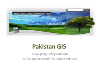
Pakistan GIS
       www.pakgis.blogspot.com
A free source of GIS/ RS Data in Pakistan
Brief History
•   Idea of Pakistan GIS was generated by a group of students from
    University of Engineering & Technology Lahore in 2008

•   Initially it was a group to share geographic data which was available as a
    product of study assignments of students

•   In 2009, an open source BLOG was created to share the data with other
    students and researchers all over the Pakistan

•   In 2010, Process of data collection was expedited and volunteers from
    Punjab University and NUST also joined hands

•   In 2010, Founder members established City Pulse (Pvt.) Ltd. And PakGIS
    was officially declared as A project of City Pulse. Since then City Pulse
    (Pvt.) Ltd. has been supporting the initiative by providing technical
    guidance and financial support to student volunteers

•   In 2011, database grew really fast. Became biggest source of free GIS
    data in Pakistan
Objectives
PakGIS holds the honor of being the first online plate form in Pakistan
aiming at creating conducive environment for research in GIS , Urban
Planning and Disaster Management in Pakistan by:

• Taking measure to ensure free availability of Pakistan related GIS
  data to academic researchers and professionals

• Capacity building of students, researchers and professionals in use
  and application of GIS/RS in urban planning and disaster
  management

• Voluntarily creation, development and collection of GIS/RS data for
  whole Pakistan
Working Principle
• Based on the principle of volunteerism
• Data is provided for research activities to students (through
  Data Request Form) who promise to return improved and
  value added data back to PakGIS
• Resultantly a Chain process of geo-data creation remains
  continued and improved data becomes available for future
  users
Current Database of Geo-data
                  available freely for research work


• Vector Data
   – Admin boundaries (for whole Pakistan)
   – Urban area maps (for 30 Cities)
   – Road network (whole Pakistan)
   – Settlements data (whole Pakistan)
http://pakgis.blogspot.com/2009/07/vector-datasets_22.html
• Raster Data
http://pakgis.blogspot.com/2009/07/raster-datasets_21.html
Achievements
• Up till July 2011, PakGIS has supported 510+ researchers, students,
  humanitarian workers and government officials all over the world in their
  tasks by providing Pakistan related geo-information.
Achievements (continued)
Volunteer Registration Program
This program has been initiated through PakGIS for the sustainability of the
forum. Curently we are having 82 volunteers working on the following tasks
off an on:

• The creation of a standard geo-database for the shapefiles of city maps
  available at PakGIS
• Development of new GIS maps of different cities in Pakistan
• Creation of a Road network dataset for complete Pakistan, we have raw
  data available. just need to compile in ArcGIS
• Managing visitors on the blog and ensuring in time feedback mechanism.
• Establishment of some GIS working groups of students in universities
  department
Future Plans
• Creation of PakGIS Geo-network (web space provided by City Pulse)
    – Admin rights can be shared and de-centralized with enthusiastic
      persons and groups (like you )
    – With improved meta-data, searching is enhanced
    – End User access to geo-data will be enhanced
    – More volunteers can give inputs in systematic way
Future Plans
• Development of new data and completion of existing
  data gaps

• Strengthen Volunteer Registration Program for
  students
   – To form PakGIS working groups in universities
   – To develop a student- industry relationship for better jobs

• Improve collaboration with other volunteer GIS
  groups for more productive and sustainable solutions
Pakistan GIS & YOU
• All geo-data available at PakGIS is yours. You can have that whenever you
  need for your research with the promise that you will return the value
  added data. Use Data Request Form to get Data freely.

• Join us as volunteers to be part of functional network of professionals

• Join us at PakGIS Facebook to stay up to date with work progress and job
  opportunities

• We can grant you access rights to Pakistan GIS Geo-network if you are
  capable of managing geo-spatial metadata and adding additional datasets
  to this network

Weitere ähnliche Inhalte

Was ist angesagt?

2017 GIS in Education Track: Sharing Historical Maps and Atlases in Web Apps
2017 GIS in Education Track: Sharing Historical Maps and Atlases in Web Apps2017 GIS in Education Track: Sharing Historical Maps and Atlases in Web Apps
2017 GIS in Education Track: Sharing Historical Maps and Atlases in Web AppsGIS in the Rockies
 
Sheffield why open data matters to local government officers - tim adams lga
Sheffield   why open data matters to local government officers - tim adams lgaSheffield   why open data matters to local government officers - tim adams lga
Sheffield why open data matters to local government officers - tim adams lgaLG Inform Plus
 
ITEM 2. CountrySIS Framework - Yusuf Ygini
ITEM 2. CountrySIS Framework - Yusuf YginiITEM 2. CountrySIS Framework - Yusuf Ygini
ITEM 2. CountrySIS Framework - Yusuf YginiFAO
 
Gis application in civil engineering
Gis application in civil engineeringGis application in civil engineering
Gis application in civil engineeringAmal C Varghese
 
Geographical information system
Geographical information systemGeographical information system
Geographical information systemRabail Urooj
 
Creation of Cadastral Information System for Staff Quarters in Covenant Unive...
Creation of Cadastral Information System for Staff Quarters in Covenant Unive...Creation of Cadastral Information System for Staff Quarters in Covenant Unive...
Creation of Cadastral Information System for Staff Quarters in Covenant Unive...AI Publications
 
Dr. Margaret M. Cusack Steciuk
Dr. Margaret M. Cusack SteciukDr. Margaret M. Cusack Steciuk
Dr. Margaret M. Cusack Steciukmcusack
 
Geospatial Information Status Data
Geospatial Information Status DataGeospatial Information Status Data
Geospatial Information Status DataMgs Zulfikar Rasyidi
 
Neogeography
NeogeographyNeogeography
Neogeographyrahul8590
 

Was ist angesagt? (10)

2017 GIS in Education Track: Sharing Historical Maps and Atlases in Web Apps
2017 GIS in Education Track: Sharing Historical Maps and Atlases in Web Apps2017 GIS in Education Track: Sharing Historical Maps and Atlases in Web Apps
2017 GIS in Education Track: Sharing Historical Maps and Atlases in Web Apps
 
Sheffield why open data matters to local government officers - tim adams lga
Sheffield   why open data matters to local government officers - tim adams lgaSheffield   why open data matters to local government officers - tim adams lga
Sheffield why open data matters to local government officers - tim adams lga
 
ITEM 2. CountrySIS Framework - Yusuf Ygini
ITEM 2. CountrySIS Framework - Yusuf YginiITEM 2. CountrySIS Framework - Yusuf Ygini
ITEM 2. CountrySIS Framework - Yusuf Ygini
 
Making MAGIC with Your Data: Interactive Maps, Mash-ups, and Data Visualizati...
Making MAGIC with Your Data: Interactive Maps, Mash-ups, and Data Visualizati...Making MAGIC with Your Data: Interactive Maps, Mash-ups, and Data Visualizati...
Making MAGIC with Your Data: Interactive Maps, Mash-ups, and Data Visualizati...
 
Gis application in civil engineering
Gis application in civil engineeringGis application in civil engineering
Gis application in civil engineering
 
Geographical information system
Geographical information systemGeographical information system
Geographical information system
 
Creation of Cadastral Information System for Staff Quarters in Covenant Unive...
Creation of Cadastral Information System for Staff Quarters in Covenant Unive...Creation of Cadastral Information System for Staff Quarters in Covenant Unive...
Creation of Cadastral Information System for Staff Quarters in Covenant Unive...
 
Dr. Margaret M. Cusack Steciuk
Dr. Margaret M. Cusack SteciukDr. Margaret M. Cusack Steciuk
Dr. Margaret M. Cusack Steciuk
 
Geospatial Information Status Data
Geospatial Information Status DataGeospatial Information Status Data
Geospatial Information Status Data
 
Neogeography
NeogeographyNeogeography
Neogeography
 

Andere mochten auch

Quality linked to geographical origin and GIs, FAO (english)
Quality linked to geographical origin and GIs, FAO (english)Quality linked to geographical origin and GIs, FAO (english)
Quality linked to geographical origin and GIs, FAO (english)ExternalEvents
 
District Muzaffar Garh Profile by Laila Rubab Jaskani
District Muzaffar Garh Profile by Laila Rubab Jaskani District Muzaffar Garh Profile by Laila Rubab Jaskani
District Muzaffar Garh Profile by Laila Rubab Jaskani DUNYA NEWS
 
Rudder - Getting everyone on board the configuration management express!
Rudder - Getting everyone on board the configuration management express!Rudder - Getting everyone on board the configuration management express!
Rudder - Getting everyone on board the configuration management express!RUDDER
 
Gis enabled fresh water supply system
Gis enabled fresh water supply systemGis enabled fresh water supply system
Gis enabled fresh water supply systemRauf Virk
 
GIS as a Tool of Resolving Protected Area Boundary Issues, Machiara National ...
GIS as a Tool of Resolving Protected Area Boundary Issues, Machiara National ...GIS as a Tool of Resolving Protected Area Boundary Issues, Machiara National ...
GIS as a Tool of Resolving Protected Area Boundary Issues, Machiara National ...Kaif Gill
 
Geography has all the answers! Get to know LMKT's GIS capabilities
Geography has all the answers! Get to know LMKT's GIS capabilitiesGeography has all the answers! Get to know LMKT's GIS capabilities
Geography has all the answers! Get to know LMKT's GIS capabilitiesLMKT Private Limited
 
Gis based flood modeling of soan river and disaster risk reduction
Gis based flood modeling of soan river and disaster risk reductionGis based flood modeling of soan river and disaster risk reduction
Gis based flood modeling of soan river and disaster risk reductionmnranapk
 
Earth Quack and its Risk Mitigation
Earth Quack and its Risk MitigationEarth Quack and its Risk Mitigation
Earth Quack and its Risk MitigationUsama Maqsood
 
How to Conduct a Noise Survey
How to Conduct a Noise SurveyHow to Conduct a Noise Survey
How to Conduct a Noise SurveyTristan Landers
 
Sound Level Meter
Sound Level MeterSound Level Meter
Sound Level Meterguestabb680
 
Structural Mapping using GIS/RS
Structural Mapping using GIS/RSStructural Mapping using GIS/RS
Structural Mapping using GIS/RSUmer Khayam
 
Gis technology Application in Urban Planning in Kenya - Mathenge Mwehe
Gis technology Application in Urban Planning in Kenya - Mathenge MweheGis technology Application in Urban Planning in Kenya - Mathenge Mwehe
Gis technology Application in Urban Planning in Kenya - Mathenge MweheMathenge Mwehe
 
Theory and Design for Mechanical Measurements solutions manual Figliola 4th ed
Theory and Design for Mechanical Measurements solutions manual Figliola 4th edTheory and Design for Mechanical Measurements solutions manual Figliola 4th ed
Theory and Design for Mechanical Measurements solutions manual Figliola 4th edDiego Fung
 
Application of gis in indian railways
Application of gis in indian railwaysApplication of gis in indian railways
Application of gis in indian railwayssumitvikram
 
Gis powerpoint
Gis powerpointGis powerpoint
Gis powerpointkaushdave
 
Using Gis To Solve City Problems
Using Gis To Solve City ProblemsUsing Gis To Solve City Problems
Using Gis To Solve City ProblemsAndrew Harrison
 
Remote sensing history and its application in Pakistan
Remote sensing history and its application in Pakistan Remote sensing history and its application in Pakistan
Remote sensing history and its application in Pakistan GCUF
 
GIS for Urban Planning and Design
GIS for Urban Planning and DesignGIS for Urban Planning and Design
GIS for Urban Planning and DesignAnthony Smith
 

Andere mochten auch (20)

Quality linked to geographical origin and GIs, FAO (english)
Quality linked to geographical origin and GIs, FAO (english)Quality linked to geographical origin and GIs, FAO (english)
Quality linked to geographical origin and GIs, FAO (english)
 
District Muzaffar Garh Profile by Laila Rubab Jaskani
District Muzaffar Garh Profile by Laila Rubab Jaskani District Muzaffar Garh Profile by Laila Rubab Jaskani
District Muzaffar Garh Profile by Laila Rubab Jaskani
 
Lesnoy dozor small
Lesnoy dozor smallLesnoy dozor small
Lesnoy dozor small
 
Rudder - Getting everyone on board the configuration management express!
Rudder - Getting everyone on board the configuration management express!Rudder - Getting everyone on board the configuration management express!
Rudder - Getting everyone on board the configuration management express!
 
Gis enabled fresh water supply system
Gis enabled fresh water supply systemGis enabled fresh water supply system
Gis enabled fresh water supply system
 
GIS as a Tool of Resolving Protected Area Boundary Issues, Machiara National ...
GIS as a Tool of Resolving Protected Area Boundary Issues, Machiara National ...GIS as a Tool of Resolving Protected Area Boundary Issues, Machiara National ...
GIS as a Tool of Resolving Protected Area Boundary Issues, Machiara National ...
 
Geography has all the answers! Get to know LMKT's GIS capabilities
Geography has all the answers! Get to know LMKT's GIS capabilitiesGeography has all the answers! Get to know LMKT's GIS capabilities
Geography has all the answers! Get to know LMKT's GIS capabilities
 
Gis based flood modeling of soan river and disaster risk reduction
Gis based flood modeling of soan river and disaster risk reductionGis based flood modeling of soan river and disaster risk reduction
Gis based flood modeling of soan river and disaster risk reduction
 
Earth Quack and its Risk Mitigation
Earth Quack and its Risk MitigationEarth Quack and its Risk Mitigation
Earth Quack and its Risk Mitigation
 
How to Conduct a Noise Survey
How to Conduct a Noise SurveyHow to Conduct a Noise Survey
How to Conduct a Noise Survey
 
Sound Level Meter
Sound Level MeterSound Level Meter
Sound Level Meter
 
Structural Mapping using GIS/RS
Structural Mapping using GIS/RSStructural Mapping using GIS/RS
Structural Mapping using GIS/RS
 
Gis technology Application in Urban Planning in Kenya - Mathenge Mwehe
Gis technology Application in Urban Planning in Kenya - Mathenge MweheGis technology Application in Urban Planning in Kenya - Mathenge Mwehe
Gis technology Application in Urban Planning in Kenya - Mathenge Mwehe
 
Theory and Design for Mechanical Measurements solutions manual Figliola 4th ed
Theory and Design for Mechanical Measurements solutions manual Figliola 4th edTheory and Design for Mechanical Measurements solutions manual Figliola 4th ed
Theory and Design for Mechanical Measurements solutions manual Figliola 4th ed
 
Gis in urban
Gis in urbanGis in urban
Gis in urban
 
Application of gis in indian railways
Application of gis in indian railwaysApplication of gis in indian railways
Application of gis in indian railways
 
Gis powerpoint
Gis powerpointGis powerpoint
Gis powerpoint
 
Using Gis To Solve City Problems
Using Gis To Solve City ProblemsUsing Gis To Solve City Problems
Using Gis To Solve City Problems
 
Remote sensing history and its application in Pakistan
Remote sensing history and its application in Pakistan Remote sensing history and its application in Pakistan
Remote sensing history and its application in Pakistan
 
GIS for Urban Planning and Design
GIS for Urban Planning and DesignGIS for Urban Planning and Design
GIS for Urban Planning and Design
 

Ähnlich wie Pakistan GIS

Research data spring: streamlining deposit
Research data spring: streamlining depositResearch data spring: streamlining deposit
Research data spring: streamlining depositJisc RDM
 
Dpi presentation wisc net 2013
Dpi presentation wisc net 2013Dpi presentation wisc net 2013
Dpi presentation wisc net 2013swebb1
 
Mapping Extension Community and Economic Projects and News using Open Source ...
Mapping Extension Community and Economic Projects and News using Open Source ...Mapping Extension Community and Economic Projects and News using Open Source ...
Mapping Extension Community and Economic Projects and News using Open Source ...bahanson
 
The GIS Capability Maturity Model Maximize Benefits from Enterprise GIS Opera...
The GIS Capability Maturity Model Maximize Benefits from Enterprise GIS Opera...The GIS Capability Maturity Model Maximize Benefits from Enterprise GIS Opera...
The GIS Capability Maturity Model Maximize Benefits from Enterprise GIS Opera...Greg Babinski
 
APNIC Update - Pita 17th AGM 2013
APNIC Update - Pita 17th AGM 2013APNIC Update - Pita 17th AGM 2013
APNIC Update - Pita 17th AGM 2013APNIC
 
Building Capacity in Partner Countries: Training and Tools and Resources
Building Capacity in Partner Countries: Training and Tools and ResourcesBuilding Capacity in Partner Countries: Training and Tools and Resources
Building Capacity in Partner Countries: Training and Tools and ResourcesMEASURE Evaluation
 
Carol Fletcher CS Summit Welcome
Carol Fletcher CS Summit WelcomeCarol Fletcher CS Summit Welcome
Carol Fletcher CS Summit WelcomeWeTeach_CS
 
XSEDE13: State of XSEDE
XSEDE13: State of XSEDEXSEDE13: State of XSEDE
XSEDE13: State of XSEDEJohn Towns
 
Information Technology application for Education
Information Technology application for EducationInformation Technology application for Education
Information Technology application for EducationiFour Technolab Pvt. Ltd.
 
Incubation Orientation
Incubation OrientationIncubation Orientation
Incubation OrientationJody Garnett
 
RKP PROJECT STATUS OVERVIEW
RKP PROJECT STATUS OVERVIEWRKP PROJECT STATUS OVERVIEW
RKP PROJECT STATUS OVERVIEWOECD CFE
 
State of XSEDE: July 2014
State of XSEDE: July 2014State of XSEDE: July 2014
State of XSEDE: July 2014John Towns
 
Support for IP-based infrastrucutre development - Preparatory Meeting of Conn...
Support for IP-based infrastrucutre development - Preparatory Meeting of Conn...Support for IP-based infrastrucutre development - Preparatory Meeting of Conn...
Support for IP-based infrastrucutre development - Preparatory Meeting of Conn...APNIC
 
Overview of N-LIST, Shodhganga, Shodhgangotri and E-PGPathshala
Overview of N-LIST, Shodhganga, Shodhgangotri and E-PGPathshalaOverview of N-LIST, Shodhganga, Shodhgangotri and E-PGPathshala
Overview of N-LIST, Shodhganga, Shodhgangotri and E-PGPathshalaPrabhat Pandey
 
L N Dewangan_Resume
L  N  Dewangan_ResumeL  N  Dewangan_Resume
L N Dewangan_ResumeL N Dewangan
 
Building a European Research Infrastructure for the Social Sciences: The Cons...
Building a European Research Infrastructure for the Social Sciences: The Cons...Building a European Research Infrastructure for the Social Sciences: The Cons...
Building a European Research Infrastructure for the Social Sciences: The Cons...UCD Library
 
Ucla july 2018 natasha simons
Ucla july 2018 natasha simonsUcla july 2018 natasha simons
Ucla july 2018 natasha simonsARDC
 
Jayachandran Mani, Technical Officer, Head, Mission management at Karnataka S...
Jayachandran Mani, Technical Officer, Head, Mission management at Karnataka S...Jayachandran Mani, Technical Officer, Head, Mission management at Karnataka S...
Jayachandran Mani, Technical Officer, Head, Mission management at Karnataka S...Kathmandu Living Labs
 

Ähnlich wie Pakistan GIS (20)

Bonares presentation oct2016v2
Bonares presentation oct2016v2Bonares presentation oct2016v2
Bonares presentation oct2016v2
 
Research data spring: streamlining deposit
Research data spring: streamlining depositResearch data spring: streamlining deposit
Research data spring: streamlining deposit
 
Dpi presentation wisc net 2013
Dpi presentation wisc net 2013Dpi presentation wisc net 2013
Dpi presentation wisc net 2013
 
Mapping Extension Community and Economic Projects and News using Open Source ...
Mapping Extension Community and Economic Projects and News using Open Source ...Mapping Extension Community and Economic Projects and News using Open Source ...
Mapping Extension Community and Economic Projects and News using Open Source ...
 
The GIS Capability Maturity Model Maximize Benefits from Enterprise GIS Opera...
The GIS Capability Maturity Model Maximize Benefits from Enterprise GIS Opera...The GIS Capability Maturity Model Maximize Benefits from Enterprise GIS Opera...
The GIS Capability Maturity Model Maximize Benefits from Enterprise GIS Opera...
 
APNIC Update - Pita 17th AGM 2013
APNIC Update - Pita 17th AGM 2013APNIC Update - Pita 17th AGM 2013
APNIC Update - Pita 17th AGM 2013
 
Building Capacity in Partner Countries: Training and Tools and Resources
Building Capacity in Partner Countries: Training and Tools and ResourcesBuilding Capacity in Partner Countries: Training and Tools and Resources
Building Capacity in Partner Countries: Training and Tools and Resources
 
Carol Fletcher CS Summit Welcome
Carol Fletcher CS Summit WelcomeCarol Fletcher CS Summit Welcome
Carol Fletcher CS Summit Welcome
 
XSEDE13: State of XSEDE
XSEDE13: State of XSEDEXSEDE13: State of XSEDE
XSEDE13: State of XSEDE
 
Information Technology application for Education
Information Technology application for EducationInformation Technology application for Education
Information Technology application for Education
 
VBkulkarni_profile1
VBkulkarni_profile1VBkulkarni_profile1
VBkulkarni_profile1
 
Incubation Orientation
Incubation OrientationIncubation Orientation
Incubation Orientation
 
RKP PROJECT STATUS OVERVIEW
RKP PROJECT STATUS OVERVIEWRKP PROJECT STATUS OVERVIEW
RKP PROJECT STATUS OVERVIEW
 
State of XSEDE: July 2014
State of XSEDE: July 2014State of XSEDE: July 2014
State of XSEDE: July 2014
 
Support for IP-based infrastrucutre development - Preparatory Meeting of Conn...
Support for IP-based infrastrucutre development - Preparatory Meeting of Conn...Support for IP-based infrastrucutre development - Preparatory Meeting of Conn...
Support for IP-based infrastrucutre development - Preparatory Meeting of Conn...
 
Overview of N-LIST, Shodhganga, Shodhgangotri and E-PGPathshala
Overview of N-LIST, Shodhganga, Shodhgangotri and E-PGPathshalaOverview of N-LIST, Shodhganga, Shodhgangotri and E-PGPathshala
Overview of N-LIST, Shodhganga, Shodhgangotri and E-PGPathshala
 
L N Dewangan_Resume
L  N  Dewangan_ResumeL  N  Dewangan_Resume
L N Dewangan_Resume
 
Building a European Research Infrastructure for the Social Sciences: The Cons...
Building a European Research Infrastructure for the Social Sciences: The Cons...Building a European Research Infrastructure for the Social Sciences: The Cons...
Building a European Research Infrastructure for the Social Sciences: The Cons...
 
Ucla july 2018 natasha simons
Ucla july 2018 natasha simonsUcla july 2018 natasha simons
Ucla july 2018 natasha simons
 
Jayachandran Mani, Technical Officer, Head, Mission management at Karnataka S...
Jayachandran Mani, Technical Officer, Head, Mission management at Karnataka S...Jayachandran Mani, Technical Officer, Head, Mission management at Karnataka S...
Jayachandran Mani, Technical Officer, Head, Mission management at Karnataka S...
 

Kürzlich hochgeladen

AI as an Interface for Commercial Buildings
AI as an Interface for Commercial BuildingsAI as an Interface for Commercial Buildings
AI as an Interface for Commercial BuildingsMemoori
 
Neo4j - How KGs are shaping the future of Generative AI at AWS Summit London ...
Neo4j - How KGs are shaping the future of Generative AI at AWS Summit London ...Neo4j - How KGs are shaping the future of Generative AI at AWS Summit London ...
Neo4j - How KGs are shaping the future of Generative AI at AWS Summit London ...Neo4j
 
Integration and Automation in Practice: CI/CD in Mule Integration and Automat...
Integration and Automation in Practice: CI/CD in Mule Integration and Automat...Integration and Automation in Practice: CI/CD in Mule Integration and Automat...
Integration and Automation in Practice: CI/CD in Mule Integration and Automat...Patryk Bandurski
 
GenCyber Cyber Security Day Presentation
GenCyber Cyber Security Day PresentationGenCyber Cyber Security Day Presentation
GenCyber Cyber Security Day PresentationMichael W. Hawkins
 
Key Features Of Token Development (1).pptx
Key  Features Of Token  Development (1).pptxKey  Features Of Token  Development (1).pptx
Key Features Of Token Development (1).pptxLBM Solutions
 
[2024]Digital Global Overview Report 2024 Meltwater.pdf
[2024]Digital Global Overview Report 2024 Meltwater.pdf[2024]Digital Global Overview Report 2024 Meltwater.pdf
[2024]Digital Global Overview Report 2024 Meltwater.pdfhans926745
 
Pigging Solutions Piggable Sweeping Elbows
Pigging Solutions Piggable Sweeping ElbowsPigging Solutions Piggable Sweeping Elbows
Pigging Solutions Piggable Sweeping ElbowsPigging Solutions
 
Breaking the Kubernetes Kill Chain: Host Path Mount
Breaking the Kubernetes Kill Chain: Host Path MountBreaking the Kubernetes Kill Chain: Host Path Mount
Breaking the Kubernetes Kill Chain: Host Path MountPuma Security, LLC
 
Azure Monitor & Application Insight to monitor Infrastructure & Application
Azure Monitor & Application Insight to monitor Infrastructure & ApplicationAzure Monitor & Application Insight to monitor Infrastructure & Application
Azure Monitor & Application Insight to monitor Infrastructure & ApplicationAndikSusilo4
 
Tech-Forward - Achieving Business Readiness For Copilot in Microsoft 365
Tech-Forward - Achieving Business Readiness For Copilot in Microsoft 365Tech-Forward - Achieving Business Readiness For Copilot in Microsoft 365
Tech-Forward - Achieving Business Readiness For Copilot in Microsoft 3652toLead Limited
 
Scaling API-first – The story of a global engineering organization
Scaling API-first – The story of a global engineering organizationScaling API-first – The story of a global engineering organization
Scaling API-first – The story of a global engineering organizationRadu Cotescu
 
How to convert PDF to text with Nanonets
How to convert PDF to text with NanonetsHow to convert PDF to text with Nanonets
How to convert PDF to text with Nanonetsnaman860154
 
Injustice - Developers Among Us (SciFiDevCon 2024)
Injustice - Developers Among Us (SciFiDevCon 2024)Injustice - Developers Among Us (SciFiDevCon 2024)
Injustice - Developers Among Us (SciFiDevCon 2024)Allon Mureinik
 
SIEMENS: RAPUNZEL – A Tale About Knowledge Graph
SIEMENS: RAPUNZEL – A Tale About Knowledge GraphSIEMENS: RAPUNZEL – A Tale About Knowledge Graph
SIEMENS: RAPUNZEL – A Tale About Knowledge GraphNeo4j
 
Salesforce Community Group Quito, Salesforce 101
Salesforce Community Group Quito, Salesforce 101Salesforce Community Group Quito, Salesforce 101
Salesforce Community Group Quito, Salesforce 101Paola De la Torre
 
The Codex of Business Writing Software for Real-World Solutions 2.pptx
The Codex of Business Writing Software for Real-World Solutions 2.pptxThe Codex of Business Writing Software for Real-World Solutions 2.pptx
The Codex of Business Writing Software for Real-World Solutions 2.pptxMalak Abu Hammad
 
The 7 Things I Know About Cyber Security After 25 Years | April 2024
The 7 Things I Know About Cyber Security After 25 Years | April 2024The 7 Things I Know About Cyber Security After 25 Years | April 2024
The 7 Things I Know About Cyber Security After 25 Years | April 2024Rafal Los
 
Transforming Data Streams with Kafka Connect: An Introduction to Single Messa...
Transforming Data Streams with Kafka Connect: An Introduction to Single Messa...Transforming Data Streams with Kafka Connect: An Introduction to Single Messa...
Transforming Data Streams with Kafka Connect: An Introduction to Single Messa...HostedbyConfluent
 
Slack Application Development 101 Slides
Slack Application Development 101 SlidesSlack Application Development 101 Slides
Slack Application Development 101 Slidespraypatel2
 
08448380779 Call Girls In Greater Kailash - I Women Seeking Men
08448380779 Call Girls In Greater Kailash - I Women Seeking Men08448380779 Call Girls In Greater Kailash - I Women Seeking Men
08448380779 Call Girls In Greater Kailash - I Women Seeking MenDelhi Call girls
 

Kürzlich hochgeladen (20)

AI as an Interface for Commercial Buildings
AI as an Interface for Commercial BuildingsAI as an Interface for Commercial Buildings
AI as an Interface for Commercial Buildings
 
Neo4j - How KGs are shaping the future of Generative AI at AWS Summit London ...
Neo4j - How KGs are shaping the future of Generative AI at AWS Summit London ...Neo4j - How KGs are shaping the future of Generative AI at AWS Summit London ...
Neo4j - How KGs are shaping the future of Generative AI at AWS Summit London ...
 
Integration and Automation in Practice: CI/CD in Mule Integration and Automat...
Integration and Automation in Practice: CI/CD in Mule Integration and Automat...Integration and Automation in Practice: CI/CD in Mule Integration and Automat...
Integration and Automation in Practice: CI/CD in Mule Integration and Automat...
 
GenCyber Cyber Security Day Presentation
GenCyber Cyber Security Day PresentationGenCyber Cyber Security Day Presentation
GenCyber Cyber Security Day Presentation
 
Key Features Of Token Development (1).pptx
Key  Features Of Token  Development (1).pptxKey  Features Of Token  Development (1).pptx
Key Features Of Token Development (1).pptx
 
[2024]Digital Global Overview Report 2024 Meltwater.pdf
[2024]Digital Global Overview Report 2024 Meltwater.pdf[2024]Digital Global Overview Report 2024 Meltwater.pdf
[2024]Digital Global Overview Report 2024 Meltwater.pdf
 
Pigging Solutions Piggable Sweeping Elbows
Pigging Solutions Piggable Sweeping ElbowsPigging Solutions Piggable Sweeping Elbows
Pigging Solutions Piggable Sweeping Elbows
 
Breaking the Kubernetes Kill Chain: Host Path Mount
Breaking the Kubernetes Kill Chain: Host Path MountBreaking the Kubernetes Kill Chain: Host Path Mount
Breaking the Kubernetes Kill Chain: Host Path Mount
 
Azure Monitor & Application Insight to monitor Infrastructure & Application
Azure Monitor & Application Insight to monitor Infrastructure & ApplicationAzure Monitor & Application Insight to monitor Infrastructure & Application
Azure Monitor & Application Insight to monitor Infrastructure & Application
 
Tech-Forward - Achieving Business Readiness For Copilot in Microsoft 365
Tech-Forward - Achieving Business Readiness For Copilot in Microsoft 365Tech-Forward - Achieving Business Readiness For Copilot in Microsoft 365
Tech-Forward - Achieving Business Readiness For Copilot in Microsoft 365
 
Scaling API-first – The story of a global engineering organization
Scaling API-first – The story of a global engineering organizationScaling API-first – The story of a global engineering organization
Scaling API-first – The story of a global engineering organization
 
How to convert PDF to text with Nanonets
How to convert PDF to text with NanonetsHow to convert PDF to text with Nanonets
How to convert PDF to text with Nanonets
 
Injustice - Developers Among Us (SciFiDevCon 2024)
Injustice - Developers Among Us (SciFiDevCon 2024)Injustice - Developers Among Us (SciFiDevCon 2024)
Injustice - Developers Among Us (SciFiDevCon 2024)
 
SIEMENS: RAPUNZEL – A Tale About Knowledge Graph
SIEMENS: RAPUNZEL – A Tale About Knowledge GraphSIEMENS: RAPUNZEL – A Tale About Knowledge Graph
SIEMENS: RAPUNZEL – A Tale About Knowledge Graph
 
Salesforce Community Group Quito, Salesforce 101
Salesforce Community Group Quito, Salesforce 101Salesforce Community Group Quito, Salesforce 101
Salesforce Community Group Quito, Salesforce 101
 
The Codex of Business Writing Software for Real-World Solutions 2.pptx
The Codex of Business Writing Software for Real-World Solutions 2.pptxThe Codex of Business Writing Software for Real-World Solutions 2.pptx
The Codex of Business Writing Software for Real-World Solutions 2.pptx
 
The 7 Things I Know About Cyber Security After 25 Years | April 2024
The 7 Things I Know About Cyber Security After 25 Years | April 2024The 7 Things I Know About Cyber Security After 25 Years | April 2024
The 7 Things I Know About Cyber Security After 25 Years | April 2024
 
Transforming Data Streams with Kafka Connect: An Introduction to Single Messa...
Transforming Data Streams with Kafka Connect: An Introduction to Single Messa...Transforming Data Streams with Kafka Connect: An Introduction to Single Messa...
Transforming Data Streams with Kafka Connect: An Introduction to Single Messa...
 
Slack Application Development 101 Slides
Slack Application Development 101 SlidesSlack Application Development 101 Slides
Slack Application Development 101 Slides
 
08448380779 Call Girls In Greater Kailash - I Women Seeking Men
08448380779 Call Girls In Greater Kailash - I Women Seeking Men08448380779 Call Girls In Greater Kailash - I Women Seeking Men
08448380779 Call Girls In Greater Kailash - I Women Seeking Men
 

Pakistan GIS

  • 1. Pakistan GIS www.pakgis.blogspot.com A free source of GIS/ RS Data in Pakistan
  • 2. Brief History • Idea of Pakistan GIS was generated by a group of students from University of Engineering & Technology Lahore in 2008 • Initially it was a group to share geographic data which was available as a product of study assignments of students • In 2009, an open source BLOG was created to share the data with other students and researchers all over the Pakistan • In 2010, Process of data collection was expedited and volunteers from Punjab University and NUST also joined hands • In 2010, Founder members established City Pulse (Pvt.) Ltd. And PakGIS was officially declared as A project of City Pulse. Since then City Pulse (Pvt.) Ltd. has been supporting the initiative by providing technical guidance and financial support to student volunteers • In 2011, database grew really fast. Became biggest source of free GIS data in Pakistan
  • 3. Objectives PakGIS holds the honor of being the first online plate form in Pakistan aiming at creating conducive environment for research in GIS , Urban Planning and Disaster Management in Pakistan by: • Taking measure to ensure free availability of Pakistan related GIS data to academic researchers and professionals • Capacity building of students, researchers and professionals in use and application of GIS/RS in urban planning and disaster management • Voluntarily creation, development and collection of GIS/RS data for whole Pakistan
  • 4. Working Principle • Based on the principle of volunteerism • Data is provided for research activities to students (through Data Request Form) who promise to return improved and value added data back to PakGIS • Resultantly a Chain process of geo-data creation remains continued and improved data becomes available for future users
  • 5. Current Database of Geo-data available freely for research work • Vector Data – Admin boundaries (for whole Pakistan) – Urban area maps (for 30 Cities) – Road network (whole Pakistan) – Settlements data (whole Pakistan) http://pakgis.blogspot.com/2009/07/vector-datasets_22.html • Raster Data http://pakgis.blogspot.com/2009/07/raster-datasets_21.html
  • 6. Achievements • Up till July 2011, PakGIS has supported 510+ researchers, students, humanitarian workers and government officials all over the world in their tasks by providing Pakistan related geo-information.
  • 7. Achievements (continued) Volunteer Registration Program This program has been initiated through PakGIS for the sustainability of the forum. Curently we are having 82 volunteers working on the following tasks off an on: • The creation of a standard geo-database for the shapefiles of city maps available at PakGIS • Development of new GIS maps of different cities in Pakistan • Creation of a Road network dataset for complete Pakistan, we have raw data available. just need to compile in ArcGIS • Managing visitors on the blog and ensuring in time feedback mechanism. • Establishment of some GIS working groups of students in universities department
  • 8. Future Plans • Creation of PakGIS Geo-network (web space provided by City Pulse) – Admin rights can be shared and de-centralized with enthusiastic persons and groups (like you ) – With improved meta-data, searching is enhanced – End User access to geo-data will be enhanced – More volunteers can give inputs in systematic way
  • 9. Future Plans • Development of new data and completion of existing data gaps • Strengthen Volunteer Registration Program for students – To form PakGIS working groups in universities – To develop a student- industry relationship for better jobs • Improve collaboration with other volunteer GIS groups for more productive and sustainable solutions
  • 10. Pakistan GIS & YOU • All geo-data available at PakGIS is yours. You can have that whenever you need for your research with the promise that you will return the value added data. Use Data Request Form to get Data freely. • Join us as volunteers to be part of functional network of professionals • Join us at PakGIS Facebook to stay up to date with work progress and job opportunities • We can grant you access rights to Pakistan GIS Geo-network if you are capable of managing geo-spatial metadata and adding additional datasets to this network