SlideShare ist ein Scribd-Unternehmen logo
1 von 1
TEMPLATE DESIGN © 2008
www.PosterPresentations.com
Land-Use Land-Cover Dynamics of Coastal South Carolina Watersheds
Amit Kumar Patel
Department of Earth and Atmospheric sciences
National institute of technology , Rourkela,769008
Abstract
Introduction
Objectives
Material and Methods
Results
Conclusions
Acknowledgements
Changes in land use land cover (LULC) are a potential threat to
coastal ecosystem health and the evolving geospatial
technology (remote sensing and GIS) fits adequately for long-
term monitoring and assessment of such effects. The objective
of this research was to assess the historical changes in land
use/cover in the coastal counties of South Carolina from 1996 to
2006. The study used high resolution LANDSAT data of the U.S
Geological Survey and supervised Anderson LULC Level-2
classified data of the National Oceanic and Atmospheric
Administration’s (NOAA) Coastal Change Analysis Program (C-
CAP) to assess historic LULC changes for the coastal South
Carolina counties for the 10-year study period. Statistics on
distribution of change (losses and gains) by land cover were
then devised from the remote sensed data.
The results show an increase in the extent of open water cover
in the South Carolina coastal counties investigated-perhaps due
to global warming and the resulting rise in sea level. Similarly,
scrub/shrub lands increased; but forestlands and some wetlands
decreased for all the counties from 1996 to 2006. The increase
in surface waters could negatively affect the beaches for
recreation/tourism as well as biological diversity in the coastal
waters. Also the decreased forest and wetlands could impact
the coastal environment negatively by decreasing ecological
services such as photosynthesis and carbon sequestration,
biodiversity, water purification and flooding. More detailed LULC
study of 20-30 year trends is suggested for a more holistic
determination of the trends in coastal South Carolina
watersheds in general.
Changes in LULC impact the environment’s quality and the
quality of life and human wellbeing. Changes in habitat, water
and air quality and the quality of life are some of the
environment, social and economic concerns associated with
LULC changes. The U.S population that most directly affects the
coast resides in a standard suite of coastal watershed counties
where land use and water quality changes most directly impact
coastal ecosystems. Coastal watershed counties can be thought
of as ‘ the population that most directly affects the coast’ (U.S
EPA, 2006)
Remote sensing has played an important role in mapping land-
cover and quantifying change for more than 25 years. Land
cover represents one of the most fundamental applications of
remote sensing, and is widely used to parameterize hydrological
and biogeochemical models.
References
•NOAA –retrieved from
http://oceanservice.noaa.gov/facts/lclu.html
•CARA - retrieved from http://www.cara.psu.edu/land/lu-
primer/luprimer02.asp
•USGS National Land Cover Characterization : retrieved
http://landcover.usgs.gov/nationallandcover.html
•NOSAKHARE, O.K.; AIGHEWI ,I.T.; CHI, A.Y.; ISHAQUE,
A.B., and MBAMALU, G., 2012. Land use-land cover changes in
the lower Eastern Shore watersheds and coastal bays of
Maryland: 1986-2006. Journal of Coastal Research, 28(1A),
p56-62. West Palm Beach, FL, ISSN O749-0208
•AIGHEWI, I.T.; NOSAKHARE, O.K., and ISHAQUE, A.B.,
0000. Land use-land cover changes and
sewage loading in the lower Eastern Shore watersheds and
coastal bays of Maryland: Implications for surface water quality.
Journal of Coastal Research, 00(0), 000-000. West Palm Beach,
FL, ISSN O749-0208
•TIGER – retrieved from www.census.gov
Fig 1: Showing the process of remote sensing
(Figure 2): Study Area
The figure above (Fig 2) shows the study area and labeled
counties of interest. This area lies in the coastal watershed
15-37, 16-36, 16-37 and 16-38 are the main path and row
blocks of interest. The main economic activities in the coastal
counties of South Carolina include fishing industry, mining ,
agri-business and tourism.
Population census data was extracted from the TIGER website
in order to relate and analyze LULC changes to the ever-
growing population.
The LEVEL 2 classification of data was used to classify the
remote sensed data (LANDSAT) for further analysis (see
Table1).
(Table 2): Distribution of Land Use-Land Cover and Changes
(Figure 3)
(Figure 4)
LEVEL 2 classification of Land Use-Land Cover (LULC) system
Developed, High Intensity (HID) Forested (FOR)
Developed, Low Intensity (LID) Grassland (GRS)
Developed, Open Space (OSD) Barren Land (BAR)
Open Water (WTR) Scrub/Shrub (SCB)
Emergent Wetland (EMW) Agriculture (AGR)
Woody Wetland (WDW)
(Table 1): Data Classification
1. Determine the historical Land Use-Land Cover (LULC)
patterns of Coastal South Carolina watersheds from 1996
-2006
(Figure 5): Population growth over study period
This research was supported by the US Department of
Energy grant.
The increase in surface water cover may be due to the
overarching theme of global warming which causes a rise in the
sea level.
Both low and high intensity development increased due to the
increase in human population during the study period.
The decrease in wetlands in the study area has serious
environmental health implications. For example Graff and
Middleton (2003) reported that wetlands are essential for
fisheries; they also reduce floods and protect surface water by
absorbing heavy metals and organic pollutants. In addition, they
provide habitat for shell fish (prawns, lobsters) and water fowls.
Consequently, there is the need to reverse this trend urgently for
sustainability .
The drastic 15% decline in forestlands may be due to the high
demand for constructions to meet the growing human
population. This trend will negatively impact the environment by
promoting global warming and soil erosion, as well as reducing
biodiversity if not reversed. A bold reforestation program is
suggested for reversing this trend.
More detailed LULC study of 20-30 year trends is suggested for
a more holistic determination of the trends in coastal South
Carolina watersheds in general as well as the impact it could
have on water quality in the future.
The extent of LULC change by class from 1996-2006 is shown
in Fig 3 and summarized in a quantitatively manner in Table 2.
In general, there was a significant net gain in scrubland
There was a net gain of about 12Sq. miles of surface water
cover at the expense of wooden Wetlands (see Table 2).
However, there was a slight increase in emergent wetlands
(EMW) during the 10-year study period.
As forested land decreased, some land became grasslands
which in general explains the increase in the GRS lands
All the counties in the study area experienced an increase in
development (LID/HID) due to increasing population (See
Figure 5).
There was also an increase in Agricultural land use and
population growth (Fig 5); this could result in more pollution of
the surface waters from agricultural inputs such as fertilizers
and pesticides from erosion as well as other human activities in
the area
However there was a significant net loss of Forested lands
which may be due to the land being used for settlement
purposes to meet the changing population
A land class which also had a significant decrease in area was
Woody Wetlands . In general, best estimates indicate that
because of agricultural and developmental impacts, more than
100 sq. miles (see Fig3) of Woody Wetland area has been lost
over the 10 year period.
Recognizing patterns of LULC Change can provide insight for
future urban/Regional planning
http://visual.merriam-webster.com/earth/satellite-remote-sensing.php

Weitere ähnliche Inhalte

Was ist angesagt?

Coupling Solid-Aqueous-Gas Phases of Carbon and Nitrogen Across Topographic G...
Coupling Solid-Aqueous-Gas Phases of Carbon and Nitrogen Across Topographic G...Coupling Solid-Aqueous-Gas Phases of Carbon and Nitrogen Across Topographic G...
Coupling Solid-Aqueous-Gas Phases of Carbon and Nitrogen Across Topographic G...National Institute of Food and Agriculture
 
Managing Critical Source Areas for Enhancing Ecosystem Services in Agricultur...
Managing Critical Source Areas for Enhancing Ecosystem Services in Agricultur...Managing Critical Source Areas for Enhancing Ecosystem Services in Agricultur...
Managing Critical Source Areas for Enhancing Ecosystem Services in Agricultur...National Institute of Food and Agriculture
 
Spatial analysis of dissolved oxygen levels using Ordinary Kriging methods ne...
Spatial analysis of dissolved oxygen levels using Ordinary Kriging methods ne...Spatial analysis of dissolved oxygen levels using Ordinary Kriging methods ne...
Spatial analysis of dissolved oxygen levels using Ordinary Kriging methods ne...Jacqueline L. Frank
 
Multi-Scale Investigation of Winter Runoff and Nutrient Loss Processes in Act...
Multi-Scale Investigation of Winter Runoff and Nutrient Loss Processes in Act...Multi-Scale Investigation of Winter Runoff and Nutrient Loss Processes in Act...
Multi-Scale Investigation of Winter Runoff and Nutrient Loss Processes in Act...National Institute of Food and Agriculture
 
Integrated Plan for Drought Preparedness and Mitigation, and Water Conservati...
Integrated Plan for Drought Preparedness and Mitigation, and Water Conservati...Integrated Plan for Drought Preparedness and Mitigation, and Water Conservati...
Integrated Plan for Drought Preparedness and Mitigation, and Water Conservati...National Institute of Food and Agriculture
 
Improved Assessment of Nitrogen and Phosphorus Fate and Transport for Irrigat...
Improved Assessment of Nitrogen and Phosphorus Fate and Transport for Irrigat...Improved Assessment of Nitrogen and Phosphorus Fate and Transport for Irrigat...
Improved Assessment of Nitrogen and Phosphorus Fate and Transport for Irrigat...National Institute of Food and Agriculture
 
Mapping Sea-Level Change inTime, Space, and Probability
Mapping Sea-Level Change inTime, Space, and ProbabilityMapping Sea-Level Change inTime, Space, and Probability
Mapping Sea-Level Change inTime, Space, and ProbabilitySérgio Sacani
 
Predicting longterm-dynamics-of-soil-salinity-and-sodicity-on-a-global-scale2...
Predicting longterm-dynamics-of-soil-salinity-and-sodicity-on-a-global-scale2...Predicting longterm-dynamics-of-soil-salinity-and-sodicity-on-a-global-scale2...
Predicting longterm-dynamics-of-soil-salinity-and-sodicity-on-a-global-scale2...erosslo
 
Processes Controlling the Source, Movement, and Release of Soil Phosphorus in...
Processes Controlling the Source, Movement, and Release of Soil Phosphorus in...Processes Controlling the Source, Movement, and Release of Soil Phosphorus in...
Processes Controlling the Source, Movement, and Release of Soil Phosphorus in...National Institute of Food and Agriculture
 
Water Quality and Productivity Enhancement in an Irrigated River Basin throug...
Water Quality and Productivity Enhancement in an Irrigated River Basin throug...Water Quality and Productivity Enhancement in an Irrigated River Basin throug...
Water Quality and Productivity Enhancement in an Irrigated River Basin throug...National Institute of Food and Agriculture
 
Lessons Learned From The Everglades Sjr Summit 2010 09 15 Esterson+Landers
Lessons Learned From The Everglades Sjr Summit 2010 09 15 Esterson+LandersLessons Learned From The Everglades Sjr Summit 2010 09 15 Esterson+Landers
Lessons Learned From The Everglades Sjr Summit 2010 09 15 Esterson+LandersKris Esterson
 
Journal of soil salinity and water quality
Journal of soil salinity and water qualityJournal of soil salinity and water quality
Journal of soil salinity and water qualityDr. Tarik Mitran
 
Agricultural sensitivity to climate change and water resources interactions i...
Agricultural sensitivityto climate change and water resources interactions i...Agricultural sensitivityto climate change and water resources interactions i...
Agricultural sensitivity to climate change and water resources interactions i...National Institute of Food and Agriculture
 
Farms, Floods And Fluvial Geomorphology: Making The Most of Our Natural Resou...
Farms, Floods And Fluvial Geomorphology: Making The Most of Our Natural Resou...Farms, Floods And Fluvial Geomorphology: Making The Most of Our Natural Resou...
Farms, Floods And Fluvial Geomorphology: Making The Most of Our Natural Resou...National Institute of Food and Agriculture
 
Measuring Success of Targeted BMP Implementation, and Getting Smarter about E...
Measuring Success of Targeted BMP Implementation, and Getting Smarter about E...Measuring Success of Targeted BMP Implementation, and Getting Smarter about E...
Measuring Success of Targeted BMP Implementation, and Getting Smarter about E...National Institute of Food and Agriculture
 
Is stationarity dead whither water management
Is stationarity dead whither water managementIs stationarity dead whither water management
Is stationarity dead whither water managementDhiraj Gyawali
 
Big Data & Machine Learning for Societal Benefit
Big Data & Machine Learning for Societal BenefitBig Data & Machine Learning for Societal Benefit
Big Data & Machine Learning for Societal BenefitDavid Lary
 

Was ist angesagt? (20)

Coupling Solid-Aqueous-Gas Phases of Carbon and Nitrogen Across Topographic G...
Coupling Solid-Aqueous-Gas Phases of Carbon and Nitrogen Across Topographic G...Coupling Solid-Aqueous-Gas Phases of Carbon and Nitrogen Across Topographic G...
Coupling Solid-Aqueous-Gas Phases of Carbon and Nitrogen Across Topographic G...
 
Managing Critical Source Areas for Enhancing Ecosystem Services in Agricultur...
Managing Critical Source Areas for Enhancing Ecosystem Services in Agricultur...Managing Critical Source Areas for Enhancing Ecosystem Services in Agricultur...
Managing Critical Source Areas for Enhancing Ecosystem Services in Agricultur...
 
A Water Quality Valuation Approach To Strategic Planning
A Water Quality Valuation Approach To Strategic PlanningA Water Quality Valuation Approach To Strategic Planning
A Water Quality Valuation Approach To Strategic Planning
 
Land use land cover impacts
Land use land cover impactsLand use land cover impacts
Land use land cover impacts
 
Spatial analysis of dissolved oxygen levels using Ordinary Kriging methods ne...
Spatial analysis of dissolved oxygen levels using Ordinary Kriging methods ne...Spatial analysis of dissolved oxygen levels using Ordinary Kriging methods ne...
Spatial analysis of dissolved oxygen levels using Ordinary Kriging methods ne...
 
Multi-Scale Investigation of Winter Runoff and Nutrient Loss Processes in Act...
Multi-Scale Investigation of Winter Runoff and Nutrient Loss Processes in Act...Multi-Scale Investigation of Winter Runoff and Nutrient Loss Processes in Act...
Multi-Scale Investigation of Winter Runoff and Nutrient Loss Processes in Act...
 
Integrated Plan for Drought Preparedness and Mitigation, and Water Conservati...
Integrated Plan for Drought Preparedness and Mitigation, and Water Conservati...Integrated Plan for Drought Preparedness and Mitigation, and Water Conservati...
Integrated Plan for Drought Preparedness and Mitigation, and Water Conservati...
 
Improved Assessment of Nitrogen and Phosphorus Fate and Transport for Irrigat...
Improved Assessment of Nitrogen and Phosphorus Fate and Transport for Irrigat...Improved Assessment of Nitrogen and Phosphorus Fate and Transport for Irrigat...
Improved Assessment of Nitrogen and Phosphorus Fate and Transport for Irrigat...
 
Mapping Sea-Level Change inTime, Space, and Probability
Mapping Sea-Level Change inTime, Space, and ProbabilityMapping Sea-Level Change inTime, Space, and Probability
Mapping Sea-Level Change inTime, Space, and Probability
 
M025128139
M025128139M025128139
M025128139
 
Predicting longterm-dynamics-of-soil-salinity-and-sodicity-on-a-global-scale2...
Predicting longterm-dynamics-of-soil-salinity-and-sodicity-on-a-global-scale2...Predicting longterm-dynamics-of-soil-salinity-and-sodicity-on-a-global-scale2...
Predicting longterm-dynamics-of-soil-salinity-and-sodicity-on-a-global-scale2...
 
Processes Controlling the Source, Movement, and Release of Soil Phosphorus in...
Processes Controlling the Source, Movement, and Release of Soil Phosphorus in...Processes Controlling the Source, Movement, and Release of Soil Phosphorus in...
Processes Controlling the Source, Movement, and Release of Soil Phosphorus in...
 
Water Quality and Productivity Enhancement in an Irrigated River Basin throug...
Water Quality and Productivity Enhancement in an Irrigated River Basin throug...Water Quality and Productivity Enhancement in an Irrigated River Basin throug...
Water Quality and Productivity Enhancement in an Irrigated River Basin throug...
 
Lessons Learned From The Everglades Sjr Summit 2010 09 15 Esterson+Landers
Lessons Learned From The Everglades Sjr Summit 2010 09 15 Esterson+LandersLessons Learned From The Everglades Sjr Summit 2010 09 15 Esterson+Landers
Lessons Learned From The Everglades Sjr Summit 2010 09 15 Esterson+Landers
 
Journal of soil salinity and water quality
Journal of soil salinity and water qualityJournal of soil salinity and water quality
Journal of soil salinity and water quality
 
Agricultural sensitivity to climate change and water resources interactions i...
Agricultural sensitivityto climate change and water resources interactions i...Agricultural sensitivityto climate change and water resources interactions i...
Agricultural sensitivity to climate change and water resources interactions i...
 
Farms, Floods And Fluvial Geomorphology: Making The Most of Our Natural Resou...
Farms, Floods And Fluvial Geomorphology: Making The Most of Our Natural Resou...Farms, Floods And Fluvial Geomorphology: Making The Most of Our Natural Resou...
Farms, Floods And Fluvial Geomorphology: Making The Most of Our Natural Resou...
 
Measuring Success of Targeted BMP Implementation, and Getting Smarter about E...
Measuring Success of Targeted BMP Implementation, and Getting Smarter about E...Measuring Success of Targeted BMP Implementation, and Getting Smarter about E...
Measuring Success of Targeted BMP Implementation, and Getting Smarter about E...
 
Is stationarity dead whither water management
Is stationarity dead whither water managementIs stationarity dead whither water management
Is stationarity dead whither water management
 
Big Data & Machine Learning for Societal Benefit
Big Data & Machine Learning for Societal BenefitBig Data & Machine Learning for Societal Benefit
Big Data & Machine Learning for Societal Benefit
 

Andere mochten auch

REDD+ benefit sharing: discourses on who ‘should’ benefit
REDD+ benefit sharing: discourses on who ‘should’ benefitREDD+ benefit sharing: discourses on who ‘should’ benefit
REDD+ benefit sharing: discourses on who ‘should’ benefitCIFOR-ICRAF
 
How is REDD+ unfolding on the ground?
How is REDD+ unfolding on the ground?How is REDD+ unfolding on the ground?
How is REDD+ unfolding on the ground?CIFOR-ICRAF
 
REDD+ National strategy and policy options
REDD+ National strategy and policy optionsREDD+ National strategy and policy options
REDD+ National strategy and policy optionsCIFOR-ICRAF
 
MRV in REDD+: Deforestation and forest degradation drivers
MRV in REDD+: Deforestation and forest degradation driversMRV in REDD+: Deforestation and forest degradation drivers
MRV in REDD+: Deforestation and forest degradation driversCIFOR-ICRAF
 
Urban Land Cover Change Detection Analysis and Modelling Spatio-Temporal Grow...
Urban Land Cover Change Detection Analysis and Modelling Spatio-Temporal Grow...Urban Land Cover Change Detection Analysis and Modelling Spatio-Temporal Grow...
Urban Land Cover Change Detection Analysis and Modelling Spatio-Temporal Grow...Bayes Ahmed
 
Land Use/Land Cover Detection
Land Use/Land Cover DetectionLand Use/Land Cover Detection
Land Use/Land Cover DetectionWansoo Im
 
A review of change detection techniques
A review of change detection techniques A review of change detection techniques
A review of change detection techniques abhishek_bhatt
 
Basic of Remote Sensing
Basic of Remote SensingBasic of Remote Sensing
Basic of Remote Sensinggueste5cfed
 
Remote sensing ppt
Remote sensing pptRemote sensing ppt
Remote sensing pptcoolmridul92
 
Remote Sensing PPT
Remote Sensing PPTRemote Sensing PPT
Remote Sensing PPTAmal Murali
 

Andere mochten auch (10)

REDD+ benefit sharing: discourses on who ‘should’ benefit
REDD+ benefit sharing: discourses on who ‘should’ benefitREDD+ benefit sharing: discourses on who ‘should’ benefit
REDD+ benefit sharing: discourses on who ‘should’ benefit
 
How is REDD+ unfolding on the ground?
How is REDD+ unfolding on the ground?How is REDD+ unfolding on the ground?
How is REDD+ unfolding on the ground?
 
REDD+ National strategy and policy options
REDD+ National strategy and policy optionsREDD+ National strategy and policy options
REDD+ National strategy and policy options
 
MRV in REDD+: Deforestation and forest degradation drivers
MRV in REDD+: Deforestation and forest degradation driversMRV in REDD+: Deforestation and forest degradation drivers
MRV in REDD+: Deforestation and forest degradation drivers
 
Urban Land Cover Change Detection Analysis and Modelling Spatio-Temporal Grow...
Urban Land Cover Change Detection Analysis and Modelling Spatio-Temporal Grow...Urban Land Cover Change Detection Analysis and Modelling Spatio-Temporal Grow...
Urban Land Cover Change Detection Analysis and Modelling Spatio-Temporal Grow...
 
Land Use/Land Cover Detection
Land Use/Land Cover DetectionLand Use/Land Cover Detection
Land Use/Land Cover Detection
 
A review of change detection techniques
A review of change detection techniques A review of change detection techniques
A review of change detection techniques
 
Basic of Remote Sensing
Basic of Remote SensingBasic of Remote Sensing
Basic of Remote Sensing
 
Remote sensing ppt
Remote sensing pptRemote sensing ppt
Remote sensing ppt
 
Remote Sensing PPT
Remote Sensing PPTRemote Sensing PPT
Remote Sensing PPT
 

Ähnlich wie Lulc dynamics

The West Africa-America Chamber of Commerce & Industries presents: Big Data &...
The West Africa-America Chamber of Commerce & Industries presents: Big Data &...The West Africa-America Chamber of Commerce & Industries presents: Big Data &...
The West Africa-America Chamber of Commerce & Industries presents: Big Data &...David Lary
 
Evaluations of Stream Flow Response to Land use and Land Cover Changes in Wab...
Evaluations of Stream Flow Response to Land use and Land Cover Changes in Wab...Evaluations of Stream Flow Response to Land use and Land Cover Changes in Wab...
Evaluations of Stream Flow Response to Land use and Land Cover Changes in Wab...IJCMESJOURNAL
 
A rank reduced analysis of runoff components and their response patterns to ...
A rank  reduced analysis of runoff components and their response patterns to ...A rank  reduced analysis of runoff components and their response patterns to ...
A rank reduced analysis of runoff components and their response patterns to ...Alexander Decker
 
Dr. Jay Famiglietti - 21st Century Water Security and Implications for Animal...
Dr. Jay Famiglietti - 21st Century Water Security and Implications for Animal...Dr. Jay Famiglietti - 21st Century Water Security and Implications for Animal...
Dr. Jay Famiglietti - 21st Century Water Security and Implications for Animal...John Blue
 
Effect of changing landuse
Effect of changing landuseEffect of changing landuse
Effect of changing landuseAlexander Decker
 
Assessment of seasonal variations in surface water quality of Laguna Lake Sta...
Assessment of seasonal variations in surface water quality of Laguna Lake Sta...Assessment of seasonal variations in surface water quality of Laguna Lake Sta...
Assessment of seasonal variations in surface water quality of Laguna Lake Sta...Open Access Research Paper
 
Modeling the Hydrology of Dal Lake
Modeling the Hydrology of Dal LakeModeling the Hydrology of Dal Lake
Modeling the Hydrology of Dal LakeShakil Romshoo
 
Land Use Land Cover Change Detection of Gulbarga City Using Remote Sensing an...
Land Use Land Cover Change Detection of Gulbarga City Using Remote Sensing an...Land Use Land Cover Change Detection of Gulbarga City Using Remote Sensing an...
Land Use Land Cover Change Detection of Gulbarga City Using Remote Sensing an...ijsrd.com
 
Shrinkage and carbon stock in wetlands of fogera plain, north west ethiopia
Shrinkage and carbon stock in wetlands of fogera plain, north west ethiopiaShrinkage and carbon stock in wetlands of fogera plain, north west ethiopia
Shrinkage and carbon stock in wetlands of fogera plain, north west ethiopiaAlexander Decker
 
2. VULNERABILITY ASSESSMENT OF SOIL EROSION USING GEOSPATIAL TECHNIQUES
2. VULNERABILITY ASSESSMENT OF SOIL EROSION USING GEOSPATIAL TECHNIQUES2. VULNERABILITY ASSESSMENT OF SOIL EROSION USING GEOSPATIAL TECHNIQUES
2. VULNERABILITY ASSESSMENT OF SOIL EROSION USING GEOSPATIAL TECHNIQUESDr. Ravinder Jangra
 
Evaluation Of Downstream And Ecosystem Water Quality And Quantity Through Tar...
Evaluation Of Downstream And Ecosystem Water Quality And Quantity Through Tar...Evaluation Of Downstream And Ecosystem Water Quality And Quantity Through Tar...
Evaluation Of Downstream And Ecosystem Water Quality And Quantity Through Tar...National Institute of Food and Agriculture
 

Ähnlich wie Lulc dynamics (20)

Bio Slide show
Bio Slide showBio Slide show
Bio Slide show
 
hydrology-03-00002
hydrology-03-00002hydrology-03-00002
hydrology-03-00002
 
Ugum River Project
Ugum River ProjectUgum River Project
Ugum River Project
 
finalturnin
finalturninfinalturnin
finalturnin
 
Water Quality Report
Water Quality ReportWater Quality Report
Water Quality Report
 
Clarisse_Betancourt_Poster_Presentation
Clarisse_Betancourt_Poster_PresentationClarisse_Betancourt_Poster_Presentation
Clarisse_Betancourt_Poster_Presentation
 
The West Africa-America Chamber of Commerce & Industries presents: Big Data &...
The West Africa-America Chamber of Commerce & Industries presents: Big Data &...The West Africa-America Chamber of Commerce & Industries presents: Big Data &...
The West Africa-America Chamber of Commerce & Industries presents: Big Data &...
 
#4
#4#4
#4
 
Evaluations of Stream Flow Response to Land use and Land Cover Changes in Wab...
Evaluations of Stream Flow Response to Land use and Land Cover Changes in Wab...Evaluations of Stream Flow Response to Land use and Land Cover Changes in Wab...
Evaluations of Stream Flow Response to Land use and Land Cover Changes in Wab...
 
A rank reduced analysis of runoff components and their response patterns to ...
A rank  reduced analysis of runoff components and their response patterns to ...A rank  reduced analysis of runoff components and their response patterns to ...
A rank reduced analysis of runoff components and their response patterns to ...
 
Dr. Jay Famiglietti - 21st Century Water Security and Implications for Animal...
Dr. Jay Famiglietti - 21st Century Water Security and Implications for Animal...Dr. Jay Famiglietti - 21st Century Water Security and Implications for Animal...
Dr. Jay Famiglietti - 21st Century Water Security and Implications for Animal...
 
Effect of changing landuse
Effect of changing landuseEffect of changing landuse
Effect of changing landuse
 
Assessment of seasonal variations in surface water quality of Laguna Lake Sta...
Assessment of seasonal variations in surface water quality of Laguna Lake Sta...Assessment of seasonal variations in surface water quality of Laguna Lake Sta...
Assessment of seasonal variations in surface water quality of Laguna Lake Sta...
 
1_Asokan and Dutta_HP_2008
1_Asokan and Dutta_HP_20081_Asokan and Dutta_HP_2008
1_Asokan and Dutta_HP_2008
 
Modeling the Hydrology of Dal Lake
Modeling the Hydrology of Dal LakeModeling the Hydrology of Dal Lake
Modeling the Hydrology of Dal Lake
 
Land Use Land Cover Change Detection of Gulbarga City Using Remote Sensing an...
Land Use Land Cover Change Detection of Gulbarga City Using Remote Sensing an...Land Use Land Cover Change Detection of Gulbarga City Using Remote Sensing an...
Land Use Land Cover Change Detection of Gulbarga City Using Remote Sensing an...
 
Shrinkage and carbon stock in wetlands of fogera plain, north west ethiopia
Shrinkage and carbon stock in wetlands of fogera plain, north west ethiopiaShrinkage and carbon stock in wetlands of fogera plain, north west ethiopia
Shrinkage and carbon stock in wetlands of fogera plain, north west ethiopia
 
2. VULNERABILITY ASSESSMENT OF SOIL EROSION USING GEOSPATIAL TECHNIQUES
2. VULNERABILITY ASSESSMENT OF SOIL EROSION USING GEOSPATIAL TECHNIQUES2. VULNERABILITY ASSESSMENT OF SOIL EROSION USING GEOSPATIAL TECHNIQUES
2. VULNERABILITY ASSESSMENT OF SOIL EROSION USING GEOSPATIAL TECHNIQUES
 
Watergauges
WatergaugesWatergauges
Watergauges
 
Evaluation Of Downstream And Ecosystem Water Quality And Quantity Through Tar...
Evaluation Of Downstream And Ecosystem Water Quality And Quantity Through Tar...Evaluation Of Downstream And Ecosystem Water Quality And Quantity Through Tar...
Evaluation Of Downstream And Ecosystem Water Quality And Quantity Through Tar...
 

Kürzlich hochgeladen

fourth grading exam for kindergarten in writing
fourth grading exam for kindergarten in writingfourth grading exam for kindergarten in writing
fourth grading exam for kindergarten in writingTeacherCyreneCayanan
 
Accessible design: Minimum effort, maximum impact
Accessible design: Minimum effort, maximum impactAccessible design: Minimum effort, maximum impact
Accessible design: Minimum effort, maximum impactdawncurless
 
Key note speaker Neum_Admir Softic_ENG.pdf
Key note speaker Neum_Admir Softic_ENG.pdfKey note speaker Neum_Admir Softic_ENG.pdf
Key note speaker Neum_Admir Softic_ENG.pdfAdmir Softic
 
Web & Social Media Analytics Previous Year Question Paper.pdf
Web & Social Media Analytics Previous Year Question Paper.pdfWeb & Social Media Analytics Previous Year Question Paper.pdf
Web & Social Media Analytics Previous Year Question Paper.pdfJayanti Pande
 
1029 - Danh muc Sach Giao Khoa 10 . pdf
1029 -  Danh muc Sach Giao Khoa 10 . pdf1029 -  Danh muc Sach Giao Khoa 10 . pdf
1029 - Danh muc Sach Giao Khoa 10 . pdfQucHHunhnh
 
Basic Civil Engineering first year Notes- Chapter 4 Building.pptx
Basic Civil Engineering first year Notes- Chapter 4 Building.pptxBasic Civil Engineering first year Notes- Chapter 4 Building.pptx
Basic Civil Engineering first year Notes- Chapter 4 Building.pptxDenish Jangid
 
Advanced Views - Calendar View in Odoo 17
Advanced Views - Calendar View in Odoo 17Advanced Views - Calendar View in Odoo 17
Advanced Views - Calendar View in Odoo 17Celine George
 
Grant Readiness 101 TechSoup and Remy Consulting
Grant Readiness 101 TechSoup and Remy ConsultingGrant Readiness 101 TechSoup and Remy Consulting
Grant Readiness 101 TechSoup and Remy ConsultingTechSoup
 
Activity 01 - Artificial Culture (1).pdf
Activity 01 - Artificial Culture (1).pdfActivity 01 - Artificial Culture (1).pdf
Activity 01 - Artificial Culture (1).pdfciinovamais
 
1029-Danh muc Sach Giao Khoa khoi 6.pdf
1029-Danh muc Sach Giao Khoa khoi  6.pdf1029-Danh muc Sach Giao Khoa khoi  6.pdf
1029-Danh muc Sach Giao Khoa khoi 6.pdfQucHHunhnh
 
Making and Justifying Mathematical Decisions.pdf
Making and Justifying Mathematical Decisions.pdfMaking and Justifying Mathematical Decisions.pdf
Making and Justifying Mathematical Decisions.pdfChris Hunter
 
An Overview of Mutual Funds Bcom Project.pdf
An Overview of Mutual Funds Bcom Project.pdfAn Overview of Mutual Funds Bcom Project.pdf
An Overview of Mutual Funds Bcom Project.pdfSanaAli374401
 
Nutritional Needs Presentation - HLTH 104
Nutritional Needs Presentation - HLTH 104Nutritional Needs Presentation - HLTH 104
Nutritional Needs Presentation - HLTH 104misteraugie
 
microwave assisted reaction. General introduction
microwave assisted reaction. General introductionmicrowave assisted reaction. General introduction
microwave assisted reaction. General introductionMaksud Ahmed
 
Class 11th Physics NEET formula sheet pdf
Class 11th Physics NEET formula sheet pdfClass 11th Physics NEET formula sheet pdf
Class 11th Physics NEET formula sheet pdfAyushMahapatra5
 
Unit-IV; Professional Sales Representative (PSR).pptx
Unit-IV; Professional Sales Representative (PSR).pptxUnit-IV; Professional Sales Representative (PSR).pptx
Unit-IV; Professional Sales Representative (PSR).pptxVishalSingh1417
 
Measures of Central Tendency: Mean, Median and Mode
Measures of Central Tendency: Mean, Median and ModeMeasures of Central Tendency: Mean, Median and Mode
Measures of Central Tendency: Mean, Median and ModeThiyagu K
 
Beyond the EU: DORA and NIS 2 Directive's Global Impact
Beyond the EU: DORA and NIS 2 Directive's Global ImpactBeyond the EU: DORA and NIS 2 Directive's Global Impact
Beyond the EU: DORA and NIS 2 Directive's Global ImpactPECB
 

Kürzlich hochgeladen (20)

fourth grading exam for kindergarten in writing
fourth grading exam for kindergarten in writingfourth grading exam for kindergarten in writing
fourth grading exam for kindergarten in writing
 
Accessible design: Minimum effort, maximum impact
Accessible design: Minimum effort, maximum impactAccessible design: Minimum effort, maximum impact
Accessible design: Minimum effort, maximum impact
 
Key note speaker Neum_Admir Softic_ENG.pdf
Key note speaker Neum_Admir Softic_ENG.pdfKey note speaker Neum_Admir Softic_ENG.pdf
Key note speaker Neum_Admir Softic_ENG.pdf
 
Web & Social Media Analytics Previous Year Question Paper.pdf
Web & Social Media Analytics Previous Year Question Paper.pdfWeb & Social Media Analytics Previous Year Question Paper.pdf
Web & Social Media Analytics Previous Year Question Paper.pdf
 
1029 - Danh muc Sach Giao Khoa 10 . pdf
1029 -  Danh muc Sach Giao Khoa 10 . pdf1029 -  Danh muc Sach Giao Khoa 10 . pdf
1029 - Danh muc Sach Giao Khoa 10 . pdf
 
Basic Civil Engineering first year Notes- Chapter 4 Building.pptx
Basic Civil Engineering first year Notes- Chapter 4 Building.pptxBasic Civil Engineering first year Notes- Chapter 4 Building.pptx
Basic Civil Engineering first year Notes- Chapter 4 Building.pptx
 
Advanced Views - Calendar View in Odoo 17
Advanced Views - Calendar View in Odoo 17Advanced Views - Calendar View in Odoo 17
Advanced Views - Calendar View in Odoo 17
 
Grant Readiness 101 TechSoup and Remy Consulting
Grant Readiness 101 TechSoup and Remy ConsultingGrant Readiness 101 TechSoup and Remy Consulting
Grant Readiness 101 TechSoup and Remy Consulting
 
Activity 01 - Artificial Culture (1).pdf
Activity 01 - Artificial Culture (1).pdfActivity 01 - Artificial Culture (1).pdf
Activity 01 - Artificial Culture (1).pdf
 
Advance Mobile Application Development class 07
Advance Mobile Application Development class 07Advance Mobile Application Development class 07
Advance Mobile Application Development class 07
 
1029-Danh muc Sach Giao Khoa khoi 6.pdf
1029-Danh muc Sach Giao Khoa khoi  6.pdf1029-Danh muc Sach Giao Khoa khoi  6.pdf
1029-Danh muc Sach Giao Khoa khoi 6.pdf
 
Making and Justifying Mathematical Decisions.pdf
Making and Justifying Mathematical Decisions.pdfMaking and Justifying Mathematical Decisions.pdf
Making and Justifying Mathematical Decisions.pdf
 
An Overview of Mutual Funds Bcom Project.pdf
An Overview of Mutual Funds Bcom Project.pdfAn Overview of Mutual Funds Bcom Project.pdf
An Overview of Mutual Funds Bcom Project.pdf
 
Nutritional Needs Presentation - HLTH 104
Nutritional Needs Presentation - HLTH 104Nutritional Needs Presentation - HLTH 104
Nutritional Needs Presentation - HLTH 104
 
microwave assisted reaction. General introduction
microwave assisted reaction. General introductionmicrowave assisted reaction. General introduction
microwave assisted reaction. General introduction
 
Class 11th Physics NEET formula sheet pdf
Class 11th Physics NEET formula sheet pdfClass 11th Physics NEET formula sheet pdf
Class 11th Physics NEET formula sheet pdf
 
Unit-IV; Professional Sales Representative (PSR).pptx
Unit-IV; Professional Sales Representative (PSR).pptxUnit-IV; Professional Sales Representative (PSR).pptx
Unit-IV; Professional Sales Representative (PSR).pptx
 
Measures of Central Tendency: Mean, Median and Mode
Measures of Central Tendency: Mean, Median and ModeMeasures of Central Tendency: Mean, Median and Mode
Measures of Central Tendency: Mean, Median and Mode
 
Mattingly "AI & Prompt Design: Structured Data, Assistants, & RAG"
Mattingly "AI & Prompt Design: Structured Data, Assistants, & RAG"Mattingly "AI & Prompt Design: Structured Data, Assistants, & RAG"
Mattingly "AI & Prompt Design: Structured Data, Assistants, & RAG"
 
Beyond the EU: DORA and NIS 2 Directive's Global Impact
Beyond the EU: DORA and NIS 2 Directive's Global ImpactBeyond the EU: DORA and NIS 2 Directive's Global Impact
Beyond the EU: DORA and NIS 2 Directive's Global Impact
 

Lulc dynamics

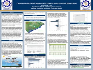
  • 1. TEMPLATE DESIGN © 2008 www.PosterPresentations.com Land-Use Land-Cover Dynamics of Coastal South Carolina Watersheds Amit Kumar Patel Department of Earth and Atmospheric sciences National institute of technology , Rourkela,769008 Abstract Introduction Objectives Material and Methods Results Conclusions Acknowledgements Changes in land use land cover (LULC) are a potential threat to coastal ecosystem health and the evolving geospatial technology (remote sensing and GIS) fits adequately for long- term monitoring and assessment of such effects. The objective of this research was to assess the historical changes in land use/cover in the coastal counties of South Carolina from 1996 to 2006. The study used high resolution LANDSAT data of the U.S Geological Survey and supervised Anderson LULC Level-2 classified data of the National Oceanic and Atmospheric Administration’s (NOAA) Coastal Change Analysis Program (C- CAP) to assess historic LULC changes for the coastal South Carolina counties for the 10-year study period. Statistics on distribution of change (losses and gains) by land cover were then devised from the remote sensed data. The results show an increase in the extent of open water cover in the South Carolina coastal counties investigated-perhaps due to global warming and the resulting rise in sea level. Similarly, scrub/shrub lands increased; but forestlands and some wetlands decreased for all the counties from 1996 to 2006. The increase in surface waters could negatively affect the beaches for recreation/tourism as well as biological diversity in the coastal waters. Also the decreased forest and wetlands could impact the coastal environment negatively by decreasing ecological services such as photosynthesis and carbon sequestration, biodiversity, water purification and flooding. More detailed LULC study of 20-30 year trends is suggested for a more holistic determination of the trends in coastal South Carolina watersheds in general. Changes in LULC impact the environment’s quality and the quality of life and human wellbeing. Changes in habitat, water and air quality and the quality of life are some of the environment, social and economic concerns associated with LULC changes. The U.S population that most directly affects the coast resides in a standard suite of coastal watershed counties where land use and water quality changes most directly impact coastal ecosystems. Coastal watershed counties can be thought of as ‘ the population that most directly affects the coast’ (U.S EPA, 2006) Remote sensing has played an important role in mapping land- cover and quantifying change for more than 25 years. Land cover represents one of the most fundamental applications of remote sensing, and is widely used to parameterize hydrological and biogeochemical models. References •NOAA –retrieved from http://oceanservice.noaa.gov/facts/lclu.html •CARA - retrieved from http://www.cara.psu.edu/land/lu- primer/luprimer02.asp •USGS National Land Cover Characterization : retrieved http://landcover.usgs.gov/nationallandcover.html •NOSAKHARE, O.K.; AIGHEWI ,I.T.; CHI, A.Y.; ISHAQUE, A.B., and MBAMALU, G., 2012. Land use-land cover changes in the lower Eastern Shore watersheds and coastal bays of Maryland: 1986-2006. Journal of Coastal Research, 28(1A), p56-62. West Palm Beach, FL, ISSN O749-0208 •AIGHEWI, I.T.; NOSAKHARE, O.K., and ISHAQUE, A.B., 0000. Land use-land cover changes and sewage loading in the lower Eastern Shore watersheds and coastal bays of Maryland: Implications for surface water quality. Journal of Coastal Research, 00(0), 000-000. West Palm Beach, FL, ISSN O749-0208 •TIGER – retrieved from www.census.gov Fig 1: Showing the process of remote sensing (Figure 2): Study Area The figure above (Fig 2) shows the study area and labeled counties of interest. This area lies in the coastal watershed 15-37, 16-36, 16-37 and 16-38 are the main path and row blocks of interest. The main economic activities in the coastal counties of South Carolina include fishing industry, mining , agri-business and tourism. Population census data was extracted from the TIGER website in order to relate and analyze LULC changes to the ever- growing population. The LEVEL 2 classification of data was used to classify the remote sensed data (LANDSAT) for further analysis (see Table1). (Table 2): Distribution of Land Use-Land Cover and Changes (Figure 3) (Figure 4) LEVEL 2 classification of Land Use-Land Cover (LULC) system Developed, High Intensity (HID) Forested (FOR) Developed, Low Intensity (LID) Grassland (GRS) Developed, Open Space (OSD) Barren Land (BAR) Open Water (WTR) Scrub/Shrub (SCB) Emergent Wetland (EMW) Agriculture (AGR) Woody Wetland (WDW) (Table 1): Data Classification 1. Determine the historical Land Use-Land Cover (LULC) patterns of Coastal South Carolina watersheds from 1996 -2006 (Figure 5): Population growth over study period This research was supported by the US Department of Energy grant. The increase in surface water cover may be due to the overarching theme of global warming which causes a rise in the sea level. Both low and high intensity development increased due to the increase in human population during the study period. The decrease in wetlands in the study area has serious environmental health implications. For example Graff and Middleton (2003) reported that wetlands are essential for fisheries; they also reduce floods and protect surface water by absorbing heavy metals and organic pollutants. In addition, they provide habitat for shell fish (prawns, lobsters) and water fowls. Consequently, there is the need to reverse this trend urgently for sustainability . The drastic 15% decline in forestlands may be due to the high demand for constructions to meet the growing human population. This trend will negatively impact the environment by promoting global warming and soil erosion, as well as reducing biodiversity if not reversed. A bold reforestation program is suggested for reversing this trend. More detailed LULC study of 20-30 year trends is suggested for a more holistic determination of the trends in coastal South Carolina watersheds in general as well as the impact it could have on water quality in the future. The extent of LULC change by class from 1996-2006 is shown in Fig 3 and summarized in a quantitatively manner in Table 2. In general, there was a significant net gain in scrubland There was a net gain of about 12Sq. miles of surface water cover at the expense of wooden Wetlands (see Table 2). However, there was a slight increase in emergent wetlands (EMW) during the 10-year study period. As forested land decreased, some land became grasslands which in general explains the increase in the GRS lands All the counties in the study area experienced an increase in development (LID/HID) due to increasing population (See Figure 5). There was also an increase in Agricultural land use and population growth (Fig 5); this could result in more pollution of the surface waters from agricultural inputs such as fertilizers and pesticides from erosion as well as other human activities in the area However there was a significant net loss of Forested lands which may be due to the land being used for settlement purposes to meet the changing population A land class which also had a significant decrease in area was Woody Wetlands . In general, best estimates indicate that because of agricultural and developmental impacts, more than 100 sq. miles (see Fig3) of Woody Wetland area has been lost over the 10 year period. Recognizing patterns of LULC Change can provide insight for future urban/Regional planning http://visual.merriam-webster.com/earth/satellite-remote-sensing.php