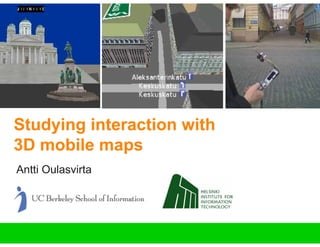
Studying interaction with 3D mobile maps
•
1 gefällt mir•795 views

Ref: Oulasvirta, Estlander, & Nurminen (2009) Personal and Ubiquitous Computing

Empfohlen
Weitere ähnliche Inhalte
Was ist angesagt?
Was ist angesagt? (20)
Andere mochten auch
Andere mochten auch (20)
Ähnlich wie Studying interaction with 3D mobile maps
Ähnlich wie Studying interaction with 3D mobile maps (20)
Mehr von Aalto University
Mehr von Aalto University (17)
Kürzlich hochgeladen
Kürzlich hochgeladen (20)
Studying interaction with 3D mobile maps
- 1. Studying interaction with 3D mobile maps Antti Oulasvirta
- 2. Acknowledgements • Antti Nurminen • Sara Estlander • Tuomo Nyyssönen interaction with 3D mobile maps 2
- 3. Literature 1. Oulasvirta, A., Estlander, S., & Nurminen, A. (in press). Embodied interaction with a 3D versus 2D mobile map. Personal and Ubiquitous Computing. 2. Nurminen, A., & Oulasvirta, A. (in press). Designing interactions for navigation in 3D mobile maps. In L. Meng, A. Zipf, S. Winter (Eds.), Map-based Mobile Services: Interactivity and Usability, Springer. 3. Nurminen, A. (in press). IEEE Computer Graphics & Applications 4. Oulasvirta, A., & Nyyssönen, T. (submitted). ARMIv2: The swiss army knife approach to mobile usability labs. Journal of Usability Studies interaction with 3D mobile maps 3
- 4. Mobile maps • 2012: 42 million users in N America + Europe • 2D dominates – Raster maps (incl. satellite imaging) – Vector maps • At the present mainly for car navigation • 3D? • What about pedestrians? interaction with 3D mobile maps 4
- 5. interaction with 3D mobile maps 5
- 6. The reference point problem interaction with 3D mobile maps 6
- 7. Volumetric • Flat Multiple views • One view Directional view • Area view Photorealism • Symbolic conventions and text Six DOFs for movement • Scrolling, panning, zooming interaction with 3D mobile maps 7
- 8. Research questions 1. Of what use is the 3rd dimension in solving the reference point problem? 2. Do users’ strategies reflect the representational and interactive differences between 3D and 2D? 3. Eventually, how should we design 3D mobile maps? 2D maps are centuries ahead in development! interaction with 3D mobile maps 8
- 9. Contents 1. Design 1. Experimenting in the field 2. Embodied interaction interaction with 3D mobile maps 9
- 10. 1. Design Designing 3D VE interaction for mobile phones
- 11. m-LOMA: A 3D city model • Modeles an area of 2x2 km2 • Wireframe models • 3500 building facades textured • 1px ~ 20 cm • Currently running on N93 – 3D hardware + 240x320 resolution • Average 30-60 fps • Several maneuvering modes and assisting features • All controls mapped to keys of N93 • No GPS due to ”urban canyons” interaction with 3D mobile maps 11
- 12. interaction with 3D mobile maps 12
- 13. Video demonstration • Show landmark • Orbiting • Animated view transition • Free maneuvering • Tracks mode • (Marker arrow) interaction with 3D mobile maps 13
- 14. Video interaction with 3D mobile maps 14
- 15. Perspective change • One button • Animated change interaction with 3D mobile maps 15
- 16. Tracks • One button to turn on/off • Shows – tracks – overlaid street names – directions at crossings • Guides movement – rails – pivoting interaction with 3D mobile maps 16
- 17. 2D map design pan / scroll zoom in / out 240x320 px raster format official city map interaction with 3D mobile maps 17
- 18. 2. A field experiment 16 pre-trained subjects, experienced 3D gamers Pointing task paradigm Proximate & remote targets, navigation A pre-defined route in the modeled area 2D versus 3D, within-subjects All maneuvering modes optional Comprehensive data collection
- 19. Participants • 19 subjects recruited • 3 re-run, 16 males, M=23.3 yo • Selection criteria – Does not know the Helsinki city center very well – Plays 3D first shooter games frequently • 3 cinema tickets rewarded interaction with 3D mobile maps 19
- 20. The pointing task paradigm ”Point with your index finger to the direction of the building that is marked on the mobile map” Facing direction in PE randomized An orange marker arrow shows the direction and distance of the target interaction with 3D mobile maps 20
- 21. Task conditions 1. Proximate pointing 2. Remote pointing 3. Navigation interaction with 3D mobile maps 21
- 22. Route interaction with 3D mobile maps 22
- 23. Design • Counterbalancing against two order effects: – Which ”loop” is started with – Which map type is started with interaction with 3D mobile maps 23
- 24. Training At home • Training on desktop with fictitious ”Fakeham” Before starting the trial: • 15 practice tasks on N93 • the pointing task • think aloud • NASA TLX + Background questionnaires + 2 x working memory span test interaction with 3D mobile maps 24
- 25. Data collection w/ ”Mobile usability lab”
- 26. Data collection Interaction • Video observation (w/ ”mobile usability lab”) • Verbal protocols (trained think aloud) • Interaction with the map Performance • Task completion times & pointing errors • Workload (NASA TLX) interaction with 3D mobile maps 26
- 27. Wishlist for a mobile usability lab • Mobility • Captures embodied interaction – hands and near bodyspace – deployment of gaze to distant and proximate objects of interest – walking – abrupt attention-drawing events in the environment • Unobtrusiveness • Multi-method support • Redundancy • Quality control interaction with 3D mobile maps 27
- 28. Previous systems • Top row: – Reichl et al. (2007) – Schusteritsch et al. (2007), • Bottom – Lyons and Starner (2001), – Applied Science Laboratories (2008). interaction with 3D mobile maps 28
- 29. ARMIv2 interaction with 3D mobile maps 29
- 30. Mic Mic Surveillance Remote camera camera DC Power 12V Wireless adapter Wireless sender sender 2.4 GHz Wireless video receiver Video hub Video Recorder ”Quad” Video Lithium Lithium DC 7.5 Audio DC 7.5 DC 7.5 12V 12V Video Video ”Necklace” cam Face cam UI cam interaction with 3D mobile maps 30
- 31. Integrated video • ~2000 kbps MPEG-1 • 520x320 resolution • 25 fps 25 • MPEG-1 Layer 3 64 kbps mono sound track interaction with 3D mobile maps 31
- 32. Analysis • 381 tasks, 12.2 hours • Coding of events from video (1 s accuracy) – Facing • Looks at the device, forward, left, right, straight up, up and to the left, or up and to the right. – Body turning • The user turns his body using his feet: left or right. – Device turning • The user rotates the device in his hands: clockwise or counterclockwise. – Head tilting • The user brings one ear toward the shoulder: to the left, right, upright (back to normal position). – Walking • The user moves his feet more than 50 cm • Directional pointing errors • Kappa .75 for inter-coder reliability • Qualitative analysis for 75 randomly sampled verbal protocols interaction with 3D mobile maps 32
- 33. Results
- 34. Example • Participant #8, 50:00 interaction with 3D mobile maps 34
- 35. Task completion time + 2D and 3D equally accurate in pointing interaction with 3D mobile maps 35
- 36. Movement in VE interaction with 3D mobile maps 36
- 37. Use of functionalities • Unit: times invoked per task • 3D – Switch perspective 1.8 – Tracks 1.3 – Show landmark 0.72 – Orbit 0.32 – Fly-to-target 0.19 • 2D – move north/south 2.2 – move east/west 3.0 – zoom in 2.0 – zoom out 5.8 times. interaction with 3D mobile maps 37
- 38. General form of solution • Look at the target – Scan around the target for cues • Direct match • Reference point search – Cue scan – Primed scan – Ego-centric alignment • Inference of target direction • (Strategy change) interaction with 3D mobile maps 38
- 39. Looking at the physical environment interaction with 3D mobile maps 39
- 40. interaction with 3D mobile maps 40
- 41. interaction with 3D mobile maps 41
- 43. interaction with 3D mobile maps 43
- 44. interaction with 3D mobile maps 44
- 45. Examples • Aligning the two views, VE with PE • Turning in PE to face in the direction of something seen in VE • Placing camera at current position in 3D • Moving in PE before pointing • Pointing at a location on the screen of the device • Letting target arrow guide navigation interaction with 3D mobile maps 45
- 46. Use of body interaction with 3D mobile maps 46
- 47. Self-location • Due to task, unavoidable if direct match is not possible • ~¾ uses PE as primary source for cues, ¼ uses VE • Deriving the target direction – Directly if VE and PE aligned – Indirectly if not • Direct s-l reduces cognitive demands interaction with 3D mobile maps 47
- 48. 3D • 3D: Direct vs. indirect (3D users often needed to double check their inference) interaction with 3D mobile maps 48
- 49. 2D • Turning the device in hands / tilting head • Purpose: Align the roads on the map with roads seen in PE • More often direct ego-centric inference than indirect interaction with 3D mobile maps 49
- 50. Practice effects MAP*PRACTICE; Unweighted Means Current effect: F(3, 45)=2,3837, p=,08178 Effective hypothesis decomposition Vertical bars denote 0,99 confidence intervals 240 220 200 180 Task completion time 160 140 120 100 80 60 40 interaction with 3D mobile maps 1 2 Phase 3 4 50
- 51. Practice effects • Users shifted to more 2D-like strategies: – Orbiting fell by 19.8% – Show landmark fell by 14.9% – Fly-to-target fell by 8.1%. – Tracks increased by 7.4%. • 3D users started to – look up less in the VE (6.0%) – more in the PE (6.7%) • 2D shows no changes in how its features are used interaction with 3D mobile maps 51
- 52. WM span • High Corsi span associated with 16% better performance in 3D • High Corsi span group used Tracks functionality 26% more • No similar results for Mannequin test (rotation) • No significant effects for 2D The problem of street-level 3D is that you have to keep in mind several invisible spatial locations interaction with 3D mobile maps 52
- 53. Summary: Why 3D was slower? • Slower movement time / time unit – Spending lot of time wondering around in the street level view • Wasting time in looking for salient&diagnostic visual cues in facades • Unpredictability in what is modeled • Moving back and forth finding legible visual cues • Losing one’s own position one’s found • Inability to use preknowledge of areas • Inability to update location on map while moving from one site to another • Self-location more difficult interaction with 3D mobile maps 53
- 54. Summary 1. Positive potentials: Direct matching, ego-centric alignment, perspective-taking 2. Task analytically strategies are the same • Selection of cues differs • Use of pre-knowledge differs • Self-location tactics differs Reflected in use of gaze & body 3. (Last slide) interaction with 3D mobile maps 54
- 55. Conclusion: Improving 3D • Design of 3D mobile maps ≠ design of virtual environments We need to • caricature facades, focusing on diagnostic and salient cues • achieve predictability in modeling of cues • emphasize salient details like logos & statues • make roof-top view the default view (2.5D?) • ”undoable” perspective changes, not only in vertical direction • support self-location w/ GPS+e-compass, ”home button” • guide maneuvering to tracks when on street level • consider some map + 3D / focus+context views interaction with 3D mobile maps 55
- 56. interaction with 3D mobile maps 56