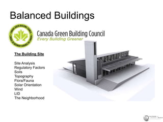
3. Basic Site Analysis
The Thought Process:
Review site plan as defined by legal
boundaries, setbacks and rights-of-way
Develop area and volume design required by the
building, amenities and future expansion/
deconstruction
Ground Slopes/Subsoil Conditions re:
suitability of building placement
Drainage Patterns - LID
Flora/Fauna
Map Climatic Conditions (Sun, Wind,
Precipitation)
Public access points/Utility availability
Views/Adjacencies/Noise/Scale re: character of
neighborhood/Car vs. no car
http:www.walkscore.com
4. Site Typologies
Brownfield – site has been built
on before, typically in urban
settings
Greenfield – No prior building
component (rural or
countryside areas)
Brownfield sites ease pressure
on Greenfield sites – typically
more sustainable
Greenfield sites are typically
less congested, may have
better views and expansion
capabilities
New housing in core areas may
lead to gentrification – areas
become trendy = area
improves, crime rate may drop,
etc.
Easier to provide public transit
when redeveloping existing
urban areas
5. Phase I and II Environmental
Environmental Assessment of
a Brownfield Site:
• Address contaminated
property issues re:
development and construction
• Determine what remediation is
needed, if any
Phase I – Review site history and
gather information on past uses
Site inspection
Review environmental files
Report prepared identifying existing
and potential sources of
contamination
Phase II – Surface and sub-surface
soil samples taken
Storage tank review, if applicable
Asbestos and PCB sampling
Measure noise levels and radiation
Use environmental models to
evaluate migration potential of
contaminants
6. Planning
Zoning Ordinances:
Manage growth
Regulate land use patterns
Control building density
Protect environmentally
sensitive areas
Conserve open spaces
Regulate type of activity on property and
location of building(s)
Set-backs from property lines
Define any easements/right-of-ways
Define maximum width, depth and height of
structure
Ratehub.ca
8. The Site Plan
Illustrates the Natural and Built
features of the property and
describes proposed
construction, relative to these
features
Loft401.com
9. Impacting the Site
Remove existing trees or work around flora?
Extensive grading or excavation required?
Change natural drainage or work within site
constraints?
Building footprint and height
AK Design
10. Toronto Green Standard
3 versions of TGS:
1. Low-rise Non-Residential
2. Low-rise Residential
3. Mid to High-rise
Tier 1 standard is compulsory
Tier 2 standard is voluntary
If both are met a 20% refund of
development charges is
provided
11. Toronto Green Standard
Breakdown:
Air Quality
GHG/Energy
Water Quality
Ecology
Solid Waste
Requirements:
1. TGS Checklist
2. TGS Statistics Template
3. Energy Report
Buildipedia.com
12. Slopes and Soils
Slope:
<5% - useable for most
activities, easy to build
on
5-10% - suitable for most
informal activities,
relatively easy to build
on
>10% - challenging to build
on
>25% - subject to erosion,
difficult to build on
Cubeme.com
13. Soils
Wikipedia
Very useful in preliminary
planning stages (footings,
foundations, plantings etc.)
Specifically diminished weight
bearing capacities are of
concern along with the the
possibility of winter heaving
(frost heave)
Drainage (percolation factors)
4”/H=good, 2-4”/H=medium
and <2”/H=poor
Directly linked with Stormwater
management (LID)
14. LID
Definitions:
Common – a removable or hinged
cover for a container
An eyelid
Urban – common terminology
(1960’s-70’s) to describe approx. 1 oz.
of Marijuana
Sustainable – site design
approaches to manage, capture and infiltrate
storm water for beneficial use, as close to its
source as possible
Lowimpactdevelopment.org
15. Water-Wise Design
Plan for water conservation
(native plant species)
Hydrozone (native plants
grouped to water-need)
Water efficiently
Improved soils
Mulching
Maintenance + healthy
plants = greater tolerance Colorado State University
16. Rainfall Analysis
MetEd
Toronto average: 840mm annually
Important when designing a stormwater
management system or implementing
rainwater harvest design
1000 s.f. of roof area captures approx. 600
gallons of water per inch of rainfall
Review annual rainfall in terms of seasonal
models –extended rainy season or dry
season statistics will impact building and
landscape design considerations
amazingworldpictures
17. Stormwater
City of Sandy, UT
Inhabitat
Keep stormwater on property
Utilize bio swales or on-site
sequestration to avoid runoff
Cistern-based capture of
rainwater for landscape
watering, flushing of toilets, car
washing etc.
Permeable pavers on patio
and driveway surfaces to aid in
percolation
18. Stormwater
Sscrcd.org
Ideal: mimic pre-
development hydrology
LID (low intensity design)
results in increased
retention of stormwater
and pollutants on site
Positive impacts related
to infrastructure (water
treatment facilities) and
fish populations in local
streams and lakes
19. Flora and Fauna
Plants Provide:
Energy Conservation
Framing (or Screening) Views
Noise Abatement
Retard Erosion
Connect the Buildings to Site
Preserve existing and native
plant species, where possible
Grass and Ground Cover
Reduce air temperature by absorbing
solar radiation and through
evaporative cooling
Stabilize Soils
Make soils more permeable to air and
water
Landscapingyourparadise.com
20. Flora and Fauna
Partial List of Locally
Endangered Species:
Jefferson Salamander
Monarch Butterfly
Chimney Swift
Barn Owl
Redside Dace
Canada Warbler
Does the site contain
habitat? What type?
Is the species present
seasonally? Year Round?
MNR.gov.on.ca
21. The Elements (Sun and Wind)
Toronto – 44 Deg. N Latitude
Suns Altitude @ Noon:
December 22nd = 22 degrees
March/September 21st = 46 degrees
(spring/autumnal equinox)
Siting: Cool Regions
Minimize building surface area = less
exposure in low temp’s, maximize
solar absorption, reduce heat loss
(radiant, convective and conductive),
provide wind protection
Seattlepi.com
22. Solar Orientation
Canada.gc.ca
Heating degree day
calculations provide a
reflected demand for
energy needed to heat
buildings
Base temperature is 18
degrees C
One HDD day = the
temperature conditions
outside building are
below the threshold
comfort temperature
inside the building by 1
degree – heat is required
to maintain thermal
comfort
Toronto: 3650 HDD
23. Solar Orientation
Dennis Holloway, Architects
Difference in pole locations causes
compass to point either east or west
of true north
Find local variation and point
compass in the opposite direction to
determine true N-S line
Sun’s path varies seasonally – high
in summer, low in winter – height in
sky referred to as altitude, horizontal
angle relative to north is its Azimuth
Information is key in designing, siting
and operating a passive building
Autodesk™
24. Solar Orientation
Autodesk, M V.Roosmalen
Passive heating vs. cooling
Overhangs and shade
devices assist in summer
cooling yet let low winter sun
in to augment heating
600mm shade provides an
average reduction in solar
heat gain of 33% in summer
(30 degrees N)
South facing glazing
percentage of < 9% of floor
area beneficial in passive
heating if thermal mass has
been optimized
25. Solar Orientation
McGraw Hill
Daylight capture key in
passive designs
Window height must be min.
40% of room depth to
optimize light penetration
North light diffuse and
efficient
S, E and West light can be
harsh – light shelves and
reflected light can assist in
balancing this
26. Microclimate
Olesondresen.com
Microclimate influenced by:
Elevation (ground)
Type and Orientation of Land Forms
Bodies of Water
Principles:
Warm air rises, cold air settles
Temperature decreases by altitude (0.56 C/122m in
elevation)
Water acts as a thermal mass reservoir –
evaporative cooling, land and sea-breeze affect
Breezes – updrafts and downdrafts may cause
cooling by up to 10 C
Flora absorbs solar radiation, hard-scapes absorb
and re-radiate (heat Island)
27. Microclimate
Archdaily.com
Ideal building siting: south facing
slope
1 s.f. of south-sloping ground
receives same intensity of solar
radiation as 1 s.f of ground 10
degrees to the south
Cold Ponding effect – chilled air in
contact with the ground (density
causes a flow downhill) – building
higher can increase ambient temp’s
by 5 to 10 degrees C
HomeAway
28. Wind Direction
E Mangubat, Architect
Evergreens protect dwelling
by tempering prevailing
winter winds
Prevailing summer
winds enter dwelling
and through stack-
effect are carried
upward, replacing
warm stale air with
cooler fresh air
greenapplepie
29. Vegetative Shading
Shelter belt: winter winds
deflected
summer
winds funneled to aid in cooling
Righthouse.nzYourHome.gov.au
Deciduous
tree
shading
aids in
cooling –
leaf loss
allows
winter sun
access with
proper
design
33. Resources
Toronto Green Standard
http://www.toronto.ca/planning/environment/greendevelopment.htm
Rainfall Statistics
http://www.climate.weatheroffice.gc.ca/climateData/dailydata_e.html?StationID=5097&Month=6
&Day=11&Year=2013&timeframe=2
Xeriscaping
http://www.toronto.ca/trees/ravines.htm
Solar Potential
http://pv.nrcan.gc.ca/
http://www.waterfrontoronto.ca/dbdocs/4561b1d6ec542.pdf
Wind Energy
http://www.windatlas.ca/en/index.php
Reference List: Building Construction Illustrated, 4th Edition. Francis DK Ching, John Wiley & Sons, Inc.