SlideShare ist ein Scribd-Unternehmen logo
1 von 13
Downloaden Sie, um offline zu lesen
Sushil Kulkarni   1
Sushil Kulkarni                                                2


       GEOGRAPHIC INFORMA TION SYSTEM
       GEOGRAPHIC INFORMA TION SYSTEM


  1..Starter…………………………………………………………………………………………....3
  1 Starter………………………………………………………………………………………… .. 3

  2..GIS defiiniitiion………………………………………………………………………………..…..3
  2 GIS def n t on……………………………………………………………………………… … 3

  3..GIS Hiistory………………………………………………………………………………………5
  3 GIS H story………………………………………………………………………………………5

  4.. Softwares…………………………… ………………………………………………………….5
  4 Softwares……………………………

    4..1.. MAPINFO Professiionall v 6..5………………………………………………………... 5
    4 1 MAPINFO Profess ona v 6 5……………………………………………………… . 5
    4..2.. ARC GIS…………………………………………………………………………………... 6
    4 2 ARC GIS………………………………………………………………………………… . 6
  5.. Data Structures iin GIS ………………………………………………………………………6
  5 Data Structures n GIS ………………………………………………………………………6

  6.. Data management requiirements of GIS………………………………………………... 8
  6 Data management requ rements of GIS……………………………………………… . 8

    6..1 Data modelliing and representatiion……..………………………………………….. 8
    6 1 Data mode ng and representat on…… ………………………………………… 8
    6..2 Data base management and anallysiis……………………………………………...11
    6 2 Data base management and ana ys s…………………………………………… .1 1
    6..3 Data Integratiion………………………………………………………………………..11
    6 3 Data Integrat on……………………………………………………………………… 11
    6..4 Data capture……………………………………………………………………………...11
    6 4 Data capture…………………………………………………………………………… .1 1

  7 GIS data operatiions………………………………………………………………………….. 11
  7 GIS data operat ons………………………………………………………………………… 11


Sushiltry@yahoo.co.in
Sushil Kulkarni                                                                               3


1.Starter

 Originally the purpose of maps was for navigation only because explorers and traders
wanted to know how to travel from one place to another through uncharted waters or over
unexplored lands. Later, after the invention of paper and as the science of cartography
advanced, people became interested in studying the relationships between natural and
manmade features on the Earth's surface. Recently, the demand for maps of the
topography and specific themes of the earth's surface, such as natural resources, has
accelerated greatly.

Scientists wanted to study man's use of the land, which led to the study of spatial
distributions of such things as soil, people, vegetation, climate, etc. First an inventory had to
be taken via which data was collected and recorded. Due to the large volume of data and
lack of mathematical tools qualitative methods of classification and mapping were used
initially. With the development of appropriate mathematical tools and the availability of the
digital computer spatial analysis and quantitative thematic mapping have mushroomed.

Before computers the spatial database was a drawing on a piece of paper or film. Various
symbols, colors and text codes together with legends were used to display geographical
entities. Other additional information was given in accompanying narratives.

Because the paper map was the spatial database the information it contained had to be
compromised, namely:

   1. data volume was greatly reduced => local detail lost
   2. map drawn extremely accurately and presentation clear

The collection and compilation of data and the publication of a printed map is costly and
time-consuming. To extract a single theme from a general-purpose map by hand is very
expensive. The need for information about how the earth's surface is changing annually,
monthly, weekly, daily, and even hourly makes conventional mapping techniques
inadequate and simply impossible by hand.

GIS is the mapping tool, which forms a marriage between remote sensing, earthbound
survey, and cartography. Be aware that computer-aided design drawing software can create
theme, display and print geo referenced data just like a GIS software package but that no
topology is present to permit spatial analyses to be performed.

2.GIS definition

The definition of GIS states that it is software, which can acquire, store, retrieve, and
analyze information describing physical properties of the geographical world. The scope of
GIS is for two types of data:


Sushiltry@yahoo.co.in
Sushil Kulkarni                                                                           4


(1)    spatial data that includes maps, digital images, administrative and political
       boundaries such as roads; transportation networks, physical data such as rivers; soil-
       characteristics; climatic regions; land elevations.
(2)    non-spatial data, such as census counts, economic data, and sales or marketing
       information

Following figure encapsulates these data:


A GIS is designed to allow a user to ask an almost unlimited number of spatial questions as
follows:
* Where is object A?
* Where is A in relation to place B?
* How many occurrences of type A are there within a distance D of B?

Sushiltry@yahoo.co.in
Sushil Kulkarni                                                                          5


* What is the value of function Z at position X?
* How large is B (area, perimeter, and inclusion count)?
* What is the result of intersecting various kinds of spatial data?
* What is the path of least cost, resistance, or distance along the ground from X to Y
  along pathway P?
* What is at points X1, X2,...?
* What objects are next to objects having certain combinations of attributes?

3.GIS History

The father of GIS is recognized to be Dr. Ian McArth, a landscape designer, who published a
book in 1969 dealing with spatial representations of features in 2 and 3 dimensions. In the
1970s Dana Tomlin, a Ph.D. student at the Harvard Graphics Lab, developed the first raster
GIS program called MAP. This software was in the public domain so others developed it
further. These individuals were Dr. Duane F. Marble, Dept. of Geography, The Ohio State
University, Columbus OH who developed OSU MAP-for-the-PC in the 1980s and Dr. Joseph
Berry, Berry & Associates, Ft. Collins CO. who developed PMAP. The 1980s saw a great
profileration of start-up GIS companies but in the last five years many have disappeared
such as PAMAP from Victoria, B.C. and SPANS from Ottawa, Canada. One of these
companies, Environmental Systems Research Institute (ESRI), Redlands, CA under the
leadership of Dr. Jack Dangermond, developed the concept of linking attributes stored in a
database to map features in 1984. This simple idea revolutionized the GIS industry. At
present ESRI has captured about 90 percent of the GIS user community and has clients all
over the world. However there are still others GIS software vendors that are alive and doing
well such as MAPINFO, MGA from Intergraph, IDRISI from Clark University, ArcView GIS
to name a few.

4. Softwares

Following are two popular softwares:

4..1.. MAPINFO Professiionall v 6..5
4 1 MAPINFO Profess ona v 6 5

With MAPINFO you can display data as points, as thematically shaded regions, as pie or bar
charts, as districts, etc. You can perform geographic operations such as redistricting,
combining and splitting geographic objects, and buffering. From MAPINFO you can perform
data powerful SQL queries and remotely access your data. For instance, it calculates
distances between customers and stores, compute which branch stores are the closest to
your biggest customers and color-code store symbols by sales volume.


Sushiltry@yahoo.co.in
Sushil Kulkarni                                                                               6


4..2.. ARC GIS
4 2 ARC GIS
ArcGIS is the collective name for three products - ArcView, ArcEditor, and ArcInfo. These
products are built on a common interface and core capability with each product offering a
different level of functionality. The basic building blocks of ArcGIS are:

   * ArcMap - for displaying and querying maps
   * ArcCatalog - for managing geographic data
   * ArcToolbox - for setting map projections and converting data

a. ArcMap

In ArcMap, you make maps from layers of spatial data, choose colors and symbols, query
attributes, analyze spatial relationships, and design map layouts. The ArcMap interface
contains a list (or table of contents) of the layers in the map, a display area for viewing the
map, and menus and tools for working with the map.

b. ArcCatalog

Spatial data can be browsed on your computer's hard disk, on a network or on the Internet.
You can search for spatial data, review it, and add it as layers to ArcMap. ArcCatalog has
tools for creating and viewing metadata (information about spatial data such as who created
it and when, its intended use, its accuracy, etc.). ArcCatalog manages spatial data that
come in a variety of formats. The geodatabase is a new spatial data format designed
specifically for ArcGIS.

c. ArcToolbox

With this ArcGIS building block spatial data can be converted from one format to another
using a set of tools. Most tools have a wizard interface that walks you through each step of
a task. Also the map projection of data can be changed. About fifty map projections are in
common use. Over 300 different models exist (and are recognized by ArcMap) to describe
the exact shape of the earth. There are 36 commonly used tools for data conversion and
management in ArcToolbox for ArcView and ArcEditor

5. Data Structures in GIS

All geographical data can be reduced to 3 basic topological concepts -- the point, the line,
and the area. A label is also needed to identify what the entity is, e.g. a section of railroad
line could be represented by a line consisting of a starting and ending x, y coordinate and
the label "railroad".

A map is a set of points, lines, and areas that are defined both by their location in space


Sushiltry@yahoo.co.in
Sushil Kulkarni                                                                           7


with reference to a coordinate system and by their non-spatial attributes.
The map legend is the key linking non-spatial attributes to the spatial entities. Colors,
symbols and shading are employed to visually display non-spatial information.
Map data is stored in a computer in the form of files, which must be accessed and cross-
referenced quickly. Therefore, the organization of the data elements comprising such files is
very important. Database management systems (software) are used to control data input,
output, storage, and retrieval.

Consider the example of simple map M with two polygons labelled I and II shown below,
with the corresponding data structure.
                        Simple map M with two polygons I and II


Sushiltry@yahoo.co.in
Sushil Kulkarni                                                                          8


From the above data structure we have the following:


6. Data management requirements of GIS

6.1 Data modeling and representation:

GIS data can be represented in two formats:

* Vector
* Raster


A. The Vector View of the World

A vector based system displays graphical data as points, lines or curves, or areas with
attributes. Cartesian coordinates (i.e., x and y) and computational algorithms of the
coordinates define points in a vector system. Lines or arcs are a series of ordered points.
Areas or polygons are also stored as ordered lists of points, but by making the beginning
and end points the same node the shape is closed and defined. Topological models define
the connectivity of vector based systems. Vector systems are capable of very high resolution
(less than or equal to .001 inch) and graphical output is similar to hand-drawn maps. This
system works well with azimuths, distances, and points, but it requires complex data
structures and is less compatible with remote sensing data. Vector data requires less

Sushiltry@yahoo.co.in
Sushil Kulkarni                                                                              9


computer storage space and maintaining topological relationships is easier in this system.
Digital line graphs (DLG) and TIGER files are examples of vector format.


B. The Raster View of the World
A raster-based system displays, locates, and stores graphical data by using a matrix or grid
of cells. A unique reference coordinate represents each pixel either at a corner or the
centroid. In turn each cell or pixel has discrete attribute data assigned to it. Raster data
resolution is dependent on the pixel or grid size and may vary from sub-meter to many
kilometers. Because these data are two-dimensional, GISs store various informations such
as forest cover, soil type, land use, wetland habitat, or other data in different layers. Layers
are functionally related map features. Generally, raster data requires less processing than
vector data, but it consumes more computer storage space. Scanning remote sensors on
satellites store data in raster format. Digital terrain models (DTM) and digital elevation
models (DEM) are examples of raster data.


Sushiltry@yahoo.co.in
Sushil Kulkarni                                                                             10


C. Graphical Comparison of Raster and Vector Systems
It is important to stress that any given real world situation can be represented in both raster
and vector modes, the choice is up to the user. Each of these systems of representation has
its advantages and disadvantages:

Method                Advantages                                Disadvantages
                                                 §   Requires greater storage space on
                                                     computer
            § Simple data structure
                                                 §   Depending on pixel size, graphical output
            § Compatible with remotely
                                                     may be less pleasing
 Raster      sensed or scanned data
                                                 §   Projection transformations are more
            § Simple spatial analysis
                                                     difficult
             procedures
                                                 §    More difficult to represent topological
                                                     relationships
            § Requires less disk storage space §     More complex data structure Not as
            § Topological relationships are          compatible with remotely sensed data
             readily                           §     Software and hardware are often more
 Vector
            § maintained Graphical output            expensive
             more closely resembles hand-      §     Some spatial analysis procedures may be
             drawn maps                              more difficult


Sushiltry@yahoo.co.in
Sushil Kulkarni                                                                               11


6.2 Data base management and analysis

Data base management and analysis include the data characteristics and analysis
techniques required for each application. Data base requirements include data acquisition
costs, manipulation costs, data quality, data scales, and data base size. Data analysis
techniques are the functional capabilities of the software and hardware, which impact
system configurations.

Data base requirements can vary widely depending on the scope of the application; eco-
system, individual refuge, state, etc. The type of data also impacts the size of the files.

GIS data undergoes various types of analysis. For example, in applications such as soil
erosion studies, environmental impact studies etc.

6.3 Data Integration

GIS must integrate both vector and raster data from a variety of sources. Some times edges
and regions are inferred from a raster image to form a vector model, or conversely, raster
images such as aerial photographs are used to update vector models.

6.4 Data capture

The spatial representations of data set are most commonly stored as either vector features
or as raster data sets along with traditional tabular attributes. For example, an RDBMS table
can be used to store a feature collection where each row in the table represents a feature. A
shape column in each row is used to hold the geometry or shape of the feature. The shape
column holding the geometry is typically one of two column types:

   ·   A binary large object (BLOB) column type
   ·   A spatial column type

A homogenous collection of common features, each having the same spatial representation,
such as a point, line, or polygon, and a common set of attribute columns is referred to as a
feature class and is managed in a single table

Raster and imagery data types are managed and stored in relational tables as well. Raster
data is typically much larger in size and requires an associated side table for storage. During
the storage process the software cuts the raster into smaller pieces, called "blocks," and
stores them in individual rows in the separate block table.

7. GIS data operations

Following are the different operations used in GIS:


Sushiltry@yahoo.co.in
Sushil Kulkarni                                                                            12


A GIS consists of a data base coupled with a graphics output. There are three major types
of operations in a GIS:

1.Access methods

The user will want to access data elements with certain properties. There are three
questions involved here. The first is whether the requested data is available in the system.
The second question is how long it will take to find the data. Spatial data structures pose
unusual indexing problems and are a topic unto themselves Usually some variation of a
quadtree (for 2D) or octree (for 3D) is used. The third question is how the user accesses
the data. The conventional query language SQL is sometimes used.

2.Analytical operations

Analytical operations allow the user to combine data to produce new data. The most
important operation is the overlay of different spatial data sets to produce a new data set.
For example, a biologist might want to determine what variables affect the population of
dolphins. For a given part of the ocean, there may be measurements for water temperature,
different fish populations, including predators (sharks), different types of pollution levels,
etc. The biologist could then try to find correlations. Note that this is a multivariate
visualization problem. The analytical operations can also include computations to produce a
new data set.

3. Rendering

Rendering operations show the data as some sort of map with the additional information
displayed. This is where Visualization techniques can be applied to GIS.

4. Interpolation

This interpolation technique is a method where a series of iterations are made over a
surface to smooth it out. There are three options, which can be set for stopping the
iterations whenever any one of the specified conditions is met.

§   The first option specifies the maximum number of iterations the routine should perform
    on the map data before stopping.

§   The second option specifies the tolerance for convergence (percent of range) as a
    percentage of the range of elevations represented in the map. The routine will stop
    when the maximum change in any pixel is less then the specified tolerance. A value of
    0.5% for a map with elevations of 3,560 to 5,600 ft. equals a change of 10.2 feet or
    less.


Sushiltry@yahoo.co.in
Sushil Kulkarni                                                                             13


§    The third option is Convergence Tolerance (Absolute) which stops iterations when the
    maximum change in any pixel is less than the specified value. The value is given in map
    elevation units, usually feet.

5. Class of Proximity analysis

Several classes can be developed to analysis the interest of a particular region like the
determination of signal failure on highway, locating shortest path using shortest path
algorithms using 2D or 3D information are the important classes of proximity analysis.

6. Raster image processing

This process is divided in to two categories:

(1) To produce new map from the existing geographical features on different map layers
    algebraically using map algebra.

(2) Digital image analysis is used to detect the edges and objects. For example, detection
    of roads in a satellite image of a city.

Weitere ähnliche Inhalte

Was ist angesagt?

Geospatial Web
Geospatial WebGeospatial Web
Geospatial Webhchen1
 
Introduction to Open Source GIS Day 1 - Institute of Archaeologists of Irelan...
Introduction to Open Source GIS Day 1 - Institute of Archaeologists of Irelan...Introduction to Open Source GIS Day 1 - Institute of Archaeologists of Irelan...
Introduction to Open Source GIS Day 1 - Institute of Archaeologists of Irelan...Gianmarco Cattari
 
Stefan Michalak - Portfolio - January 2016
Stefan Michalak - Portfolio - January 2016Stefan Michalak - Portfolio - January 2016
Stefan Michalak - Portfolio - January 2016stefan michalak
 
Geographical information system by zewde alemayehu tilahun
Geographical information system by zewde alemayehu tilahunGeographical information system by zewde alemayehu tilahun
Geographical information system by zewde alemayehu tilahunzewde alemayehu
 
GIS.INTRODUCTION TO GIS PACKAGES &GEOGRAPHIIC ANALYSIS
GIS.INTRODUCTION TO GIS PACKAGES &GEOGRAPHIIC ANALYSISGIS.INTRODUCTION TO GIS PACKAGES &GEOGRAPHIIC ANALYSIS
GIS.INTRODUCTION TO GIS PACKAGES &GEOGRAPHIIC ANALYSISTessaRaju
 
Cyril Connolly, Lecturer, IADT, Dun Laoghaire: Visualising Road Accident Data
Cyril Connolly, Lecturer, IADT, Dun Laoghaire: Visualising Road Accident Data Cyril Connolly, Lecturer, IADT, Dun Laoghaire: Visualising Road Accident Data
Cyril Connolly, Lecturer, IADT, Dun Laoghaire: Visualising Road Accident Data Dublinked .
 
Rahul seminar1 for_slideshare
Rahul seminar1 for_slideshareRahul seminar1 for_slideshare
Rahul seminar1 for_slideshareRahulSingh769902
 
Gis spatial analysis for digital elevation model dem application
Gis spatial analysis for digital elevation model  dem  applicationGis spatial analysis for digital elevation model  dem  application
Gis spatial analysis for digital elevation model dem applicationIAEME Publication
 
Modeling a geo spatial database for managing travelers demand
Modeling a geo spatial database for managing travelers demandModeling a geo spatial database for managing travelers demand
Modeling a geo spatial database for managing travelers demandijdms
 
READING LIST: USING A RETROSPECTIVE APPROACH TO MINE THE LITERATURE FOR GIS A...
READING LIST: USING A RETROSPECTIVE APPROACH TO MINE THE LITERATURE FOR GIS A...READING LIST: USING A RETROSPECTIVE APPROACH TO MINE THE LITERATURE FOR GIS A...
READING LIST: USING A RETROSPECTIVE APPROACH TO MINE THE LITERATURE FOR GIS A...Barry Wellar
 
CKANへの空間情報機能拡張実装の試み
CKANへの空間情報機能拡張実装の試みCKANへの空間情報機能拡張実装の試み
CKANへの空間情報機能拡張実装の試みYoichi Kayama
 

Was ist angesagt? (20)

Geospatial Web
Geospatial WebGeospatial Web
Geospatial Web
 
Introduction to Open Source GIS Day 1 - Institute of Archaeologists of Irelan...
Introduction to Open Source GIS Day 1 - Institute of Archaeologists of Irelan...Introduction to Open Source GIS Day 1 - Institute of Archaeologists of Irelan...
Introduction to Open Source GIS Day 1 - Institute of Archaeologists of Irelan...
 
Apresentação IBGE
Apresentação IBGEApresentação IBGE
Apresentação IBGE
 
Stefan Michalak - Portfolio - January 2016
Stefan Michalak - Portfolio - January 2016Stefan Michalak - Portfolio - January 2016
Stefan Michalak - Portfolio - January 2016
 
Geographical information system by zewde alemayehu tilahun
Geographical information system by zewde alemayehu tilahunGeographical information system by zewde alemayehu tilahun
Geographical information system by zewde alemayehu tilahun
 
GIS.INTRODUCTION TO GIS PACKAGES &GEOGRAPHIIC ANALYSIS
GIS.INTRODUCTION TO GIS PACKAGES &GEOGRAPHIIC ANALYSISGIS.INTRODUCTION TO GIS PACKAGES &GEOGRAPHIIC ANALYSIS
GIS.INTRODUCTION TO GIS PACKAGES &GEOGRAPHIIC ANALYSIS
 
Cyril Connolly, Lecturer, IADT, Dun Laoghaire: Visualising Road Accident Data
Cyril Connolly, Lecturer, IADT, Dun Laoghaire: Visualising Road Accident Data Cyril Connolly, Lecturer, IADT, Dun Laoghaire: Visualising Road Accident Data
Cyril Connolly, Lecturer, IADT, Dun Laoghaire: Visualising Road Accident Data
 
Rahul seminar1 for_slideshare
Rahul seminar1 for_slideshareRahul seminar1 for_slideshare
Rahul seminar1 for_slideshare
 
Gis
GisGis
Gis
 
Global positioning system
Global positioning systemGlobal positioning system
Global positioning system
 
Field move clino
Field move clinoField move clino
Field move clino
 
Introduction to Digital Maps
Introduction to Digital MapsIntroduction to Digital Maps
Introduction to Digital Maps
 
survey paper 2
survey paper 2survey paper 2
survey paper 2
 
Gis spatial analysis for digital elevation model dem application
Gis spatial analysis for digital elevation model  dem  applicationGis spatial analysis for digital elevation model  dem  application
Gis spatial analysis for digital elevation model dem application
 
Modeling a geo spatial database for managing travelers demand
Modeling a geo spatial database for managing travelers demandModeling a geo spatial database for managing travelers demand
Modeling a geo spatial database for managing travelers demand
 
READING LIST: USING A RETROSPECTIVE APPROACH TO MINE THE LITERATURE FOR GIS A...
READING LIST: USING A RETROSPECTIVE APPROACH TO MINE THE LITERATURE FOR GIS A...READING LIST: USING A RETROSPECTIVE APPROACH TO MINE THE LITERATURE FOR GIS A...
READING LIST: USING A RETROSPECTIVE APPROACH TO MINE THE LITERATURE FOR GIS A...
 
Applied ML (Machine Learning)
Applied ML (Machine Learning)Applied ML (Machine Learning)
Applied ML (Machine Learning)
 
Presentation1.1
Presentation1.1Presentation1.1
Presentation1.1
 
CKANへの空間情報機能拡張実装の試み
CKANへの空間情報機能拡張実装の試みCKANへの空間情報機能拡張実装の試み
CKANへの空間情報機能拡張実装の試み
 
Fall 2010 US Topo: The Next Generation of Topographic Maps
Fall 2010 US Topo: The Next Generation of Topographic MapsFall 2010 US Topo: The Next Generation of Topographic Maps
Fall 2010 US Topo: The Next Generation of Topographic Maps
 

Andere mochten auch

Intrusion detection in homogeneous and heterogeneous wireless sensor networks
Intrusion detection in homogeneous and heterogeneous wireless sensor networksIntrusion detection in homogeneous and heterogeneous wireless sensor networks
Intrusion detection in homogeneous and heterogeneous wireless sensor networksHarshal Ladhe
 
Intrusion detection in homogeneous and heterogeneous wireless sensor networks...
Intrusion detection in homogeneous and heterogeneous wireless sensor networks...Intrusion detection in homogeneous and heterogeneous wireless sensor networks...
Intrusion detection in homogeneous and heterogeneous wireless sensor networks...Mumbai Academisc
 
Intrusion detection systems in wireless sensor networks
Intrusion detection systems in wireless sensor networksIntrusion detection systems in wireless sensor networks
Intrusion detection systems in wireless sensor networksBala Lavanya
 
Intrusion detection in wireless sensor network
Intrusion detection in wireless sensor networkIntrusion detection in wireless sensor network
Intrusion detection in wireless sensor networkVinayak Raja
 
Wireless Sensor Networks
Wireless Sensor NetworksWireless Sensor Networks
Wireless Sensor Networksrajatmal4
 
wireless sensor network my seminar ppt
wireless sensor network my seminar pptwireless sensor network my seminar ppt
wireless sensor network my seminar pptEisha Madhwal
 

Andere mochten auch (6)

Intrusion detection in homogeneous and heterogeneous wireless sensor networks
Intrusion detection in homogeneous and heterogeneous wireless sensor networksIntrusion detection in homogeneous and heterogeneous wireless sensor networks
Intrusion detection in homogeneous and heterogeneous wireless sensor networks
 
Intrusion detection in homogeneous and heterogeneous wireless sensor networks...
Intrusion detection in homogeneous and heterogeneous wireless sensor networks...Intrusion detection in homogeneous and heterogeneous wireless sensor networks...
Intrusion detection in homogeneous and heterogeneous wireless sensor networks...
 
Intrusion detection systems in wireless sensor networks
Intrusion detection systems in wireless sensor networksIntrusion detection systems in wireless sensor networks
Intrusion detection systems in wireless sensor networks
 
Intrusion detection in wireless sensor network
Intrusion detection in wireless sensor networkIntrusion detection in wireless sensor network
Intrusion detection in wireless sensor network
 
Wireless Sensor Networks
Wireless Sensor NetworksWireless Sensor Networks
Wireless Sensor Networks
 
wireless sensor network my seminar ppt
wireless sensor network my seminar pptwireless sensor network my seminar ppt
wireless sensor network my seminar ppt
 

Ähnlich wie GIS

Introduction to Geographic Information System.pptx
Introduction to Geographic Information System.pptxIntroduction to Geographic Information System.pptx
Introduction to Geographic Information System.pptxElijahEmmanuel6
 
Fundamentals of gis
Fundamentals of gisFundamentals of gis
Fundamentals of gisJessy Mol
 
GIS 11:45 Lima Team
GIS 11:45 Lima TeamGIS 11:45 Lima Team
GIS 11:45 Lima Teamguest6f1f1e4
 
Introduction and Application of GIS
Introduction and Application of GISIntroduction and Application of GIS
Introduction and Application of GISSatish Taji
 
1_GEOGRAPHIC INFORMATION SYSTEMSTEM.pptx
1_GEOGRAPHIC INFORMATION SYSTEMSTEM.pptx1_GEOGRAPHIC INFORMATION SYSTEMSTEM.pptx
1_GEOGRAPHIC INFORMATION SYSTEMSTEM.pptxLaleanePale
 
GIS for geophysics.pptx
GIS for geophysics.pptxGIS for geophysics.pptx
GIS for geophysics.pptxThomasHundasa1
 
GIS Desktop and how it works.
GIS Desktop and how it works.GIS Desktop and how it works.
GIS Desktop and how it works.Joymike YIGA
 
Arc gis concept
Arc gis conceptArc gis concept
Arc gis conceptArif Doel
 
GIS and QGIS training notes
GIS and QGIS training notesGIS and QGIS training notes
GIS and QGIS training notesArnold Kilaini
 
Geographic Information System unit 1
Geographic Information System   unit 1Geographic Information System   unit 1
Geographic Information System unit 1sridevi5983
 

Ähnlich wie GIS (20)

gis.pdf
gis.pdfgis.pdf
gis.pdf
 
Gis
GisGis
Gis
 
gis
gisgis
gis
 
introduction to GIS
introduction to GIS introduction to GIS
introduction to GIS
 
Introduction to gis
Introduction to gisIntroduction to gis
Introduction to gis
 
Introduction to Geographic Information System.pptx
Introduction to Geographic Information System.pptxIntroduction to Geographic Information System.pptx
Introduction to Geographic Information System.pptx
 
Fundamentals of gis
Fundamentals of gisFundamentals of gis
Fundamentals of gis
 
Gis dr rahul
Gis dr rahulGis dr rahul
Gis dr rahul
 
GIS 11:45 Lima Team
GIS 11:45 Lima TeamGIS 11:45 Lima Team
GIS 11:45 Lima Team
 
Introduction and Application of GIS
Introduction and Application of GISIntroduction and Application of GIS
Introduction and Application of GIS
 
GIS MAPPING
GIS MAPPINGGIS MAPPING
GIS MAPPING
 
1_GEOGRAPHIC INFORMATION SYSTEMSTEM.pptx
1_GEOGRAPHIC INFORMATION SYSTEMSTEM.pptx1_GEOGRAPHIC INFORMATION SYSTEMSTEM.pptx
1_GEOGRAPHIC INFORMATION SYSTEMSTEM.pptx
 
GIS for geophysics.pptx
GIS for geophysics.pptxGIS for geophysics.pptx
GIS for geophysics.pptx
 
Data sources and input in GIS
Data  sources and input in GISData  sources and input in GIS
Data sources and input in GIS
 
GIS Desktop and how it works.
GIS Desktop and how it works.GIS Desktop and how it works.
GIS Desktop and how it works.
 
Arc gis concept
Arc gis conceptArc gis concept
Arc gis concept
 
GIS and QGIS training notes
GIS and QGIS training notesGIS and QGIS training notes
GIS and QGIS training notes
 
GIS in Civil Engineering
GIS in Civil EngineeringGIS in Civil Engineering
GIS in Civil Engineering
 
Geographic Information System unit 1
Geographic Information System   unit 1Geographic Information System   unit 1
Geographic Information System unit 1
 
Fundamentals of GIS
Fundamentals of GISFundamentals of GIS
Fundamentals of GIS
 

Mehr von Harshal Ladhe

RGB Image Compression using Two-dimensional Discrete Cosine Transform
RGB Image Compression using Two-dimensional Discrete Cosine TransformRGB Image Compression using Two-dimensional Discrete Cosine Transform
RGB Image Compression using Two-dimensional Discrete Cosine TransformHarshal Ladhe
 
A robust watermarking algorithm based on image normalization and dc coefficients
A robust watermarking algorithm based on image normalization and dc coefficientsA robust watermarking algorithm based on image normalization and dc coefficients
A robust watermarking algorithm based on image normalization and dc coefficientsHarshal Ladhe
 
Image compression using discrete wavelet transform
Image compression using discrete wavelet transformImage compression using discrete wavelet transform
Image compression using discrete wavelet transformHarshal Ladhe
 
Adaptive noise estimation algorithm for speech enhancement
Adaptive noise estimation algorithm for speech enhancementAdaptive noise estimation algorithm for speech enhancement
Adaptive noise estimation algorithm for speech enhancementHarshal Ladhe
 
Bilateral filtering for gray and color images
Bilateral filtering for gray and color imagesBilateral filtering for gray and color images
Bilateral filtering for gray and color imagesHarshal Ladhe
 
Phase locked loop techniques for fm demodulation and modulation
Phase locked loop techniques for fm demodulation and modulationPhase locked loop techniques for fm demodulation and modulation
Phase locked loop techniques for fm demodulation and modulationHarshal Ladhe
 
Design of iir notch filters and narrow and wide band filters
Design of iir notch filters and narrow and wide band filtersDesign of iir notch filters and narrow and wide band filters
Design of iir notch filters and narrow and wide band filtersHarshal Ladhe
 
A geometric approach to improving active packet loss measurement
A geometric approach to improving active packet loss measurementA geometric approach to improving active packet loss measurement
A geometric approach to improving active packet loss measurementHarshal Ladhe
 
Genetic algorithm for the design of optimal iir digital filters
Genetic algorithm for the design of optimal iir digital filtersGenetic algorithm for the design of optimal iir digital filters
Genetic algorithm for the design of optimal iir digital filtersHarshal Ladhe
 
Study & simulation of O.F.D.M. system
Study & simulation of O.F.D.M. systemStudy & simulation of O.F.D.M. system
Study & simulation of O.F.D.M. systemHarshal Ladhe
 
A simulation and analysis of ofdm system for 4 g communications
A simulation and analysis of ofdm system for 4 g communicationsA simulation and analysis of ofdm system for 4 g communications
A simulation and analysis of ofdm system for 4 g communicationsHarshal Ladhe
 
Speech compression using voiced excited loosy predictive coding (lpc)
Speech compression using voiced excited loosy predictive coding (lpc)Speech compression using voiced excited loosy predictive coding (lpc)
Speech compression using voiced excited loosy predictive coding (lpc)Harshal Ladhe
 
Speech compression using loosy predictive coding (lpc)
Speech compression using loosy predictive coding (lpc)Speech compression using loosy predictive coding (lpc)
Speech compression using loosy predictive coding (lpc)Harshal Ladhe
 
Noise analysis & qrs detection in ecg signals
Noise analysis & qrs detection in ecg signalsNoise analysis & qrs detection in ecg signals
Noise analysis & qrs detection in ecg signalsHarshal Ladhe
 

Mehr von Harshal Ladhe (14)

RGB Image Compression using Two-dimensional Discrete Cosine Transform
RGB Image Compression using Two-dimensional Discrete Cosine TransformRGB Image Compression using Two-dimensional Discrete Cosine Transform
RGB Image Compression using Two-dimensional Discrete Cosine Transform
 
A robust watermarking algorithm based on image normalization and dc coefficients
A robust watermarking algorithm based on image normalization and dc coefficientsA robust watermarking algorithm based on image normalization and dc coefficients
A robust watermarking algorithm based on image normalization and dc coefficients
 
Image compression using discrete wavelet transform
Image compression using discrete wavelet transformImage compression using discrete wavelet transform
Image compression using discrete wavelet transform
 
Adaptive noise estimation algorithm for speech enhancement
Adaptive noise estimation algorithm for speech enhancementAdaptive noise estimation algorithm for speech enhancement
Adaptive noise estimation algorithm for speech enhancement
 
Bilateral filtering for gray and color images
Bilateral filtering for gray and color imagesBilateral filtering for gray and color images
Bilateral filtering for gray and color images
 
Phase locked loop techniques for fm demodulation and modulation
Phase locked loop techniques for fm demodulation and modulationPhase locked loop techniques for fm demodulation and modulation
Phase locked loop techniques for fm demodulation and modulation
 
Design of iir notch filters and narrow and wide band filters
Design of iir notch filters and narrow and wide band filtersDesign of iir notch filters and narrow and wide band filters
Design of iir notch filters and narrow and wide band filters
 
A geometric approach to improving active packet loss measurement
A geometric approach to improving active packet loss measurementA geometric approach to improving active packet loss measurement
A geometric approach to improving active packet loss measurement
 
Genetic algorithm for the design of optimal iir digital filters
Genetic algorithm for the design of optimal iir digital filtersGenetic algorithm for the design of optimal iir digital filters
Genetic algorithm for the design of optimal iir digital filters
 
Study & simulation of O.F.D.M. system
Study & simulation of O.F.D.M. systemStudy & simulation of O.F.D.M. system
Study & simulation of O.F.D.M. system
 
A simulation and analysis of ofdm system for 4 g communications
A simulation and analysis of ofdm system for 4 g communicationsA simulation and analysis of ofdm system for 4 g communications
A simulation and analysis of ofdm system for 4 g communications
 
Speech compression using voiced excited loosy predictive coding (lpc)
Speech compression using voiced excited loosy predictive coding (lpc)Speech compression using voiced excited loosy predictive coding (lpc)
Speech compression using voiced excited loosy predictive coding (lpc)
 
Speech compression using loosy predictive coding (lpc)
Speech compression using loosy predictive coding (lpc)Speech compression using loosy predictive coding (lpc)
Speech compression using loosy predictive coding (lpc)
 
Noise analysis & qrs detection in ecg signals
Noise analysis & qrs detection in ecg signalsNoise analysis & qrs detection in ecg signals
Noise analysis & qrs detection in ecg signals
 

Kürzlich hochgeladen

Arihant handbook biology for class 11 .pdf
Arihant handbook biology for class 11 .pdfArihant handbook biology for class 11 .pdf
Arihant handbook biology for class 11 .pdfchloefrazer622
 
Organic Name Reactions for the students and aspirants of Chemistry12th.pptx
Organic Name Reactions  for the students and aspirants of Chemistry12th.pptxOrganic Name Reactions  for the students and aspirants of Chemistry12th.pptx
Organic Name Reactions for the students and aspirants of Chemistry12th.pptxVS Mahajan Coaching Centre
 
1029-Danh muc Sach Giao Khoa khoi 6.pdf
1029-Danh muc Sach Giao Khoa khoi  6.pdf1029-Danh muc Sach Giao Khoa khoi  6.pdf
1029-Danh muc Sach Giao Khoa khoi 6.pdfQucHHunhnh
 
Ecosystem Interactions Class Discussion Presentation in Blue Green Lined Styl...
Ecosystem Interactions Class Discussion Presentation in Blue Green Lined Styl...Ecosystem Interactions Class Discussion Presentation in Blue Green Lined Styl...
Ecosystem Interactions Class Discussion Presentation in Blue Green Lined Styl...fonyou31
 
POINT- BIOCHEMISTRY SEM 2 ENZYMES UNIT 5.pptx
POINT- BIOCHEMISTRY SEM 2 ENZYMES UNIT 5.pptxPOINT- BIOCHEMISTRY SEM 2 ENZYMES UNIT 5.pptx
POINT- BIOCHEMISTRY SEM 2 ENZYMES UNIT 5.pptxSayali Powar
 
Activity 01 - Artificial Culture (1).pdf
Activity 01 - Artificial Culture (1).pdfActivity 01 - Artificial Culture (1).pdf
Activity 01 - Artificial Culture (1).pdfciinovamais
 
JAPAN: ORGANISATION OF PMDA, PHARMACEUTICAL LAWS & REGULATIONS, TYPES OF REGI...
JAPAN: ORGANISATION OF PMDA, PHARMACEUTICAL LAWS & REGULATIONS, TYPES OF REGI...JAPAN: ORGANISATION OF PMDA, PHARMACEUTICAL LAWS & REGULATIONS, TYPES OF REGI...
JAPAN: ORGANISATION OF PMDA, PHARMACEUTICAL LAWS & REGULATIONS, TYPES OF REGI...anjaliyadav012327
 
Measures of Dispersion and Variability: Range, QD, AD and SD
Measures of Dispersion and Variability: Range, QD, AD and SDMeasures of Dispersion and Variability: Range, QD, AD and SD
Measures of Dispersion and Variability: Range, QD, AD and SDThiyagu K
 
Student login on Anyboli platform.helpin
Student login on Anyboli platform.helpinStudent login on Anyboli platform.helpin
Student login on Anyboli platform.helpinRaunakKeshri1
 
Mastering the Unannounced Regulatory Inspection
Mastering the Unannounced Regulatory InspectionMastering the Unannounced Regulatory Inspection
Mastering the Unannounced Regulatory InspectionSafetyChain Software
 
Separation of Lanthanides/ Lanthanides and Actinides
Separation of Lanthanides/ Lanthanides and ActinidesSeparation of Lanthanides/ Lanthanides and Actinides
Separation of Lanthanides/ Lanthanides and ActinidesFatimaKhan178732
 
The basics of sentences session 2pptx copy.pptx
The basics of sentences session 2pptx copy.pptxThe basics of sentences session 2pptx copy.pptx
The basics of sentences session 2pptx copy.pptxheathfieldcps1
 
mini mental status format.docx
mini    mental       status     format.docxmini    mental       status     format.docx
mini mental status format.docxPoojaSen20
 
SOCIAL AND HISTORICAL CONTEXT - LFTVD.pptx
SOCIAL AND HISTORICAL CONTEXT - LFTVD.pptxSOCIAL AND HISTORICAL CONTEXT - LFTVD.pptx
SOCIAL AND HISTORICAL CONTEXT - LFTVD.pptxiammrhaywood
 
Introduction to Nonprofit Accounting: The Basics
Introduction to Nonprofit Accounting: The BasicsIntroduction to Nonprofit Accounting: The Basics
Introduction to Nonprofit Accounting: The BasicsTechSoup
 
The Most Excellent Way | 1 Corinthians 13
The Most Excellent Way | 1 Corinthians 13The Most Excellent Way | 1 Corinthians 13
The Most Excellent Way | 1 Corinthians 13Steve Thomason
 
microwave assisted reaction. General introduction
microwave assisted reaction. General introductionmicrowave assisted reaction. General introduction
microwave assisted reaction. General introductionMaksud Ahmed
 
Disha NEET Physics Guide for classes 11 and 12.pdf
Disha NEET Physics Guide for classes 11 and 12.pdfDisha NEET Physics Guide for classes 11 and 12.pdf
Disha NEET Physics Guide for classes 11 and 12.pdfchloefrazer622
 

Kürzlich hochgeladen (20)

Arihant handbook biology for class 11 .pdf
Arihant handbook biology for class 11 .pdfArihant handbook biology for class 11 .pdf
Arihant handbook biology for class 11 .pdf
 
Organic Name Reactions for the students and aspirants of Chemistry12th.pptx
Organic Name Reactions  for the students and aspirants of Chemistry12th.pptxOrganic Name Reactions  for the students and aspirants of Chemistry12th.pptx
Organic Name Reactions for the students and aspirants of Chemistry12th.pptx
 
1029-Danh muc Sach Giao Khoa khoi 6.pdf
1029-Danh muc Sach Giao Khoa khoi  6.pdf1029-Danh muc Sach Giao Khoa khoi  6.pdf
1029-Danh muc Sach Giao Khoa khoi 6.pdf
 
Ecosystem Interactions Class Discussion Presentation in Blue Green Lined Styl...
Ecosystem Interactions Class Discussion Presentation in Blue Green Lined Styl...Ecosystem Interactions Class Discussion Presentation in Blue Green Lined Styl...
Ecosystem Interactions Class Discussion Presentation in Blue Green Lined Styl...
 
POINT- BIOCHEMISTRY SEM 2 ENZYMES UNIT 5.pptx
POINT- BIOCHEMISTRY SEM 2 ENZYMES UNIT 5.pptxPOINT- BIOCHEMISTRY SEM 2 ENZYMES UNIT 5.pptx
POINT- BIOCHEMISTRY SEM 2 ENZYMES UNIT 5.pptx
 
Activity 01 - Artificial Culture (1).pdf
Activity 01 - Artificial Culture (1).pdfActivity 01 - Artificial Culture (1).pdf
Activity 01 - Artificial Culture (1).pdf
 
JAPAN: ORGANISATION OF PMDA, PHARMACEUTICAL LAWS & REGULATIONS, TYPES OF REGI...
JAPAN: ORGANISATION OF PMDA, PHARMACEUTICAL LAWS & REGULATIONS, TYPES OF REGI...JAPAN: ORGANISATION OF PMDA, PHARMACEUTICAL LAWS & REGULATIONS, TYPES OF REGI...
JAPAN: ORGANISATION OF PMDA, PHARMACEUTICAL LAWS & REGULATIONS, TYPES OF REGI...
 
Measures of Dispersion and Variability: Range, QD, AD and SD
Measures of Dispersion and Variability: Range, QD, AD and SDMeasures of Dispersion and Variability: Range, QD, AD and SD
Measures of Dispersion and Variability: Range, QD, AD and SD
 
Student login on Anyboli platform.helpin
Student login on Anyboli platform.helpinStudent login on Anyboli platform.helpin
Student login on Anyboli platform.helpin
 
Mastering the Unannounced Regulatory Inspection
Mastering the Unannounced Regulatory InspectionMastering the Unannounced Regulatory Inspection
Mastering the Unannounced Regulatory Inspection
 
Separation of Lanthanides/ Lanthanides and Actinides
Separation of Lanthanides/ Lanthanides and ActinidesSeparation of Lanthanides/ Lanthanides and Actinides
Separation of Lanthanides/ Lanthanides and Actinides
 
Código Creativo y Arte de Software | Unidad 1
Código Creativo y Arte de Software | Unidad 1Código Creativo y Arte de Software | Unidad 1
Código Creativo y Arte de Software | Unidad 1
 
The basics of sentences session 2pptx copy.pptx
The basics of sentences session 2pptx copy.pptxThe basics of sentences session 2pptx copy.pptx
The basics of sentences session 2pptx copy.pptx
 
mini mental status format.docx
mini    mental       status     format.docxmini    mental       status     format.docx
mini mental status format.docx
 
SOCIAL AND HISTORICAL CONTEXT - LFTVD.pptx
SOCIAL AND HISTORICAL CONTEXT - LFTVD.pptxSOCIAL AND HISTORICAL CONTEXT - LFTVD.pptx
SOCIAL AND HISTORICAL CONTEXT - LFTVD.pptx
 
Introduction to Nonprofit Accounting: The Basics
Introduction to Nonprofit Accounting: The BasicsIntroduction to Nonprofit Accounting: The Basics
Introduction to Nonprofit Accounting: The Basics
 
The Most Excellent Way | 1 Corinthians 13
The Most Excellent Way | 1 Corinthians 13The Most Excellent Way | 1 Corinthians 13
The Most Excellent Way | 1 Corinthians 13
 
Mattingly "AI & Prompt Design: The Basics of Prompt Design"
Mattingly "AI & Prompt Design: The Basics of Prompt Design"Mattingly "AI & Prompt Design: The Basics of Prompt Design"
Mattingly "AI & Prompt Design: The Basics of Prompt Design"
 
microwave assisted reaction. General introduction
microwave assisted reaction. General introductionmicrowave assisted reaction. General introduction
microwave assisted reaction. General introduction
 
Disha NEET Physics Guide for classes 11 and 12.pdf
Disha NEET Physics Guide for classes 11 and 12.pdfDisha NEET Physics Guide for classes 11 and 12.pdf
Disha NEET Physics Guide for classes 11 and 12.pdf
 

GIS

  • 2. Sushil Kulkarni 2 GEOGRAPHIC INFORMA TION SYSTEM GEOGRAPHIC INFORMA TION SYSTEM 1..Starter…………………………………………………………………………………………....3 1 Starter………………………………………………………………………………………… .. 3 2..GIS defiiniitiion………………………………………………………………………………..…..3 2 GIS def n t on……………………………………………………………………………… … 3 3..GIS Hiistory………………………………………………………………………………………5 3 GIS H story………………………………………………………………………………………5 4.. Softwares…………………………… ………………………………………………………….5 4 Softwares…………………………… 4..1.. MAPINFO Professiionall v 6..5………………………………………………………... 5 4 1 MAPINFO Profess ona v 6 5……………………………………………………… . 5 4..2.. ARC GIS…………………………………………………………………………………... 6 4 2 ARC GIS………………………………………………………………………………… . 6 5.. Data Structures iin GIS ………………………………………………………………………6 5 Data Structures n GIS ………………………………………………………………………6 6.. Data management requiirements of GIS………………………………………………... 8 6 Data management requ rements of GIS……………………………………………… . 8 6..1 Data modelliing and representatiion……..………………………………………….. 8 6 1 Data mode ng and representat on…… ………………………………………… 8 6..2 Data base management and anallysiis……………………………………………...11 6 2 Data base management and ana ys s…………………………………………… .1 1 6..3 Data Integratiion………………………………………………………………………..11 6 3 Data Integrat on……………………………………………………………………… 11 6..4 Data capture……………………………………………………………………………...11 6 4 Data capture…………………………………………………………………………… .1 1 7 GIS data operatiions………………………………………………………………………….. 11 7 GIS data operat ons………………………………………………………………………… 11 Sushiltry@yahoo.co.in
  • 3. Sushil Kulkarni 3 1.Starter Originally the purpose of maps was for navigation only because explorers and traders wanted to know how to travel from one place to another through uncharted waters or over unexplored lands. Later, after the invention of paper and as the science of cartography advanced, people became interested in studying the relationships between natural and manmade features on the Earth's surface. Recently, the demand for maps of the topography and specific themes of the earth's surface, such as natural resources, has accelerated greatly. Scientists wanted to study man's use of the land, which led to the study of spatial distributions of such things as soil, people, vegetation, climate, etc. First an inventory had to be taken via which data was collected and recorded. Due to the large volume of data and lack of mathematical tools qualitative methods of classification and mapping were used initially. With the development of appropriate mathematical tools and the availability of the digital computer spatial analysis and quantitative thematic mapping have mushroomed. Before computers the spatial database was a drawing on a piece of paper or film. Various symbols, colors and text codes together with legends were used to display geographical entities. Other additional information was given in accompanying narratives. Because the paper map was the spatial database the information it contained had to be compromised, namely: 1. data volume was greatly reduced => local detail lost 2. map drawn extremely accurately and presentation clear The collection and compilation of data and the publication of a printed map is costly and time-consuming. To extract a single theme from a general-purpose map by hand is very expensive. The need for information about how the earth's surface is changing annually, monthly, weekly, daily, and even hourly makes conventional mapping techniques inadequate and simply impossible by hand. GIS is the mapping tool, which forms a marriage between remote sensing, earthbound survey, and cartography. Be aware that computer-aided design drawing software can create theme, display and print geo referenced data just like a GIS software package but that no topology is present to permit spatial analyses to be performed. 2.GIS definition The definition of GIS states that it is software, which can acquire, store, retrieve, and analyze information describing physical properties of the geographical world. The scope of GIS is for two types of data: Sushiltry@yahoo.co.in
  • 4. Sushil Kulkarni 4 (1) spatial data that includes maps, digital images, administrative and political boundaries such as roads; transportation networks, physical data such as rivers; soil- characteristics; climatic regions; land elevations. (2) non-spatial data, such as census counts, economic data, and sales or marketing information Following figure encapsulates these data: A GIS is designed to allow a user to ask an almost unlimited number of spatial questions as follows: * Where is object A? * Where is A in relation to place B? * How many occurrences of type A are there within a distance D of B? Sushiltry@yahoo.co.in
  • 5. Sushil Kulkarni 5 * What is the value of function Z at position X? * How large is B (area, perimeter, and inclusion count)? * What is the result of intersecting various kinds of spatial data? * What is the path of least cost, resistance, or distance along the ground from X to Y along pathway P? * What is at points X1, X2,...? * What objects are next to objects having certain combinations of attributes? 3.GIS History The father of GIS is recognized to be Dr. Ian McArth, a landscape designer, who published a book in 1969 dealing with spatial representations of features in 2 and 3 dimensions. In the 1970s Dana Tomlin, a Ph.D. student at the Harvard Graphics Lab, developed the first raster GIS program called MAP. This software was in the public domain so others developed it further. These individuals were Dr. Duane F. Marble, Dept. of Geography, The Ohio State University, Columbus OH who developed OSU MAP-for-the-PC in the 1980s and Dr. Joseph Berry, Berry & Associates, Ft. Collins CO. who developed PMAP. The 1980s saw a great profileration of start-up GIS companies but in the last five years many have disappeared such as PAMAP from Victoria, B.C. and SPANS from Ottawa, Canada. One of these companies, Environmental Systems Research Institute (ESRI), Redlands, CA under the leadership of Dr. Jack Dangermond, developed the concept of linking attributes stored in a database to map features in 1984. This simple idea revolutionized the GIS industry. At present ESRI has captured about 90 percent of the GIS user community and has clients all over the world. However there are still others GIS software vendors that are alive and doing well such as MAPINFO, MGA from Intergraph, IDRISI from Clark University, ArcView GIS to name a few. 4. Softwares Following are two popular softwares: 4..1.. MAPINFO Professiionall v 6..5 4 1 MAPINFO Profess ona v 6 5 With MAPINFO you can display data as points, as thematically shaded regions, as pie or bar charts, as districts, etc. You can perform geographic operations such as redistricting, combining and splitting geographic objects, and buffering. From MAPINFO you can perform data powerful SQL queries and remotely access your data. For instance, it calculates distances between customers and stores, compute which branch stores are the closest to your biggest customers and color-code store symbols by sales volume. Sushiltry@yahoo.co.in
  • 6. Sushil Kulkarni 6 4..2.. ARC GIS 4 2 ARC GIS ArcGIS is the collective name for three products - ArcView, ArcEditor, and ArcInfo. These products are built on a common interface and core capability with each product offering a different level of functionality. The basic building blocks of ArcGIS are: * ArcMap - for displaying and querying maps * ArcCatalog - for managing geographic data * ArcToolbox - for setting map projections and converting data a. ArcMap In ArcMap, you make maps from layers of spatial data, choose colors and symbols, query attributes, analyze spatial relationships, and design map layouts. The ArcMap interface contains a list (or table of contents) of the layers in the map, a display area for viewing the map, and menus and tools for working with the map. b. ArcCatalog Spatial data can be browsed on your computer's hard disk, on a network or on the Internet. You can search for spatial data, review it, and add it as layers to ArcMap. ArcCatalog has tools for creating and viewing metadata (information about spatial data such as who created it and when, its intended use, its accuracy, etc.). ArcCatalog manages spatial data that come in a variety of formats. The geodatabase is a new spatial data format designed specifically for ArcGIS. c. ArcToolbox With this ArcGIS building block spatial data can be converted from one format to another using a set of tools. Most tools have a wizard interface that walks you through each step of a task. Also the map projection of data can be changed. About fifty map projections are in common use. Over 300 different models exist (and are recognized by ArcMap) to describe the exact shape of the earth. There are 36 commonly used tools for data conversion and management in ArcToolbox for ArcView and ArcEditor 5. Data Structures in GIS All geographical data can be reduced to 3 basic topological concepts -- the point, the line, and the area. A label is also needed to identify what the entity is, e.g. a section of railroad line could be represented by a line consisting of a starting and ending x, y coordinate and the label "railroad". A map is a set of points, lines, and areas that are defined both by their location in space Sushiltry@yahoo.co.in
  • 7. Sushil Kulkarni 7 with reference to a coordinate system and by their non-spatial attributes. The map legend is the key linking non-spatial attributes to the spatial entities. Colors, symbols and shading are employed to visually display non-spatial information. Map data is stored in a computer in the form of files, which must be accessed and cross- referenced quickly. Therefore, the organization of the data elements comprising such files is very important. Database management systems (software) are used to control data input, output, storage, and retrieval. Consider the example of simple map M with two polygons labelled I and II shown below, with the corresponding data structure. Simple map M with two polygons I and II Sushiltry@yahoo.co.in
  • 8. Sushil Kulkarni 8 From the above data structure we have the following: 6. Data management requirements of GIS 6.1 Data modeling and representation: GIS data can be represented in two formats: * Vector * Raster A. The Vector View of the World A vector based system displays graphical data as points, lines or curves, or areas with attributes. Cartesian coordinates (i.e., x and y) and computational algorithms of the coordinates define points in a vector system. Lines or arcs are a series of ordered points. Areas or polygons are also stored as ordered lists of points, but by making the beginning and end points the same node the shape is closed and defined. Topological models define the connectivity of vector based systems. Vector systems are capable of very high resolution (less than or equal to .001 inch) and graphical output is similar to hand-drawn maps. This system works well with azimuths, distances, and points, but it requires complex data structures and is less compatible with remote sensing data. Vector data requires less Sushiltry@yahoo.co.in
  • 9. Sushil Kulkarni 9 computer storage space and maintaining topological relationships is easier in this system. Digital line graphs (DLG) and TIGER files are examples of vector format. B. The Raster View of the World A raster-based system displays, locates, and stores graphical data by using a matrix or grid of cells. A unique reference coordinate represents each pixel either at a corner or the centroid. In turn each cell or pixel has discrete attribute data assigned to it. Raster data resolution is dependent on the pixel or grid size and may vary from sub-meter to many kilometers. Because these data are two-dimensional, GISs store various informations such as forest cover, soil type, land use, wetland habitat, or other data in different layers. Layers are functionally related map features. Generally, raster data requires less processing than vector data, but it consumes more computer storage space. Scanning remote sensors on satellites store data in raster format. Digital terrain models (DTM) and digital elevation models (DEM) are examples of raster data. Sushiltry@yahoo.co.in
  • 10. Sushil Kulkarni 10 C. Graphical Comparison of Raster and Vector Systems It is important to stress that any given real world situation can be represented in both raster and vector modes, the choice is up to the user. Each of these systems of representation has its advantages and disadvantages: Method Advantages Disadvantages § Requires greater storage space on computer § Simple data structure § Depending on pixel size, graphical output § Compatible with remotely may be less pleasing Raster sensed or scanned data § Projection transformations are more § Simple spatial analysis difficult procedures § More difficult to represent topological relationships § Requires less disk storage space § More complex data structure Not as § Topological relationships are compatible with remotely sensed data readily § Software and hardware are often more Vector § maintained Graphical output expensive more closely resembles hand- § Some spatial analysis procedures may be drawn maps more difficult Sushiltry@yahoo.co.in
  • 1
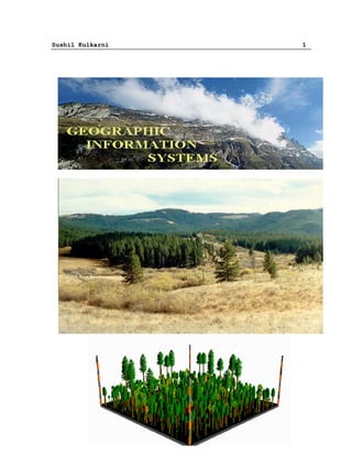
1. Sushil Kulkarni 11 6.2 Data base management and analysis Data base management and analysis include the data characteristics and analysis techniques required for each application. Data base requirements include data acquisition costs, manipulation costs, data quality, data scales, and data base size. Data analysis techniques are the functional capabilities of the software and hardware, which impact system configurations. Data base requirements can vary widely depending on the scope of the application; eco- system, individual refuge, state, etc. The type of data also impacts the size of the files. GIS data undergoes various types of analysis. For example, in applications such as soil erosion studies, environmental impact studies etc. 6.3 Data Integration GIS must integrate both vector and raster data from a variety of sources. Some times edges and regions are inferred from a raster image to form a vector model, or conversely, raster images such as aerial photographs are used to update vector models. 6.4 Data capture The spatial representations of data set are most commonly stored as either vector features or as raster data sets along with traditional tabular attributes. For example, an RDBMS table can be used to store a feature collection where each row in the table represents a feature. A shape column in each row is used to hold the geometry or shape of the feature. The shape column holding the geometry is typically one of two column types: · A binary large object (BLOB) column type · A spatial column type A homogenous collection of common features, each having the same spatial representation, such as a point, line, or polygon, and a common set of attribute columns is referred to as a feature class and is managed in a single table Raster and imagery data types are managed and stored in relational tables as well. Raster data is typically much larger in size and requires an associated side table for storage. During the storage process the software cuts the raster into smaller pieces, called "blocks," and stores them in individual rows in the separate block table. 7. GIS data operations Following are the different operations used in GIS: Sushiltry@yahoo.co.in
  • 12. Sushil Kulkarni 12 A GIS consists of a data base coupled with a graphics output. There are three major types of operations in a GIS: 1.Access methods The user will want to access data elements with certain properties. There are three questions involved here. The first is whether the requested data is available in the system. The second question is how long it will take to find the data. Spatial data structures pose unusual indexing problems and are a topic unto themselves Usually some variation of a quadtree (for 2D) or octree (for 3D) is used. The third question is how the user accesses the data. The conventional query language SQL is sometimes used. 2.Analytical operations Analytical operations allow the user to combine data to produce new data. The most important operation is the overlay of different spatial data sets to produce a new data set. For example, a biologist might want to determine what variables affect the population of dolphins. For a given part of the ocean, there may be measurements for water temperature, different fish populations, including predators (sharks), different types of pollution levels, etc. The biologist could then try to find correlations. Note that this is a multivariate visualization problem. The analytical operations can also include computations to produce a new data set. 3. Rendering Rendering operations show the data as some sort of map with the additional information displayed. This is where Visualization techniques can be applied to GIS. 4. Interpolation This interpolation technique is a method where a series of iterations are made over a surface to smooth it out. There are three options, which can be set for stopping the iterations whenever any one of the specified conditions is met. § The first option specifies the maximum number of iterations the routine should perform on the map data before stopping. § The second option specifies the tolerance for convergence (percent of range) as a percentage of the range of elevations represented in the map. The routine will stop when the maximum change in any pixel is less then the specified tolerance. A value of 0.5% for a map with elevations of 3,560 to 5,600 ft. equals a change of 10.2 feet or less. Sushiltry@yahoo.co.in
  • 13. Sushil Kulkarni 13 § The third option is Convergence Tolerance (Absolute) which stops iterations when the maximum change in any pixel is less than the specified value. The value is given in map elevation units, usually feet. 5. Class of Proximity analysis Several classes can be developed to analysis the interest of a particular region like the determination of signal failure on highway, locating shortest path using shortest path algorithms using 2D or 3D information are the important classes of proximity analysis. 6. Raster image processing This process is divided in to two categories: (1) To produce new map from the existing geographical features on different map layers algebraically using map algebra. (2) Digital image analysis is used to detect the edges and objects. For example, detection of roads in a satellite image of a city.