Mesopotamia
•Als PPT, PDF herunterladen•
10 gefällt mir•13,842 views


Empfohlen
Weitere ähnliche Inhalte
Was ist angesagt?
Was ist angesagt? (20)
Ähnlich wie Mesopotamia
Ähnlich wie Mesopotamia (20)
Mehr von Hamzah Meraj, Faculty of Architecture, Jamia Millia Islamia, New delhi
Mehr von Hamzah Meraj, Faculty of Architecture, Jamia Millia Islamia, New delhi (20)
Kürzlich hochgeladen
Kürzlich hochgeladen (20)
Mesopotamia
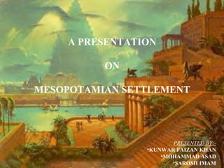
- 1. A PRESENTATION ON MESOPOTAMIAN SETTLEMENT PRESENTED BY:•KUNWAR FAIZAN KHAN •MOHAMMAD ASAD •SAROSH IMAM
- 2. INTRODUCTION • Mesopotamia is a Greek word that means the land between two rivers the Tigris and the Euphrates. • Around 3500 B.C small agricultural pottery making and cloth weaving in villages were transmitted through societies of cities. • Initial settlement on the northern plains, with movement out to the south and west from 6000 BC. • Mesopotamia does not refer to any particular civilization. Over the course of several millennia, many civilizations developed, collapsed, and were replaced in this region including the Sumerians, Akkadians, Babylonians and Assyrians.
- 3. EUROPE Caspian Sea Black S ea Aral Sea ASIA Mesopotamia Mediterranean Sea GEOGRAPHY AFRICA Red Sea 500 km Jazira Plateau Arabian Sea • Samarra Dyala Fan Ramadi Fallujah Zagros Mountains Baghdad Ti gr is Kut Diwanyiah Najaf E u Amarah ph ra te Samawah s Karun Fan • Nasyriyah at Sh Basrah lA ta Arabian Platform areas outside Mesopotamian b ra Wadi Fan 100 km Persian Gulf depression alluvial plain the zone of marshes and lakes ('Ahwar') estuary alluvial fans • Alluvial plains surrounded on two sides by better watered mountainous zones. Summer drought and winter rains although the lowland plains receive minimal rainfall. Where the Tigris and Euphrates rivers join, the land is flat and there are many marshy areas. This unecompassed spaced presented no natural barrier to invaders and indeed there was continual warfare in the region. Areas near rivers protected from flooding - elevated above the river.Within reach of irrigation water and the closer they were to the river the greater their productivity.
- 4. CLIMATE • The climate is exceedingly hot, but also very humid - the floods often unpredictable. Mesopotamians were at the mercy of their hostile environment, and believed themselves to be at the mercy of angry and irrational gods. The civilization which produced one of the seven wonders of the ancient world; the hanging gardens of Babylon, also compiled the Epic of Gilgamesh, a pessimistic portrayal of the futile search for immortality and human meaning. City states rose and fell, empires rose and fell, yet the human spirit of the Mesopotamians endured.
- 5. FAVOURABLE CONDITION • Favorable geographic circumstances allowed the peoples of Mesopotamia to evolve from a hunter-gatherer culture to a culture based on husbandry, agriculture, and permanent settlements • Trade with other regions also flourished, as indicated by the presence in early burial sites of metals and precious stones not locally available • The rich wildlife was probably what first attracted humans to the Mesopotamian plain. The Southern plain, outside the area of rain, fed agriculture, but, over the millennia, the rivers have laid down thick deposits of very fertile silt and, once water is brought to this soil in ditches and canals, it proves a very attractive area to farmers. For materials such as wood, stone and metals, however, people have to look North and East, to the mountains where the first settlers had originated.
- 6. COMPARISON WITH EGYPTIAN CIVILIZATION • Civilization developed in Mesopotamia simultaneously with Egypt and the two are often called the 'Fertile Crescent'. • In contrast to the clear cut Nile valley rich valley of Tigris and Euphrates river had ill defined edges. To the south and west the areas faded into the emptiness of Arabia to the west to the north into the fertile plain of Syria and to east foothill merge with Persian and Armenian highland.
- 8. SETTLEMENT PATTERN Toward the end of the early dynastic period change in settlement pattern. Small villages that surrounded the cities disappear and the cities themselves grow in size. Many of the rural people moved to the new fortified cities such as Uruk. In response to increased inter-city warfare related to the dominance of the secular-based ruling elite.The growing power of a military based authority could have been a crucial factor in the rise of cities and state society • Neolithic: No substantial settlement in southern Mesopotamia before 5500BC. From 6000BC to 4000BC settlement expanded from the uplands to incorporate more and more of the Mesopotamian plain. • The Ubaid :culture expands to northern Mesopotamia, seen by the presence of shared material culture particularly painted pottery. The Ubaid culture was the foundation culture of Mesopotamia with temple centred settlements that administered exchange. • Eridu: Eridu established by 5400 BC initially 1-2 ha for the whole site. Located in the extreme south of the Mesopotamian plain. Agriculture around Eridu is dependent on irrigation with wheat, barley, sheep, goats and cattle. Possible that irrigation management is responsible for the expansion and elaboration of the temple institution.
- 9. • Uruk: Uruk earliest urban centre to form a city state. A number of cities develop at the same time. From the middle of the 4th millennium BC one city in each of the proto-states becomes dominant, the most important being Uruk. Development concentrated in the south. The cities have large walls, and mud brick buildings that create tells • At Uruk a precinct where several temples were adjacent. Temples associated with ziggurats -stepped towers the temples have large storage facilities. They are the redistributive centers for both agricultural produce and craft goods. The temple joined by a palace suggesting religion supporting secular control. Some temples built on a large platform or ziggurat to make them even more impressive. • Akkadian Empire. The city states only ever unified for short periods of time before they collapsed back to individual cities. Sargon of Agade conquered Kish and spread south from there. His success led to the fall of the last of the Sumerian rulers and the establishment of the Akkadian empire. The empire lasted from 2350-2150 BC. A more integrated system of trade developed controlled by the palace. But it did not create a long-lived political or economic system
- 10. FACTORS AFECTING SETTLEMENT DISTRIBUTION A’ avulsion point new ch annel b e lt A avu lsed c ha nne l bel t Avulsion is a major river diversion to a lower elevation on the floodplain in which the older channel becomes abandoned and a new channel is initiated.
- 11. FACTORS THAT MAY AFFECT SETTLEMENT DISTRIBUTION • Avulsion rate (abrupt vs gradual abandonment of former channel) • Avulsion frequency (number of avulsions during certain period of time) • Avulsion style (reoccupational vs progradational) - reoccupation: flow occupies channel previously existing channel on floodplain (e.g. former major channel or smaller stream channel) - progradation: avulsion belt is deposited following avulsion, followed by formation of a new single channel; • Channel pattern following avulsion (single channel or multiple channel system)
- 12. PRELIMINARY CONCLUSIONS • Avulsions and resulting channel and sedimentation patterns affected the distribution and sizes of irrigated floodplain, quality of soils, and, therefore, settlement patterns; • Progradational avulsions with avulsion belts created conditions for local increase in naturally-irrigated area with well-drained soils, generation of food surpluses and population migration toward area possibly leading to appearance of urban settlements; • During and after abandonment of avulsion belts and multiple channel networks in favor of two-channel or single-channel system, extensive canal construction was required to maintain urban and many rural settlements, eventually abandoned (probably due to increased inefficiency) during mid-Islamic period.
- 13. GOVERNMENT • Mesopotamia did not have protection from natural boundaries. This led to constant migrations of Indo-European people from the area between the Black and Caspian seas. This lead to a constant migration and 'Cultural Diffusion', or the process where an existing culture adopts the traits of another and the two eventually merge into a new culture. As a result, a strong central government failed to develop in Mesopotamia. The dominant political unit was the 'City-State', a small area surrounding a large, complex city.
- 14. ANCIENT MESOPOTAMIAN CITIES • • • Were located on river banks and surrounded by their countryside with ‘corona’ of irrigation agriculture; sustaining area per individual was estimated between 0.5-1.5 ha/person; daily travel distances from city to countryside did not exceed 3-4 km for maximum agricultural productivity;
- 15. URUK • • • At the end of the fourth millennium, Uruk was probably the largest city in the world (estimated by some scholars at 400 hectares - the size of Rome in the first century of our Common Era). Centered on the important temple (ziggurat) of Inanna (the Great Goddess of Love and War), the city has produced beautiful stone sculptures depicting the temple flocks of sheep and goats The city is believed to have been surrounded by moats.
- 16. • Of more significance, however, is the discovery at Uruk of the world's earliest recorded writing. Using a reed stylus to draw on tablets of clay, the temple administrators recorded the movement of agricultural produce and out of the temple storerooms including beer, bread and sheep. • Initially the records took the form of pictures of the objects being counted together with signs representing numerals. Gradually, these pictographs became more stylized and wedge-like or cuneiform (Latin for wedge = cuneus) and adapted to write the local language, or Sumerian. • The ability to write allowed the Sumerians to record not only lists of goods but also events around them. This development therefore takes us from pre-history to history.
- 17. THE CITY OF UR • Around 2350 BCE the southern city states were united into one empire by Sargon, king of the city of Akkad (also read as Agade). The administration was centralised and the Semitic language Akkadian (named after Sargon's capital) was introduced as the official language in preference to Sumerian. Akkad has not been located but the period produced some astonishing works of art, including fine cylinder seals. • Sargon and his sons ruled Mesopotamia for 150 years. The Akkadian Empire had collapsed and Mesopotamia was in turmoil. The southern cities began to reassert their independence. Chief among these was the city of Ur. Under king Ur-Nammu, the city established itself as the capital of an empire that rivalled that of the Akkadian rulers.
- 18. • Ur-Nammu was a prodigious builder. The most impressive monument of his reign was the ziggurat at Ur. Although similar in shape to the pyramids of Egypt, ziggurats were not tombs but made of solid brickwork. • Often, as at Ur, three staircases led up one side of the tower to several stages. At the summit was a shrine to the god. `
- 19. BABYLONIA • Around 1780 BCE as king of the small town of Babylon, Hammurapi united Southern Mesopotamia into a single empire. • Hammurapi is best remembered for his code of laws (the famous stela of Hammurapi is now in the Louvre in Paris). Hammurapi's death caused his empire to fall apart. Despite this, the city of Babylon was to remain the capital of a Southern kingdom • Sixty years of Babylonian supremacy was threatened during the reign of king Nabonidus, when Mesopotamia was faced with the expansion of yet another eastern power, the Persians. In 539 BCE, the armies of the Persian king Cyrus (a member of the Achaemenid family) marched upon Babylon and captured the city and with it all the Neo-Babylonian Empire. • This, in effect, brought to an end three thousand years of self-rule in Mesopotamia. While many of the traditions and way of life in the region continued under the new rulers, Mesopotamia was now part of the much greater empire of the Persians which stretched from Egypt to India • Over the next 200 years the region would see the advance of Greek civilisation and the eventual destruction of the Persian Empire at the hand of the Macedonian king Alexander the Great.
- 20. LANGUAGE • Mesopotamians had one of the first recorded languages.It was invented to keep track of farming and trade.The form of writing, called Pictograms that was used by the Mesopotamians was very simple. • One mark indicated a number, the other indicated what was being counted. The writing was done by marking wet clay with a reed. Efficient and easy as this was it became much more difficult with higher numbers. • Gradually this system became out-dated and indograms came into use
- 21. PATTERNS IN URBAN PLANNING • • • • Massive size compared to previous settlements Complex central administration Greater concentration of people Size does not necessarily equal population. there were space devoted to gardens, grazing land, etc. • Location near rivers in order to control waterway • New urban form--> citadel with closely-linked templepalace unit, separated from rest of town by height or walls • Mesopotamian tradition of seeing universe as square, reflected in ground plans.
- 22. THANK YOU!