Global Navigations Satellite System (GNSS) Indonesia
•Als PPTX, PDF herunterladen•
4 gefällt mir•1,663 views

Global Navigations Satellite System (GNSS) Indonesia

Empfohlen
Weitere ähnliche Inhalte
Was ist angesagt?
Was ist angesagt? (20)
Andere mochten auch
Andere mochten auch (20)
Ähnlich wie Global Navigations Satellite System (GNSS) Indonesia
Ähnlich wie Global Navigations Satellite System (GNSS) Indonesia (20)
Mehr von Edi Supriyanto
Mehr von Edi Supriyanto (20)
Kürzlich hochgeladen
Kürzlich hochgeladen (20)
Global Navigations Satellite System (GNSS) Indonesia
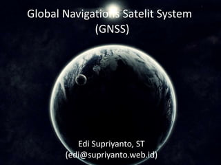
- 1. Global Navigations Satelit System (GNSS) Edi Supriyanto, ST (edi@supriyanto.web.id)
- 2. What is GNSS and how it works? • GNSS (Global navigation Satellite System) is a satellite system that is used to pinpoint the geographic location of a user’s receiver anywhere in the world. • It allows small electronic receivers to determine the latitude, longitude and altitude of a point • It use time signals transmitted along a line of sight by radio from satellites. • Receivers calculate the precise time as well as position, wich can be used as a reference for scientific experiments. Edi Supriyanto, ST (edi@supriyanto.web.id)
- 3. Satellite navigation systems that provide enhanced accuracy and integrity monitoring usable for civil navigation GPS (United States) GLONASS (Russian Federation) Galileo (European Union) Compass (China) Satellite Navigation System Edi Supriyanto, ST (edi@supriyanto.web.id)
- 4. Every country has agency in charge to build and maintain national geodetic control points throughout the country. They play an important role in the national surveying activities as the source of the base data including triangulation points for precise positional data (longitude and latitude), benchmarks (elevation) and such. National Geodetic Survey Edi Supriyanto, ST (edi@supriyanto.web.id)
- 5. Since the early 2007, Edi Supriyanto & Partners has been at the forefront of providing leading-edge surveying solutions. Our extensive experience and expertise makes us unique in an industry that is characterized by frequent change and uncertainty. We offer a broad expanse of product solutions, including the latest GPS/GNSS technologies from the leader in the industry. Our Services & Portfolio Edi Supriyanto, ST (edi@supriyanto.web.id)
- 6. Portfolio: National Geodetic Survey (Timorleste) Indonesia Team Members: Edi Supriyanto Adyanta Karo-Karo Arys Setya Gusmana Christanto Nainggolan Sugandi Agus Prasetyo Widodo
- 7. Planned Geodetic Network for Timor Leste. Edi Supriyanto, ST (edi@supriyanto.web.id)
- 8. First Order Benchmark in Raça Edi Supriyanto, ST (edi@supriyanto.web.id)
- 9. Field Work Area Edi Supriyanto, ST (edi@supriyanto.web.id)
- 10. Observation Vectors for Dili Edi Supriyanto, ST (edi@supriyanto.web.id)
- 11. 2nd Order Geodetic Points Edi Supriyanto, ST (edi@supriyanto.web.id)
- 12. Site Documentation Edi Supriyanto, ST (edi@supriyanto.web.id)
- 13. Site Documentation Edi Supriyanto, ST (edi@supriyanto.web.id)
- 14. Site Documentation Edi Supriyanto, ST (edi@supriyanto.web.id)
- 15. Site Documentation Edi Supriyanto, ST (edi@supriyanto.web.id)
- 16. Site Documentation Edi Supriyanto, ST (edi@supriyanto.web.id)
- 17. Site Documentation Edi Supriyanto, ST (edi@supriyanto.web.id)
- 18. Site Documentation Edi Supriyanto, ST (edi@supriyanto.web.id)
- 19. Site Documentation Edi Supriyanto, ST (edi@supriyanto.web.id)
- 20. Site Documentation Edi Supriyanto, ST (edi@supriyanto.web.id)
- 21. Site Documentation Edi Supriyanto, ST (edi@supriyanto.web.id)
- 22. Site Documentation Edi Supriyanto, ST (edi@supriyanto.web.id)
- 23. Site Documentation Edi Supriyanto, ST (edi@supriyanto.web.id)
- 24. Site Documentation Edi Supriyanto, ST (edi@supriyanto.web.id)
- 25. Site Documentation Edi Supriyanto, ST (edi@supriyanto.web.id)
- 26. Site Documentation Edi Supriyanto, ST (edi@supriyanto.web.id)
- 27. Site Documentation Edi Supriyanto, ST (edi@supriyanto.web.id)
- 28. Site Documentation Edi Supriyanto, ST (edi@supriyanto.web.id)
- 29. Site Documentation Edi Supriyanto, ST (edi@supriyanto.web.id)
- 30. Site Documentation Edi Supriyanto, ST (edi@supriyanto.web.id)
- 31. Site Documentation Edi Supriyanto, ST (edi@supriyanto.web.id)
- 32. Site Documentation Edi Supriyanto, ST (edi@supriyanto.web.id)
- 33. Site Documentation Edi Supriyanto, ST (edi@supriyanto.web.id)
- 34. Site Documentation Edi Supriyanto, ST (edi@supriyanto.web.id)
- 35. Site Documentation Edi Supriyanto, ST (edi@supriyanto.web.id)
- 36. Site Documentation Edi Supriyanto, ST (edi@supriyanto.web.id)
- 37. Site Documentation Edi Supriyanto, ST (edi@supriyanto.web.id)
- 38. Site Documentation Edi Supriyanto, ST (edi@supriyanto.web.id)
- 39. Site Documentation Edi Supriyanto, ST (edi@supriyanto.web.id)
- 40. Site Documentation Edi Supriyanto, ST (edi@supriyanto.web.id)
- 41. Site Documentation Edi Supriyanto, ST (edi@supriyanto.web.id)
- 42. Site Documentation Edi Supriyanto, ST (edi@supriyanto.web.id)
- 43. Site Documentation Edi Supriyanto, ST (edi@supriyanto.web.id)
- 44. Site Documentation Edi Supriyanto, ST (edi@supriyanto.web.id)
- 45. Site Documentation Edi Supriyanto, ST (edi@supriyanto.web.id)
- 46. Site Documentation Edi Supriyanto, ST (edi@supriyanto.web.id)
- 47. Site Documentation Edi Supriyanto, ST (edi@supriyanto.web.id)
- 48. Site Documentation Edi Supriyanto, ST (edi@supriyanto.web.id)
- 49. Site Documentation Edi Supriyanto, ST (edi@supriyanto.web.id)
- 50. Site Documentation Edi Supriyanto, ST (edi@supriyanto.web.id)
- 51. Site Documentation Edi Supriyanto, ST (edi@supriyanto.web.id)
- 52. Site Documentation Edi Supriyanto, ST (edi@supriyanto.web.id)
- 53. Site Documentation Edi Supriyanto, ST (edi@supriyanto.web.id)
- 54. Manual Document
- 56. The mission has been completed Edi Supriyanto, ST (edi@supriyanto.web.id)
- 57. Thank You