SlideShare ist ein Scribd-Unternehmen logo
1 von 8
Concepts and Functions of Geographic Information Systems (4/5) MSc GIS - Alexander Mogollon Diaz Department of Agronomy 2009
Concepts and Functions of GIS .PPT Topic #1 Topic #2 Topic #3 1 A GIS is an information system GIS is a technology 2 Spatial Data modelling Sources of data for geodatasets Metadata 3 Geo-referencing Coordinate transformations 4 Database management 5 Spatial Analysis
Functionalities of GIS INPUT   QUERY - DISPLAY - MAP ANALYSE STRUCTURE MANAGE TRANSFORM
Databases are managed with a DBMS ,[object Object],[object Object],[object Object],[object Object],[object Object],[object Object],[object Object],[object Object],[object Object],[object Object],[object Object]
Also gDB are managed with a DBMS A/D conversion Structuring Computing functions Other functions Data collection Database Information System Managed with DBMS
Hybrid GIS DBMS for geometry <> DBMS for attributes polygon line point TIN categoric raster image lattice Specific (file-based) DBMS Standardised (relational) DBMS Arc- Info ArcView –  dBase/Access
Integrated/Universal GIS   DBMS for geometry <> DBMS for attributes polygon line point TIN categoric raster image lattice Standardised (relational) DBMS ,[object Object],[object Object],[object Object]
Questions or remarks ? Thank you …

Weitere ähnliche Inhalte

Was ist angesagt?

Vector data model
Vector data model Vector data model
Vector data model Pramoda Raj
 
Remote Sensing: Overlay Analysis
Remote Sensing: Overlay AnalysisRemote Sensing: Overlay Analysis
Remote Sensing: Overlay AnalysisKamlesh Kumar
 
Introduction to gis
Introduction to gisIntroduction to gis
Introduction to gisJay_mittal
 
Lect 7 &amp; 8 types of vector data model-gis
Lect 7 &amp; 8 types of vector data model-gisLect 7 &amp; 8 types of vector data model-gis
Lect 7 &amp; 8 types of vector data model-gisRehana Jamal
 
Conversion of Existing Data
Conversion of Existing DataConversion of Existing Data
Conversion of Existing DataTilok Chetri
 
Lecture+12+topology+2013 (3)
Lecture+12+topology+2013 (3)Lecture+12+topology+2013 (3)
Lecture+12+topology+2013 (3)Mei Chi Lo
 
TYBSC IT PGIS Unit IV Spacial Data Analysis
TYBSC IT PGIS Unit IV  Spacial Data AnalysisTYBSC IT PGIS Unit IV  Spacial Data Analysis
TYBSC IT PGIS Unit IV Spacial Data AnalysisArti Parab Academics
 
datamodel_vector
datamodel_vectordatamodel_vector
datamodel_vectorRiya Gupta
 
Data models in geographical information system(GIS)
Data models in geographical information system(GIS)Data models in geographical information system(GIS)
Data models in geographical information system(GIS)Pramoda Raj
 
5 spatial data editing
5 spatial data editing5 spatial data editing
5 spatial data editinganita bodke
 

Was ist angesagt? (18)

Raster data and Vector data
Raster data and Vector dataRaster data and Vector data
Raster data and Vector data
 
Vector data model
Vector data model Vector data model
Vector data model
 
Remote Sensing: Overlay Analysis
Remote Sensing: Overlay AnalysisRemote Sensing: Overlay Analysis
Remote Sensing: Overlay Analysis
 
Introduction to gis
Introduction to gisIntroduction to gis
Introduction to gis
 
Spatial data for GIS
Spatial data for GISSpatial data for GIS
Spatial data for GIS
 
Lect 7 &amp; 8 types of vector data model-gis
Lect 7 &amp; 8 types of vector data model-gisLect 7 &amp; 8 types of vector data model-gis
Lect 7 &amp; 8 types of vector data model-gis
 
Conversion of Existing Data
Conversion of Existing DataConversion of Existing Data
Conversion of Existing Data
 
Lecture+12+topology+2013 (3)
Lecture+12+topology+2013 (3)Lecture+12+topology+2013 (3)
Lecture+12+topology+2013 (3)
 
Gis Concepts 1/5
Gis Concepts 1/5Gis Concepts 1/5
Gis Concepts 1/5
 
Georeferencing
GeoreferencingGeoreferencing
Georeferencing
 
Vector data model
Vector data modelVector data model
Vector data model
 
TYBSC IT PGIS Unit IV Spacial Data Analysis
TYBSC IT PGIS Unit IV  Spacial Data AnalysisTYBSC IT PGIS Unit IV  Spacial Data Analysis
TYBSC IT PGIS Unit IV Spacial Data Analysis
 
datamodel_vector
datamodel_vectordatamodel_vector
datamodel_vector
 
Data models in geographical information system(GIS)
Data models in geographical information system(GIS)Data models in geographical information system(GIS)
Data models in geographical information system(GIS)
 
functions of GIS
functions of GISfunctions of GIS
functions of GIS
 
5 spatial data editing
5 spatial data editing5 spatial data editing
5 spatial data editing
 
GIS Modeling
GIS ModelingGIS Modeling
GIS Modeling
 
Info Grafix
Info GrafixInfo Grafix
Info Grafix
 

Andere mochten auch

Geographic information system and remote sensing
Geographic information system and remote sensingGeographic information system and remote sensing
Geographic information system and remote sensingDhiren Patel
 
An Introduction to Mapping, GIS and Spatial Modelling in R (presentation)
An Introduction to Mapping, GIS and Spatial Modelling in R (presentation)An Introduction to Mapping, GIS and Spatial Modelling in R (presentation)
An Introduction to Mapping, GIS and Spatial Modelling in R (presentation)Rich Harris
 
Gis powerpoint
Gis powerpointGis powerpoint
Gis powerpointkaushdave
 
Spatial vs non spatial
Spatial vs non spatialSpatial vs non spatial
Spatial vs non spatialSumant Diwakar
 
ppt spatial data
ppt spatial datappt spatial data
ppt spatial dataRahul Kumar
 
Photogrammetry- Surveying
Photogrammetry- SurveyingPhotogrammetry- Surveying
Photogrammetry- SurveyingGokul Saud
 
Lecture on photogrammetry
Lecture on photogrammetryLecture on photogrammetry
Lecture on photogrammetryWaleed Liaqat
 
"GPS" Global Positioning System [PDF]
"GPS" Global Positioning System  [PDF]"GPS" Global Positioning System  [PDF]
"GPS" Global Positioning System [PDF]Course Hero
 
Welcome to the presentation on ‘total station
Welcome to the presentation on ‘total stationWelcome to the presentation on ‘total station
Welcome to the presentation on ‘total stationShashank Javalagi
 
Remote sensing ppt
Remote sensing pptRemote sensing ppt
Remote sensing pptcoolmridul92
 
Global positioning System
Global positioning SystemGlobal positioning System
Global positioning Systemayushrajput
 
Gis (geographic information system)
Gis (geographic information system)Gis (geographic information system)
Gis (geographic information system)Saad Bare
 

Andere mochten auch (20)

Gis Concepts 2/5
Gis Concepts 2/5Gis Concepts 2/5
Gis Concepts 2/5
 
Geographic information system and remote sensing
Geographic information system and remote sensingGeographic information system and remote sensing
Geographic information system and remote sensing
 
An Introduction to Mapping, GIS and Spatial Modelling in R (presentation)
An Introduction to Mapping, GIS and Spatial Modelling in R (presentation)An Introduction to Mapping, GIS and Spatial Modelling in R (presentation)
An Introduction to Mapping, GIS and Spatial Modelling in R (presentation)
 
Gis Concepts 3/5
Gis Concepts 3/5Gis Concepts 3/5
Gis Concepts 3/5
 
Gis powerpoint
Gis powerpointGis powerpoint
Gis powerpoint
 
Spatial vs non spatial
Spatial vs non spatialSpatial vs non spatial
Spatial vs non spatial
 
ppt spatial data
ppt spatial datappt spatial data
ppt spatial data
 
remote sensing
remote sensingremote sensing
remote sensing
 
Photogrammetry 1.
Photogrammetry 1.Photogrammetry 1.
Photogrammetry 1.
 
Photogrammetry- Surveying
Photogrammetry- SurveyingPhotogrammetry- Surveying
Photogrammetry- Surveying
 
GIS Data Types
GIS Data TypesGIS Data Types
GIS Data Types
 
Total station
Total stationTotal station
Total station
 
Lecture on photogrammetry
Lecture on photogrammetryLecture on photogrammetry
Lecture on photogrammetry
 
"GPS" Global Positioning System [PDF]
"GPS" Global Positioning System  [PDF]"GPS" Global Positioning System  [PDF]
"GPS" Global Positioning System [PDF]
 
Welcome to the presentation on ‘total station
Welcome to the presentation on ‘total stationWelcome to the presentation on ‘total station
Welcome to the presentation on ‘total station
 
Open Channel Flow
Open Channel FlowOpen Channel Flow
Open Channel Flow
 
Remote sensing ppt
Remote sensing pptRemote sensing ppt
Remote sensing ppt
 
Global positioning System
Global positioning SystemGlobal positioning System
Global positioning System
 
Gis (geographic information system)
Gis (geographic information system)Gis (geographic information system)
Gis (geographic information system)
 
Gps ppt
Gps pptGps ppt
Gps ppt
 

Ähnlich wie Gis Concepts 4/5

Data base management system
Data base management systemData base management system
Data base management systemPramoda Raj
 
Dsm Presentation
Dsm PresentationDsm Presentation
Dsm Presentationrichoe
 
Introduction to arc gis
Introduction to arc gisIntroduction to arc gis
Introduction to arc gisMohamed Hamed
 
Unit 4 Data Input and Analysis.pptx
Unit 4 Data Input and Analysis.pptxUnit 4 Data Input and Analysis.pptx
Unit 4 Data Input and Analysis.pptxe20ag004
 
SPATIAL DATABASES.pptx
SPATIAL DATABASES.pptxSPATIAL DATABASES.pptx
SPATIAL DATABASES.pptxAmanSingla57
 
Giving MongoDB a Way to Play with the GIS Community
Giving MongoDB a Way to Play with the GIS CommunityGiving MongoDB a Way to Play with the GIS Community
Giving MongoDB a Way to Play with the GIS CommunityMongoDB
 
Geographic information system
Geographic information systemGeographic information system
Geographic information systemOssamaElShanawany
 
Evolution of Esri Data Formats Seminar
Evolution of Esri Data Formats SeminarEvolution of Esri Data Formats Seminar
Evolution of Esri Data Formats SeminarEsri South Africa
 
Lecture-8-The-GIS-Database-Part-1.ppt
Lecture-8-The-GIS-Database-Part-1.pptLecture-8-The-GIS-Database-Part-1.ppt
Lecture-8-The-GIS-Database-Part-1.pptPrabin Pandit
 
Geodatabase: The ArcGIS Mechanism for Data Management
Geodatabase: The ArcGIS Mechanism for Data ManagementGeodatabase: The ArcGIS Mechanism for Data Management
Geodatabase: The ArcGIS Mechanism for Data ManagementEsri South Africa
 
Introduction To Geographical Information System (GIS)
Introduction To Geographical Information System (GIS) Introduction To Geographical Information System (GIS)
Introduction To Geographical Information System (GIS) Ajay Singh Lodhi
 
Chap1 introduction to geographic information system (gis)
Chap1 introduction to geographic information system (gis)Chap1 introduction to geographic information system (gis)
Chap1 introduction to geographic information system (gis)Mweemba Hachita
 
Towards and adaptable spatial processing architecture
Towards and adaptable spatial processing architectureTowards and adaptable spatial processing architecture
Towards and adaptable spatial processing architectureArmando Guevara
 
gislec1.ppt
gislec1.pptgislec1.ppt
gislec1.pptfelip19
 
Database Development Strategies
Database Development StrategiesDatabase Development Strategies
Database Development StrategiesProf. Erwin Globio
 
the title of this course is Entitles as GIS and Remote sensing
the title of this course is Entitles as GIS and Remote sensingthe title of this course is Entitles as GIS and Remote sensing
the title of this course is Entitles as GIS and Remote sensingmulugeta48
 
SIG-04-Databases.pptx
SIG-04-Databases.pptxSIG-04-Databases.pptx
SIG-04-Databases.pptxHugoDeConello
 

Ähnlich wie Gis Concepts 4/5 (20)

Data base management system
Data base management systemData base management system
Data base management system
 
Dsm Presentation
Dsm PresentationDsm Presentation
Dsm Presentation
 
Introduction to arc gis
Introduction to arc gisIntroduction to arc gis
Introduction to arc gis
 
Unit 4 Data Input and Analysis.pptx
Unit 4 Data Input and Analysis.pptxUnit 4 Data Input and Analysis.pptx
Unit 4 Data Input and Analysis.pptx
 
Introduction To GIS
Introduction To GISIntroduction To GIS
Introduction To GIS
 
SPATIAL DATABASES.pptx
SPATIAL DATABASES.pptxSPATIAL DATABASES.pptx
SPATIAL DATABASES.pptx
 
Giving MongoDB a Way to Play with the GIS Community
Giving MongoDB a Way to Play with the GIS CommunityGiving MongoDB a Way to Play with the GIS Community
Giving MongoDB a Way to Play with the GIS Community
 
Geographic information system
Geographic information systemGeographic information system
Geographic information system
 
Introduction to GIS
Introduction to GISIntroduction to GIS
Introduction to GIS
 
Evolution of Esri Data Formats Seminar
Evolution of Esri Data Formats SeminarEvolution of Esri Data Formats Seminar
Evolution of Esri Data Formats Seminar
 
Lecture-8-The-GIS-Database-Part-1.ppt
Lecture-8-The-GIS-Database-Part-1.pptLecture-8-The-GIS-Database-Part-1.ppt
Lecture-8-The-GIS-Database-Part-1.ppt
 
Geodatabase: The ArcGIS Mechanism for Data Management
Geodatabase: The ArcGIS Mechanism for Data ManagementGeodatabase: The ArcGIS Mechanism for Data Management
Geodatabase: The ArcGIS Mechanism for Data Management
 
Introduction To Geographical Information System (GIS)
Introduction To Geographical Information System (GIS) Introduction To Geographical Information System (GIS)
Introduction To Geographical Information System (GIS)
 
Chap1 introduction to geographic information system (gis)
Chap1 introduction to geographic information system (gis)Chap1 introduction to geographic information system (gis)
Chap1 introduction to geographic information system (gis)
 
Towards and adaptable spatial processing architecture
Towards and adaptable spatial processing architectureTowards and adaptable spatial processing architecture
Towards and adaptable spatial processing architecture
 
gislec1.ppt
gislec1.pptgislec1.ppt
gislec1.ppt
 
Database Development Strategies
Database Development StrategiesDatabase Development Strategies
Database Development Strategies
 
Gislec1
Gislec1Gislec1
Gislec1
 
the title of this course is Entitles as GIS and Remote sensing
the title of this course is Entitles as GIS and Remote sensingthe title of this course is Entitles as GIS and Remote sensing
the title of this course is Entitles as GIS and Remote sensing
 
SIG-04-Databases.pptx
SIG-04-Databases.pptxSIG-04-Databases.pptx
SIG-04-Databases.pptx
 

Kürzlich hochgeladen

Nutritional Needs Presentation - HLTH 104
Nutritional Needs Presentation - HLTH 104Nutritional Needs Presentation - HLTH 104
Nutritional Needs Presentation - HLTH 104misteraugie
 
Accessible design: Minimum effort, maximum impact
Accessible design: Minimum effort, maximum impactAccessible design: Minimum effort, maximum impact
Accessible design: Minimum effort, maximum impactdawncurless
 
Sports & Fitness Value Added Course FY..
Sports & Fitness Value Added Course FY..Sports & Fitness Value Added Course FY..
Sports & Fitness Value Added Course FY..Disha Kariya
 
Unit-V; Pricing (Pharma Marketing Management).pptx
Unit-V; Pricing (Pharma Marketing Management).pptxUnit-V; Pricing (Pharma Marketing Management).pptx
Unit-V; Pricing (Pharma Marketing Management).pptxVishalSingh1417
 
Unit-IV- Pharma. Marketing Channels.pptx
Unit-IV- Pharma. Marketing Channels.pptxUnit-IV- Pharma. Marketing Channels.pptx
Unit-IV- Pharma. Marketing Channels.pptxVishalSingh1417
 
fourth grading exam for kindergarten in writing
fourth grading exam for kindergarten in writingfourth grading exam for kindergarten in writing
fourth grading exam for kindergarten in writingTeacherCyreneCayanan
 
Z Score,T Score, Percential Rank and Box Plot Graph
Z Score,T Score, Percential Rank and Box Plot GraphZ Score,T Score, Percential Rank and Box Plot Graph
Z Score,T Score, Percential Rank and Box Plot GraphThiyagu K
 
Web & Social Media Analytics Previous Year Question Paper.pdf
Web & Social Media Analytics Previous Year Question Paper.pdfWeb & Social Media Analytics Previous Year Question Paper.pdf
Web & Social Media Analytics Previous Year Question Paper.pdfJayanti Pande
 
Gardella_Mateo_IntellectualProperty.pdf.
Gardella_Mateo_IntellectualProperty.pdf.Gardella_Mateo_IntellectualProperty.pdf.
Gardella_Mateo_IntellectualProperty.pdf.MateoGardella
 
Beyond the EU: DORA and NIS 2 Directive's Global Impact
Beyond the EU: DORA and NIS 2 Directive's Global ImpactBeyond the EU: DORA and NIS 2 Directive's Global Impact
Beyond the EU: DORA and NIS 2 Directive's Global ImpactPECB
 
Advanced Views - Calendar View in Odoo 17
Advanced Views - Calendar View in Odoo 17Advanced Views - Calendar View in Odoo 17
Advanced Views - Calendar View in Odoo 17Celine George
 
Basic Civil Engineering first year Notes- Chapter 4 Building.pptx
Basic Civil Engineering first year Notes- Chapter 4 Building.pptxBasic Civil Engineering first year Notes- Chapter 4 Building.pptx
Basic Civil Engineering first year Notes- Chapter 4 Building.pptxDenish Jangid
 
psychiatric nursing HISTORY COLLECTION .docx
psychiatric  nursing HISTORY  COLLECTION  .docxpsychiatric  nursing HISTORY  COLLECTION  .docx
psychiatric nursing HISTORY COLLECTION .docxPoojaSen20
 
Class 11th Physics NEET formula sheet pdf
Class 11th Physics NEET formula sheet pdfClass 11th Physics NEET formula sheet pdf
Class 11th Physics NEET formula sheet pdfAyushMahapatra5
 
Application orientated numerical on hev.ppt
Application orientated numerical on hev.pptApplication orientated numerical on hev.ppt
Application orientated numerical on hev.pptRamjanShidvankar
 
Measures of Central Tendency: Mean, Median and Mode
Measures of Central Tendency: Mean, Median and ModeMeasures of Central Tendency: Mean, Median and Mode
Measures of Central Tendency: Mean, Median and ModeThiyagu K
 
Grant Readiness 101 TechSoup and Remy Consulting
Grant Readiness 101 TechSoup and Remy ConsultingGrant Readiness 101 TechSoup and Remy Consulting
Grant Readiness 101 TechSoup and Remy ConsultingTechSoup
 
Holdier Curriculum Vitae (April 2024).pdf
Holdier Curriculum Vitae (April 2024).pdfHoldier Curriculum Vitae (April 2024).pdf
Holdier Curriculum Vitae (April 2024).pdfagholdier
 
SOCIAL AND HISTORICAL CONTEXT - LFTVD.pptx
SOCIAL AND HISTORICAL CONTEXT - LFTVD.pptxSOCIAL AND HISTORICAL CONTEXT - LFTVD.pptx
SOCIAL AND HISTORICAL CONTEXT - LFTVD.pptxiammrhaywood
 

Kürzlich hochgeladen (20)

Nutritional Needs Presentation - HLTH 104
Nutritional Needs Presentation - HLTH 104Nutritional Needs Presentation - HLTH 104
Nutritional Needs Presentation - HLTH 104
 
Accessible design: Minimum effort, maximum impact
Accessible design: Minimum effort, maximum impactAccessible design: Minimum effort, maximum impact
Accessible design: Minimum effort, maximum impact
 
Sports & Fitness Value Added Course FY..
Sports & Fitness Value Added Course FY..Sports & Fitness Value Added Course FY..
Sports & Fitness Value Added Course FY..
 
Unit-V; Pricing (Pharma Marketing Management).pptx
Unit-V; Pricing (Pharma Marketing Management).pptxUnit-V; Pricing (Pharma Marketing Management).pptx
Unit-V; Pricing (Pharma Marketing Management).pptx
 
Unit-IV- Pharma. Marketing Channels.pptx
Unit-IV- Pharma. Marketing Channels.pptxUnit-IV- Pharma. Marketing Channels.pptx
Unit-IV- Pharma. Marketing Channels.pptx
 
fourth grading exam for kindergarten in writing
fourth grading exam for kindergarten in writingfourth grading exam for kindergarten in writing
fourth grading exam for kindergarten in writing
 
Z Score,T Score, Percential Rank and Box Plot Graph
Z Score,T Score, Percential Rank and Box Plot GraphZ Score,T Score, Percential Rank and Box Plot Graph
Z Score,T Score, Percential Rank and Box Plot Graph
 
Web & Social Media Analytics Previous Year Question Paper.pdf
Web & Social Media Analytics Previous Year Question Paper.pdfWeb & Social Media Analytics Previous Year Question Paper.pdf
Web & Social Media Analytics Previous Year Question Paper.pdf
 
Gardella_Mateo_IntellectualProperty.pdf.
Gardella_Mateo_IntellectualProperty.pdf.Gardella_Mateo_IntellectualProperty.pdf.
Gardella_Mateo_IntellectualProperty.pdf.
 
Beyond the EU: DORA and NIS 2 Directive's Global Impact
Beyond the EU: DORA and NIS 2 Directive's Global ImpactBeyond the EU: DORA and NIS 2 Directive's Global Impact
Beyond the EU: DORA and NIS 2 Directive's Global Impact
 
Advanced Views - Calendar View in Odoo 17
Advanced Views - Calendar View in Odoo 17Advanced Views - Calendar View in Odoo 17
Advanced Views - Calendar View in Odoo 17
 
Basic Civil Engineering first year Notes- Chapter 4 Building.pptx
Basic Civil Engineering first year Notes- Chapter 4 Building.pptxBasic Civil Engineering first year Notes- Chapter 4 Building.pptx
Basic Civil Engineering first year Notes- Chapter 4 Building.pptx
 
psychiatric nursing HISTORY COLLECTION .docx
psychiatric  nursing HISTORY  COLLECTION  .docxpsychiatric  nursing HISTORY  COLLECTION  .docx
psychiatric nursing HISTORY COLLECTION .docx
 
Class 11th Physics NEET formula sheet pdf
Class 11th Physics NEET formula sheet pdfClass 11th Physics NEET formula sheet pdf
Class 11th Physics NEET formula sheet pdf
 
Application orientated numerical on hev.ppt
Application orientated numerical on hev.pptApplication orientated numerical on hev.ppt
Application orientated numerical on hev.ppt
 
Measures of Central Tendency: Mean, Median and Mode
Measures of Central Tendency: Mean, Median and ModeMeasures of Central Tendency: Mean, Median and Mode
Measures of Central Tendency: Mean, Median and Mode
 
Grant Readiness 101 TechSoup and Remy Consulting
Grant Readiness 101 TechSoup and Remy ConsultingGrant Readiness 101 TechSoup and Remy Consulting
Grant Readiness 101 TechSoup and Remy Consulting
 
Holdier Curriculum Vitae (April 2024).pdf
Holdier Curriculum Vitae (April 2024).pdfHoldier Curriculum Vitae (April 2024).pdf
Holdier Curriculum Vitae (April 2024).pdf
 
Advance Mobile Application Development class 07
Advance Mobile Application Development class 07Advance Mobile Application Development class 07
Advance Mobile Application Development class 07
 
SOCIAL AND HISTORICAL CONTEXT - LFTVD.pptx
SOCIAL AND HISTORICAL CONTEXT - LFTVD.pptxSOCIAL AND HISTORICAL CONTEXT - LFTVD.pptx
SOCIAL AND HISTORICAL CONTEXT - LFTVD.pptx
 

Gis Concepts 4/5

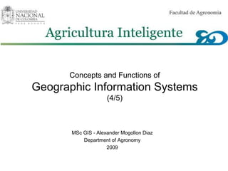
  • 1. Concepts and Functions of Geographic Information Systems (4/5) MSc GIS - Alexander Mogollon Diaz Department of Agronomy 2009
  • 2. Concepts and Functions of GIS .PPT Topic #1 Topic #2 Topic #3 1 A GIS is an information system GIS is a technology 2 Spatial Data modelling Sources of data for geodatasets Metadata 3 Geo-referencing Coordinate transformations 4 Database management 5 Spatial Analysis
  • 3. Functionalities of GIS INPUT QUERY - DISPLAY - MAP ANALYSE STRUCTURE MANAGE TRANSFORM
  • 4.
  • 5. Also gDB are managed with a DBMS A/D conversion Structuring Computing functions Other functions Data collection Database Information System Managed with DBMS
  • 6. Hybrid GIS DBMS for geometry <> DBMS for attributes polygon line point TIN categoric raster image lattice Specific (file-based) DBMS Standardised (relational) DBMS Arc- Info ArcView – dBase/Access
  • 7.
  • 8. Questions or remarks ? Thank you …