C3.05: Toward national multi-disciplinary coastal forecasts in Australia - Emlyn Jones

Many of the issues surrounding management of the coastal zone relate to water quality. If numerical models are to assist in management strategies revolving around compliance and response, it is essential that the models are capable of hindcasting, nowcasting and forecasting sediment transport and biogeochemical processes. CSIRO Oceans and Atmospheres have taken the first steps in developing such systems through the eReefs initiative, where models spanning physics, sediment transport and biogeochemistry have been constructed for the Great Barrier Reef (GBR) at 4km and 1km scales, capable of forecasts out to 4 days. These models explicitly account for freshwater, sediment and nutrient inputs from catchments and subsequently predict the response of the GBR lagoon. An essential component of these models is the ingestion of observations to optimally constrain the models. This has been achieved through data assimilation techniques, where the focus is on using observations to inform optimum parameter configurations rather than covering up deficiencies in the underlying model by altering the model state alone. The inclusion of an optical model within the biogeochemical library allows cutting edge assimilation to be performed, where joint parameter and state estimation can be achieved by assimilating the raw optical observations from satellites rather than modeled products such as chlorophyll. In this presentation we demonstrate the performance of the multi-disciplinary eReefs models, and project on how such a system could be applied nationally to allow managers a current view of water quality around the Australian coastline.

Empfohlen
Empfohlen
Weitere ähnliche Inhalte
Was ist angesagt?
Was ist angesagt? (20)
Andere mochten auch
Ähnlich wie C3.05: Toward national multi-disciplinary coastal forecasts in Australia - Emlyn Jones
Ähnlich wie C3.05: Toward national multi-disciplinary coastal forecasts in Australia - Emlyn Jones (20)
Mehr von Blue Planet Symposium
Mehr von Blue Planet Symposium (20)
Kürzlich hochgeladen
Kürzlich hochgeladen (20)
C3.05: Toward national multi-disciplinary coastal forecasts in Australia - Emlyn Jones
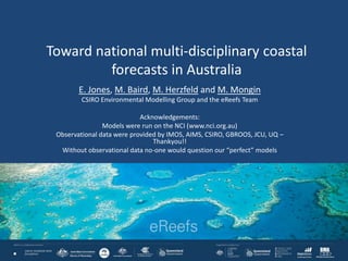
- 1. Toward national multi-disciplinary coastal forecasts in Australia E. Jones, M. Baird, M. Herzfeld and M. Mongin CSIRO Environmental Modelling Group and the eReefs Team Acknowledgements: Models were run on the NCI (www.nci.org.au) Observational data were provided by IMOS, AIMS, CSIRO, GBROOS, JCU, UQ – Thankyou!! Without observational data no-one would question our “perfect” models
- 2. Outline • eReefs project as a demonstration of a multi-disciplinary forecast system • Nested Grids • Resolution Matters • Hydrodynamic Model Forecast • Sediment/BGC Model Forecast • Using Data Assimilation to constrain the models • Parameter Estimation in the hydrodynamics • State Estimation in the BGC • Toward a national hydrodynamic, sediment and BGC coastal information system
- 3. GBR : One of seven Natural Wonders of the World • UNESCO World Heritage Area • 2600 km long reef & lagoon complex • 344,000 km2 area • 2800 reefs • 450 species of hard coral • >1620 species of fish • ~500 species of seaweed • 2000 species of sponges • 23% of known global species diversity • Coral cover is in decline (50% loss over the last few decades) • Management of the GBR requires access to information.
- 4. The eReefs project aims to develop an information system for the GBR. A system that explicitly links catchment inputs with estuary, lagoon and shelf scale hydrodynamics and water quality
- 5. The eReefs project aims to develop an information system for the GBR. Hydrodynamic, sediment and BGC models routinely running in hindcast, near real time and forecast mode.
- 6. Hi-res regional (1km) • Downscaling to the reef/estuary scale is required (local models), • Multiple nests are required to achieve boundary ratios , • 36 estuaries with freshwater input represented. Global products: • OceanMAPS (10km) • ACCESS-A (12km) Bridging models (4km) Local models Nested approach to traverse scales http://www.emg.cmar.csiro.au/www/en/emg/projects/eReefs.html
- 7. Resolution matters: increased process resolution in the 1km model permits sub meso-scale dynamics GBR4 GBR1
- 9. BGC model
- 10. Use of DA • Correct the sources of error rather than cover the symptoms, – Correct model forcing and parameters and remove persistent bias – Use of EnKF, hybrid EnOI-EnKF • Avoid adjusting hydrodynamic state to maintain equilibrium between pycnocline and nutricline (cause of spurious blooms in BGC). • Avoid adjusting the state to perform scenario simulations. • EnOI used to diagnose error sources; – Observing system is insufficient at scales modelled, especially sub-surface during stratified (flood) conditions – Must use techniques to only constrain mesoscale – fine scale structure at higher resolution should be unaltered – Performs poorly during extreme episodic events (cyclones, floods) not captured by the background ensemble • EnKF allows joint state and parameter estimation, captures flow dependent errors. – Important in the BGC due to model and parameterization uncertainty.
- 11. SWR parameterization using EnKF Transmission Attenuation Bottom absorption Difference between 2D histogram of control run (atten=0.1, trans=0.7, abs=0.5) and assimilated run. Red denotes areas where the assimilated data density has moved to from the control run.
- 12. Berkelmans et al. (2002, 2004); Hoegh-Guldberg (1999). BGC DA System: Results Compare the forecast and analysis fields for the reflectance data
- 13. Berkelmans et al. (2002, 2004); Hoegh-Guldberg (1999). BGC DA System: Results Compare the forecast and analysis fields for the reflectance data
- 14. Berkelmans et al. (2002, 2004); Hoegh-Guldberg (1999). BGC DA System: Results Compare the forecast and analysis fields for the reflectance data
- 15. Berkelmans et al. (2002, 2004); Hoegh-Guldberg (1999). BGC DA System: Results Compare the forecast and analysis fields for the reflectance data
- 17. Going National: Extending the eReefs approach and infrastructure to multi-disciplinary national scale modelling
- 18. Modelling initiatives in Australia AusROMS (UWA) Adapted from Middleton et al. ACOMO2012 OceanMAPS & eReefs (BOM) CSIRO (Environmental Modelling Group)
- 19. Australian National Shelf Reanalysis (ANSR): Bringing the modelling community together to create a 20 year shelf reanalysis (Phase 1: Hydrodynamics only)
- 20. National Approach: Ribbon/Flinders as an example - eventually coupled hydrodynamics, sediments and BGC
- 21. Multi-disciplinary models (hydrodynamics, sediments and BGC) are now routinely running in hindcast, nowcast and forecast modes for the GBR region. The next step is to upscale this system to a larger region (perhaps nationally). The DA solutions can be characterized as the “best estimate of the state” we have available to us. This is a hybrid solution that combines models and observations seamlessly. The BGC DA system could assimilate data from any platform that collects geo- located reflectance’s: Non-ocean color specific satellites, Ships of opportunity (DALEC’s … easier than flow through systems?) Drones? Citizen Science (RGB from mobile phones etc …) http://misclab.umeoce.maine.edu/research/HydroColor.php Berkelmans et al. (2002, 2004); Hoegh-Guldberg (1999). Summary
- 22. Berkelmans et al. (2002, 2004); Hoegh-Guldberg (1999). Summary: Citizen Science using Hydrocolor
- 23. Observation sites QIMOS (T,S,h,v) Wave-rider (T) Tide Gauge (h)Argo (T/S)
- 24. Model Assesment: free running model Argo YONGALA GHRSST SST comparison Frequency
Hinweis der Redaktion
- Catchment estuaries lagoon shelf open ocean Catchment hydrodynamics waves sediment transport BGC Routinely running nowcast/forecast, scenario modelling products