Strategize a Smooth Tenant-to-tenant Migration and Copilot Takeoff
Iamg2013 dpc
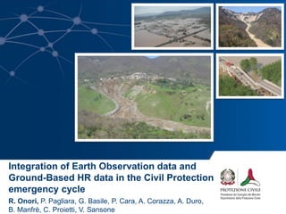
1. Integration of Earth Observation data and
Ground-Based HR data in the Civil Protection
emergency cycle
R. Onori, P. Pagliara, G. Basile, P. Cara, A. Corazza, A. Duro,
B. Manfrè, C. Proietti, V. Sansone
2. www.protezionecivile.gov.it
Contents
• Natural Risk in Italy
• Landslide Risk in Italy
• Integration of EO data in the Civil Protection
emergency cycle: the 2009-2010 Messina
Emergency
– EO data in the Emergency phase
– EO data in the Recovery phase: the DORIS project
– EO data in the Prevention&Prepardness phase: no
structural prevention, monitoring and early warning
• Conclusions
9. Relatore, evento, luogo e data N. 1 di 4
www.protezionecivile.gov.it
Segnalazioni
Dichiarazioni dello stato di emergenza
Interrogazioni parlamentari
San Fratello, Feb. 14th 2010
NO casualties
more than 2,000 evacuated
15. www.protezionecivile.gov.it
Integration of DORIS project
Ground-deformation DInSAR map
Ground-deformation DInSAR time series
Ground-deformation velocity maps
ERS-ENVI asc
1992-2010
RSAT asc
2005-2010
RSAT desc
2006-2010
CSK desc
2011-2012
TSX desc
2011-2012
C-band X-band
Landslides Inventory map
Susceptibility map
Vulnerability map
Damage assessment map
Thematic (lithology, land cover, land use) map
Map of areas at landslide risk
16. www.protezionecivile.gov.it
Integration of DORIS products
in the Civil Protection System
National Geological Council
Sicily Region
Italian Civil Protection Department
- National Centre for Surveillance and Forecasting
- Hydrogeological Risk Service
Regional Department of Civil Protection (DRPC)
- Hydrogeological and Environmental Risks Service
- Service for Messina Province
Regional Office for Environment
and Territory (ARTA)
Environmental Department
Local Mayors
Regional
National
18. www.protezionecivile.gov.it
Decreasing of displacement velocities
in the landslide area from the
operative phase of the interventions
Start of interventions
Recovery Phase
San Fratello, Jan. 14th 2013
Evaluation of the stabilization measures and interventions
19. www.protezionecivile.gov.it
Satellite InSAR data for the detection and the evaluation of ground
movements Update the Hydrogeological Management Plan
NO-STRUCTURAL
PREVENTIONPrevention & Prepardness
20. www.protezionecivile.gov.it
Hydrogeological management
plan
Assessment of landslide risk
scenarios
Civil Protection emergency plan
EO products
in the Civil Protection Emergency cycle
Evaluate the magnitude of the
event
Residual risk evaluation
Monitoring and early warning
Define preliminary stabilization
measures
Evaluation of the stabilization
measures and interventions
Update the pre-existing landslide
inventory maps
Assess the geomorphological
hazard for new settlements
PREVENTION & PREPARDNESS
- Landslide Inventory Map;
- Ground-deformation PSInSAR map;
- Ground-deformation PSInSAR time series;
- Ground-deformation velocity maps;
- Susceptibility Map.
EMERGENCY
- Ground-deformation PSInSAR map;
- Ground-deformation PSInSAR time series;
- Ground-deformation velocity maps;
- Event maps.
RECOVERY
- Ground-deformation PSInSAR map;
- Ground-deformation PSInSAR time series;
- Ground-deformation velocity maps;
- Event maps;
- Landslide inventory maps; Susceptibility Map.
21. www.protezionecivile.gov.itConclusions:
The integration of new and emerging technologies
(EO, non-EO, aerial) with the conventional
analysis and methods have greatly supported the
landslide risk management activities through all
the phases of the emergency cycle.
Close collaboration between National, Regional
and Local Authorities, Research Institute, and
technological partners, improved the operational
application and the reliability of the products.