1. 30/08/2013
1
Integration of Earth Observation data
in the Civil Protection emergency cycle
Chiara Proietti
www.protezionecivile.gov.itNational Fire‐fighters Corps
Police
Prefectures
118
ISPRA
Interior
Foreign Affairs
Environment
HealthCoordination
i i
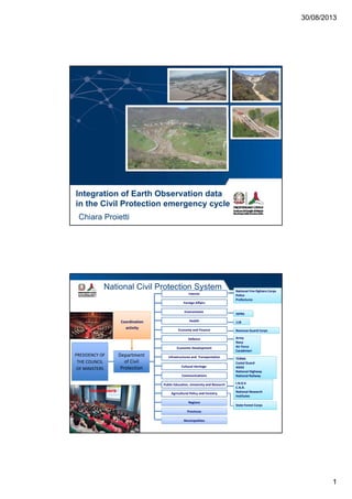
National Civil Protection System
Revenue Guard Corps
Army
Navy
Air Force
Carabinieri
TERNA
Costal Guard
ANAS
National Highway
National Railway
Economy and Finance
Communications
Infrastructures and Transportation
Defence
Economic Development
Cultural Heritage
PRESIDENCY OF
THE COUNCIL
OF MINISTERS
Department
of Civil
Protection
activity
I.N.G.V.
C.N.R.
National Research
Institutes
State Forest Corps
Agricultural Policy and Forestry
Regions
Provinces
Municipalities
Public Education, University and Research
Volunteers
3. 30/08/2013
3
www.protezionecivile.gov.itwww.protezionecivile.gov.it
from a network of
1950 rain gauges
are obtained
Maierato, 2010
Prevention & Prepardness
National Early Warning System
for Rainfall Induced Landslides
MONITORING &
SURVEILLANCE
Rainfall measurements
are obtained
every 6 hours
Landslide events
prepared through
numerical modelling are
obtained
every 12 hours
Rainfall forecasts
www.protezionecivile.gov.it
CENTRES FOR FORECASTING AND SURVAILLANCE
NETWORK
Announcement, monitoring and survaillance of risk
scenarios in real time
National Early Warning System
1. FORECAST
Declaration of the expected severity levels
Warning activation of operative response in real time
at different territorial levels
2 phases
2. MONITORING
AND
SURVAILLANCE
1. METEOROLOGICAL
2. HYDROGEOLOGICAL
AND HYDRAULIC
2 areas
4. 30/08/2013
4
www.protezionecivile.gov.it
Satellite InSAR data for the detection and the evaluation of ground movements
NO-STRUCTURAL
PREVENTIONPrevention & Prepardness
www.protezionecivile.gov.it
Emergency
Messina, Oct. 2009‐ Feb. 2010
GiampilieriSan Fratello
6. 30/08/2013
6
www.protezionecivile.gov.it
San Fratello, Feb. 14th 2010
NO casualties
more than 2,000 evacuated
Segnalazioni
Dichiarazioni dello stato di emergenza
Interrogazioni parlamentari
Relatore, evento, luogo e data N. 1 di 4
www.protezionecivile.gov.it
Emergency activities
Residual risk assessment
Technical support
to regional and local Authorities
Monitoring & Early Warning
Relatore, evento, luogo e data
7. 30/08/2013
7
www.protezionecivile.gov.itHigh Resolution Data
Satellite data
Optical
Giampilieri –
Geomorphological Map
Giampilieri –
Residual Risk Areas
p
InSAR
LiDAR
GBInSAR
San Fratello –
Early Warning System
www.protezionecivile.gov.itRecovery Phase
San Fratello, Jan. 14th 2013
8. 30/08/2013
8
www.protezionecivile.gov.it
Integration of DORIS products in
the Civil Protection System
Regional Department of Civil Protection (DRPC)
- Hydrogeological and Environmental Risks Service
- Service for Messina Province
Regional Office for Environment
and Territory (ARTA)
Environmental Department
Local Mayors
National Geological Council
Sicily Region
Italian Civil Protection Department
- National Centre for Surveillance and Forecasting
- Hydrogeological Risk Service
p
Regional
National
www.protezionecivile.gov.it
Integration of DORIS products
Ground-deformation velocity mapsGround-deformation PSInSAR maps
Evaluation of the stabilization
measures and interventions
Update the pre-existing landslide
inventory maps
9. 30/08/2013
9
www.protezionecivile.gov.it
DORIS products
in the Civil Protection Emergency cycle
PREVENTION & PREPARDNESS
- Landslide Inventory Map;
Ground deformation PSInSAR map;
- Hydrogeological management plan
-Assessment of landslide risk
i- Ground-deformation PSInSAR map;
- Ground-deformation PSInSAR time series;
- Ground-deformation velocity maps;
- Susceptibility Map.
EMERGENCY
- Ground-deformation PSInSAR map;
- Ground-deformation PSInSAR time series;
- Ground-deformation velocity maps;
- Event maps.
scenarios
- Evaluate the magnitude of the
event
- Residual risk evaluation
- Monitoring and early warning
- Define preliminary stabilization
measures
Civil protection
emergency plans
RECOVERY
- Ground-deformation PSInSAR map;
- Ground-deformation PSInSAR time series;
- Ground-deformation velocity maps;
- Event maps;
- Landslide inventory maps;
- Susceptibility Map.
- Evaluation of the stabilization
measures and interventions
- Update the pre-existing landslide
inventory maps
- Assess the geomorphological
hazard for new settlements
www.protezionecivile.gov.it
Conclusions
Selection and integration of space-based data derived by different
data sources for the optimization of the product performances indata sources for the optimization of the product performances in
terms of:
- timely of delivery;
- accuracy;
- spatial and temporal resolution.
Cl ll b ti b t N ti l R i l d L lClose collaboration between National, Regional and Local
Authorities, Research Institute, Space Agencies,and technological
partners, in order to improve the operational application and the
reliability of the products.