SlideShare ist ein Scribd-Unternehmen logo
1 von 9
Downloaden Sie, um offline zu lesen
Geospatial Intelligence
in Support of the Australian Approach to Warfare1
R.J.Williams
Command and Control Division, DSTO, Edinburgh, 5111, Australia
Tel: 08 82597008, Fax: 08 8259 5619, email: bob.Williams@dsto.defence.gov.au
ABSTRACT
This paper introduces the term geospatial intelligence to the lexicon of Australia’s national security.
The paper describes a framework of concepts as they apply to imagery, imagery intelligence, and
geographic, infrastructure and environmental information, referred to collectively as Geospatial
Intelligence. The paper also describes the means of acquiring, processing and disseminating the range
of products and services to the Defence community, referred to as Geospatial Information
Infrastructure.
INTRODUCTION
This paper presents a high-level concept and fundamental principles that are generally applicable to
practitioners throughout the Defence community.
This concept paper describes our highest enduring principles, providing the conceptual link between
our national strategy and the plans, procedures, and methods that geospatial professionals develop and
apply in their work every day. It responds to the direction set in the Government’s Defence White
Paper, Defence 2000: Our Future Defence Force, Australia’s National Security: A Defence Update
2003, and the doctrinal publications Force 2020 and The Australian Approach to Warfare.
A PROUD HERITAGE
The belief that a sound knowledge of the natural
and man-made features of a battlefield constitutes
one of the most important factors of military
appreciation has long been recognised. A detailed
knowledge of the environment and its
infrastructure is fundamental to the effective
control of military operations.
The Australian Defence Organisation (ADO) has
a proud heritage of surveying and mapping our
areas of geo-strategic interest and a proud heritage
of embracing new technologies and new
paradigms to achieve its task of providing
geospatial information for the planning and
conduct of operations.
The ADO has already acknowledged that maps
and charts are the issue of the past and has
acknowledged that the real issue is in creating a
geospatial information infrastructure that not only
supports the needs of the intelligence community,
but supports the needs for modelling and
simulation, rehearsal and operations.
General William Bridges and his staff watching
manoeuvres of the 1st
Australian Division in the desert
in Egypt, March 1915
Australian War Memorial
1
This paper was written by Dr Williams for the Defence Imagery and Geospatial Organisation
(DIGO). DIGO was fully consulted in the preparation of this paper.
GEOSPATIAL INTELLIGENCE IN SUPPORT OF THE AUSTRALIAN APPROACH TO WARFARE 1
GEO-STRATEGIC INFLUENCES – CATALYSTS FOR CHANGE
In The Australian Approach to Warfare the Chief of the Defence Force (CDF) describes Australia’s
Geo-Strategic Influences. “Australia is a secure country. It obtains much of its security from its
geographic environment. Australia has a large land mass, no land border with another country, a
substantial natural resource base and vast ocean surrounds that include extensive areas of very shallow
water. Australia’s people, industries and infrastructure are largely concentrated on the coast, in our
eastern, south-eastern, and south-western fringes. These physical characteristics contribute to our
defence against armed attack using conventional means.
However, while Australia is difficult to attack, there is also a great deal to defend. We are a large
country, and have a small population. Conducting military operations in or from the northern parts of
Australia would be a challenging task in terms of logistic support, transport, demands on civil
infrastructure and, at times, the adverse effects of harsh climatic conditions on the performance of
people and equipment. These factors highlight some of the challenges associated with the defence of
Australia.
Bali bombing Image Sunday, October 13, 2002
In addition to potential security threats
involving conventional military attack,
Australia’s security is also affected by
emerging dangers posed by proliferation of
weapons of mass destruction (nuclear,
chemical and biological weapons, and their
chief means of delivery – ballistic
missiles), terrorism and attacks on
information systems. Other, non-military
threats to national security include natural
disasters, pandemic disease, illegal
immigration, illegal fishing, people
smuggling, environmental degradation,
narcotics and transnational crime”.
Combined, these influences and emerging threats establish very real catalysts for change in the way
Defence will acquire, process, manage and disseminate geospatial information for use by the broad
spectrum of users from senior decision makers to troops on the ground. In short, Defence’s response to
these challenges is to adopt the concept of providing Geospatial Intelligence and managing the
processes through a Geospatial Information Infrastructure.
GEOSPATIAL INTELLIGENCE
Geospatial Intelligence is primarily about obtaining knowledge of the physical and cultural aspects of
the global security environment and the capabilities and intentions of potential adversaries.
The imperatives of information age warfare combined with the demands of contemporary threats to
security have turned the model of national intelligence upside down. Previously, intelligence reports
written by tactical units were sifted and analysed by national agencies for the benefits of national
decision makers. In today’s more distributed model, the national collection systems and subject matter
expertise once dedicated to supporting a select group of national decision makers now support a vastly
expanded base of theatre and tactical users as well. Interoperability has become essential in a
distributed worldwide network of intelligence producers and consumers, where finished intelligence
often ends up in the guidance system of a tactical weapon.
The growing demand for tactical support has been a key factor in the emergence of geospatial
intelligence as a new discipline. The rapid pace of the targeting cycle and the increased number of
targets has placed stress on the intelligence production processes. Emerging network-centric concepts
of operations, which rely on the ability of friendly forces to detect, process, and respond to changes in
the battle-space more quickly than adversary forces, require us to further reduce cycle times. The
timeliness required for rapid, precision engagement demands closer integration of tools and processes
GEOSPATIAL INTELLIGENCE IN SUPPORT OF THE AUSTRALIAN APPROACH TO WARFARE 2
of imagery specialists who detect and characterise targets and the geospatial specialists who describe
and measure the battle space.
Geospatial intelligence aims to reduce uncertainty, providing a knowledge advantage in time for a
decision to be made or an action to be taken to advance or protect national interests.
“On the modern day battlefield everything is spatially related
and if you don’t understand the spatial relationships you will never win the war!”
The discipline of Geospatial Intelligence
Unifying the strengths of imagery analysis and mapping, charting and geodesy, geospatial intelligence
has emerged as a new discipline, separate and distinct from its predecessors. As a discipline, geospatial
intelligence is defined primarily by three qualities: its character as an intelligence discipline, its unique
analytical and geometrical aspects, and its fundamental spatial and temporal nature.
Geospatial intelligence is an intelligence function. It primarily aims to understand the physical and
cultural aspects of the global security environment.
Geospatial intelligence is an analytical discipline and, as such, embodies a number of applied sciences,
disciplines and technologies. The sciences include geography, cartography and mapping, geodesy and
surveying, geomatics, several earth sciences, and computer science. Disciplines include
photogrammetry and remote sensing, spatial analysis and geographic information systems, and so on.
Technologies include GPS and location-based technologies, GIS, information technology, and so on.
Geospatial intelligence is characterised by its fundamental spatial and temporal nature. Geospatial
intelligence includes the description of geographical features, infrastructure and environmental aspects
of our world. These features include political and administrative entities; population, demography and
urban areas; the road, rail, air, sea infrastructure; facilities, communications and resources;
physiographic, hydrographic, oceanographic, and meteorological features and state; and the natural and
cultivated landscape. The description then involves the modelling, representation and location of these
features to place them in a reference system.
GEOSPATIAL INTELLIGENCE IN SUPPORT OF THE AUSTRALIAN APPROACH TO WARFARE 3
These spatial and temporal aspects make geospatial intelligence a powerful, visual medium.
Information from many sources can be integrated in a spatial framework to reveal spatial relationships
not immediately evident. Through visualisation, geospatial intelligence permits both rapid, intuitive
understanding of the physical environment and evaluation of potential courses of action in three spatial
dimensions and through time.
Geospatial Intelligence specialists represent and communicate the phenomena of our world.
Applications of Geospatial Intelligence
Geospatial intelligence provides unique knowledge not available by other means.
Geospatial intelligence provides knowledge national decision leaders need to make informed decisions
on matters of national security and foreign affairs. It plays a central role in identifying strategic threats,
providing warnings of war, predicting humanitarian crises, and verifying international treaty
compliance.
Geospatial intelligence supports the development of national policy, the planning and execution of
military operations, the protection of homeland security and other civil operations.
Geospatial intelligence provides the vital knowledge foundation for modern joint warfare, serving as
the basis for decision superiority, manoeuvre, engagement and interoperability.
Geospatial intelligence offers the visual picture of the battle-space and the situational understanding
that is essential for operational decision-making throughout the spectrum of conflict and at all levels of
warfare. It is the major source of content for the common operational picture and the primary means of
visualising it. Geospatial intelligence modelling capabilities are powerful tools for Intelligence
Preparation of the Battle-space, giving Commanders unparalleled decision superiority.
Geospatial intelligence gives war-fighters a critical understanding of an adversary’s strategic
infrastructure and vulnerabilities, permitting precision strikes against strategic and tactical targets in all
weather conditions.
In addition, geospatial intelligence provides products on selected urban areas of interest, land and
maritime entry and exit points, identification and assessment of foreign threats, and extent and scope of
natural and man-made damage. In cases of terrorist attack or natural disaster, geospatial intelligence
can rapidly give federal agencies and emergency services a comprehensive and detailed view of the
scene, helping them to make the best possible decisions in preparation, response, and recovery actions.
Geospatial intelligence also plays a role in a wide range of other applications including drug
interdiction, illegal immigration, illegal fishing, and humanitarian relief.
With its common spatial and temporal frame of reference, geospatial intelligence is essential for
interoperability in joint and combined warfare.
GEOSPATIAL INTELLIGENCE IN SUPPORT OF THE AUSTRALIAN APPROACH TO WARFARE 4
EMERGING CAPABILITIES
The discipline of geospatial intelligence unites a broad range of
evolving and emerging capabilities and technologies. By bringing
together the technical capabilities traditionally associated with imagery
intelligence with those more typically used for acquiring, processing,
and disseminating geodetic, topographic, hydrographic, geographic and
aeronautical data, we are developing an expanded tool set for solving
intelligence problems, as well as enhancing the capabilities of
command support systems and operational combat support systems.
Command support systems
Rapidly advancing digital processing capabilities are revolutionising
our ability to respond to the needs of our customers in the emerging
network-centric environment, while the incorporation of an expanded
range of data sources is enabling us to provide new dimensions of
knowledge to national security decision-makers, and decision support
systems, navigation systems, and a plethora of applications.
Onboard navigation systems
Mission planning Precision targeting Tactical operations Integrated CSS
A GEOSPATIAL INFORMATION INFRASTRUCTURE
“Imagery and geospatial information provide information about our world. When
combined, as we have done with this new organisation, they enable Defence to extract
knowledge for specific strategic and planning purposes. Key uses for this kind of
information include situational awareness, decision-making and operational planning.
The change announced today will provide the Australian Defence Organisation and the
Government with intelligence and geospatial information needed to effectively operate
in an increasingly complex environment.
A modern and versatile defence force needs reliable information, ranging from accurate
maps to digital data for electronic equipment, to three-dimensional computer models
for planning operations. Advanced weapons systems in particular require ‘smarter’
geospatial information to support them and Australia must be able to produce this
information.
The formation of DIGO is a significant step in developing this capability.”
Media Release MIN 332/00 - 08 Nov 2000
GEOSPATIAL INTELLIGENCE IN SUPPORT OF THE AUSTRALIAN APPROACH TO WARFARE 5
Defence Imagery and Geospatial Organisation (DIGO) is the lead agency within the Australian
Defence Organisation in the production and dissemination of geospatial intelligence. Whilst being the
lead agency, DIGO is not the only agency involved in the capability. There is a range of agencies and
organisations performing functions which, in total, make up the geospatial intelligence capability.
These agencies include other Defence units, Commonwealth and State Government agencies, industry
groups, and international agencies and bodies.
As such, these capabilities need to be brought together to form a Geospatial Information
Infrastructure (GII). A GII is an enabling infrastructure that meets the needs of the community for
geospatial information. The infrastructure is the collection of people, doctrine, policies, architecture,
standards, and technologies necessary to create, maintain, and utilise a shared geospatial framework.
The GII:
Establishes a framework for acquiring, producing, managing, and disseminating geospatial
information;
Provides the supporting services needed to ensure information content meets user needs, is
easily accessible, and can readily be applied to support operational information requirements;
and
Ensures the supporting infrastructure components (including policy, doctrine, training, and
force structure) are in place to optimise the use of the geographic information, products, and
services (i.e. geospatial intelligence) provided.
In order to implement the GII, DIGO provides the lead role in the ADO with respect to the geospatial
intelligence capability and DIGO collaborates both nationally and internationally in order to fulfil its
functional mandate.
In the near future DIGO plans to host the service centre of Defence’s GII and, via its portal, link key
ADO command support systems and other geospatial information providers such as the Navy’s
Hydrographic Service and Air Force’s Aeronautical Information Service. DIGO is investigating the
means to access and serve the National Spatial Data Infrastructure via arrangements with its civilian
counterpart, Geoscience Australia. DIGO will continue to collaborate in the international arena with
our traditional partners (the US, UK, Canada and New Zealand), the broader international forum (via
the Digital Geospatial Information Working Group and other organisations) and with nations in South-
East Asia and the South-West Pacific via a range of agreements and understandings.
GEOSPATIAL INTELLIGENCE IN SUPPORT OF THE AUSTRALIAN APPROACH TO WARFARE 6
DIGO will continue to develop its own intellectual property by working through both formal processes
and informal cooperative ventures with research laboratories and industry. DIGO sponsors tasking with
Defence Science and Technology Organisation (DSTO), collaborates with the Commonwealth
Scientific and Industrial Research Organisation (CSIRO), sponsors students at universities and
institutes around the nation, has exchange staff at various places around the world, and will participate
in the new Cooperative Research Centre for Spatial Information.
In summary, the Geospatial Information Infrastructure provides the means of acquiring, processing
and disseminating the range of products and services to the Defence community; products and services
that are primarily about obtaining and providing knowledge of the physical and cultural aspects of the
global security environment and the capabilities and intentions of potential adversaries, that is
Geospatial Intelligence.
THE FUTURE OF GEOSPATIAL INTELLIGENCE
As we move forward and beyond this time of dramatic change, geospatial intelligence will continue to
face new challenges and new opportunities.
Future State: Geospatial Intelligence Online
DIGO is investigating initiatives to address just some of the challenges and opportunities. These
include:
The integration of its imagery and geospatial capabilities;
The consultative process with the Defence user community and the Defence capability
development community;
The enhancement of its international relations;
The participation in multi-national collaborative production of geospatial information;
The engagement of academia and industry;
and others.
DIGO is examining the migration of its processes, systems and tools to an all-digital, data-centric
environment, beginning with significant improvements to its infrastructure (such as embracing the
concept of a Geospatial Information Infrastructure).
DIGO is embracing comprehensive information system networking practices to ensure the most timely,
relevant, and accurate online content possible. DIGO will endeavour to provide customers what they
need, when they need it, through anticipating their future information needs.
DIGO is proactive in examining its capability to provide the
ubiquitous knowledge map, the foundation of the Commonly
Informed Operating Picture (CIOP), on which other forms of
information can be overlaid. This comprehensive,
geospatially referenced database links DIGO’s base of
intelligence knowledge to a precise, digital model of the
Earth, enabling the CIOP to serve as a powerful, intuitive
medium through which we can collaborate with our partners
and our customers can better visualise the mission space.
And beyond … …
The need to have a detailed knowledge of our geo-strategic environment is enduring, as is the need to
continually develop and evolve our surveying and mapping capabilities.
Contemporary issues and concerns such as the proliferation of weapons of mass destruction, terrorism,
illegal immigration, and so on combined with society’s desire to be better informed will be the drivers
to cause DIGO to continue to embrace change. These contemporary issues will demand a review on the
very way we describe and model our environment. Our schemas and analytical tools will have to be far
GEOSPATIAL INTELLIGENCE IN SUPPORT OF THE AUSTRALIAN APPROACH TO WARFARE 7
richer than ever before; our products and services will need to be reliable and credible to meet the
mission critical and safety critical needs of future needs and applications. The ways we visualise and
portray our world will be need to be compatible and appropriate to the plethora of platforms, systems
and devices that will need the geospatial intelligence to meet their various needs; systems and devices
that range from complex command centres down to the ubiquitous mobile phone.
DIGO has acknowledged that its tasks are going to become ever more complex, and has acknowledged
that the important step of merging imagery, imagery intelligence and geospatial components is a vital
step in the evolution of our geospatial intelligence capability.
CONCLUSION
Geospatial Intelligence in the Support of the Australian Approach to
Warfare
The convergence of our nation’s imagery and geospatial capabilities is an imperative of the current era,
made necessary by the challenges of the changing national security environment and the emerging
concepts of warfare, and made possible by the revolution in information technology. The demands of
the current global environment require a robust ability to provide a growing set of intelligence and
operational consumers a fully integrated visual picture of the strategic, operational and tactical
situation.
Imagery and geographic information provide information about our world. When combined, as we
have done with this new organisation, they enable Defence to extract knowledge for specific strategic
and planning purposes. Key uses for this kind of information include situational awareness, decision-
making and operational planning.
In this draft concept publication, Defence is introducing the term geospatial intelligence to the lexicon
of Australia’s national security. The publication described a framework of concepts as they apply to
imagery, imagery intelligence, and geographic, infrastructure and environmental information, referred
to collectively as geospatial intelligence. The publication also described the means of acquiring,
processing and disseminating the range of products and services to the Defence community, referred to
as Geospatial Information Infrastructure.
GEOSPATIAL INTELLIGENCE IN SUPPORT OF THE AUSTRALIAN APPROACH TO WARFARE 8
REFERENCES
White Paper, Defence 2000: Our Future Defence Force, Department of Defence, Australia, 2000
http://203.6.115.8/whitepaper/
Australia’s National Security: A Defence Update, Department of Defence, Australia, 2003
http://203.6.115.8/ans2003/
The Australian Approach to Warfare, Department of Defence, 2002
http://203.6.115.8/publications/taatw.pdf
Force 2020, Department of Defence, 2002
http://203.6.115.8/publications/f2020.pdf
GEOSPATIAL INTELLIGENCE IN SUPPORT OF THE AUSTRALIAN APPROACH TO WARFARE 9

Weitere ähnliche Inhalte

Was ist angesagt?

MODELLING THE IMPACT OF FLOODING USING GEOGRAPHIC INFORMATION SYSTEM AND REMO...
MODELLING THE IMPACT OF FLOODING USING GEOGRAPHIC INFORMATION SYSTEM AND REMO...MODELLING THE IMPACT OF FLOODING USING GEOGRAPHIC INFORMATION SYSTEM AND REMO...
MODELLING THE IMPACT OF FLOODING USING GEOGRAPHIC INFORMATION SYSTEM AND REMO...
International Journal of Technical Research & Application
 
TSUNAMI EMERGENCY RESPONSE SYSTEM USING GEO-INFORMATION TECHNOLOGY ALONG THE ...
TSUNAMI EMERGENCY RESPONSE SYSTEM USING GEO-INFORMATION TECHNOLOGY ALONG THE ...TSUNAMI EMERGENCY RESPONSE SYSTEM USING GEO-INFORMATION TECHNOLOGY ALONG THE ...
TSUNAMI EMERGENCY RESPONSE SYSTEM USING GEO-INFORMATION TECHNOLOGY ALONG THE ...
IAEME Publication
 
UP691938 FInished Report
UP691938 FInished ReportUP691938 FInished Report
UP691938 FInished Report
Katie Acton
 
APPLICATIONS OF REMOTE SENSING AND GIS TECHNOLOGIES IN FLOOD RISK MANAGEMENT
APPLICATIONS OF REMOTE SENSING AND GIS TECHNOLOGIES IN FLOOD RISK MANAGEMENTAPPLICATIONS OF REMOTE SENSING AND GIS TECHNOLOGIES IN FLOOD RISK MANAGEMENT
APPLICATIONS OF REMOTE SENSING AND GIS TECHNOLOGIES IN FLOOD RISK MANAGEMENT
rsmahabir
 
Geographical information systems in health research and services delivery in ...
Geographical information systems in health research and services delivery in ...Geographical information systems in health research and services delivery in ...
Geographical information systems in health research and services delivery in ...
John Francis Jr Faustorilla
 
Caulfield_Thesis_Poster_Final
Caulfield_Thesis_Poster_FinalCaulfield_Thesis_Poster_Final
Caulfield_Thesis_Poster_Final
Katie Caulfield
 

Was ist angesagt? (16)

Essays on Geography and GIS, Vol. 3
Essays on Geography and GIS, Vol. 3Essays on Geography and GIS, Vol. 3
Essays on Geography and GIS, Vol. 3
 
Gis in disaster managemant
Gis  in disaster managemantGis  in disaster managemant
Gis in disaster managemant
 
MODELLING THE IMPACT OF FLOODING USING GEOGRAPHIC INFORMATION SYSTEM AND REMO...
MODELLING THE IMPACT OF FLOODING USING GEOGRAPHIC INFORMATION SYSTEM AND REMO...MODELLING THE IMPACT OF FLOODING USING GEOGRAPHIC INFORMATION SYSTEM AND REMO...
MODELLING THE IMPACT OF FLOODING USING GEOGRAPHIC INFORMATION SYSTEM AND REMO...
 
TSUNAMI EMERGENCY RESPONSE SYSTEM USING GEO-INFORMATION TECHNOLOGY ALONG THE ...
TSUNAMI EMERGENCY RESPONSE SYSTEM USING GEO-INFORMATION TECHNOLOGY ALONG THE ...TSUNAMI EMERGENCY RESPONSE SYSTEM USING GEO-INFORMATION TECHNOLOGY ALONG THE ...
TSUNAMI EMERGENCY RESPONSE SYSTEM USING GEO-INFORMATION TECHNOLOGY ALONG THE ...
 
Application of Remote Sensing & GIS in Disaster Management
Application of Remote Sensing & GIS in Disaster ManagementApplication of Remote Sensing & GIS in Disaster Management
Application of Remote Sensing & GIS in Disaster Management
 
Remote sensing in Disaster management
Remote sensing in Disaster managementRemote sensing in Disaster management
Remote sensing in Disaster management
 
Ijciet 06 07_010
Ijciet 06 07_010Ijciet 06 07_010
Ijciet 06 07_010
 
3157
31573157
3157
 
UP691938 FInished Report
UP691938 FInished ReportUP691938 FInished Report
UP691938 FInished Report
 
Philippine Initiatives on the Applications of Space Technology on Hazard Mit...
Philippine Initiatives on the Applications of Space Technology  on Hazard Mit...Philippine Initiatives on the Applications of Space Technology  on Hazard Mit...
Philippine Initiatives on the Applications of Space Technology on Hazard Mit...
 
A440111.pdf
A440111.pdfA440111.pdf
A440111.pdf
 
Is Space technology contributing enough to Disaster Risk Reduction?
Is Space technology contributing enough to Disaster Risk Reduction?Is Space technology contributing enough to Disaster Risk Reduction?
Is Space technology contributing enough to Disaster Risk Reduction?
 
APPLICATIONS OF REMOTE SENSING AND GIS TECHNOLOGIES IN FLOOD RISK MANAGEMENT
APPLICATIONS OF REMOTE SENSING AND GIS TECHNOLOGIES IN FLOOD RISK MANAGEMENTAPPLICATIONS OF REMOTE SENSING AND GIS TECHNOLOGIES IN FLOOD RISK MANAGEMENT
APPLICATIONS OF REMOTE SENSING AND GIS TECHNOLOGIES IN FLOOD RISK MANAGEMENT
 
Geographical information systems in health research and services delivery in ...
Geographical information systems in health research and services delivery in ...Geographical information systems in health research and services delivery in ...
Geographical information systems in health research and services delivery in ...
 
Caulfield_Thesis_Poster_Final
Caulfield_Thesis_Poster_FinalCaulfield_Thesis_Poster_Final
Caulfield_Thesis_Poster_Final
 
An Assessment of the level of vulnerability to climate change risks in a deve...
An Assessment of the level of vulnerability to climate change risks in a deve...An Assessment of the level of vulnerability to climate change risks in a deve...
An Assessment of the level of vulnerability to climate change risks in a deve...
 

Ähnlich wie Geospatial Intelligence in Support of the Australian Approach to Warfare

ThompsonMark_CapstoneResearch
ThompsonMark_CapstoneResearchThompsonMark_CapstoneResearch
ThompsonMark_CapstoneResearch
Mark Thompson
 
Alexandros kolovos on_'esdp and space'_initiative_presented_on_eumc_on_24th s...
Alexandros kolovos on_'esdp and space'_initiative_presented_on_eumc_on_24th s...Alexandros kolovos on_'esdp and space'_initiative_presented_on_eumc_on_24th s...
Alexandros kolovos on_'esdp and space'_initiative_presented_on_eumc_on_24th s...
alexanderkolovos
 
Gi science discipline_foloo
Gi science discipline_folooGi science discipline_foloo
Gi science discipline_foloo
oloofrank
 
Iirs lecture space inputs to disaster management in india
Iirs lecture space inputs to disaster management in indiaIirs lecture space inputs to disaster management in india
Iirs lecture space inputs to disaster management in india
Tushar Dholakia
 

Ähnlich wie Geospatial Intelligence in Support of the Australian Approach to Warfare (20)

Geographic Information: Defence and and the Broader Community
Geographic Information: Defence and and the Broader CommunityGeographic Information: Defence and and the Broader Community
Geographic Information: Defence and and the Broader Community
 
RJW ReGIS 1994
RJW ReGIS 1994RJW ReGIS 1994
RJW ReGIS 1994
 
Asymmetric warfare for geoworld
Asymmetric warfare for geoworldAsymmetric warfare for geoworld
Asymmetric warfare for geoworld
 
Geo Int AURISA 2002
Geo Int AURISA 2002Geo Int AURISA 2002
Geo Int AURISA 2002
 
WILLIAMS Future GII in 2020
WILLIAMS Future GII in 2020WILLIAMS Future GII in 2020
WILLIAMS Future GII in 2020
 
Health GIS (Geographic Information System)
Health GIS (Geographic Information System)Health GIS (Geographic Information System)
Health GIS (Geographic Information System)
 
MSIA Canberra EGICS 1996
MSIA Canberra EGICS 1996MSIA Canberra EGICS 1996
MSIA Canberra EGICS 1996
 
BENOUAR IDRC 2014 FORENSIC INVESTIGATION OF DISASTERS
BENOUAR IDRC 2014 FORENSIC INVESTIGATION OF DISASTERSBENOUAR IDRC 2014 FORENSIC INVESTIGATION OF DISASTERS
BENOUAR IDRC 2014 FORENSIC INVESTIGATION OF DISASTERS
 
Disaster Epidemiology - breif overview
Disaster Epidemiology - breif overview Disaster Epidemiology - breif overview
Disaster Epidemiology - breif overview
 
ThompsonMark_CapstoneResearch
ThompsonMark_CapstoneResearchThompsonMark_CapstoneResearch
ThompsonMark_CapstoneResearch
 
FINAL REPORT
FINAL REPORTFINAL REPORT
FINAL REPORT
 
Alexandros kolovos on_'esdp and space'_initiative_presented_on_eumc_on_24th s...
Alexandros kolovos on_'esdp and space'_initiative_presented_on_eumc_on_24th s...Alexandros kolovos on_'esdp and space'_initiative_presented_on_eumc_on_24th s...
Alexandros kolovos on_'esdp and space'_initiative_presented_on_eumc_on_24th s...
 
Natural Disaster
Natural DisasterNatural Disaster
Natural Disaster
 
Gi science discipline_foloo
Gi science discipline_folooGi science discipline_foloo
Gi science discipline_foloo
 
GIS KD.pdf
GIS KD.pdfGIS KD.pdf
GIS KD.pdf
 
A Memorable Day in Retrospect – Friday 24 August 2001
A Memorable Day in Retrospect – Friday 24 August 2001A Memorable Day in Retrospect – Friday 24 August 2001
A Memorable Day in Retrospect – Friday 24 August 2001
 
FULLYFINAL GIS CHOUBEYJI.pptx
FULLYFINAL GIS CHOUBEYJI.pptxFULLYFINAL GIS CHOUBEYJI.pptx
FULLYFINAL GIS CHOUBEYJI.pptx
 
Citizen science, The New Enlightenment
Citizen science, The New EnlightenmentCitizen science, The New Enlightenment
Citizen science, The New Enlightenment
 
Iirs lecture space inputs to disaster management in india
Iirs lecture space inputs to disaster management in indiaIirs lecture space inputs to disaster management in india
Iirs lecture space inputs to disaster management in india
 
Role of IT & Computer in Environment
Role of IT & Computer in EnvironmentRole of IT & Computer in Environment
Role of IT & Computer in Environment
 

Mehr von Robert (Bob) Williams

Mehr von Robert (Bob) Williams (20)

Dare to Change 1980Reflections of one of Australia's Military Mapmakers
Dare to Change 1980Reflections of one of Australia's Military MapmakersDare to Change 1980Reflections of one of Australia's Military Mapmakers
Dare to Change 1980Reflections of one of Australia's Military Mapmakers
 
An Overview of a Cartographic Package
An Overview of a Cartographic PackageAn Overview of a Cartographic Package
An Overview of a Cartographic Package
 
Dare to Change - Geographic Intelligence - 2002
Dare to Change - Geographic Intelligence - 2002Dare to Change - Geographic Intelligence - 2002
Dare to Change - Geographic Intelligence - 2002
 
Land Information Systems and Terrain Intelligence
Land Information Systems and Terrain Intelligence Land Information Systems and Terrain Intelligence
Land Information Systems and Terrain Intelligence
 
Land Information Systems and Terrain Intelligence
Land Information Systems and Terrain IntelligenceLand Information Systems and Terrain Intelligence
Land Information Systems and Terrain Intelligence
 
Back to the future: A Personal Experience
Back to the future: A Personal ExperienceBack to the future: A Personal Experience
Back to the future: A Personal Experience
 
Back to the Future: Policy
Back to the Future: PolicyBack to the Future: Policy
Back to the Future: Policy
 
Back to the Future: Capability Development
Back to the Future: Capability DevelopmentBack to the Future: Capability Development
Back to the Future: Capability Development
 
Back to the Future: Rosetta
Back to the Future: RosettaBack to the Future: Rosetta
Back to the Future: Rosetta
 
Back to the Future: The Climate for Change and the Hydrographer of the Future
Back to the Future: The Climate for Change and the Hydrographer of the FutureBack to the Future: The Climate for Change and the Hydrographer of the Future
Back to the Future: The Climate for Change and the Hydrographer of the Future
 
Back to the Future: A proud heritage
Back to the Future: A proud heritageBack to the Future: A proud heritage
Back to the Future: A proud heritage
 
Geographic intelligence 2002
Geographic intelligence 2002Geographic intelligence 2002
Geographic intelligence 2002
 
Future Defence Geospatial Environment Future [2000]
Future Defence Geospatial Environment Future [2000]Future Defence Geospatial Environment Future [2000]
Future Defence Geospatial Environment Future [2000]
 
eGeoBriefAfghanistan facilities
eGeoBriefAfghanistan facilitieseGeoBriefAfghanistan facilities
eGeoBriefAfghanistan facilities
 
Geospatial Information Development - 2001
Geospatial Information Development - 2001Geospatial Information Development - 2001
Geospatial Information Development - 2001
 
DCW Data Quality 1992
DCW Data Quality 1992DCW Data Quality 1992
DCW Data Quality 1992
 
Military Mapmakers of Fortuna
Military Mapmakers of FortunaMilitary Mapmakers of Fortuna
Military Mapmakers of Fortuna
 
Vision and innovation Bob Williams 1976 84
Vision and innovation Bob Williams 1976 84Vision and innovation Bob Williams 1976 84
Vision and innovation Bob Williams 1976 84
 
But what about IMAGINATION?
But what about IMAGINATION?But what about IMAGINATION?
But what about IMAGINATION?
 
Deciphering a historic image - Back to the Future
Deciphering a historic image - Back to the FutureDeciphering a historic image - Back to the Future
Deciphering a historic image - Back to the Future
 

Kürzlich hochgeladen

怎样办理伊利诺伊大学厄巴纳-香槟分校毕业证(UIUC毕业证书)成绩单学校原版复制
怎样办理伊利诺伊大学厄巴纳-香槟分校毕业证(UIUC毕业证书)成绩单学校原版复制怎样办理伊利诺伊大学厄巴纳-香槟分校毕业证(UIUC毕业证书)成绩单学校原版复制
怎样办理伊利诺伊大学厄巴纳-香槟分校毕业证(UIUC毕业证书)成绩单学校原版复制
yynod
 
怎样办理哥伦比亚大学毕业证(Columbia毕业证书)成绩单学校原版复制
怎样办理哥伦比亚大学毕业证(Columbia毕业证书)成绩单学校原版复制怎样办理哥伦比亚大学毕业证(Columbia毕业证书)成绩单学校原版复制
怎样办理哥伦比亚大学毕业证(Columbia毕业证书)成绩单学校原版复制
yynod
 
Simple, 3-Step Strategy to Improve Your Executive Presence (Even if You Don't...
Simple, 3-Step Strategy to Improve Your Executive Presence (Even if You Don't...Simple, 3-Step Strategy to Improve Your Executive Presence (Even if You Don't...
Simple, 3-Step Strategy to Improve Your Executive Presence (Even if You Don't...
Angela Justice, PhD
 
b-sc-agri-course-curriculum.pdf for Karnataka state board
b-sc-agri-course-curriculum.pdf for Karnataka state boardb-sc-agri-course-curriculum.pdf for Karnataka state board
b-sc-agri-course-curriculum.pdf for Karnataka state board
ramyaul734
 
<DUBAI>Abortion pills IN UAE {{+971561686603*^Mifepristone & Misoprostol in D...
<DUBAI>Abortion pills IN UAE {{+971561686603*^Mifepristone & Misoprostol in D...<DUBAI>Abortion pills IN UAE {{+971561686603*^Mifepristone & Misoprostol in D...
<DUBAI>Abortion pills IN UAE {{+971561686603*^Mifepristone & Misoprostol in D...
gynedubai
 
Jual obat aborsi Dubai ( 085657271886 ) Cytote pil telat bulan penggugur kand...
Jual obat aborsi Dubai ( 085657271886 ) Cytote pil telat bulan penggugur kand...Jual obat aborsi Dubai ( 085657271886 ) Cytote pil telat bulan penggugur kand...
Jual obat aborsi Dubai ( 085657271886 ) Cytote pil telat bulan penggugur kand...
ZurliaSoop
 
Top profile Call Girls In daman [ 7014168258 ] Call Me For Genuine Models We ...
Top profile Call Girls In daman [ 7014168258 ] Call Me For Genuine Models We ...Top profile Call Girls In daman [ 7014168258 ] Call Me For Genuine Models We ...
Top profile Call Girls In daman [ 7014168258 ] Call Me For Genuine Models We ...
gajnagarg
 
Jual obat aborsi Jakarta ( 085657271886 )Cytote pil telat bulan penggugur kan...
Jual obat aborsi Jakarta ( 085657271886 )Cytote pil telat bulan penggugur kan...Jual obat aborsi Jakarta ( 085657271886 )Cytote pil telat bulan penggugur kan...
Jual obat aborsi Jakarta ( 085657271886 )Cytote pil telat bulan penggugur kan...
ZurliaSoop
 
K Venkat Naveen Kumar | GCP Data Engineer | CV
K Venkat Naveen Kumar | GCP Data Engineer | CVK Venkat Naveen Kumar | GCP Data Engineer | CV
K Venkat Naveen Kumar | GCP Data Engineer | CV
K VENKAT NAVEEN KUMAR
 
Girls in Aiims Metro (delhi) call me [🔝9953056974🔝] escort service 24X7
Girls in Aiims Metro (delhi) call me [🔝9953056974🔝] escort service 24X7Girls in Aiims Metro (delhi) call me [🔝9953056974🔝] escort service 24X7
Girls in Aiims Metro (delhi) call me [🔝9953056974🔝] escort service 24X7
9953056974 Low Rate Call Girls In Saket, Delhi NCR
 
207095666-Book-Review-on-Ignited-Minds-Final.pptx
207095666-Book-Review-on-Ignited-Minds-Final.pptx207095666-Book-Review-on-Ignited-Minds-Final.pptx
207095666-Book-Review-on-Ignited-Minds-Final.pptx
pawangadkhe786
 
Top profile Call Girls In chittoor [ 7014168258 ] Call Me For Genuine Models ...
Top profile Call Girls In chittoor [ 7014168258 ] Call Me For Genuine Models ...Top profile Call Girls In chittoor [ 7014168258 ] Call Me For Genuine Models ...
Top profile Call Girls In chittoor [ 7014168258 ] Call Me For Genuine Models ...
gajnagarg
 

Kürzlich hochgeladen (20)

怎样办理伊利诺伊大学厄巴纳-香槟分校毕业证(UIUC毕业证书)成绩单学校原版复制
怎样办理伊利诺伊大学厄巴纳-香槟分校毕业证(UIUC毕业证书)成绩单学校原版复制怎样办理伊利诺伊大学厄巴纳-香槟分校毕业证(UIUC毕业证书)成绩单学校原版复制
怎样办理伊利诺伊大学厄巴纳-香槟分校毕业证(UIUC毕业证书)成绩单学校原版复制
 
怎样办理哥伦比亚大学毕业证(Columbia毕业证书)成绩单学校原版复制
怎样办理哥伦比亚大学毕业证(Columbia毕业证书)成绩单学校原版复制怎样办理哥伦比亚大学毕业证(Columbia毕业证书)成绩单学校原版复制
怎样办理哥伦比亚大学毕业证(Columbia毕业证书)成绩单学校原版复制
 
Simple, 3-Step Strategy to Improve Your Executive Presence (Even if You Don't...
Simple, 3-Step Strategy to Improve Your Executive Presence (Even if You Don't...Simple, 3-Step Strategy to Improve Your Executive Presence (Even if You Don't...
Simple, 3-Step Strategy to Improve Your Executive Presence (Even if You Don't...
 
b-sc-agri-course-curriculum.pdf for Karnataka state board
b-sc-agri-course-curriculum.pdf for Karnataka state boardb-sc-agri-course-curriculum.pdf for Karnataka state board
b-sc-agri-course-curriculum.pdf for Karnataka state board
 
B.tech civil major project by Deepak Kumar
B.tech civil major project by Deepak KumarB.tech civil major project by Deepak Kumar
B.tech civil major project by Deepak Kumar
 
B.tech Civil Engineering Major Project by Deepak Kumar ppt.pdf
B.tech Civil Engineering Major Project by Deepak Kumar ppt.pdfB.tech Civil Engineering Major Project by Deepak Kumar ppt.pdf
B.tech Civil Engineering Major Project by Deepak Kumar ppt.pdf
 
<DUBAI>Abortion pills IN UAE {{+971561686603*^Mifepristone & Misoprostol in D...
<DUBAI>Abortion pills IN UAE {{+971561686603*^Mifepristone & Misoprostol in D...<DUBAI>Abortion pills IN UAE {{+971561686603*^Mifepristone & Misoprostol in D...
<DUBAI>Abortion pills IN UAE {{+971561686603*^Mifepristone & Misoprostol in D...
 
Specialize in a MSc within Biomanufacturing, and work part-time as Process En...
Specialize in a MSc within Biomanufacturing, and work part-time as Process En...Specialize in a MSc within Biomanufacturing, and work part-time as Process En...
Specialize in a MSc within Biomanufacturing, and work part-time as Process En...
 
Personal Brand Exploration - Fernando Negron
Personal Brand Exploration - Fernando NegronPersonal Brand Exploration - Fernando Negron
Personal Brand Exploration - Fernando Negron
 
Jual obat aborsi Dubai ( 085657271886 ) Cytote pil telat bulan penggugur kand...
Jual obat aborsi Dubai ( 085657271886 ) Cytote pil telat bulan penggugur kand...Jual obat aborsi Dubai ( 085657271886 ) Cytote pil telat bulan penggugur kand...
Jual obat aborsi Dubai ( 085657271886 ) Cytote pil telat bulan penggugur kand...
 
UIowa Application Instructions - 2024 Update
UIowa Application Instructions - 2024 UpdateUIowa Application Instructions - 2024 Update
UIowa Application Instructions - 2024 Update
 
Top profile Call Girls In daman [ 7014168258 ] Call Me For Genuine Models We ...
Top profile Call Girls In daman [ 7014168258 ] Call Me For Genuine Models We ...Top profile Call Girls In daman [ 7014168258 ] Call Me For Genuine Models We ...
Top profile Call Girls In daman [ 7014168258 ] Call Me For Genuine Models We ...
 
Jual obat aborsi Jakarta ( 085657271886 )Cytote pil telat bulan penggugur kan...
Jual obat aborsi Jakarta ( 085657271886 )Cytote pil telat bulan penggugur kan...Jual obat aborsi Jakarta ( 085657271886 )Cytote pil telat bulan penggugur kan...
Jual obat aborsi Jakarta ( 085657271886 )Cytote pil telat bulan penggugur kan...
 
Guide to a Winning Interview May 2024 for MCWN
Guide to a Winning Interview May 2024 for MCWNGuide to a Winning Interview May 2024 for MCWN
Guide to a Winning Interview May 2024 for MCWN
 
K Venkat Naveen Kumar | GCP Data Engineer | CV
K Venkat Naveen Kumar | GCP Data Engineer | CVK Venkat Naveen Kumar | GCP Data Engineer | CV
K Venkat Naveen Kumar | GCP Data Engineer | CV
 
Girls in Aiims Metro (delhi) call me [🔝9953056974🔝] escort service 24X7
Girls in Aiims Metro (delhi) call me [🔝9953056974🔝] escort service 24X7Girls in Aiims Metro (delhi) call me [🔝9953056974🔝] escort service 24X7
Girls in Aiims Metro (delhi) call me [🔝9953056974🔝] escort service 24X7
 
Miletti Gabriela_Vision Plan for artist Jahzel.pdf
Miletti Gabriela_Vision Plan for artist Jahzel.pdfMiletti Gabriela_Vision Plan for artist Jahzel.pdf
Miletti Gabriela_Vision Plan for artist Jahzel.pdf
 
Vip Malegaon Escorts Service Girl ^ 9332606886, WhatsApp Anytime Malegaon
Vip Malegaon Escorts Service Girl ^ 9332606886, WhatsApp Anytime MalegaonVip Malegaon Escorts Service Girl ^ 9332606886, WhatsApp Anytime Malegaon
Vip Malegaon Escorts Service Girl ^ 9332606886, WhatsApp Anytime Malegaon
 
207095666-Book-Review-on-Ignited-Minds-Final.pptx
207095666-Book-Review-on-Ignited-Minds-Final.pptx207095666-Book-Review-on-Ignited-Minds-Final.pptx
207095666-Book-Review-on-Ignited-Minds-Final.pptx
 
Top profile Call Girls In chittoor [ 7014168258 ] Call Me For Genuine Models ...
Top profile Call Girls In chittoor [ 7014168258 ] Call Me For Genuine Models ...Top profile Call Girls In chittoor [ 7014168258 ] Call Me For Genuine Models ...
Top profile Call Girls In chittoor [ 7014168258 ] Call Me For Genuine Models ...
 

Geospatial Intelligence in Support of the Australian Approach to Warfare

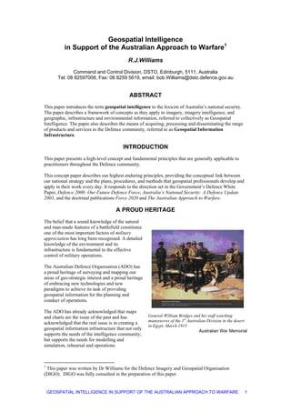
  • 1. Geospatial Intelligence in Support of the Australian Approach to Warfare1 R.J.Williams Command and Control Division, DSTO, Edinburgh, 5111, Australia Tel: 08 82597008, Fax: 08 8259 5619, email: bob.Williams@dsto.defence.gov.au ABSTRACT This paper introduces the term geospatial intelligence to the lexicon of Australia’s national security. The paper describes a framework of concepts as they apply to imagery, imagery intelligence, and geographic, infrastructure and environmental information, referred to collectively as Geospatial Intelligence. The paper also describes the means of acquiring, processing and disseminating the range of products and services to the Defence community, referred to as Geospatial Information Infrastructure. INTRODUCTION This paper presents a high-level concept and fundamental principles that are generally applicable to practitioners throughout the Defence community. This concept paper describes our highest enduring principles, providing the conceptual link between our national strategy and the plans, procedures, and methods that geospatial professionals develop and apply in their work every day. It responds to the direction set in the Government’s Defence White Paper, Defence 2000: Our Future Defence Force, Australia’s National Security: A Defence Update 2003, and the doctrinal publications Force 2020 and The Australian Approach to Warfare. A PROUD HERITAGE The belief that a sound knowledge of the natural and man-made features of a battlefield constitutes one of the most important factors of military appreciation has long been recognised. A detailed knowledge of the environment and its infrastructure is fundamental to the effective control of military operations. The Australian Defence Organisation (ADO) has a proud heritage of surveying and mapping our areas of geo-strategic interest and a proud heritage of embracing new technologies and new paradigms to achieve its task of providing geospatial information for the planning and conduct of operations. The ADO has already acknowledged that maps and charts are the issue of the past and has acknowledged that the real issue is in creating a geospatial information infrastructure that not only supports the needs of the intelligence community, but supports the needs for modelling and simulation, rehearsal and operations. General William Bridges and his staff watching manoeuvres of the 1st Australian Division in the desert in Egypt, March 1915 Australian War Memorial 1 This paper was written by Dr Williams for the Defence Imagery and Geospatial Organisation (DIGO). DIGO was fully consulted in the preparation of this paper. GEOSPATIAL INTELLIGENCE IN SUPPORT OF THE AUSTRALIAN APPROACH TO WARFARE 1
  • 2. GEO-STRATEGIC INFLUENCES – CATALYSTS FOR CHANGE In The Australian Approach to Warfare the Chief of the Defence Force (CDF) describes Australia’s Geo-Strategic Influences. “Australia is a secure country. It obtains much of its security from its geographic environment. Australia has a large land mass, no land border with another country, a substantial natural resource base and vast ocean surrounds that include extensive areas of very shallow water. Australia’s people, industries and infrastructure are largely concentrated on the coast, in our eastern, south-eastern, and south-western fringes. These physical characteristics contribute to our defence against armed attack using conventional means. However, while Australia is difficult to attack, there is also a great deal to defend. We are a large country, and have a small population. Conducting military operations in or from the northern parts of Australia would be a challenging task in terms of logistic support, transport, demands on civil infrastructure and, at times, the adverse effects of harsh climatic conditions on the performance of people and equipment. These factors highlight some of the challenges associated with the defence of Australia. Bali bombing Image Sunday, October 13, 2002 In addition to potential security threats involving conventional military attack, Australia’s security is also affected by emerging dangers posed by proliferation of weapons of mass destruction (nuclear, chemical and biological weapons, and their chief means of delivery – ballistic missiles), terrorism and attacks on information systems. Other, non-military threats to national security include natural disasters, pandemic disease, illegal immigration, illegal fishing, people smuggling, environmental degradation, narcotics and transnational crime”. Combined, these influences and emerging threats establish very real catalysts for change in the way Defence will acquire, process, manage and disseminate geospatial information for use by the broad spectrum of users from senior decision makers to troops on the ground. In short, Defence’s response to these challenges is to adopt the concept of providing Geospatial Intelligence and managing the processes through a Geospatial Information Infrastructure. GEOSPATIAL INTELLIGENCE Geospatial Intelligence is primarily about obtaining knowledge of the physical and cultural aspects of the global security environment and the capabilities and intentions of potential adversaries. The imperatives of information age warfare combined with the demands of contemporary threats to security have turned the model of national intelligence upside down. Previously, intelligence reports written by tactical units were sifted and analysed by national agencies for the benefits of national decision makers. In today’s more distributed model, the national collection systems and subject matter expertise once dedicated to supporting a select group of national decision makers now support a vastly expanded base of theatre and tactical users as well. Interoperability has become essential in a distributed worldwide network of intelligence producers and consumers, where finished intelligence often ends up in the guidance system of a tactical weapon. The growing demand for tactical support has been a key factor in the emergence of geospatial intelligence as a new discipline. The rapid pace of the targeting cycle and the increased number of targets has placed stress on the intelligence production processes. Emerging network-centric concepts of operations, which rely on the ability of friendly forces to detect, process, and respond to changes in the battle-space more quickly than adversary forces, require us to further reduce cycle times. The timeliness required for rapid, precision engagement demands closer integration of tools and processes GEOSPATIAL INTELLIGENCE IN SUPPORT OF THE AUSTRALIAN APPROACH TO WARFARE 2
  • 3. of imagery specialists who detect and characterise targets and the geospatial specialists who describe and measure the battle space. Geospatial intelligence aims to reduce uncertainty, providing a knowledge advantage in time for a decision to be made or an action to be taken to advance or protect national interests. “On the modern day battlefield everything is spatially related and if you don’t understand the spatial relationships you will never win the war!” The discipline of Geospatial Intelligence Unifying the strengths of imagery analysis and mapping, charting and geodesy, geospatial intelligence has emerged as a new discipline, separate and distinct from its predecessors. As a discipline, geospatial intelligence is defined primarily by three qualities: its character as an intelligence discipline, its unique analytical and geometrical aspects, and its fundamental spatial and temporal nature. Geospatial intelligence is an intelligence function. It primarily aims to understand the physical and cultural aspects of the global security environment. Geospatial intelligence is an analytical discipline and, as such, embodies a number of applied sciences, disciplines and technologies. The sciences include geography, cartography and mapping, geodesy and surveying, geomatics, several earth sciences, and computer science. Disciplines include photogrammetry and remote sensing, spatial analysis and geographic information systems, and so on. Technologies include GPS and location-based technologies, GIS, information technology, and so on. Geospatial intelligence is characterised by its fundamental spatial and temporal nature. Geospatial intelligence includes the description of geographical features, infrastructure and environmental aspects of our world. These features include political and administrative entities; population, demography and urban areas; the road, rail, air, sea infrastructure; facilities, communications and resources; physiographic, hydrographic, oceanographic, and meteorological features and state; and the natural and cultivated landscape. The description then involves the modelling, representation and location of these features to place them in a reference system. GEOSPATIAL INTELLIGENCE IN SUPPORT OF THE AUSTRALIAN APPROACH TO WARFARE 3
  • 4. These spatial and temporal aspects make geospatial intelligence a powerful, visual medium. Information from many sources can be integrated in a spatial framework to reveal spatial relationships not immediately evident. Through visualisation, geospatial intelligence permits both rapid, intuitive understanding of the physical environment and evaluation of potential courses of action in three spatial dimensions and through time. Geospatial Intelligence specialists represent and communicate the phenomena of our world. Applications of Geospatial Intelligence Geospatial intelligence provides unique knowledge not available by other means. Geospatial intelligence provides knowledge national decision leaders need to make informed decisions on matters of national security and foreign affairs. It plays a central role in identifying strategic threats, providing warnings of war, predicting humanitarian crises, and verifying international treaty compliance. Geospatial intelligence supports the development of national policy, the planning and execution of military operations, the protection of homeland security and other civil operations. Geospatial intelligence provides the vital knowledge foundation for modern joint warfare, serving as the basis for decision superiority, manoeuvre, engagement and interoperability. Geospatial intelligence offers the visual picture of the battle-space and the situational understanding that is essential for operational decision-making throughout the spectrum of conflict and at all levels of warfare. It is the major source of content for the common operational picture and the primary means of visualising it. Geospatial intelligence modelling capabilities are powerful tools for Intelligence Preparation of the Battle-space, giving Commanders unparalleled decision superiority. Geospatial intelligence gives war-fighters a critical understanding of an adversary’s strategic infrastructure and vulnerabilities, permitting precision strikes against strategic and tactical targets in all weather conditions. In addition, geospatial intelligence provides products on selected urban areas of interest, land and maritime entry and exit points, identification and assessment of foreign threats, and extent and scope of natural and man-made damage. In cases of terrorist attack or natural disaster, geospatial intelligence can rapidly give federal agencies and emergency services a comprehensive and detailed view of the scene, helping them to make the best possible decisions in preparation, response, and recovery actions. Geospatial intelligence also plays a role in a wide range of other applications including drug interdiction, illegal immigration, illegal fishing, and humanitarian relief. With its common spatial and temporal frame of reference, geospatial intelligence is essential for interoperability in joint and combined warfare. GEOSPATIAL INTELLIGENCE IN SUPPORT OF THE AUSTRALIAN APPROACH TO WARFARE 4
  • 5. EMERGING CAPABILITIES The discipline of geospatial intelligence unites a broad range of evolving and emerging capabilities and technologies. By bringing together the technical capabilities traditionally associated with imagery intelligence with those more typically used for acquiring, processing, and disseminating geodetic, topographic, hydrographic, geographic and aeronautical data, we are developing an expanded tool set for solving intelligence problems, as well as enhancing the capabilities of command support systems and operational combat support systems. Command support systems Rapidly advancing digital processing capabilities are revolutionising our ability to respond to the needs of our customers in the emerging network-centric environment, while the incorporation of an expanded range of data sources is enabling us to provide new dimensions of knowledge to national security decision-makers, and decision support systems, navigation systems, and a plethora of applications. Onboard navigation systems Mission planning Precision targeting Tactical operations Integrated CSS A GEOSPATIAL INFORMATION INFRASTRUCTURE “Imagery and geospatial information provide information about our world. When combined, as we have done with this new organisation, they enable Defence to extract knowledge for specific strategic and planning purposes. Key uses for this kind of information include situational awareness, decision-making and operational planning. The change announced today will provide the Australian Defence Organisation and the Government with intelligence and geospatial information needed to effectively operate in an increasingly complex environment. A modern and versatile defence force needs reliable information, ranging from accurate maps to digital data for electronic equipment, to three-dimensional computer models for planning operations. Advanced weapons systems in particular require ‘smarter’ geospatial information to support them and Australia must be able to produce this information. The formation of DIGO is a significant step in developing this capability.” Media Release MIN 332/00 - 08 Nov 2000 GEOSPATIAL INTELLIGENCE IN SUPPORT OF THE AUSTRALIAN APPROACH TO WARFARE 5
  • 6. Defence Imagery and Geospatial Organisation (DIGO) is the lead agency within the Australian Defence Organisation in the production and dissemination of geospatial intelligence. Whilst being the lead agency, DIGO is not the only agency involved in the capability. There is a range of agencies and organisations performing functions which, in total, make up the geospatial intelligence capability. These agencies include other Defence units, Commonwealth and State Government agencies, industry groups, and international agencies and bodies. As such, these capabilities need to be brought together to form a Geospatial Information Infrastructure (GII). A GII is an enabling infrastructure that meets the needs of the community for geospatial information. The infrastructure is the collection of people, doctrine, policies, architecture, standards, and technologies necessary to create, maintain, and utilise a shared geospatial framework. The GII: Establishes a framework for acquiring, producing, managing, and disseminating geospatial information; Provides the supporting services needed to ensure information content meets user needs, is easily accessible, and can readily be applied to support operational information requirements; and Ensures the supporting infrastructure components (including policy, doctrine, training, and force structure) are in place to optimise the use of the geographic information, products, and services (i.e. geospatial intelligence) provided. In order to implement the GII, DIGO provides the lead role in the ADO with respect to the geospatial intelligence capability and DIGO collaborates both nationally and internationally in order to fulfil its functional mandate. In the near future DIGO plans to host the service centre of Defence’s GII and, via its portal, link key ADO command support systems and other geospatial information providers such as the Navy’s Hydrographic Service and Air Force’s Aeronautical Information Service. DIGO is investigating the means to access and serve the National Spatial Data Infrastructure via arrangements with its civilian counterpart, Geoscience Australia. DIGO will continue to collaborate in the international arena with our traditional partners (the US, UK, Canada and New Zealand), the broader international forum (via the Digital Geospatial Information Working Group and other organisations) and with nations in South- East Asia and the South-West Pacific via a range of agreements and understandings. GEOSPATIAL INTELLIGENCE IN SUPPORT OF THE AUSTRALIAN APPROACH TO WARFARE 6
  • 7. DIGO will continue to develop its own intellectual property by working through both formal processes and informal cooperative ventures with research laboratories and industry. DIGO sponsors tasking with Defence Science and Technology Organisation (DSTO), collaborates with the Commonwealth Scientific and Industrial Research Organisation (CSIRO), sponsors students at universities and institutes around the nation, has exchange staff at various places around the world, and will participate in the new Cooperative Research Centre for Spatial Information. In summary, the Geospatial Information Infrastructure provides the means of acquiring, processing and disseminating the range of products and services to the Defence community; products and services that are primarily about obtaining and providing knowledge of the physical and cultural aspects of the global security environment and the capabilities and intentions of potential adversaries, that is Geospatial Intelligence. THE FUTURE OF GEOSPATIAL INTELLIGENCE As we move forward and beyond this time of dramatic change, geospatial intelligence will continue to face new challenges and new opportunities. Future State: Geospatial Intelligence Online DIGO is investigating initiatives to address just some of the challenges and opportunities. These include: The integration of its imagery and geospatial capabilities; The consultative process with the Defence user community and the Defence capability development community; The enhancement of its international relations; The participation in multi-national collaborative production of geospatial information; The engagement of academia and industry; and others. DIGO is examining the migration of its processes, systems and tools to an all-digital, data-centric environment, beginning with significant improvements to its infrastructure (such as embracing the concept of a Geospatial Information Infrastructure). DIGO is embracing comprehensive information system networking practices to ensure the most timely, relevant, and accurate online content possible. DIGO will endeavour to provide customers what they need, when they need it, through anticipating their future information needs. DIGO is proactive in examining its capability to provide the ubiquitous knowledge map, the foundation of the Commonly Informed Operating Picture (CIOP), on which other forms of information can be overlaid. This comprehensive, geospatially referenced database links DIGO’s base of intelligence knowledge to a precise, digital model of the Earth, enabling the CIOP to serve as a powerful, intuitive medium through which we can collaborate with our partners and our customers can better visualise the mission space. And beyond … … The need to have a detailed knowledge of our geo-strategic environment is enduring, as is the need to continually develop and evolve our surveying and mapping capabilities. Contemporary issues and concerns such as the proliferation of weapons of mass destruction, terrorism, illegal immigration, and so on combined with society’s desire to be better informed will be the drivers to cause DIGO to continue to embrace change. These contemporary issues will demand a review on the very way we describe and model our environment. Our schemas and analytical tools will have to be far GEOSPATIAL INTELLIGENCE IN SUPPORT OF THE AUSTRALIAN APPROACH TO WARFARE 7
  • 8. richer than ever before; our products and services will need to be reliable and credible to meet the mission critical and safety critical needs of future needs and applications. The ways we visualise and portray our world will be need to be compatible and appropriate to the plethora of platforms, systems and devices that will need the geospatial intelligence to meet their various needs; systems and devices that range from complex command centres down to the ubiquitous mobile phone. DIGO has acknowledged that its tasks are going to become ever more complex, and has acknowledged that the important step of merging imagery, imagery intelligence and geospatial components is a vital step in the evolution of our geospatial intelligence capability. CONCLUSION Geospatial Intelligence in the Support of the Australian Approach to Warfare The convergence of our nation’s imagery and geospatial capabilities is an imperative of the current era, made necessary by the challenges of the changing national security environment and the emerging concepts of warfare, and made possible by the revolution in information technology. The demands of the current global environment require a robust ability to provide a growing set of intelligence and operational consumers a fully integrated visual picture of the strategic, operational and tactical situation. Imagery and geographic information provide information about our world. When combined, as we have done with this new organisation, they enable Defence to extract knowledge for specific strategic and planning purposes. Key uses for this kind of information include situational awareness, decision- making and operational planning. In this draft concept publication, Defence is introducing the term geospatial intelligence to the lexicon of Australia’s national security. The publication described a framework of concepts as they apply to imagery, imagery intelligence, and geographic, infrastructure and environmental information, referred to collectively as geospatial intelligence. The publication also described the means of acquiring, processing and disseminating the range of products and services to the Defence community, referred to as Geospatial Information Infrastructure. GEOSPATIAL INTELLIGENCE IN SUPPORT OF THE AUSTRALIAN APPROACH TO WARFARE 8
  • 9. REFERENCES White Paper, Defence 2000: Our Future Defence Force, Department of Defence, Australia, 2000 http://203.6.115.8/whitepaper/ Australia’s National Security: A Defence Update, Department of Defence, Australia, 2003 http://203.6.115.8/ans2003/ The Australian Approach to Warfare, Department of Defence, 2002 http://203.6.115.8/publications/taatw.pdf Force 2020, Department of Defence, 2002 http://203.6.115.8/publications/f2020.pdf GEOSPATIAL INTELLIGENCE IN SUPPORT OF THE AUSTRALIAN APPROACH TO WARFARE 9