SlideShare ist ein Scribd-Unternehmen logo
1 von 53
Downloaden Sie, um offline zu lesen
CHAPTER 4 : PHOTOGRAMMETRY
(IMP FOR 2 LONG Q = 16 MARKS)(NUMERICAL 1)
Prepared By:
Asst. Prof. Pramesh Hada
MSC in Urban Planning
B.E In Civil
Asst. Professor, Civil Engineering Dept.
Nepal Engineering College
Er.PrameshHada,Asst.Professor,necEr.PrameshHada,Asst.Professor,nec
Photogrammetric Survey
CHAPTER 4 : PHOTOGRAMMETRY
Introduction and Basic Terms of photogrammetry
(Short note )PU 2006,
Uses & importance of Photogrammetry (pu2010)
Types of Photogrammetry
Types of Photographs (pu07)
Scale of Vertical Photograph(pu09,010)
Er.PrameshHada,Asst.Professor,nec
Scale of Vertical Photograph(pu09,010)
Relief Displacement (pu08,010*2, 011,)
Instruction on Field Works
Numerical (1 on exam always)
Phototheodolite -2006,stereoscope & stereoscopic vision -06,07,
Define – Vertical,oblique photograph,forward,side overlap.-07*2,09,
Er.PrameshHada,Asst.Professor,nec
Er.PrameshHada,Asst.Professor,necEr.PrameshHada,Asst.Professor,nec
TUTORIAL -2 (IMPORTANT QUESTIONS)
What is Photogrammetry? Write its significance/uses in Surveying.
What are the types of Photograph.
Write a short note on construction and use of phototheodolite. (6)
2006
Derive an expression to find the scale of a vertical photogaph.
(7)2009,2010
What is relief displacement ? Derive an expression to find the relief
displacement ? (7) 2008,2010*2,2011
What is photogrammetry. Discuss its limitations. (7) 2010
Er.PrameshHada,Asst.Professor,nec
What is photogrammetry. Discuss its limitations. (7) 2010
Write short notes: (pu 2006, 2007)
vertical photograph
Camera axis
Forward & side overlap
Isocentre
Fiducial Mark
Aerial camera
Oblique photograph
Er.PrameshHada,Asst.Professor,nec
INTRODUCTION
Is the science of making measurements from photographs.
Output of photogrammetry is typically a map, drawing,
measurement, or a 3D model of some real-world object or scene.
Photogrammetric surveying or photogrammetry is the branch of
surveying in which maps are prepared from photo-graphs taken from
ground or air stations.
With an advancement of the photogrammetric techniques,
photographs are also being used for the interpretation of geology,
classification of soils and crops,etc.
Er.PrameshHada,Asst.Professor,nec
classification of soils and crops,etc.
Is the science of making measurements from photographs,
especially for recovering the exact positions of surface points.
Used to recover the motion pathways of designated reference
points located on any moving object, on its components and in the
immediately adjacent environment.
Photogrammetry may employ high-speed imaging and remote
sensing in order to detect, measure and record complex 2-D and
3-D motion fields.
Now a days devices– drone camera, aircraft,phototheodolite, digital camera etc.
Er.PrameshHada,Asst.Professor,nec
DRONE CAMERA
Er.PrameshHada,Asst.Professor,nec
Er.PrameshHada,Asst.Professor,necEr.PrameshHada,Asst.Professor,nec
Photogrammetry is the practice
of determining the geometric
properties of objects from
photographic images.
Is the making of precise
measurements from
photographs; the making of
maps from photographs,
INTRODUCTION
Er.PrameshHada,Asst.Professor,nec
maps from photographs,
especially from aerial surveying.
Er.PrameshHada,Asst.Professor,nec
• The science of using aerial photography and other remote
sensing imagery to obtain measurement of natural and man-
made features on the earth.
•In this method, object are measured without being touched.
LOW ALTITUDE AERIAL PHOTOGRAPH FOR USE
IN PHOTOGRAMMETRY - LOCATION THREE
ARCH BAY, LAGUNA BEACH CA.
Definition
Process of making surveys and maps using
photographs.
The science of deducing the physical
dimensions of objects from measurements
on images (usually photographs) of the
objects.
The making of maps by photography from
the air using reference points of known
level and position which can be identified
Er.PrameshHada,Asst.Professor,nec
stereophotogrammetry technology Rapidlevel and position which can be identified
on the photographs.
The art and science of obtaining reliable
quantitative and qualitative
measurements through the use of
photographs.
Er.PrameshHada,Asst.Professor,nec
A series of techniques for measuring position and altitude from aerial photographs
or images.
Is the Art, Science and Technology of obtaining reliable information about physical
objects and the environment through processes of recording, measuring and
interpreting photographic images.
stereophotogrammetry technology Rapid
3D Mapping applied on the Royal Castle
of Sweden.
Broadly Photogrammetry Requires:
Planing & taking the photographs
Processing the photographs
Measuring the photographs & Reducing
the measurement to produce end results.
Field Application of Photogrammetry :
Used to conduct topographical survey or engineering surveys.
Suitable for mountainous and hilly terain with little vegetation.
Used for geological mapping which includes identification of land
Er.PrameshHada,Asst.Professor,nec
Used for geological mapping which includes identification of land
forms, rock type & rock structures.
Used for projects demanding higher accuracy, since it provides
accurate measurements.
Used in urban and regional planning applications.
Used mostly in Planning/designing in transport planning, bridge,
pipeline, hydropower, urban planning, security and strategic
planning, disaster management, natural resources management, city
models, conservation of archaeological sites etc.
Er.PrameshHada,Asst.Professor,nec
Its applications include satellite tracking of the relative
positioning alterations in all Earth environments.
The quantitative results of photogrammetry are used to
guide and match the results of computational models of
the natural systems, thus helping to invalidate or
confirm new theories, to design novel vehicles or new
methods for predicting or/and controlling the
consequences of earthquakes, tsunamis, any other
Importance/application of photogrammetry
Er.PrameshHada,Asst.Professor,nec
consequences of earthquakes, tsunamis, any other
weather types.
Photogrammetry also helps for the solving
of triangulation, trilateration and multidimensional
scaling.
In the simplest example, the distance between two
points that lie on a plane parallel to the photographic
image plane can be determined by measuring their
distance on the image, if the scale (s) of the image is
known.
Er.PrameshHada,Asst.Professor,nec
Used in different fields, such as topographic
mapping, architecture, engineering, manufacturing, quality
control, police investigation, and geology, as well as
by archaeologists to quickly produce plans of large or complex sites
and by meteorologists.
Importance/application of photogrammetry
Advantage
•Covers large area
•Less time consuming/fast
Disadvantage
• Complex system, highly trained human
resource needed
Er.PrameshHada,Asst.Professor,nec
•Less time consuming/fast
•Can ‘reach’ inaccessible and
restricted area
•Cheap/cost effective for large
area and in a long run
•Easy to interpret, understand
resource needed
•Costly at the time of
installation/initiation
•Heavy and sophisticated equipments
needed
•Lengthy administrative procedure for
getting permission to fly
•Weather dependent
Er.PrameshHada,Asst.Professor,nec
PRINCIPLE OF PHOTOGRAMMETRY
Principle of photogrammetric survey in its simplest
form is very similar to that of the plane table survey.
Only difference is that the most of the work which in
plane table survey is executed in the field, but here is
done in office.
The principal point of each photograph is used as a
fixed station and rays are drawn to get points of
intersections very similar to those used in plane table.
Er.PrameshHada,Asst.Professor,nec
intersections very similar to those used in plane table.
Is suitable for topographical or engineering surveys and
also for those projects demanding higher accuracy.
It is unsuitable for dense forest & others due to the
difficulty of identifying points upon the pair of
photographs.
Er.PrameshHada,Asst.Professor,nec
TYPES OF PHOTOGRAMMETRY / PHOTOGRAPHS
The photographs used in photogrammetry may be broadly
classified into two types depending upon the camera position at
the time of photography.
The types are-
Terrestrial Photographs
Aerial Photographs
Terrestrial Photographs
Er.PrameshHada,Asst.Professor,nec
Terrestrial Photographs
Photographs taken from camera station at a fixed position on or
near the ground is known as Terrestrial Photographs.
The photographs are taken by means of a phototheodolite which
is combination of a camera and a theodolite.
Based on the principle that “if the directions of same objects
photographed from two extremities of measured base are known,
their position can be located by the intersection of two rays to the
same object.
Er.PrameshHada,Asst.Professor,nec
TERRESTRIAL PHOTOGRAPHS
Er.PrameshHada,Asst.Professor,nec
•photographs are taken from elevated ground stations.
•Method is very similar that the camera is in stationary position.
•Camera used in this method is called photo-theodolite as it will require
the same features as theodolite.
•It is much cheaper and can be carried out by individual surveying firms also.
Er.PrameshHada,Asst.Professor,nec
Er.PrameshHada,Asst.Professor,necEr.PrameshHada,Asst.Professor,nec
Difference between this and plane tabling is that more details are at
once obtained from the photographs and their subsequent plotting etc.
is done by the office while in plane tabling all the detailing is done in
the field itself.
Fig A and B are the two stations at the ends of base AB.
Arrows indicate the directions of horizontal pointing (in plan) of the
camera.
For each pair of pictures taken from the two ends, the camera axis is
kept parallel to each other.
From economy and speed point of view, minimum number of
photographs should be used to cover the whole area and to achieve this,
TERRESTRIAL PHOTOGRAPHS
Er.PrameshHada,Asst.Professor,nec
photographs should be used to cover the whole area and to achieve this,
it is essential to select the best positions of the camera stations.
Study of the area should be done from the existing maps, and a ground
reconnaissance should be made. Selection of actual stations depends
upon the size and ruggedness of the area.
These photographs provides the front view of elevation & are generally
used for the survey of structure & Architectural Monuments.
Er.PrameshHada,Asst.Professor,nec
AERIAL PHOTOGRAPHS
Photographs taken from a Aerial camera mounted on a aerial
vehicle
Used for various purpose, mainly information extraction on the
ground surface
Aerial photographs are obtained from the aerial cameras
mounted on aerial vehicle(aeroplane for the purpose of
photography)
Used for various purpose, mainly information extraction on the
ground surface
Er.PrameshHada,Asst.Professor,nec
ground surface
Photographs are taken from camera station in the air with the
axis of camera vertical or nearly vertical.
Is the branch of photogrammetry where the photographs are
taken from air station.
This is the best mapping procedure yet developed for large
objects and are useful for military intelligence.
For this, aerial camera is used which are fixed on flying
aircraft.
Er.PrameshHada,Asst.Professor,nec
Er.PrameshHada,Asst.Professor,necEr.PrameshHada,Asst.Professor,nec
AERIAL PHOTOGRAPHS
According to the direction of the camera axis at the time of exposure
aerial photographs may be classified into:
Vertical photographs
Oblique photographs
Vertical photographs
These photographs are taken from the air with the axis of the
Camera vertical or nearly vertical .
A truly vertical Photograph closely resembles a map.
AERIAL PHOTOGRAPHS
Er.PrameshHada,Asst.Professor,nec
A truly vertical Photograph closely resembles a map.
These are utilized for the compilation of topographic and engineering
surveys on various scales.
Er.PrameshHada,Asst.Professor,nec
Vertical photographs Oblique photographs
Er.PrameshHada,Asst.Professor,necEr.PrameshHada,Asst.Professor,nec
OBLIQUE PHOTOGRAPHS
Photographs are taken from air with the axis of the camera intentionally
tilted from the vertical.
An oblique photograph covers larger area of the ground but clarity of details
diminishes towards the far end of the photograph.
Depending upon the angle of obliquity, oblique photographs may he further
divided into two categories.
Low oblique photographs :
An oblique photograph which does not show the horizon, is known as low
oblique photograph.
Such photographs are generally used to compile reconnaissance maps of
Er.PrameshHada,Asst.Professor,nec
Such photographs are generally used to compile reconnaissance maps of
inaccessible areas.
High oblique photograph:
• An oblique photograph which is sufficiently tilted
to show the horizon, is known as high oblique,
photograph.
•Such photographs were previously used for the
extension of planimetric and height control in areas
having scanty ground control.
Er.PrameshHada,Asst.Professor,nec
OBLIQUE AERIAL PHOTOGRAPHYVertical photo
Er.PrameshHada,Asst.Professor,nec
Er.PrameshHada,Asst.Professor,necEr.PrameshHada,Asst.Professor,nec
THE PHOTO-THEODOLITE
CONSTRUCTION AND USE OF PHOTOTHEODOLITE (PU 2006)
Is a combination of camera and theodolite mounted on
the same tripod,
Used in terrestrial photogrammetry for mapmaking
and other purposes.
Photographs obtained are used for the construction of
topographic maps, classification of soil, interpretation
of geology.
Er.PrameshHada,Asst.Professor,nec
While taking the photographs the camera axis is kept
parallel to each other.
It consists of :
A camera box of fixed focus type
A hollow rectangular frame placed vertically to the
rear side
The sensified photographic plate.
Er.PrameshHada,Asst.Professor,nec
THE PHOTO-THEODOLITE
Camera box is supported on the tripod and is
furnished with an inner and outer axis each of
which is fitted with a clamp and fine adjusting
screw.
The graduated horizontal circle carries
verniers reading to single minutes. These are
supported on a levelling head carrying three
foot screws.
Er.PrameshHada,Asst.Professor,nec
foot screws.
On the top of the box, a telescope is fitted.
The telescope can be rotated in a vertical plane
about a horizontal axis and is fitted with
vertical arc with verniers, clamp & slow
motion screw.
The line of sight of the telescope is set in the
same vertical plane as the optical axis of
camera.
Er.PrameshHada,Asst.Professor,nec
AERIAL PHOTOGRAPH / CAMERA (PU2006)
Aerial camera are used to have aerial photographs which are fixed
on flying aircarft.
Primary function of the terrestrial camera as well as the aerial
camera is the same, i.e., that of taking pictures.
Aerial camera is mounted on a fast moving aeroplane, its
requirements are quite different.
Aerial camera requires :
Fast Lens
Er.PrameshHada,Asst.Professor,nec
Fast Lens
High speed & sufficient shutter
High speed emulsion for the film
A Magazine to hold large rolls of film
Aerial camera is considered to be a surveying instrument of great
precision.
Er.PrameshHada,Asst.Professor,nec
An aerial camera consists of following
essential parts
lens assembly consists of lenses, the
diaphragm, shutter and the filter.(Fig-6,8,9)
Camera cone which supports the entire lens
assembly including the filter. (fig - 5)
focal (2) plane exactly above the collimation
mark.
camera body (3) provided at the top of cone
AERIAL PHOTOGRAPH / CAMERA (PU2006)
Er.PrameshHada,Asst.Professor,nec
camera body (3) provided at the top of cone
which acts as an integral part to preserve
the interior orientation.
Drive mechanism which is housed in camera
body & used for winding and tripping the
shutter, operating the vaccum system for
flattering the film, winding the film.
The magazine (1) which holds the exposed
and unexposed films & houses the film
flattening device at the focal plane.
Er.PrameshHada,Asst.Professor,nec
JAPANESE AERIAL CAMERAS
Er.PrameshHada,Asst.Professor,nec
GOWLAND DELUXE 4X5 AERIAL CAMERA
WITH FOCUS TUBE
There are three types of Aerial Camera :
Super wide angle camera – f=100mm
(used in flat areas like terai of nepal & in plain areas)
Wide angle camera – f=150mm
(Used in hilly areas)
Narrow angle camera – f=300mm
(Used in higher himalayas, sky scrappers & city like New york)
Er.PrameshHada,Asst.Professor,necEr.PrameshHada,Asst.Professor,nec
DETERMINATION OF A SCALE OF THE VERTICAL
PHOTOGRAPH (PU 2004,2009,2010) IMP (NUMERICAL IMP)
The scale of the vertical photograph
is the ratio of a distance on the photo
to the corresponding distance to the
ground.
Let N = Perspective centre
H= flying height of the camera
f = focal length of camera
h= height of ground above mean sea
level
N
Er.PrameshHada,Asst.Professor,nec
level
Construction :
Draw BK perpendicular to NV meeting
at K
From similar triangles Nvb and NKB,
Scale of Photograph ( SA ) = f
H- h
Er.PrameshHada,Asst.Professor,nec
If the terrain is perfectly flat or plane at
the mean sea level then , h=0,
So, Scale of photograph = f
H
SCALE OF THE VERTICAL PHOTOGRAPH
Er.PrameshHada,Asst.Professor,nec
This shows, the scale of vertical photographs over the flat terrain is
the ratio of the photo distance to the ground distance.
Note : Relation between Photoscale & Mapscale
Er.PrameshHada,Asst.Professor,nec
RELIEF DISPLACEMENT (2008,2010,2011)
•The scale of an aerial photograph is partly a function of flying
height.
•Thus, variations in elevation cause variations in scale on aerial
photographs.
• Specifically, the higher the elevation of an object, the farther the
object will be displaced from its actual position away from the
principal point of the photograph (the point on the ground surface
Er.PrameshHada,Asst.Professor,nec
principal point of the photograph (the point on the ground surface
that is directly below the camera lens).
•The lower the elevation of an object, the more it will be displaced
toward the principal point. This effect, called relief displacement,
is illustrated in the diagram below.
• Note that the effect increases with distance from the principal
point.
Er.PrameshHada,Asst.Professor,nec
Er.PrameshHada,Asst.Professor,necEr.PrameshHada,Asst.Professor,nec
•Ground relief is shown in perspective on the photograph due to which every
point on the photograph is displaced from their true orthographic position.
•This Displacement is called relief displacement.
•It is denoted by d.
Determine an expression for determining the relief displacement
on a vertical photograph (PU 08,10,11,12)
relief d
Er.PrameshHada,Asst.Professor,nec
relief d
Er.PrameshHada,Asst.Professor,nec
Determine an expression for determining the relief displacement
on a vertical photograph (PU 08,10,11,12)
From equations (3) and (4) above, we
conclude the following :
•Relief displacement increases as the
distance from the principal point
increases.
• Relief displacement decreases with
the increase in the flying height.
•For point above datum, the relief
Er.PrameshHada,Asst.Professor,nec
•For point above datum, the relief
displacement is positive being
radially outward.
•For point below datum (having
negative value), reIief displacement
is negative, being radially inward.
• Relief displacement of the point
vertically below the exposure station
is zero.
Er.PrameshHada,Asst.Professor,nec
TILT DISPLACEMENT
Defined as the difference between the distance of the
image of a point on the tilted photograph from the
isocentre and the distance of the image of the same
point on the photograph from the isocentre if there
had been no tilt.
An error in the position of a point on
the photograph due to indeliberate
Er.PrameshHada,Asst.Professor,nec
the photograph due to indeliberate
tilting of the aircraft
Due to instability of aircraft
May be due to tilting of the aircraft
along the flight
line and/or perpendicular to the flight
line
Increases radially from the isocenter
Er.PrameshHada,Asst.Professor,nec
Er.PrameshHada,Asst.Professor,necEr.PrameshHada,Asst.Professor,nec
BASIC TERMS USED IN PHOTOGRAMMETRY
Tilted Photograph:
An aerial photograph taken with a camera having it’s optical axis
tilted usually less than 3º from the vertical is known as tilted
photograph.
Exposure (or air) station (O):
The exact position of the front nodal point of the lens in the air at
the instant of exposure.
Flying height (H): (2009)
Er.PrameshHada,Asst.Professor,nec
Flying height (H): (2009)
The elevation of the air station above the mean sea level is known
as flying height of the aircraft.
Nadir Point (Plumb Point): (2009)
The point where a plumb line dropped from the front nodal point
strikes the photograph
Camera Axis : (2006)
It is the line passing through the centre of the camera lens
perpendicular both to the camera plate (negative) and the picture
plane (photography).
Er.PrameshHada,Asst.Professor,nec
TERMS USED IN PHOTOGRAMMETRY
Er.PrameshHada,Asst.Professor,nec
Fiducial mark – 2006,2007 (Reference mark)
A fiducial mark is one of two, three or four marks, located in contact with
the photographic emulsion in a camera image plane to provide a reference
line or lines for the plate measurement of images.
Iso centre (2006)
The point in which the bisector of the angle of tilt meets the photographs is
known as Isocentre.
It lies on the principal line at a distance of f tan t/2 from the principal point.
Principal Point
The point where a perpendicular dropped from the front nodal point strikes
BASIC TERMS USED IN PHOTOGRAMMETRY
Er.PrameshHada,Asst.Professor,nec
The point where a perpendicular dropped from the front nodal point strikes
the photographs is known as principal point of photograph
Focal length –
It is the perpendicular distance from the centre of the camera lens to either
the picture plane or the camera plate.
Tilt : The deviation of a plate from the horizontal plane at the time of
exposure is known as tilt.
Horizontal Point (h): The point of intersection of the principal line (VIP) and
the horizontal line (oh) through the perspective centre O is known as
horizontal point.
Er.PrameshHada,Asst.Professor,nec
Er.PrameshHada,Asst.Professor,necEr.PrameshHada,Asst.Professor,nec
INTERPRETATIONS THROUGH
MAPS AND AERIAL PHOTOS
Er.PramesheshHada,Asst.Professor,nec
INTERPRETATIONS THROUGH
MAPS AND AERIAL PHOTOS
AERIAL IMAGE - 1957
SATELLITE IMAGE- 1998
Er.Pramesh
AERIAL IMAGE- 1981
PATAN DURBAR SQUARE AREA
eshHada,Asst.Professor,nec
Er.PrameshHada,Asst.Professor,nec
IRS1 CPAN1 04052A0_23NOV1996
OF KATHMANDU
CORONA1M_KATHMANDU 05FEB 1967
Er.PrameshHada,Asst.Professor,nec
PATAN DURBAR SQUARE AREA
Er.PrameshHada,Asst.Professor,nec
AERIAL PHOTO 1957
Er.PrameshHada,Asst.Professor,nec
AERIAL PHOTO 1981 AERIAL PHOTO 1998
Er.PrameshHada,Asst.Professor,nec
Er.PrameshHada,Asst.Professor,necEr.PrameshHada,Asst.Professor,nec
Thank you
Best of luck for
Er.PrameshHada,Asst.Professor,nec
Best of luck for
the Exam
Er.PrameshHada,Asst.Professor,nec

Weitere ähnliche Inhalte

Was ist angesagt?

Lecture on photogrammetry
Lecture on photogrammetryLecture on photogrammetry
Lecture on photogrammetryWaleed Liaqat
 
Aerial Photogrammetry 01
Aerial Photogrammetry 01Aerial Photogrammetry 01
Aerial Photogrammetry 01Rajesh Rajguru
 
1 2 aerial photography
1 2 aerial photography1 2 aerial photography
1 2 aerial photographymayasubodh22
 
Aerial photography abraham thomas
Aerial photography abraham thomasAerial photography abraham thomas
Aerial photography abraham thomasSumant Diwakar
 
Lecture01: Introduction to Photogrammetry
Lecture01: Introduction to PhotogrammetryLecture01: Introduction to Photogrammetry
Lecture01: Introduction to PhotogrammetrySarhat Adam
 
Vertical Exaggeration
Vertical ExaggerationVertical Exaggeration
Vertical ExaggerationRob Marchetto
 
Flight planning (aerial Photogrammetry)
Flight planning            (aerial Photogrammetry)Flight planning            (aerial Photogrammetry)
Flight planning (aerial Photogrammetry)Mr Amol Ghogare
 
Distortions and displacement on aerial photograph
Distortions and displacement on aerial photographDistortions and displacement on aerial photograph
Distortions and displacement on aerial photographchandan00781
 
Hydrographic Surveying By Jithin Jose
Hydrographic Surveying  By Jithin JoseHydrographic Surveying  By Jithin Jose
Hydrographic Surveying By Jithin JoseJithin Jose
 
Aerial photography- Concept and Terminologies
Aerial photography- Concept and Terminologies Aerial photography- Concept and Terminologies
Aerial photography- Concept and Terminologies UTTIYACHATTOPADHYAY2
 
Geometry of Aerial photograph
Geometry of Aerial photographGeometry of Aerial photograph
Geometry of Aerial photographApoorva Mathur
 
VISUAL IMAGE INTERPRETATION.pptx
VISUAL IMAGE INTERPRETATION.pptxVISUAL IMAGE INTERPRETATION.pptx
VISUAL IMAGE INTERPRETATION.pptxSamirsinh Parmar
 
Types of aerial cameras - photogrammetry
Types of aerial cameras - photogrammetry Types of aerial cameras - photogrammetry
Types of aerial cameras - photogrammetry prasenjit bhowmick
 

Was ist angesagt? (20)

Photogrammetry 1.
Photogrammetry 1.Photogrammetry 1.
Photogrammetry 1.
 
Lecture on photogrammetry
Lecture on photogrammetryLecture on photogrammetry
Lecture on photogrammetry
 
Introduction of photogrammetry
Introduction of photogrammetryIntroduction of photogrammetry
Introduction of photogrammetry
 
Stereoscopic Parallax
Stereoscopic ParallaxStereoscopic Parallax
Stereoscopic Parallax
 
Aerial Photogrammetry 01
Aerial Photogrammetry 01Aerial Photogrammetry 01
Aerial Photogrammetry 01
 
1 2 aerial photography
1 2 aerial photography1 2 aerial photography
1 2 aerial photography
 
Aerial photography abraham thomas
Aerial photography abraham thomasAerial photography abraham thomas
Aerial photography abraham thomas
 
Lecture01: Introduction to Photogrammetry
Lecture01: Introduction to PhotogrammetryLecture01: Introduction to Photogrammetry
Lecture01: Introduction to Photogrammetry
 
Photogrammetry-part 1
Photogrammetry-part 1Photogrammetry-part 1
Photogrammetry-part 1
 
Vertical Exaggeration
Vertical ExaggerationVertical Exaggeration
Vertical Exaggeration
 
Digital photogrammetry
Digital photogrammetryDigital photogrammetry
Digital photogrammetry
 
Flight planning (aerial Photogrammetry)
Flight planning            (aerial Photogrammetry)Flight planning            (aerial Photogrammetry)
Flight planning (aerial Photogrammetry)
 
Types of stereoscope
Types of stereoscopeTypes of stereoscope
Types of stereoscope
 
Distortions and displacement on aerial photograph
Distortions and displacement on aerial photographDistortions and displacement on aerial photograph
Distortions and displacement on aerial photograph
 
Photogrammetry
PhotogrammetryPhotogrammetry
Photogrammetry
 
Hydrographic Surveying By Jithin Jose
Hydrographic Surveying  By Jithin JoseHydrographic Surveying  By Jithin Jose
Hydrographic Surveying By Jithin Jose
 
Aerial photography- Concept and Terminologies
Aerial photography- Concept and Terminologies Aerial photography- Concept and Terminologies
Aerial photography- Concept and Terminologies
 
Geometry of Aerial photograph
Geometry of Aerial photographGeometry of Aerial photograph
Geometry of Aerial photograph
 
VISUAL IMAGE INTERPRETATION.pptx
VISUAL IMAGE INTERPRETATION.pptxVISUAL IMAGE INTERPRETATION.pptx
VISUAL IMAGE INTERPRETATION.pptx
 
Types of aerial cameras - photogrammetry
Types of aerial cameras - photogrammetry Types of aerial cameras - photogrammetry
Types of aerial cameras - photogrammetry
 

Andere mochten auch

Lecture 1-aerial photogrammetry
Lecture 1-aerial photogrammetryLecture 1-aerial photogrammetry
Lecture 1-aerial photogrammetryVidhi Khokhani
 
Principle of aerial photography and types.ppt
Principle of aerial photography and types.pptPrinciple of aerial photography and types.ppt
Principle of aerial photography and types.pptsrinivas2036
 
Introduction to aerial photography and photogrammetry.ppt
Introduction to aerial photography and photogrammetry.pptIntroduction to aerial photography and photogrammetry.ppt
Introduction to aerial photography and photogrammetry.pptsrinivas2036
 
A new remote sensing methodology for detailed international mapping in the V4...
A new remote sensing methodology for detailed international mapping in the V4...A new remote sensing methodology for detailed international mapping in the V4...
A new remote sensing methodology for detailed international mapping in the V4...mirijovsky
 
Langhammer, Miřijovský
Langhammer, MiřijovskýLanghammer, Miřijovský
Langhammer, Miřijovskýmirijovsky
 
Structure from motion
Structure from motionStructure from motion
Structure from motionFatima Radi
 
Introduction to Sequence Stratigraphy Powerpoint
Introduction to Sequence Stratigraphy Powerpoint Introduction to Sequence Stratigraphy Powerpoint
Introduction to Sequence Stratigraphy Powerpoint SERC at Carleton College
 
Top 10 project quantity surveyor interview questions and answers
Top 10 project quantity surveyor interview questions and answersTop 10 project quantity surveyor interview questions and answers
Top 10 project quantity surveyor interview questions and answersmitchellparker911
 
Surveying ii module iii class 1,2
Surveying ii module iii class 1,2Surveying ii module iii class 1,2
Surveying ii module iii class 1,2SHAMJITH KM
 
Lab 9 - What do you Measure in a Topo Field?
Lab 9 - What do you Measure in a Topo Field?Lab 9 - What do you Measure in a Topo Field?
Lab 9 - What do you Measure in a Topo Field?Lori Miller Zimmerman
 
FIELD ASTRONOMY SURVEYING
FIELD ASTRONOMY SURVEYINGFIELD ASTRONOMY SURVEYING
FIELD ASTRONOMY SURVEYINGKavin Raval
 
About the paper: Graph Connectivity Measures for Unsupervised Word Sense Disa...
About the paper: Graph Connectivity Measures for Unsupervised Word Sense Disa...About the paper: Graph Connectivity Measures for Unsupervised Word Sense Disa...
About the paper: Graph Connectivity Measures for Unsupervised Word Sense Disa...Giovanni Murru
 
Surveying - chain, compass and plane table surveying
Surveying - chain, compass and plane table surveyingSurveying - chain, compass and plane table surveying
Surveying - chain, compass and plane table surveyingMalla Reddy University
 

Andere mochten auch (19)

Lecture 1-aerial photogrammetry
Lecture 1-aerial photogrammetryLecture 1-aerial photogrammetry
Lecture 1-aerial photogrammetry
 
Principle of aerial photography and types.ppt
Principle of aerial photography and types.pptPrinciple of aerial photography and types.ppt
Principle of aerial photography and types.ppt
 
Introduction to aerial photography and photogrammetry.ppt
Introduction to aerial photography and photogrammetry.pptIntroduction to aerial photography and photogrammetry.ppt
Introduction to aerial photography and photogrammetry.ppt
 
Surveying
Surveying Surveying
Surveying
 
Introduction to Fault Scarps
Introduction to Fault Scarps Introduction to Fault Scarps
Introduction to Fault Scarps
 
SfM Research Applications Presentation
SfM Research Applications PresentationSfM Research Applications Presentation
SfM Research Applications Presentation
 
A new remote sensing methodology for detailed international mapping in the V4...
A new remote sensing methodology for detailed international mapping in the V4...A new remote sensing methodology for detailed international mapping in the V4...
A new remote sensing methodology for detailed international mapping in the V4...
 
Langhammer, Miřijovský
Langhammer, MiřijovskýLanghammer, Miřijovský
Langhammer, Miřijovský
 
SfM Workflow Presentation
SfM Workflow PresentationSfM Workflow Presentation
SfM Workflow Presentation
 
Structure from motion
Structure from motionStructure from motion
Structure from motion
 
Introduction to Sequence Stratigraphy Powerpoint
Introduction to Sequence Stratigraphy Powerpoint Introduction to Sequence Stratigraphy Powerpoint
Introduction to Sequence Stratigraphy Powerpoint
 
GIS PPT
GIS PPTGIS PPT
GIS PPT
 
Top 10 project quantity surveyor interview questions and answers
Top 10 project quantity surveyor interview questions and answersTop 10 project quantity surveyor interview questions and answers
Top 10 project quantity surveyor interview questions and answers
 
Surveying ii module iii class 1,2
Surveying ii module iii class 1,2Surveying ii module iii class 1,2
Surveying ii module iii class 1,2
 
Lab 9 - What do you Measure in a Topo Field?
Lab 9 - What do you Measure in a Topo Field?Lab 9 - What do you Measure in a Topo Field?
Lab 9 - What do you Measure in a Topo Field?
 
Gis presentation
Gis presentationGis presentation
Gis presentation
 
FIELD ASTRONOMY SURVEYING
FIELD ASTRONOMY SURVEYINGFIELD ASTRONOMY SURVEYING
FIELD ASTRONOMY SURVEYING
 
About the paper: Graph Connectivity Measures for Unsupervised Word Sense Disa...
About the paper: Graph Connectivity Measures for Unsupervised Word Sense Disa...About the paper: Graph Connectivity Measures for Unsupervised Word Sense Disa...
About the paper: Graph Connectivity Measures for Unsupervised Word Sense Disa...
 
Surveying - chain, compass and plane table surveying
Surveying - chain, compass and plane table surveyingSurveying - chain, compass and plane table surveying
Surveying - chain, compass and plane table surveying
 

Ähnlich wie Photogrammetry Survey- Surveying II , Civil Engineering Students

Photogrammetry_nec.pdf
Photogrammetry_nec.pdfPhotogrammetry_nec.pdf
Photogrammetry_nec.pdfUjjwalSubedi8
 
GST - First Class Intro, Unit 1 and Unit 2 Part.pptx
GST - First Class Intro, Unit 1 and Unit 2 Part.pptxGST - First Class Intro, Unit 1 and Unit 2 Part.pptx
GST - First Class Intro, Unit 1 and Unit 2 Part.pptxpoola2015
 
chapter19. Terrestrial and Close-Range Photogrammetry.pdf
chapter19. Terrestrial and Close-Range Photogrammetry.pdfchapter19. Terrestrial and Close-Range Photogrammetry.pdf
chapter19. Terrestrial and Close-Range Photogrammetry.pdfssuser3f7a17
 
01 introdcution to photogrammetry
01 introdcution to photogrammetry01 introdcution to photogrammetry
01 introdcution to photogrammetrySarhat Adam
 
Photogrammetry survey.pdf
Photogrammetry survey.pdfPhotogrammetry survey.pdf
Photogrammetry survey.pdfVivek Thakur
 
Photogrammetry.pdf
Photogrammetry.pdfPhotogrammetry.pdf
Photogrammetry.pdfBSuresh26
 
PHOTOGRAMMETIC SURVEYING
PHOTOGRAMMETIC SURVEYING PHOTOGRAMMETIC SURVEYING
PHOTOGRAMMETIC SURVEYING ADCET, Ashta
 
applicationsofremotesensingingeologicalaspects-170606133459.pdf
applicationsofremotesensingingeologicalaspects-170606133459.pdfapplicationsofremotesensingingeologicalaspects-170606133459.pdf
applicationsofremotesensingingeologicalaspects-170606133459.pdfCIVIL48
 
Applications of remote sensing in geological aspects
Applications of remote sensing in geological aspectsApplications of remote sensing in geological aspects
Applications of remote sensing in geological aspectsPramoda Raj
 
Iaetsd concepts of surveying with totalstation-a latest
Iaetsd concepts of surveying with totalstation-a latestIaetsd concepts of surveying with totalstation-a latest
Iaetsd concepts of surveying with totalstation-a latestIaetsd Iaetsd
 
REMOTE SENSING_TOPIC_II_2023.pptx
REMOTE SENSING_TOPIC_II_2023.pptxREMOTE SENSING_TOPIC_II_2023.pptx
REMOTE SENSING_TOPIC_II_2023.pptxarmanisingh31
 
Remote sensing, GPS and GIS ppt
Remote sensing, GPS and GIS pptRemote sensing, GPS and GIS ppt
Remote sensing, GPS and GIS pptNaufil Sayyad
 
Landslide monitoring systems & techniques
Landslide monitoring systems & techniquesLandslide monitoring systems & techniques
Landslide monitoring systems & techniquesmaneeb
 
Remote sensing and tunneling.pptx
Remote sensing and tunneling.pptxRemote sensing and tunneling.pptx
Remote sensing and tunneling.pptxpandieswarim1
 
Seismic Reflection for Engineering Problems
Seismic Reflection for Engineering ProblemsSeismic Reflection for Engineering Problems
Seismic Reflection for Engineering ProblemsAli Osman Öncel
 

Ähnlich wie Photogrammetry Survey- Surveying II , Civil Engineering Students (20)

Photogrammetry_nec.pdf
Photogrammetry_nec.pdfPhotogrammetry_nec.pdf
Photogrammetry_nec.pdf
 
PHOTOGRAMMETRY.pptx
PHOTOGRAMMETRY.pptxPHOTOGRAMMETRY.pptx
PHOTOGRAMMETRY.pptx
 
Photographic survey
Photographic survey Photographic survey
Photographic survey
 
GST - First Class Intro, Unit 1 and Unit 2 Part.pptx
GST - First Class Intro, Unit 1 and Unit 2 Part.pptxGST - First Class Intro, Unit 1 and Unit 2 Part.pptx
GST - First Class Intro, Unit 1 and Unit 2 Part.pptx
 
G044044249
G044044249G044044249
G044044249
 
chapter19. Terrestrial and Close-Range Photogrammetry.pdf
chapter19. Terrestrial and Close-Range Photogrammetry.pdfchapter19. Terrestrial and Close-Range Photogrammetry.pdf
chapter19. Terrestrial and Close-Range Photogrammetry.pdf
 
01 introdcution to photogrammetry
01 introdcution to photogrammetry01 introdcution to photogrammetry
01 introdcution to photogrammetry
 
Photogrammetry survey.pdf
Photogrammetry survey.pdfPhotogrammetry survey.pdf
Photogrammetry survey.pdf
 
Photogrammetry.pdf
Photogrammetry.pdfPhotogrammetry.pdf
Photogrammetry.pdf
 
PHOTOGRAMMETIC SURVEYING
PHOTOGRAMMETIC SURVEYING PHOTOGRAMMETIC SURVEYING
PHOTOGRAMMETIC SURVEYING
 
Photogrammetry amir
Photogrammetry amirPhotogrammetry amir
Photogrammetry amir
 
applicationsofremotesensingingeologicalaspects-170606133459.pdf
applicationsofremotesensingingeologicalaspects-170606133459.pdfapplicationsofremotesensingingeologicalaspects-170606133459.pdf
applicationsofremotesensingingeologicalaspects-170606133459.pdf
 
Applications of remote sensing in geological aspects
Applications of remote sensing in geological aspectsApplications of remote sensing in geological aspects
Applications of remote sensing in geological aspects
 
Iaetsd concepts of surveying with totalstation-a latest
Iaetsd concepts of surveying with totalstation-a latestIaetsd concepts of surveying with totalstation-a latest
Iaetsd concepts of surveying with totalstation-a latest
 
REMOTE SENSING_TOPIC_II_2023.pptx
REMOTE SENSING_TOPIC_II_2023.pptxREMOTE SENSING_TOPIC_II_2023.pptx
REMOTE SENSING_TOPIC_II_2023.pptx
 
Remote sensing, GPS and GIS ppt
Remote sensing, GPS and GIS pptRemote sensing, GPS and GIS ppt
Remote sensing, GPS and GIS ppt
 
Landslide monitoring systems & techniques
Landslide monitoring systems & techniquesLandslide monitoring systems & techniques
Landslide monitoring systems & techniques
 
Remote sensing and tunneling.pptx
Remote sensing and tunneling.pptxRemote sensing and tunneling.pptx
Remote sensing and tunneling.pptx
 
Seismic Reflection for Engineering Problems
Seismic Reflection for Engineering ProblemsSeismic Reflection for Engineering Problems
Seismic Reflection for Engineering Problems
 
Introduction to Aerial Photogrammetry
Introduction to Aerial PhotogrammetryIntroduction to Aerial Photogrammetry
Introduction to Aerial Photogrammetry
 

Kürzlich hochgeladen

Call Girls Service Nashik Vaishnavi 7001305949 Independent Escort Service Nashik
Call Girls Service Nashik Vaishnavi 7001305949 Independent Escort Service NashikCall Girls Service Nashik Vaishnavi 7001305949 Independent Escort Service Nashik
Call Girls Service Nashik Vaishnavi 7001305949 Independent Escort Service NashikCall Girls in Nagpur High Profile
 
AKTU Computer Networks notes --- Unit 3.pdf
AKTU Computer Networks notes ---  Unit 3.pdfAKTU Computer Networks notes ---  Unit 3.pdf
AKTU Computer Networks notes --- Unit 3.pdfankushspencer015
 
ONLINE FOOD ORDER SYSTEM PROJECT REPORT.pdf
ONLINE FOOD ORDER SYSTEM PROJECT REPORT.pdfONLINE FOOD ORDER SYSTEM PROJECT REPORT.pdf
ONLINE FOOD ORDER SYSTEM PROJECT REPORT.pdfKamal Acharya
 
Glass Ceramics: Processing and Properties
Glass Ceramics: Processing and PropertiesGlass Ceramics: Processing and Properties
Glass Ceramics: Processing and PropertiesPrabhanshu Chaturvedi
 
(PRIYA) Rajgurunagar Call Girls Just Call 7001035870 [ Cash on Delivery ] Pun...
(PRIYA) Rajgurunagar Call Girls Just Call 7001035870 [ Cash on Delivery ] Pun...(PRIYA) Rajgurunagar Call Girls Just Call 7001035870 [ Cash on Delivery ] Pun...
(PRIYA) Rajgurunagar Call Girls Just Call 7001035870 [ Cash on Delivery ] Pun...ranjana rawat
 
Call Girls Service Nagpur Tanvi Call 7001035870 Meet With Nagpur Escorts
Call Girls Service Nagpur Tanvi Call 7001035870 Meet With Nagpur EscortsCall Girls Service Nagpur Tanvi Call 7001035870 Meet With Nagpur Escorts
Call Girls Service Nagpur Tanvi Call 7001035870 Meet With Nagpur EscortsCall Girls in Nagpur High Profile
 
KubeKraft presentation @CloudNativeHooghly
KubeKraft presentation @CloudNativeHooghlyKubeKraft presentation @CloudNativeHooghly
KubeKraft presentation @CloudNativeHooghlysanyuktamishra911
 
Introduction to Multiple Access Protocol.pptx
Introduction to Multiple Access Protocol.pptxIntroduction to Multiple Access Protocol.pptx
Introduction to Multiple Access Protocol.pptxupamatechverse
 
Processing & Properties of Floor and Wall Tiles.pptx
Processing & Properties of Floor and Wall Tiles.pptxProcessing & Properties of Floor and Wall Tiles.pptx
Processing & Properties of Floor and Wall Tiles.pptxpranjaldaimarysona
 
Top Rated Pune Call Girls Budhwar Peth ⟟ 6297143586 ⟟ Call Me For Genuine Se...
Top Rated  Pune Call Girls Budhwar Peth ⟟ 6297143586 ⟟ Call Me For Genuine Se...Top Rated  Pune Call Girls Budhwar Peth ⟟ 6297143586 ⟟ Call Me For Genuine Se...
Top Rated Pune Call Girls Budhwar Peth ⟟ 6297143586 ⟟ Call Me For Genuine Se...Call Girls in Nagpur High Profile
 
The Most Attractive Pune Call Girls Budhwar Peth 8250192130 Will You Miss Thi...
The Most Attractive Pune Call Girls Budhwar Peth 8250192130 Will You Miss Thi...The Most Attractive Pune Call Girls Budhwar Peth 8250192130 Will You Miss Thi...
The Most Attractive Pune Call Girls Budhwar Peth 8250192130 Will You Miss Thi...ranjana rawat
 
result management system report for college project
result management system report for college projectresult management system report for college project
result management system report for college projectTonystark477637
 
VIP Call Girls Ankleshwar 7001035870 Whatsapp Number, 24/07 Booking
VIP Call Girls Ankleshwar 7001035870 Whatsapp Number, 24/07 BookingVIP Call Girls Ankleshwar 7001035870 Whatsapp Number, 24/07 Booking
VIP Call Girls Ankleshwar 7001035870 Whatsapp Number, 24/07 Bookingdharasingh5698
 
Coefficient of Thermal Expansion and their Importance.pptx
Coefficient of Thermal Expansion and their Importance.pptxCoefficient of Thermal Expansion and their Importance.pptx
Coefficient of Thermal Expansion and their Importance.pptxAsutosh Ranjan
 
UNIT-III FMM. DIMENSIONAL ANALYSIS
UNIT-III FMM.        DIMENSIONAL ANALYSISUNIT-III FMM.        DIMENSIONAL ANALYSIS
UNIT-III FMM. DIMENSIONAL ANALYSISrknatarajan
 
Java Programming :Event Handling(Types of Events)
Java Programming :Event Handling(Types of Events)Java Programming :Event Handling(Types of Events)
Java Programming :Event Handling(Types of Events)simmis5
 
Call Girls Pimpri Chinchwad Call Me 7737669865 Budget Friendly No Advance Boo...
Call Girls Pimpri Chinchwad Call Me 7737669865 Budget Friendly No Advance Boo...Call Girls Pimpri Chinchwad Call Me 7737669865 Budget Friendly No Advance Boo...
Call Girls Pimpri Chinchwad Call Me 7737669865 Budget Friendly No Advance Boo...roncy bisnoi
 
Russian Call Girls in Nagpur Grishma Call 7001035870 Meet With Nagpur Escorts
Russian Call Girls in Nagpur Grishma Call 7001035870 Meet With Nagpur EscortsRussian Call Girls in Nagpur Grishma Call 7001035870 Meet With Nagpur Escorts
Russian Call Girls in Nagpur Grishma Call 7001035870 Meet With Nagpur EscortsCall Girls in Nagpur High Profile
 
The Most Attractive Pune Call Girls Manchar 8250192130 Will You Miss This Cha...
The Most Attractive Pune Call Girls Manchar 8250192130 Will You Miss This Cha...The Most Attractive Pune Call Girls Manchar 8250192130 Will You Miss This Cha...
The Most Attractive Pune Call Girls Manchar 8250192130 Will You Miss This Cha...ranjana rawat
 

Kürzlich hochgeladen (20)

Call Girls Service Nashik Vaishnavi 7001305949 Independent Escort Service Nashik
Call Girls Service Nashik Vaishnavi 7001305949 Independent Escort Service NashikCall Girls Service Nashik Vaishnavi 7001305949 Independent Escort Service Nashik
Call Girls Service Nashik Vaishnavi 7001305949 Independent Escort Service Nashik
 
AKTU Computer Networks notes --- Unit 3.pdf
AKTU Computer Networks notes ---  Unit 3.pdfAKTU Computer Networks notes ---  Unit 3.pdf
AKTU Computer Networks notes --- Unit 3.pdf
 
ONLINE FOOD ORDER SYSTEM PROJECT REPORT.pdf
ONLINE FOOD ORDER SYSTEM PROJECT REPORT.pdfONLINE FOOD ORDER SYSTEM PROJECT REPORT.pdf
ONLINE FOOD ORDER SYSTEM PROJECT REPORT.pdf
 
Glass Ceramics: Processing and Properties
Glass Ceramics: Processing and PropertiesGlass Ceramics: Processing and Properties
Glass Ceramics: Processing and Properties
 
(PRIYA) Rajgurunagar Call Girls Just Call 7001035870 [ Cash on Delivery ] Pun...
(PRIYA) Rajgurunagar Call Girls Just Call 7001035870 [ Cash on Delivery ] Pun...(PRIYA) Rajgurunagar Call Girls Just Call 7001035870 [ Cash on Delivery ] Pun...
(PRIYA) Rajgurunagar Call Girls Just Call 7001035870 [ Cash on Delivery ] Pun...
 
Call Girls Service Nagpur Tanvi Call 7001035870 Meet With Nagpur Escorts
Call Girls Service Nagpur Tanvi Call 7001035870 Meet With Nagpur EscortsCall Girls Service Nagpur Tanvi Call 7001035870 Meet With Nagpur Escorts
Call Girls Service Nagpur Tanvi Call 7001035870 Meet With Nagpur Escorts
 
KubeKraft presentation @CloudNativeHooghly
KubeKraft presentation @CloudNativeHooghlyKubeKraft presentation @CloudNativeHooghly
KubeKraft presentation @CloudNativeHooghly
 
Introduction to Multiple Access Protocol.pptx
Introduction to Multiple Access Protocol.pptxIntroduction to Multiple Access Protocol.pptx
Introduction to Multiple Access Protocol.pptx
 
Processing & Properties of Floor and Wall Tiles.pptx
Processing & Properties of Floor and Wall Tiles.pptxProcessing & Properties of Floor and Wall Tiles.pptx
Processing & Properties of Floor and Wall Tiles.pptx
 
Top Rated Pune Call Girls Budhwar Peth ⟟ 6297143586 ⟟ Call Me For Genuine Se...
Top Rated  Pune Call Girls Budhwar Peth ⟟ 6297143586 ⟟ Call Me For Genuine Se...Top Rated  Pune Call Girls Budhwar Peth ⟟ 6297143586 ⟟ Call Me For Genuine Se...
Top Rated Pune Call Girls Budhwar Peth ⟟ 6297143586 ⟟ Call Me For Genuine Se...
 
The Most Attractive Pune Call Girls Budhwar Peth 8250192130 Will You Miss Thi...
The Most Attractive Pune Call Girls Budhwar Peth 8250192130 Will You Miss Thi...The Most Attractive Pune Call Girls Budhwar Peth 8250192130 Will You Miss Thi...
The Most Attractive Pune Call Girls Budhwar Peth 8250192130 Will You Miss Thi...
 
result management system report for college project
result management system report for college projectresult management system report for college project
result management system report for college project
 
VIP Call Girls Ankleshwar 7001035870 Whatsapp Number, 24/07 Booking
VIP Call Girls Ankleshwar 7001035870 Whatsapp Number, 24/07 BookingVIP Call Girls Ankleshwar 7001035870 Whatsapp Number, 24/07 Booking
VIP Call Girls Ankleshwar 7001035870 Whatsapp Number, 24/07 Booking
 
Coefficient of Thermal Expansion and their Importance.pptx
Coefficient of Thermal Expansion and their Importance.pptxCoefficient of Thermal Expansion and their Importance.pptx
Coefficient of Thermal Expansion and their Importance.pptx
 
UNIT-III FMM. DIMENSIONAL ANALYSIS
UNIT-III FMM.        DIMENSIONAL ANALYSISUNIT-III FMM.        DIMENSIONAL ANALYSIS
UNIT-III FMM. DIMENSIONAL ANALYSIS
 
Java Programming :Event Handling(Types of Events)
Java Programming :Event Handling(Types of Events)Java Programming :Event Handling(Types of Events)
Java Programming :Event Handling(Types of Events)
 
Call Girls Pimpri Chinchwad Call Me 7737669865 Budget Friendly No Advance Boo...
Call Girls Pimpri Chinchwad Call Me 7737669865 Budget Friendly No Advance Boo...Call Girls Pimpri Chinchwad Call Me 7737669865 Budget Friendly No Advance Boo...
Call Girls Pimpri Chinchwad Call Me 7737669865 Budget Friendly No Advance Boo...
 
Russian Call Girls in Nagpur Grishma Call 7001035870 Meet With Nagpur Escorts
Russian Call Girls in Nagpur Grishma Call 7001035870 Meet With Nagpur EscortsRussian Call Girls in Nagpur Grishma Call 7001035870 Meet With Nagpur Escorts
Russian Call Girls in Nagpur Grishma Call 7001035870 Meet With Nagpur Escorts
 
(INDIRA) Call Girl Aurangabad Call Now 8617697112 Aurangabad Escorts 24x7
(INDIRA) Call Girl Aurangabad Call Now 8617697112 Aurangabad Escorts 24x7(INDIRA) Call Girl Aurangabad Call Now 8617697112 Aurangabad Escorts 24x7
(INDIRA) Call Girl Aurangabad Call Now 8617697112 Aurangabad Escorts 24x7
 
The Most Attractive Pune Call Girls Manchar 8250192130 Will You Miss This Cha...
The Most Attractive Pune Call Girls Manchar 8250192130 Will You Miss This Cha...The Most Attractive Pune Call Girls Manchar 8250192130 Will You Miss This Cha...
The Most Attractive Pune Call Girls Manchar 8250192130 Will You Miss This Cha...
 

Photogrammetry Survey- Surveying II , Civil Engineering Students

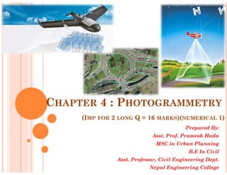
  • 1. CHAPTER 4 : PHOTOGRAMMETRY (IMP FOR 2 LONG Q = 16 MARKS)(NUMERICAL 1) Prepared By: Asst. Prof. Pramesh Hada MSC in Urban Planning B.E In Civil Asst. Professor, Civil Engineering Dept. Nepal Engineering College
  • 3. CHAPTER 4 : PHOTOGRAMMETRY Introduction and Basic Terms of photogrammetry (Short note )PU 2006, Uses & importance of Photogrammetry (pu2010) Types of Photogrammetry Types of Photographs (pu07) Scale of Vertical Photograph(pu09,010) Er.PrameshHada,Asst.Professor,nec Scale of Vertical Photograph(pu09,010) Relief Displacement (pu08,010*2, 011,) Instruction on Field Works Numerical (1 on exam always) Phototheodolite -2006,stereoscope & stereoscopic vision -06,07, Define – Vertical,oblique photograph,forward,side overlap.-07*2,09, Er.PrameshHada,Asst.Professor,nec
  • 5. TUTORIAL -2 (IMPORTANT QUESTIONS) What is Photogrammetry? Write its significance/uses in Surveying. What are the types of Photograph. Write a short note on construction and use of phototheodolite. (6) 2006 Derive an expression to find the scale of a vertical photogaph. (7)2009,2010 What is relief displacement ? Derive an expression to find the relief displacement ? (7) 2008,2010*2,2011 What is photogrammetry. Discuss its limitations. (7) 2010 Er.PrameshHada,Asst.Professor,nec What is photogrammetry. Discuss its limitations. (7) 2010 Write short notes: (pu 2006, 2007) vertical photograph Camera axis Forward & side overlap Isocentre Fiducial Mark Aerial camera Oblique photograph Er.PrameshHada,Asst.Professor,nec
  • 6. INTRODUCTION Is the science of making measurements from photographs. Output of photogrammetry is typically a map, drawing, measurement, or a 3D model of some real-world object or scene. Photogrammetric surveying or photogrammetry is the branch of surveying in which maps are prepared from photo-graphs taken from ground or air stations. With an advancement of the photogrammetric techniques, photographs are also being used for the interpretation of geology, classification of soils and crops,etc. Er.PrameshHada,Asst.Professor,nec classification of soils and crops,etc. Is the science of making measurements from photographs, especially for recovering the exact positions of surface points. Used to recover the motion pathways of designated reference points located on any moving object, on its components and in the immediately adjacent environment. Photogrammetry may employ high-speed imaging and remote sensing in order to detect, measure and record complex 2-D and 3-D motion fields. Now a days devices– drone camera, aircraft,phototheodolite, digital camera etc. Er.PrameshHada,Asst.Professor,nec
  • 10. Photogrammetry is the practice of determining the geometric properties of objects from photographic images. Is the making of precise measurements from photographs; the making of maps from photographs, INTRODUCTION Er.PrameshHada,Asst.Professor,nec maps from photographs, especially from aerial surveying. Er.PrameshHada,Asst.Professor,nec • The science of using aerial photography and other remote sensing imagery to obtain measurement of natural and man- made features on the earth. •In this method, object are measured without being touched. LOW ALTITUDE AERIAL PHOTOGRAPH FOR USE IN PHOTOGRAMMETRY - LOCATION THREE ARCH BAY, LAGUNA BEACH CA.
  • 11. Definition Process of making surveys and maps using photographs. The science of deducing the physical dimensions of objects from measurements on images (usually photographs) of the objects. The making of maps by photography from the air using reference points of known level and position which can be identified Er.PrameshHada,Asst.Professor,nec stereophotogrammetry technology Rapidlevel and position which can be identified on the photographs. The art and science of obtaining reliable quantitative and qualitative measurements through the use of photographs. Er.PrameshHada,Asst.Professor,nec A series of techniques for measuring position and altitude from aerial photographs or images. Is the Art, Science and Technology of obtaining reliable information about physical objects and the environment through processes of recording, measuring and interpreting photographic images. stereophotogrammetry technology Rapid 3D Mapping applied on the Royal Castle of Sweden.
  • 12. Broadly Photogrammetry Requires: Planing & taking the photographs Processing the photographs Measuring the photographs & Reducing the measurement to produce end results. Field Application of Photogrammetry : Used to conduct topographical survey or engineering surveys. Suitable for mountainous and hilly terain with little vegetation. Used for geological mapping which includes identification of land Er.PrameshHada,Asst.Professor,nec Used for geological mapping which includes identification of land forms, rock type & rock structures. Used for projects demanding higher accuracy, since it provides accurate measurements. Used in urban and regional planning applications. Used mostly in Planning/designing in transport planning, bridge, pipeline, hydropower, urban planning, security and strategic planning, disaster management, natural resources management, city models, conservation of archaeological sites etc. Er.PrameshHada,Asst.Professor,nec
  • 13. Its applications include satellite tracking of the relative positioning alterations in all Earth environments. The quantitative results of photogrammetry are used to guide and match the results of computational models of the natural systems, thus helping to invalidate or confirm new theories, to design novel vehicles or new methods for predicting or/and controlling the consequences of earthquakes, tsunamis, any other Importance/application of photogrammetry Er.PrameshHada,Asst.Professor,nec consequences of earthquakes, tsunamis, any other weather types. Photogrammetry also helps for the solving of triangulation, trilateration and multidimensional scaling. In the simplest example, the distance between two points that lie on a plane parallel to the photographic image plane can be determined by measuring their distance on the image, if the scale (s) of the image is known. Er.PrameshHada,Asst.Professor,nec
  • 14. Used in different fields, such as topographic mapping, architecture, engineering, manufacturing, quality control, police investigation, and geology, as well as by archaeologists to quickly produce plans of large or complex sites and by meteorologists. Importance/application of photogrammetry Advantage •Covers large area •Less time consuming/fast Disadvantage • Complex system, highly trained human resource needed Er.PrameshHada,Asst.Professor,nec •Less time consuming/fast •Can ‘reach’ inaccessible and restricted area •Cheap/cost effective for large area and in a long run •Easy to interpret, understand resource needed •Costly at the time of installation/initiation •Heavy and sophisticated equipments needed •Lengthy administrative procedure for getting permission to fly •Weather dependent Er.PrameshHada,Asst.Professor,nec
  • 15. PRINCIPLE OF PHOTOGRAMMETRY Principle of photogrammetric survey in its simplest form is very similar to that of the plane table survey. Only difference is that the most of the work which in plane table survey is executed in the field, but here is done in office. The principal point of each photograph is used as a fixed station and rays are drawn to get points of intersections very similar to those used in plane table. Er.PrameshHada,Asst.Professor,nec intersections very similar to those used in plane table. Is suitable for topographical or engineering surveys and also for those projects demanding higher accuracy. It is unsuitable for dense forest & others due to the difficulty of identifying points upon the pair of photographs. Er.PrameshHada,Asst.Professor,nec
  • 16. TYPES OF PHOTOGRAMMETRY / PHOTOGRAPHS The photographs used in photogrammetry may be broadly classified into two types depending upon the camera position at the time of photography. The types are- Terrestrial Photographs Aerial Photographs Terrestrial Photographs Er.PrameshHada,Asst.Professor,nec Terrestrial Photographs Photographs taken from camera station at a fixed position on or near the ground is known as Terrestrial Photographs. The photographs are taken by means of a phototheodolite which is combination of a camera and a theodolite. Based on the principle that “if the directions of same objects photographed from two extremities of measured base are known, their position can be located by the intersection of two rays to the same object. Er.PrameshHada,Asst.Professor,nec
  • 17. TERRESTRIAL PHOTOGRAPHS Er.PrameshHada,Asst.Professor,nec •photographs are taken from elevated ground stations. •Method is very similar that the camera is in stationary position. •Camera used in this method is called photo-theodolite as it will require the same features as theodolite. •It is much cheaper and can be carried out by individual surveying firms also. Er.PrameshHada,Asst.Professor,nec
  • 19. Difference between this and plane tabling is that more details are at once obtained from the photographs and their subsequent plotting etc. is done by the office while in plane tabling all the detailing is done in the field itself. Fig A and B are the two stations at the ends of base AB. Arrows indicate the directions of horizontal pointing (in plan) of the camera. For each pair of pictures taken from the two ends, the camera axis is kept parallel to each other. From economy and speed point of view, minimum number of photographs should be used to cover the whole area and to achieve this, TERRESTRIAL PHOTOGRAPHS Er.PrameshHada,Asst.Professor,nec photographs should be used to cover the whole area and to achieve this, it is essential to select the best positions of the camera stations. Study of the area should be done from the existing maps, and a ground reconnaissance should be made. Selection of actual stations depends upon the size and ruggedness of the area. These photographs provides the front view of elevation & are generally used for the survey of structure & Architectural Monuments. Er.PrameshHada,Asst.Professor,nec
  • 20. AERIAL PHOTOGRAPHS Photographs taken from a Aerial camera mounted on a aerial vehicle Used for various purpose, mainly information extraction on the ground surface Aerial photographs are obtained from the aerial cameras mounted on aerial vehicle(aeroplane for the purpose of photography) Used for various purpose, mainly information extraction on the ground surface Er.PrameshHada,Asst.Professor,nec ground surface Photographs are taken from camera station in the air with the axis of camera vertical or nearly vertical. Is the branch of photogrammetry where the photographs are taken from air station. This is the best mapping procedure yet developed for large objects and are useful for military intelligence. For this, aerial camera is used which are fixed on flying aircraft. Er.PrameshHada,Asst.Professor,nec
  • 22. According to the direction of the camera axis at the time of exposure aerial photographs may be classified into: Vertical photographs Oblique photographs Vertical photographs These photographs are taken from the air with the axis of the Camera vertical or nearly vertical . A truly vertical Photograph closely resembles a map. AERIAL PHOTOGRAPHS Er.PrameshHada,Asst.Professor,nec A truly vertical Photograph closely resembles a map. These are utilized for the compilation of topographic and engineering surveys on various scales. Er.PrameshHada,Asst.Professor,nec
  • 23. Vertical photographs Oblique photographs Er.PrameshHada,Asst.Professor,necEr.PrameshHada,Asst.Professor,nec
  • 24. OBLIQUE PHOTOGRAPHS Photographs are taken from air with the axis of the camera intentionally tilted from the vertical. An oblique photograph covers larger area of the ground but clarity of details diminishes towards the far end of the photograph. Depending upon the angle of obliquity, oblique photographs may he further divided into two categories. Low oblique photographs : An oblique photograph which does not show the horizon, is known as low oblique photograph. Such photographs are generally used to compile reconnaissance maps of Er.PrameshHada,Asst.Professor,nec Such photographs are generally used to compile reconnaissance maps of inaccessible areas. High oblique photograph: • An oblique photograph which is sufficiently tilted to show the horizon, is known as high oblique, photograph. •Such photographs were previously used for the extension of planimetric and height control in areas having scanty ground control. Er.PrameshHada,Asst.Professor,nec
  • 27. THE PHOTO-THEODOLITE CONSTRUCTION AND USE OF PHOTOTHEODOLITE (PU 2006) Is a combination of camera and theodolite mounted on the same tripod, Used in terrestrial photogrammetry for mapmaking and other purposes. Photographs obtained are used for the construction of topographic maps, classification of soil, interpretation of geology. Er.PrameshHada,Asst.Professor,nec While taking the photographs the camera axis is kept parallel to each other. It consists of : A camera box of fixed focus type A hollow rectangular frame placed vertically to the rear side The sensified photographic plate. Er.PrameshHada,Asst.Professor,nec
  • 28. THE PHOTO-THEODOLITE Camera box is supported on the tripod and is furnished with an inner and outer axis each of which is fitted with a clamp and fine adjusting screw. The graduated horizontal circle carries verniers reading to single minutes. These are supported on a levelling head carrying three foot screws. Er.PrameshHada,Asst.Professor,nec foot screws. On the top of the box, a telescope is fitted. The telescope can be rotated in a vertical plane about a horizontal axis and is fitted with vertical arc with verniers, clamp & slow motion screw. The line of sight of the telescope is set in the same vertical plane as the optical axis of camera. Er.PrameshHada,Asst.Professor,nec
  • 29. AERIAL PHOTOGRAPH / CAMERA (PU2006) Aerial camera are used to have aerial photographs which are fixed on flying aircarft. Primary function of the terrestrial camera as well as the aerial camera is the same, i.e., that of taking pictures. Aerial camera is mounted on a fast moving aeroplane, its requirements are quite different. Aerial camera requires : Fast Lens Er.PrameshHada,Asst.Professor,nec Fast Lens High speed & sufficient shutter High speed emulsion for the film A Magazine to hold large rolls of film Aerial camera is considered to be a surveying instrument of great precision. Er.PrameshHada,Asst.Professor,nec
  • 30. An aerial camera consists of following essential parts lens assembly consists of lenses, the diaphragm, shutter and the filter.(Fig-6,8,9) Camera cone which supports the entire lens assembly including the filter. (fig - 5) focal (2) plane exactly above the collimation mark. camera body (3) provided at the top of cone AERIAL PHOTOGRAPH / CAMERA (PU2006) Er.PrameshHada,Asst.Professor,nec camera body (3) provided at the top of cone which acts as an integral part to preserve the interior orientation. Drive mechanism which is housed in camera body & used for winding and tripping the shutter, operating the vaccum system for flattering the film, winding the film. The magazine (1) which holds the exposed and unexposed films & houses the film flattening device at the focal plane. Er.PrameshHada,Asst.Professor,nec
  • 32. There are three types of Aerial Camera : Super wide angle camera – f=100mm (used in flat areas like terai of nepal & in plain areas) Wide angle camera – f=150mm (Used in hilly areas) Narrow angle camera – f=300mm (Used in higher himalayas, sky scrappers & city like New york) Er.PrameshHada,Asst.Professor,necEr.PrameshHada,Asst.Professor,nec
  • 33. DETERMINATION OF A SCALE OF THE VERTICAL PHOTOGRAPH (PU 2004,2009,2010) IMP (NUMERICAL IMP) The scale of the vertical photograph is the ratio of a distance on the photo to the corresponding distance to the ground. Let N = Perspective centre H= flying height of the camera f = focal length of camera h= height of ground above mean sea level N Er.PrameshHada,Asst.Professor,nec level Construction : Draw BK perpendicular to NV meeting at K From similar triangles Nvb and NKB, Scale of Photograph ( SA ) = f H- h Er.PrameshHada,Asst.Professor,nec
  • 34. If the terrain is perfectly flat or plane at the mean sea level then , h=0, So, Scale of photograph = f H SCALE OF THE VERTICAL PHOTOGRAPH Er.PrameshHada,Asst.Professor,nec This shows, the scale of vertical photographs over the flat terrain is the ratio of the photo distance to the ground distance. Note : Relation between Photoscale & Mapscale Er.PrameshHada,Asst.Professor,nec
  • 35. RELIEF DISPLACEMENT (2008,2010,2011) •The scale of an aerial photograph is partly a function of flying height. •Thus, variations in elevation cause variations in scale on aerial photographs. • Specifically, the higher the elevation of an object, the farther the object will be displaced from its actual position away from the principal point of the photograph (the point on the ground surface Er.PrameshHada,Asst.Professor,nec principal point of the photograph (the point on the ground surface that is directly below the camera lens). •The lower the elevation of an object, the more it will be displaced toward the principal point. This effect, called relief displacement, is illustrated in the diagram below. • Note that the effect increases with distance from the principal point. Er.PrameshHada,Asst.Professor,nec
  • 37. •Ground relief is shown in perspective on the photograph due to which every point on the photograph is displaced from their true orthographic position. •This Displacement is called relief displacement. •It is denoted by d. Determine an expression for determining the relief displacement on a vertical photograph (PU 08,10,11,12) relief d Er.PrameshHada,Asst.Professor,nec relief d Er.PrameshHada,Asst.Professor,nec
  • 38. Determine an expression for determining the relief displacement on a vertical photograph (PU 08,10,11,12) From equations (3) and (4) above, we conclude the following : •Relief displacement increases as the distance from the principal point increases. • Relief displacement decreases with the increase in the flying height. •For point above datum, the relief Er.PrameshHada,Asst.Professor,nec •For point above datum, the relief displacement is positive being radially outward. •For point below datum (having negative value), reIief displacement is negative, being radially inward. • Relief displacement of the point vertically below the exposure station is zero. Er.PrameshHada,Asst.Professor,nec
  • 39. TILT DISPLACEMENT Defined as the difference between the distance of the image of a point on the tilted photograph from the isocentre and the distance of the image of the same point on the photograph from the isocentre if there had been no tilt. An error in the position of a point on the photograph due to indeliberate Er.PrameshHada,Asst.Professor,nec the photograph due to indeliberate tilting of the aircraft Due to instability of aircraft May be due to tilting of the aircraft along the flight line and/or perpendicular to the flight line Increases radially from the isocenter Er.PrameshHada,Asst.Professor,nec
  • 41. BASIC TERMS USED IN PHOTOGRAMMETRY Tilted Photograph: An aerial photograph taken with a camera having it’s optical axis tilted usually less than 3º from the vertical is known as tilted photograph. Exposure (or air) station (O): The exact position of the front nodal point of the lens in the air at the instant of exposure. Flying height (H): (2009) Er.PrameshHada,Asst.Professor,nec Flying height (H): (2009) The elevation of the air station above the mean sea level is known as flying height of the aircraft. Nadir Point (Plumb Point): (2009) The point where a plumb line dropped from the front nodal point strikes the photograph Camera Axis : (2006) It is the line passing through the centre of the camera lens perpendicular both to the camera plate (negative) and the picture plane (photography). Er.PrameshHada,Asst.Professor,nec
  • 42. Er.PrameshHada,Asst.Professor,nec TERMS USED IN PHOTOGRAMMETRY Er.PrameshHada,Asst.Professor,nec
  • 43. Fiducial mark – 2006,2007 (Reference mark) A fiducial mark is one of two, three or four marks, located in contact with the photographic emulsion in a camera image plane to provide a reference line or lines for the plate measurement of images. Iso centre (2006) The point in which the bisector of the angle of tilt meets the photographs is known as Isocentre. It lies on the principal line at a distance of f tan t/2 from the principal point. Principal Point The point where a perpendicular dropped from the front nodal point strikes BASIC TERMS USED IN PHOTOGRAMMETRY Er.PrameshHada,Asst.Professor,nec The point where a perpendicular dropped from the front nodal point strikes the photographs is known as principal point of photograph Focal length – It is the perpendicular distance from the centre of the camera lens to either the picture plane or the camera plate. Tilt : The deviation of a plate from the horizontal plane at the time of exposure is known as tilt. Horizontal Point (h): The point of intersection of the principal line (VIP) and the horizontal line (oh) through the perspective centre O is known as horizontal point. Er.PrameshHada,Asst.Professor,nec
  • 45. INTERPRETATIONS THROUGH MAPS AND AERIAL PHOTOS Er.PramesheshHada,Asst.Professor,nec
  • 46. INTERPRETATIONS THROUGH MAPS AND AERIAL PHOTOS AERIAL IMAGE - 1957 SATELLITE IMAGE- 1998 Er.Pramesh AERIAL IMAGE- 1981 PATAN DURBAR SQUARE AREA eshHada,Asst.Professor,nec
  • 47. Er.PrameshHada,Asst.Professor,nec IRS1 CPAN1 04052A0_23NOV1996 OF KATHMANDU CORONA1M_KATHMANDU 05FEB 1967 Er.PrameshHada,Asst.Professor,nec
  • 48. PATAN DURBAR SQUARE AREA Er.PrameshHada,Asst.Professor,nec AERIAL PHOTO 1957 Er.PrameshHada,Asst.Professor,nec
  • 49. Er.PrameshHada,Asst.Professor,nec AERIAL PHOTO 1981 AERIAL PHOTO 1998 Er.PrameshHada,Asst.Professor,nec
  • 53. Thank you Best of luck for Er.PrameshHada,Asst.Professor,nec Best of luck for the Exam Er.PrameshHada,Asst.Professor,nec