
Empfohlen
Weitere ähnliche Inhalte
Was ist angesagt?
Was ist angesagt? (20)
Ähnlich wie Lecture-8-The-GIS-Database-Part-1.ppt
Ähnlich wie Lecture-8-The-GIS-Database-Part-1.ppt (20)
Mehr von Prabin Pandit
Mehr von Prabin Pandit (20)
Kürzlich hochgeladen
Kürzlich hochgeladen (20)
Lecture-8-The-GIS-Database-Part-1.ppt
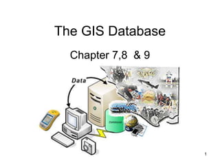
- 1. The GIS Database Chapter 7,8 & 9 1
- 2. The backbone of GIS is good data accurate enough to accomplish its objectives. Geographic data are organized in a geographic database. There aretwo important components of this geographic database: geographic position (spatial data)-where is it? attributes or properties (attribute data)- what things are? GIS data types of are grouped into three classes: i. Spatial data (where?): used to describe location, shape, size, and all kinds features of spatial entities. GIS Data Concepts
- 3. ii. Non-spatial data (what, when, in what amount?): also called attribute or characteristic data, Also known as descriptive data There are fundamental differences between them: spatial data are generally multi- dimensionaland autocorrelated. are positional data iii. Metadata: is data about data and contains information about scale, accuracy, projection/datum, data source, manipulations, how to acquire data. GIS Data Concepts (Contd..,)
- 4. Digital Representation of Data We need to come up with a digital representations of the geographic phenomena in order to store them in a GIS.
- 5. Regular Tessellation Examples of raster data representation are aerial photograph, a satellite image, or a scanned map, etc. In raster representation the field attribute value assigned to a cell is associated with the entire area occupied by the cell. The size of the area that a single raster cell represents is called the raster’s resolution. Reality Raster Representation (Contd..,)
- 6. Vector representations useful for representing and storing discrete features such as buildings, pipes, or parcel boundaries and can be: Triangulated Irregular Networks (TIN) Point Line Area i. TIN A TIN is built from a set of measurements for example points of height. These points can be scattered unevenly over the study area, with areas of more change having more points. Triangles are fitted through three points to form planes. Vector Representations
- 7. ATin is a vector representation • Each anchor point has a stored geo-reference. • The planes do not have a stored values (like raster cells have) No value is stored for this plane Ageo-reference and value is stored for each anchor point Stretched triangles Delaunay triangulation Elevation for TIN construction Vector Representations (Contd..,)
- 8. ii. Point Points are defined as: • single coordinate pairs (x,y) when we work in 2D; • coordinate triplets (x,y,z) when we work in 3D. Mekelle City can be represented both in point and polygon. HOW?? Used to represent shape and size less single features such as: tree, oil well, poles, fire plugs, etc. iii. Line Used to represent one dimensional objects (roads, railroads, canals, rivers, etc.) Line is defined b des to define the shape of the l y 2 end nodes and 0-n internal no ine. Vector Representations (Contd..,)
- 9. iv.Area (polygon) Used to represent two dimensional features. Polygonal features, such as city boundaries and river catchments can be stored as a closed loop of coordinates. Polygonal data is the most common type of data in natural resource applications. Examples of polygonal data include forest stands, soil classification areas, administrative boundaries, and climate zones. Vector Representations (Contd..,)
- 10. Raster Model Vector Model Advantages: Simple data structure Easy and efficient overlaying Compatible with RS imagery High spatial variability is efficiently represented Simple for own programming Disadvantages: Need high computer storage Errors in perimeter and shape Difficult network analysis Inefficient in projection transformations Loss of information when using large cells Advantages: Compact data structure Efficient for network analysis Efficient for projection transformation Accurate map output. Disadvantages: Complex data structure Difficult overlay operations High spatial variability is inefficiently represented Not compatible with RS imagery Raster vs Vector (Contd..,)
- 11. What is a database? A database is any organized collection of data. Some examples common examples: – a telephone book – T.V. Guide – airline reservation system – motor vehicle registration records – papers in your filing cabinet – files on your computer hard drive. 11
- 12. A database can be defined as: A collection of related data/information stored in a structured format. Computerized collection of structured data stored in one or more tables as electronic filing cabinet. A collection of inter-related data stored together to serve one or more applications. A combination of software and hardware that makes it possible and convenient to perform tasks that involve handling large amounts of data. The data are stored together with as little redundancy as possible to serve one or more users. Database
- 13. Database Definitions What is a database? It’s an organized collection of data, it need not be a computer based system. What is a database management system (DBMS)? A software system designed to: – Organize that data in a flexible manner, – Provide tools to add, modify or delete data from the database, – Query the data, – Produce reports summarizing selected contents. 13
- 14. What is the ultimate purpose of a database management system? Data Information Knowledge Action Is to transform 14
- 15. Features of a DBMS Database Management Systems provide features to maintain database: – Transaction management - A transaction comprises a unit of work performed within a DBMS against a database, and treated in a coherent and reliable way independent of other transactions. Transactions in a database environment have two main purposes: • To provide isolation from other transactions. • To have an “all or nothing” effect. Transactions must pass the ACID test (atomic, consistent, isolated and durable Lecture 8 15
- 16. Features of a DBMS Database Management Systems provide features to maintain database: – Concurrency control - ensures that correct results for concurrent operations are generated, while getting those results as quickly as possible. – Backup and recovery – Provides a language for the creation and querying of the database. – A language for writing application programs Lecture 8 16
- 17. Features of a DBMS Database Management Systems provide features to maintain database: – Data independence - It refers to the immunity of user applications to make changes in the definition and organization of data. – Integrity and security - refers to maintaining and assuring the accuracy and consistency of data over its entire life-cycle 17
- 18. DATA BASE MANAGEMENT SYSTEM: ❖Dale and McLaughlin (1988) define a DBMS as a computer program to control the storage, retrieval and modification of data (in a database) ❖Stern and Stern (1993), a DBMS will allow users to joint, manipulate or otherwise access the data in any number of database files.
- 19. Spatial database is a collection of spatially referenced data that acts as a model of reality. To create and maintain a computer database, you need a database program, often called: Database Management System (DBMS). DBMS is a software package that allows the user to set up, create and maintain a database. GIS is a DBMS specifically designed for processing of spatial and related attribute data. In addition to DBMS, GIS also has many capabilities. A geographic database is a critical part of GIS. Database Management Systems (Contd..,)
- 20. Handling large amounts of data. Backup and recovery functions to avoid loss of data. Declarative query language for retrieval of data. Collecting all data at a single location reduces duplication. redundancy and Maintenance costs decrease because of better organization and decreased data duplication. Applications become data independent so that multiple applications can use the same data. User knowledge can be transferred between applications more easily because the database remains constant. Data sharing is facilitated and a corporate view of data can be provided to all managers and users. Security and standards for data and data access can be established and enforced. Why Use a Database?
- 21. Selecting a Database Management System Database management systems (or DBMSs) can be divided into two categories: – Desktop databases are oriented toward single-user applications and reside on standard personal computers (hence the term desktop). – Server databases contain mechanisms to ensure the reliability and consistency of data and are geared toward multi-user applications. Lecture 8 21
- 22. Relational Databases • The relational database model is the most dominant model in both the corporate and GIS world, due to its flexibility, organization, and functioning.. • It was defined by Edgar F. Codd (1970). • It can accommodate a wide range of data types. • It is not necessary to know beforehand the types of processing that will be performed on the database. Lecture 8 22
- 23. Relational DBMS is most widely accepted for managing the attributes of geographic data. The relational DBMS is attractive because of its: Simplicity in organization and data modeling. Flexibility - data can be manipulated in an ad hoc manner by joining tables. Efficiency of storage- by the proper design of data tables redundant data can be minimized; and The non-procedural nature - queries on a relational database do not need to take into account the internal organization of the data. Disadvantages No explicit representation of relationships. Reduced performance for large, well-defined databases. Relational DBMS
- 24. Define database structure: attribute, tuples and relations. Define integrity rules. Define queries (extract without alteration). Transactions (change database contents). Comprises a set of tables, each a two-D list of records. containing attributes about the objects under study. Were primarily focused on business applications such as banking, human resource management. Were never designed to deal with rich data types such as geographic objects, sound, and video. Poor performance for many types of geographic query. Relational DBMS (Contd..,)
- 25. Map Map Table Stand Table 16 15 MapID Area (ha) Perimeter (m) StandID 14 1.08 416 J-234 15 0.75 350 J-129 16 0.31 223 J-143 17 1.38 523 J-888 Stand Number Dominant Species Stand Age J-127 Hemlock 25 J-316 White Pine 34 J-129 Hemlock 65 J-411 Spruce 34 14 17 Relational DBMS (Contd..,)
- 26. Relation (a table) is a collection of similarly shaped tuples/records (having the same named attributes). Tuples are records or rows with attribute values. Attribute (a column) is characteristic of the relation of a named field of a tuple. The primary key of a relation has one or more attributes that uniquely identifies a tuple (record). Foreign key is used to refer between records of different relations. It is not a key of the relation in which it appears but is a primary key of another relation. Relations, Tuples and Attributes
- 27. THANK YOU