SlideShare ist ein Scribd-Unternehmen logo
1 von 2
ã2017 California Institute of Technology. Government sponsorship acknowledged.
NISAR: The NASA-ISRO SAR Mission
Fire management
Environmental protection policies and resources to
manage public lands have remained relatively constant,
yet high impact fires are becoming more common as
urban sprawl into wildlands grows. In 1995 the cost to
fight wildland fires was approximately 16% of the US
Forest Service budget but by 2015 it had grown to 52% of
the annual budget (USFS 2015).
Fires are crucial to many ecosystems, yet often threaten developed urban
areas, protected lands and regional air quality. Categorizing fire danger,
detecting fires, identifying area burned and quantifying the severity of
fires is critical for mitigating the impacts of fire.
Modern Technology and Fire
Fire management includes a combination of ground tactical
strategies, inter-agency coordination, simulation modeling, pro-
active fuels management, and post-fire remediation. These
activities are informed by field observations and make use of
satellite and airborne observations in the visible to thermal
infrared portion of the electromagnetic spectrum such as MODIS
and VIIRS, which provide a continuous record of global fire
detections since 2002, or Landsat sensors that provide area
burned and land cover and land use information.
The use of remote sensing data in the fire management
community is prolific, however optical imaging methods can be
ineffective in cloudy areas and at high latitudes when daylight
hours are short, e.g., Alaska. Radar imaging can help fill these
information gaps.
The NISAR Mission – Reliable, Consistent Observations
The NASA–ISRO Synthetic Aperture Radar (NISAR) mission, a collaboration
between the National Aeronautics and Space Administration (NASA) and the
Indian Space Research Organization (ISRO), will provide all-weather, day/night
imaging of nearly the entire land and ice masses of the Earth repeated 4-6 times
per month. NISAR’s orbiting radars will image at resolutions of 5-10 meters to
identify and track subtle movement of the Earth’s land and its sea ice, and even
provide information about what is happening below the surface. NISAR will also
provide forest volume and biomass over time and with enough detail to reveal
changes on human scales. Products are expected to be available 1-2 days after
observation, and within hours in response to disasters, providing actionable,
timely data for many applications.
Smart Firefighting: Arming land
managers with new information
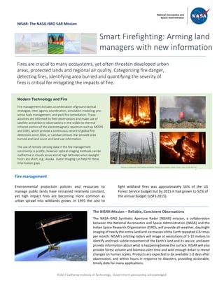
Photos (clockwise): USFS/Mike McMillan, NASA/JPL-Caltech, USDA, Flickr: Lisa, CC BY-NC 2.0
S
ã2017 California Institute of Technology. Government sponsorship acknowledged.
NISAR: The NASA-ISRO SAR Mission
Land and fire managers are looking for as much
information as possible to help manage fires. Because of
the dangerous nature of fires and their sometimes-
remote locations, remote sensing is a widely used and
accepted tool used by national and international
organizations to detect active fires, monitor impacts from
fire and assess fire danger. For example, the National
Interagency Coordination Center (NICC), the US Forest
Service Wildland Fire Assessment System (WFAS), the US
Forest Service Remote Sensing Application Center and the
National Aeronautics and Space Agency (NASA) are among
the key organizations in the U.S. providing information to
land and fire managers of daily and seasonal projected fire
danger, active fire detections, area burnt, and fire
severity. Fire danger is determined by current moisture
conditions, duration of those conditions, and vegetation
water content, while fire severity refers to the total
environmental change caused by fire. Managers
customize this information based on local expert
knowledge of the total fuels available to burn to provide
public service announcements and develop management
strategies to mitigate potential impacts.
The upcoming NISAR mission will address fire
management needs through a dependable observing
strategy that will collect high resolution synthetic
aperture radar (SAR) images over 90% of the Earth’s land
surfaces throughout the year. Radar images from
satellites, such as NISAR, are known for their ability to
penetrate through clouds, and their day/night imaging
capability. NISAR imagery can provide observations that
complement optical data and independent information
that is sensitive to the changing structure and moisture
conditions of terrestrial (land) ecosystems. Specifically,
radar remote sensing with NISAR can provide
observations detecting disturbance, vegetation and soil
water content that are useful for monitoring fire danger,
and biomass that is useful for quantifying total available
fuel to burn and emissions lost to the atmosphere. All of
these observations can help managers make informed
decisions on how to allocate limited resources.
National Aeronautics and Space Administration For more information, visit http://nisar.jpl.nasa.gov/applications
Jet Propulsion Laboratory / California Institute of Technology / Pasadena, California / www.jpl.nasa.gov
Active Fire Mapping using Radar
Observations of the Earth’s land surfaces from space using radars makes
it possible for reliable and repeated measurements to be made
throughout the year despite varying duration of daylight hours or cloud
cover. The structures of different land cover types provide a rich variety
of responses to the radar illumination through time-varying polarization
signatures. Because of the rapid changes in structure and composition
after disturbance like wildfire, information like this can be used to
determine area burnt, even when traditional methods do not work well.
Shown at right is the fire burn scar of the 2015 Lake Fire in San
Bernardino National Forest, California. The image on top shows
probability of change derived from interferometric radar (InSAR) using 14
pre-event images and one post-fire image from an overpass on June 29,
2015, using the airborne Jet Propulsion Laboratory (JPL) Uninhabited
Aerial Vehicle (UAV)SAR radar instrument, which is a testbed for NISAR.
For comparison, the plot shown at right below is the differenced
Normalized Burn Ratio (dNBR) fire severity map obtained from Landsat.
The radar is able to identify the more severely burned areas. Although it
was possible in this particular fire to use both Landsat and InSAR data,
there are many areas (e.g., Alaska) where it is frequently too dark or
overcast to produce maps from optical data on a regular basis. Use of
radar can improve mapping capabilities across many areas.

Weitere ähnliche Inhalte

Ähnlich wie NISAR NASA-ISRO Synthetic Aperture Radar (NISAR) Fire Management

NISAR NASA-ISRO Synthetic Aperture Radar (NISAR) Flood Forecasting
NISAR NASA-ISRO Synthetic Aperture Radar (NISAR)  Flood ForecastingNISAR NASA-ISRO Synthetic Aperture Radar (NISAR)  Flood Forecasting
NISAR NASA-ISRO Synthetic Aperture Radar (NISAR) Flood ForecastingDr. Pankaj Dhussa
 
Ambee Historical Wildfire Data Everything You Need To Know
Ambee Historical Wildfire Data Everything You Need To KnowAmbee Historical Wildfire Data Everything You Need To Know
Ambee Historical Wildfire Data Everything You Need To KnowAmbee
 
Optical Remote sensing with case studies
Optical Remote sensing with case studiesOptical Remote sensing with case studies
Optical Remote sensing with case studiesSAISIKAN PATRA
 
TRACKING ANALYSIS OF HURRICANE GONZALO USING AIRBORNE MICROWAVE RADIOMETER
TRACKING ANALYSIS OF HURRICANE GONZALO USING AIRBORNE MICROWAVE RADIOMETERTRACKING ANALYSIS OF HURRICANE GONZALO USING AIRBORNE MICROWAVE RADIOMETER
TRACKING ANALYSIS OF HURRICANE GONZALO USING AIRBORNE MICROWAVE RADIOMETERjmicro
 
DISASTER PREDICTION
DISASTER PREDICTIONDISASTER PREDICTION
DISASTER PREDICTIONLibcorpio
 
NISAR NASA-ISRO Synthetic Aperture Radar (NISAR) Marine Hazards
NISAR NASA-ISRO Synthetic Aperture Radar (NISAR) Marine HazardsNISAR NASA-ISRO Synthetic Aperture Radar (NISAR) Marine Hazards
NISAR NASA-ISRO Synthetic Aperture Radar (NISAR) Marine HazardsDr. Pankaj Dhussa
 
Development and Applications of Fire Danger Rating Systems in Southeast Asia
Development and Applications of Fire Danger Rating Systems in Southeast AsiaDevelopment and Applications of Fire Danger Rating Systems in Southeast Asia
Development and Applications of Fire Danger Rating Systems in Southeast AsiaCIFOR-ICRAF
 
IRJET- Classification of Agricultural Land’s Capability
IRJET-  	  Classification of Agricultural Land’s CapabilityIRJET-  	  Classification of Agricultural Land’s Capability
IRJET- Classification of Agricultural Land’s CapabilityIRJET Journal
 
Remote sensing in Disaster management
Remote sensing in Disaster managementRemote sensing in Disaster management
Remote sensing in Disaster managementDebasis Ray
 
Moderate_resolution_GEC
Moderate_resolution_GECModerate_resolution_GEC
Moderate_resolution_GECKenneth Kay
 
Landuse landcover and ndvi analysis for halia catchment
Landuse landcover and ndvi analysis for halia catchmentLanduse landcover and ndvi analysis for halia catchment
Landuse landcover and ndvi analysis for halia catchmentIAEME Publication
 
Wildfire Hazards
Wildfire HazardsWildfire Hazards
Wildfire Hazardsguest73b391
 
DELINEATION OF LANDSLIDE AREA USING SAR INTERFEROMETRY AND D-INSAR :A CASE ST...
DELINEATION OF LANDSLIDE AREA USING SAR INTERFEROMETRY AND D-INSAR :A CASE ST...DELINEATION OF LANDSLIDE AREA USING SAR INTERFEROMETRY AND D-INSAR :A CASE ST...
DELINEATION OF LANDSLIDE AREA USING SAR INTERFEROMETRY AND D-INSAR :A CASE ST...SUJAN GHIMIRE
 
INTEGRATED TECHNOLOGY OF DATA REMOTE SENSING AND GIS TECHNIQUES ASSESS THE LA...
INTEGRATED TECHNOLOGY OF DATA REMOTE SENSING AND GIS TECHNIQUES ASSESS THE LA...INTEGRATED TECHNOLOGY OF DATA REMOTE SENSING AND GIS TECHNIQUES ASSESS THE LA...
INTEGRATED TECHNOLOGY OF DATA REMOTE SENSING AND GIS TECHNIQUES ASSESS THE LA...acijjournal
 
NISAR NASA-ISRO Synthetic Aperture Radar (NISAR) Damage Mapping
NISAR NASA-ISRO Synthetic Aperture Radar (NISAR) Damage MappingNISAR NASA-ISRO Synthetic Aperture Radar (NISAR) Damage Mapping
NISAR NASA-ISRO Synthetic Aperture Radar (NISAR) Damage MappingDr. Pankaj Dhussa
 
The Use of HPC to Model the California Wildfires
The Use of HPC to Model the California WildfiresThe Use of HPC to Model the California Wildfires
The Use of HPC to Model the California Wildfiresinside-BigData.com
 

Ähnlich wie NISAR NASA-ISRO Synthetic Aperture Radar (NISAR) Fire Management (20)

NISAR NASA-ISRO Synthetic Aperture Radar (NISAR) Flood Forecasting
NISAR NASA-ISRO Synthetic Aperture Radar (NISAR)  Flood ForecastingNISAR NASA-ISRO Synthetic Aperture Radar (NISAR)  Flood Forecasting
NISAR NASA-ISRO Synthetic Aperture Radar (NISAR) Flood Forecasting
 
NISAR Utilization Plan
NISAR Utilization PlanNISAR Utilization Plan
NISAR Utilization Plan
 
Ambee Historical Wildfire Data Everything You Need To Know
Ambee Historical Wildfire Data Everything You Need To KnowAmbee Historical Wildfire Data Everything You Need To Know
Ambee Historical Wildfire Data Everything You Need To Know
 
Great Lakes Restoration Initiative Remote Sensing Applications
Great Lakes Restoration Initiative Remote Sensing ApplicationsGreat Lakes Restoration Initiative Remote Sensing Applications
Great Lakes Restoration Initiative Remote Sensing Applications
 
Optical Remote sensing with case studies
Optical Remote sensing with case studiesOptical Remote sensing with case studies
Optical Remote sensing with case studies
 
NASA Keynote Presentation - Monday Conservation Forum
NASA Keynote Presentation - Monday Conservation ForumNASA Keynote Presentation - Monday Conservation Forum
NASA Keynote Presentation - Monday Conservation Forum
 
Decision Support for Wildland Fire Management
Decision Support for Wildland Fire ManagementDecision Support for Wildland Fire Management
Decision Support for Wildland Fire Management
 
TRACKING ANALYSIS OF HURRICANE GONZALO USING AIRBORNE MICROWAVE RADIOMETER
TRACKING ANALYSIS OF HURRICANE GONZALO USING AIRBORNE MICROWAVE RADIOMETERTRACKING ANALYSIS OF HURRICANE GONZALO USING AIRBORNE MICROWAVE RADIOMETER
TRACKING ANALYSIS OF HURRICANE GONZALO USING AIRBORNE MICROWAVE RADIOMETER
 
DISASTER PREDICTION
DISASTER PREDICTIONDISASTER PREDICTION
DISASTER PREDICTION
 
NISAR NASA-ISRO Synthetic Aperture Radar (NISAR) Marine Hazards
NISAR NASA-ISRO Synthetic Aperture Radar (NISAR) Marine HazardsNISAR NASA-ISRO Synthetic Aperture Radar (NISAR) Marine Hazards
NISAR NASA-ISRO Synthetic Aperture Radar (NISAR) Marine Hazards
 
Development and Applications of Fire Danger Rating Systems in Southeast Asia
Development and Applications of Fire Danger Rating Systems in Southeast AsiaDevelopment and Applications of Fire Danger Rating Systems in Southeast Asia
Development and Applications of Fire Danger Rating Systems in Southeast Asia
 
IRJET- Classification of Agricultural Land’s Capability
IRJET-  	  Classification of Agricultural Land’s CapabilityIRJET-  	  Classification of Agricultural Land’s Capability
IRJET- Classification of Agricultural Land’s Capability
 
Remote sensing in Disaster management
Remote sensing in Disaster managementRemote sensing in Disaster management
Remote sensing in Disaster management
 
Moderate_resolution_GEC
Moderate_resolution_GECModerate_resolution_GEC
Moderate_resolution_GEC
 
Landuse landcover and ndvi analysis for halia catchment
Landuse landcover and ndvi analysis for halia catchmentLanduse landcover and ndvi analysis for halia catchment
Landuse landcover and ndvi analysis for halia catchment
 
Wildfire Hazards
Wildfire HazardsWildfire Hazards
Wildfire Hazards
 
DELINEATION OF LANDSLIDE AREA USING SAR INTERFEROMETRY AND D-INSAR :A CASE ST...
DELINEATION OF LANDSLIDE AREA USING SAR INTERFEROMETRY AND D-INSAR :A CASE ST...DELINEATION OF LANDSLIDE AREA USING SAR INTERFEROMETRY AND D-INSAR :A CASE ST...
DELINEATION OF LANDSLIDE AREA USING SAR INTERFEROMETRY AND D-INSAR :A CASE ST...
 
INTEGRATED TECHNOLOGY OF DATA REMOTE SENSING AND GIS TECHNIQUES ASSESS THE LA...
INTEGRATED TECHNOLOGY OF DATA REMOTE SENSING AND GIS TECHNIQUES ASSESS THE LA...INTEGRATED TECHNOLOGY OF DATA REMOTE SENSING AND GIS TECHNIQUES ASSESS THE LA...
INTEGRATED TECHNOLOGY OF DATA REMOTE SENSING AND GIS TECHNIQUES ASSESS THE LA...
 
NISAR NASA-ISRO Synthetic Aperture Radar (NISAR) Damage Mapping
NISAR NASA-ISRO Synthetic Aperture Radar (NISAR) Damage MappingNISAR NASA-ISRO Synthetic Aperture Radar (NISAR) Damage Mapping
NISAR NASA-ISRO Synthetic Aperture Radar (NISAR) Damage Mapping
 
The Use of HPC to Model the California Wildfires
The Use of HPC to Model the California WildfiresThe Use of HPC to Model the California Wildfires
The Use of HPC to Model the California Wildfires
 

Mehr von Dr. Pankaj Dhussa

NASA Public Perception: Community Response to X-59 Quesst Mission: Phase 3
NASA Public Perception: Community Response to X-59 Quesst Mission: Phase 3NASA Public Perception: Community Response to X-59 Quesst Mission: Phase 3
NASA Public Perception: Community Response to X-59 Quesst Mission: Phase 3Dr. Pankaj Dhussa
 
NASA Overcoming the 50-Year Ban History of the Ban on Commercial Supersonic F...
NASA Overcoming the 50-Year Ban History of the Ban on Commercial Supersonic F...NASA Overcoming the 50-Year Ban History of the Ban on Commercial Supersonic F...
NASA Overcoming the 50-Year Ban History of the Ban on Commercial Supersonic F...Dr. Pankaj Dhussa
 
NASA Flight Demonstration and Capabilities Quesst Phase 3 Flight Operations
NASA Flight Demonstration and Capabilities Quesst Phase 3 Flight OperationsNASA Flight Demonstration and Capabilities Quesst Phase 3 Flight Operations
NASA Flight Demonstration and Capabilities Quesst Phase 3 Flight OperationsDr. Pankaj Dhussa
 
NASA Carbon Fiber Composites (CFC) Recycling Technology Enabled by the TuFF T...
NASA Carbon Fiber Composites (CFC) Recycling Technology Enabled by the TuFF T...NASA Carbon Fiber Composites (CFC) Recycling Technology Enabled by the TuFF T...
NASA Carbon Fiber Composites (CFC) Recycling Technology Enabled by the TuFF T...Dr. Pankaj Dhussa
 
NASA Urban Air Mobility Fatigue Prediction Aaron Crawford – NASA ULI Innovati...
NASA Urban Air Mobility Fatigue Prediction Aaron Crawford – NASA ULI Innovati...NASA Urban Air Mobility Fatigue Prediction Aaron Crawford – NASA ULI Innovati...
NASA Urban Air Mobility Fatigue Prediction Aaron Crawford – NASA ULI Innovati...Dr. Pankaj Dhussa
 
NASA Automated Repair Approaches for AAM
NASA Automated Repair Approaches for AAMNASA Automated Repair Approaches for AAM
NASA Automated Repair Approaches for AAMDr. Pankaj Dhussa
 
NASA Multiscale Analysis Tool (NASMAT) Robust, Integrated, Physics-based, Non...
NASA Multiscale Analysis Tool (NASMAT) Robust, Integrated, Physics-based, Non...NASA Multiscale Analysis Tool (NASMAT) Robust, Integrated, Physics-based, Non...
NASA Multiscale Analysis Tool (NASMAT) Robust, Integrated, Physics-based, Non...Dr. Pankaj Dhussa
 
NASA Materials Informatics Enables Rapid Materials Discovery
NASA Materials Informatics Enables Rapid Materials DiscoveryNASA Materials Informatics Enables Rapid Materials Discovery
NASA Materials Informatics Enables Rapid Materials DiscoveryDr. Pankaj Dhussa
 
NASA CFD Vision 2030: The Power of Exascale Computing
NASA CFD Vision 2030: The Power of Exascale ComputingNASA CFD Vision 2030: The Power of Exascale Computing
NASA CFD Vision 2030: The Power of Exascale ComputingDr. Pankaj Dhussa
 
NASA High Lift Common Research Model (CRM-HL) Ecosystem
NASA High Lift Common Research Model (CRM-HL) EcosystemNASA High Lift Common Research Model (CRM-HL) Ecosystem
NASA High Lift Common Research Model (CRM-HL) EcosystemDr. Pankaj Dhussa
 
NASA Aviary Open-source software tool for optimizing next-generation aircraft...
NASA Aviary Open-source software tool for optimizing next-generation aircraft...NASA Aviary Open-source software tool for optimizing next-generation aircraft...
NASA Aviary Open-source software tool for optimizing next-generation aircraft...Dr. Pankaj Dhussa
 
NASA Aircraft Certification by Analysis (CbA) 20-year Vision for Virtual Flig...
NASA Aircraft Certification by Analysis (CbA) 20-year Vision for Virtual Flig...NASA Aircraft Certification by Analysis (CbA) 20-year Vision for Virtual Flig...
NASA Aircraft Certification by Analysis (CbA) 20-year Vision for Virtual Flig...Dr. Pankaj Dhussa
 
NASA Self-Aligned Focusing Schlieren (SAFS) Flow Visualization Technique
NASA Self-Aligned Focusing Schlieren (SAFS) Flow Visualization TechniqueNASA Self-Aligned Focusing Schlieren (SAFS) Flow Visualization Technique
NASA Self-Aligned Focusing Schlieren (SAFS) Flow Visualization TechniqueDr. Pankaj Dhussa
 
NASA DECO CAS Research into a New Operating Mode for Digitally Enabled Cooper...
NASA DECO CAS Research into a New Operating Mode for Digitally Enabled Cooper...NASA DECO CAS Research into a New Operating Mode for Digitally Enabled Cooper...
NASA DECO CAS Research into a New Operating Mode for Digitally Enabled Cooper...Dr. Pankaj Dhussa
 
NASA Advanced Exploration of Reliable Operation at low Altitudes: meteorology...
NASA Advanced Exploration of Reliable Operation at low Altitudes: meteorology...NASA Advanced Exploration of Reliable Operation at low Altitudes: meteorology...
NASA Advanced Exploration of Reliable Operation at low Altitudes: meteorology...Dr. Pankaj Dhussa
 
NASA Self-Adaptation of Loosely Coupled Systems across a System of Small Uncr...
NASA Self-Adaptation of Loosely Coupled Systems across a System of Small Uncr...NASA Self-Adaptation of Loosely Coupled Systems across a System of Small Uncr...
NASA Self-Adaptation of Loosely Coupled Systems across a System of Small Uncr...Dr. Pankaj Dhussa
 
NASA Safety Case Approach for Automated Flight Authorization System
NASA Safety Case Approach for Automated Flight Authorization SystemNASA Safety Case Approach for Automated Flight Authorization System
NASA Safety Case Approach for Automated Flight Authorization SystemDr. Pankaj Dhussa
 
NASA RealWindDroneSim (RWDS) Enhancing Simulation Fidelity of small Uncrewed ...
NASA RealWindDroneSim (RWDS) Enhancing Simulation Fidelity of small Uncrewed ...NASA RealWindDroneSim (RWDS) Enhancing Simulation Fidelity of small Uncrewed ...
NASA RealWindDroneSim (RWDS) Enhancing Simulation Fidelity of small Uncrewed ...Dr. Pankaj Dhussa
 
NASA ARMD Test Data Portal (ATDP) Agile Development Method Introduction of an...
NASA ARMD Test Data Portal (ATDP) Agile Development Method Introduction of an...NASA ARMD Test Data Portal (ATDP) Agile Development Method Introduction of an...
NASA ARMD Test Data Portal (ATDP) Agile Development Method Introduction of an...Dr. Pankaj Dhussa
 
NASA ARMD Test Data Portal (ATDP) he ARMD Test Data Portal (ATDP) is a secure...
NASA ARMD Test Data Portal (ATDP) he ARMD Test Data Portal (ATDP) is a secure...NASA ARMD Test Data Portal (ATDP) he ARMD Test Data Portal (ATDP) is a secure...
NASA ARMD Test Data Portal (ATDP) he ARMD Test Data Portal (ATDP) is a secure...Dr. Pankaj Dhussa
 

Mehr von Dr. Pankaj Dhussa (20)

NASA Public Perception: Community Response to X-59 Quesst Mission: Phase 3
NASA Public Perception: Community Response to X-59 Quesst Mission: Phase 3NASA Public Perception: Community Response to X-59 Quesst Mission: Phase 3
NASA Public Perception: Community Response to X-59 Quesst Mission: Phase 3
 
NASA Overcoming the 50-Year Ban History of the Ban on Commercial Supersonic F...
NASA Overcoming the 50-Year Ban History of the Ban on Commercial Supersonic F...NASA Overcoming the 50-Year Ban History of the Ban on Commercial Supersonic F...
NASA Overcoming the 50-Year Ban History of the Ban on Commercial Supersonic F...
 
NASA Flight Demonstration and Capabilities Quesst Phase 3 Flight Operations
NASA Flight Demonstration and Capabilities Quesst Phase 3 Flight OperationsNASA Flight Demonstration and Capabilities Quesst Phase 3 Flight Operations
NASA Flight Demonstration and Capabilities Quesst Phase 3 Flight Operations
 
NASA Carbon Fiber Composites (CFC) Recycling Technology Enabled by the TuFF T...
NASA Carbon Fiber Composites (CFC) Recycling Technology Enabled by the TuFF T...NASA Carbon Fiber Composites (CFC) Recycling Technology Enabled by the TuFF T...
NASA Carbon Fiber Composites (CFC) Recycling Technology Enabled by the TuFF T...
 
NASA Urban Air Mobility Fatigue Prediction Aaron Crawford – NASA ULI Innovati...
NASA Urban Air Mobility Fatigue Prediction Aaron Crawford – NASA ULI Innovati...NASA Urban Air Mobility Fatigue Prediction Aaron Crawford – NASA ULI Innovati...
NASA Urban Air Mobility Fatigue Prediction Aaron Crawford – NASA ULI Innovati...
 
NASA Automated Repair Approaches for AAM
NASA Automated Repair Approaches for AAMNASA Automated Repair Approaches for AAM
NASA Automated Repair Approaches for AAM
 
NASA Multiscale Analysis Tool (NASMAT) Robust, Integrated, Physics-based, Non...
NASA Multiscale Analysis Tool (NASMAT) Robust, Integrated, Physics-based, Non...NASA Multiscale Analysis Tool (NASMAT) Robust, Integrated, Physics-based, Non...
NASA Multiscale Analysis Tool (NASMAT) Robust, Integrated, Physics-based, Non...
 
NASA Materials Informatics Enables Rapid Materials Discovery
NASA Materials Informatics Enables Rapid Materials DiscoveryNASA Materials Informatics Enables Rapid Materials Discovery
NASA Materials Informatics Enables Rapid Materials Discovery
 
NASA CFD Vision 2030: The Power of Exascale Computing
NASA CFD Vision 2030: The Power of Exascale ComputingNASA CFD Vision 2030: The Power of Exascale Computing
NASA CFD Vision 2030: The Power of Exascale Computing
 
NASA High Lift Common Research Model (CRM-HL) Ecosystem
NASA High Lift Common Research Model (CRM-HL) EcosystemNASA High Lift Common Research Model (CRM-HL) Ecosystem
NASA High Lift Common Research Model (CRM-HL) Ecosystem
 
NASA Aviary Open-source software tool for optimizing next-generation aircraft...
NASA Aviary Open-source software tool for optimizing next-generation aircraft...NASA Aviary Open-source software tool for optimizing next-generation aircraft...
NASA Aviary Open-source software tool for optimizing next-generation aircraft...
 
NASA Aircraft Certification by Analysis (CbA) 20-year Vision for Virtual Flig...
NASA Aircraft Certification by Analysis (CbA) 20-year Vision for Virtual Flig...NASA Aircraft Certification by Analysis (CbA) 20-year Vision for Virtual Flig...
NASA Aircraft Certification by Analysis (CbA) 20-year Vision for Virtual Flig...
 
NASA Self-Aligned Focusing Schlieren (SAFS) Flow Visualization Technique
NASA Self-Aligned Focusing Schlieren (SAFS) Flow Visualization TechniqueNASA Self-Aligned Focusing Schlieren (SAFS) Flow Visualization Technique
NASA Self-Aligned Focusing Schlieren (SAFS) Flow Visualization Technique
 
NASA DECO CAS Research into a New Operating Mode for Digitally Enabled Cooper...
NASA DECO CAS Research into a New Operating Mode for Digitally Enabled Cooper...NASA DECO CAS Research into a New Operating Mode for Digitally Enabled Cooper...
NASA DECO CAS Research into a New Operating Mode for Digitally Enabled Cooper...
 
NASA Advanced Exploration of Reliable Operation at low Altitudes: meteorology...
NASA Advanced Exploration of Reliable Operation at low Altitudes: meteorology...NASA Advanced Exploration of Reliable Operation at low Altitudes: meteorology...
NASA Advanced Exploration of Reliable Operation at low Altitudes: meteorology...
 
NASA Self-Adaptation of Loosely Coupled Systems across a System of Small Uncr...
NASA Self-Adaptation of Loosely Coupled Systems across a System of Small Uncr...NASA Self-Adaptation of Loosely Coupled Systems across a System of Small Uncr...
NASA Self-Adaptation of Loosely Coupled Systems across a System of Small Uncr...
 
NASA Safety Case Approach for Automated Flight Authorization System
NASA Safety Case Approach for Automated Flight Authorization SystemNASA Safety Case Approach for Automated Flight Authorization System
NASA Safety Case Approach for Automated Flight Authorization System
 
NASA RealWindDroneSim (RWDS) Enhancing Simulation Fidelity of small Uncrewed ...
NASA RealWindDroneSim (RWDS) Enhancing Simulation Fidelity of small Uncrewed ...NASA RealWindDroneSim (RWDS) Enhancing Simulation Fidelity of small Uncrewed ...
NASA RealWindDroneSim (RWDS) Enhancing Simulation Fidelity of small Uncrewed ...
 
NASA ARMD Test Data Portal (ATDP) Agile Development Method Introduction of an...
NASA ARMD Test Data Portal (ATDP) Agile Development Method Introduction of an...NASA ARMD Test Data Portal (ATDP) Agile Development Method Introduction of an...
NASA ARMD Test Data Portal (ATDP) Agile Development Method Introduction of an...
 
NASA ARMD Test Data Portal (ATDP) he ARMD Test Data Portal (ATDP) is a secure...
NASA ARMD Test Data Portal (ATDP) he ARMD Test Data Portal (ATDP) is a secure...NASA ARMD Test Data Portal (ATDP) he ARMD Test Data Portal (ATDP) is a secure...
NASA ARMD Test Data Portal (ATDP) he ARMD Test Data Portal (ATDP) is a secure...
 

Kürzlich hochgeladen

GenCyber Cyber Security Day Presentation
GenCyber Cyber Security Day PresentationGenCyber Cyber Security Day Presentation
GenCyber Cyber Security Day PresentationMichael W. Hawkins
 
Boost Fertility New Invention Ups Success Rates.pdf
Boost Fertility New Invention Ups Success Rates.pdfBoost Fertility New Invention Ups Success Rates.pdf
Boost Fertility New Invention Ups Success Rates.pdfsudhanshuwaghmare1
 
Strategies for Unlocking Knowledge Management in Microsoft 365 in the Copilot...
Strategies for Unlocking Knowledge Management in Microsoft 365 in the Copilot...Strategies for Unlocking Knowledge Management in Microsoft 365 in the Copilot...
Strategies for Unlocking Knowledge Management in Microsoft 365 in the Copilot...Drew Madelung
 
Finology Group – Insurtech Innovation Award 2024
Finology Group – Insurtech Innovation Award 2024Finology Group – Insurtech Innovation Award 2024
Finology Group – Insurtech Innovation Award 2024The Digital Insurer
 
Automating Google Workspace (GWS) & more with Apps Script
Automating Google Workspace (GWS) & more with Apps ScriptAutomating Google Workspace (GWS) & more with Apps Script
Automating Google Workspace (GWS) & more with Apps Scriptwesley chun
 
The Role of Taxonomy and Ontology in Semantic Layers - Heather Hedden.pdf
The Role of Taxonomy and Ontology in Semantic Layers - Heather Hedden.pdfThe Role of Taxonomy and Ontology in Semantic Layers - Heather Hedden.pdf
The Role of Taxonomy and Ontology in Semantic Layers - Heather Hedden.pdfEnterprise Knowledge
 
How to Troubleshoot Apps for the Modern Connected Worker
How to Troubleshoot Apps for the Modern Connected WorkerHow to Troubleshoot Apps for the Modern Connected Worker
How to Troubleshoot Apps for the Modern Connected WorkerThousandEyes
 
How to Troubleshoot Apps for the Modern Connected Worker
How to Troubleshoot Apps for the Modern Connected WorkerHow to Troubleshoot Apps for the Modern Connected Worker
How to Troubleshoot Apps for the Modern Connected WorkerThousandEyes
 
Partners Life - Insurer Innovation Award 2024
Partners Life - Insurer Innovation Award 2024Partners Life - Insurer Innovation Award 2024
Partners Life - Insurer Innovation Award 2024The Digital Insurer
 
08448380779 Call Girls In Greater Kailash - I Women Seeking Men
08448380779 Call Girls In Greater Kailash - I Women Seeking Men08448380779 Call Girls In Greater Kailash - I Women Seeking Men
08448380779 Call Girls In Greater Kailash - I Women Seeking MenDelhi Call girls
 
From Event to Action: Accelerate Your Decision Making with Real-Time Automation
From Event to Action: Accelerate Your Decision Making with Real-Time AutomationFrom Event to Action: Accelerate Your Decision Making with Real-Time Automation
From Event to Action: Accelerate Your Decision Making with Real-Time AutomationSafe Software
 
IAC 2024 - IA Fast Track to Search Focused AI Solutions
IAC 2024 - IA Fast Track to Search Focused AI SolutionsIAC 2024 - IA Fast Track to Search Focused AI Solutions
IAC 2024 - IA Fast Track to Search Focused AI SolutionsEnterprise Knowledge
 
GenAI Risks & Security Meetup 01052024.pdf
GenAI Risks & Security Meetup 01052024.pdfGenAI Risks & Security Meetup 01052024.pdf
GenAI Risks & Security Meetup 01052024.pdflior mazor
 
Powerful Google developer tools for immediate impact! (2023-24 C)
Powerful Google developer tools for immediate impact! (2023-24 C)Powerful Google developer tools for immediate impact! (2023-24 C)
Powerful Google developer tools for immediate impact! (2023-24 C)wesley chun
 
Driving Behavioral Change for Information Management through Data-Driven Gree...
Driving Behavioral Change for Information Management through Data-Driven Gree...Driving Behavioral Change for Information Management through Data-Driven Gree...
Driving Behavioral Change for Information Management through Data-Driven Gree...Enterprise Knowledge
 
Exploring the Future Potential of AI-Enabled Smartphone Processors
Exploring the Future Potential of AI-Enabled Smartphone ProcessorsExploring the Future Potential of AI-Enabled Smartphone Processors
Exploring the Future Potential of AI-Enabled Smartphone Processorsdebabhi2
 
Bajaj Allianz Life Insurance Company - Insurer Innovation Award 2024
Bajaj Allianz Life Insurance Company - Insurer Innovation Award 2024Bajaj Allianz Life Insurance Company - Insurer Innovation Award 2024
Bajaj Allianz Life Insurance Company - Insurer Innovation Award 2024The Digital Insurer
 
Understanding Discord NSFW Servers A Guide for Responsible Users.pdf
Understanding Discord NSFW Servers A Guide for Responsible Users.pdfUnderstanding Discord NSFW Servers A Guide for Responsible Users.pdf
Understanding Discord NSFW Servers A Guide for Responsible Users.pdfUK Journal
 
Workshop - Best of Both Worlds_ Combine KG and Vector search for enhanced R...
Workshop - Best of Both Worlds_ Combine  KG and Vector search for  enhanced R...Workshop - Best of Both Worlds_ Combine  KG and Vector search for  enhanced R...
Workshop - Best of Both Worlds_ Combine KG and Vector search for enhanced R...Neo4j
 
What Are The Drone Anti-jamming Systems Technology?
What Are The Drone Anti-jamming Systems Technology?What Are The Drone Anti-jamming Systems Technology?
What Are The Drone Anti-jamming Systems Technology?Antenna Manufacturer Coco
 

Kürzlich hochgeladen (20)

GenCyber Cyber Security Day Presentation
GenCyber Cyber Security Day PresentationGenCyber Cyber Security Day Presentation
GenCyber Cyber Security Day Presentation
 
Boost Fertility New Invention Ups Success Rates.pdf
Boost Fertility New Invention Ups Success Rates.pdfBoost Fertility New Invention Ups Success Rates.pdf
Boost Fertility New Invention Ups Success Rates.pdf
 
Strategies for Unlocking Knowledge Management in Microsoft 365 in the Copilot...
Strategies for Unlocking Knowledge Management in Microsoft 365 in the Copilot...Strategies for Unlocking Knowledge Management in Microsoft 365 in the Copilot...
Strategies for Unlocking Knowledge Management in Microsoft 365 in the Copilot...
 
Finology Group – Insurtech Innovation Award 2024
Finology Group – Insurtech Innovation Award 2024Finology Group – Insurtech Innovation Award 2024
Finology Group – Insurtech Innovation Award 2024
 
Automating Google Workspace (GWS) & more with Apps Script
Automating Google Workspace (GWS) & more with Apps ScriptAutomating Google Workspace (GWS) & more with Apps Script
Automating Google Workspace (GWS) & more with Apps Script
 
The Role of Taxonomy and Ontology in Semantic Layers - Heather Hedden.pdf
The Role of Taxonomy and Ontology in Semantic Layers - Heather Hedden.pdfThe Role of Taxonomy and Ontology in Semantic Layers - Heather Hedden.pdf
The Role of Taxonomy and Ontology in Semantic Layers - Heather Hedden.pdf
 
How to Troubleshoot Apps for the Modern Connected Worker
How to Troubleshoot Apps for the Modern Connected WorkerHow to Troubleshoot Apps for the Modern Connected Worker
How to Troubleshoot Apps for the Modern Connected Worker
 
How to Troubleshoot Apps for the Modern Connected Worker
How to Troubleshoot Apps for the Modern Connected WorkerHow to Troubleshoot Apps for the Modern Connected Worker
How to Troubleshoot Apps for the Modern Connected Worker
 
Partners Life - Insurer Innovation Award 2024
Partners Life - Insurer Innovation Award 2024Partners Life - Insurer Innovation Award 2024
Partners Life - Insurer Innovation Award 2024
 
08448380779 Call Girls In Greater Kailash - I Women Seeking Men
08448380779 Call Girls In Greater Kailash - I Women Seeking Men08448380779 Call Girls In Greater Kailash - I Women Seeking Men
08448380779 Call Girls In Greater Kailash - I Women Seeking Men
 
From Event to Action: Accelerate Your Decision Making with Real-Time Automation
From Event to Action: Accelerate Your Decision Making with Real-Time AutomationFrom Event to Action: Accelerate Your Decision Making with Real-Time Automation
From Event to Action: Accelerate Your Decision Making with Real-Time Automation
 
IAC 2024 - IA Fast Track to Search Focused AI Solutions
IAC 2024 - IA Fast Track to Search Focused AI SolutionsIAC 2024 - IA Fast Track to Search Focused AI Solutions
IAC 2024 - IA Fast Track to Search Focused AI Solutions
 
GenAI Risks & Security Meetup 01052024.pdf
GenAI Risks & Security Meetup 01052024.pdfGenAI Risks & Security Meetup 01052024.pdf
GenAI Risks & Security Meetup 01052024.pdf
 
Powerful Google developer tools for immediate impact! (2023-24 C)
Powerful Google developer tools for immediate impact! (2023-24 C)Powerful Google developer tools for immediate impact! (2023-24 C)
Powerful Google developer tools for immediate impact! (2023-24 C)
 
Driving Behavioral Change for Information Management through Data-Driven Gree...
Driving Behavioral Change for Information Management through Data-Driven Gree...Driving Behavioral Change for Information Management through Data-Driven Gree...
Driving Behavioral Change for Information Management through Data-Driven Gree...
 
Exploring the Future Potential of AI-Enabled Smartphone Processors
Exploring the Future Potential of AI-Enabled Smartphone ProcessorsExploring the Future Potential of AI-Enabled Smartphone Processors
Exploring the Future Potential of AI-Enabled Smartphone Processors
 
Bajaj Allianz Life Insurance Company - Insurer Innovation Award 2024
Bajaj Allianz Life Insurance Company - Insurer Innovation Award 2024Bajaj Allianz Life Insurance Company - Insurer Innovation Award 2024
Bajaj Allianz Life Insurance Company - Insurer Innovation Award 2024
 
Understanding Discord NSFW Servers A Guide for Responsible Users.pdf
Understanding Discord NSFW Servers A Guide for Responsible Users.pdfUnderstanding Discord NSFW Servers A Guide for Responsible Users.pdf
Understanding Discord NSFW Servers A Guide for Responsible Users.pdf
 
Workshop - Best of Both Worlds_ Combine KG and Vector search for enhanced R...
Workshop - Best of Both Worlds_ Combine  KG and Vector search for  enhanced R...Workshop - Best of Both Worlds_ Combine  KG and Vector search for  enhanced R...
Workshop - Best of Both Worlds_ Combine KG and Vector search for enhanced R...
 
What Are The Drone Anti-jamming Systems Technology?
What Are The Drone Anti-jamming Systems Technology?What Are The Drone Anti-jamming Systems Technology?
What Are The Drone Anti-jamming Systems Technology?
 

NISAR NASA-ISRO Synthetic Aperture Radar (NISAR) Fire Management

  • 1. ã2017 California Institute of Technology. Government sponsorship acknowledged. NISAR: The NASA-ISRO SAR Mission Fire management Environmental protection policies and resources to manage public lands have remained relatively constant, yet high impact fires are becoming more common as urban sprawl into wildlands grows. In 1995 the cost to fight wildland fires was approximately 16% of the US Forest Service budget but by 2015 it had grown to 52% of the annual budget (USFS 2015). Fires are crucial to many ecosystems, yet often threaten developed urban areas, protected lands and regional air quality. Categorizing fire danger, detecting fires, identifying area burned and quantifying the severity of fires is critical for mitigating the impacts of fire. Modern Technology and Fire Fire management includes a combination of ground tactical strategies, inter-agency coordination, simulation modeling, pro- active fuels management, and post-fire remediation. These activities are informed by field observations and make use of satellite and airborne observations in the visible to thermal infrared portion of the electromagnetic spectrum such as MODIS and VIIRS, which provide a continuous record of global fire detections since 2002, or Landsat sensors that provide area burned and land cover and land use information. The use of remote sensing data in the fire management community is prolific, however optical imaging methods can be ineffective in cloudy areas and at high latitudes when daylight hours are short, e.g., Alaska. Radar imaging can help fill these information gaps. The NISAR Mission – Reliable, Consistent Observations The NASA–ISRO Synthetic Aperture Radar (NISAR) mission, a collaboration between the National Aeronautics and Space Administration (NASA) and the Indian Space Research Organization (ISRO), will provide all-weather, day/night imaging of nearly the entire land and ice masses of the Earth repeated 4-6 times per month. NISAR’s orbiting radars will image at resolutions of 5-10 meters to identify and track subtle movement of the Earth’s land and its sea ice, and even provide information about what is happening below the surface. NISAR will also provide forest volume and biomass over time and with enough detail to reveal changes on human scales. Products are expected to be available 1-2 days after observation, and within hours in response to disasters, providing actionable, timely data for many applications. Smart Firefighting: Arming land managers with new information Photos (clockwise): USFS/Mike McMillan, NASA/JPL-Caltech, USDA, Flickr: Lisa, CC BY-NC 2.0 S
  • 2. ã2017 California Institute of Technology. Government sponsorship acknowledged. NISAR: The NASA-ISRO SAR Mission Land and fire managers are looking for as much information as possible to help manage fires. Because of the dangerous nature of fires and their sometimes- remote locations, remote sensing is a widely used and accepted tool used by national and international organizations to detect active fires, monitor impacts from fire and assess fire danger. For example, the National Interagency Coordination Center (NICC), the US Forest Service Wildland Fire Assessment System (WFAS), the US Forest Service Remote Sensing Application Center and the National Aeronautics and Space Agency (NASA) are among the key organizations in the U.S. providing information to land and fire managers of daily and seasonal projected fire danger, active fire detections, area burnt, and fire severity. Fire danger is determined by current moisture conditions, duration of those conditions, and vegetation water content, while fire severity refers to the total environmental change caused by fire. Managers customize this information based on local expert knowledge of the total fuels available to burn to provide public service announcements and develop management strategies to mitigate potential impacts. The upcoming NISAR mission will address fire management needs through a dependable observing strategy that will collect high resolution synthetic aperture radar (SAR) images over 90% of the Earth’s land surfaces throughout the year. Radar images from satellites, such as NISAR, are known for their ability to penetrate through clouds, and their day/night imaging capability. NISAR imagery can provide observations that complement optical data and independent information that is sensitive to the changing structure and moisture conditions of terrestrial (land) ecosystems. Specifically, radar remote sensing with NISAR can provide observations detecting disturbance, vegetation and soil water content that are useful for monitoring fire danger, and biomass that is useful for quantifying total available fuel to burn and emissions lost to the atmosphere. All of these observations can help managers make informed decisions on how to allocate limited resources. National Aeronautics and Space Administration For more information, visit http://nisar.jpl.nasa.gov/applications Jet Propulsion Laboratory / California Institute of Technology / Pasadena, California / www.jpl.nasa.gov Active Fire Mapping using Radar Observations of the Earth’s land surfaces from space using radars makes it possible for reliable and repeated measurements to be made throughout the year despite varying duration of daylight hours or cloud cover. The structures of different land cover types provide a rich variety of responses to the radar illumination through time-varying polarization signatures. Because of the rapid changes in structure and composition after disturbance like wildfire, information like this can be used to determine area burnt, even when traditional methods do not work well. Shown at right is the fire burn scar of the 2015 Lake Fire in San Bernardino National Forest, California. The image on top shows probability of change derived from interferometric radar (InSAR) using 14 pre-event images and one post-fire image from an overpass on June 29, 2015, using the airborne Jet Propulsion Laboratory (JPL) Uninhabited Aerial Vehicle (UAV)SAR radar instrument, which is a testbed for NISAR. For comparison, the plot shown at right below is the differenced Normalized Burn Ratio (dNBR) fire severity map obtained from Landsat. The radar is able to identify the more severely burned areas. Although it was possible in this particular fire to use both Landsat and InSAR data, there are many areas (e.g., Alaska) where it is frequently too dark or overcast to produce maps from optical data on a regular basis. Use of radar can improve mapping capabilities across many areas.