SlideShare ist ein Scribd-Unternehmen logo
1 von 21
Downloaden Sie, um offline zu lesen
Impact of Wetlands Loss on the Long-term
Flood risks of Devils Lake in a Changing
Climate
2017 North Dakota GIS User Conference
Sergey Gulbin
This study was partially funded by NSF RII EPSCoR (1355466) grant
Devils Lake History
August, 1984
September, 2009
http://earthobservatory.nasa.gov/IOTD/view.php?id=42624
August, 1984
September, 2009
Devils Lake Flooding. Minnewaukan
Source: “Minnewaukan”. 48°04'17.62" N 99°15'02.46" W.
Google Earth. 9/20/1997. 3/30/2017
Source: “Minnewaukan”. 48°04'17.62" N 99°15'02.46" W.
Google Earth. 4/30/2014. 3/30/2017
Devils Lake Flooding. Churchs Ferry
Source: “Churchs Ferry”. 48°16‘09.52" N 99°11‘47.98" W.
Google Earth. 9/20/1997. 3/30/2017
Source: “Churchs Ferry”. 48°16‘09.52" N 99°11‘47.98" W.
Google Earth. 4/30/2014. 3/30/2017
Devils Lake Flooding
48°15‘25.94" N 99°11‘14.75" W. Google Earth.
9/20/1997. 3/30/2017
48°15‘25.94" N 99°11‘14.75" W. Google Earth.
4/30/2014. 3/30/2017
48°15‘39.74" N 99°11‘14.75" W. Google Earth.
7/30/1990. 3/30/2017
48°15‘39.74" N 99°11‘14.75" W. Google Earth.
4/30/2016. 3/30/2017
Devils Lake Flood Mitigation and Outlets
Controversy
• Outlet may lead to contamination of Red River
Basin, eutrophication of Lake Winnipeg, transfer
of invasive species, poses a threat to valley
residents health
• Boundary Waters Treaty 1909 prevents and
resolves disputes over boundary waters between
USA and Canada
• Manitoba Government and US communities from
Red River Valley expressed protest against
outlet construction
• In Response U.S. Army Corps of Engineers
proposed to include gravel filter in the project
• 2005 – 100 cfs West-end outlet
• 2010 – West-end outlet capacity expansion to
250 cfs
• 2011 – 350 cfs East-end outlet
1280
600
Dissolved
Solids (mg/l)
Sulfate (mg/l)
Land Cover Change in the Basin
• ~ 50% of original North Dakota wetlands is lost (by area)
For the settlers:
• Wetlands/Swamps/Marches – mosquitos and malaria
• Reduce passing ability
For farmers nowadays:
• Wetlands - obstacle for large farm machinery
• Ethanol production has increased demand on corn
• Corn price tripled from 2002 to 2012
Policies Directed on Reducing the Rate of Habitat Loss:
• Wetland Conservation Provision, 1985 (“Swampbuster”) – producers converting wetlands to
cropland lose eligibility for some federal program benefits. U.S. wetlands loss rate dropped by 5
times
• Wetlands Reserve Program, 1990 – voluntary program, providing funding to producers for wetlands
restoration and protection. 4,350 sq. km (1,680) sq. miles of protected wetlands (1995-2002).
45°48‘05.55" N 97°00‘50.95" W. Google Earth. 8/30/1991.
3/30/2017
45°48‘05.55" N 97°00‘50.95" W. Google Earth. 6/15/2016.
3/30/2017
48°15‘31.76" N 99°28‘25.99" W. Google Earth.
9/20/1997. 3/30/2017
48°15‘31.76" N 99°28‘25.99" W. Google Earth. 9/21/2014.
3/30/2017
SWAT, Model Inputs and Study Area
• Soil and Water Assessment Tool
(SWAT) – a physically based
model; allows to examine
relative impact of input data
• DEM: National Elevation Dataset
(NED; 30-m resolution)
• Land Cover: National Land
Cover Dataset (NLCD) 2006.
Cropland – 60%, wetlands –
10.7%, open water – 9.9%, hay –
8.1%, grasslands – 6.6%, urban –
4.1% and forests – 0.6%
• Soil Data: STATSGO (125-m
resolution). Soils in the basin
are dominated by loam and clay
with low infiltration
Climate of the Devils Lake Region
The Most Likely Historical Wetlands
Locations. Methods
𝐶𝑇𝐼 = 𝑙𝑛
𝛼
𝑡𝑎𝑛𝛽
, where
𝛼 – upland contributing (draining) area
𝛽 – slope in radians
• Compound Topographic Index (CTI):
• “Flow Direction” and “Flow
Accumulation” tools in ArcGIS were
used to calculate upland contributing
area and “Slope” tool for calculating
slopes
The Most Likely Historical Wetlands
Locations. Output
Wetlands Parameters
• National Wetland
Inventory – outdated
(1970s – 1980s)
• NLCD 2006 – the latest
land cover data for study
period (1991-2010)
• Wetland volume equation:
V = 0.25𝐴1.4742
• Drainage area equation:
UA = 2.24𝐴0.4647 (UA –
Upland Area)
Gleason, R., Laubhan, M. K., & Euliss Jr, N. H. (2008). Ecosystem services derived from wetland conservation practices in the
United States prairie pothole region with an emphasis on the United States Department of Agriculture Conservation Reserve
and Wetlands Reserve programs: United States Geological profess. Reston, Virginia, USA.
Parameter Meaning 0%
wetlands
5%
wetlands
11%
wetlands
(current)
16%
wetlands
20%
wetlands
WET_MXVOL,
104 m3
Volume of water
stored in wetlands
when filled to
maximum water
level
-
19,362.1 58,463.4 111,251.8 141,554.4
WET_MXSA, ha Surface area of
wetlands at
maximum water
level
-
47,574.7 102,201.9 152,256.4 190,298.8
WET_FR the fraction of
subbasin area that
drains into wetlands
-
0.05 0.11 0.17 0.22
Calibration and Validation
Parameter name Meaning
Fitted
Value
SFTMP.bsn Snowfall temperature (°C) 0.58
SMTMP.bsn Snow melt base temperature (°C) 1.28
SMFMX.bsn Melt factor for snow on June 21 (mm H2O/°C-day) 5.5
SMFMN.bsn Melt factor for snow on December 21 (mm H2O/°C-day) 2.25
TIMP.bsn Snow pack temperature lag factor 0.33
SNOCOVMX.bsn Minimum snow water content that corresponds to 100% snow cover, SNO100 (mm H2O) 14
EVLAI.bsn Leaf area index at which no evaporation occurs from water surface 3.8
GW_DELAY.gw Groundwater delay time (days) 331.79
ALPHA_BF.gw Baseflow alpha factor (1/days) 0.74
GWQMN.gw
Threshold depth of water in shallow aquifer required for return flow to occur (mm H2O)
4400.16
GW_REVAP.gw Groundwater “revap” coefficient 0.04
REVAPMN.gw
Threshold depth of water in the shallow aquifer for "revap" or percolation to the deep aquifer to occur (mm H2O)
48.95
RCHRG_DP.gw Deep aquifer percolation fraction 0.88
OV_N.hru Manning's "n" value for overland flow -0.08*
ESCO.hru Soil evaporation compensation factor 0.30
EPCO.hru Plant uptake compensation factor 0.77
CN2.mgt Initial SCS runoff number for moisture condition II 0.02*
CH_N(2).rte Manning's "n" value for the main channel 0.12
ALPHA_BNK.rte Baseflow alpha factor for bank storage (days) 0.40
CH_N(1).sub Manning’s “n” value for the tributary channels 8.72
RMSE = 0.27
Future Climate Scenarios
• Downscaled CMIP5 weather
integrations based on IPCC AR5 RCP
• 4 major simulation runs: based on
climate of 1991-2010 period with
and without outlet and based on
climate of 1981-2010 period with
and without outlet
• 17 Global Circulation Models (GCM),
each with 4 Representative
Concentration Pathways (RCP), total
68 climate scenarios
• Years in climate scenarios were
shuffled 20 times, so total final
number of simulated scenarios is
5,520
Precipitation (mm/day) Temperature (°C)
1990s 1980s 1990s&1980s
GCM rcp26 rcp45 rcp60 rcp85 rcp26 rcp45 rcp60 rcp85 rcp26 rcp45 rcp60 rcp85
BCC-CSM 1.1 1.420 1.477 1.474 1.445 1.354 1.408 1.405 1.378 5.574 5.574 5.099 5.669
BCC-CSM 1.1(m) 1.479 1.503 1.493 1.460 1.410 1.434 1.423 1.392 4.337 4.061 4.224 4.576
CSIRO-Mk3.6.0 1.437 1.484 1.404 1.497 1.370 1.415 1.338 1.427 6.577 6.058 5.592 6.086
FIO-ESM 1.552 1.503 1.473 1.449 1.479 1.433 1.404 1.382 6.009 5.747 5.777 6.201
GFDL-CM3 1.499 1.417 1.455 1.509 1.429 1.351 1.388 1.439 5.536 5.727 5.405 5.758
GFDL-ESM2G 1.371 1.320 1.339 1.279 1.307 1.259 1.277 1.219 5.160 5.515 5.157 5.608
GFDL-ESM2M 1.347 1.449 1.291 1.512 1.284 1.382 1.231 1.442 5.197 5.473 5.330 5.051
GISS-E2-H 1.465 1.489 1.491 1.530 1.397 1.420 1.422 1.459 5.826 5.662 5.420 5.833
GISS-E2-R 1.497 1.511 1.496 1.497 1.427 1.441 1.427 1.427 4.654 4.889 4.747 4.953
HadGEM2-ES 1.516 1.506 1.509 1.566 1.445 1.436 1.439 1.493 4.851 5.205 4.651 5.231
IPSL-CM5A-LR 1.643 1.572 1.460 1.462 1.566 1.499 1.392 1.394 4.426 4.465 4.431 4.580
IPSL-CM5A-MR 1.481 1.655 1.500 1.652 1.412 1.578 1.430 1.575 4.618 4.781 4.492 4.547
MIROC-ESM 1.600 1.551 1.610 1.688 1.525 1.479 1.535 1.609 5.589 5.774 5.338 5.682
MIROC-ESM-
CHEM 1.477 1.480 1.559 1.412 1.409 1.412 1.486 1.346 4.355 4.643 4.299 4.785
MIROC5 1.447 1.525 1.482 1.478 1.379 1.454 1.413 1.409 5.207 4.978 4.633 5.093
MRI-CGCM3 1.507 1.451 1.422 1.429 1.437 1.383 1.356 1.363 4.894 4.597 5.316 4.904
NorESM1-M 1.448 1.343 1.511 1.483 1.381 1.281 1.441 1.414 5.113 5.145 4.747 5.382
Mean 1.481 1.484 1.469 1.491 1.413 1.415 1.400 1.422 5.172 5.194 4.980 5.290
Baseline 1.415 1.349 3.599
Change 0.066 0.069 0.054 0.076 0.063 0.066 0.051 0.072 1.573 1.595 1.381 1.692
% Change 4.48% 4.67% 3.65% 5.10% 4.48% 4.67% 3.65% 5.10% 30.42% 30.71% 27.73% 31.98%
Historical Climate
• On average Devils Lake
descents by 0.47 meters on
every increase in fraction of
wetlands in the basin by 5%
Streamflow Comparison for two wetland
scenarios
Precipitation effect on streamflow
Future Climate
SCENARIO
1980s baseline 1990s baseline
rcp26 rcp45 rcp60 rcp85 mean baseline rcp26 rcp45 rcp60 rcp85 mean baseline
WithOutlet
No wetlands 16% 16% 10% 25% 17% 1% 44% 44% 36% 52% 44% 19%
5% 13% 10% 4% 17% 11% 0% 34% 36% 24% 36% 32% 9%
Current (11%) 9% 7% 3% 14% 8% 0% 29% 26% 17% 32% 26% 5%
16% 5% 2% 1% 9% 4% 0% 18% 16% 11% 21% 16% 1%
20% 2% 0% 1% 5% 2% 0% 11% 11% 7% 16% 11% 0%
NoOutlet
No wetlands 67% 71% 67% 74% 70% 80% 89% 88% 89% 93% 90% 100%
5% 46% 54% 47% 52% 50% 37% 80% 81% 79% 82% 80% 97%
Current (11%) 35% 44% 34% 40% 38% 17% 72% 74% 71% 74% 73% 81%
16% 19% 22% 14% 25% 20% 4% 54% 59% 51% 56% 55% 40%
20% 15% 11% 7% 18% 13% 2% 41% 46% 40% 41% 42% 16%
PRECIPITATION
(MM/DAY)
1.41 1.42 1.40 1.42 1.41 1.35
1.48 1.48 1.47 1.49 1.48 1.42
TEMPERATURE C 5.17 5.19 4.98 5.29 5.16 3.60 5.17 5.19 4.98 5.29 5.16 3.60
Analysis of Devils Lake Area Released
due to Wetlands Restoration
• On average the lake descents by 0.47 meters on every increase
in acreage of wetlands in the basin by 5%
• Restoration of wetlands might be not in farmers’ best interest,
because part of their cropland will be withdrawn for wetlands
• Even though land released from Devils Lake will be saline and
very unlikely cropped, but these lands can be used as
pastures, hay and wildlife
• With restoring wetlands area equivalent to 500 km2, Devils
Lake area will be reduced only by 80 km2 and doubling current
wetlands acreage (restoration of approximately 1,000 km2)
will cause Devils Lake area reduction by 133 km2
Conclusions
• Model simulations indicate that the land use change in the Devils
Lake watershed increased the impacts of climate change on
hydrology by further elevating Devils Lake water level
• Conversely, wetland restoration reduce the flooding and moderates
risks of a potential high-impact Devils Lake overspill to the
Sheyenne River watershed
• Simulations for the period from 2011 to 2040 indicate that with
increasing area of wetlands, probability of Devils Lake overspill to
Sheyenne River decreases
• Wetlands restoration is not as effective as outlet in mitigating
Devils Lake flooding
Thank you for your time and attention!
Questions?
Sergey Gulbin, M.S., University of North Dakota
Sergey.Gulbin@und.edu

Weitere ähnliche Inhalte

Was ist angesagt?

Remote Sensing Methods for operational ET determinations in the NENA region, ...
Remote Sensing Methods for operational ET determinations in the NENA region, ...Remote Sensing Methods for operational ET determinations in the NENA region, ...
Remote Sensing Methods for operational ET determinations in the NENA region, ...NENAwaterscarcity
 
Drought Assessment + Impacts: A Preview
Drought Assessment + Impacts: A PreviewDrought Assessment + Impacts: A Preview
Drought Assessment + Impacts: A PreviewJenkins Macedo
 
Adding Confidence to Seasonal Drought Forecasts using reference evapotranspir...
Adding Confidence to Seasonal Drought Forecasts using reference evapotranspir...Adding Confidence to Seasonal Drought Forecasts using reference evapotranspir...
Adding Confidence to Seasonal Drought Forecasts using reference evapotranspir...DRIscience
 
Global Climate Change: Drought Assessment + Impacts
Global Climate Change: Drought Assessment + ImpactsGlobal Climate Change: Drought Assessment + Impacts
Global Climate Change: Drought Assessment + ImpactsJenkins Macedo
 
Impact of Sea Surface Temperatures, Climate and Management on Plant Productio...
Impact of Sea Surface Temperatures, Climate and Management onPlant Productio...Impact of Sea Surface Temperatures, Climate and Management onPlant Productio...
Impact of Sea Surface Temperatures, Climate and Management on Plant Productio...National Institute of Food and Agriculture
 
Phosphorus indices what is the water quality goal
Phosphorus indices what is the water quality goalPhosphorus indices what is the water quality goal
Phosphorus indices what is the water quality goalLPE Learning Center
 
Agricultural water interventions for sustainable intensification – upstream d...
Agricultural water interventions for sustainable intensification – upstream d...Agricultural water interventions for sustainable intensification – upstream d...
Agricultural water interventions for sustainable intensification – upstream d...SIANI
 
FR1.L10.1: OVERVIEW OF SMOS RETRIEVALS OVER LAND
FR1.L10.1: OVERVIEW OF SMOS RETRIEVALS OVER LANDFR1.L10.1: OVERVIEW OF SMOS RETRIEVALS OVER LAND
FR1.L10.1: OVERVIEW OF SMOS RETRIEVALS OVER LANDgrssieee
 
Conservation Tillage Impacts on Water and Soil Quality Parameters Under Furro...
Conservation Tillage Impacts on Water and Soil Quality Parameters Under Furro...Conservation Tillage Impacts on Water and Soil Quality Parameters Under Furro...
Conservation Tillage Impacts on Water and Soil Quality Parameters Under Furro...EmmanuelDeleon11
 
IGARSS_July2011_CANEX_SH.ppt
IGARSS_July2011_CANEX_SH.pptIGARSS_July2011_CANEX_SH.ppt
IGARSS_July2011_CANEX_SH.pptgrssieee
 
Gsoc17 fredy neira
Gsoc17 fredy neira Gsoc17 fredy neira
Gsoc17 fredy neira Fredy Neira
 
Afsismidtermreviewconsortiumpresentationv2 110203031825-phpapp02
Afsismidtermreviewconsortiumpresentationv2 110203031825-phpapp02Afsismidtermreviewconsortiumpresentationv2 110203031825-phpapp02
Afsismidtermreviewconsortiumpresentationv2 110203031825-phpapp02FridaKa
 
Af sis midterm_review_consortium_presentation_v3
Af sis midterm_review_consortium_presentation_v3Af sis midterm_review_consortium_presentation_v3
Af sis midterm_review_consortium_presentation_v3Bob MacMillan
 
Measuring water from Sky: Basin-wide ET monitoring and application
Measuring water from Sky: Basin-wide ET monitoring and applicationMeasuring water from Sky: Basin-wide ET monitoring and application
Measuring water from Sky: Basin-wide ET monitoring and applicationIwl Pcu
 

Was ist angesagt? (20)

Remote Sensing Methods for operational ET determinations in the NENA region, ...
Remote Sensing Methods for operational ET determinations in the NENA region, ...Remote Sensing Methods for operational ET determinations in the NENA region, ...
Remote Sensing Methods for operational ET determinations in the NENA region, ...
 
Drought Assessment + Impacts: A Preview
Drought Assessment + Impacts: A PreviewDrought Assessment + Impacts: A Preview
Drought Assessment + Impacts: A Preview
 
Adding Confidence to Seasonal Drought Forecasts using reference evapotranspir...
Adding Confidence to Seasonal Drought Forecasts using reference evapotranspir...Adding Confidence to Seasonal Drought Forecasts using reference evapotranspir...
Adding Confidence to Seasonal Drought Forecasts using reference evapotranspir...
 
Water Productivity Mapping (WPM) at various Resolutions (scales) using Remote...
Water Productivity Mapping (WPM) at various Resolutions (scales) using Remote...Water Productivity Mapping (WPM) at various Resolutions (scales) using Remote...
Water Productivity Mapping (WPM) at various Resolutions (scales) using Remote...
 
Mapping and modeling affected areas by environment and climate stresses: Egyp...
Mapping and modeling affected areas by environment and climate stresses: Egyp...Mapping and modeling affected areas by environment and climate stresses: Egyp...
Mapping and modeling affected areas by environment and climate stresses: Egyp...
 
Global Climate Change: Drought Assessment + Impacts
Global Climate Change: Drought Assessment + ImpactsGlobal Climate Change: Drought Assessment + Impacts
Global Climate Change: Drought Assessment + Impacts
 
Crop mapping and modeling in Egypt
Crop mapping and modeling in EgyptCrop mapping and modeling in Egypt
Crop mapping and modeling in Egypt
 
Impact of Sea Surface Temperatures, Climate and Management on Plant Productio...
Impact of Sea Surface Temperatures, Climate and Management onPlant Productio...Impact of Sea Surface Temperatures, Climate and Management onPlant Productio...
Impact of Sea Surface Temperatures, Climate and Management on Plant Productio...
 
Joint GWP CEE/DMCSEE training: Drought management by Gregor Gregorič and Andr...
Joint GWP CEE/DMCSEE training: Drought management by Gregor Gregorič and Andr...Joint GWP CEE/DMCSEE training: Drought management by Gregor Gregorič and Andr...
Joint GWP CEE/DMCSEE training: Drought management by Gregor Gregorič and Andr...
 
SeniorResearch
SeniorResearchSeniorResearch
SeniorResearch
 
Phosphorus indices what is the water quality goal
Phosphorus indices what is the water quality goalPhosphorus indices what is the water quality goal
Phosphorus indices what is the water quality goal
 
Study of silt load assessment by usle
Study of silt load assessment by usleStudy of silt load assessment by usle
Study of silt load assessment by usle
 
Agricultural water interventions for sustainable intensification – upstream d...
Agricultural water interventions for sustainable intensification – upstream d...Agricultural water interventions for sustainable intensification – upstream d...
Agricultural water interventions for sustainable intensification – upstream d...
 
FR1.L10.1: OVERVIEW OF SMOS RETRIEVALS OVER LAND
FR1.L10.1: OVERVIEW OF SMOS RETRIEVALS OVER LANDFR1.L10.1: OVERVIEW OF SMOS RETRIEVALS OVER LAND
FR1.L10.1: OVERVIEW OF SMOS RETRIEVALS OVER LAND
 
Conservation Tillage Impacts on Water and Soil Quality Parameters Under Furro...
Conservation Tillage Impacts on Water and Soil Quality Parameters Under Furro...Conservation Tillage Impacts on Water and Soil Quality Parameters Under Furro...
Conservation Tillage Impacts on Water and Soil Quality Parameters Under Furro...
 
IGARSS_July2011_CANEX_SH.ppt
IGARSS_July2011_CANEX_SH.pptIGARSS_July2011_CANEX_SH.ppt
IGARSS_July2011_CANEX_SH.ppt
 
Gsoc17 fredy neira
Gsoc17 fredy neira Gsoc17 fredy neira
Gsoc17 fredy neira
 
Afsismidtermreviewconsortiumpresentationv2 110203031825-phpapp02
Afsismidtermreviewconsortiumpresentationv2 110203031825-phpapp02Afsismidtermreviewconsortiumpresentationv2 110203031825-phpapp02
Afsismidtermreviewconsortiumpresentationv2 110203031825-phpapp02
 
Af sis midterm_review_consortium_presentation_v3
Af sis midterm_review_consortium_presentation_v3Af sis midterm_review_consortium_presentation_v3
Af sis midterm_review_consortium_presentation_v3
 
Measuring water from Sky: Basin-wide ET monitoring and application
Measuring water from Sky: Basin-wide ET monitoring and applicationMeasuring water from Sky: Basin-wide ET monitoring and application
Measuring water from Sky: Basin-wide ET monitoring and application
 

Ähnlich wie NDGISUC2017 - Impact of Wetlands Loss

2. Climate risk management in Laos PDR
2. Climate risk management in Laos PDR2. Climate risk management in Laos PDR
2. Climate risk management in Laos PDRLittle Daisy
 
Effects of limiting water on growth, development and yield of alfalfa grown i...
Effects of limiting water on growth, development and yield of alfalfa grown i...Effects of limiting water on growth, development and yield of alfalfa grown i...
Effects of limiting water on growth, development and yield of alfalfa grown i...Caleb M Carter
 
Qurat ul ain ahmad
Qurat ul ain ahmadQurat ul ain ahmad
Qurat ul ain ahmadClimDev15
 
Climate Change Observations - Regional Perspective
Climate Change Observations - Regional PerspectiveClimate Change Observations - Regional Perspective
Climate Change Observations - Regional Perspectiveipcc-media
 
DSD-Kampala 2023 Climate uncertainty in the Nile Basin - Zaroug
DSD-Kampala 2023 Climate uncertainty in the Nile Basin - ZarougDSD-Kampala 2023 Climate uncertainty in the Nile Basin - Zaroug
DSD-Kampala 2023 Climate uncertainty in the Nile Basin - ZarougDeltares
 
Agusan River Basin Hydrological Modeling
Agusan River Basin Hydrological ModelingAgusan River Basin Hydrological Modeling
Agusan River Basin Hydrological Modelingglenn_batincila
 
Day1 2 nijsten_methodology
Day1 2 nijsten_methodologyDay1 2 nijsten_methodology
Day1 2 nijsten_methodologygroundwatercop
 
Master's course defense presentation in Water Resource Management and GIS
Master's course defense presentation in Water Resource Management and GIS  Master's course defense presentation in Water Resource Management and GIS
Master's course defense presentation in Water Resource Management and GIS Tooryalay Ayoubi
 
ESPC3 - Petteri Taalas - Secretary general World Meteorological Organization ...
ESPC3 - Petteri Taalas - Secretary general World Meteorological Organization ...ESPC3 - Petteri Taalas - Secretary general World Meteorological Organization ...
ESPC3 - Petteri Taalas - Secretary general World Meteorological Organization ...European Sustainable Phosphorus Platform
 
b13final-160611140933.pptx
b13final-160611140933.pptxb13final-160611140933.pptx
b13final-160611140933.pptxMASANA11
 
DSD-Kampala 2023 Modelling the impacts of rising Lake Victoria water levels o...
DSD-Kampala 2023 Modelling the impacts of rising Lake Victoria water levels o...DSD-Kampala 2023 Modelling the impacts of rising Lake Victoria water levels o...
DSD-Kampala 2023 Modelling the impacts of rising Lake Victoria water levels o...Deltares
 
Jaya r pudashine
Jaya r pudashineJaya r pudashine
Jaya r pudashineClimDev15
 
Effectiveness Analysis of Best Management Practices by SWAT for Appropriate C...
Effectiveness Analysis of Best Management Practices by SWAT for Appropriate C...Effectiveness Analysis of Best Management Practices by SWAT for Appropriate C...
Effectiveness Analysis of Best Management Practices by SWAT for Appropriate C...ExternalEvents
 

Ähnlich wie NDGISUC2017 - Impact of Wetlands Loss (20)

2. Climate risk management in Laos PDR
2. Climate risk management in Laos PDR2. Climate risk management in Laos PDR
2. Climate risk management in Laos PDR
 
GROUNDWATER FLOW SIMULATION IN GUIMARAS ISLAND, PHILIPPINE
GROUNDWATER FLOW SIMULATION IN GUIMARAS ISLAND, PHILIPPINEGROUNDWATER FLOW SIMULATION IN GUIMARAS ISLAND, PHILIPPINE
GROUNDWATER FLOW SIMULATION IN GUIMARAS ISLAND, PHILIPPINE
 
Effects of limiting water on growth, development and yield of alfalfa grown i...
Effects of limiting water on growth, development and yield of alfalfa grown i...Effects of limiting water on growth, development and yield of alfalfa grown i...
Effects of limiting water on growth, development and yield of alfalfa grown i...
 
Comparison of wepp and apex runoff
Comparison of wepp and apex runoffComparison of wepp and apex runoff
Comparison of wepp and apex runoff
 
Qurat ul ain ahmad
Qurat ul ain ahmadQurat ul ain ahmad
Qurat ul ain ahmad
 
Climate Change Observations - Regional Perspective
Climate Change Observations - Regional PerspectiveClimate Change Observations - Regional Perspective
Climate Change Observations - Regional Perspective
 
Evaluation of nutrient reductions
Evaluation of nutrient reductionsEvaluation of nutrient reductions
Evaluation of nutrient reductions
 
DSD-Kampala 2023 Climate uncertainty in the Nile Basin - Zaroug
DSD-Kampala 2023 Climate uncertainty in the Nile Basin - ZarougDSD-Kampala 2023 Climate uncertainty in the Nile Basin - Zaroug
DSD-Kampala 2023 Climate uncertainty in the Nile Basin - Zaroug
 
Agusan River Basin Hydrological Modeling
Agusan River Basin Hydrological ModelingAgusan River Basin Hydrological Modeling
Agusan River Basin Hydrological Modeling
 
Day1 2 nijsten_methodology
Day1 2 nijsten_methodologyDay1 2 nijsten_methodology
Day1 2 nijsten_methodology
 
Master's course defense presentation in Water Resource Management and GIS
Master's course defense presentation in Water Resource Management and GIS  Master's course defense presentation in Water Resource Management and GIS
Master's course defense presentation in Water Resource Management and GIS
 
ESPC3 - Petteri Taalas - Secretary general World Meteorological Organization ...
ESPC3 - Petteri Taalas - Secretary general World Meteorological Organization ...ESPC3 - Petteri Taalas - Secretary general World Meteorological Organization ...
ESPC3 - Petteri Taalas - Secretary general World Meteorological Organization ...
 
Ijetcas14 589
Ijetcas14 589Ijetcas14 589
Ijetcas14 589
 
Modeling the water food-energy nexus in the arab world: River basin modeling ...
Modeling the water food-energy nexus in the arab world: River basin modeling ...Modeling the water food-energy nexus in the arab world: River basin modeling ...
Modeling the water food-energy nexus in the arab world: River basin modeling ...
 
b13final-160611140933.pptx
b13final-160611140933.pptxb13final-160611140933.pptx
b13final-160611140933.pptx
 
DSD-Kampala 2023 Modelling the impacts of rising Lake Victoria water levels o...
DSD-Kampala 2023 Modelling the impacts of rising Lake Victoria water levels o...DSD-Kampala 2023 Modelling the impacts of rising Lake Victoria water levels o...
DSD-Kampala 2023 Modelling the impacts of rising Lake Victoria water levels o...
 
July 29-330-Mohammad Khakbazan
July 29-330-Mohammad KhakbazanJuly 29-330-Mohammad Khakbazan
July 29-330-Mohammad Khakbazan
 
Jaya r pudashine
Jaya r pudashineJaya r pudashine
Jaya r pudashine
 
a3-4.park.pdf
a3-4.park.pdfa3-4.park.pdf
a3-4.park.pdf
 
Effectiveness Analysis of Best Management Practices by SWAT for Appropriate C...
Effectiveness Analysis of Best Management Practices by SWAT for Appropriate C...Effectiveness Analysis of Best Management Practices by SWAT for Appropriate C...
Effectiveness Analysis of Best Management Practices by SWAT for Appropriate C...
 

Mehr von North Dakota GIS Hub

NDGeospatialSummit2022 - ArcGIS Solutions: A tour for Water Utilities
NDGeospatialSummit2022 - ArcGIS Solutions: A tour for Water UtilitiesNDGeospatialSummit2022 - ArcGIS Solutions: A tour for Water Utilities
NDGeospatialSummit2022 - ArcGIS Solutions: A tour for Water UtilitiesNorth Dakota GIS Hub
 
NDGeospatialSummit2022 - SaaS GIS for Local Government
NDGeospatialSummit2022 - SaaS GIS for Local GovernmentNDGeospatialSummit2022 - SaaS GIS for Local Government
NDGeospatialSummit2022 - SaaS GIS for Local GovernmentNorth Dakota GIS Hub
 
NDGeospatialSummit2022 - Carpe Geo A Field Guide To Enjoying Your Career Journey
NDGeospatialSummit2022 - Carpe Geo A Field Guide To Enjoying Your Career JourneyNDGeospatialSummit2022 - Carpe Geo A Field Guide To Enjoying Your Career Journey
NDGeospatialSummit2022 - Carpe Geo A Field Guide To Enjoying Your Career JourneyNorth Dakota GIS Hub
 
NDGeospatialSummit2022 - STARK COUNTY, ND: POWERING PROCESSES WITH MODERN GIS
NDGeospatialSummit2022 - STARK COUNTY, ND: POWERING PROCESSES WITH MODERN GISNDGeospatialSummit2022 - STARK COUNTY, ND: POWERING PROCESSES WITH MODERN GIS
NDGeospatialSummit2022 - STARK COUNTY, ND: POWERING PROCESSES WITH MODERN GISNorth Dakota GIS Hub
 
NDGeospatialSummit2022 - USGS The National Map
NDGeospatialSummit2022 - USGS The National MapNDGeospatialSummit2022 - USGS The National Map
NDGeospatialSummit2022 - USGS The National MapNorth Dakota GIS Hub
 
NDGeospatialSummit2022 - Geospatial Program Update
NDGeospatialSummit2022 - Geospatial Program UpdateNDGeospatialSummit2022 - Geospatial Program Update
NDGeospatialSummit2022 - Geospatial Program UpdateNorth Dakota GIS Hub
 
NDGeospatialSummit2022 - The North Dakota Parcel Program
NDGeospatialSummit2022 - The North Dakota Parcel ProgramNDGeospatialSummit2022 - The North Dakota Parcel Program
NDGeospatialSummit2022 - The North Dakota Parcel ProgramNorth Dakota GIS Hub
 
NDGeospatialSummit2022 - GIS FOR NEXT GENERATION 9-1-1 The Value Add Proposition
NDGeospatialSummit2022 - GIS FOR NEXT GENERATION 9-1-1 The Value Add PropositionNDGeospatialSummit2022 - GIS FOR NEXT GENERATION 9-1-1 The Value Add Proposition
NDGeospatialSummit2022 - GIS FOR NEXT GENERATION 9-1-1 The Value Add PropositionNorth Dakota GIS Hub
 
NDGeospatialSummit2022 - UAS Lidar Mission Planning and Applications
NDGeospatialSummit2022 - UAS Lidar Mission Planning and ApplicationsNDGeospatialSummit2022 - UAS Lidar Mission Planning and Applications
NDGeospatialSummit2022 - UAS Lidar Mission Planning and ApplicationsNorth Dakota GIS Hub
 
NDGeospatialSummit2022 - StoryMaps : Let’s Talk About Science!
NDGeospatialSummit2022 - StoryMaps : Let’s Talk About Science!NDGeospatialSummit2022 - StoryMaps : Let’s Talk About Science!
NDGeospatialSummit2022 - StoryMaps : Let’s Talk About Science!North Dakota GIS Hub
 
NDGeospatialSummit2022 - Learning on the Fly: The MN GIS Response to Bird Flu...
NDGeospatialSummit2022 - Learning on the Fly: The MN GIS Response to Bird Flu...NDGeospatialSummit2022 - Learning on the Fly: The MN GIS Response to Bird Flu...
NDGeospatialSummit2022 - Learning on the Fly: The MN GIS Response to Bird Flu...North Dakota GIS Hub
 
NDGeospatialSummit2022 - GIS Applications in Right of Way: A Case Study on th...
NDGeospatialSummit2022 - GIS Applications in Right of Way: A Case Study on th...NDGeospatialSummit2022 - GIS Applications in Right of Way: A Case Study on th...
NDGeospatialSummit2022 - GIS Applications in Right of Way: A Case Study on th...North Dakota GIS Hub
 
NDGeospatialSummit2022 - Soil carbon in the Red River Valley: towards precisi...
NDGeospatialSummit2022 - Soil carbon in the Red River Valley: towards precisi...NDGeospatialSummit2022 - Soil carbon in the Red River Valley: towards precisi...
NDGeospatialSummit2022 - Soil carbon in the Red River Valley: towards precisi...North Dakota GIS Hub
 
NDGeospatialSummit2022 - Well Rounded with GIS Managing the Flow of Informati...
NDGeospatialSummit2022 - Well Rounded with GIS Managing the Flow of Informati...NDGeospatialSummit2022 - Well Rounded with GIS Managing the Flow of Informati...
NDGeospatialSummit2022 - Well Rounded with GIS Managing the Flow of Informati...North Dakota GIS Hub
 
NDGeospatialSummit2022 - KEEPING IT FRESH: ASSET COLLECTOR FOR ND STATE PARKS
NDGeospatialSummit2022 - KEEPING IT FRESH: ASSET COLLECTOR FOR ND STATE PARKSNDGeospatialSummit2022 - KEEPING IT FRESH: ASSET COLLECTOR FOR ND STATE PARKS
NDGeospatialSummit2022 - KEEPING IT FRESH: ASSET COLLECTOR FOR ND STATE PARKSNorth Dakota GIS Hub
 
NDGeospatialSummit2022 - A Geospatial Analysis of the Association Between Chr...
NDGeospatialSummit2022 - A Geospatial Analysis of the Association Between Chr...NDGeospatialSummit2022 - A Geospatial Analysis of the Association Between Chr...
NDGeospatialSummit2022 - A Geospatial Analysis of the Association Between Chr...North Dakota GIS Hub
 
NDGeospatialSummit2022 - Using Machine Learning and Quasi Binomial Model to P...
NDGeospatialSummit2022 - Using Machine Learning and Quasi Binomial Model to P...NDGeospatialSummit2022 - Using Machine Learning and Quasi Binomial Model to P...
NDGeospatialSummit2022 - Using Machine Learning and Quasi Binomial Model to P...North Dakota GIS Hub
 
NDGeospatialSummit2022 - Replacing the Clipboard with ESRI’s Survey123
NDGeospatialSummit2022 - Replacing the Clipboard with ESRI’s Survey123NDGeospatialSummit2022 - Replacing the Clipboard with ESRI’s Survey123
NDGeospatialSummit2022 - Replacing the Clipboard with ESRI’s Survey123North Dakota GIS Hub
 
NDGeospatialSummit2022 - A Look Underneath the Climax Slump
NDGeospatialSummit2022 - A Look Underneath the Climax SlumpNDGeospatialSummit2022 - A Look Underneath the Climax Slump
NDGeospatialSummit2022 - A Look Underneath the Climax SlumpNorth Dakota GIS Hub
 
NDGeospatialSummit2022 - NDDOT ROADWAY DATA FROM PAST TO PRESENT A TALE OF IN...
NDGeospatialSummit2022 - NDDOT ROADWAY DATA FROM PAST TO PRESENT A TALE OF IN...NDGeospatialSummit2022 - NDDOT ROADWAY DATA FROM PAST TO PRESENT A TALE OF IN...
NDGeospatialSummit2022 - NDDOT ROADWAY DATA FROM PAST TO PRESENT A TALE OF IN...North Dakota GIS Hub
 

Mehr von North Dakota GIS Hub (20)

NDGeospatialSummit2022 - ArcGIS Solutions: A tour for Water Utilities
NDGeospatialSummit2022 - ArcGIS Solutions: A tour for Water UtilitiesNDGeospatialSummit2022 - ArcGIS Solutions: A tour for Water Utilities
NDGeospatialSummit2022 - ArcGIS Solutions: A tour for Water Utilities
 
NDGeospatialSummit2022 - SaaS GIS for Local Government
NDGeospatialSummit2022 - SaaS GIS for Local GovernmentNDGeospatialSummit2022 - SaaS GIS for Local Government
NDGeospatialSummit2022 - SaaS GIS for Local Government
 
NDGeospatialSummit2022 - Carpe Geo A Field Guide To Enjoying Your Career Journey
NDGeospatialSummit2022 - Carpe Geo A Field Guide To Enjoying Your Career JourneyNDGeospatialSummit2022 - Carpe Geo A Field Guide To Enjoying Your Career Journey
NDGeospatialSummit2022 - Carpe Geo A Field Guide To Enjoying Your Career Journey
 
NDGeospatialSummit2022 - STARK COUNTY, ND: POWERING PROCESSES WITH MODERN GIS
NDGeospatialSummit2022 - STARK COUNTY, ND: POWERING PROCESSES WITH MODERN GISNDGeospatialSummit2022 - STARK COUNTY, ND: POWERING PROCESSES WITH MODERN GIS
NDGeospatialSummit2022 - STARK COUNTY, ND: POWERING PROCESSES WITH MODERN GIS
 
NDGeospatialSummit2022 - USGS The National Map
NDGeospatialSummit2022 - USGS The National MapNDGeospatialSummit2022 - USGS The National Map
NDGeospatialSummit2022 - USGS The National Map
 
NDGeospatialSummit2022 - Geospatial Program Update
NDGeospatialSummit2022 - Geospatial Program UpdateNDGeospatialSummit2022 - Geospatial Program Update
NDGeospatialSummit2022 - Geospatial Program Update
 
NDGeospatialSummit2022 - The North Dakota Parcel Program
NDGeospatialSummit2022 - The North Dakota Parcel ProgramNDGeospatialSummit2022 - The North Dakota Parcel Program
NDGeospatialSummit2022 - The North Dakota Parcel Program
 
NDGeospatialSummit2022 - GIS FOR NEXT GENERATION 9-1-1 The Value Add Proposition
NDGeospatialSummit2022 - GIS FOR NEXT GENERATION 9-1-1 The Value Add PropositionNDGeospatialSummit2022 - GIS FOR NEXT GENERATION 9-1-1 The Value Add Proposition
NDGeospatialSummit2022 - GIS FOR NEXT GENERATION 9-1-1 The Value Add Proposition
 
NDGeospatialSummit2022 - UAS Lidar Mission Planning and Applications
NDGeospatialSummit2022 - UAS Lidar Mission Planning and ApplicationsNDGeospatialSummit2022 - UAS Lidar Mission Planning and Applications
NDGeospatialSummit2022 - UAS Lidar Mission Planning and Applications
 
NDGeospatialSummit2022 - StoryMaps : Let’s Talk About Science!
NDGeospatialSummit2022 - StoryMaps : Let’s Talk About Science!NDGeospatialSummit2022 - StoryMaps : Let’s Talk About Science!
NDGeospatialSummit2022 - StoryMaps : Let’s Talk About Science!
 
NDGeospatialSummit2022 - Learning on the Fly: The MN GIS Response to Bird Flu...
NDGeospatialSummit2022 - Learning on the Fly: The MN GIS Response to Bird Flu...NDGeospatialSummit2022 - Learning on the Fly: The MN GIS Response to Bird Flu...
NDGeospatialSummit2022 - Learning on the Fly: The MN GIS Response to Bird Flu...
 
NDGeospatialSummit2022 - GIS Applications in Right of Way: A Case Study on th...
NDGeospatialSummit2022 - GIS Applications in Right of Way: A Case Study on th...NDGeospatialSummit2022 - GIS Applications in Right of Way: A Case Study on th...
NDGeospatialSummit2022 - GIS Applications in Right of Way: A Case Study on th...
 
NDGeospatialSummit2022 - Soil carbon in the Red River Valley: towards precisi...
NDGeospatialSummit2022 - Soil carbon in the Red River Valley: towards precisi...NDGeospatialSummit2022 - Soil carbon in the Red River Valley: towards precisi...
NDGeospatialSummit2022 - Soil carbon in the Red River Valley: towards precisi...
 
NDGeospatialSummit2022 - Well Rounded with GIS Managing the Flow of Informati...
NDGeospatialSummit2022 - Well Rounded with GIS Managing the Flow of Informati...NDGeospatialSummit2022 - Well Rounded with GIS Managing the Flow of Informati...
NDGeospatialSummit2022 - Well Rounded with GIS Managing the Flow of Informati...
 
NDGeospatialSummit2022 - KEEPING IT FRESH: ASSET COLLECTOR FOR ND STATE PARKS
NDGeospatialSummit2022 - KEEPING IT FRESH: ASSET COLLECTOR FOR ND STATE PARKSNDGeospatialSummit2022 - KEEPING IT FRESH: ASSET COLLECTOR FOR ND STATE PARKS
NDGeospatialSummit2022 - KEEPING IT FRESH: ASSET COLLECTOR FOR ND STATE PARKS
 
NDGeospatialSummit2022 - A Geospatial Analysis of the Association Between Chr...
NDGeospatialSummit2022 - A Geospatial Analysis of the Association Between Chr...NDGeospatialSummit2022 - A Geospatial Analysis of the Association Between Chr...
NDGeospatialSummit2022 - A Geospatial Analysis of the Association Between Chr...
 
NDGeospatialSummit2022 - Using Machine Learning and Quasi Binomial Model to P...
NDGeospatialSummit2022 - Using Machine Learning and Quasi Binomial Model to P...NDGeospatialSummit2022 - Using Machine Learning and Quasi Binomial Model to P...
NDGeospatialSummit2022 - Using Machine Learning and Quasi Binomial Model to P...
 
NDGeospatialSummit2022 - Replacing the Clipboard with ESRI’s Survey123
NDGeospatialSummit2022 - Replacing the Clipboard with ESRI’s Survey123NDGeospatialSummit2022 - Replacing the Clipboard with ESRI’s Survey123
NDGeospatialSummit2022 - Replacing the Clipboard with ESRI’s Survey123
 
NDGeospatialSummit2022 - A Look Underneath the Climax Slump
NDGeospatialSummit2022 - A Look Underneath the Climax SlumpNDGeospatialSummit2022 - A Look Underneath the Climax Slump
NDGeospatialSummit2022 - A Look Underneath the Climax Slump
 
NDGeospatialSummit2022 - NDDOT ROADWAY DATA FROM PAST TO PRESENT A TALE OF IN...
NDGeospatialSummit2022 - NDDOT ROADWAY DATA FROM PAST TO PRESENT A TALE OF IN...NDGeospatialSummit2022 - NDDOT ROADWAY DATA FROM PAST TO PRESENT A TALE OF IN...
NDGeospatialSummit2022 - NDDOT ROADWAY DATA FROM PAST TO PRESENT A TALE OF IN...
 

Kürzlich hochgeladen

Call Girls in Sakinaka Agency, { 9892124323 } Mumbai Vashi Call Girls Serivce...
Call Girls in Sakinaka Agency, { 9892124323 } Mumbai Vashi Call Girls Serivce...Call Girls in Sakinaka Agency, { 9892124323 } Mumbai Vashi Call Girls Serivce...
Call Girls in Sakinaka Agency, { 9892124323 } Mumbai Vashi Call Girls Serivce...Pooja Nehwal
 
Enhancing forest data transparency for climate action
Enhancing forest data transparency for climate actionEnhancing forest data transparency for climate action
Enhancing forest data transparency for climate actionRocioDanicaCondorGol1
 
VIP Model Call Girls Hadapsar ( Pune ) Call ON 8005736733 Starting From 5K to...
VIP Model Call Girls Hadapsar ( Pune ) Call ON 8005736733 Starting From 5K to...VIP Model Call Girls Hadapsar ( Pune ) Call ON 8005736733 Starting From 5K to...
VIP Model Call Girls Hadapsar ( Pune ) Call ON 8005736733 Starting From 5K to...SUHANI PANDEY
 
Sector 18, Noida Call girls :8448380779 Model Escorts | 100% verified
Sector 18, Noida Call girls :8448380779 Model Escorts | 100% verifiedSector 18, Noida Call girls :8448380779 Model Escorts | 100% verified
Sector 18, Noida Call girls :8448380779 Model Escorts | 100% verifiedDelhi Call girls
 
GENUINE Babe,Call Girls IN Chhatarpur Delhi | +91-8377877756
GENUINE Babe,Call Girls IN Chhatarpur Delhi | +91-8377877756GENUINE Babe,Call Girls IN Chhatarpur Delhi | +91-8377877756
GENUINE Babe,Call Girls IN Chhatarpur Delhi | +91-8377877756dollysharma2066
 
💚😋 Mathura Escort Service Call Girls, 9352852248 ₹5000 To 25K With AC💚😋
💚😋 Mathura Escort Service Call Girls, 9352852248 ₹5000 To 25K With AC💚😋💚😋 Mathura Escort Service Call Girls, 9352852248 ₹5000 To 25K With AC💚😋
💚😋 Mathura Escort Service Call Girls, 9352852248 ₹5000 To 25K With AC💚😋nirzagarg
 
Plastic Bank Beyond EPR - Sustainability Programs
Plastic Bank Beyond EPR - Sustainability ProgramsPlastic Bank Beyond EPR - Sustainability Programs
Plastic Bank Beyond EPR - Sustainability Programsitadmin50
 
Call On 6297143586 Pimpri Chinchwad Call Girls In All Pune 24/7 Provide Call...
Call On 6297143586  Pimpri Chinchwad Call Girls In All Pune 24/7 Provide Call...Call On 6297143586  Pimpri Chinchwad Call Girls In All Pune 24/7 Provide Call...
Call On 6297143586 Pimpri Chinchwad Call Girls In All Pune 24/7 Provide Call...tanu pandey
 
RATING SYSTEMS- IGBC, GRIHA, LEED--.pptx
RATING  SYSTEMS- IGBC, GRIHA, LEED--.pptxRATING  SYSTEMS- IGBC, GRIHA, LEED--.pptx
RATING SYSTEMS- IGBC, GRIHA, LEED--.pptxJIT KUMAR GUPTA
 
DENR EPR Law Compliance Updates April 2024
DENR EPR Law Compliance Updates April 2024DENR EPR Law Compliance Updates April 2024
DENR EPR Law Compliance Updates April 2024itadmin50
 
VIP Model Call Girls Wagholi ( Pune ) Call ON 8005736733 Starting From 5K to ...
VIP Model Call Girls Wagholi ( Pune ) Call ON 8005736733 Starting From 5K to ...VIP Model Call Girls Wagholi ( Pune ) Call ON 8005736733 Starting From 5K to ...
VIP Model Call Girls Wagholi ( Pune ) Call ON 8005736733 Starting From 5K to ...SUHANI PANDEY
 
Presentation: Farmer-led climate adaptation - Project launch and overview by ...
Presentation: Farmer-led climate adaptation - Project launch and overview by ...Presentation: Farmer-led climate adaptation - Project launch and overview by ...
Presentation: Farmer-led climate adaptation - Project launch and overview by ...AICCRA
 
VIP Model Call Girls Uruli Kanchan ( Pune ) Call ON 8005736733 Starting From ...
VIP Model Call Girls Uruli Kanchan ( Pune ) Call ON 8005736733 Starting From ...VIP Model Call Girls Uruli Kanchan ( Pune ) Call ON 8005736733 Starting From ...
VIP Model Call Girls Uruli Kanchan ( Pune ) Call ON 8005736733 Starting From ...SUHANI PANDEY
 
Principle of erosion control- Introduction to contouring,strip cropping,conto...
Principle of erosion control- Introduction to contouring,strip cropping,conto...Principle of erosion control- Introduction to contouring,strip cropping,conto...
Principle of erosion control- Introduction to contouring,strip cropping,conto...ZAPPAC1
 
Proposed Amendments to Chapter 15, Article X: Wetland Conservation Areas
Proposed Amendments to Chapter 15, Article X: Wetland Conservation AreasProposed Amendments to Chapter 15, Article X: Wetland Conservation Areas
Proposed Amendments to Chapter 15, Article X: Wetland Conservation Areas💥Victoria K. Colangelo
 
Call Now ☎️🔝 9332606886 🔝 Call Girls ❤ Service In Muzaffarpur Female Escorts ...
Call Now ☎️🔝 9332606886 🔝 Call Girls ❤ Service In Muzaffarpur Female Escorts ...Call Now ☎️🔝 9332606886 🔝 Call Girls ❤ Service In Muzaffarpur Female Escorts ...
Call Now ☎️🔝 9332606886 🔝 Call Girls ❤ Service In Muzaffarpur Female Escorts ...Anamikakaur10
 
CSR_Module5_Green Earth Initiative, Tree Planting Day
CSR_Module5_Green Earth Initiative, Tree Planting DayCSR_Module5_Green Earth Initiative, Tree Planting Day
CSR_Module5_Green Earth Initiative, Tree Planting DayGeorgeDiamandis11
 

Kürzlich hochgeladen (20)

Call Girls in Sakinaka Agency, { 9892124323 } Mumbai Vashi Call Girls Serivce...
Call Girls in Sakinaka Agency, { 9892124323 } Mumbai Vashi Call Girls Serivce...Call Girls in Sakinaka Agency, { 9892124323 } Mumbai Vashi Call Girls Serivce...
Call Girls in Sakinaka Agency, { 9892124323 } Mumbai Vashi Call Girls Serivce...
 
Enhancing forest data transparency for climate action
Enhancing forest data transparency for climate actionEnhancing forest data transparency for climate action
Enhancing forest data transparency for climate action
 
VIP Model Call Girls Hadapsar ( Pune ) Call ON 8005736733 Starting From 5K to...
VIP Model Call Girls Hadapsar ( Pune ) Call ON 8005736733 Starting From 5K to...VIP Model Call Girls Hadapsar ( Pune ) Call ON 8005736733 Starting From 5K to...
VIP Model Call Girls Hadapsar ( Pune ) Call ON 8005736733 Starting From 5K to...
 
Sector 18, Noida Call girls :8448380779 Model Escorts | 100% verified
Sector 18, Noida Call girls :8448380779 Model Escorts | 100% verifiedSector 18, Noida Call girls :8448380779 Model Escorts | 100% verified
Sector 18, Noida Call girls :8448380779 Model Escorts | 100% verified
 
GENUINE Babe,Call Girls IN Chhatarpur Delhi | +91-8377877756
GENUINE Babe,Call Girls IN Chhatarpur Delhi | +91-8377877756GENUINE Babe,Call Girls IN Chhatarpur Delhi | +91-8377877756
GENUINE Babe,Call Girls IN Chhatarpur Delhi | +91-8377877756
 
Climate Change
Climate ChangeClimate Change
Climate Change
 
Green Marketing
Green MarketingGreen Marketing
Green Marketing
 
💚😋 Mathura Escort Service Call Girls, 9352852248 ₹5000 To 25K With AC💚😋
💚😋 Mathura Escort Service Call Girls, 9352852248 ₹5000 To 25K With AC💚😋💚😋 Mathura Escort Service Call Girls, 9352852248 ₹5000 To 25K With AC💚😋
💚😋 Mathura Escort Service Call Girls, 9352852248 ₹5000 To 25K With AC💚😋
 
Plastic Bank Beyond EPR - Sustainability Programs
Plastic Bank Beyond EPR - Sustainability ProgramsPlastic Bank Beyond EPR - Sustainability Programs
Plastic Bank Beyond EPR - Sustainability Programs
 
Call On 6297143586 Pimpri Chinchwad Call Girls In All Pune 24/7 Provide Call...
Call On 6297143586  Pimpri Chinchwad Call Girls In All Pune 24/7 Provide Call...Call On 6297143586  Pimpri Chinchwad Call Girls In All Pune 24/7 Provide Call...
Call On 6297143586 Pimpri Chinchwad Call Girls In All Pune 24/7 Provide Call...
 
RATING SYSTEMS- IGBC, GRIHA, LEED--.pptx
RATING  SYSTEMS- IGBC, GRIHA, LEED--.pptxRATING  SYSTEMS- IGBC, GRIHA, LEED--.pptx
RATING SYSTEMS- IGBC, GRIHA, LEED--.pptx
 
DENR EPR Law Compliance Updates April 2024
DENR EPR Law Compliance Updates April 2024DENR EPR Law Compliance Updates April 2024
DENR EPR Law Compliance Updates April 2024
 
VIP Model Call Girls Wagholi ( Pune ) Call ON 8005736733 Starting From 5K to ...
VIP Model Call Girls Wagholi ( Pune ) Call ON 8005736733 Starting From 5K to ...VIP Model Call Girls Wagholi ( Pune ) Call ON 8005736733 Starting From 5K to ...
VIP Model Call Girls Wagholi ( Pune ) Call ON 8005736733 Starting From 5K to ...
 
Presentation: Farmer-led climate adaptation - Project launch and overview by ...
Presentation: Farmer-led climate adaptation - Project launch and overview by ...Presentation: Farmer-led climate adaptation - Project launch and overview by ...
Presentation: Farmer-led climate adaptation - Project launch and overview by ...
 
VIP Model Call Girls Uruli Kanchan ( Pune ) Call ON 8005736733 Starting From ...
VIP Model Call Girls Uruli Kanchan ( Pune ) Call ON 8005736733 Starting From ...VIP Model Call Girls Uruli Kanchan ( Pune ) Call ON 8005736733 Starting From ...
VIP Model Call Girls Uruli Kanchan ( Pune ) Call ON 8005736733 Starting From ...
 
(NEHA) Call Girls Navi Mumbai Call Now 8250077686 Navi Mumbai Escorts 24x7
(NEHA) Call Girls Navi Mumbai Call Now 8250077686 Navi Mumbai Escorts 24x7(NEHA) Call Girls Navi Mumbai Call Now 8250077686 Navi Mumbai Escorts 24x7
(NEHA) Call Girls Navi Mumbai Call Now 8250077686 Navi Mumbai Escorts 24x7
 
Principle of erosion control- Introduction to contouring,strip cropping,conto...
Principle of erosion control- Introduction to contouring,strip cropping,conto...Principle of erosion control- Introduction to contouring,strip cropping,conto...
Principle of erosion control- Introduction to contouring,strip cropping,conto...
 
Proposed Amendments to Chapter 15, Article X: Wetland Conservation Areas
Proposed Amendments to Chapter 15, Article X: Wetland Conservation AreasProposed Amendments to Chapter 15, Article X: Wetland Conservation Areas
Proposed Amendments to Chapter 15, Article X: Wetland Conservation Areas
 
Call Now ☎️🔝 9332606886 🔝 Call Girls ❤ Service In Muzaffarpur Female Escorts ...
Call Now ☎️🔝 9332606886 🔝 Call Girls ❤ Service In Muzaffarpur Female Escorts ...Call Now ☎️🔝 9332606886 🔝 Call Girls ❤ Service In Muzaffarpur Female Escorts ...
Call Now ☎️🔝 9332606886 🔝 Call Girls ❤ Service In Muzaffarpur Female Escorts ...
 
CSR_Module5_Green Earth Initiative, Tree Planting Day
CSR_Module5_Green Earth Initiative, Tree Planting DayCSR_Module5_Green Earth Initiative, Tree Planting Day
CSR_Module5_Green Earth Initiative, Tree Planting Day
 

NDGISUC2017 - Impact of Wetlands Loss

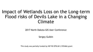
  • 1. Impact of Wetlands Loss on the Long-term Flood risks of Devils Lake in a Changing Climate 2017 North Dakota GIS User Conference Sergey Gulbin This study was partially funded by NSF RII EPSCoR (1355466) grant
  • 2. Devils Lake History August, 1984 September, 2009 http://earthobservatory.nasa.gov/IOTD/view.php?id=42624 August, 1984 September, 2009
  • 3. Devils Lake Flooding. Minnewaukan Source: “Minnewaukan”. 48°04'17.62" N 99°15'02.46" W. Google Earth. 9/20/1997. 3/30/2017 Source: “Minnewaukan”. 48°04'17.62" N 99°15'02.46" W. Google Earth. 4/30/2014. 3/30/2017
  • 4. Devils Lake Flooding. Churchs Ferry Source: “Churchs Ferry”. 48°16‘09.52" N 99°11‘47.98" W. Google Earth. 9/20/1997. 3/30/2017 Source: “Churchs Ferry”. 48°16‘09.52" N 99°11‘47.98" W. Google Earth. 4/30/2014. 3/30/2017
  • 5. Devils Lake Flooding 48°15‘25.94" N 99°11‘14.75" W. Google Earth. 9/20/1997. 3/30/2017 48°15‘25.94" N 99°11‘14.75" W. Google Earth. 4/30/2014. 3/30/2017 48°15‘39.74" N 99°11‘14.75" W. Google Earth. 7/30/1990. 3/30/2017 48°15‘39.74" N 99°11‘14.75" W. Google Earth. 4/30/2016. 3/30/2017
  • 6. Devils Lake Flood Mitigation and Outlets Controversy • Outlet may lead to contamination of Red River Basin, eutrophication of Lake Winnipeg, transfer of invasive species, poses a threat to valley residents health • Boundary Waters Treaty 1909 prevents and resolves disputes over boundary waters between USA and Canada • Manitoba Government and US communities from Red River Valley expressed protest against outlet construction • In Response U.S. Army Corps of Engineers proposed to include gravel filter in the project • 2005 – 100 cfs West-end outlet • 2010 – West-end outlet capacity expansion to 250 cfs • 2011 – 350 cfs East-end outlet 1280 600 Dissolved Solids (mg/l) Sulfate (mg/l)
  • 7. Land Cover Change in the Basin • ~ 50% of original North Dakota wetlands is lost (by area) For the settlers: • Wetlands/Swamps/Marches – mosquitos and malaria • Reduce passing ability For farmers nowadays: • Wetlands - obstacle for large farm machinery • Ethanol production has increased demand on corn • Corn price tripled from 2002 to 2012 Policies Directed on Reducing the Rate of Habitat Loss: • Wetland Conservation Provision, 1985 (“Swampbuster”) – producers converting wetlands to cropland lose eligibility for some federal program benefits. U.S. wetlands loss rate dropped by 5 times • Wetlands Reserve Program, 1990 – voluntary program, providing funding to producers for wetlands restoration and protection. 4,350 sq. km (1,680) sq. miles of protected wetlands (1995-2002). 45°48‘05.55" N 97°00‘50.95" W. Google Earth. 8/30/1991. 3/30/2017 45°48‘05.55" N 97°00‘50.95" W. Google Earth. 6/15/2016. 3/30/2017 48°15‘31.76" N 99°28‘25.99" W. Google Earth. 9/20/1997. 3/30/2017 48°15‘31.76" N 99°28‘25.99" W. Google Earth. 9/21/2014. 3/30/2017
  • 8. SWAT, Model Inputs and Study Area • Soil and Water Assessment Tool (SWAT) – a physically based model; allows to examine relative impact of input data • DEM: National Elevation Dataset (NED; 30-m resolution) • Land Cover: National Land Cover Dataset (NLCD) 2006. Cropland – 60%, wetlands – 10.7%, open water – 9.9%, hay – 8.1%, grasslands – 6.6%, urban – 4.1% and forests – 0.6% • Soil Data: STATSGO (125-m resolution). Soils in the basin are dominated by loam and clay with low infiltration
  • 9. Climate of the Devils Lake Region
  • 10. The Most Likely Historical Wetlands Locations. Methods 𝐶𝑇𝐼 = 𝑙𝑛 𝛼 𝑡𝑎𝑛𝛽 , where 𝛼 – upland contributing (draining) area 𝛽 – slope in radians • Compound Topographic Index (CTI): • “Flow Direction” and “Flow Accumulation” tools in ArcGIS were used to calculate upland contributing area and “Slope” tool for calculating slopes
  • 11. The Most Likely Historical Wetlands Locations. Output
  • 12. Wetlands Parameters • National Wetland Inventory – outdated (1970s – 1980s) • NLCD 2006 – the latest land cover data for study period (1991-2010) • Wetland volume equation: V = 0.25𝐴1.4742 • Drainage area equation: UA = 2.24𝐴0.4647 (UA – Upland Area) Gleason, R., Laubhan, M. K., & Euliss Jr, N. H. (2008). Ecosystem services derived from wetland conservation practices in the United States prairie pothole region with an emphasis on the United States Department of Agriculture Conservation Reserve and Wetlands Reserve programs: United States Geological profess. Reston, Virginia, USA. Parameter Meaning 0% wetlands 5% wetlands 11% wetlands (current) 16% wetlands 20% wetlands WET_MXVOL, 104 m3 Volume of water stored in wetlands when filled to maximum water level - 19,362.1 58,463.4 111,251.8 141,554.4 WET_MXSA, ha Surface area of wetlands at maximum water level - 47,574.7 102,201.9 152,256.4 190,298.8 WET_FR the fraction of subbasin area that drains into wetlands - 0.05 0.11 0.17 0.22
  • 13. Calibration and Validation Parameter name Meaning Fitted Value SFTMP.bsn Snowfall temperature (°C) 0.58 SMTMP.bsn Snow melt base temperature (°C) 1.28 SMFMX.bsn Melt factor for snow on June 21 (mm H2O/°C-day) 5.5 SMFMN.bsn Melt factor for snow on December 21 (mm H2O/°C-day) 2.25 TIMP.bsn Snow pack temperature lag factor 0.33 SNOCOVMX.bsn Minimum snow water content that corresponds to 100% snow cover, SNO100 (mm H2O) 14 EVLAI.bsn Leaf area index at which no evaporation occurs from water surface 3.8 GW_DELAY.gw Groundwater delay time (days) 331.79 ALPHA_BF.gw Baseflow alpha factor (1/days) 0.74 GWQMN.gw Threshold depth of water in shallow aquifer required for return flow to occur (mm H2O) 4400.16 GW_REVAP.gw Groundwater “revap” coefficient 0.04 REVAPMN.gw Threshold depth of water in the shallow aquifer for "revap" or percolation to the deep aquifer to occur (mm H2O) 48.95 RCHRG_DP.gw Deep aquifer percolation fraction 0.88 OV_N.hru Manning's "n" value for overland flow -0.08* ESCO.hru Soil evaporation compensation factor 0.30 EPCO.hru Plant uptake compensation factor 0.77 CN2.mgt Initial SCS runoff number for moisture condition II 0.02* CH_N(2).rte Manning's "n" value for the main channel 0.12 ALPHA_BNK.rte Baseflow alpha factor for bank storage (days) 0.40 CH_N(1).sub Manning’s “n” value for the tributary channels 8.72 RMSE = 0.27
  • 14. Future Climate Scenarios • Downscaled CMIP5 weather integrations based on IPCC AR5 RCP • 4 major simulation runs: based on climate of 1991-2010 period with and without outlet and based on climate of 1981-2010 period with and without outlet • 17 Global Circulation Models (GCM), each with 4 Representative Concentration Pathways (RCP), total 68 climate scenarios • Years in climate scenarios were shuffled 20 times, so total final number of simulated scenarios is 5,520 Precipitation (mm/day) Temperature (°C) 1990s 1980s 1990s&1980s GCM rcp26 rcp45 rcp60 rcp85 rcp26 rcp45 rcp60 rcp85 rcp26 rcp45 rcp60 rcp85 BCC-CSM 1.1 1.420 1.477 1.474 1.445 1.354 1.408 1.405 1.378 5.574 5.574 5.099 5.669 BCC-CSM 1.1(m) 1.479 1.503 1.493 1.460 1.410 1.434 1.423 1.392 4.337 4.061 4.224 4.576 CSIRO-Mk3.6.0 1.437 1.484 1.404 1.497 1.370 1.415 1.338 1.427 6.577 6.058 5.592 6.086 FIO-ESM 1.552 1.503 1.473 1.449 1.479 1.433 1.404 1.382 6.009 5.747 5.777 6.201 GFDL-CM3 1.499 1.417 1.455 1.509 1.429 1.351 1.388 1.439 5.536 5.727 5.405 5.758 GFDL-ESM2G 1.371 1.320 1.339 1.279 1.307 1.259 1.277 1.219 5.160 5.515 5.157 5.608 GFDL-ESM2M 1.347 1.449 1.291 1.512 1.284 1.382 1.231 1.442 5.197 5.473 5.330 5.051 GISS-E2-H 1.465 1.489 1.491 1.530 1.397 1.420 1.422 1.459 5.826 5.662 5.420 5.833 GISS-E2-R 1.497 1.511 1.496 1.497 1.427 1.441 1.427 1.427 4.654 4.889 4.747 4.953 HadGEM2-ES 1.516 1.506 1.509 1.566 1.445 1.436 1.439 1.493 4.851 5.205 4.651 5.231 IPSL-CM5A-LR 1.643 1.572 1.460 1.462 1.566 1.499 1.392 1.394 4.426 4.465 4.431 4.580 IPSL-CM5A-MR 1.481 1.655 1.500 1.652 1.412 1.578 1.430 1.575 4.618 4.781 4.492 4.547 MIROC-ESM 1.600 1.551 1.610 1.688 1.525 1.479 1.535 1.609 5.589 5.774 5.338 5.682 MIROC-ESM- CHEM 1.477 1.480 1.559 1.412 1.409 1.412 1.486 1.346 4.355 4.643 4.299 4.785 MIROC5 1.447 1.525 1.482 1.478 1.379 1.454 1.413 1.409 5.207 4.978 4.633 5.093 MRI-CGCM3 1.507 1.451 1.422 1.429 1.437 1.383 1.356 1.363 4.894 4.597 5.316 4.904 NorESM1-M 1.448 1.343 1.511 1.483 1.381 1.281 1.441 1.414 5.113 5.145 4.747 5.382 Mean 1.481 1.484 1.469 1.491 1.413 1.415 1.400 1.422 5.172 5.194 4.980 5.290 Baseline 1.415 1.349 3.599 Change 0.066 0.069 0.054 0.076 0.063 0.066 0.051 0.072 1.573 1.595 1.381 1.692 % Change 4.48% 4.67% 3.65% 5.10% 4.48% 4.67% 3.65% 5.10% 30.42% 30.71% 27.73% 31.98%
  • 15. Historical Climate • On average Devils Lake descents by 0.47 meters on every increase in fraction of wetlands in the basin by 5%
  • 16. Streamflow Comparison for two wetland scenarios
  • 18. Future Climate SCENARIO 1980s baseline 1990s baseline rcp26 rcp45 rcp60 rcp85 mean baseline rcp26 rcp45 rcp60 rcp85 mean baseline WithOutlet No wetlands 16% 16% 10% 25% 17% 1% 44% 44% 36% 52% 44% 19% 5% 13% 10% 4% 17% 11% 0% 34% 36% 24% 36% 32% 9% Current (11%) 9% 7% 3% 14% 8% 0% 29% 26% 17% 32% 26% 5% 16% 5% 2% 1% 9% 4% 0% 18% 16% 11% 21% 16% 1% 20% 2% 0% 1% 5% 2% 0% 11% 11% 7% 16% 11% 0% NoOutlet No wetlands 67% 71% 67% 74% 70% 80% 89% 88% 89% 93% 90% 100% 5% 46% 54% 47% 52% 50% 37% 80% 81% 79% 82% 80% 97% Current (11%) 35% 44% 34% 40% 38% 17% 72% 74% 71% 74% 73% 81% 16% 19% 22% 14% 25% 20% 4% 54% 59% 51% 56% 55% 40% 20% 15% 11% 7% 18% 13% 2% 41% 46% 40% 41% 42% 16% PRECIPITATION (MM/DAY) 1.41 1.42 1.40 1.42 1.41 1.35 1.48 1.48 1.47 1.49 1.48 1.42 TEMPERATURE C 5.17 5.19 4.98 5.29 5.16 3.60 5.17 5.19 4.98 5.29 5.16 3.60
  • 19. Analysis of Devils Lake Area Released due to Wetlands Restoration • On average the lake descents by 0.47 meters on every increase in acreage of wetlands in the basin by 5% • Restoration of wetlands might be not in farmers’ best interest, because part of their cropland will be withdrawn for wetlands • Even though land released from Devils Lake will be saline and very unlikely cropped, but these lands can be used as pastures, hay and wildlife • With restoring wetlands area equivalent to 500 km2, Devils Lake area will be reduced only by 80 km2 and doubling current wetlands acreage (restoration of approximately 1,000 km2) will cause Devils Lake area reduction by 133 km2
  • 20. Conclusions • Model simulations indicate that the land use change in the Devils Lake watershed increased the impacts of climate change on hydrology by further elevating Devils Lake water level • Conversely, wetland restoration reduce the flooding and moderates risks of a potential high-impact Devils Lake overspill to the Sheyenne River watershed • Simulations for the period from 2011 to 2040 indicate that with increasing area of wetlands, probability of Devils Lake overspill to Sheyenne River decreases • Wetlands restoration is not as effective as outlet in mitigating Devils Lake flooding
  • 21. Thank you for your time and attention! Questions? Sergey Gulbin, M.S., University of North Dakota Sergey.Gulbin@und.edu