Pieuavv4 en-20171018
•
1 gefällt mir•36 views

PIEUAV is photogrammetry software that can automatically process UAV image data into 3D models, dense point clouds, and orthomosaics without manual intervention. It uses computer vision and photogrammetry algorithms to calculate camera positions and generate outputs. PIEUAV can process thousands of images quickly, even without accurate camera parameters, and produces maps and models with centimeter-level accuracy. The document provides several case studies where PIEUAV was used to automatically process large amounts of UAV image data and generate high quality 3D and mapping outputs for areas like reservoirs, cities, and mountains.

Empfohlen
Weitere ähnliche Inhalte
Ähnlich wie Pieuavv4 en-20171018
Ähnlich wie Pieuavv4 en-20171018 (20)
Mehr von GeoMedeelel
Mehr von GeoMedeelel (20)
Kürzlich hochgeladen
Kürzlich hochgeladen (20)
Pieuavv4 en-20171018
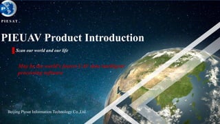
- 1. Beijing Piesat Information Technology Co.,Ltd. 1 PIEUAV Product Introduction Scan our world and our life P I E S AT May be the world's fastest UAV data intelligent processing software
- 2. 3.PIEUAV Case Introduction 2.PIEUAV Product Advantages 1.PIEUAV Product Brief 2
- 3. 1 PIEUAV Product Brief 3 PIEUAV mainly uses computer vision and photogrammetry technology, for UAV photogrammetry, generate DOM/DSM and real three-dimensional models with high resolution automatically, the entire process does not require manual intervention. UAV applications have been quietly infiltrated into all walks of life, slowly changing the way people deal with the problem. But UAV hardware can only obtain photos and videos, limited application. In many applications need to combine professional processing software to provide more useful products and services. For example, agricultural production needs to measure the area, emergency relief needs terrain data to guide the rescue operations (disaster area, landslide volume, etc), the construction of three-dimensional urban scenic spots.
- 4. 1 PIEUAV Product Brief 4 The difficulty of UAV data processing The posture of the aircraft is unstable No track planning or even any flight pat Camera parameters are absence or inaccurate The IMU information is absence or not accurate Processing speed is slow Traditional aerial photogrammetry software is complex Flat and elevation accuracy is not high Can not make full use of computer hardware resources
- 5. 1 PIEUAV Product Brief 5 Comparison of Air Images Data processing difficulty Consumer UAV Industrial UAV Airplane At present, PIEUAV is the only one domestic software, which compatible with the above three kinds of aviation data processing. Breaking the dilemma that consumer UAV has been known as the upgraded version of the self-timer. So that consumer UAV better serve more industries Processing difficulty
- 6. 1 PIEUAV Product Brief 6 Original photos Shooting attitude calculation and sparse point cloud Digital Surface Model(DSM) Digital Orthophotos(DOM)Dense point cloud construction triangulationTrue 3D model Data processing flow
- 7. 3. PIEUAV Case Introduction 2.PIEUAV Product Advantages 1.PIEUAV Product Brief 7
- 8. 2 PIEUAV Product Advantages 8 Automatic processing, without human intervention PIEUAV is a landmark product for the digital photogrammetry era , eliminating the overmuch need of human-computer interaction, truly fully automated. Operators do not need to have professional knowledge PIEUAV is extremely easy to use, only need to add the image and POS, one click to complete the fast puzzle, digital elevation model and three-dimensional dense point cloud production. Speed pixel processing engine PIEUAV is a 64-bit program, the use of multi-core processors and GPU joint acceleration, the use of innovative algorithms, making the processing speed has been greatly. CPU recommended the use of i7 or more processors, GPU recommended the use of high-end graphics card GTX970 or above. GPU and CPU dual-mode automatic switching: When the computer is equipped with high-end GPU, the program can take full advantage of computing resources, when there is no high-end GPU, the program automatically switches to normal CPU program running.
- 9. 9 Support any track PIEUAV uses the technology which combines computer vision and photogrammetry, can support any kind of photo taken by the automatic processing. 2 PIEUAV Product Advantages
- 10. 10 Camera self-calibration system When the camera parameters are not accurate or do not have camera parameters, PIEUAV can based on the tie points information between the image and using the camera self-calibration algorithm, approximate calculate the camera parameters, such as the main distance, like the coordinates of the main point, radial distortion and eccentric distortion. Data quality self-checking system PIEUAV can automatically remove bad photos (such as full cloud cover, full water coverage, etc.) according to the texture quality of the image, only choice the effective area of the flight to process. Accuracy of mapping level PIEUAV software supports control point import and editing, the accuracy of DOM / DEM can meet requirements from 1: 10000 to 1: 500. 2 PIEUAV Product Advantages
- 11. 11 Supports various camera types PIEUAV supports a variety of types of cameras, both to support full-frame micro-single and SLR cameras (such as Sony micro-single, Canon 5D3, Nikon, etc.), but also to support the ordinary card camera or even mobile phone. 2 PIEUAV Product Advantages
- 12. 12 Product True Orthophotos PIEUAV can use the high-precision DSM for true orthophotos production automatically. DOM TDOM 2 PIEUAV Product Advantages
- 13. 13 Automatic uniform light and color PIEUAV support automatic uniform light and uniform color, using self-created color area network adjustment algorithm to achieve the purpose of the overall color of the same. After Before 2 PIEUAV Product Advantages
- 14. 14 Support difference GPS Support difference GPS(POS) auxiliary Aerotriangulation, the absolute accuracy without GCPS can reach 0.4 meters or less. Support DJI UAV Support the consumer UAV of DJI, such as PHANTOM, INSPIRE, provide mapping-level image map services to the majority of users. Based on the DJI’s SDK ,we developed a track flight APP. Using this APP, you can one click to complete the aircraft take off, flight, capture photos, GPS data acquisition, landing and other operations, without professional knowledge. Common data interface PIEUAV can enter BMP, JPG and other commonly used formats of pictures, can also export GEOTIFF, IMG, PIX and other common format remote sensing image. 2 PIEUAV Product Advantages
- 15. 15 Support thousands of images at the same time PIEUAV internal unique data structure, you can handle thousands of images at the same time. Automatic Aerotriangulation Calculation PIEUAV completely uses the texture of the photo to create the connection between the photos. The use of computer vision and photogrammetry combined with the regional network adjustment algorithm, automatically calculate the position and attitude of each photo shoot, and generate the final adjustment. 2 PIEUAV Product Advantages
- 16. 16 Fast puzzle PIEUAV automatically corrects the distortion of the photo's perspective, splicing all the photos into a georeferenced image, and can achieve the geometric accuracy of the measurement level. The efficiency of the measured data processing is shown in the following table: No. Camera Size Photos Number GSD(cm) Time 1 Canon 5D Mark2 5616*3744 500 10 48min 2 NIKON D800 7360*4912 450 12 1h5min 3 Panasonic DMC-GX1 4592*3448 200 5 25min 4 SONY DSC-RX1 6000*4000 250 8 35min 5 NIKON D810 7360*4912 960 10 2h10min 6 Phase One IQ180 10328*7760 82 3 24min 2 PIEUAV Product Advantages
- 17. 17 Automatically generate digital surface models Using the international advanced three-dimensional dense matching algorithm, automatic generation of digital surface model, accurate calculation of the height of each pixel value. 2 PIEUAV Product Advantages
- 18. 18 Ultra high density real 3D point cloud production PIEUAV can generate realistic real-world 3D point cloud data from simple continuous images without human intervention, and can be used for 3D viewing and measurement. 2 PIEUAV Product Advantages
- 19. 19 Automatic generation of ultra-high real 3D model PIEUAV can generate lifelike real 3d models (OBJ format) from simple continuous images without human intervention, and can be used for 3D viewing and measurement. Dense point cloud (Source: DJi Phantom 4) MESH gridThe real 3D model after the texture 2 PIEUAV Product Advantages
- 20. 3. PIEUAV Case Introduction 2.PIEUAV Product Advantages 1.PIEUAV Product Brief 20
- 21. 3 PIEUAV Case Introduction 21 • UAV model: Fixed wing UAV • Camera: Nikon D810 • Flight height: 700 m • Ground resolution: 8 cm • Number of photos: 4308 • Coverage area: 130 km2 Case 1: With Control Points
- 22. 22 DOM & DSM 3 PIEUAV Case Introduction
- 23. 23 DOM and DSM match graphs 3 PIEUAV Case Introduction
- 24. 24 Control points accuracy 控制点实际位置 控制点DOM位置 3 PIEUAV Case Introduction
- 25. 25 Case 2: DSM230 data processing Area: 120 km2 Resolution: 0.18 m Camera: DMC230 Number of pixels: 14144x15552 Camera focal length: 92mm Number of images: 110 Data volume: 67GB Method: one-button fully automated processing 3 PIEUAV Case Introduction
- 26. 26 DOM&DSM 3 PIEUAV Case Introduction
- 27. 27 Case 3: 3D model of the reservoir Survey Area Name: Jinghe Reservoir Camera: Nikon D800 Number of pixels: 7360x4912 Shooting mode: single shot, vertical photography Method: one-button fully automated processing 3 PIEUAV Case Introduction
- 28. 28 Dense point cloud and triangulation 3 PIEUAV Case Introduction
- 29. 29 3D model effect 3 PIEUAV Case Introduction
- 30. 30 Case4:Urban • UAV model: fixed wing UAV • Flight height: 200 m • Ground resolution: 3 cm • Number of photos: 1265 • Coverage area: 1 km2 3 PIEUAV Case Introduction
- 31. 31 DOM 3 PIEUAV Case Introduction
- 32. 32 DSM 3 PIEUAV Case Introduction
- 33. 33 Case 5:Mountain • UAV model: fixed wing UAV • Flight height: 500 m • Ground resolution: 12 cm • Number of photos: 773 • Coverage area: 39 km2 3 PIEUAV Case Introduction
- 34. 34 DOM 3 PIEUAV Case Introduction
- 35. 35 DSM 3 PIEUAV Case Introduction
- 36. 36 Contact Information YiYuan c-5-3, Xingshikou Road, Haidian District, Beijing Add: Beijing Piesat Information Technology Co.,Ltd. 010-82556925Tel: 010-82556924Fax: http://www.piesat.com.cnWeb: 单 击 地 图 可 放 大 Official Wechat
- 37. 37 T H A N K Y O U