SlideShare ist ein Scribd-Unternehmen logo
1 von 8
Downloaden Sie, um offline zu lesen
Role of Remote Sensing and GIS in Disaster
Management
Prepared by Er. Bishnu Khatri
With the achievement and advancement of Science and Technology with growing
human civilization ,Space Technology had become more fruitful and beneficial part at
any sectors /field of study at any level of this universe, space and planets, their
physical, biological and chemical composition revolution, origin and expansion
.Similarly I had tried to summarize and mentioned a few and least method &
application of Space Technology through RS &GIS in Disaster Management .I hope
potential reader will fully love to learn and enjoy this Article
Catastrophe is a dangerous disruption of life which cannot be predicted, either
partially or totally.
Natural Disaster is a dangerous event that causes environmental effects or alteration
(physical, biological, social and economic) and these are of such magnitude that the
ecosystem and or society are unable to tolerate them and remains just witnessing
their basic functioning elements i.e. basic needs and dynamic balance being
destroyed.
The following aspects come into consideration when disaster occur;
 Disruption of lifestyles and behavior pattern
 Impact on man and other living creatures
 Impact on social infrastructure and Eco structures i.e. Banking and Finance
sectors ,Buildings, Transportation System and other vital intersects such as
Food chain ,social aim amenities/basic needs such as Housing ,Food
,Drinking water ,Shelter and Medical care
Disaster types;
1. Natural Geological Disaster : It originates from depth of the earth e.g.
Earth quake, Volcano, Tsunami
2. Hydro climatic Disaster : It occurs on surface of earth e.g. Storms
(Hurricanes, Cyclones , Flood , Droughts )
3. Other Catastrophes : These origins are both subterranean and
superficial e.g. Landslides
4. Environmental Disaster : It is caused by excessive harmful human
activity that leads climate change e.g.
A. Floods, Droughts, Desertification due to Deforestation
B. Wild Fires and Forest Fires due to Human carelessness
C. Lethal Diseases e.g. SARS, EBOLA, BIRDFLU, GICA
due to Viral Transmission and Communicative Interaction
5. Technological Disaster : It is caused by both, either from Technical
Errors ,Lack of practice on Safety Management procedure ,Irresponsible Quality
Control of physical and chemical constituent of Matter/Material Used at
Development Infrastructure and Activity or by serious use of Nuclear power
Expose Administration and Power Exercise for their
Country/Regions/Religion/State sovereignty,
it reveals the correlation between natural and technological disasters
e.g. 1. Nuclear Bomb, Hydrogen Bombs, Atom Bomb, Radiation Activity for
War Basis
2. Mining of Coal and Minerals blasting
3. Nuclear plant explosion
4. High Voltage Current Transmission
5. Gas pipe, Oil pipe, Petroleum plant explosion
6. Falling of Large structures such as Buildings, Bridges, Rail Track
Role of Space Technology; Through Remote sensing and GIS we can
handle such Disasters by applying 4 ‘T’ i.e. Tips, Trick, Technique, Tools
1. “Tips” are generally the hints of available National and International practices of
data acquisition (spatial or attribute) on population living on that particular area,
data feasibility analysis/access/administration, abstraction on Rescue, Recovery
and Reconstruction
2. “Trick” is the short phenomenal brain application of encountering and facing the
problems like Natural Disasters i.e. Early Warning Systems and Safe alternate
settlement Area or open Space that can be guided by
3. “Technique” is the analogue/analytical method that we use i.e. mapping and
visualization through available topographical map, topographical database, satellite
imageries, web map and web feature servers and so on
4. “Tools” is the software based final arms and weapon that is made from
programming language, structures and commands of the core missions and rescue
operation e.g. Network Analysis (Optimal path finding ,Path tracing/tracking
,Spatial Interaction ,Distance Matrix Calculation and so on )
These all facilities are guided and provided by newly born Remote Sensing and
GIS technology via /through 4 ‘M’ s
1. Measurement ; It consist Area ,Volume ,Density ,Statics, Distance Matrix
Calculation ,Probability ,Magnitude and Frequency determination of Affected
or Potential Hazard Area
2. Monitoring ; Frequent update and evaluation of time series data regarding
change detection on quantity i.e. (for water volume ,for hurricane and cyclone
speed ),spectral signature of satellite imageries, hot spot analysis for thermal
activity for forest fires ,flow direction for hydrological nature of water ,spread
computation on Viral germs/lethal diseases ,Water paths and Traffic
Administration etc.
3. Modelling ;It is a planned work flow of specific solution oriented decision
support tool aided and added by programmer or software developer e.g.
Hydrological Modelling ,Flood Risk Modelling
4. Mapping ; Disseminative Displaytory Informative and Communicative
Positional Information based geographical visualization of Details location and
its phenomenon.
Objective of Space Technology in Disaster;
1) Early warning system and disaster preparedness
2) Search and rescue of disaster survivors
3) Findings out Ultimate safe settlement area
4) Route finding
5) Alternate places for rescue operation
6) Energy and Power supply to victims
7) Food supply ,storage, and safety managements
8) Water purification and treatment
9) Medicine and healthcare for Disaster victim
10) Sanitation and Waste Management in Disaster
11) Disaster Resistant Housing and Construction
12) High Military Security and Diplomatic intelligence for counter Country
Attacks and Illegal entry of criminal groups/terrorists and Citizens
Property Safety
Remote Sensing (RS)
&
Geographical
Information System
(GIS)
Disaster
Disaster
Prepare
dness
Disaster
Mitigation
Reconstruction
Standards
Production
Service
Figure: Schematic Descriptions, Capability and Potential of
Remote Sensing & GIS
Capability and Potential of RS /GIS Before, During and After Disaster;
1) Disaster ;
 Disaster information ,Quick Processing & Analysis
 Disaster Mapping
 Scenario simulation ,Disaster Trend fore casting
 Emergency Response decision support tool
2) Disaster Relief ;
 Information integration and Analysis
 Disaster monitoring
 Dynamic Disaster loss assessment
3) Recovery ;
 Disaster Relief Decision Making support tool
4) Reconstruction ;
 Requires Assessment e.g. PDNA
 Disaster loss information
 Monitoring of Reconstruction and Recovery
5) Disaster Mitigation ;
 Disaster Characteristic Factor Monitoring
 Disaster Reduction Planning
 Vulnerability ,Hazard, Risk Information & Assessment
6) Disaster Preparedness ;
 Disaster Early Warning System
 Hazard Monitoring
 DBS(Database) construction
 Logistic Preparation for Disaster relief
Role of RS & GIS; gis in disaster management prepared by er. bishnu khatri

Weitere ähnliche Inhalte

Was ist angesagt?

Geographic Information System(GIS) and Remote Sensing(RS) in Disaster Managem...
Geographic Information System(GIS) and Remote Sensing(RS) in Disaster Managem...Geographic Information System(GIS) and Remote Sensing(RS) in Disaster Managem...
Geographic Information System(GIS) and Remote Sensing(RS) in Disaster Managem...Our slides
 
DIFFERENT APPROACHES & RELATION WITH HUMAN ECOLOGY TO REDUCE THE DISASTER RISK
DIFFERENT APPROACHES & RELATION WITH HUMAN ECOLOGY TO REDUCE THE DISASTER RISKDIFFERENT APPROACHES & RELATION WITH HUMAN ECOLOGY TO REDUCE THE DISASTER RISK
DIFFERENT APPROACHES & RELATION WITH HUMAN ECOLOGY TO REDUCE THE DISASTER RISKMALLIKARJUNA REDDY KASIREDDY
 
Early warning System Disaster Management
Early warning System Disaster ManagementEarly warning System Disaster Management
Early warning System Disaster ManagementVraj Pandya
 
geo information ppt in disaster management
geo information ppt in disaster managementgeo information ppt in disaster management
geo information ppt in disaster managementKirpaldumaniya
 
Vulnerability analysis and experience of vulnerability in india
Vulnerability analysis and experience of vulnerability in indiaVulnerability analysis and experience of vulnerability in india
Vulnerability analysis and experience of vulnerability in indiaShubham Agrawal
 
Reconstruction and development
Reconstruction and developmentReconstruction and development
Reconstruction and developmentMahmoud Shaqria
 
COMMUNITY PARTICIPATION IN DISASTER MANAGEMENT
COMMUNITY PARTICIPATION IN DISASTER MANAGEMENTCOMMUNITY PARTICIPATION IN DISASTER MANAGEMENT
COMMUNITY PARTICIPATION IN DISASTER MANAGEMENTYash Shah
 
Role of gis in climate change
Role of gis in climate changeRole of gis in climate change
Role of gis in climate changeSalar Saeed Dogar
 
Disaster Management: role of ICTs
Disaster Management: role of ICTsDisaster Management: role of ICTs
Disaster Management: role of ICTsglobal
 
Flood risk mapping using GIS and remote sensing and SAR
Flood risk mapping using GIS and remote sensing and SARFlood risk mapping using GIS and remote sensing and SAR
Flood risk mapping using GIS and remote sensing and SARRohan Tuteja
 
The role of land use planning in the disaster risk reduction
The role of land use planning in the disaster risk reductionThe role of land use planning in the disaster risk reduction
The role of land use planning in the disaster risk reductionGlobal Risk Forum GRFDavos
 
Vulnerability Mapping (Vulnerability Assessment)
Vulnerability Mapping (Vulnerability Assessment)Vulnerability Mapping (Vulnerability Assessment)
Vulnerability Mapping (Vulnerability Assessment)ESD UNU-IAS
 
Flood risk mapping using GIS and remote sensing
Flood risk mapping using GIS and remote sensingFlood risk mapping using GIS and remote sensing
Flood risk mapping using GIS and remote sensingRohan Tuteja
 

Was ist angesagt? (20)

Community based disaster management
Community based disaster managementCommunity based disaster management
Community based disaster management
 
Geographic Information System(GIS) and Remote Sensing(RS) in Disaster Managem...
Geographic Information System(GIS) and Remote Sensing(RS) in Disaster Managem...Geographic Information System(GIS) and Remote Sensing(RS) in Disaster Managem...
Geographic Information System(GIS) and Remote Sensing(RS) in Disaster Managem...
 
Community Based Disaster Management
Community Based Disaster ManagementCommunity Based Disaster Management
Community Based Disaster Management
 
GIS IN DISASTER MANAGEMENT
GIS IN DISASTER MANAGEMENTGIS IN DISASTER MANAGEMENT
GIS IN DISASTER MANAGEMENT
 
DIFFERENT APPROACHES & RELATION WITH HUMAN ECOLOGY TO REDUCE THE DISASTER RISK
DIFFERENT APPROACHES & RELATION WITH HUMAN ECOLOGY TO REDUCE THE DISASTER RISKDIFFERENT APPROACHES & RELATION WITH HUMAN ECOLOGY TO REDUCE THE DISASTER RISK
DIFFERENT APPROACHES & RELATION WITH HUMAN ECOLOGY TO REDUCE THE DISASTER RISK
 
Early warning System Disaster Management
Early warning System Disaster ManagementEarly warning System Disaster Management
Early warning System Disaster Management
 
geo information ppt in disaster management
geo information ppt in disaster managementgeo information ppt in disaster management
geo information ppt in disaster management
 
Land use cover pptx.
Land use cover pptx.Land use cover pptx.
Land use cover pptx.
 
GIS in emergency management
GIS in emergency managementGIS in emergency management
GIS in emergency management
 
Vulnerability analysis and experience of vulnerability in india
Vulnerability analysis and experience of vulnerability in indiaVulnerability analysis and experience of vulnerability in india
Vulnerability analysis and experience of vulnerability in india
 
Reconstruction and development
Reconstruction and developmentReconstruction and development
Reconstruction and development
 
COMMUNITY PARTICIPATION IN DISASTER MANAGEMENT
COMMUNITY PARTICIPATION IN DISASTER MANAGEMENTCOMMUNITY PARTICIPATION IN DISASTER MANAGEMENT
COMMUNITY PARTICIPATION IN DISASTER MANAGEMENT
 
Role of gis in climate change
Role of gis in climate changeRole of gis in climate change
Role of gis in climate change
 
Disaster Management: role of ICTs
Disaster Management: role of ICTsDisaster Management: role of ICTs
Disaster Management: role of ICTs
 
Flood risk mapping using GIS and remote sensing and SAR
Flood risk mapping using GIS and remote sensing and SARFlood risk mapping using GIS and remote sensing and SAR
Flood risk mapping using GIS and remote sensing and SAR
 
The role of land use planning in the disaster risk reduction
The role of land use planning in the disaster risk reductionThe role of land use planning in the disaster risk reduction
The role of land use planning in the disaster risk reduction
 
Landslide disaster management
Landslide disaster managementLandslide disaster management
Landslide disaster management
 
Vulnerability Mapping (Vulnerability Assessment)
Vulnerability Mapping (Vulnerability Assessment)Vulnerability Mapping (Vulnerability Assessment)
Vulnerability Mapping (Vulnerability Assessment)
 
Flood risk mapping using GIS and remote sensing
Flood risk mapping using GIS and remote sensingFlood risk mapping using GIS and remote sensing
Flood risk mapping using GIS and remote sensing
 
Applications of remote sensing and modelling in flood risk analysis and irrig...
Applications of remote sensing and modelling in flood risk analysis and irrig...Applications of remote sensing and modelling in flood risk analysis and irrig...
Applications of remote sensing and modelling in flood risk analysis and irrig...
 

Andere mochten auch

Space-based Information and Solutions for Disaster Management and Emergency ...
Space-based Information and Solutions for  Disaster Management and Emergency ...Space-based Information and Solutions for  Disaster Management and Emergency ...
Space-based Information and Solutions for Disaster Management and Emergency ...UN-SPIDER
 
Introduction to ICST 2017
Introduction to ICST 2017Introduction to ICST 2017
Introduction to ICST 2017Keizo Tatsumi
 
Space Technologies for Disaster Management
Space Technologies for Disaster ManagementSpace Technologies for Disaster Management
Space Technologies for Disaster ManagementSTDM
 
Intro to RS and GIS by mndp poonia
Intro to RS and GIS by mndp pooniaIntro to RS and GIS by mndp poonia
Intro to RS and GIS by mndp pooniamndp_slide
 
DROUGHT ANALYSIS
DROUGHT ANALYSISDROUGHT ANALYSIS
DROUGHT ANALYSISAkash KP
 
Application of gis and remote sensing in disease prevention and control with
Application of gis and remote sensing in disease prevention and control withApplication of gis and remote sensing in disease prevention and control with
Application of gis and remote sensing in disease prevention and control withDr. Ramkesh Prasad
 
Rahul Bajpai M.tech Remote sensing & GIS RSACUP
Rahul Bajpai M.tech Remote sensing & GIS RSACUPRahul Bajpai M.tech Remote sensing & GIS RSACUP
Rahul Bajpai M.tech Remote sensing & GIS RSACUPrahul64
 
GIS and Civil Engineering: Esri UC
GIS and Civil Engineering: Esri UCGIS and Civil Engineering: Esri UC
GIS and Civil Engineering: Esri UCBond Harper
 
GIS applications in Emergency / Disaster Management
GIS applications in Emergency / Disaster ManagementGIS applications in Emergency / Disaster Management
GIS applications in Emergency / Disaster ManagementPhongsakorn Uar-amrungkoon
 
REMOTE SENSING & GIS APPLICATIONS IN WATERSHED MANAGEMENT
REMOTE SENSING & GIS APPLICATIONS IN WATERSHED MANAGEMENT REMOTE SENSING & GIS APPLICATIONS IN WATERSHED MANAGEMENT
REMOTE SENSING & GIS APPLICATIONS IN WATERSHED MANAGEMENT Sumant Diwakar
 
Iirs overview -Remote sensing and GIS application in Water Resources Management
Iirs overview -Remote sensing and GIS application in Water Resources ManagementIirs overview -Remote sensing and GIS application in Water Resources Management
Iirs overview -Remote sensing and GIS application in Water Resources ManagementTushar Dholakia
 
APPLICATIONS OF REMOTE SENSING AND GIS IN WATERSHED MANAGEMENT
APPLICATIONS OF REMOTE SENSING AND GIS IN WATERSHED MANAGEMENTAPPLICATIONS OF REMOTE SENSING AND GIS IN WATERSHED MANAGEMENT
APPLICATIONS OF REMOTE SENSING AND GIS IN WATERSHED MANAGEMENTSriram Chakravarthy
 
Application of gis & rs in urban planning
Application of gis & rs in urban planning Application of gis & rs in urban planning
Application of gis & rs in urban planning sathish1446
 
Intro to GIS and Remote Sensing
Intro to GIS and Remote SensingIntro to GIS and Remote Sensing
Intro to GIS and Remote SensingJohn Reiser
 
Using ICT for Earthquake Disaster Risk Reduction in Iran
Using ICT for Earthquake Disaster Risk Reduction in IranUsing ICT for Earthquake Disaster Risk Reduction in Iran
Using ICT for Earthquake Disaster Risk Reduction in IranGlobal Risk Forum GRFDavos
 

Andere mochten auch (17)

Space-based Information and Solutions for Disaster Management and Emergency ...
Space-based Information and Solutions for  Disaster Management and Emergency ...Space-based Information and Solutions for  Disaster Management and Emergency ...
Space-based Information and Solutions for Disaster Management and Emergency ...
 
Introduction to ICST 2017
Introduction to ICST 2017Introduction to ICST 2017
Introduction to ICST 2017
 
GIS & RS
GIS & RSGIS & RS
GIS & RS
 
Space Technologies for Disaster Management
Space Technologies for Disaster ManagementSpace Technologies for Disaster Management
Space Technologies for Disaster Management
 
Intro to RS and GIS by mndp poonia
Intro to RS and GIS by mndp pooniaIntro to RS and GIS by mndp poonia
Intro to RS and GIS by mndp poonia
 
DROUGHT ANALYSIS
DROUGHT ANALYSISDROUGHT ANALYSIS
DROUGHT ANALYSIS
 
Application of gis and remote sensing in disease prevention and control with
Application of gis and remote sensing in disease prevention and control withApplication of gis and remote sensing in disease prevention and control with
Application of gis and remote sensing in disease prevention and control with
 
Rahul Bajpai M.tech Remote sensing & GIS RSACUP
Rahul Bajpai M.tech Remote sensing & GIS RSACUPRahul Bajpai M.tech Remote sensing & GIS RSACUP
Rahul Bajpai M.tech Remote sensing & GIS RSACUP
 
civil engineer
civil engineercivil engineer
civil engineer
 
GIS and Civil Engineering: Esri UC
GIS and Civil Engineering: Esri UCGIS and Civil Engineering: Esri UC
GIS and Civil Engineering: Esri UC
 
GIS applications in Emergency / Disaster Management
GIS applications in Emergency / Disaster ManagementGIS applications in Emergency / Disaster Management
GIS applications in Emergency / Disaster Management
 
REMOTE SENSING & GIS APPLICATIONS IN WATERSHED MANAGEMENT
REMOTE SENSING & GIS APPLICATIONS IN WATERSHED MANAGEMENT REMOTE SENSING & GIS APPLICATIONS IN WATERSHED MANAGEMENT
REMOTE SENSING & GIS APPLICATIONS IN WATERSHED MANAGEMENT
 
Iirs overview -Remote sensing and GIS application in Water Resources Management
Iirs overview -Remote sensing and GIS application in Water Resources ManagementIirs overview -Remote sensing and GIS application in Water Resources Management
Iirs overview -Remote sensing and GIS application in Water Resources Management
 
APPLICATIONS OF REMOTE SENSING AND GIS IN WATERSHED MANAGEMENT
APPLICATIONS OF REMOTE SENSING AND GIS IN WATERSHED MANAGEMENTAPPLICATIONS OF REMOTE SENSING AND GIS IN WATERSHED MANAGEMENT
APPLICATIONS OF REMOTE SENSING AND GIS IN WATERSHED MANAGEMENT
 
Application of gis & rs in urban planning
Application of gis & rs in urban planning Application of gis & rs in urban planning
Application of gis & rs in urban planning
 
Intro to GIS and Remote Sensing
Intro to GIS and Remote SensingIntro to GIS and Remote Sensing
Intro to GIS and Remote Sensing
 
Using ICT for Earthquake Disaster Risk Reduction in Iran
Using ICT for Earthquake Disaster Risk Reduction in IranUsing ICT for Earthquake Disaster Risk Reduction in Iran
Using ICT for Earthquake Disaster Risk Reduction in Iran
 

Ähnlich wie Role of RS & GIS; gis in disaster management prepared by er. bishnu khatri

MICRO-ZONING AND RISK MAPPING FOR DISASTER PREPAREDNESS
MICRO-ZONING AND RISK MAPPING FOR DISASTER PREPAREDNESSMICRO-ZONING AND RISK MAPPING FOR DISASTER PREPAREDNESS
MICRO-ZONING AND RISK MAPPING FOR DISASTER PREPAREDNESSEminent Planners
 
disaster management...........................
disaster management...........................disaster management...........................
disaster management...........................MeruvaLokeshwar
 
UP691938 FInished Report
UP691938 FInished ReportUP691938 FInished Report
UP691938 FInished ReportKatie Acton
 
To Establish Evacuation Decision-Making Selection Modes of Aboriginal Tribes ...
To Establish Evacuation Decision-Making Selection Modes of Aboriginal Tribes ...To Establish Evacuation Decision-Making Selection Modes of Aboriginal Tribes ...
To Establish Evacuation Decision-Making Selection Modes of Aboriginal Tribes ...IJERA Editor
 
DISASTER MITIGATION AND MANAGEMENT INTRODUCTION
DISASTER MITIGATION AND MANAGEMENT INTRODUCTIONDISASTER MITIGATION AND MANAGEMENT INTRODUCTION
DISASTER MITIGATION AND MANAGEMENT INTRODUCTIONKavya Kusam
 
Hazard vulnerability capacity assesstment b
Hazard vulnerability capacity assesstment bHazard vulnerability capacity assesstment b
Hazard vulnerability capacity assesstment bNDRC Nepal
 
Role of Geologists in Natural Hazard Mapping and Application_Dr Kyi Khin_MGSS...
Role of Geologists in Natural Hazard Mapping and Application_Dr Kyi Khin_MGSS...Role of Geologists in Natural Hazard Mapping and Application_Dr Kyi Khin_MGSS...
Role of Geologists in Natural Hazard Mapping and Application_Dr Kyi Khin_MGSS...KYI KHIN
 
DIGITAL SOCIETY : A REVIEW OF E-SERVICE AND MOBILE TECHNOLOGY IN EARTHQUAKES ...
DIGITAL SOCIETY : A REVIEW OF E-SERVICE AND MOBILE TECHNOLOGY IN EARTHQUAKES ...DIGITAL SOCIETY : A REVIEW OF E-SERVICE AND MOBILE TECHNOLOGY IN EARTHQUAKES ...
DIGITAL SOCIETY : A REVIEW OF E-SERVICE AND MOBILE TECHNOLOGY IN EARTHQUAKES ...IJMIT JOURNAL
 
Digital society a review of e service and mobile technology in earthquakes re...
Digital society a review of e service and mobile technology in earthquakes re...Digital society a review of e service and mobile technology in earthquakes re...
Digital society a review of e service and mobile technology in earthquakes re...IJMIT JOURNAL
 
APPLICATIONS OF REMOTE SENSING AND GIS TECHNOLOGIES IN FLOOD RISK MANAGEMENT
APPLICATIONS OF REMOTE SENSING AND GIS TECHNOLOGIES IN FLOOD RISK MANAGEMENTAPPLICATIONS OF REMOTE SENSING AND GIS TECHNOLOGIES IN FLOOD RISK MANAGEMENT
APPLICATIONS OF REMOTE SENSING AND GIS TECHNOLOGIES IN FLOOD RISK MANAGEMENTrsmahabir
 
ROLE OF TECHNOLOGY TO ESTABLISH COMMUNICATION IN NATURAL DISASTERS
ROLE OF TECHNOLOGY TO ESTABLISH COMMUNICATION IN NATURAL DISASTERSROLE OF TECHNOLOGY TO ESTABLISH COMMUNICATION IN NATURAL DISASTERS
ROLE OF TECHNOLOGY TO ESTABLISH COMMUNICATION IN NATURAL DISASTERSAM Publications,India
 
I Need Help To Prepare
I Need Help To PrepareI Need Help To Prepare
I Need Help To Preparetotal
 
MX3084 DISASTER RISK REDUCTION AND MANAGEMENT.pptx
MX3084 DISASTER RISK REDUCTION AND MANAGEMENT.pptxMX3084 DISASTER RISK REDUCTION AND MANAGEMENT.pptx
MX3084 DISASTER RISK REDUCTION AND MANAGEMENT.pptxdvedha1975
 
15 fa transportation-system_ws2015
15 fa transportation-system_ws201515 fa transportation-system_ws2015
15 fa transportation-system_ws2015Luca Marescotti
 
Disasters and Their Awareness in J&K
Disasters and Their Awareness in J&KDisasters and Their Awareness in J&K
Disasters and Their Awareness in J&KIRJAES Editor
 
R18B.Tech.OpenElectives (2).pdf
R18B.Tech.OpenElectives (2).pdfR18B.Tech.OpenElectives (2).pdf
R18B.Tech.OpenElectives (2).pdfkarunyamittapally
 

Ähnlich wie Role of RS & GIS; gis in disaster management prepared by er. bishnu khatri (20)

MICRO-ZONING AND RISK MAPPING FOR DISASTER PREPAREDNESS
MICRO-ZONING AND RISK MAPPING FOR DISASTER PREPAREDNESSMICRO-ZONING AND RISK MAPPING FOR DISASTER PREPAREDNESS
MICRO-ZONING AND RISK MAPPING FOR DISASTER PREPAREDNESS
 
disaster management...........................
disaster management...........................disaster management...........................
disaster management...........................
 
UP691938 FInished Report
UP691938 FInished ReportUP691938 FInished Report
UP691938 FInished Report
 
To Establish Evacuation Decision-Making Selection Modes of Aboriginal Tribes ...
To Establish Evacuation Decision-Making Selection Modes of Aboriginal Tribes ...To Establish Evacuation Decision-Making Selection Modes of Aboriginal Tribes ...
To Establish Evacuation Decision-Making Selection Modes of Aboriginal Tribes ...
 
DISASTER MITIGATION AND MANAGEMENT INTRODUCTION
DISASTER MITIGATION AND MANAGEMENT INTRODUCTIONDISASTER MITIGATION AND MANAGEMENT INTRODUCTION
DISASTER MITIGATION AND MANAGEMENT INTRODUCTION
 
Hazard vulnerability capacity assesstment b
Hazard vulnerability capacity assesstment bHazard vulnerability capacity assesstment b
Hazard vulnerability capacity assesstment b
 
Natural Disaster
Natural DisasterNatural Disaster
Natural Disaster
 
Role of Geologists in Natural Hazard Mapping and Application_Dr Kyi Khin_MGSS...
Role of Geologists in Natural Hazard Mapping and Application_Dr Kyi Khin_MGSS...Role of Geologists in Natural Hazard Mapping and Application_Dr Kyi Khin_MGSS...
Role of Geologists in Natural Hazard Mapping and Application_Dr Kyi Khin_MGSS...
 
DIGITAL SOCIETY : A REVIEW OF E-SERVICE AND MOBILE TECHNOLOGY IN EARTHQUAKES ...
DIGITAL SOCIETY : A REVIEW OF E-SERVICE AND MOBILE TECHNOLOGY IN EARTHQUAKES ...DIGITAL SOCIETY : A REVIEW OF E-SERVICE AND MOBILE TECHNOLOGY IN EARTHQUAKES ...
DIGITAL SOCIETY : A REVIEW OF E-SERVICE AND MOBILE TECHNOLOGY IN EARTHQUAKES ...
 
DIGITAL SOCIETY : A REVIEW OF E-SERVICE AND MOBILE TECHNOLOGY IN EARTHQUAKES ...
DIGITAL SOCIETY : A REVIEW OF E-SERVICE AND MOBILE TECHNOLOGY IN EARTHQUAKES ...DIGITAL SOCIETY : A REVIEW OF E-SERVICE AND MOBILE TECHNOLOGY IN EARTHQUAKES ...
DIGITAL SOCIETY : A REVIEW OF E-SERVICE AND MOBILE TECHNOLOGY IN EARTHQUAKES ...
 
Digital society a review of e service and mobile technology in earthquakes re...
Digital society a review of e service and mobile technology in earthquakes re...Digital society a review of e service and mobile technology in earthquakes re...
Digital society a review of e service and mobile technology in earthquakes re...
 
Hazard mapping
Hazard mappingHazard mapping
Hazard mapping
 
Technologies for natural disaster
Technologies for natural disasterTechnologies for natural disaster
Technologies for natural disaster
 
APPLICATIONS OF REMOTE SENSING AND GIS TECHNOLOGIES IN FLOOD RISK MANAGEMENT
APPLICATIONS OF REMOTE SENSING AND GIS TECHNOLOGIES IN FLOOD RISK MANAGEMENTAPPLICATIONS OF REMOTE SENSING AND GIS TECHNOLOGIES IN FLOOD RISK MANAGEMENT
APPLICATIONS OF REMOTE SENSING AND GIS TECHNOLOGIES IN FLOOD RISK MANAGEMENT
 
ROLE OF TECHNOLOGY TO ESTABLISH COMMUNICATION IN NATURAL DISASTERS
ROLE OF TECHNOLOGY TO ESTABLISH COMMUNICATION IN NATURAL DISASTERSROLE OF TECHNOLOGY TO ESTABLISH COMMUNICATION IN NATURAL DISASTERS
ROLE OF TECHNOLOGY TO ESTABLISH COMMUNICATION IN NATURAL DISASTERS
 
I Need Help To Prepare
I Need Help To PrepareI Need Help To Prepare
I Need Help To Prepare
 
MX3084 DISASTER RISK REDUCTION AND MANAGEMENT.pptx
MX3084 DISASTER RISK REDUCTION AND MANAGEMENT.pptxMX3084 DISASTER RISK REDUCTION AND MANAGEMENT.pptx
MX3084 DISASTER RISK REDUCTION AND MANAGEMENT.pptx
 
15 fa transportation-system_ws2015
15 fa transportation-system_ws201515 fa transportation-system_ws2015
15 fa transportation-system_ws2015
 
Disasters and Their Awareness in J&K
Disasters and Their Awareness in J&KDisasters and Their Awareness in J&K
Disasters and Their Awareness in J&K
 
R18B.Tech.OpenElectives (2).pdf
R18B.Tech.OpenElectives (2).pdfR18B.Tech.OpenElectives (2).pdf
R18B.Tech.OpenElectives (2).pdf
 

Kürzlich hochgeladen

University management System project report..pdf
University management System project report..pdfUniversity management System project report..pdf
University management System project report..pdfKamal Acharya
 
Booking open Available Pune Call Girls Koregaon Park 6297143586 Call Hot Ind...
Booking open Available Pune Call Girls Koregaon Park  6297143586 Call Hot Ind...Booking open Available Pune Call Girls Koregaon Park  6297143586 Call Hot Ind...
Booking open Available Pune Call Girls Koregaon Park 6297143586 Call Hot Ind...Call Girls in Nagpur High Profile
 
Online banking management system project.pdf
Online banking management system project.pdfOnline banking management system project.pdf
Online banking management system project.pdfKamal Acharya
 
Thermal Engineering-R & A / C - unit - V
Thermal Engineering-R & A / C - unit - VThermal Engineering-R & A / C - unit - V
Thermal Engineering-R & A / C - unit - VDineshKumar4165
 
Coefficient of Thermal Expansion and their Importance.pptx
Coefficient of Thermal Expansion and their Importance.pptxCoefficient of Thermal Expansion and their Importance.pptx
Coefficient of Thermal Expansion and their Importance.pptxAsutosh Ranjan
 
KubeKraft presentation @CloudNativeHooghly
KubeKraft presentation @CloudNativeHooghlyKubeKraft presentation @CloudNativeHooghly
KubeKraft presentation @CloudNativeHooghlysanyuktamishra911
 
Generative AI or GenAI technology based PPT
Generative AI or GenAI technology based PPTGenerative AI or GenAI technology based PPT
Generative AI or GenAI technology based PPTbhaskargani46
 
Booking open Available Pune Call Girls Pargaon 6297143586 Call Hot Indian Gi...
Booking open Available Pune Call Girls Pargaon  6297143586 Call Hot Indian Gi...Booking open Available Pune Call Girls Pargaon  6297143586 Call Hot Indian Gi...
Booking open Available Pune Call Girls Pargaon 6297143586 Call Hot Indian Gi...Call Girls in Nagpur High Profile
 
Thermal Engineering -unit - III & IV.ppt
Thermal Engineering -unit - III & IV.pptThermal Engineering -unit - III & IV.ppt
Thermal Engineering -unit - III & IV.pptDineshKumar4165
 
UNIT-II FMM-Flow Through Circular Conduits
UNIT-II FMM-Flow Through Circular ConduitsUNIT-II FMM-Flow Through Circular Conduits
UNIT-II FMM-Flow Through Circular Conduitsrknatarajan
 
Unit 1 - Soil Classification and Compaction.pdf
Unit 1 - Soil Classification and Compaction.pdfUnit 1 - Soil Classification and Compaction.pdf
Unit 1 - Soil Classification and Compaction.pdfRagavanV2
 
Vivazz, Mieres Social Housing Design Spain
Vivazz, Mieres Social Housing Design SpainVivazz, Mieres Social Housing Design Spain
Vivazz, Mieres Social Housing Design Spaintimesproduction05
 
Thermal Engineering Unit - I & II . ppt
Thermal Engineering  Unit - I & II . pptThermal Engineering  Unit - I & II . ppt
Thermal Engineering Unit - I & II . pptDineshKumar4165
 
UNIT-IFLUID PROPERTIES & FLOW CHARACTERISTICS
UNIT-IFLUID PROPERTIES & FLOW CHARACTERISTICSUNIT-IFLUID PROPERTIES & FLOW CHARACTERISTICS
UNIT-IFLUID PROPERTIES & FLOW CHARACTERISTICSrknatarajan
 
UNIT - IV - Air Compressors and its Performance
UNIT - IV - Air Compressors and its PerformanceUNIT - IV - Air Compressors and its Performance
UNIT - IV - Air Compressors and its Performancesivaprakash250
 
Extrusion Processes and Their Limitations
Extrusion Processes and Their LimitationsExtrusion Processes and Their Limitations
Extrusion Processes and Their Limitations120cr0395
 
AKTU Computer Networks notes --- Unit 3.pdf
AKTU Computer Networks notes ---  Unit 3.pdfAKTU Computer Networks notes ---  Unit 3.pdf
AKTU Computer Networks notes --- Unit 3.pdfankushspencer015
 
VIP Model Call Girls Kothrud ( Pune ) Call ON 8005736733 Starting From 5K to ...
VIP Model Call Girls Kothrud ( Pune ) Call ON 8005736733 Starting From 5K to ...VIP Model Call Girls Kothrud ( Pune ) Call ON 8005736733 Starting From 5K to ...
VIP Model Call Girls Kothrud ( Pune ) Call ON 8005736733 Starting From 5K to ...SUHANI PANDEY
 

Kürzlich hochgeladen (20)

University management System project report..pdf
University management System project report..pdfUniversity management System project report..pdf
University management System project report..pdf
 
Booking open Available Pune Call Girls Koregaon Park 6297143586 Call Hot Ind...
Booking open Available Pune Call Girls Koregaon Park  6297143586 Call Hot Ind...Booking open Available Pune Call Girls Koregaon Park  6297143586 Call Hot Ind...
Booking open Available Pune Call Girls Koregaon Park 6297143586 Call Hot Ind...
 
Online banking management system project.pdf
Online banking management system project.pdfOnline banking management system project.pdf
Online banking management system project.pdf
 
Thermal Engineering-R & A / C - unit - V
Thermal Engineering-R & A / C - unit - VThermal Engineering-R & A / C - unit - V
Thermal Engineering-R & A / C - unit - V
 
Coefficient of Thermal Expansion and their Importance.pptx
Coefficient of Thermal Expansion and their Importance.pptxCoefficient of Thermal Expansion and their Importance.pptx
Coefficient of Thermal Expansion and their Importance.pptx
 
KubeKraft presentation @CloudNativeHooghly
KubeKraft presentation @CloudNativeHooghlyKubeKraft presentation @CloudNativeHooghly
KubeKraft presentation @CloudNativeHooghly
 
NFPA 5000 2024 standard .
NFPA 5000 2024 standard                                  .NFPA 5000 2024 standard                                  .
NFPA 5000 2024 standard .
 
Generative AI or GenAI technology based PPT
Generative AI or GenAI technology based PPTGenerative AI or GenAI technology based PPT
Generative AI or GenAI technology based PPT
 
Booking open Available Pune Call Girls Pargaon 6297143586 Call Hot Indian Gi...
Booking open Available Pune Call Girls Pargaon  6297143586 Call Hot Indian Gi...Booking open Available Pune Call Girls Pargaon  6297143586 Call Hot Indian Gi...
Booking open Available Pune Call Girls Pargaon 6297143586 Call Hot Indian Gi...
 
Thermal Engineering -unit - III & IV.ppt
Thermal Engineering -unit - III & IV.pptThermal Engineering -unit - III & IV.ppt
Thermal Engineering -unit - III & IV.ppt
 
UNIT-II FMM-Flow Through Circular Conduits
UNIT-II FMM-Flow Through Circular ConduitsUNIT-II FMM-Flow Through Circular Conduits
UNIT-II FMM-Flow Through Circular Conduits
 
Unit 1 - Soil Classification and Compaction.pdf
Unit 1 - Soil Classification and Compaction.pdfUnit 1 - Soil Classification and Compaction.pdf
Unit 1 - Soil Classification and Compaction.pdf
 
Vivazz, Mieres Social Housing Design Spain
Vivazz, Mieres Social Housing Design SpainVivazz, Mieres Social Housing Design Spain
Vivazz, Mieres Social Housing Design Spain
 
Thermal Engineering Unit - I & II . ppt
Thermal Engineering  Unit - I & II . pptThermal Engineering  Unit - I & II . ppt
Thermal Engineering Unit - I & II . ppt
 
UNIT-IFLUID PROPERTIES & FLOW CHARACTERISTICS
UNIT-IFLUID PROPERTIES & FLOW CHARACTERISTICSUNIT-IFLUID PROPERTIES & FLOW CHARACTERISTICS
UNIT-IFLUID PROPERTIES & FLOW CHARACTERISTICS
 
UNIT - IV - Air Compressors and its Performance
UNIT - IV - Air Compressors and its PerformanceUNIT - IV - Air Compressors and its Performance
UNIT - IV - Air Compressors and its Performance
 
Extrusion Processes and Their Limitations
Extrusion Processes and Their LimitationsExtrusion Processes and Their Limitations
Extrusion Processes and Their Limitations
 
Call Girls in Ramesh Nagar Delhi 💯 Call Us 🔝9953056974 🔝 Escort Service
Call Girls in Ramesh Nagar Delhi 💯 Call Us 🔝9953056974 🔝 Escort ServiceCall Girls in Ramesh Nagar Delhi 💯 Call Us 🔝9953056974 🔝 Escort Service
Call Girls in Ramesh Nagar Delhi 💯 Call Us 🔝9953056974 🔝 Escort Service
 
AKTU Computer Networks notes --- Unit 3.pdf
AKTU Computer Networks notes ---  Unit 3.pdfAKTU Computer Networks notes ---  Unit 3.pdf
AKTU Computer Networks notes --- Unit 3.pdf
 
VIP Model Call Girls Kothrud ( Pune ) Call ON 8005736733 Starting From 5K to ...
VIP Model Call Girls Kothrud ( Pune ) Call ON 8005736733 Starting From 5K to ...VIP Model Call Girls Kothrud ( Pune ) Call ON 8005736733 Starting From 5K to ...
VIP Model Call Girls Kothrud ( Pune ) Call ON 8005736733 Starting From 5K to ...
 

Role of RS & GIS; gis in disaster management prepared by er. bishnu khatri

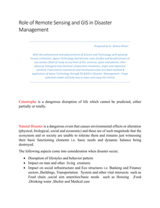
  • 1. Role of Remote Sensing and GIS in Disaster Management Prepared by Er. Bishnu Khatri With the achievement and advancement of Science and Technology with growing human civilization ,Space Technology had become more fruitful and beneficial part at any sectors /field of study at any level of this universe, space and planets, their physical, biological and chemical composition revolution, origin and expansion .Similarly I had tried to summarize and mentioned a few and least method & application of Space Technology through RS &GIS in Disaster Management .I hope potential reader will fully love to learn and enjoy this Article Catastrophe is a dangerous disruption of life which cannot be predicted, either partially or totally. Natural Disaster is a dangerous event that causes environmental effects or alteration (physical, biological, social and economic) and these are of such magnitude that the ecosystem and or society are unable to tolerate them and remains just witnessing their basic functioning elements i.e. basic needs and dynamic balance being destroyed. The following aspects come into consideration when disaster occur;  Disruption of lifestyles and behavior pattern  Impact on man and other living creatures  Impact on social infrastructure and Eco structures i.e. Banking and Finance sectors ,Buildings, Transportation System and other vital intersects such as Food chain ,social aim amenities/basic needs such as Housing ,Food ,Drinking water ,Shelter and Medical care
  • 2. Disaster types; 1. Natural Geological Disaster : It originates from depth of the earth e.g. Earth quake, Volcano, Tsunami 2. Hydro climatic Disaster : It occurs on surface of earth e.g. Storms (Hurricanes, Cyclones , Flood , Droughts ) 3. Other Catastrophes : These origins are both subterranean and superficial e.g. Landslides 4. Environmental Disaster : It is caused by excessive harmful human activity that leads climate change e.g. A. Floods, Droughts, Desertification due to Deforestation B. Wild Fires and Forest Fires due to Human carelessness C. Lethal Diseases e.g. SARS, EBOLA, BIRDFLU, GICA due to Viral Transmission and Communicative Interaction 5. Technological Disaster : It is caused by both, either from Technical Errors ,Lack of practice on Safety Management procedure ,Irresponsible Quality Control of physical and chemical constituent of Matter/Material Used at Development Infrastructure and Activity or by serious use of Nuclear power Expose Administration and Power Exercise for their Country/Regions/Religion/State sovereignty, it reveals the correlation between natural and technological disasters e.g. 1. Nuclear Bomb, Hydrogen Bombs, Atom Bomb, Radiation Activity for War Basis 2. Mining of Coal and Minerals blasting 3. Nuclear plant explosion 4. High Voltage Current Transmission 5. Gas pipe, Oil pipe, Petroleum plant explosion 6. Falling of Large structures such as Buildings, Bridges, Rail Track
  • 3. Role of Space Technology; Through Remote sensing and GIS we can handle such Disasters by applying 4 ‘T’ i.e. Tips, Trick, Technique, Tools 1. “Tips” are generally the hints of available National and International practices of data acquisition (spatial or attribute) on population living on that particular area, data feasibility analysis/access/administration, abstraction on Rescue, Recovery and Reconstruction 2. “Trick” is the short phenomenal brain application of encountering and facing the problems like Natural Disasters i.e. Early Warning Systems and Safe alternate settlement Area or open Space that can be guided by 3. “Technique” is the analogue/analytical method that we use i.e. mapping and visualization through available topographical map, topographical database, satellite imageries, web map and web feature servers and so on 4. “Tools” is the software based final arms and weapon that is made from programming language, structures and commands of the core missions and rescue operation e.g. Network Analysis (Optimal path finding ,Path tracing/tracking ,Spatial Interaction ,Distance Matrix Calculation and so on ) These all facilities are guided and provided by newly born Remote Sensing and GIS technology via /through 4 ‘M’ s 1. Measurement ; It consist Area ,Volume ,Density ,Statics, Distance Matrix Calculation ,Probability ,Magnitude and Frequency determination of Affected or Potential Hazard Area 2. Monitoring ; Frequent update and evaluation of time series data regarding change detection on quantity i.e. (for water volume ,for hurricane and cyclone speed ),spectral signature of satellite imageries, hot spot analysis for thermal activity for forest fires ,flow direction for hydrological nature of water ,spread computation on Viral germs/lethal diseases ,Water paths and Traffic Administration etc. 3. Modelling ;It is a planned work flow of specific solution oriented decision support tool aided and added by programmer or software developer e.g. Hydrological Modelling ,Flood Risk Modelling 4. Mapping ; Disseminative Displaytory Informative and Communicative Positional Information based geographical visualization of Details location and its phenomenon.
  • 4. Objective of Space Technology in Disaster; 1) Early warning system and disaster preparedness 2) Search and rescue of disaster survivors 3) Findings out Ultimate safe settlement area 4) Route finding 5) Alternate places for rescue operation 6) Energy and Power supply to victims 7) Food supply ,storage, and safety managements 8) Water purification and treatment 9) Medicine and healthcare for Disaster victim 10) Sanitation and Waste Management in Disaster 11) Disaster Resistant Housing and Construction 12) High Military Security and Diplomatic intelligence for counter Country Attacks and Illegal entry of criminal groups/terrorists and Citizens Property Safety
  • 5. Remote Sensing (RS) & Geographical Information System (GIS) Disaster Disaster Prepare dness Disaster Mitigation Reconstruction Standards Production Service Figure: Schematic Descriptions, Capability and Potential of Remote Sensing & GIS
  • 6. Capability and Potential of RS /GIS Before, During and After Disaster; 1) Disaster ;  Disaster information ,Quick Processing & Analysis  Disaster Mapping  Scenario simulation ,Disaster Trend fore casting  Emergency Response decision support tool 2) Disaster Relief ;  Information integration and Analysis  Disaster monitoring  Dynamic Disaster loss assessment 3) Recovery ;  Disaster Relief Decision Making support tool 4) Reconstruction ;  Requires Assessment e.g. PDNA  Disaster loss information  Monitoring of Reconstruction and Recovery 5) Disaster Mitigation ;  Disaster Characteristic Factor Monitoring  Disaster Reduction Planning  Vulnerability ,Hazard, Risk Information & Assessment 6) Disaster Preparedness ;  Disaster Early Warning System  Hazard Monitoring  DBS(Database) construction  Logistic Preparation for Disaster relief