SlideShare ist ein Scribd-Unternehmen logo
1 von 9
Geographic Information Systems (GIS) store, analyze, and visualize data for geographic
positions on Earth’s surface. GIS stands for Geographic Information Systems and is a
computer-based tool that examines spatial relationships, patterns, and trends in
geography.
GIS
"A Geo Information System is
a system for capturing,
storing, checking,
integrating, manipulating,
analysing, and displaying
data which are spatially
referenced to the Earth.
(P.Stefanovic)
Components of GIS
A GIS is an organized collection of computer hardware, software, geographic data, and
personnel designed to efficiently capture, store, update, manipulate, analyze, and display all
forms of geographically referenced information.
Hardware
Hardware is the computer on which a GIS operates. Today, GIS software runs on a wide
range of hardware types, from centralized computer servers to desktop computers used in
stand-alone or networked configurations.
Motherboard: It is board where major hardware parts are installed or It is a place where all
components gets hooked up.
Hard Drive: It is also called hard disk, place to store data.
Processor: Processor is the major component in computer, it performs calculation. It is
called as Central processing Unit (CPU).
RAM: Random Access Memory (RAM) where all running programs load temporarily.
Printer: It is output device and used to print image, map or document. There are various
type of printer available in market.
External Disk: These are portable storage space such as USB drive, DVD, CD or external disk.
Monitor: It is a screen for displaying output information. Nowadays there are various type
of monitor: CRT (cathode ray tube), LCD (Liquid Crystal Display), LED (Light Emitting Diodes)
and more.
Software
GIS software provides the functions and tools needed to store, analyze, and display
geographic information. It helps to query, edit, run and display GIS data. It uses RDBMS
(Relational Database Management System) to store the data. Few GIS software list:
ArcGis, ArcView 3.2, QGIS, SAGA GIS.
Software Components:
GIS Tools: Key tools to support the browsing of the GIS data
RDBMS: Relational Database Management System to store GIS data. GIS Software
retrieve from RDBMS or insert data into RDBMS.
Query Tools: Tools that work with database management system for querying, insertion,
deletion and other SQL (Standard Query Language).
GUI: Graphical User Interface that helps user and Software to interact well.
Layout: Good layout window to design map.
Data
Possibly the most important component of a GIS is the data. Geographic data and related
tabular data can be collected in-house or purchased from a commercial data provider. A
GIS will integrate spatial data with other data resources and can even use a DBMS, used
by most organizations to organize and maintain their data, to manage spatial data.
The data that a GIS operates on consists of any data bearing a definable relationship to
space, including any data about things and events that occur in nature. At one time this
consisted of hard-copy data, like traditional cartographic maps, surveyor’s logs,
demographic statistics, geographic reports, and descriptions from the field. Advances in
spatial data collection, classification, and accuracy have allowed more and more standard
digital base-maps to become available at different scales. Data are two types- Spatial and
Non spatial.
Spatial Data
Vector
Vector data is graphical representations of the real world. There are three main types of
vector data: points, lines, and polygons.
Connecting points create lines, and connecting lines that create an enclosed area create
polygons.
Point Data-
Data points, also known as data items, are the atomic state of data. Conceptually, you can
think of them as one cell in a data table, or one piece of information, about an
observation, at a given point in time.
Line Data-
Line (or arc) data is used to represent linear features. Common examples would be rivers,
trails, and streets. Line features only have one dimension and therefore can only be used
to measure length.
Area Data- Area data is used to represent polygon features. Common examples would be
forest, agricultural land, water body. Polygon features have two dimension and therefore
can be used to measure area.
Raster
Raster data is data that is presented in a grid of pixels. Each pixel within a raster has a
value, whether it be a colour or unit of measurement. This communicates information
about the element in question. Rasters typically refer to imagery. However, in the spatial
world, this may specifically refer to orthoimagery which are photos taken from satellites
or other aerial devices. Raster data quality varies depending on resolution and your task
at hand.
Attribute data are non-spatial characteristics that are connected by tables to points,
lines, “events” on lines, and polygons (and in some cases GRID cells)A point, vector or
raster geologic map might describe a “rock unit” on a map with a single number, letter or
name, but the associated attribute table might have age lithology percent quartz etc, for
each rock type on the map.
Data
Possibly the most important component of a GIS is the data. Geographic data and related
tabular data can be collected in-house or purchased from a commercial data provider. A
GIS will integrate spatial data with other data resources and can even use a DBMS, used
by most organizations to organize and maintain their data, to manage spatial data.
People
GIS technology is of limited value without the people who manage the system and
develop plans for applying it to real-world problems. GIS users range from technical
specialists who design and maintain the system to those who use it to help them
perform their everyday work.

Weitere ähnliche Inhalte

Was ist angesagt?

Was ist angesagt? (20)

Functions of GIS
Functions of GISFunctions of GIS
Functions of GIS
 
Landsat
LandsatLandsat
Landsat
 
Data models in geographical information system(GIS)
Data models in geographical information system(GIS)Data models in geographical information system(GIS)
Data models in geographical information system(GIS)
 
Basics of Remote Sensing
Basics of Remote SensingBasics of Remote Sensing
Basics of Remote Sensing
 
Chapter 5: Remote sensing
Chapter 5: Remote sensingChapter 5: Remote sensing
Chapter 5: Remote sensing
 
Introduction and Application of GIS
Introduction and Application of GISIntroduction and Application of GIS
Introduction and Application of GIS
 
GIS Map Projection
GIS Map ProjectionGIS Map Projection
GIS Map Projection
 
Remote sensing and image interpretation
Remote sensing and image interpretationRemote sensing and image interpretation
Remote sensing and image interpretation
 
Coordinate systems, datum & map projections
Coordinate systems, datum & map projectionsCoordinate systems, datum & map projections
Coordinate systems, datum & map projections
 
Digital image processing
Digital image processingDigital image processing
Digital image processing
 
Resolution and scanning system
Resolution and scanning systemResolution and scanning system
Resolution and scanning system
 
Types of scanners
Types of scannersTypes of scanners
Types of scanners
 
Application of GIS (Geographical information system)
Application of GIS (Geographical information system)Application of GIS (Geographical information system)
Application of GIS (Geographical information system)
 
Visual Interpretation
Visual InterpretationVisual Interpretation
Visual Interpretation
 
Spectral signatures
Spectral signaturesSpectral signatures
Spectral signatures
 
Remote Sensing Platforms and Sensors
Remote Sensing Platforms and SensorsRemote Sensing Platforms and Sensors
Remote Sensing Platforms and Sensors
 
Remote Sensing Platforms and Its types
Remote Sensing Platforms and Its typesRemote Sensing Platforms and Its types
Remote Sensing Platforms and Its types
 
Data base management system
Data base management systemData base management system
Data base management system
 
ENERGY INTERACTIONS WITH EARTH SURFACE FEATURES
 ENERGY INTERACTIONS WITH EARTH SURFACE FEATURES  ENERGY INTERACTIONS WITH EARTH SURFACE FEATURES
ENERGY INTERACTIONS WITH EARTH SURFACE FEATURES
 
Spectral reflectance curve of dead stressed vegetation
Spectral reflectance curve of dead stressed vegetationSpectral reflectance curve of dead stressed vegetation
Spectral reflectance curve of dead stressed vegetation
 

Ähnlich wie GIS and Its Components.pptx

Geographical information system
Geographical information systemGeographical information system
Geographical information system
Bipin Karki
 

Ähnlich wie GIS and Its Components.pptx (20)

Gis
GisGis
Gis
 
Fundamentals of GIS and Database Management for Disaster Management
Fundamentals of GIS and Database Management for Disaster ManagementFundamentals of GIS and Database Management for Disaster Management
Fundamentals of GIS and Database Management for Disaster Management
 
Principles of GIS unit 2
Principles of GIS unit 2Principles of GIS unit 2
Principles of GIS unit 2
 
introduction to GIS
introduction to GIS introduction to GIS
introduction to GIS
 
Overview of gis new
Overview of gis newOverview of gis new
Overview of gis new
 
Introduction to gis and arc gis
Introduction to gis and arc gis Introduction to gis and arc gis
Introduction to gis and arc gis
 
1_GEOGRAPHIC INFORMATION SYSTEMSTEM.pptx
1_GEOGRAPHIC INFORMATION SYSTEMSTEM.pptx1_GEOGRAPHIC INFORMATION SYSTEMSTEM.pptx
1_GEOGRAPHIC INFORMATION SYSTEMSTEM.pptx
 
TYBSC IT PGIS Unit I Chapter I- Introduction to Geographic Information Systems
TYBSC IT PGIS Unit I  Chapter I- Introduction to Geographic Information SystemsTYBSC IT PGIS Unit I  Chapter I- Introduction to Geographic Information Systems
TYBSC IT PGIS Unit I Chapter I- Introduction to Geographic Information Systems
 
UNIt 6.pptxkkkkkkkkkkkkkkkkkkkkkkkkkkkkkkkkkkkkk
UNIt 6.pptxkkkkkkkkkkkkkkkkkkkkkkkkkkkkkkkkkkkkkUNIt 6.pptxkkkkkkkkkkkkkkkkkkkkkkkkkkkkkkkkkkkkk
UNIt 6.pptxkkkkkkkkkkkkkkkkkkkkkkkkkkkkkkkkkkkkk
 
Geographical information system
Geographical information systemGeographical information system
Geographical information system
 
Geographical information system
Geographical information systemGeographical information system
Geographical information system
 
Chap1 introduction to geographic information system (gis)
Chap1 introduction to geographic information system (gis)Chap1 introduction to geographic information system (gis)
Chap1 introduction to geographic information system (gis)
 
29
2929
29
 
Geographic information system (gis)
Geographic information system (gis)Geographic information system (gis)
Geographic information system (gis)
 
GIS for geophysics.pptx
GIS for geophysics.pptxGIS for geophysics.pptx
GIS for geophysics.pptx
 
Introduction to arc gis
Introduction to arc gisIntroduction to arc gis
Introduction to arc gis
 
Introduction to gis
Introduction to gisIntroduction to gis
Introduction to gis
 
Introduction to GIS
Introduction to GISIntroduction to GIS
Introduction to GIS
 
GIS Lecture_edited.ppt
GIS Lecture_edited.pptGIS Lecture_edited.ppt
GIS Lecture_edited.ppt
 
2-200305220204.pdf
2-200305220204.pdf2-200305220204.pdf
2-200305220204.pdf
 

Kürzlich hochgeladen

Beyond the EU: DORA and NIS 2 Directive's Global Impact
Beyond the EU: DORA and NIS 2 Directive's Global ImpactBeyond the EU: DORA and NIS 2 Directive's Global Impact
Beyond the EU: DORA and NIS 2 Directive's Global Impact
PECB
 
1029 - Danh muc Sach Giao Khoa 10 . pdf
1029 -  Danh muc Sach Giao Khoa 10 . pdf1029 -  Danh muc Sach Giao Khoa 10 . pdf
1029 - Danh muc Sach Giao Khoa 10 . pdf
QucHHunhnh
 
BASLIQ CURRENT LOOKBOOK LOOKBOOK(1) (1).pdf
BASLIQ CURRENT LOOKBOOK  LOOKBOOK(1) (1).pdfBASLIQ CURRENT LOOKBOOK  LOOKBOOK(1) (1).pdf
BASLIQ CURRENT LOOKBOOK LOOKBOOK(1) (1).pdf
SoniaTolstoy
 
Kisan Call Centre - To harness potential of ICT in Agriculture by answer farm...
Kisan Call Centre - To harness potential of ICT in Agriculture by answer farm...Kisan Call Centre - To harness potential of ICT in Agriculture by answer farm...
Kisan Call Centre - To harness potential of ICT in Agriculture by answer farm...
Krashi Coaching
 

Kürzlich hochgeladen (20)

Beyond the EU: DORA and NIS 2 Directive's Global Impact
Beyond the EU: DORA and NIS 2 Directive's Global ImpactBeyond the EU: DORA and NIS 2 Directive's Global Impact
Beyond the EU: DORA and NIS 2 Directive's Global Impact
 
IGNOU MSCCFT and PGDCFT Exam Question Pattern: MCFT003 Counselling and Family...
IGNOU MSCCFT and PGDCFT Exam Question Pattern: MCFT003 Counselling and Family...IGNOU MSCCFT and PGDCFT Exam Question Pattern: MCFT003 Counselling and Family...
IGNOU MSCCFT and PGDCFT Exam Question Pattern: MCFT003 Counselling and Family...
 
Advanced Views - Calendar View in Odoo 17
Advanced Views - Calendar View in Odoo 17Advanced Views - Calendar View in Odoo 17
Advanced Views - Calendar View in Odoo 17
 
fourth grading exam for kindergarten in writing
fourth grading exam for kindergarten in writingfourth grading exam for kindergarten in writing
fourth grading exam for kindergarten in writing
 
Grant Readiness 101 TechSoup and Remy Consulting
Grant Readiness 101 TechSoup and Remy ConsultingGrant Readiness 101 TechSoup and Remy Consulting
Grant Readiness 101 TechSoup and Remy Consulting
 
1029 - Danh muc Sach Giao Khoa 10 . pdf
1029 -  Danh muc Sach Giao Khoa 10 . pdf1029 -  Danh muc Sach Giao Khoa 10 . pdf
1029 - Danh muc Sach Giao Khoa 10 . pdf
 
Accessible design: Minimum effort, maximum impact
Accessible design: Minimum effort, maximum impactAccessible design: Minimum effort, maximum impact
Accessible design: Minimum effort, maximum impact
 
BASLIQ CURRENT LOOKBOOK LOOKBOOK(1) (1).pdf
BASLIQ CURRENT LOOKBOOK  LOOKBOOK(1) (1).pdfBASLIQ CURRENT LOOKBOOK  LOOKBOOK(1) (1).pdf
BASLIQ CURRENT LOOKBOOK LOOKBOOK(1) (1).pdf
 
BAG TECHNIQUE Bag technique-a tool making use of public health bag through wh...
BAG TECHNIQUE Bag technique-a tool making use of public health bag through wh...BAG TECHNIQUE Bag technique-a tool making use of public health bag through wh...
BAG TECHNIQUE Bag technique-a tool making use of public health bag through wh...
 
Kisan Call Centre - To harness potential of ICT in Agriculture by answer farm...
Kisan Call Centre - To harness potential of ICT in Agriculture by answer farm...Kisan Call Centre - To harness potential of ICT in Agriculture by answer farm...
Kisan Call Centre - To harness potential of ICT in Agriculture by answer farm...
 
Holdier Curriculum Vitae (April 2024).pdf
Holdier Curriculum Vitae (April 2024).pdfHoldier Curriculum Vitae (April 2024).pdf
Holdier Curriculum Vitae (April 2024).pdf
 
Call Girls in Dwarka Mor Delhi Contact Us 9654467111
Call Girls in Dwarka Mor Delhi Contact Us 9654467111Call Girls in Dwarka Mor Delhi Contact Us 9654467111
Call Girls in Dwarka Mor Delhi Contact Us 9654467111
 
Measures of Central Tendency: Mean, Median and Mode
Measures of Central Tendency: Mean, Median and ModeMeasures of Central Tendency: Mean, Median and Mode
Measures of Central Tendency: Mean, Median and Mode
 
Mattingly "AI & Prompt Design: Structured Data, Assistants, & RAG"
Mattingly "AI & Prompt Design: Structured Data, Assistants, & RAG"Mattingly "AI & Prompt Design: Structured Data, Assistants, & RAG"
Mattingly "AI & Prompt Design: Structured Data, Assistants, & RAG"
 
SOCIAL AND HISTORICAL CONTEXT - LFTVD.pptx
SOCIAL AND HISTORICAL CONTEXT - LFTVD.pptxSOCIAL AND HISTORICAL CONTEXT - LFTVD.pptx
SOCIAL AND HISTORICAL CONTEXT - LFTVD.pptx
 
Q4-W6-Restating Informational Text Grade 3
Q4-W6-Restating Informational Text Grade 3Q4-W6-Restating Informational Text Grade 3
Q4-W6-Restating Informational Text Grade 3
 
Interactive Powerpoint_How to Master effective communication
Interactive Powerpoint_How to Master effective communicationInteractive Powerpoint_How to Master effective communication
Interactive Powerpoint_How to Master effective communication
 
General AI for Medical Educators April 2024
General AI for Medical Educators April 2024General AI for Medical Educators April 2024
General AI for Medical Educators April 2024
 
Advance Mobile Application Development class 07
Advance Mobile Application Development class 07Advance Mobile Application Development class 07
Advance Mobile Application Development class 07
 
Nutritional Needs Presentation - HLTH 104
Nutritional Needs Presentation - HLTH 104Nutritional Needs Presentation - HLTH 104
Nutritional Needs Presentation - HLTH 104
 

GIS and Its Components.pptx

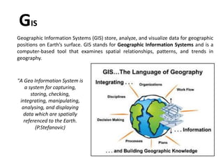
  • 1. Geographic Information Systems (GIS) store, analyze, and visualize data for geographic positions on Earth’s surface. GIS stands for Geographic Information Systems and is a computer-based tool that examines spatial relationships, patterns, and trends in geography. GIS "A Geo Information System is a system for capturing, storing, checking, integrating, manipulating, analysing, and displaying data which are spatially referenced to the Earth. (P.Stefanovic)
  • 3. A GIS is an organized collection of computer hardware, software, geographic data, and personnel designed to efficiently capture, store, update, manipulate, analyze, and display all forms of geographically referenced information. Hardware Hardware is the computer on which a GIS operates. Today, GIS software runs on a wide range of hardware types, from centralized computer servers to desktop computers used in stand-alone or networked configurations. Motherboard: It is board where major hardware parts are installed or It is a place where all components gets hooked up. Hard Drive: It is also called hard disk, place to store data. Processor: Processor is the major component in computer, it performs calculation. It is called as Central processing Unit (CPU). RAM: Random Access Memory (RAM) where all running programs load temporarily. Printer: It is output device and used to print image, map or document. There are various type of printer available in market. External Disk: These are portable storage space such as USB drive, DVD, CD or external disk. Monitor: It is a screen for displaying output information. Nowadays there are various type of monitor: CRT (cathode ray tube), LCD (Liquid Crystal Display), LED (Light Emitting Diodes) and more.
  • 4.
  • 5. Software GIS software provides the functions and tools needed to store, analyze, and display geographic information. It helps to query, edit, run and display GIS data. It uses RDBMS (Relational Database Management System) to store the data. Few GIS software list: ArcGis, ArcView 3.2, QGIS, SAGA GIS. Software Components: GIS Tools: Key tools to support the browsing of the GIS data RDBMS: Relational Database Management System to store GIS data. GIS Software retrieve from RDBMS or insert data into RDBMS. Query Tools: Tools that work with database management system for querying, insertion, deletion and other SQL (Standard Query Language). GUI: Graphical User Interface that helps user and Software to interact well. Layout: Good layout window to design map.
  • 6.
  • 7. Data Possibly the most important component of a GIS is the data. Geographic data and related tabular data can be collected in-house or purchased from a commercial data provider. A GIS will integrate spatial data with other data resources and can even use a DBMS, used by most organizations to organize and maintain their data, to manage spatial data. The data that a GIS operates on consists of any data bearing a definable relationship to space, including any data about things and events that occur in nature. At one time this consisted of hard-copy data, like traditional cartographic maps, surveyor’s logs, demographic statistics, geographic reports, and descriptions from the field. Advances in spatial data collection, classification, and accuracy have allowed more and more standard digital base-maps to become available at different scales. Data are two types- Spatial and Non spatial. Spatial Data Vector Vector data is graphical representations of the real world. There are three main types of vector data: points, lines, and polygons. Connecting points create lines, and connecting lines that create an enclosed area create polygons.
  • 8. Point Data- Data points, also known as data items, are the atomic state of data. Conceptually, you can think of them as one cell in a data table, or one piece of information, about an observation, at a given point in time. Line Data- Line (or arc) data is used to represent linear features. Common examples would be rivers, trails, and streets. Line features only have one dimension and therefore can only be used to measure length. Area Data- Area data is used to represent polygon features. Common examples would be forest, agricultural land, water body. Polygon features have two dimension and therefore can be used to measure area.
  • 9. Raster Raster data is data that is presented in a grid of pixels. Each pixel within a raster has a value, whether it be a colour or unit of measurement. This communicates information about the element in question. Rasters typically refer to imagery. However, in the spatial world, this may specifically refer to orthoimagery which are photos taken from satellites or other aerial devices. Raster data quality varies depending on resolution and your task at hand. Attribute data are non-spatial characteristics that are connected by tables to points, lines, “events” on lines, and polygons (and in some cases GRID cells)A point, vector or raster geologic map might describe a “rock unit” on a map with a single number, letter or name, but the associated attribute table might have age lithology percent quartz etc, for each rock type on the map. Data Possibly the most important component of a GIS is the data. Geographic data and related tabular data can be collected in-house or purchased from a commercial data provider. A GIS will integrate spatial data with other data resources and can even use a DBMS, used by most organizations to organize and maintain their data, to manage spatial data. People GIS technology is of limited value without the people who manage the system and develop plans for applying it to real-world problems. GIS users range from technical specialists who design and maintain the system to those who use it to help them perform their everyday work.