Android Geo Apps in Soviet Russia: Latitude and longitude find you
•
0 gefällt mir•808 views

Alexey Zinoviev presented this paper on DroidCon Moscow 2014 http://ru.droidcon.com/2014/android-geo-apps/ and on Thumbtack Technology Expert Day. Youtube video is here https://www.youtube.com/watch?v=AstDJbcT2lQ This paper covers next topics: Android, Google Maps, Open Street Maps, Yandex Map Kit, HERE Maps, GPS, localization.

Empfohlen
Weitere ähnliche Inhalte
Ähnlich wie Android Geo Apps in Soviet Russia: Latitude and longitude find you
Ähnlich wie Android Geo Apps in Soviet Russia: Latitude and longitude find you (20)
Mehr von Alexey Zinoviev
Mehr von Alexey Zinoviev (20)
Kürzlich hochgeladen
Kürzlich hochgeladen (20)
Android Geo Apps in Soviet Russia: Latitude and longitude find you
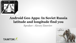
- 1. Speaker : Alexey Zinoviev Android Geo Apps: In Soviet Russia latitude and longitude find you
- 2. About ● I am a scientist. I’m interested graph theory, machine learning, traffic-jam prediction, and big data algorithms. ● I'm also a programmer, so I'm interested in NoSQL databases, Java, JavaScript, Android, MongoDB, Cassandra, Hadoop, MapReduce, metaprogramming, reflection. ● And I’m a huge fan of GEO APIs (e.g., Maps APIs)
- 3. Introduction
- 4. Some maps are extremely old
- 5. Some maps are inaccurate
- 6. Some maps are used in games
- 7. And, of course, some maps are realistic
- 8. ● Geo applications are a specific type ● Maps are optional ● Geo content in your app ● There’s a mobile aspect Geo apps
- 13. Data sources
- 14. ● Cell of Origin : finds location by CellID ● Time of Arrival (TOA) ● Observed Time Difference (OTD) ● A-GPS : starts from base stations LBS (Location Based Services)
- 15. ● GPS guzzles battery power ● GPS is often inaccurate ● People active in more than 10 times Why LBS?
- 16. Maps
- 17. The Maps Family Let's map everything on the map
- 18. ● Convenient controls (zoom) ● Geocoding ● Routing ● Layers ● Gestures ● Showing traffic jams and public transport (optional) Opportunities of Respectable API
- 19. ● v2 with 3D rendering ● Gesture control ● Best support and documentation ● Heatmap & clustering ● Simple integration with location API Google Maps
- 20. ● Excellent coverage in Russia ● More attractive on iOS ● No direct geocoding ● Development was stopped ● No special limits ● 25,000 geocoding requests per day Yandex Map Kit
- 21. ● Data from OpenStreetMaps ● Best coverage in the world ● Development by community ● No routing & traffic jams ● Tiles from MapQuest + OpenLayers ● Fork & control code :) OsmDroid
- 22. ● This SDK was designed to work with Android 2.x devices ● Best photos from space ● Excellent coverage in the U.S. ● Supports geocoding, reverse geocoding, and routing Bing Maps SDK
- 23. If you developing a project for... ● a U.S. company - Bing Maps ● a transnational company - Google Maps ● a Russian company, or one in in the former U.S.S.R. - YandexMapKit ● OpenSource with special tiles - iOS maps with overrided tiles MapQuest + OpenLayers ● OpenSource with its own data - OsmDroid ● … just to play - NokiaMaps
- 24. Geo Technologies
- 25. ● Latitude & longitude ● Latitude is y, longitude is x ● But it looks like this: (y, x) ● To indicate the cities, regions and countries you need diffirent coordinate precision ● Spherical geometry Latitude and longitude
- 28. Data, People & Revenue
- 29. People
- 30. ● Popular commercial sites pay for usage ● Limits ● Google Maps for business ● AdMob integration ● Time in app Google’s profit
- 31. ● Media content with geolabel ● Places, addresses, organizations ● Wiki ● Type of activity ● Individual tracking ● Purchases Data
- 32. Analyze it!
- 33. Popular Cases
- 34. Checking in
- 35. Local trade
- 36. Next generation of games
- 37. Local deals and offers
- 39. Journalism
- 40. In conclusion ● Don’t overlocalize ● End to real privacy ● Steps to real life
- 41. Your Questions?