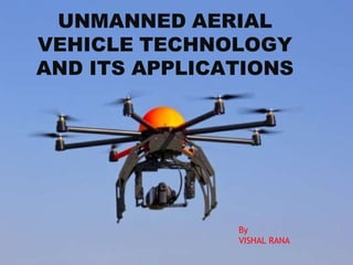
SlideShare ist ein Scribd-Unternehmen logo
1 von 19
UNMANNED AERIAL
VEHICLE TECHNOLOGY
AND ITS APPLICATIONS
By
VISHAL RANA
INTRODUCTION
An Unmanned Aerial Vehicle(UAV) is
an aircraft without a human pilot.
It’s flight is either controlled
autonomously by computers or under
the remote control of a pilot on the
ground.
DEFINITION& DIFFERENCE WITH
MISSILES
.
UAV is defined as a
"powered, aerial vehicle that does not carry a human operator,
uses aerodynamic forces to provide vehicle lift, can fly
autonomously or be piloted remotely, can be expendable or
recoverable, and can carry a lethal or nonlethal payload".
Cruise Missiles are not considered UAVs because,
like many other guided missiles, the vehicle itself is an
weapon that is not reused,
even though it is also unmanned and in some cases
remotely guided.
Birth of uAv
 1916 by A. M. Lows named
Kettering “BUG”
 1935 (After World War-I), developed by the film star
and model airplane enthusiast Reginald Denny
 1959 first US aircraft
 1964, U.S. Navy initiated highly classified UAVs into
their first combat missions of the Vietnam War
 Target and decoy
providing ground and aerial gunnery a target that simulates an
enemy aircraft or missile
 Battlefield intelligence
Combat providing attack capability for high risk missions.
 Research and development
Further development of UAV technologies to be integrated into
field deployed UAV aircraft.
 Civil and Commercial UAVs
UAVs specifically designed for civil and commercial applications.
TYPE ALTITUDE RANGE
HANDHELD 600 m 2-5 km
TACTICAL 5500 m 100km
MALE
(medium altitude
long endurance)
7000 m 200 km
HALE
(high altitude long
endurance)
9100 m 250 km
HYPERSONIC 15200 m 300 km
IN TERMS of ALTITUDE/RANGE
 PAYLOADS
It is the carrying capacity of an aircraft or launch vehicle, usually
measured in terms of weight .
Driven by the needs of the operational task. These can range from:
(a) simple sub-systems consisting of video camera with a ïŹxed lens
having a mass as little as 200 g, through
(b)a video system with a greater range capability, employing a
longer focal length lens with zoom facility, gyro-stabilised and with pan
and tilt function with a mass of probably 3–4 kg, to
(c) a high-power radar having a mass, with its power supplies, of
possibly up to 1000 kg.
Some more sophisticated UAV carry a combination of different types of
sensors, within a payload module or within a series of modules.
The Air Vehicle
Depending on needs of the operational mission air vehicle is designed
 primarily task is to carry the mission payload to its point of
application,
 operational range , air speed and endurance.
The endurance and range requirement will determine the
fuel load to be carried.
Navigation Systems
It is necessary for the operators to know, on demand, where the aircraft is
at any moment in time.
 For fully autonomous operation, i.e. without any communication between
the CS and the air vehicle, sufïŹcient navigation equipment must be
carried in the aircraft. This was achieved by radio tracking or by the
recognition of geographical features. While GPS services a seamless
navigation with cheap receiver, it may not receive the satellite signal by
the obstacles or the signal jamming. It is GPS/INS(inertial navigation
system) sensor fusion that might overcome these constraints. The ground
test showed that GPS/INS sensor fusion system could provide well the
altitude information as well as the trajectory according to a vehicle
movement.
where communication between aircraft and CS is virtually continuous
(i.e for unautonomous system), or where there is a risk of the GPS system
being blocked, other means of navigation are possible fall-back options


 Radar tracking
Here the aircraft is ïŹtted with a transponder
which responds to a RADAR scanner emitting
from the CS transmitter, so that the aircraft
position is seen on the CS radar display in
bearing and range.
 Radio tracking
Here the radio signal carrying data from the aircraft to the CS is tracked in
bearing from the CS, whilst its range is determined from the time taken for a
coded signal to travel between the aircraft and the CS.
 Direct reckoning
If the mission is over land and the aircraft carries a TV camera, surveying
the ground, its position can be conïŹrmed by relating visible geographical
features with their known position on a map.
 Communications
The principal, and probably the most demanding, requirement for the
communications system is to provide the data links (up and down) between
the CS and the aircraft.
(a) Uplink (i.e. from the CS to the aircraft)
i)Transmit ïŹ‚ight path tasking which is then stored in the aircraft automatic
ïŹ‚ight control system
ii) real-time ïŹ‚ight control commands such as updated positional information
to the aircraft INS where relevant.
(b) Downlink (i.e. from the aircraft to the CS)
i) Transmit aircraft positional data
ii) payload imagery
iii)aircraft housekeeping data, e.g. fuel state, engine temperature, etc. to
the CS.
 APPLICATIONS
A. Beyond the military applications of UAVs with whi
ch "drones" became most associated, numerous ci
vil aviation uses have been developed, including
B. aerial surveying of crops (land surveying)
C. acrobatic aerial footage in filmmaking,
D. search and rescue operations,
E. inspecting power lines and pipelines,
F. counting wildlife,
G. delivering medical supplies to remote or
otherwise inaccessible regions,
H. surveillance &
border patrol missions,
I. forest fire detection,
J. detection of illegal hunting,
K. fire and large accident investigation,
L. landslide measurement,
M. illegal landfill detection,
N. and crowd monitoring.
 DISADVANTAGES
Civilian casualties
Can be hacked or given viruses
Too small for transportation of large materials
Low resistance to weather
Cannot refuel in flight
If contact is lost with the ground station, the
vehicle may be lost.
INDIAN UAV
DRDO RUSTOM a medium altitude
Long endurance combat air vehicle
Range about 250km,payload 95kg
DRDO NISHANT day night capability
UAV range about 160km,payload 45kg
 LAKSHYA
high speed UAV ,range about 150 km , rocket assisted
launching system , only for millitary purpose.
 CONCLUSION
However, the very dynamic nature of the field
also creates a significant amount of
uncertainty.
Unmanned Aerial Vehicles are an exciting field
in the world of aviation, with new discoveries.
Over the next 16 years, UAVs will become a
significant component of military, civil, and
perhaps even commercial aviation.
UAV.pptx

Weitere Àhnliche Inhalte

Ähnlich wie UAV.pptx

Data acquisition Platforms
Data acquisition PlatformsData acquisition Platforms
Data acquisition Platforms
Sumant Diwakar
 
Nav_Aids_Presentation_NA.pptx
Nav_Aids_Presentation_NA.pptxNav_Aids_Presentation_NA.pptx
Nav_Aids_Presentation_NA.pptx
mancangkul1
 
Global observer, usa high altitude long endurance uav
Global observer, usa   high altitude long endurance uavGlobal observer, usa   high altitude long endurance uav
Global observer, usa high altitude long endurance uav
hindujudaic
 

Ähnlich wie UAV.pptx (20)

Unmanned Aerial Vehicle-UAVs
Unmanned Aerial Vehicle-UAVsUnmanned Aerial Vehicle-UAVs
Unmanned Aerial Vehicle-UAVs
 
Remotesensing 04-01671
Remotesensing 04-01671Remotesensing 04-01671
Remotesensing 04-01671
 
drones-an introduction to design
drones-an introduction to designdrones-an introduction to design
drones-an introduction to design
 
electronics-10-00999.pdf
electronics-10-00999.pdfelectronics-10-00999.pdf
electronics-10-00999.pdf
 
Island Air Defence: Challenges, Novel Surveillance Concepts and Advanced Rada...
Island Air Defence: Challenges, Novel Surveillance Concepts and Advanced Rada...Island Air Defence: Challenges, Novel Surveillance Concepts and Advanced Rada...
Island Air Defence: Challenges, Novel Surveillance Concepts and Advanced Rada...
 
Helicopter With Gps
Helicopter With GpsHelicopter With Gps
Helicopter With Gps
 
ILS paperwork air traffic control
ILS paperwork air traffic controlILS paperwork air traffic control
ILS paperwork air traffic control
 
Data acquisition Platforms
Data acquisition PlatformsData acquisition Platforms
Data acquisition Platforms
 
UAV (Unmanned Aerial Vehicle)
UAV (Unmanned Aerial Vehicle)UAV (Unmanned Aerial Vehicle)
UAV (Unmanned Aerial Vehicle)
 
Unmanned Aerial Vehicle for urban surveillance
Unmanned Aerial Vehicle for urban surveillanceUnmanned Aerial Vehicle for urban surveillance
Unmanned Aerial Vehicle for urban surveillance
 
IRJET- A Review on Unmanned Aerial Vehicles/Drones Used in Various Applications
IRJET- A Review on Unmanned Aerial Vehicles/Drones Used in Various ApplicationsIRJET- A Review on Unmanned Aerial Vehicles/Drones Used in Various Applications
IRJET- A Review on Unmanned Aerial Vehicles/Drones Used in Various Applications
 
Overview Of Unmanned Aircraft Systems (UAS)
Overview Of Unmanned Aircraft Systems (UAS)Overview Of Unmanned Aircraft Systems (UAS)
Overview Of Unmanned Aircraft Systems (UAS)
 
SMART MINING USING UAV.pptx
SMART MINING USING UAV.pptxSMART MINING USING UAV.pptx
SMART MINING USING UAV.pptx
 
AE8006- UAV Unit -V( The development of UAV(Unmanned Aerial Vehicles) System)...
AE8006- UAV Unit -V( The development of UAV(Unmanned Aerial Vehicles) System)...AE8006- UAV Unit -V( The development of UAV(Unmanned Aerial Vehicles) System)...
AE8006- UAV Unit -V( The development of UAV(Unmanned Aerial Vehicles) System)...
 
unmanned aerial vehicle (UAV)
unmanned aerial vehicle (UAV)unmanned aerial vehicle (UAV)
unmanned aerial vehicle (UAV)
 
A MINI UNMANNED AERIAL VEHICLE ( UAV) SYSTEM OVERVIEW AND IMAGE ACQUISITION
A MINI UNMANNED AERIAL VEHICLE ( UAV)  SYSTEM OVERVIEW AND IMAGE ACQUISITIONA MINI UNMANNED AERIAL VEHICLE ( UAV)  SYSTEM OVERVIEW AND IMAGE ACQUISITION
A MINI UNMANNED AERIAL VEHICLE ( UAV) SYSTEM OVERVIEW AND IMAGE ACQUISITION
 
Nav_Aids_Presentation_NA.pptx
Nav_Aids_Presentation_NA.pptxNav_Aids_Presentation_NA.pptx
Nav_Aids_Presentation_NA.pptx
 
PIA internship report
PIA internship reportPIA internship report
PIA internship report
 
Global observer, usa high altitude long endurance uav
Global observer, usa   high altitude long endurance uavGlobal observer, usa   high altitude long endurance uav
Global observer, usa high altitude long endurance uav
 
Unmanned Aerial Systems and its history
Unmanned Aerial Systems and its historyUnmanned Aerial Systems and its history
Unmanned Aerial Systems and its history
 

Mehr von vishalrana390975 (20)

HISTORY.pptx
HISTORY.pptxHISTORY.pptx
HISTORY.pptx
 
AAI.pptx
AAI.pptxAAI.pptx
AAI.pptx
 
AVIATION PERSONNEL.pptx
AVIATION PERSONNEL.pptxAVIATION PERSONNEL.pptx
AVIATION PERSONNEL.pptx
 
BCAS.pptx
BCAS.pptxBCAS.pptx
BCAS.pptx
 
AIRPORT.pptx
AIRPORT.pptxAIRPORT.pptx
AIRPORT.pptx
 
FLIGHT CONTROL SYSTEM.pptx
FLIGHT CONTROL SYSTEM.pptxFLIGHT CONTROL SYSTEM.pptx
FLIGHT CONTROL SYSTEM.pptx
 
GROUND STAFF.pptx
GROUND STAFF.pptxGROUND STAFF.pptx
GROUND STAFF.pptx
 
FAA.pptx
FAA.pptxFAA.pptx
FAA.pptx
 
AIRCRAFT AIRWORTHINESS.pptx
AIRCRAFT AIRWORTHINESS.pptxAIRCRAFT AIRWORTHINESS.pptx
AIRCRAFT AIRWORTHINESS.pptx
 
DGCA.pptx
DGCA.pptxDGCA.pptx
DGCA.pptx
 
aircrafts.pptx
aircrafts.pptxaircrafts.pptx
aircrafts.pptx
 
AAI.pptx
AAI.pptxAAI.pptx
AAI.pptx
 
IATA.pptx
IATA.pptxIATA.pptx
IATA.pptx
 
AIRAC PPT RAHUL.pptx
AIRAC PPT RAHUL.pptxAIRAC PPT RAHUL.pptx
AIRAC PPT RAHUL.pptx
 
716379.ppt
716379.ppt716379.ppt
716379.ppt
 
INTRODUCTION TO AVIATION.pptx
INTRODUCTION TO AVIATION.pptxINTRODUCTION TO AVIATION.pptx
INTRODUCTION TO AVIATION.pptx
 
scheduled and non scheduled.pptx
scheduled and non scheduled.pptxscheduled and non scheduled.pptx
scheduled and non scheduled.pptx
 
RAT.pptx
RAT.pptxRAT.pptx
RAT.pptx
 
MMEL MEL PPT.ppt
MMEL MEL PPT.pptMMEL MEL PPT.ppt
MMEL MEL PPT.ppt
 
climatology of india.pptx
climatology of india.pptxclimatology of india.pptx
climatology of india.pptx
 

KĂŒrzlich hochgeladen

Gardella_Mateo_IntellectualProperty.pdf.
Gardella_Mateo_IntellectualProperty.pdf.Gardella_Mateo_IntellectualProperty.pdf.
Gardella_Mateo_IntellectualProperty.pdf.
MateoGardella
 
1029 - Danh muc Sach Giao Khoa 10 . pdf
1029 -  Danh muc Sach Giao Khoa 10 . pdf1029 -  Danh muc Sach Giao Khoa 10 . pdf
1029 - Danh muc Sach Giao Khoa 10 . pdf
QucHHunhnh
 
The basics of sentences session 2pptx copy.pptx
The basics of sentences session 2pptx copy.pptxThe basics of sentences session 2pptx copy.pptx
The basics of sentences session 2pptx copy.pptx
heathfieldcps1
 
Seal of Good Local Governance (SGLG) 2024Final.pptx
Seal of Good Local Governance (SGLG) 2024Final.pptxSeal of Good Local Governance (SGLG) 2024Final.pptx
Seal of Good Local Governance (SGLG) 2024Final.pptx
negromaestrong
 

KĂŒrzlich hochgeladen (20)

PROCESS RECORDING FORMAT.docx
PROCESS      RECORDING        FORMAT.docxPROCESS      RECORDING        FORMAT.docx
PROCESS RECORDING FORMAT.docx
 
Explore beautiful and ugly buildings. Mathematics helps us create beautiful d...
Explore beautiful and ugly buildings. Mathematics helps us create beautiful d...Explore beautiful and ugly buildings. Mathematics helps us create beautiful d...
Explore beautiful and ugly buildings. Mathematics helps us create beautiful d...
 
microwave assisted reaction. General introduction
microwave assisted reaction. General introductionmicrowave assisted reaction. General introduction
microwave assisted reaction. General introduction
 
Gardella_Mateo_IntellectualProperty.pdf.
Gardella_Mateo_IntellectualProperty.pdf.Gardella_Mateo_IntellectualProperty.pdf.
Gardella_Mateo_IntellectualProperty.pdf.
 
Grant Readiness 101 TechSoup and Remy Consulting
Grant Readiness 101 TechSoup and Remy ConsultingGrant Readiness 101 TechSoup and Remy Consulting
Grant Readiness 101 TechSoup and Remy Consulting
 
Basic Civil Engineering first year Notes- Chapter 4 Building.pptx
Basic Civil Engineering first year Notes- Chapter 4 Building.pptxBasic Civil Engineering first year Notes- Chapter 4 Building.pptx
Basic Civil Engineering first year Notes- Chapter 4 Building.pptx
 
psychiatric nursing HISTORY COLLECTION .docx
psychiatric  nursing HISTORY  COLLECTION  .docxpsychiatric  nursing HISTORY  COLLECTION  .docx
psychiatric nursing HISTORY COLLECTION .docx
 
Advanced Views - Calendar View in Odoo 17
Advanced Views - Calendar View in Odoo 17Advanced Views - Calendar View in Odoo 17
Advanced Views - Calendar View in Odoo 17
 
Presentation by Andreas Schleicher Tackling the School Absenteeism Crisis 30 ...
Presentation by Andreas Schleicher Tackling the School Absenteeism Crisis 30 ...Presentation by Andreas Schleicher Tackling the School Absenteeism Crisis 30 ...
Presentation by Andreas Schleicher Tackling the School Absenteeism Crisis 30 ...
 
1029 - Danh muc Sach Giao Khoa 10 . pdf
1029 -  Danh muc Sach Giao Khoa 10 . pdf1029 -  Danh muc Sach Giao Khoa 10 . pdf
1029 - Danh muc Sach Giao Khoa 10 . pdf
 
The basics of sentences session 2pptx copy.pptx
The basics of sentences session 2pptx copy.pptxThe basics of sentences session 2pptx copy.pptx
The basics of sentences session 2pptx copy.pptx
 
Key note speaker Neum_Admir Softic_ENG.pdf
Key note speaker Neum_Admir Softic_ENG.pdfKey note speaker Neum_Admir Softic_ENG.pdf
Key note speaker Neum_Admir Softic_ENG.pdf
 
Seal of Good Local Governance (SGLG) 2024Final.pptx
Seal of Good Local Governance (SGLG) 2024Final.pptxSeal of Good Local Governance (SGLG) 2024Final.pptx
Seal of Good Local Governance (SGLG) 2024Final.pptx
 
Class 11th Physics NEET formula sheet pdf
Class 11th Physics NEET formula sheet pdfClass 11th Physics NEET formula sheet pdf
Class 11th Physics NEET formula sheet pdf
 
Unit-IV; Professional Sales Representative (PSR).pptx
Unit-IV; Professional Sales Representative (PSR).pptxUnit-IV; Professional Sales Representative (PSR).pptx
Unit-IV; Professional Sales Representative (PSR).pptx
 
Measures of Dispersion and Variability: Range, QD, AD and SD
Measures of Dispersion and Variability: Range, QD, AD and SDMeasures of Dispersion and Variability: Range, QD, AD and SD
Measures of Dispersion and Variability: Range, QD, AD and SD
 
Mattingly "AI & Prompt Design: The Basics of Prompt Design"
Mattingly "AI & Prompt Design: The Basics of Prompt Design"Mattingly "AI & Prompt Design: The Basics of Prompt Design"
Mattingly "AI & Prompt Design: The Basics of Prompt Design"
 
Unit-IV- Pharma. Marketing Channels.pptx
Unit-IV- Pharma. Marketing Channels.pptxUnit-IV- Pharma. Marketing Channels.pptx
Unit-IV- Pharma. Marketing Channels.pptx
 
This PowerPoint helps students to consider the concept of infinity.
This PowerPoint helps students to consider the concept of infinity.This PowerPoint helps students to consider the concept of infinity.
This PowerPoint helps students to consider the concept of infinity.
 
Application orientated numerical on hev.ppt
Application orientated numerical on hev.pptApplication orientated numerical on hev.ppt
Application orientated numerical on hev.ppt
 

UAV.pptx

  • 1. UNMANNED AERIAL VEHICLE TECHNOLOGY AND ITS APPLICATIONS By VISHAL RANA
  • 2. INTRODUCTION An Unmanned Aerial Vehicle(UAV) is an aircraft without a human pilot. It’s flight is either controlled autonomously by computers or under the remote control of a pilot on the ground.
  • 3. DEFINITION& DIFFERENCE WITH MISSILES . UAV is defined as a "powered, aerial vehicle that does not carry a human operator, uses aerodynamic forces to provide vehicle lift, can fly autonomously or be piloted remotely, can be expendable or recoverable, and can carry a lethal or nonlethal payload". Cruise Missiles are not considered UAVs because, like many other guided missiles, the vehicle itself is an weapon that is not reused, even though it is also unmanned and in some cases remotely guided.
  • 4. Birth of uAv  1916 by A. M. Lows named Kettering “BUG”  1935 (After World War-I), developed by the film star and model airplane enthusiast Reginald Denny  1959 first US aircraft  1964, U.S. Navy initiated highly classified UAVs into their first combat missions of the Vietnam War
  • 5.  Target and decoy providing ground and aerial gunnery a target that simulates an enemy aircraft or missile  Battlefield intelligence Combat providing attack capability for high risk missions.  Research and development Further development of UAV technologies to be integrated into field deployed UAV aircraft.  Civil and Commercial UAVs UAVs specifically designed for civil and commercial applications.
  • 6. TYPE ALTITUDE RANGE HANDHELD 600 m 2-5 km TACTICAL 5500 m 100km MALE (medium altitude long endurance) 7000 m 200 km HALE (high altitude long endurance) 9100 m 250 km HYPERSONIC 15200 m 300 km IN TERMS of ALTITUDE/RANGE
  • 7.
  • 8.  PAYLOADS It is the carrying capacity of an aircraft or launch vehicle, usually measured in terms of weight . Driven by the needs of the operational task. These can range from: (a) simple sub-systems consisting of video camera with a ïŹxed lens having a mass as little as 200 g, through (b)a video system with a greater range capability, employing a longer focal length lens with zoom facility, gyro-stabilised and with pan and tilt function with a mass of probably 3–4 kg, to (c) a high-power radar having a mass, with its power supplies, of possibly up to 1000 kg. Some more sophisticated UAV carry a combination of different types of sensors, within a payload module or within a series of modules.
  • 9. The Air Vehicle Depending on needs of the operational mission air vehicle is designed  primarily task is to carry the mission payload to its point of application,  operational range , air speed and endurance. The endurance and range requirement will determine the fuel load to be carried.
  • 10.
  • 11. Navigation Systems It is necessary for the operators to know, on demand, where the aircraft is at any moment in time.  For fully autonomous operation, i.e. without any communication between the CS and the air vehicle, sufïŹcient navigation equipment must be carried in the aircraft. This was achieved by radio tracking or by the recognition of geographical features. While GPS services a seamless navigation with cheap receiver, it may not receive the satellite signal by the obstacles or the signal jamming. It is GPS/INS(inertial navigation system) sensor fusion that might overcome these constraints. The ground test showed that GPS/INS sensor fusion system could provide well the altitude information as well as the trajectory according to a vehicle movement.
  • 12. where communication between aircraft and CS is virtually continuous (i.e for unautonomous system), or where there is a risk of the GPS system being blocked, other means of navigation are possible fall-back options

  Radar tracking Here the aircraft is ïŹtted with a transponder which responds to a RADAR scanner emitting from the CS transmitter, so that the aircraft position is seen on the CS radar display in bearing and range.  Radio tracking Here the radio signal carrying data from the aircraft to the CS is tracked in bearing from the CS, whilst its range is determined from the time taken for a coded signal to travel between the aircraft and the CS.  Direct reckoning If the mission is over land and the aircraft carries a TV camera, surveying the ground, its position can be conïŹrmed by relating visible geographical features with their known position on a map.
  • 13.  Communications The principal, and probably the most demanding, requirement for the communications system is to provide the data links (up and down) between the CS and the aircraft. (a) Uplink (i.e. from the CS to the aircraft) i)Transmit ïŹ‚ight path tasking which is then stored in the aircraft automatic ïŹ‚ight control system ii) real-time ïŹ‚ight control commands such as updated positional information to the aircraft INS where relevant. (b) Downlink (i.e. from the aircraft to the CS) i) Transmit aircraft positional data ii) payload imagery iii)aircraft housekeeping data, e.g. fuel state, engine temperature, etc. to the CS.
  • 14.  APPLICATIONS A. Beyond the military applications of UAVs with whi ch "drones" became most associated, numerous ci vil aviation uses have been developed, including B. aerial surveying of crops (land surveying) C. acrobatic aerial footage in filmmaking, D. search and rescue operations, E. inspecting power lines and pipelines, F. counting wildlife, G. delivering medical supplies to remote or otherwise inaccessible regions, H. surveillance & border patrol missions, I. forest fire detection, J. detection of illegal hunting, K. fire and large accident investigation, L. landslide measurement, M. illegal landfill detection, N. and crowd monitoring.
  • 15.  DISADVANTAGES Civilian casualties Can be hacked or given viruses Too small for transportation of large materials Low resistance to weather Cannot refuel in flight If contact is lost with the ground station, the vehicle may be lost.
  • 16. INDIAN UAV DRDO RUSTOM a medium altitude Long endurance combat air vehicle Range about 250km,payload 95kg DRDO NISHANT day night capability UAV range about 160km,payload 45kg
  • 17.  LAKSHYA high speed UAV ,range about 150 km , rocket assisted launching system , only for millitary purpose.
  • 18.  CONCLUSION However, the very dynamic nature of the field also creates a significant amount of uncertainty. Unmanned Aerial Vehicles are an exciting field in the world of aviation, with new discoveries. Over the next 16 years, UAVs will become a significant component of military, civil, and perhaps even commercial aviation.