Different Tools to Detect and Monitor Oil Spills Aerial Observation Tech.
•Als PPT, PDF herunterladen•
11 gefällt mir•5,533 views


Empfohlen
Weitere ähnliche Inhalte
Was ist angesagt?
Was ist angesagt? (20)
Andere mochten auch
Andere mochten auch (20)
Ähnlich wie Different Tools to Detect and Monitor Oil Spills Aerial Observation Tech.
Ähnlich wie Different Tools to Detect and Monitor Oil Spills Aerial Observation Tech. (20)
Mehr von A.Tuğsan İşiaçık Çolak
Mehr von A.Tuğsan İşiaçık Çolak (20)
Different Tools to Detect and Monitor Oil Spills Aerial Observation Tech.
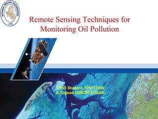
- 1. Remote Sensing Techniques for Monitoring Oil Pollution PhD Student, 705112006 A.Tuğsan ISIACIK ÇOLAK,
- 2. Objectives 1. Definition of Remote Sensing and RS Applications 2. Marine Pollution 3. Ship Based Oil Polllution 3.1 Illegal Discharging 3.2 Ships accidents involving tankers 4. Different tools to detect and monitor oil spills 5. Conclusion
- 3. 1. Definition of Remote Sensing • Remote Sensing is the broadest sense for the measuring information of some property of objects or phenomenon, by a recording device that is not in physical or intimate contact with that object or phenomenon 1 1 Glossary of the Landsat Missions, 2008 Pic. Ref: Introductory Digital Image Processing, 3rd edition 2004
- 4. Cont. • Remote sensing systems use technology of analysing and extracting information by observing, measuring and recording the electromagnetic radiation reflected or emitted by the Earth and its environment. 2 2 Fundamentalsof Remote Sensing- A CanadaCenter for Remote Sensing Tutorial
- 5. Remote Sensing Application Areas • Agriculture • Marine – Precision Farming Suite – Ship Detection Service – Crop Inventory – Marine Pollution – Land Subsidence • Oil Spill Monitoring • Forestry – Sea Ice Monitoring – Strategic Forest Inventory – Marine Gravity Anomaly Mapping – Forest extent and type mapping – Shallow Water Bathymetric – Bushfire Monitoring Mapping – Forest Damage Monitoring – Sea State Forecasting & • Cartography Monitoring – Environmental Planning Map – Seasonal climatology – Infrastructure Planning Map – (Wave) Estimation – Regional Planning Map • Risk – Land Use Map – Flood Damage Assessment • Geology – Fire Damage Assessment – Geology Structure Map – Geology Image Map – Storm Damage Assessment – Digital Elevation Model – Land Subsidence – Oil Seep Detection – Seismic deformation – Terrestrial Mineral Deposits – Volcanic activity Identification –
- 6. 2. Marine Pollution Marine Pollution is great and very troublesome problem. Marine pollution can be directly or indirectly by man made source giving energy or substance to the marine environment. Marine pollution is created and results hazards to the marine environment, human, marine life, etc. 3 3 Climate Change and The Use Of The Dıspute Settlement Regime Of The Law Of The Sea Convention,2005
- 7. Marine Pollution Sources • Oil Pollution • Heavy Metals and their products • Bioaccumulation • Disposal of Radioactive Materials • Discharge of Sewage • Harmful Algal Blooms 4 4 Lal. G, 2010, Presentation on Oil Spill. Disaster Management and Security
- 8. Major inputs of Oil to the Marine Environment – 37% comes from industrial wastes, reach the sea, via storm water drain, creeks, sewage and rivers. – 12% from ship accidents involving tankers. – 33% from vessels illegal operations – 9% absorbed from atmosphere. – 7% comes from natural sources like fissures from sea bed. – 2% during explorations and 4 4 Lal. G, 2010, Presentation on Oil Spill. Disaster Management and Security
- 9. 3. Ship Based Oil Pollution • MARPOL defines oil as; petroleum in any form including crude oil, fuel oil, sludge, oil refuse and refined products (other than petrochemicals which are subject to the provisions of Annex II of the present Convention) 5 5 IMO, 1978-79, International Convention for the Prevention of Pollution from Ships MARPOL Convention, Annex I
- 10. SHIP’S SURVEY NIPPON KAIJI KYOKAI Pic Ref: http//wordpress.com/category/marine-transportation/tanker, 2011
- 11. 3.1 Why Ships Discharge Illegal Oil Waste and Oily Water to the Sea ? • Three categories of oily waste generally accumulate onboard especially on large and very old vessels Bilge water Sludge Oil cargo residue 6 6 İşiaçık Çolak A.T., 2011. Monitoring Ship Based Oil Pollution For Black Sea
- 12. • The best method for dealing with bilge water, sludge and slop is storing and delivering ashore as disposal but storing these oily water and oily products on board causes less cargo transportation and too much cost for delivering the oily products a shore as disposal. These are the great reason why ships make illegal discharging. Pictures ref: Trieschmann. O, CleanSeaNetSatellite Based Monitoring Services, ,2010 Interpol,Illegal Oil Dischargesfrom Vessels Investigate Manual , 2009
- 13. Sludge in the Sludge Tank
- 16. Ship Accidents, Involving Tankers Cause Serious Oil Pollution. Pic. Ref: Can, S. Ship based pollution,2008 16
- 17. Any Accidents with Oil Pollution Pic. Ref:İşiaçık Çolak A.T., Can S. 2011. INT NAM Ship based Oil Pollution for Black Sea
- 18. GROUNDING Pic. Ref:İşiaçık Çolak A.T., Can S. 2011. INT NAM Ship based Oil Pollution for Black Sea
- 19. COLLISION Pic. Ref:İşiaçık Çolak A.T., Can S. 2011. INT NAM Ship based Oil Pollution for Black Sea
- 20. FIRE Exxon Valdez, March 1989, Alaska Mega Borg, June 1990, Texas Cibro Savannah, March 1990, New Jersey Burmah Agate, November 1979, Gulf of Mexico Pic. Ref: http://geology.com/noaa/major-oil-spills,2010
- 21. SINKING Argo Merchant, December 1976, Nantucket Island Pic. Ref: http://geology.com/noaa/major-oil-spills,2010
- 22. OIL SPILL
- 23. Examples for Accidental and Operational Oil Pollution
- 24. Uydu Görüntüleriyle Tespit Edilen Kirliliğin Dağılımı 150 ENVISAT picture 100 possible oil slicks.(May 2007 –Jan 2008)
- 25. The Exxon Valdez oil spill caused the needless death of thousands of animals.
- 27. Oil incidents versus chronic oil pollution Amoco Cadiz, March 1978 © CJ Camphuysen
- 33. •
- 35. Results of Oil Spill • Thick oil film covers the surface of water. • Affects entire marine and natural life. • Mass fish deaths. • Nature needs up to 10 years to recover, if oil reaches the sea bed.
- 36. Progress of Oil Spill on the Sea Surface
- 38. • Sample Deepwater Horizon spill aerial photos on 23 June 2010 of • A Sheen and thin slick. • B. Fresh surfaced oil in thin slick. • C. Distant slick. • D. Same as C, but closer, showing wake bunch-up and sheen coverage asymmetry. • E. Dispersant application. • F. Possible weak Langmuir slick organization and cloud shadows. • Platform (P1) identified in E and F to aid orientation.
- 39. Different Tools to Detect and Monitor Oil Spills 1-AERIAL OBSERVATION 2-SATELITTE OBSERVATION
- 40. Different Tools to Detect and Monitor Oil Spills There are different remote sensing applications for detection of oil pollution/spills on sea surface. In the electromagnetic spectrum, Oil gives different responses and signatures to radiation from different wavelengths. Different tools to detect and monitor oil spills: – Vessels Remains necessary in case of oil sampling, but they can cover a very limited area. -Airborne • SLAR (Side looking airborne Radar) • LFS (Laser Fluorosensor) • MWR (Microwave radiometry) • IR/UV (Infrared/ultraviolet line scanner) • FLIR (Forward looking infrared) • Camera/video - Satellite • SAR (Synthetic Aperture Radar) • Optical Sensors
- 42. Aerial observation can be used for two distinct purposes First, it can be carried out routinely, to look for and suppress operational pollution by ships. In this case the aims are to: • detect the pollution • accurately locate and describe the pollution • where possible, identify the polluter in order to: • assess the pollution (quantity and quality) • anticipate the evolution of the situation • prosecute the polluter via a pollution observation report
- 43. Secondly, aerial observation is used in the event of an accident, to assist in recovery and dispersion operations at sea. The aims of the observation missions are to: •locate the slicks •accurately describe the slicks •map the pollution in order to: •monitor the pollution •adjust drift models •guide response operations that day •prepare the response operations for the following days
- 45. All missions must be prepared. The aim here is to try to predict what is likely to be encountered, including the appearance, extent and location of the slicks. Prepare basic maps of the zone, on which the pollution can be mapped and observations noted during the flight. Clearly indicate on these maps the orientation, coastline, geographical co- ordinates, scale...
- 46. Aerial Observation Oil Spill Monitoring Tools
- 47. Pic Ref:Operatıonal Guıde For Aerial Observation,Cedre,2006
- 48. SLAR
- 49. • The platform (aircraft or satellite) of an side-looking airborne radar (SLAR) travels forward in the flight direction with the nadir directly beneath the platform. • The microwave beam is transmitted obliquely at right angles to the direction of flight illuminating a swath. • Range refers to the across-track dimension perpendicular to the flight direction, while azimuth refers to the along-track dimension parallel to the flight direction.
- 52. Laser Fluorosensor Light APPLICATION • Detection of laser-induced fluorescence of crude oils, petroleum products and water constituents • Classification of crude oils, petroleum products and chemicals spilled at sea • Detection of crude oils, petroleum products and chemicals floating underneath the water surface • Measurements of oil film thickness over very thin (optically thin) oil layers • Distinction of naturally occuring biogenic surface films (slicks) from oil spills • Hydrographic measurements (CDOM, turbidity, chlorophyll- a)
- 54. …. • A lidar is an active sensor which is used to illuminate objects and to detect and analyse signals which originate from that object as a result of the illumination. It thus resembles a radar, however, it uses the ultraviolet (UV), visible (VIS) or infrared (IR) region of the electromagnetic spectrum instead of microwaves
- 55. Pulse lasers are used as a light source, since there is a high background radiation from sunlight in the UV, VIS and IR during the day. Daylight intensity is almost constant and therefore the signals which originate from laser pulses illuminating an object can be easily discriminated from the sunlight-induced background, and lidar can also be used during the day. Just like radar, it is is possible to measure the distance r between the instrument and an object by measuring the time lapse t between laser pulse emission and return of the signal reflected by an object: r=ct/2 c is the velocity of light. it is possible to measure the depth of the sea floor in coastal seas down to water depths of about 50 m, and to plot nautical maps in regions where the waters are not too turbid. Many objects absorb light and re-emit a fraction of it as fluorescent light. The spectral analysis of the fluorescent light makes it possible quite often to characterise the substances of which the object is composed. Lidar instruments which measure fluorescence are called fluorescence lidar orlaser fluorosensor. They can be operated aboard an aircraft to analyse physical and biological parameters of waters such as the turbidity and the algae content, or to detect marine pollutants
- 56. IR/UV line scanners • IR/UV line scanners have been established as standard tools in airborne oil spill remote sensing for some time. They are capable of simultaneously mapping the total extent of the oil spill, from thin layers (> 0.01 μm thick) through to thick surface oil (> 100 μm thick). The instrument uses two different sensors: • an optical detector sensitive to light in the near ultraviolet (UV) range, typically 320-380 nm, and • an infrared (IR) detector sensitive to radiation in the thermal range, typically 8-12 μm.
- 57. • Typical sensor specifications: • UV wave-band: λ = 320 - 380 nm • IR wave-band: λ = 8 - 12 μm • Scan method: across-track scanning • Scan rate: 20 Hz (20 lines per second) • Instantaneous Field of View (IFOV): 2.5 mrad (= 0.014°) • Field of View (FOV): 90° • Altitude of operation: ideally 1000 ft
- 58. • For oil spill monitoring the important parameter is oil-water contrast. This is usually defined as the signal from a patch of oil less the signal from surrounding water divided by the signal from the water. When the contrast is 0, oil cannot be detected; negative or positive contrast allows the oil to be detected if the contrast is greater than the noise level of the instruments.
- 59. Oil is detectable in thermal images for two reasons: • The thermal emissivity of oil is lower than that of water. • The temperature of surface oil is often different from the temperature of the surrounding water.
- 60. Oil-water contrast in UV images • UV sensors detect surface oil because the optical properties of the oil are very different from those of the surrounding water: • Oil has a higher refractive index than water, particularly in the UV; so surface oil reflects more of the incident light from sun and sky and appears brighter than the surrounding water. • In bright sunlight UVA and UVB radiation can excite oil fluorescence at wavelengths of about 360nm and longer; this sunlight-induced fluorescence increases as the thickness of the oil increases.
- 61. • UV/IR data fusion • Data fusion is the combination of data from different sensors to obtain information that may not be reliably obtained by single sensors alone. The technique of combining UV and IR images in oil spill detection is based on several decades of successful oil detection with UV and IR cameras and video cameras, and later with line scanners capable of producing geo-referenced digital images. Ultraviolet (UV) and thermal infrared (IR) sensors are sensitive to very different ranges of oil thickness, so by overlaying images from the two sensors reliable maps of relative oil thickness may be produced.
- 62. • Forward Looking Infra Red Cameras (FLIR Camera) are used to gather evidence of on-going illegal discharges. FLIR Cameras can precisely measure surface temperature differences - between clean surface water and any oil being discharged from a ship, for instance.
- 63. • ULTRAVIOLET Detect oil spills at thin layers, not usable at night, and wind slicks, sun glints and biogenic material. • VISIBLE In the visible region of EM spectrum oil has a higher surface reflectance than water and absorbs energy showing black or brown signatures, limited and cause mistakes due to atm. condition . 7 • INFRARED Emmisivity difference between oil (0.972 μm) and water (0.993 μm) leads to different brightness temperatures, Therefore, oil layers appear colder than water in thermal images. For thickness of oil slicks, as the thickness increases they appear hotter in the infrared images Limited for very thin oil slicks. 7 7 S. Akar Offshore Oil Slıck Detection With Remote Sensıng Techniques,2007
- 64. Microwave Sensors - RADAR Microwave sensors are the most applicable tools for oil slick monitoring since they are not affected by clouds, haze, weather conditions and day/night differences.7 Radio Detection and Ranging (RADAR) operates in the microwave portion of the electromagnetic spectrum. 8 7 S. Akar, 2007 Offshore Oil Slıck Detection With Remote Sensıng Techniques 8 Woodhouse, I. H. 2006, Introduction To Microwave Remote Sensing
- 65. Synthetic Aperture Radar (SAR) Most common microwave sensor for oil slick detection is SAR. The main mechanism in detection of oil slicks is the dampening effect of oil on water. Dampening of sea waves results in reduced water radar return from the affected area, so that oil slicks appear as relatively dark features on the SAR scenes.9 G. Franceschetti, SAR Raw Signal Simulation of Oil Slicks in Ocean Environments 2002 Pic Ref: Yonggang. J, First Institute of Oceanography SOA.2009
- 66. • The presence of an oil film on the sea surface damps out the small waves due to the increased viscosity of the top layer and drastically reduces the measured backscattered energy, resulting in darker areas in SAR imagery
- 67. SAR can be used on both airborne and space borne observational platforms Advantage • Day & night observation. • All-weather capability. • High spatial resolution. • Wide area coverage. Disadvantage • No wind. • Strong winds (above 13m/sec). • Look – alikes. Pic Ref: Yonggang. J, First Institute of Oceanography SOA.2009
- 68. M/T Independenta, Tanker Accident, Big explosion, fire, pollution and tanker wreck for years at İstanbul Strait Thank You, Any Question? Ref. Pic: www.seanews.com.tr/article/HOTN/38403/Marmara-2010-Symposium, 2012
Hinweis der Redaktion
- Ground monitoring is conducted for the purpose of detecting and interpreting small changes in the geometric status of the earth. Satellite and Airborne Radar includes a wide range of applications in agriculture, forestry, cartography (mapping), geology, security, marine and risk assessment.
- Anlamları:
- First everything is legal but after the departure a line is set and remove the function of oily water sprt.
- Aerial observation can be used for two distinct purposes. First, it can be carried out routinely, to look for and suppress operational pollution by ships. In this case the aims are to: • detect the pollution • accurately locate and describe the pollution • where possible, identify the polluter Secondly, aerial observation is used in the event of an accident, to assist in recovery and dispersion operations at sea. The aims of the observation missions are to: • locate the slicks • accurately describe the slicks • map the pollution