SlideShare ist ein Scribd-Unternehmen logo
1 von 29
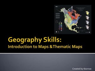
Created by tbonnar.
   A map is an image that represents an area of
    the earth’s surface, usually from above.
   A map can provide
    different
    information such as
    place names, land
    features, elevation,
    and political
    boundaries.
   North is usually at
    the top of the
    map, check the
    compass rose to see
    if it has been
    repositioned in a
    different direction.
   Physical maps
    indicate natural
    features such as
    mountains, deserts,
    rivers and lakes.
   Political maps focus
    on the division of
    the earth’s surface
    into different
    countries, states or
    provinces.
   Most maps in this
    atlas will show
    physical features as
    well as country
    borders, cities, and
    towns.
 Today, scientists
  can make more
  accurate maps of
  the world than
  ever before.
 They can use
  information from
  satellites that
  orbit the earth.
 A thematic map is one
  that focuses on a
  particular main idea (or
  theme).
 These might include:
     Climate
     Vegetation
     Economy
     Population
     Language
 Map legends are very
  important for all types
  of maps, but perhaps
  especially so for
  thematic maps.
 Legends can include:
     Symbols
     Elevation
     Scale
     Colour Keys
   Maps often use symbols instead of words to
    label real-life features and make maps clearer.
   Symbols
    can be
    small
    pictures,
    letters, lines
    or coloured
    areas.
 Each symbol
  is placed in a
  key or
  legend next
  to the map.
 The key
  explains
  what each
  symbol
  means.
 Climate Maps are a
  type of Thematic Map.
 They present
  information about
  climate such as:
       Temperature
       Precipitation
       Sunshine Hours
       Growing Season
       Climate Regions
       Environmental Concerns
   Climate is the
    overall weather
    pattern of a region.

   The two major
    aspects of climate
    are temperature
    and precipitation.
   A Climate Graph shows:
     A title
     Precipitation bars in blue
     A temperature line in red
     Months of the year
     Usually the Total Annual
      Precipitation
     Sometimes the
      growing season at 6°C

   Interactive Climate Graphs
   Revolution of the earth      Rotation of the earth
    – causes seasons              – causes day and night
   latitude – proximity to      altitude (elevation) –
    the equator or to the         temperature decreases
    poles ex. high latitude       1 C for every increase
    = lower temperatures          of 165 metres
   wind – wind can lower or raise temperature
    depending on where the wind comes from

   large bodies of water – water’s temperature
    changes more slowly than land’s
    temperature; therefore the temperature near
    large bodies of water will be more moderate
   ocean currents – make the water cold or
    warm and thus affect the land
   pollution (man-made or natural)
     gases in the atmosphere trap heat
     forest fires and volcanoes can also affect
     temperature
   winds – will bring
    precipitation to an
    area

   large water bodies
    – will usually
    increase
    precipitation in
    that area
   air pressure –
    differences in air
    pressure cause
    precipitation to fall
   temperature – interaction between warm
    and cold air causes precipitation
   physiography – the presence of physical features
    such as
    mountains
    or deserts
   Orographic – caused by mountains, as in
    Greater Vancouver
   Convectional – thunderstorms, caused by the
    rising of hot air
   Cyclonic – the most common type, caused by
    differences in air pressure

Weitere ähnliche Inhalte

Was ist angesagt?

Platforms of Remote sensing and GIS
Platforms of Remote sensing and GISPlatforms of Remote sensing and GIS
Platforms of Remote sensing and GISMouna Guru
 
Aerial photography abraham thomas
Aerial photography abraham thomasAerial photography abraham thomas
Aerial photography abraham thomasSumant Diwakar
 
Commonly used ground truth equipments
Commonly used ground truth equipmentsCommonly used ground truth equipments
Commonly used ground truth equipmentsHimangshuKalita10
 
Surface Analysis in GIS
Surface Analysis in GISSurface Analysis in GIS
Surface Analysis in GISRituSaha3
 
Spatial Analysis Using GIS
Spatial Analysis Using GISSpatial Analysis Using GIS
Spatial Analysis Using GISPrachi Mehta
 
Coordinate systems, datum & map projections
Coordinate systems, datum & map projectionsCoordinate systems, datum & map projections
Coordinate systems, datum & map projectionsKU Leuven
 
Map Design and Symbology in GIS Environment
Map Design and Symbology in GIS EnvironmentMap Design and Symbology in GIS Environment
Map Design and Symbology in GIS EnvironmentKaium Chowdhury
 
What is GIS
What is GISWhat is GIS
What is GISEsri
 
Chap1 introduction to geographic information system (gis)
Chap1 introduction to geographic information system (gis)Chap1 introduction to geographic information system (gis)
Chap1 introduction to geographic information system (gis)Mweemba Hachita
 
Projections and coordinate system
Projections and coordinate systemProjections and coordinate system
Projections and coordinate systemMohsin Siddique
 
Topographic Map
Topographic MapTopographic Map
Topographic Mapmjcnavarro
 
Fundamentals of GIS and Database Management for Disaster Management
Fundamentals of GIS and Database Management for Disaster ManagementFundamentals of GIS and Database Management for Disaster Management
Fundamentals of GIS and Database Management for Disaster ManagementSyadur Rahaman
 
Digital image processing
Digital image processingDigital image processing
Digital image processingMuheeb Awawdeh
 
Map Projections ―concepts, classes and usage
Map Projections ―concepts, classes and usage Map Projections ―concepts, classes and usage
Map Projections ―concepts, classes and usage Prof Ashis Sarkar
 

Was ist angesagt? (20)

Platforms of Remote sensing and GIS
Platforms of Remote sensing and GISPlatforms of Remote sensing and GIS
Platforms of Remote sensing and GIS
 
Aerial photography abraham thomas
Aerial photography abraham thomasAerial photography abraham thomas
Aerial photography abraham thomas
 
Digitalcartography
DigitalcartographyDigitalcartography
Digitalcartography
 
Maps, cartography and significances
Maps, cartography and significancesMaps, cartography and significances
Maps, cartography and significances
 
Introduction to Maps
Introduction to MapsIntroduction to Maps
Introduction to Maps
 
Commonly used ground truth equipments
Commonly used ground truth equipmentsCommonly used ground truth equipments
Commonly used ground truth equipments
 
Surface Analysis in GIS
Surface Analysis in GISSurface Analysis in GIS
Surface Analysis in GIS
 
Spatial Analysis Using GIS
Spatial Analysis Using GISSpatial Analysis Using GIS
Spatial Analysis Using GIS
 
Coordinate systems, datum & map projections
Coordinate systems, datum & map projectionsCoordinate systems, datum & map projections
Coordinate systems, datum & map projections
 
Map Design and Symbology in GIS Environment
Map Design and Symbology in GIS EnvironmentMap Design and Symbology in GIS Environment
Map Design and Symbology in GIS Environment
 
What is GIS
What is GISWhat is GIS
What is GIS
 
Chap1 introduction to geographic information system (gis)
Chap1 introduction to geographic information system (gis)Chap1 introduction to geographic information system (gis)
Chap1 introduction to geographic information system (gis)
 
Projections and coordinate system
Projections and coordinate systemProjections and coordinate system
Projections and coordinate system
 
Topographic Map
Topographic MapTopographic Map
Topographic Map
 
Maps ppt
Maps pptMaps ppt
Maps ppt
 
Fundamentals of GIS and Database Management for Disaster Management
Fundamentals of GIS and Database Management for Disaster ManagementFundamentals of GIS and Database Management for Disaster Management
Fundamentals of GIS and Database Management for Disaster Management
 
What is GIS?
What is GIS?What is GIS?
What is GIS?
 
Digital image processing
Digital image processingDigital image processing
Digital image processing
 
Remote sensing
Remote sensing Remote sensing
Remote sensing
 
Map Projections ―concepts, classes and usage
Map Projections ―concepts, classes and usage Map Projections ―concepts, classes and usage
Map Projections ―concepts, classes and usage
 

Ähnlich wie Geography Skills - Thematic Maps & Climate

Climate : Eliments and Factors
Climate : Eliments and FactorsClimate : Eliments and Factors
Climate : Eliments and FactorsTanvirHridoy1
 
Climate : Eliments and Factors
Climate : Eliments and FactorsClimate : Eliments and Factors
Climate : Eliments and FactorsTanvirHridoy1
 
EARTH_SCIENCE_SOL.ppt
EARTH_SCIENCE_SOL.pptEARTH_SCIENCE_SOL.ppt
EARTH_SCIENCE_SOL.pptCharlesBuale1
 
Lesson1battleforbiospherewhatandwherearebiomes
Lesson1battleforbiospherewhatandwherearebiomesLesson1battleforbiospherewhatandwherearebiomes
Lesson1battleforbiospherewhatandwherearebiomessarah marks
 
Unit 0 - The Physical Map of the World and Spain (ppt)
Unit 0 - The Physical Map of the World and Spain (ppt)Unit 0 - The Physical Map of the World and Spain (ppt)
Unit 0 - The Physical Map of the World and Spain (ppt)JaimeAlonsoEdu
 
What is Geography glossary task
What is Geography glossary taskWhat is Geography glossary task
What is Geography glossary taskAndy Knill
 
Physical Geography Lecture 05 - Atmospheric Energy and Global Temps 101216
Physical Geography Lecture 05 - Atmospheric Energy and Global Temps 101216Physical Geography Lecture 05 - Atmospheric Energy and Global Temps 101216
Physical Geography Lecture 05 - Atmospheric Energy and Global Temps 101216angelaorr
 
Physical geography
Physical geographyPhysical geography
Physical geographymgdean
 
Physical geography
Physical geographyPhysical geography
Physical geographymgdean
 
Chapter 2 Weather Su09
Chapter 2 Weather Su09Chapter 2 Weather Su09
Chapter 2 Weather Su09fdent
 
Lesson 2 hydrology
Lesson 2 hydrologyLesson 2 hydrology
Lesson 2 hydrologyNed Baring
 
GEOG100--Lecture 05--Atmos energy, temp, weather
GEOG100--Lecture 05--Atmos energy, temp, weatherGEOG100--Lecture 05--Atmos energy, temp, weather
GEOG100--Lecture 05--Atmos energy, temp, weatherangelaorr
 
SS10 Chapter 3 Review Part I
SS10 Chapter 3 Review Part ISS10 Chapter 3 Review Part I
SS10 Chapter 3 Review Part Iclaraleetutor
 
Weather.climate edited
Weather.climate editedWeather.climate edited
Weather.climate editedNeilfieOrit2
 
Meteorology -Weather acloutier 2011 power point
Meteorology -Weather acloutier 2011 power pointMeteorology -Weather acloutier 2011 power point
Meteorology -Weather acloutier 2011 power pointAnnie C. Cloutier
 

Ähnlich wie Geography Skills - Thematic Maps & Climate (20)

Climate : Eliments and Factors
Climate : Eliments and FactorsClimate : Eliments and Factors
Climate : Eliments and Factors
 
Climate : Eliments and Factors
Climate : Eliments and FactorsClimate : Eliments and Factors
Climate : Eliments and Factors
 
EARTH_SCIENCE_SOL.ppt
EARTH_SCIENCE_SOL.pptEARTH_SCIENCE_SOL.ppt
EARTH_SCIENCE_SOL.ppt
 
Lesson1battleforbiospherewhatandwherearebiomes
Lesson1battleforbiospherewhatandwherearebiomesLesson1battleforbiospherewhatandwherearebiomes
Lesson1battleforbiospherewhatandwherearebiomes
 
Climate
ClimateClimate
Climate
 
Unit 0 - The Physical Map of the World and Spain (ppt)
Unit 0 - The Physical Map of the World and Spain (ppt)Unit 0 - The Physical Map of the World and Spain (ppt)
Unit 0 - The Physical Map of the World and Spain (ppt)
 
What is Geography glossary task
What is Geography glossary taskWhat is Geography glossary task
What is Geography glossary task
 
Physical Geography Lecture 05 - Atmospheric Energy and Global Temps 101216
Physical Geography Lecture 05 - Atmospheric Energy and Global Temps 101216Physical Geography Lecture 05 - Atmospheric Energy and Global Temps 101216
Physical Geography Lecture 05 - Atmospheric Energy and Global Temps 101216
 
Chapter seven
Chapter sevenChapter seven
Chapter seven
 
Physical geography
Physical geographyPhysical geography
Physical geography
 
Physical geography
Physical geographyPhysical geography
Physical geography
 
Chapter 2 Weather Su09
Chapter 2 Weather Su09Chapter 2 Weather Su09
Chapter 2 Weather Su09
 
Weather and Climate
Weather and ClimateWeather and Climate
Weather and Climate
 
Lesson 2 hydrology
Lesson 2 hydrologyLesson 2 hydrology
Lesson 2 hydrology
 
GEOG100--Lecture 05--Atmos energy, temp, weather
GEOG100--Lecture 05--Atmos energy, temp, weatherGEOG100--Lecture 05--Atmos energy, temp, weather
GEOG100--Lecture 05--Atmos energy, temp, weather
 
6th Grade Chapter 18 Part 2
6th Grade Chapter 18 Part 26th Grade Chapter 18 Part 2
6th Grade Chapter 18 Part 2
 
SS10 Chapter 3 Review Part I
SS10 Chapter 3 Review Part ISS10 Chapter 3 Review Part I
SS10 Chapter 3 Review Part I
 
Weather.climate edited
Weather.climate editedWeather.climate edited
Weather.climate edited
 
Climate
ClimateClimate
Climate
 
Meteorology -Weather acloutier 2011 power point
Meteorology -Weather acloutier 2011 power pointMeteorology -Weather acloutier 2011 power point
Meteorology -Weather acloutier 2011 power point
 

Mehr von Tim Bonnar

Avoir = To Have
Avoir = To HaveAvoir = To Have
Avoir = To HaveTim Bonnar
 
Reflexive verbs - in French
Reflexive verbs - in FrenchReflexive verbs - in French
Reflexive verbs - in FrenchTim Bonnar
 
Mes opinions des sports
Mes opinions des sportsMes opinions des sports
Mes opinions des sportsTim Bonnar
 
Faire = to do or to make
Faire = to do or to makeFaire = to do or to make
Faire = to do or to makeTim Bonnar
 
Common Multiples and Common Factors
Common Multiples and Common FactorsCommon Multiples and Common Factors
Common Multiples and Common FactorsTim Bonnar
 
Divisibility Rules
Divisibility RulesDivisibility Rules
Divisibility RulesTim Bonnar
 
Direction and Bearings
Direction and BearingsDirection and Bearings
Direction and BearingsTim Bonnar
 
Geography Skills: Contours
Geography Skills: ContoursGeography Skills: Contours
Geography Skills: ContoursTim Bonnar
 
Economic Revolutions - Agricultural Revolution
Economic Revolutions - Agricultural RevolutionEconomic Revolutions - Agricultural Revolution
Economic Revolutions - Agricultural RevolutionTim Bonnar
 
The French Revolution - part 2
The French Revolution - part 2The French Revolution - part 2
The French Revolution - part 2Tim Bonnar
 
The French Revolution - part 1
The French Revolution - part 1The French Revolution - part 1
The French Revolution - part 1Tim Bonnar
 
Geography Skills: Scale
Geography Skills:  ScaleGeography Skills:  Scale
Geography Skills: ScaleTim Bonnar
 
DSABC Briefing for Judges
DSABC Briefing for JudgesDSABC Briefing for Judges
DSABC Briefing for JudgesTim Bonnar
 
The 5 Themes of Geography
The 5 Themes of GeographyThe 5 Themes of Geography
The 5 Themes of GeographyTim Bonnar
 
New France Powerpoint
New France PowerpointNew France Powerpoint
New France PowerpointTim Bonnar
 

Mehr von Tim Bonnar (18)

Avoir = To Have
Avoir = To HaveAvoir = To Have
Avoir = To Have
 
Reflexive verbs - in French
Reflexive verbs - in FrenchReflexive verbs - in French
Reflexive verbs - in French
 
Mes opinions des sports
Mes opinions des sportsMes opinions des sports
Mes opinions des sports
 
Verbes en -ER
Verbes en  -ERVerbes en  -ER
Verbes en -ER
 
Faire = to do or to make
Faire = to do or to makeFaire = to do or to make
Faire = to do or to make
 
Common Multiples and Common Factors
Common Multiples and Common FactorsCommon Multiples and Common Factors
Common Multiples and Common Factors
 
Divisibility Rules
Divisibility RulesDivisibility Rules
Divisibility Rules
 
Direction and Bearings
Direction and BearingsDirection and Bearings
Direction and Bearings
 
Geography Skills: Contours
Geography Skills: ContoursGeography Skills: Contours
Geography Skills: Contours
 
Economic Revolutions - Agricultural Revolution
Economic Revolutions - Agricultural RevolutionEconomic Revolutions - Agricultural Revolution
Economic Revolutions - Agricultural Revolution
 
The French Revolution - part 2
The French Revolution - part 2The French Revolution - part 2
The French Revolution - part 2
 
The French Revolution - part 1
The French Revolution - part 1The French Revolution - part 1
The French Revolution - part 1
 
Napoleon
NapoleonNapoleon
Napoleon
 
Geography Skills: Scale
Geography Skills:  ScaleGeography Skills:  Scale
Geography Skills: Scale
 
DSABC Briefing for Judges
DSABC Briefing for JudgesDSABC Briefing for Judges
DSABC Briefing for Judges
 
The 5 Themes of Geography
The 5 Themes of GeographyThe 5 Themes of Geography
The 5 Themes of Geography
 
First Contact
First ContactFirst Contact
First Contact
 
New France Powerpoint
New France PowerpointNew France Powerpoint
New France Powerpoint
 

Kürzlich hochgeladen

Accessible design: Minimum effort, maximum impact
Accessible design: Minimum effort, maximum impactAccessible design: Minimum effort, maximum impact
Accessible design: Minimum effort, maximum impactdawncurless
 
Class 11th Physics NEET formula sheet pdf
Class 11th Physics NEET formula sheet pdfClass 11th Physics NEET formula sheet pdf
Class 11th Physics NEET formula sheet pdfAyushMahapatra5
 
Web & Social Media Analytics Previous Year Question Paper.pdf
Web & Social Media Analytics Previous Year Question Paper.pdfWeb & Social Media Analytics Previous Year Question Paper.pdf
Web & Social Media Analytics Previous Year Question Paper.pdfJayanti Pande
 
Disha NEET Physics Guide for classes 11 and 12.pdf
Disha NEET Physics Guide for classes 11 and 12.pdfDisha NEET Physics Guide for classes 11 and 12.pdf
Disha NEET Physics Guide for classes 11 and 12.pdfchloefrazer622
 
Q4-W6-Restating Informational Text Grade 3
Q4-W6-Restating Informational Text Grade 3Q4-W6-Restating Informational Text Grade 3
Q4-W6-Restating Informational Text Grade 3JemimahLaneBuaron
 
Russian Escort Service in Delhi 11k Hotel Foreigner Russian Call Girls in Delhi
Russian Escort Service in Delhi 11k Hotel Foreigner Russian Call Girls in DelhiRussian Escort Service in Delhi 11k Hotel Foreigner Russian Call Girls in Delhi
Russian Escort Service in Delhi 11k Hotel Foreigner Russian Call Girls in Delhikauryashika82
 
Software Engineering Methodologies (overview)
Software Engineering Methodologies (overview)Software Engineering Methodologies (overview)
Software Engineering Methodologies (overview)eniolaolutunde
 
Z Score,T Score, Percential Rank and Box Plot Graph
Z Score,T Score, Percential Rank and Box Plot GraphZ Score,T Score, Percential Rank and Box Plot Graph
Z Score,T Score, Percential Rank and Box Plot GraphThiyagu K
 
Interactive Powerpoint_How to Master effective communication
Interactive Powerpoint_How to Master effective communicationInteractive Powerpoint_How to Master effective communication
Interactive Powerpoint_How to Master effective communicationnomboosow
 
Nutritional Needs Presentation - HLTH 104
Nutritional Needs Presentation - HLTH 104Nutritional Needs Presentation - HLTH 104
Nutritional Needs Presentation - HLTH 104misteraugie
 
The Most Excellent Way | 1 Corinthians 13
The Most Excellent Way | 1 Corinthians 13The Most Excellent Way | 1 Corinthians 13
The Most Excellent Way | 1 Corinthians 13Steve Thomason
 
Introduction to Nonprofit Accounting: The Basics
Introduction to Nonprofit Accounting: The BasicsIntroduction to Nonprofit Accounting: The Basics
Introduction to Nonprofit Accounting: The BasicsTechSoup
 
Beyond the EU: DORA and NIS 2 Directive's Global Impact
Beyond the EU: DORA and NIS 2 Directive's Global ImpactBeyond the EU: DORA and NIS 2 Directive's Global Impact
Beyond the EU: DORA and NIS 2 Directive's Global ImpactPECB
 
Holdier Curriculum Vitae (April 2024).pdf
Holdier Curriculum Vitae (April 2024).pdfHoldier Curriculum Vitae (April 2024).pdf
Holdier Curriculum Vitae (April 2024).pdfagholdier
 
Presentation by Andreas Schleicher Tackling the School Absenteeism Crisis 30 ...
Presentation by Andreas Schleicher Tackling the School Absenteeism Crisis 30 ...Presentation by Andreas Schleicher Tackling the School Absenteeism Crisis 30 ...
Presentation by Andreas Schleicher Tackling the School Absenteeism Crisis 30 ...EduSkills OECD
 
social pharmacy d-pharm 1st year by Pragati K. Mahajan
social pharmacy d-pharm 1st year by Pragati K. Mahajansocial pharmacy d-pharm 1st year by Pragati K. Mahajan
social pharmacy d-pharm 1st year by Pragati K. Mahajanpragatimahajan3
 
IGNOU MSCCFT and PGDCFT Exam Question Pattern: MCFT003 Counselling and Family...
IGNOU MSCCFT and PGDCFT Exam Question Pattern: MCFT003 Counselling and Family...IGNOU MSCCFT and PGDCFT Exam Question Pattern: MCFT003 Counselling and Family...
IGNOU MSCCFT and PGDCFT Exam Question Pattern: MCFT003 Counselling and Family...PsychoTech Services
 
9548086042 for call girls in Indira Nagar with room service
9548086042  for call girls in Indira Nagar  with room service9548086042  for call girls in Indira Nagar  with room service
9548086042 for call girls in Indira Nagar with room servicediscovermytutordmt
 

Kürzlich hochgeladen (20)

Accessible design: Minimum effort, maximum impact
Accessible design: Minimum effort, maximum impactAccessible design: Minimum effort, maximum impact
Accessible design: Minimum effort, maximum impact
 
Class 11th Physics NEET formula sheet pdf
Class 11th Physics NEET formula sheet pdfClass 11th Physics NEET formula sheet pdf
Class 11th Physics NEET formula sheet pdf
 
Web & Social Media Analytics Previous Year Question Paper.pdf
Web & Social Media Analytics Previous Year Question Paper.pdfWeb & Social Media Analytics Previous Year Question Paper.pdf
Web & Social Media Analytics Previous Year Question Paper.pdf
 
Disha NEET Physics Guide for classes 11 and 12.pdf
Disha NEET Physics Guide for classes 11 and 12.pdfDisha NEET Physics Guide for classes 11 and 12.pdf
Disha NEET Physics Guide for classes 11 and 12.pdf
 
Q4-W6-Restating Informational Text Grade 3
Q4-W6-Restating Informational Text Grade 3Q4-W6-Restating Informational Text Grade 3
Q4-W6-Restating Informational Text Grade 3
 
Código Creativo y Arte de Software | Unidad 1
Código Creativo y Arte de Software | Unidad 1Código Creativo y Arte de Software | Unidad 1
Código Creativo y Arte de Software | Unidad 1
 
Russian Escort Service in Delhi 11k Hotel Foreigner Russian Call Girls in Delhi
Russian Escort Service in Delhi 11k Hotel Foreigner Russian Call Girls in DelhiRussian Escort Service in Delhi 11k Hotel Foreigner Russian Call Girls in Delhi
Russian Escort Service in Delhi 11k Hotel Foreigner Russian Call Girls in Delhi
 
Software Engineering Methodologies (overview)
Software Engineering Methodologies (overview)Software Engineering Methodologies (overview)
Software Engineering Methodologies (overview)
 
Z Score,T Score, Percential Rank and Box Plot Graph
Z Score,T Score, Percential Rank and Box Plot GraphZ Score,T Score, Percential Rank and Box Plot Graph
Z Score,T Score, Percential Rank and Box Plot Graph
 
Interactive Powerpoint_How to Master effective communication
Interactive Powerpoint_How to Master effective communicationInteractive Powerpoint_How to Master effective communication
Interactive Powerpoint_How to Master effective communication
 
Nutritional Needs Presentation - HLTH 104
Nutritional Needs Presentation - HLTH 104Nutritional Needs Presentation - HLTH 104
Nutritional Needs Presentation - HLTH 104
 
The Most Excellent Way | 1 Corinthians 13
The Most Excellent Way | 1 Corinthians 13The Most Excellent Way | 1 Corinthians 13
The Most Excellent Way | 1 Corinthians 13
 
Introduction to Nonprofit Accounting: The Basics
Introduction to Nonprofit Accounting: The BasicsIntroduction to Nonprofit Accounting: The Basics
Introduction to Nonprofit Accounting: The Basics
 
Beyond the EU: DORA and NIS 2 Directive's Global Impact
Beyond the EU: DORA and NIS 2 Directive's Global ImpactBeyond the EU: DORA and NIS 2 Directive's Global Impact
Beyond the EU: DORA and NIS 2 Directive's Global Impact
 
Holdier Curriculum Vitae (April 2024).pdf
Holdier Curriculum Vitae (April 2024).pdfHoldier Curriculum Vitae (April 2024).pdf
Holdier Curriculum Vitae (April 2024).pdf
 
Presentation by Andreas Schleicher Tackling the School Absenteeism Crisis 30 ...
Presentation by Andreas Schleicher Tackling the School Absenteeism Crisis 30 ...Presentation by Andreas Schleicher Tackling the School Absenteeism Crisis 30 ...
Presentation by Andreas Schleicher Tackling the School Absenteeism Crisis 30 ...
 
social pharmacy d-pharm 1st year by Pragati K. Mahajan
social pharmacy d-pharm 1st year by Pragati K. Mahajansocial pharmacy d-pharm 1st year by Pragati K. Mahajan
social pharmacy d-pharm 1st year by Pragati K. Mahajan
 
IGNOU MSCCFT and PGDCFT Exam Question Pattern: MCFT003 Counselling and Family...
IGNOU MSCCFT and PGDCFT Exam Question Pattern: MCFT003 Counselling and Family...IGNOU MSCCFT and PGDCFT Exam Question Pattern: MCFT003 Counselling and Family...
IGNOU MSCCFT and PGDCFT Exam Question Pattern: MCFT003 Counselling and Family...
 
Mattingly "AI & Prompt Design: Structured Data, Assistants, & RAG"
Mattingly "AI & Prompt Design: Structured Data, Assistants, & RAG"Mattingly "AI & Prompt Design: Structured Data, Assistants, & RAG"
Mattingly "AI & Prompt Design: Structured Data, Assistants, & RAG"
 
9548086042 for call girls in Indira Nagar with room service
9548086042  for call girls in Indira Nagar  with room service9548086042  for call girls in Indira Nagar  with room service
9548086042 for call girls in Indira Nagar with room service
 

Geography Skills - Thematic Maps & Climate

  • 2. A map is an image that represents an area of the earth’s surface, usually from above.
  • 3. A map can provide different information such as place names, land features, elevation, and political boundaries.
  • 4. North is usually at the top of the map, check the compass rose to see if it has been repositioned in a different direction.
  • 5. Physical maps indicate natural features such as mountains, deserts, rivers and lakes.
  • 6. Political maps focus on the division of the earth’s surface into different countries, states or provinces.
  • 7. Most maps in this atlas will show physical features as well as country borders, cities, and towns.
  • 8.  Today, scientists can make more accurate maps of the world than ever before.  They can use information from satellites that orbit the earth.
  • 9.  A thematic map is one that focuses on a particular main idea (or theme).  These might include:  Climate  Vegetation  Economy  Population  Language
  • 10.
  • 11.  Map legends are very important for all types of maps, but perhaps especially so for thematic maps.  Legends can include:  Symbols  Elevation  Scale  Colour Keys
  • 12. Maps often use symbols instead of words to label real-life features and make maps clearer.
  • 13. Symbols can be small pictures, letters, lines or coloured areas.
  • 14.  Each symbol is placed in a key or legend next to the map.  The key explains what each symbol means.
  • 15.  Climate Maps are a type of Thematic Map.  They present information about climate such as:  Temperature  Precipitation  Sunshine Hours  Growing Season  Climate Regions  Environmental Concerns
  • 16. Climate is the overall weather pattern of a region.  The two major aspects of climate are temperature and precipitation.
  • 17. A Climate Graph shows:  A title  Precipitation bars in blue  A temperature line in red  Months of the year  Usually the Total Annual Precipitation  Sometimes the growing season at 6°C  Interactive Climate Graphs
  • 18. Revolution of the earth  Rotation of the earth – causes seasons – causes day and night
  • 19. latitude – proximity to  altitude (elevation) – the equator or to the temperature decreases poles ex. high latitude 1 C for every increase = lower temperatures of 165 metres
  • 20. wind – wind can lower or raise temperature depending on where the wind comes from  large bodies of water – water’s temperature changes more slowly than land’s temperature; therefore the temperature near large bodies of water will be more moderate
  • 21. ocean currents – make the water cold or warm and thus affect the land
  • 22. pollution (man-made or natural)  gases in the atmosphere trap heat  forest fires and volcanoes can also affect temperature
  • 23. winds – will bring precipitation to an area  large water bodies – will usually increase precipitation in that area
  • 24. air pressure – differences in air pressure cause precipitation to fall
  • 25. temperature – interaction between warm and cold air causes precipitation
  • 26. physiography – the presence of physical features such as mountains or deserts
  • 27. Orographic – caused by mountains, as in Greater Vancouver
  • 28. Convectional – thunderstorms, caused by the rising of hot air
  • 29. Cyclonic – the most common type, caused by differences in air pressure