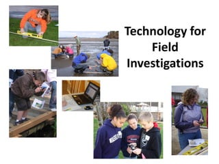
Introduction to Technology for Field Investigations
•
1 gefällt mir•447 views

This presentation is part of the Pacific Education Institute's content for the STEM Project Based Learning tutorial available through NH e-Learning for Educators as part of the Conservation Education series supported by the Association of Fish and Wildlife Agencies.

Empfohlen
Empfohlen
Weitere ähnliche Inhalte
Ähnlich wie Introduction to Technology for Field Investigations
Ähnlich wie Introduction to Technology for Field Investigations (20)
Mehr von OPEN NH / NH e-Learning for Educators
Mehr von OPEN NH / NH e-Learning for Educators (20)
Introduction to Technology for Field Investigations
- 1. Technology for Field Investigations
- 2. Take a Moment • Take a moment to define technology. Write your definition on the Technology Resources in my Profession document. • Reflect on the role technology plays in your job.
- 3. This is the definition of technology provided by the Next Generation Science Standards K-12 Science Education Framework 2011 (NGSS) Technology is any modification of the natural world made to fulfill human needs or desires (8-11). Technologies extend the measurement, exploration, modeling and computational capacity of scientific investigations. Next Generation of Science Standards: A Framework for K- 12 Science Education, 2011
- 4. Technology Defined • How does your definition compare with the NGSS technology definition? • Revise your definition, if needed.
- 5. To Educators: Review the Table of Contents of the Technology for K-12 Field Investigations guide. Think about: Which of these technologies do you currently use? What technologies interest you? Technology for K-12 Field Investigations: Scientist Driven Technology and Practices Table of Contents Section 1: Technologies used to measure the natural environment: listed by natural resource professionals Section 2: Websites to prepare for field work or apply science: recommended by natural resource professionals Part 1: List of recommended websites Part 2: WebQuest lessons designed to seek information from reliable websites for field studies, stewardship and recreation. Section 3: Mobile Units: apps and software for field studies: recommended by natural resource professionals Part 1: Smart Phones for Science Teachers Part 2: List of recommended apps Part 3: NatureTracker: icon driven data collection software for mobile units and desktop Section 4: Geospatial Literacy: GIS practices essential for natural resource science and engineering. Students develop GIS capacity through Part 1: Use of Powerpoint Part 2: Use of Google Earth Part 3: Use of ESRI ArcGIS Explorer Online
- 6. To Educators: Review the possible technology tools that can be used to assist each step of field investigation. On the Technology for my Profession document, respond to the question: Which of these technology tools do you currently use? Table 1: Practices in Science for Field Investigation Field Investigation Methodologies Technology tools (AFWA/PEI) Formulating Investigative Question Access State & National Fish and Wildlife Agency websites for relevant Descriptive research & background Comparative Access online journals Correlative Identify Setting with a System: Identify Determine Latitude and Longitude using Maps, iphones and websites with boundaries of study area and time frame – GPS, Google Earth, Bing, ArcMap etc functions. geographic scale of study Identify Variables of Interest Use Apps & Websites to assist observation Observation Collect and Organize Data Collect Data Mobile Units SmartPhones PDA’s- Garmins Trimbles, iPAQ’s with NatureTracker Laptops with desktop NatureTracker software Report data into excel spreadsheets (in NatureTracker) & report to online sites Analyze Data Analyze Data Develop Spreadsheet and analyze using graphs or GIS for descriptive, comparative and correlative questions Use Evidence to Support a Conclusion Creating an explanation with; Google Earth ESRI ArcGIS Explorer Discussion, Communicating Information Sharing Information: Citizen Science sites NatureMapping Foundation (All species); eBird (birds) Communicating Information: Webinars, blogs, Skype etc
- 7. Typical Field Investigation Data Recording Form: Fish and Wildlife Date Time Temp Species How Latitude Longitude How Is this an Habitat name Observed? many did estimate Code Description: (Saw, heard, you see? ? tracks, etc) iCalendar iWatch iThermo- Apps & Binoculars iGPS iGPS Visual Visual Visual eCalendar eWatch meter websites Plaster casts iPhoto iPhoto iPhoto iPhotos for verification Smartphone or computer reference: (i) or (e) To Educators: You can use a variety of websites and/or apps for each of the fields (columns) in the data reporting form typically used for field investigation. A list of recommended websites and apps from biologists and conservation educators are available in the Technology Guide: Section 2: Part 1: List of recommended websites (page 15-18) Section 3: Part 2: List of recommended apps (pages 34-36)
- 8. To Educators: In this section you will find websites used and recommended by natural resource professionals that may have value for your work as educators. Each website cited has one or more of the purposes listed below. Section 2 Part 1: Websites recommended by natural resource professionals (Pages 15-18) Field observation help– where users receive assistance to identify their target Field locations – where users receive assistance to identify their specific geographic location Report Data – citizen science – a site where users may contribute their data Recreation – where users may find locations for outdoor recreation Background info - location specific natural resource information Data available for download Access to journals
- 9. A Webquest is…… Section 2: Part 2. Teacher Guide to using WebQuests (page 19) Field Investigation: 1. Biodiversity: What Other Wildlife Lives Here? 2. Invasive Species Take Over 3. The Future for Shellfish Farming 4. Plants are Grocery Stores and Apartment Buildings Stewardship: 5. Birds Belong: Creating Good Bird Habitat 6. Litter and It Will Hurt 7. Marine Debris Team Recreation 8. Going Fishing: example provided 9. Hunting Trip To Educators: Conservation Educators and teachers can provide rich research experiences for students through their own customized WebQuests. The WebQuests provided in the Technology Guide may be edited to suit your learning purposes.
- 10. Section 3: Mobile Units: apps and software for field studies: recommended by natural resource professionals Part 1: Smart Phones for Science Teachers (page 32-33): advice to educators Part 2: List of recommended apps (page 34-36): provided by natural resource professionals Part 3: NatureTracker: icon driven data collection software for mobile units and desktop designed to function as a field notebook (pages 37-48): ideal for students
- 11. To Educators: The NatureTracker software assists professionals and learners to collect data using icon driven screens. Examine the icons and their link to data in spreadsheets to determine their instructional value for your students. Date Time Temp Species How Latitude Longitude How Is this an Habitat name Observed? many did estimate Code Description: (Saw, heard, you see? ? tracks, etc) iCalendar iWatch iThermo- Apps & Binoculars iGPS iGPS Visual Visual Visual eCalendar eWatch meter websites Plaster casts iPhoto iPhoto iPhoto iPhotos for verification Smartphone or computer reference: (i) or (e) __________________________________________________________________________________________________________ Icon Driven Screens of NatureTracker Software for Smartphones, PDA’s or Desktop Computers Spreadsheet of data from NatureTracker ↓
- 12. Section 4: Geospatial Literacy: Use of Geographical Information Systems with Field Investigation Example Uses: Part 1: Using PowerPoint: To create a map or demonstrate a GIS layer of data Part 2: Using Google Earth: To involve students in simulated map-reading activities (such as the Oil Spill Simulation) or to upload data and create maps related to field studies. Part 3: Using ArcGIS Explorer Online: To upload data and create maps related to field studies and/or to present data about a location(s).
- 13. GIS Resources To Educators: ArcGIS Explorer Online is a free online program provided by Environmental Systems Research Institute (ESRI) to create maps and/or presentations (slide shows) related to GIS projects. The ESRI Arcview Professional GIS Package is currently being offered free to the Department of Education and School Districts until 2014. Check to see if your state or school district has an agreement with ESRI to use the Professional Arcview GIS Package.
- 14. Conclusion • Technology practices used by scientists and natural resource managers are important to Science Technology, Engineering and Math (STEM) • Reflect on technology practices that you can highlight in your conservation education program and consider those you can add.