Xinjiang Tianshan Tianchi Scenic Area: Majestic Alpine Lakes and Mountains
•
0 gefällt mir•130 views

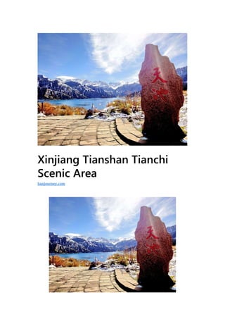
Xinjiang Tianshan Tianchi Scenic Area is a national scenic spot located in Fukang City, Xinjiang, China. It features the large Tianchi Lake surrounded by mountains, as well as smaller lakes like West Xiaotianchi and East Xiaotianchi. Main attractions include Shimen Canyon, the lakes, waterfalls, and mountains with legends about the Queen Mother of the West. The area was formed by ancient glaciers and has diverse landscapes ranging from glaciers to forests.

Empfohlen
Weitere ähnliche Inhalte
Was ist angesagt?
Was ist angesagt? (20)
Ähnlich wie Xinjiang Tianshan Tianchi Scenic Area: Majestic Alpine Lakes and Mountains
Ähnlich wie Xinjiang Tianshan Tianchi Scenic Area: Majestic Alpine Lakes and Mountains (20)
Mehr von Journey Han
Mehr von Journey Han (20)
Kürzlich hochgeladen
Kürzlich hochgeladen (20)
Xinjiang Tianshan Tianchi Scenic Area: Majestic Alpine Lakes and Mountains
- 1. Xinjiang Tianshan Tianchi Scenic Area hanjourney.com
- 2. G eographic location:Fukang City, Changji Hui Autonomous Prefecture, Xinjiang Uygur Autonomous Region Level:AAAAA Famous scenery:Xiaotianchi, Dengliangshan, Shixia Opening hours:8:00-19:00 Xinjiang Tianshan Tianchi Scenic Area is located in the middle of the mountain below the Bogda Peak in the Kangji City, Changji Hui Autonomous Prefecture, Xinjiang Uygur Autonomous Region. It is a national scenic spot and a national AAAAA scenic spot. The total area of the scenic area is 160 square kilometers (planned area of 548 square kilometers), with Tianchi as the center, Shimen in the north, snow line in the south, Ma Dashan in the west, and Dadonggou in the east. There are 4 vertical natural landscape belts. In 2013, Xinjiang Tianshan Tianchi Scenic Area was included in the UNESCO World Heritage List. In June 2015, the myth of Xiwangmu in Tianchi Tianchi was included in China’s fourth batch of representative projects of national intangible cultural heritage. In 2015, it was rated as the first batch of “China Tourism Price Trusted Scenic Spot” by the National Tourism Administration. In 2016, it was honored as the “Eleventh” Holiday Tourism Red List and was rated as “Best Scenic Spot of Tourism Order” by the National Tourism Administration. The main attractions are small. Tianchi, Dengliang Mountain, Tianchi North Slope Tourist Area, and Quanquan Cave. Development History Tianchi was called Yaochi in ancient times, and Tang Taizong was established under the Bogda Peak.
- 3. “Yao Chi Du Hu Fu”; “Tianchi” appeared in less than two hundred years ago may be the combination of the two words of Tianzi, Shenchi, once known as Haizi, Longtan, Yaochi, Shenchi, etc.; Qing Emperor Qiang 48 years ( In 1783, Xinjiang Dutong Bright had visited the Bogda Mountain and Tianchi to inspect the topography and open the stone to divert water. In 1958, a mountaineering road leading to Tianchi was built along the Sangong River Valley. In June 1980, the People’s Government of Xinjiang Uygur Autonomous Region established the Tianchi Nature Reserve centered on the Bogda Peak. In November 1982, Tianshan Tianchi was approved by the State Council as the first batch of 44 national key scenic spots. In 1993, the Ministry of Construction approved the “Overall Plan for Tianshan Tianchi Scenic Area”. On July 23, 2014, the Ma’ershan Ropeway Project was officially opened to the public. On September 3, 2014, “Tianshan Tianchi Geological Hazard Prevention and Ecological Protection Key Technologies and Applications” was adopted. In June 2015, the myth of Xiwangmu in Tianchi Tianchi was included in China’s fourth batch of representative projects of national intangible cultural heritage.
- 4. Geographical environment Location horizon Xinjiang Tianshan Tianchi Scenic Area is located in the Fukang County of Fukang City, Changji Hui Autonomous Prefecture, Xinjiang Uygur Autonomous Region. It is halfway down the Bogda Peak in the upper reaches of the Sangong River on the northern slope of the Tianshan Mountains. It is 37 km from the city of Fukang and 97 km from Urumqi. (one said 110 kilometers), the lake is 1910 meters above sea level. Its central part is 43°53’12.25′′ north latitude and 88°07′46.37′′ east longitude. The total area of the scenic area is 160 square kilometers (planned area of 548 square kilometers), with Tianchi as the center, Shimen in the north, snow line in the south, Ma Dashan in the west, and Dadonggou in the east. There are 4 vertical natural landscape belts. Topography The Tianshan Bogda Peak is 5,445 meters high, with snow all year round and glaciers stretching. Tianshan Tianchi is a mountain dammed lake formed by ancient glacial mudslides blocking the river. The shape is twisted and deep due to the original river valley. The lake is half-moon shaped, 3.5 km long from north to south (about 3,400 m), 0.8 to 1.5 km wide from east to west, 1,500 m wide at its
- 5. widest point, and 103 m deep (about 105 m), with an area of 4.9 square kilometers. Tianchi water is divided into a wet season and a peaceful water period in one year. The pool water rises from April to September every year, and the pool water falls from September to April, which is a reincarnation; its activity water level is between 10-13 meters, and the water temperature is maintained at an average annual rate. At 7.4 degrees Celsius. The natural scenic area is centered on alpine lakes. It is divided into four complete natural landscapes: glacier snow belt, alpine subalpine belt, mountain coniferous forest belt, and low mountain belt. Tianshan Tianchi in Xinjiang is a hail lake created by ancient glaciers. The glacial movement since the Quaternary on Earth has been four times. The formation of the Tianchi can be roughly divided into three stages. After three accumulations, a seal is formed in the mountains. The depression, blocked the melting of snow and ice and the precipitation of the mountains, the final ridge is as high as 286 meters, thus creating the Tianchi. Climate characteristics Tianshan Tianchi is located near Urumqi. Xinjiang is a typical continental arid climate. The southern Xinjiang is arid, with long light and little rain. The annual precipitation is only 20-100 mm, while the northern Xinjiang is 100-500 mm. The annual average temperature is 10 km. -13 °C, the northern plains are below 10 °C; the southern
- 6. plains have a frost-free period of 200-220 days, and the northern plains are mostly less than 150 days. The scenic spot is in the Tianshan inversion layer. Due to the influence of atmospheric recirculation, the temperature is relatively stable and moderate. The annual average temperature of the scenic spot is 2.55 degrees Celsius, the highest temperature in July is 15.9 degrees Celsius, the lowest temperature in January is -12.4 degrees Celsius, and the winter snowfall is 6-7 degrees. In the month, the icing period is 5 months, and the thickness of the lake ice layer is more than 1 meter. It is a natural ice rink. Main Attractions Shimen Shichi Shimen, named “Shimen First Line”, is 1,500 meters above sea level, 5.9 kilometers north of Datianchi. It is a stone canyon formed by the Sangonghe ancient river channel. This mountain pass is the natural gateway to the scenic area; It is about a hundred meters long, and the narrowest part is only ten meters wide. The erect rock walls on both sides are more than tens of meters high. The situation is
- 7. dangerous. Looking up at the first line of the sky, the side is winding around the Sangong River. Fifty plates, the name is Fifty Pantian, is a winding mountain trail below Shimen. After passing through Shimen, the Panshan Highway from the Pinggang “Yi’an Village” on the top of the Tianchi Lake. About fifty. Xi Xiaotianchi Xixiao Tianchi, at an altitude of 1,600 meters (1,60 meters), is located in the northwest of the main lake (Tianchi Haizi), about two kilometers northwest of its foot, the lower right of the third disk of the fifty-span highway, the lake is covered by the Tianchi Dam. The southwest leaks into the pool in the form of a waterfall and plunges into the Sangong River. It is known as the Jade Woman Lake. It is said to be the foot washing place of the West King Mother. The name is “Wangmu Foot Basin”, also known as Xiaolongtan, hence the name “Longtan Bi”. month”. West Xiaotianchi Waterfall, the scenery called “Jade Belt Silver Curtain” flies in the right side of the road not far from the west small Tianchi, the volcano falls tens of meters, and the Xixia Tianchi is formed by diarrhea; the legend is the bathing water of the Queen Mother, opposite the mountain In the Guangxu period, there was a hexagonal and pointed apex.
- 8. Qiquan Cave is the source of the West Xiaotianchi Waterfall. It is like a hole in the cave. It is hidden and difficult to find. It is also called “hidden breast cave”. The name of the cave is “醴泉隐乳”; the spring water emerges from the ground, clean and sweet, legend It is the spring of the Queen Mother. East Xiaotianchi Dongxiao Tianchi, at an altitude of 1860 meters, is located at the northeast exit of the main lake (500 meters east). It is half a kilometer on the left side of the last plate of 50 plates. The pool is about a hundred meters wide and covers an area of about 10,000 square meters. The main lake water passes through an artificial sluice gate at the eastern end of the Tianchi dam. The entrance and exit have waterfalls, which are connected by waterfalls. There is a lagoon in the north. The pool water falls 200 meters, forming a rolling waterfall through the three works. River Canyon; the ancient name of Black Dragon Pool (/Feilongtan), the legend is originally the swimming pool of the heavenly fairy, and later became the nest by the Black Dragon, and it is said that the West Queen is bathing and grooming, so it is called “sweeting” and “bath “The environment is quiet, the water is clear, the pool is deep and unpredictable, the pool is full of pines and cypresses, the space is deep, the scenery is quiet; the recreation trail along the east small Tianchi and the waterfall expands the tour space and enriches the tour content. It is not perfect
- 9. for the number, location and shape of several viewing pavilions and bridges. The East Xiaotianchi Lagoon Waterfall, known as the “Changquan Waterfall”, is located on the north bank of the East Xiaotianchi. The cliffs are nearly 100 meters high and are called “Bai Mi Cliff”. When the ice and snow melt in the late spring and early summer, the pool water rises and passes through this. The effluent fell, forming a rolling waterfall nearly 100 meters high and flowing through the Sangong River Gorge, splashing straight down, the water sounds like a thunder, if the sun refracts, then the color training is empty, the weather is tens of thousands, there is a poem: “Pearl springs are suspended in the air. Dongxiao Tianchi Yuantou Waterfall, the scenery called “crocodile spit beads”, and “Snow Pool Silver Curtain”, “Cover Spring Waterfall” collectively known as “Tianchi Three Waterfalls”; turned over the hills to the south of Dongxiao Tianchi, that is, the north shore of Datianchi It is a huge natural dam composed of ancient glaciers and ridges and mountain collapses. It is 289 meters high. The whole dam is like a crocodile tail. It is called “crocodile dam”. The Tianchi water is built by the dam east. Some artificial sluices “crocodile gates” slid down to form a waterfall of 10 meters high. The water splashed “Black Dragon Canyon” and merged into a mountain stream. The north stream formed a pool, namely the East Xiaotianchi.
- 10. Big Tianchi Tianchi Dazizi, or the main lake and the big Tianchi, is located in the Zhongshan Gorge forest belt in the northern foot of the Bogda Mountains. The lake is 1910 meters above sea level, forming a north- south rectangle (one is half-moon shape) and 3.5 kilometers (3.4 kilometers) from north to south. It has a width of 0.5–1.5 km, a perimeter of 9.7 km, an average water depth of 60 m (40 m), and a maximum depth of 103 m (102 m) in the northeast. The lake area is generally 2.75 km2 (3.5 km2) and the maximum area is 4.90 sq. Kilometers, the average water storage capacity is 130 million cubic meters (generally 160 million tons, the maximum water capacity is 200 million tons); there are many reasons for the formation of glaciers, the formation of faults, the formation of collapses, the formation of mudslides, etc. The composition of precipitation and snow melting water is followed by a small amount of groundwater replenishment; the big Tianchi is like a gourd in the south of the head. The Sangong River in the southern part is the gourd. The legend of the lake is the dressing mirror of the Queen Mother, the name “sky mirror”. The scene is called “the sky mirror floating.” The lake is surrounded by the peaks and valleys. The peaks on both sides are steep and steep. The central lake is clear and beautiful, surrounded by forests, grasses and flowers. [12] The lake is cold and clear, with cold-watered scaleless fish. The trees around Tianchi are mostly snow-covered spruces, which grow at an altitude of 1500- 2700 meters and have a history of 40 million years. Brightly wrote: “From then on (referring to the West Xiaotianchi), the number of layers in the Chongling Mountains, the beginning of the summit. Zhenhai Ancient Temple (also known as Dinghai Shenzhen), an ancient eucalyptus tree growing at an altitude of 1910 meters above the north bank of Tianchi Haizi, can be seen on the crocodile dam to the lake. It is the only one within a few kilometers of the core area of the ring pool. The banyan tree has a high ecological value; it is said to be the treasure of the Western Queen Mother, which is inserted here to lock the water monster. In fact, it is the descendant or the eucalyptus tree that the West Queen Mother commemorates Mu
- 11. Tianzi, and planted at the poolside. The descendants of the eucalyptus tree suitable for the hydrological soil of the area; this ancient singularity is unique, the sea is arrogant to the south, the canopy is as large as an umbrella, lush, lush foliage, and the special natural environment adds to it. Austria, for a long time, the distance between the roots of the ancient scorpion and the surface of the lake has changed constantly. Even if the water level of the Fengshui Lake rises again, it will never reach the root of the tree, just like the “Dinghai Shenzhen.” Wolong Mountain, the east bank prostitute, heads south toward the north, and the Longji nine songs are 9 undulating peaks. The dragon claws on the west side of the dragon ridge become 5 branches into the pool; every day when the mountains are thin, the afterglow of the setting sun A silhouette of a girl will be sketched along the mountain. She bends her legs, lies on her back, her head is high in the mountains, her long eyelashes turn into a few pine trees on the top of the mountain, and the plump chest turns into two rounded peaks. It is said that this young girl will come to Wolong with the sunset when the sun sets. Crocodile Mountain, the West Coast crocodile, is located in the Longlang Mountain on the west bank of Tianchi. It is said that a crocodile has changed. The name is that the crocodile head is facing the south toward the south, the back is curved and the peak is raised, and the foot is inserted in the lake. The crocodile tail is The aforementioned “crocodile dam”. The Sanjiang River flood, that is, “Nanhu Huanglong”, the Sanjiang River water flows from the southern section of the Dayianchi Lake to the lake. Due to the high summer precipitation in the Bogda Mountain area, the torrential rainwater splashes. The catchment area of the Sangong River is 168 square kilometers. When heavy rain surges into the north, it looks from the north of Tianchi. Dawanzi, the name of the scene is “Dawan Reflection”, which is the southwestern part of the Datianchi Lake. It is calm and calm, and the peak forest reflects the lake. There is a large slope of gentle grass on the southwest side of the Tianchi Sea. It is a good place to watch the reflection. The rest of the West Bank to the South Bank Trail; the
- 12. reflection must be mastered. The Tianchi winds down the mountain during the day and the mountain winds at night. The wind change time is usually at 9 or 10 o’clock every morning. At this time, the Tianchi is the most calm and picturesque. West Queen Mother Temple The Dharma Dangerous Trail, from the north bank of the Great Tianchi, follow the road extending to the east on the left side and see a dock for hundreds of meters. You can reach the Niangniang Temple Tour Area on the east bank along the east coast road for half an hour. You can see the left on the way. On the side, there is a mountain path that reaches the Modong from the water outlet. It is curved, thin and long. It is very dangerous and few people are involved. It is said that it was opened by Bodhidharma. Xiwang Mazu Temple, formerly Dharma, used to call the Niangniang Temple. It is located on the hillside on the northeastern coast of Tianchi. It is located on the east side of the Tianchi Lake. It covers an area of about 2,000 square meters and has a building area of more than 400 square meters. The main hall is dedicated to the West Queen Mother. The idol; it is recorded that the scale of the building is grand, once the incense was strong, it was destroyed in the war in 1932; it was built on the original site in 1992 and rebuilt in 2000;
- 13. there are some ancient monasteries, such as ancient clocks, watts, murals, etc., which are Taoist temples at home and abroad. One of the holy places where the believers seek their roots. Juxian Cave (Juxian Cave), located 50 meters to the right of the West Wangmu Temple, above the Dharma, there are vaguely recognizable murals in the cave; the legend is the place where the immortals live, also known as the Guanyin Cave. On the hillside 50 meters to the right of Juxian Cave, there are mountains and stones independent, about five or six meters high. If you look at the fairy, you will raise your right arm and welcome the Xianbin, who is here to participate in the peach festival. Dharma Cave (Dharma Zen Cave) is located at the upper right of the West Queen Mother Temple on the east bank of Tianchi. At the top right of the Xianxian Cave, it is said that Bodhidharma’s “walled meditation and cultivation of the fruit” has been enshrined in the cave. The statue of the founder. Guanyin Pavilion Site (Guanyin Pavilion), above the Dharma Zen Cave, the age of the building is unknown. There were 2 Taoist priests who were destroyed in the last years of the Republic of China. Huixian platform, on the edge of the Tianchi in front of the West Queen Mother Temple, is a flat circular grass. Laozi’s cave, on the east bank of Tianchi; “Historical Records” volume sixty-three clouds: “I’m writing a book on the top and bottom, saying that the meaning of morality is more than five thousand words, (West is out of the valley), I don’t know what it is. “The legend Laozi came to the mountain, and together with the West Queen, and so on in the Tianchi, they made a little sorrow, so they further cultivated in Laozi’s cave. The Buddha Pavilion, also known as the “Guanhai Pavilion”, is located on the bank of the east bank of Tianchi. If the sky is covered with broken clouds at sunrise, then there will be Buddha light flickering over the Xiwangmu Temple. I don’t know why it is “Haifeng morning dawn.”
- 14. Dengliang Mountain (Zen Dengshan), 2,718 meters above sea level, about 4 kilometers away from the west bank of the Great Tianchi (about three kilometers), the mountain is north-south, 3 kilometers long, 2 kilometers wide, and the area of travel is 0.2 square kilometers. It is the second peak of the west side of Tianchi Lake. It belongs to the Zhongshan Gorge Forest Belt. There are large pastures on the mountain. Laojun Temple and Dongyue Temple are built here. In the past, there were priests hanging on the top of the mountain with a pine pole hanging on the top of the mountain. The immortality indicates that the world is too peaceful, also known as the Taiping Lantern; the Dengliang Mountain is an excellent viewing place, overlooking the snow peaks of Bogda and overlooking the entire Tianchi Lake. It is also excellent for watching the sunset and watching the sunset. Location; thus, Xiqiao, Urumqi can have a panoramic view, especially at the beginning of the night when the lights are on, you can see the Urumqi Wanjia lights. According to legend, the pine pole on the top of the mountain with the “sky lantern” is the meditation that people think and pass in order to commemorate the Bodhidharma’s “Dharma Zen Cave”. Follow the Panshan Highway on the west side of Datianchi for hundreds of meters. See the roadside “Xinjiang Yaochi International Travel Agency China Tianshan Tianchi Mark Bell Resort” (the Silk Road, the Mark Clock Restaurant Square, etc.), and then reach it about 3 kilometers. Three large rocks standing on the top of the pole, the volcanic rock wall is weathered along the fissures. It is like a scorpion, named “Sanshi Stone”, also known as “Qingtian Stone”; the stalagmites point to the sky, it seems to have sky Lay the top support. The cauldron pit is located at 2,530 meters west of the Tianchi Lake. It is an ancient hail formed during the ancient glacial activity. It is shaped like a pot bottom, hence the name; it is 2180 meters above sea level and covers an area of 125,000 square meters. There are steep walls on the south, west and north sides. Surrounded, the east side is open, the bottom of the pit is grassland, the spruce is formed on both sides of the south and west, and the north facing the hillside of the hillside is undulating. A large depression under the Zen Light Mountain, 2180 meters above sea level, 538 meters lower than the
- 15. Zen Mountain Peak, shaped like a large pot bottom, the pot mouth tilts toward the Tianchi, is a undulating grassland, green grass, spruce The mountain wind can’t blow, the temperature is high, and the springs of the bottom of the pit are pouring out. Therefore, the spring comes here first, the water is rich and the grass is blooming, the flowers are like flowers, and the name of the scenery is “Jianxian Yaotai”. The Dongyue Temple Site is located on the southwestern side of Tianchi Lake, on a platform on the southern mountainside of the Dengshan Mountain. The three sides of the platform are surrounded by the Maya Mountain and the Dengliang Mountain. The northeast faces the cauldron pit; the terrace is surrounded by spruce jungle; Dongyue Temple Also known as Bo Yue Temple, Bogda Mountain Temple, referred to as the Mountain Temple, was built in the 16th year of the Guangxu Period of the Qing Dynasty (1890), and was later burned down; the 11th year of the Republic of China (1922) rebuilt the Dongyue Temple on the original site; The war was destroyed in 1933 and was not repaired. Chen Cheng (AD 1365-1457)’s “Western Region Fan Guozhi” recorded: “… There are Lingshan in more than 100 miles, and it is said that there are 100,000 Luohan Buddha Nirvana. Near the mountain, there are more than ten feet in the earth, and it was built in Yuntang. There is a temple on the bank of the temple. There is a stone spring under the temple. The forest is a few acres. From here, there are more than 20 miles. After the south of the gorge, there is a soil house, a willow tree next to it, a mountain climbing slope along the dirt house. There is a stone lodge on the upper, a height of five feet, a wide seven or eight feet. There are five small Buddha statues in the room, there are many wooden cards, all of them are written in the name of the book, and the name of the Yunyou Mountain is a name. There is no water in the shallow, no dust.” “Taiwan Bagua” refers to the “Baoyu Pavilion Site” and the “Taiwan Site” under the “Dongyue Temple Site”, which was built by Yang Feixia, who was once the guardian of Yili Town during the Republic of China. The “Bagua Pavilion” has two layers of octagonal and the profile is eight-shaped, hence the name. “Too vain”, under the Bagua Pavilion, for Yang Feixia’s practice, take the Yang “Tai Xu” name.
- 16. Mashan Ma’er Mountain, at an altitude of 3,056 meters, is located 4.5 kilometers southwest of the Great Tianchi (about two kilometers) and is connected to the southern part of the Zen Light Mountain. The mountain is about 5 kilometers long and has a swimming area of 0.5 square kilometers. It consists of rows of ancient glacier planes. It is eclipsed, the peak is steep and erect, straight into the sky, shaped like a row of huge horse teeth, hence the name, on the north side of the mountain, at the edge of the forest, there is a kind of columnar stone forest formed by the erosion of the columnar eruptive rock by weathering and flowing water. The shape is very beautiful. It is the best rock in the Tianchi scenic area because of ice sculpture. The Maya Mountain Stone Forest is a must in the Tianchi Scenic Area. Under the weathering and erosion, the megaliths form a strange landscape of horses. Their shapes are different. The stone forest is always a fascinating connection; the Maya Mountain is characterized by a mountain landscape. It is the tallest of the ten peaks that surround the Tianchi. It stands on the top of the mountain, looks at Tianchi and Zen Lanshan in the north, and looks at the three peaks of Bogda in the east. Xiqiao Urumqi is always in sight.
- 17. Tiewa Temple Ruins The Tiewa Temple site is located 700 meters away from the lake on the west side of Tianchi. It is located on a platform of more than 4,000 square meters. It is located in the southwest and northeast, and is backed by the mountain Tianchi. It is surrounded by three pines, quiet and elegant, and the front is flat and open. Naturally set aside a vision; Haibei dyke, lake water, Haidong Wolong mountain view, and tourists’ eyes; the Tiewa Temple construction time has two kinds of sayings: In the early years of the Yuan Dynasty, the whole true Taoist Qiu Chuji called Genghis Khan on the way to the west, led the 18 disciples to the foot of the Tianshan Mountains. Qiu’s masters built a temple on the hillside of Tianchi, and called the Tiewa Temple with iron tiles. Another way is Tiewa Temple. Built in the 41st year of Emperor Qianlong of the Qing Dynasty (1776), it was named after the brick wall and iron tile. The name of Tiewa Temple was destroyed in the history. The name was changed to Fushou Temple in the Qing Dynasty. When I visited the Tianchi in the right, I stayed at the Fushou Temple. I saw the Buddhist and Taoist temples and the Taoist temple named after the temple. The name of the book was “Lingshan Taoist Temple”.
- 18. North slope of Bogda From the crocodile dam to the south of Bogda Peak, this is the last scene of the Eight Views of Tianchi, “Nanshan Wangxue”, and the other seven scenes are the “Shimen First Line”, “Longtan Biyue” and “Changquan Waterfall” mentioned above. “Dinghai Shenzhen”, “Xishan Guansong”, “Dingtian Sanshi” and “Haifeng Chenxi”, the above-mentioned eight scenes of “Tianchi Bajing Poetry” was made by the contemporary poet Xie Yukang. From the crocodile dam to the south bank of Tianchi, continue to the south after the south bank. Along the felt ditch and the red deer ditch, the valleys in the valley are deep and turbulent, the waves are rumbling, the river is cool and pure, and the river banks are sometimes dangerous and standing, sometimes wide and flat. The plants in the valley are divided into 5 layers according to the height, the highest layer is the conical canopy of spruce, the second layer is the Tianshan flower bud, the third layer is rose, honeysuckle, red fruit scorpion, the fourth layer is stalk, precocious More than 200 kinds of herbaceous plants such as grass, wintergreen, Tangsongcao, Tianshan iris, and high goat horn, and the fifth layer is moss and lichens. They are either interdependent or alone, and they decorate the Zhongshan Canyon with thousands of gestures and thousands of styles. There are many kinds of wild animals in the valley. The beasts include red deer, scorpion, wild boar, brown bear, fox, lynx, sarcophagus, ai tiger, hare, etc. Birds have stone chicken, spotted dogwood, black pheasant, willow, star. Crow, amount of bear finch, red-fronted goldfinch, suzaku, iris, etc. The meadow grassland is the sub-alpine meadow grassland natural landscape area between 2800-3500 meters above sea level in the northern slope of Bogda Peak. The platform in the scenic area is connected by the undulating things. It is formed by the erosion of water when the mountain is in the process of rising speed. The scientific name is “Easy Plane”, commonly known as “Taizi”. June-
- 19. August is the summer here, and the average temperature in July is 3°C-4°C. It has plenty of rainfall in summer and is a good summer pasture. The plants in the scenic area are perennial and very short. There are many kinds of plants, and the coverage is large, which is a green grassy meadow grassland scene. Due to the high altitude, the ultraviolet rays are strong. The flowers of the plants here include gentian, purple wan, velvet grass, geranium, bead bud, and golden flower. There are a variety of wild animals in the scenic area: the beautiful red-billed crows, the embarrassing little marmots, the obese and awkward big brown bears, and the snow-capped chickens and snow leopards on the snowy mountains. In addition, there are northern goats in the past. And the yang sheep live here. There is a rock carving in the upper section of the meadow grass natural landscape area. The mountain camp is located at the intersection of the meadow grassland natural landscape area and the alpine gravel natural landscape area above it. The elevation is 3540 meters, and the base camp of Deng Bogda is located here. From the south bank of Tianchi to the base camp, climbers generally take the following two roads: First, they turn south along the Dadonggou to the south and turn over the “three 岔达坂”. This road is relatively flat; Turning over the “takes by Ken”, this road is steeper. The two roads are 25 km and 30 km respectively. Ice stone flowering alpine flower jujube snow lotus, belonging to the family Asteraceae, snow chrysanthemum, snow lotus, snow lotus, stone lotus, leilian, big wood flower, yaohua, xiwang mother flower, sage grass, eucalyptus flower (title in Buddhist scriptures) , the mountain rose, the king of the herb (the Kazakh on the Tianchi called the snow lotus as “Hoka’s Cup”, meaning “king of the grass”) and other aliases. It grows in hailstone gravel and snow-covered rock seams at an altitude of 2,600-4,000 meters. The glacier snow sea is a glacier snow sea natural landscape area above the snow line (about 3800 meters above sea level) in the northern slope of Bogda Peak. This is the most frequent avalanche in the Tianshan Mountains. The avalanche has a large density, path, and drop. The most prone to avalanches is during summer snowfall and
- 20. after snowfall, which causes many troubles for climbers. The snow all year round in this area has turned the snow at the bottom into ice and formed a glacier. The advance and retreat of the glaciers is covered by glaciers as the climate is warm and cold. The largest glaciers are 27 kilometers long. The huge glaciers move down the valley, leaving a lot of traces everywhere. This is the above-mentioned natural landscape of high mountains and gravel. The ancient glacial remains of the area. Bogda The mountains are east-west, with an elevation of 5,445 meters; in the high mountains of 2,800 meters, the terrain is high, the foundation stone is exposed, the stones are scattered, the snow is all year round, the cold is dangerous, and there are many glaciers, with a glacier area of 55.05 square kilometers and ice reserves of 1.84 billion. Cubic meters, equivalent to 1.64 billion cubic meters of water, is a natural alpine solid reservoir, the birthplace of many rivers. It is the uppermost part of the glacier snowy sea natural landscape area. The top three peaks stand side by side. The main peak in the east is the Bogda Peak, which is 5445 meters above sea level. The peak of the glacier snow does not change all the year round. It is the famous peak of the eastern section of the Tianshan Mountains. The first peak of the eastern Tianshan Mountains; the middle is the “Lingfeng”, with an elevation of 5,287 meters; the westernmost is the “Shengfeng”,
- 21. with an elevation of 5,213 meters. The glittering light of Bogda Peak, which is in harmony with the Tianchi Green Water in the valley, constitutes a beautiful view of the alpine Pinghu Lake. It is also known as the “guardian god” of the Junggar Basin. Natural resources Animal resources The wildlife resources and their fauna composition in the Bogda Peak People and Biosphere Reserve are ancient, complex and unique. There are 32 species of mammals, 144 species of birds, amphibians and reptiles and 5 species of fish. Among them, the national key protected wild animals such as snow leopard, brown bear, sarcophagus, red deer, argali, and dark-bellied snow chicken.
- 22. Plant resources The forests in the Tianchi Tianchi Scenic Spot in Xinjiang are important plant resources. The 191 species of higher flowering plants cover 41.5% of the core scenic spots; the large fungal resources are abundant, and the edible fungi include grass mushrooms, pine mushrooms, velvet mushrooms, morels, etc. More than 20 kinds. Honors In 2004, it was included in the list of China’s wetland protected areas. In December 2006, it was rated as one of the 15 “China’s Best Tourism Destinations” by the international strong tourism organizations. In 2007, it became the first batch of 66 national 5A scenic tourist areas assessed by the National Tourism Administration; In 2009, it was awarded the fifth batch of national geological parks and was included in the second batch of China National Natural Heritage Reserve List. In 2000, Tianshan Tianchi was rated as the first batch of national AAAA scenic spots by the National Tourism Administration. In 2013, it was included in the UNESCO World Heritage List.
- 23. In 2014, “West Queen Mother Myth” successfully entered the fourth batch of national intangible cultural heritage representative projects. In 2015, it was rated as the first batch of “China Tourism Price Trusted Scenic Spots” by the National Tourism Administration. In 2016, it was honored as the “Eleventh” holiday tourism red list, and was rated as “the best scenic spot for tourism order” by the National Tourism Administration. Travel Information Ticket information Low season: 40 yuan / person (November 1 to March 31); peak season: 100 yuan / person (April 1 to October 31) Tianchi cableway and shuttle bus fare 40 yuan (round trip); Tianchi cruise 35 yuan, there are also 80 yuan of the building boat to choose from; parking fee 10 yuan. Bus routes Urumqi Beijiao Passenger Transport Station to Fukang Passenger Transport Station, the fare is 15 yuan. Summer: starting at 8:00 am, every 10 minutes, 21:00 last bus; winter: 8:40 am, every 10 minutes,
- 24. 19:30 last bus. From the Fukang Bus Terminal to the Tianchi Ticket Office, the fare is 5 yuan (20 minutes a shift). Urumqi Passenger Transport North Station and People’s Park have direct access to Tianshan Scenic Area, with a round trip plus 215 yuan. Self-driving Tourists from Urumqi and Changji City drive along the Tu-Wu-Da Expressway to the direction of Fukang City. After 5 km, take the Kangkang Overpass and reach the Tianchi Overpass. Follow the signs to enter the S111 line and arrive at the Tianchi Ticket Office. Tourists in the direction of Qitai County and Mulei County travel along the Tu-Wu-Da Expressway to the city of Fukang, and arrive at the Tianchi Overpass. Follow the signs to enter the S111 line to reach the Tianchi Ticket Office.