This document provides a summary of Stephen Metts' portfolio projects from 2006-2009 related to urban planning. It includes contact information and summaries of several projects involving environmental assessments and impact statements for rezoning and development projects in New York City. Responsibilities on these projects involved graphics production, GIS data development, cartography, shadow analysis, and authoring of technical chapters.
1. STEPHEN METTS
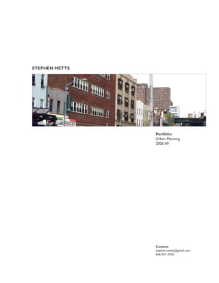
Portfolio
Urban Planning
2006-09
Contact:
stephen.metts@gmail.com
646-957-3929
2. Bronx
New Jersey
ork
wY
Ne
Queens
Brooklyn
Staten
Island
Future Project Overview Future Pedestrian Ramp
Stantec | Thomas Balsley Associates, 2009. Stantec | Thomas Balsley Associates, 2009.
CHATHAM SQUARE | PARK ROW IMPROVEMENT PROJECT CHATHAM SQUARE | PARK ROW IMPROVEMENT PROJECT
DOCUMENT: Environmental Assessment Project Corridor Location
CLIENT: Lower Manhattan Development Corporation
DATE: 2009
PROJECT DESCRIPTION:
Under NEPA- and SEQRA-compliant environmental review processes, an Environmental
Assessment is currently in process and under contract with the Lower Manhattan
Development Corporation.
improvements (two new open spaces, a new pedestrian promenade and a new pedes-
trian ramp), and will serve to mitigate the effects of the One Police Plaza Security Zone
that was established following the events of 9/11 (including the closure of Park Row to
Preliminary Improvement Plan
PROJECT RESPONSIBILITIES:
-Director of graphics production for this Environmental Assessment.
-Lead GIS data developer and project catographer.
Page 2 Stantec | Thomas Balsley Associates, 2009. Page 3
3. Bronx
New Jersey
ork
wY
Ne
Queens
Brooklyn
Staten
Island
Bond Street at Gowanus Canal President Street- West View
GOWANUS CANAL CORRIDOR REZONING AND RELATED ACTIONS GOWANUS CANAL CORRIDOR REZONING AND RELATED ACTIONS
DOCUMENT: Environmental Assessment Statement Projected Development Sites
CLIENT: New York City Department of City Planning
DATE: 2008-09
PROJECT DESCRIPTION:
This New York City Department of Planning rezoning project is designed to revitalize
and infuse an underutilized industrial and manufacturing sector with new zoning districts
allowing for new uses including mixed-use and residential uses. The rezoning area is
comprised of approximately 20 whole and 3 partial blocks in the Gowanus neighborhood,
located in southern Brooklyn.
The proposed project is a zoning map amendment from M1-2 and M2-1 to M1-4/R6B,
M1-4/R7A Inclusionary, R8A/C2-4 Inclusionary and the creation of a Special District for
blocks along the waterfront permitting a mix of uses in an Inclusionary district with a
max FAR of 3.6 in an approximately 25 block area surrounding the northern extent of
the Gowanus Canal. The reasonable worst case development scenario analyzed in the
EIS is comprised of 26 potential developments and 40 projected development sites.
PROJECT RESPONSIBILITIES:
-Lead author of land use, neighborhood character and urban design analysis chapters of
this EIS.
-Lead developer and author of shadow analysis 3-D modeling and resulting shadow
analysis EIS chapter.
-Lead graphics and GIS developer for both scoping documents and EIS.
Shadow Analysis Sites | No Build Projects
Page 4 Page 5
4. Bronx
New Jersey
ork
wY
Ne
Queens
Brooklyn
Staten
Island
Eugenio De Hostos Playground Bartlett Playground
BROADWAY TRIANGLE REZONING AND RELATED ACTIONS BROADWAY TRIANGLE REZONING AND RELATED ACTIONS
DOCUMENT: Environmental Impact Statement Shadow Analysis at Eugenio De Hostos Playground
CLIENT: New York City Department of Housing Preservation & Development
DATE: 2008-09
PROJECT DESCRIPTION:
This comprehensive redevelopment action consists of a nine-block portion of the
Broadway Triangle area located in Williamsburg, Brooklyn, Community District 1.
For years a blighted area of Brooklyn following the movement of many manufacturing and
industrial companies from the area, the Broadway Triangle now stands underutilized with
many vacant buildings and lots.
The Proposed Action includes zoning map amendments to establish new residential and
commercial zoning districts; zoning text amendments to establish Inclusionary Housing in
the Project Area; the disposition of City-owned properties; Urban Development Action
Plan (URP). The reasonable worst case development scenario analyzed in the EIS is
comprised of 3 potential development sites and 34 projected development sites.
PROJECT RESPONSIBILITIES:
-Lead author of land use, urban design and shadow analysis chapters of the EIS document.
-Lead GIS data developer and project catographer.
-Lead Developer of 3-D Shadow Model and Analysis.
-Lead graphics designer for all technical chapters of the EIS document.
Project Noise Contours- Proposed Rezoning Area
Page 6 Page 7
5. Bronx
New Jersey
ork
wY
Ne
Queens
Brooklyn
Staten
Island
Existing Building- Southwest View Existing Building- Northwest View
29-31 BARTLETT STREET REDEVELOPMENT PROJECT 29-31 BARTLETT STREET REDEVELOPMENT PROJECT
DOCUMENT: Environmental Assessment Statement
CLIENT: Ridgewood Bushwick Senior Citizens Council
DATE: 2009 Existing Land Use within 400 Feet of Project Building
PROJECT DESCRIPTION:
building in order to provide 20 units of affordable housing to the surrounding community,
as well as alleviate existing blight.
Utilizing CEQR guidelines, an Environmental Assessment (EA) was prepared for the
requirments for this redevelopent project.
PROJECT RESPONSIBILITIES:
-Director of graphics production for this Environmental Assessment.
-Lead GIS data developer and project catographer.
Page 8 Page 9
6. Bronx
New Jersey
ork
wY
Ne
Queens
Brooklyn
Staten
Island
Land Use Near Meadowlands Land Use Adjacent to Project Alignment
ACCESS TO THE REGION’S CORE TRANSPORTATION PROJECT ACCESS TO THE REGION’S CORE TRANSPORTATION PROJECT
DOCUMENT: Environmental Impact Statement Parkland and Open Spaces Near Proposed Alignment entering Manhattan.
CLIENT: Transit Link Consultants and NJ TRANSIT
DATE: 2008-09
PROJECT DESCRIPTION:
The proposed project would result in the construction and operation of two new Hud-
son River tunnels for commercial trains and the Secaucus Loop which would allow pas-
sengers from destinations in Central and Northern New Jersey and parts of New York
State to enjoy a one-seat ride to midtown Manhattan. In support of Transit Link Consul-
tants and NJ TRANSIT, socioeconomic-related and land use studies were conducted for
this large-scale transportation project EIS.
Project components included mapping and analyzing impacts to potentially vulnerable
wetland resources in the New Jersey Meadowlands as well as impacts to nearby
population, community resources, and parkland, open space, and conservation areas.
PROJECT RESPONSIBILITIES:
-Lead graphics designer and GIS services for the Environmental Impact Statement of this
Large-scale urban transportation project.
Page 10 Page 11
7. Bronx
New Jersey
ork
wY
Ne
Queens
Brooklyn
Staten
Island
Existing Facility Proposed Facility
Terjesen Associates, Architects, 2009.
MORRIS HEIGHTS HEALTH CENTER MORRIS HEIGHTS HEALTH CENTER
DOCUMENT: Environmental Assessment Statement Existing & Proposed Facility Location
CLIENT: Morris Heights Health Center
DATE: 2009
PROJECT DESCRIPTION:
An Environmental Assessment for this approximately 30,000 square foot medical facility
that will be located in the Morris Heights neighborhood of Community District 5 in the
Borough of the Bronx.
The proposed multi-service medical facility will be an addition to the existing Morris
West Burnside Avenue in Bronx, New York. The proposed medical facility is expected
to alleviate the Health Center’s current lack of space and to provide laboratory services,
primary medical care and physical therapy services. The project will be designed to
achieve a Leadership in Energy and Environmental Design (LEED) Silver rating or higher. 3-D Shadow Analysis of Proposed Building
PROJECT RESPONSIBILITIES:
-Director of graphics production for this Environmental Assessment.
-Lead GIS data developer and project catographer.
-Lead Developer of 3-D Shadow Model and Analysis.
Page 12 Page 13
8. Bronx
New Jersey
ork
wY
Ne
Queens
Brooklyn
Staten
Island
24th Street 39th Avenue
DUTCH KILLS REZONING AND RELATED ACTIONS DUTCH KILLS REZONING AND RELATED ACTIONS
DOCUMENT: Environmental Impact Statement Proposed Rezoning Area | Projected Development Sites
CLIENT: New York City Department of Planning
DATE: 2008-07
PROJECT DESCRIPTION:
Dutch Kills is a lively mixed-use residential, commercial and light industrial
community located directly north of the Queensboro Bridge and the Special Long
Island City Mixed-Use District. This rezoning project would encompasses 40 blocks
adjacent to Sunnyside Yards and just north of Queens Plaza and the Long Island
City core. At present, approximately half of all zoning lots in the rezoning area are
resident and mixed-use, and about one-third are in light industrial, wholesale, warehouse
or parking use.
The project includes the rezoning of M1-3D and M1-1 zoning districts to mixed-use
districts was well as a small M1-2 district. Designed to retain the neighborhood fabric of
Dutch Kills as well as encourage Transportation Oriented Developmentnear the Queens 3-D Shadow Analysis of Proposed Building
Plaza transport hub., the new mixed-use districts will infuse new development that
enhances present neighborhood elements.
PROJECT RESPONSIBILITIES:
-Lead author of land use, neighborhood character and urban design analysis chapters
of the EIS.
-Lead developer and author of shadow analysis 3-D modeling and resulting shadow analysis
EIS chapter.
-Lead graphics and GIS developer for the EIS.
Page 14 Page 15
9. Bronx
New Jersey
ork
wY
Ne
Queens
Brooklyn
Staten
Island
Existing Vacant Building Proposed Project Location
CARIBBEAN TRADE CENTER CARIBBEAN TRADE CENTER
DOCUMENT: Environmental Assessment Statement Community Facility Locations near Project
CLIENT: Caribbean American Chamber of Commerce and Industry, Inc. (CACCI)
DATE: 2007-08
PROJECT DESCRIPTION:
Caribbean American Chamber of Commerce and Industry, Inc’s (CACCI) conversion of a
23,000 gross square foot (gsf) abandoned school building into a commercial development
and the development of a pavilion. The proposed project will have three major compo-
nents, a commercial space that will be rented to tenants, administrative space for CACCI,
and the Trade Center Atrium Exhibition Pavilion (the Pavilion).
CACCI, which provides small business support services, anticipates 7,000 visitors to their
conference space for approximately 20 events. Estimated use of the Pavilion includes 12
exhibitions a year; 26 banquet and fund raiser events a year; and 12 outdoor events a
year.
PROJECT RESPONSIBILITIES:
-Lead graphics and GIS developer for this Evironmental Assessment Statement.
Existing and Proposed Building Envelops
Page 16 Page 17
10. Bronx
New Jersey
ork
wY
Ne
Queens
Brooklyn
Staten
Island
East River Waterfront Lower Manhattan Waterfront
ECONOMIC ANALYSIS OF LMDC-FUNDED INITIATIVES ECONOMIC ANALYSIS OF LMDC-FUNDED INITIATIVES
Business Recovery Grant Distribution
DOCUMENT: Economic Analysis Report
CLIENT:
Lower Manhattan, 2006.
Lower Manhattan Development Corporation (LMDC)
DATE: 2006
PROJECT DESCRIPTION:
Berger provided technical support for an economic analysis of Lower Manhattan
Development Corporation (LMDC) funded initiatives. Berger reviewed and mapped the
agency’s use of residential grant program funds, business recovery grant programs and
park improvement funds, among other programs as part of the redevelopment effort for
Lower Manhattan.
Analytical results and mapping were used to prepare documents for the general public
and quarterly reports for the U.S. Housing and Urban Development, a major program
funding agency for grants after 9/11.
Report Components Included:
• Spatial distribution of residential grants and business recovery initiatives.
• Mapping of the location, size, park features and functions, status and value of park improvements.
• Patterns of funding distribution.
PROJECT RESPONSIBILITIES:
-Lead GIS data developer and project catographer.
LMDC Open Space and Parks Initiatives
Page 18 Page 19
11. Bronx
New Jersey
ork
wY
Ne
Queens
Brooklyn
Staten
Island
Zoning at Project Site Project FEMA map
8TH AVENUE VENTILATION PLANT ASSESSMENT 8TH AVENUE VENTILATION PLANT ASSESSMENT
DOCUMENT: Environmental Assessment Statement Site Selection Exploratory Panoramas at 8th Avenue
CLIENT: MTA, New York City Transit
DATE: 2007
PROJECT DESCRIPTION:
An Environmental Assessment under New York State Environmental Quality Review
(SEQR) regarding the development of an underground ventilation facility for the City
subway system in the Theater District portion of Manhattan. Major project issues
quality impacts.
PROJECT RESPONSIBILITIES:
-Graphics designer and lead cartographer for an Environmental Assessment (EA) under
SEQR guidelines
Existing Land Use near Project Site
Page 20 Page 21
12. Bronx
New Jersey
ork
wY
Ne
Queens
Brooklyn
Staten
Island
Future Esplanade Future Waterfront
Wallace, Roberts & Todd Architects, 2009. Wallace, Roberts & Todd Architects, 2009.
SPECIAL STAPLETON WATERFRONT DISTRICT SPECIAL STAPLETON WATERFRONT DISTRICT
DOCUMENT: Environmental Impact Statement Preliminary Waterfront District Plan
CLIENT: New York City Department of Planning
DATE: 2006
PROJECT DESCRIPTION:
In support of the New York City Economic Development Corporation and the
Department of City Planning to redevelop and revitalize the Stapleton neighborhood
waterfront located on the eastern shore of Staten Island, EIS and associated planning
services were made available during the environmental review process for this project.
Redevelopment improvements will include the creation of a 12-acre waterfront
esplanade and park space as well as transit-oriented, mixed-use development in place of
currently underutilized and vacant waterfront facilities. Additionally, the Plan encourages
complimentary private development of parcels west of Stapleton’s Front Street through
the implementation of the Special Stapleton Waterfront Zoning District.
PROJECT RESPONSIBILITIES:
-Lead author of land use, urban design and visual resources EIS chapters.
-GIS data development and lead project cartographer.
-Lead graphics designer for all technical chapters of EIS document.
Page 22 Page 23