Radkarte Teutoburger Wald
•
0 gefällt mir•432 views

Eine Karte mit Radfahrrouten und Zielen in der region des Teutoburger Walds.

Weitere ähnliche Inhalte
Andere mochten auch
Andere mochten auch (18)
Radkarte Teutoburger Wald
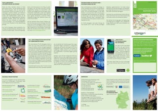
- 1. INTERAKTIVEURLAUBSKARTE TEUTO_NAVIGATOR KOMPAKTINFORMATIONEN www.teutoburgerwald.de „MEIN TEUTO“ - TEUTOBURGER WALD FÜR UNTERWEGS Die „Mein TEUTO“ App bietet ab sofort den ganz persön- lichen 24h-Reiseexperten für die Hosentasche. Mit allen Touren, Sehenswürdigkeiten undUnterkünftenausder On- line-Datenbank des TEUTO_ Navigator, tagesaktuellen Nachrichten, Veran- staltungskalender, Wetteraussichten, interak- tiver Karte und GPS-Ortung im Gelände. Mit dieser App finden Sie auch unterwegs immer die schönsten Ziele und Touren im Teu- to! „MEIN TEUTO“ - TEUTOBURGER WALD FÜR UNTERWEGS Die „Mein TEUTO“ App bietet ab sofort den ganz persön- lichen 24h-Reiseexperten für die Hosentasche. Mit allen Touren, Sehenswürdigkeiten undUnterkünftenausder On- line-Datenbank des TEUTO_ Navigator, tagesaktuellen Nachrichten, Veran- TEUTO_NAVIGATOR – URLAUBSPLANUNG IM INTERNET Planen Sie Ihren nächsten Urlaub im Teuto ganz einfach online - mit der interaktiven Karte des TEUTO_Navigator. Über die komfortable Zoomfunktion können Sie jeden Ort der Ur- laubsregion zwischen Minden und Paderborn sowie Gütersloh und Höxter bereits virtuell er- kunden. Mit Satellitenbildern erleben Sie die Landschaft aus der Vogelperspektive. Wandern, Radfahren, Walken, Skaten oder Motorrad- fahren: Mit einer Vielzahl an erstklassigen Tourenvorschlägen und Sehenswürdigkeiten rund um Ihren Urlaubsort ist für Abwechslung gesorgt! Der TEUTO_Navigator bietet detaillierte Tou- rentipps mit Übersichtskarte, Höhenprofil, Gas- tronomie-Empfehlungen, Übernachtungsange- boten und Sehenswertem am Weg. Zu jeder Tour gibt es ein GPS-Track und einen 3D-Flug. Ausgewählte TopTipps für barrierefreie, wet- terfeste und kindgerechte Einrichtungen sowie individuelle Unterkünfte runden das Angebot ab. Über die Merkzettelfunktion stellen Sie sich Ihren eigenen Reiseplaner zusammen. Bilder, Wikipedia-Einträge oder Webcams lassen sich online hinzuschalten. Auf der Rückseite dieses kleinen Faltplans ge- ben wir Ihnen einen kurzen Einstieg in die Funk- tionen des TEUTO_Navigator. Klicken Sie rein, probieren Sie aus und entdecken Sie die vielfäl- tigen Angebote der Urlaubsregion Teutoburger Wald! Die interaktive Karte finden Sie im Inter- net unter www.teutoburgerwald.de. GPS - SATELLITENGESTÜTZTE NAVIGATION AUF UNBEKANNTEN PFADEN Das Internetportal TEUTO_Navigator bietet zu jeder Tour auch einen GPS-Track für die Nut- zung auf mobilen Outdoor-Navigationsgeräten an, die die Orientierung im Gelände erleichtern. GPS bedeutet „Global Positioning System“ und basiert auf einem Navigationssatellitensystem zur Positionsbestimmung auf der ganzen Welt. Die Track-Dateien stehen im TEUTO_Navigator im gängigen gpx.-Format als download zur Ver- fügung. Mit zusätzlicher Software, die entwe- der mit dem Endgerät mitgeliefert wurde oder frei im Internet verfügbar ist, kann der gewähl- te Track oder sogar gleich mehrere dann auf die Geräte gespielt werden. So komfortabel wie das „Navi“ im Auto sind die Geräte derzeit noch nicht, wohl aber unterstüt- zen sie ideal bei der Orientierung auf den vorge- zeichneten Wegen und Routen in unbekannter Umgebung. Sie besitzen kein eigenes GPS-Emp- fangsgerät? Einige Tourist-Infos und Hotels im Teutoburger Wald verleihen auch GPS-Geräte mit ausgewählten Tourentipps (gegen geringe Gebühr). Übrigens: Auch mit dem integrierten GPS-Emp- fänger des iPhones oder vergleichbarer Android- Geräte kann unterwegs die Standortbestimmung entlang des Streckenverlaufs erfolgen. Die gan- ze Vielfalt an Touren und Ausflugszielen im TEUTO_Navigator bietet die kostenlose App „Mein TEUTO“ mit Kartenfunktion. INFORMATIONEN AUS ERSTER HAND – DIE REDAKTIONEN VOR ORT Über 120 Redakteure erstellen und pflegen im TEUTO_Navigator die touristisch ausgewählten Tourentipps, Informationen zu Sehenswürdig- keiten und Serviceeinrichtungen in fast allen Städten und Gemeinden der Urlaubsregion Teutoburger Wald. Das garantiert von Versmold bis Beverungen und von Bad Wünnenberg bis Stemwede aktuelle Daten, individuelle Tipps und authentische Informationen direkt von den Experten vor Ort! Im TEUTO_Navigator wird jeder Eintrag mit einer Quelle und z.T. auch mit dem jeweiligen Redakteur gekennzeichnet. Sie finden diesen Nachweis am Ende des Eintrages. Die Datenpfle- ge erfolgt dabei dynamisch Schritt für Schritt in den Orten und Kreisen der Region. Vermissen Sie noch bestimmte örtliche Informa- tionen oder kennen Sie noch interessante Punkte und Touren, die wir mit aufnehmen sollten? Wir nehmen Ihre Anregungen und Ergänzungs- vorschläge gerne entgegen unter info@teuto- burgerwald.de oder über unser Infotelefon un- ter 0521 9673325. IMPRESSUM OstWestfalenLippe Marketing GmbH Teutoburger Wald Tourismus V.i.S.d.P.: Herbert Weber, Geschäftsführer Jahnplatz 5, 33602 Bielefeld Tel.: 0521 96733-25 Fax: 0521 96733-19 info@teutoburgerwald.de www.teutoburgerwald.de Redaktion: Heiko Böddeker Bildnachweis: OstWestfalenLippe Marketing GmbH, Torben Conrad, Fotolia Kartengrundlage: © ALPSTEIN Tourismus GmbH & Co. KG (www.alpstein-tourismus.de) © BKG und Vermessungsverwaltungen der Bundesländer (www.bkg.bund.de) 1. Auflage Stand: Juni 2011 Dieses Produkt wurde im Rahmen des Projektes TEUTO_Navigator erstellt und durch die Europä- ische Union sowie das Land Nordrhein-Westfa- len gefördert. URLAUBSREGION TEUTOBURGER WALD Lage in Deutschland REGIONALE PROJEKTPARTNER Der TEUTO_Navigator wird als Gemeinschafts- projekt der Urlaubsregion Teutoburger Wald durch folgende Partner unterstützt: Bielefeld Marketing GmbH www.bielefeld.de GfW im Kreis Höxter mbH www.kulturland.org Lippe Tourismus & Marketing AG www.land-des-hermann.de Mühlenkreis Minden-Lübbecke www.muehlenkreis.de pro Wirtschaft GT GmbH www.pro-wirtschaft.de Touristikzentrale Paderborner Land e.V. www.paderborner-land.de Touristikgemeinschaft Wittekindsland e.V. www.wittekindsland.de Teutoburger Wald Tourismus www.teutoburgerwald.de AKTUELLE URLAUBSINFORMATIONEN Spannende Neuigkeiten aus der Urlaubsregion Teutoburger Wald, Veranstaltungshinweise und Tipps zum TEUTO_Navigator auch auf Face- book, Twitter oder in unserem Urlaubsblog. www.facebook.com/TEUTO.Navigator www.facebook.com/teutoburgerwald www.twitter.com/teutoburgerwald www.teuto.over-blog.de Tipps für einen erlebnisreichen Urlaub im Teutoburger Wald - mit freundlicher Empfehlung von:
- 2. AKTION: 3D FLUG Erleben Sie unsere Touren aus der Vogelpers- pektive! Die Funktion „3D Flug“ finden Sie in jedem Tourensteckbrief neben dem Titelbild in der Aktionsliste. Grundvoraussetzung für den 3D Flug ist das Google Earth-Browser- Plugin, das im TEUTO_Navigator kostenlos angeboten wird. Nach Installation des Plug- ins ist im Kartenbereich die 3D Ansicht ver- fügbar und kürzere Touren lassen sich in be- wegten dreidimensionalen Bildern ansehen. Bei längeren Touren ist diese Anwendung allerdings nur eingeschränkt nutzbar. AKTION: TOUR DRUCKEN Eine Tour können Sie nicht nur online betrach- ten, sondern auch mit allen Informationen in einen pdf-Tourensteckbrief inklusive Karte umwandeln und kostenfrei als Ausdruck mit- nehmen. Zum Tourexport stehen drei Vari- anten zur Verfügung, die vom kompletten Steckbrief über eine nutzbare Streckenkarte bis zur groben Übersichtskarte reichen. Dabei ergeben sich die verschiedenen, auswählba- ren Kartenmaßstäbe aus der Länge der Tour. AKTION: MERKEN Alle Punkte und Touren, die Sie im TEUTO_ Navigator interessieren, können Sie über die „merken“-Funktion auf Ihren Merkzettel set- zen. Damit erstellen Sie sich aus der Menge der Informationen Ihren persönlichen Reise- führer Teutoburger Wald. In der Fußzeile des TEUTO_Navigator haben Sie direkten Zugriff auf den Merkzettel. Als Community-Mitglied wird der Merkzettel in Ihrem Account gespei- chert und kann dort immer wieder aufgeru- fen werden. AKTION: GPS-TRACK DOWNLOAD Zu jeder Tour bietet der TEUTO_Navigator auch einen kostenlosen GPS-Track für die Na- vigationimGelände.NacheinemKlickaufdas Symbol oder den Schriftzug „GPS-Track“ im Aktionsfeld bzw. am Ende des Tourensteck- briefes, öffnet sich ein Downloadfenster. Speichern Sie die Datei in einem beliebigen Verzeichnis auf Ihrem PC. Die Track-Datei ist jetzt im .gpx-Format für andere Programme verfügbar und kann auf das GPS-Gerät über- spielt werden. Wahlweise lassen sich auch die Koordinatenpunkte (Waypoints) der Se- henswürdigkeiten am Weg mit herunterladen. AKTION: ANFAHRT PLANEN Der Anfahrtsplaner steht Ihnen am Ende je- desSteckbriefeszurVerfügung.DerAusgangs- punkt der gewählten Tour bzw. die Adresse der Sehenswürdigkeit ist als Zielpunkt der An- fahrtvoreingestellt,sodassSienurnochIhren individuellenStartpunktergänzenmüssen.In- formationen zu den Parkmöglichkeiten sind im Steckbrief textlich erläutert. Zu den Se- henswürdigkeiten steht zusätzlich ein ÖPNV- Auskunftsservice zum nächstgelegenen Bahn- und Bushalt zur Verfügung. AKTION: COMMUNITY Alle Touren, Sehenswürdigkeiten und Unter- künfte im TEUTO_Navigator können durch Sie bewertet und kommentiert werden. Tei- len Sie Ihre Erfahrungen mit anderen Wande- rern,RadfahrernoderMotorradfahrern,laden Sie Ihre Bilder zur Tour hoch und geben Sie hilfreiche Tipps. Um diese Funktion nutzen zu können, ist eine kostenlose Registrierung in der outdooractive.com-Community nötig. Wahlweise können Sie sich auch über Ihren bestehenden Facebook-Account anmelden. Wir freuen uns auf Ihre Berichte! TEUTO_Navigator - Urlaubsplanung im Internet TOUREN Wandern, Radeln, Skaten oder Paddeln – die schönsten Tourentipps aus der Region als übersichtlicher Steckbrief! KATEGORIEN Ausflugsziele und Servicepunkte – hilfreiche und spannende Informationen im Überblick! TOP TIPPS Barrierefrei, kindgerecht oder wetterfest – ausgewählte redaktionelle Tipps für Ihren Urlaub! UNTERKÜNFTE Wohnmobilstellplatz, Ferienwohnung oder First Class Hotel – finden Sie die passende Unterkunft! INTERAKTIVE KARTE Zoomfähige Karte mit vielen zusätzlichen Inhalten – voll routingfähig und einfach zu bedienen!