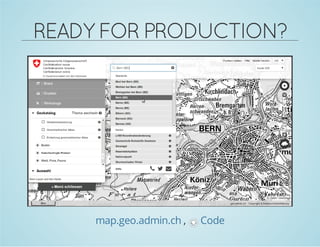
Das Dokument bietet eine Einführung in OpenLayers 3, eine weit verbreitete JavaScript-Bibliothek für dynamische Kartenanwendungen. Es beschreibt die neuesten technischen Highlights, zum Beispiel die vollständige Neuausrichtung der Software zur Unterstützung moderner Webtechnologien und die Einführungen von Funktionen wie Drag-and-Drop sowie die Implementierung von API-Entwicklungen für verbesserte Performance. Es wird auch auf die zukünftigen Entwicklungen und Möglichkeiten zur Zusammenarbeit im Open-Source-Bereich eingegangen.


![… kompiliert:
CLOSURECOMPILER
ol.format.XMLFeature.prototype.readFeatures = function(source) {
if (ol.xml.isDocument(source)) {
return this.readFeaturesFromDocument(/** @type {Document} */ (source));
} else if (ol.xml.isNode(source)) {
return this.readFeaturesFromNode(/** @type {Node} */ (source));
} else if (goog.isString(source)) {
var doc = ol.xml.load(source);
return this.readFeaturesFromDocument(doc);
} else {
goog.asserts.fail();
return [];
}
};
l.Ga=function(a){return Kn(a)?fo(this,a):Nn(a)?this.$b(a):la(a)?(a=Rn(a),fo(this,a)):[]};](https://image.slidesharecdn.com/jansen-hocevar-openlayers3-fossgis2014-final-140324055801-phpapp01/85/OpenLayers-3-Einfuhrung-Verwendungsbeispiele-und-technische-Highlights-16-320.jpg)


![CODE
varmap=newol.Map({
layers:[
newol.layer.Tile({
source:newol.source.OSM()
})
],
target:'map',
view:newol.View2D({
center:[0,0],
zoom:2
})
});](https://image.slidesharecdn.com/jansen-hocevar-openlayers3-fossgis2014-final-140324055801-phpapp01/85/OpenLayers-3-Einfuhrung-Verwendungsbeispiele-und-technische-Highlights-22-320.jpg)


![CODE
varvectorSource=newol.source.IGC({
urls:[
'data/igc/ClementLatour.igc'//etc.
]
});
varstyleFunction=function(feature,resolution){
//...
returnstyleArray;
};
varlayer=newol.layer.Vector({
source:vectorSource,
styleFunction:styleFunction
});](https://image.slidesharecdn.com/jansen-hocevar-openlayers3-fossgis2014-final-140324055801-phpapp01/85/OpenLayers-3-Einfuhrung-Verwendungsbeispiele-und-technische-Highlights-26-320.jpg)

![CODE1
//ErzeugungeinerspezifischenInteraktion:
vardragAndDropInteraction=newol.interaction.DragAndDrop({
formatConstructors:[
ol.format.GPX,
ol.format.GeoJSON//..
]
});
//ErweiternderStandardinteraktionen&
//ErzeugungderKartemitdenInteraktionen
varinteractions=ol.interaction.defaults();
varmap=newol.Map({
interactions:interactions.extend([dragNDropInteraction]),
//...
}](https://image.slidesharecdn.com/jansen-hocevar-openlayers3-fossgis2014-final-140324055801-phpapp01/85/OpenLayers-3-Einfuhrung-Verwendungsbeispiele-und-technische-Highlights-28-320.jpg)


![PRE-/POSTCOMPOSEAPI
//ClippingvordemRendern
imagery.on('precompose',function(event){
varctx=event.context;
ctx.save();
ctx.beginPath();
if(mousePosition){
//nurdenUmkreisdesMauscursorszeigen
ctx.arc(mousePosition[0],mousePosition[1],radius,0,2*Math.PI);
ctx.lineWidth=5;
ctx.strokeStyle='rgba(0,0,0,0.5)';
ctx.stroke();
}
ctx.clip();
});
//AufräumennachdemRendern
imagery.on('postcompose',function(event){
varctx=event.context;
ctx.restore();
});](https://image.slidesharecdn.com/jansen-hocevar-openlayers3-fossgis2014-final-140324055801-phpapp01/85/OpenLayers-3-Einfuhrung-Verwendungsbeispiele-und-technische-Highlights-36-320.jpg)