
Empfohlen
Weitere ähnliche Inhalte
Was ist angesagt?
Was ist angesagt? (20)
Ähnlich wie GPS Survey Basics and Applications
Ähnlich wie GPS Survey Basics and Applications (20)
Kürzlich hochgeladen
Kürzlich hochgeladen (20)
GPS Survey Basics and Applications
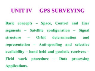
- 1. UNIT IV GPS SURVEYING Basic concepts – Space, Control and User segments – Satellite configuration – Signal structure – Orbit determination and representation – Anti-spoofing and selective availability – hand held and geodetic receivers – Field work procedure – Data processing Applications.
- 2. Introduction… • The Global Positioning System (GPS) is a satellite-based navigation and surveying system for determination of precise position and time, using radio signals from the satellites, in real-time or in post-processing mode. • GPS is being used all over the world for numerous navigational and positioning applications, including navigation on land, in air and on sea, determining the precise coordinates of important geographical features as an essential input to mapping and Geographical Information System (GIS), along with its use for precise cadastral surveys, vehicle guidance in cities and on highways using GPS-GIS integrated systems, earthquake and landslide monitoring, etc.,
- 3. Before & Now… • The Navigation Satellite Timing and Ranging Global Positioning System (NAVSTAR GPS) developed by the U.S. Department of Defense (DoD) to replace the TRANSIT Navy Navigation Satellite System (NNSS) by mid-90’s, is an all-weather high accuracy radio navigation and positioning system which has revolutionized the fields of modern surveying, navigation and mapping. • For every day surveying, GPS has become a highly competitive technique to the terrestrial surveying methods using theodolites and EDMs; whereas in geodetic fields, GPS is likely to replace most techniques currently in use for determining precise horizontal positions of points more than few tens of km apart.
- 4. Before & Now… • The GPS, which consists of 24 satellites in near circular orbits at about 20,200 Km altitude, now provides full coverage with signals from minimum 4 satellites available to the user, at any place on the Earth. • By receiving signals transmitted by minimum 4 satellites simultaneously, the observer can determine this geometric position (latitude, longitude and height), Coordinated Universal Time (UTC) and velocity vectors with higher accuracy, economy and in less time compared to any other technique available today.
- 5. Before, Now & Future… • These advantages over the conventional techniques, and the economy of operations make GPS the most promising surveying technique of the future. • With the well-established high accuracy achievable with GPS in positioning of points separated by few hundreds of meters to hundreds of km, this unique surveying technique has found important applications in diverse fields. • In India also, GPS is being used for numerous applications in diverse fields like aircraft and ship navigation, surveying, geodetic control networks, crustal deformation studies, cadastral surveys, creation of GIS databases, time service, etc., by various organisations.
- 7. Historical Background • The TRANSIT NNSS - the satellite navigation system operational prior to GPS, was launched in 1958 by the U.S. Navy. • It became operational in 1964 and was made available to civilian users in 1967. • The system, comprising 5 satellites at 1075 km altitude, was phased out in the early 90s. • This system has now been replaced by the NAVSTAR GPS in an extensive multibillion dollars project launched in 1972 as a Joint Services Program of U.S. Air Force, Navy, Army, Marines and Defence Mapping Agency; in three phases. The GPS system became fully operational and available to the commercial users by early 90s.
- 8. GPS Segments • The Global Positioning System basically consists of three segments: SPACE SEGMENT CONTROL SEGMENT USER SEGMENT
- 9. Space Segments • The Space Segment contains 24 satellites, in 12-hour near- circular orbits at altitude of about 20000 km, with inclination of orbit 55°. • The constellation ensures at least 4 satellites in view from any point on the earth at any time for 3-D positioning and navigation on world-wide basis. • The three axis controlled, earth-pointing satellites continuously transmit navigation and system data comprising predicted satellite ephemeris, clock error etc., on dual frequency L1 and L2 bands • The current GPS constellation consists of 29 Block II/IIA/IIR/IIR- M satellites. The first Block II satellite was launched in February 1989.
- 11. Control Segments • This has a Master Control Station (MCS), few Monitor Stations (MSs) and an Up-Load Station (ULS). • The MSs are transportable shelters with receivers and computers; all located in U.S.A., which passively track satellites, accumulating ranging data from navigation signals. • Future navigation messages are generated from this and loaded into satellite memory once a day via ULS which has a parabolic antenna, a transmitter and a computer. Thus, role of Control Segment is: • To estimate satellite [space vehicle (SV)] ephemerides and atomic clock behaviour. • To predict SV positions and clock drifts. • To upload this data to SVs.
- 13. User Segments • The user equipment consists of an antenna, a receiver, a data- processor with software and a control/display unit. • The GPS receiver measures the pseudo range, phase and other data using navigation signals from minimum 4 satellites and computes the 3-D position, velocity and system time. • The position is in geocentric coordinates in the basic reference coordinate system: World Geodetic reference System 1984 (WGS 84), which are converted and displayed as geographic, UTM, grid, or any other type of coordinates. • Corrections like delay due to ionosphere and tropospheric refraction, clock errors, etc. are also computed and applied by the user equipment / processing software.
- 16. Biases and Errors • Satellite Dependent • Orbit representation biases • Satellite clock model biases • Station Dependent • Receiver clock biases • Station Coordinates • Observation Dependent • Ionospheric delay • Tropospheric delay • Carrier phase ambiguity
- 17. Features of GPS Satellites • Design Life: 5 years (with expendables stored for 7 years) • On orbit weight: 430 kg and End-of-life power: 400 W • Power Source: 5m2 solar arrays tracking the sun and 3 Ni-cd batteries for eclipse • 3 axis stablished, earth pointing satellites • Navigation Pay Load: Pseudo Random Noise (PRN) signal assembly, atomic frequency standard - Cesium beam atomic Clocks accurate to 10-14 sec, processor and L band antenna • Codes: • Precision (P) Code: Generated at GPS clock frequency of 10.23 MHz (equivalent to 30 m in range) interpolated to sub-meter level. Repeats itself after 267 days, resolution = 100 nanoseconds. • Coarse Acquisition (C/A) Code: Code sequence frequency of 1.023 MHz (range 300 m) interpolated to few m. Repeats itself every 1 millisecond, resolution = 1 micro second
- 18. Biases Satellite Station Biases Observation Dependent Biases The satellite is not where the GPS broadcast message says it is. Receiver clock time differs from satellite clock time. Those associated with signal propagation The satellite clocks are not perfectly synchronized with GPS time. Uncertainties in the coordinates of the station. Time transfer and orbital tracking.
- 19. Errors Residual Biases Cycle Slips Multipath Antenna Phase Center Movement Random Observation Error
- 20. Errors • In addition to biases factors effecting position and/or time determined by GPS is dependant upon: • The geometric strength of the satellite configuration being observed (DOP). • Remnants from the biases after the major effects have been modeled out. • Errors affecting the measurements themselves
- 21. Dilution of Precision (DOP) •HDOP: for horizontal positioning •VDOP: for vertical positioning •PDOP: for 3D positioning •TDOP: for time determination
- 22. Advantages • It helps to survey with many times greater Precision. • It helps to complete a Survey with lesser time and thus helps to cut down the Completion Period. • It Reduces the difficulty of taking manual measurements to great extent. • With GPS there is a very less chances of error. • And this error may come only due to the Instrument malfunction
- 23. Disadvantages • The main Disadvantage is that, it requires high initial investments. • To conduct such High End Survey works and to operate such Electronic Equipments much skilled persons are required.
- 24. Disadvantages • The main Disadvantage is that, it requires high initial investments. • To conduct such High End Survey works and to operate such Electronic Equipments much skilled persons are required.
- 25. GPS Signal Structure • Fundamental Frequency • fo = 10.23 MHz • Carriers • L1 = 154 (fo) = 1575.42 MHz λ = 19cm • L2 = 120 (fo) = 1227.60 MHz λ = 24cm • Both carriers carry the broadcast satellite message, a low frequency stream of data designed to inform the user about the health and position of the satellite.
- 26. GPS Signal Structure • Pseudo Random Noise (PRN) Codes • C/A (coarse/acquisition) code and L1 carrier • Repeated every millisecond • Emitted at frequency 1.023 MHz • Wavelength = 300m. • P (precise) code • L1 and L2 carriers • Repeated every 267 days chopped into 38 seven day segments, 32 of which each are assigned to a different satellite • Emitted at frequency 10.23 MHz • Wavelength = 30m • Y code • Similar to P code, with secret generating equation • L1 and L2 carriers
- 27. Observation Types • Pseudo Range Observable (uses PRN codes) • The pseudo range is a measure of the distance between the satellite and the receiver at epochs of transmission and reception of the signals. • Carrier Phase Observable (uses carrier frequencies) • The carrier phase observable is the difference between the phase of the carrier signal of the satellite, measured at the receiver, and the phase of the local oscillator within the receiver at the epoch of measurement.
- 31. Absolute v. Relative Positioning • Absolute Positioning: • The position of a single point is directly determined. • Relative Positioning: • Two receivers are used simultaneously to observe satellite signals. • The vector (dx, dy, dz) joining the two receivers is computed. • The position of one point is determined relative to the other point.
- 33. Linear Combinations of Observations • Single Difference: • Takes away some noise and clock bias • Between Receiver => Satellite clock bias • Between Satellite => Receiver clock bias • Between Epochs => Change of phase between two epochs
- 34. Linear Combinations of Observations • Double Difference: • Receiver-Time => the change from one epoch to the next in the between receiver single difference for the same satellite. • Allows for easier editing of cycle slips • Receiver-Satellite => Two receivers and two satellites at the same epoch • Removes or greatly reduces the effects of: • Receiver clock errors • Satellite clock errors
- 35. Linear Combinations of Observations • Triple Difference: • Receiver-Time => change in a receiver-satellite double difference from one epoch to the next. • Cycle ambiguity terms cancel allowing easier automatic editing of cycle slips. • Most common approach is to difference: • Between two receivers • Between two satellites • Between two epochs
- 36. Ephemerides • Ephemeris data is a set of parameters that can be used to accurately calculate the location of a GPS satellite at a particular point in time. • It describes the path that the satellite is following as it orbits Earth. • Broadcast: Included with the satellite message, based upon a least squared forecast, subject to degradation. • Precise: Based upon actual observation, available after observations made.
- 37. GPS Field Procedures • Static • Traditional Static • Rapid Static • Re-occupation (pseudo-kinematic) • Kinematic • Stop and Go • Traditional Kinematic • Real Time Differential (RTK)
- 38. Traditional Static Survey • Method: • Base receiver (single or dual frequency) set over point of known (X,Y,Z) coordinates. • Additional receiver(s) placed over permanent station(s) to be positioned. • Observation times vary from 1 hour to several days depending upon accuracy required, length of vectors, satellite geometry, atmospheric conditions. • Post processing required. • Uses: • Long lines for geodetic control • Control densification • Precise engineering surveys
- 39. Rapid Static Survey • Method • Uses dual frequency receivers over short (<15 km) lines. • Base station set over known point (X,Y,Z) • Rover moves from station to station with pole mounted antenna (no need to maintain lock). • Observation times of 5 to 10 minutes are typical. • Accuracies of a few millimeters achievable. • Requires post processing.
- 40. Re-occupation Survey • Re-occupation Survey (pseudo-kinematic) • Method • Base station established on known (X,Y,Z) point. • Rovers (pole mounted) occupy remote stations for relatively short periods of time (10-15 minutes) • Remote stations are re-occupied when satellite geometry has changed (> 1 hour). • Solution can be strengthened by setting base station over second know point during re-occupation. • Useful when less than ideal number of satellites are available or when GDOP is weak. • Single or dual frequency receivers. • Post processing required.
- 41. Stop and Go Survey • Both base and rover receivers occupy known points less than 10km distant until ambiguities are resolved (5-10 minutes) • Alternatively a short baseline (antenna cable length) with one known position can be used and the technique of “antenna swapping” employed to resolve ambiguities. • With the base station in static mode the rover moves to position all detail points. • Satellite lock must be maintained ! Post processing required
- 42. Traditional Kinematic Survey • Computes the relative differential position at preset time intervals instead of at operator selected points. • Satellite lock must be maintained or must be reestablished when lost • Used for road profiling, ship and aircraft positioning.
- 43. Real Time Differential GPS (RTK) • Combines GPS receivers, mobile data communications, onboard data processing, onboard applications software. • Base station receiver processes baseline corrections and broadcasts the corrections to any number of rovers via radio transmissions. • Solution instantaneous with no post processing required.
- 44. Real Time Differential GPS (RTK)
- 45. Ellipsoids
- 47. Datums
- 48. Datums • A datum is a framework that enables us to define coordinate systems. • The framework includes the ellipsoid and other parameters. • The way a datum is defined has changed with the improvement of measurement techniques through technology.
- 49. Geodetic Coordinate Systems Longitude, Latitude, Height
- 50. GPS Heights
- 51. GPS Heights • The geoid approximates mean sea level. • The shape of the ellipsoid was calculated based on the hypothetical equi-potential gravitational surface. • A significant difference exists between this mathematical model and the real object. • However, even the most mathematically sophisticated geoid can only approximate the real shape of the earth.
- 52. GPS Heights • The accuracy of GPS height measurements depends on several factors but the most crucial one is the "imperfection" of the earth's shape. • Height can be measured in two ways. The GPS uses height (h) above the reference ellipsoid that approximates the earth's surface. • The traditional, orthometric height (H) is the height above an imaginary surface called the geoid, which is determined by the earth's gravity and approximated by MSL. • The signed difference between the two heights—the difference between the ellipsoid and geoid—is the geoid height (N).
- 53. Geoid Models
- 54. Vertical Datums • Until 1991 the official datum in the United States was the National Geodetic Vertical Datum of 1929 (NGVD29). • The current datum is the North American Vertical Datum of 1988 (NAVD88).
- 55. NAVD 88 • Primary tidal benchmark is Father Point, Rimouski, Quebec. • Contains leveling from the United States, Canada, Mexico, and includes the International Great Lakes Datum of 1985 (IGLD85) • Differences between NGVD29 and NAVD88 in the continental United States ranges from -0.040m to 1.50m.
- 57. GPS Mission Planning • Purpose of Survey • Horizontal and Vertical Accuracy Requirements • Equipment Selection • Point Selection • Satellite Availability and Geometry • Site Reconnaissance • Surveying Scheme
- 58. Point Selection
- 62. Dilution of Precision (DOP)
- 63. Network Design • Loops (i.e. traverses) made from GPS baseline observations provide the mechanism for performing field data validation as well as final adjustment accuracy analysis • Loops must not include trivial baselines. • Design loops to meet closure requirements. • Keep within the limits of your control. • Avoid radial spurs at all costs. These contribute nothing and are impossible to assess qualitatively.
- 64. Surveying Scheme • Independent Baselines • Number of Baselines per session = n(n-1)/2 • Independent Baselines per session = n-1 • where n = number of receivers deployed • Example: • 4 receivers deployed simultaneously • Number of Baselines = 4(4-1)/2 = 6 Baselines • Independent Baselines = 4-1 = 3 independent (non-trivial) baselines
- 65. Surveying Scheme
- 66. Surveying Scheme
- 67. Surveying Scheme • Finding the Number of Sessions S = (m*n)/r + [(m*n)(p-1)]/r +(k*m) • S = the number of observing sessions • R = the number of receivers • m = the total number of stations involved • n = planned redundancy • p = production factor (varies by firm. • Typical is 1.1) k = safety factor (0.1 w/in 100 km of home base, 0.2 otherwise)
- 68. Network Adjustment • After all the baselines have been processed and their reliabilities verified, they are adjusted within the framework of a network using least squares. • Minimally constrained adjustment: One point held fixed with all other stations adjusted relative to it. • Determines the quality of the observations. • Constrained: Determines the quality of control.
- 69. Present Status • The GPS satellite constellation is now complete, with 24 satellites in operation and replacement satellites being launched regularly. • Thus, a minimum of 4 (upto 6-8 in most cases) satellites are visible at any time from any place on the earth, to enable the observer to obtain his 3-D position in real-time. • The selective availability (SA) - intentional degradation of the accuracy of the time and position information being transmitted by the satellites, was in operation, which restricted the accuracy of the absolute position obtained from the satellite to about 100 metres in real-time. • This has recently been switched off by a US Presidential directive of 1st May, 2000, thus enabling the user to get absolute position accurate to about 15-20 m.
- 70. Present Status • However, for surveying applications, by getting the precise position of the GPS satellites from tracking data, and using relative mode, it is possible to improve this accuracy in post-processing mode to at least few centimetres, even when the SA is operative. • The anti-spoofing (AS) - denial of P code to the international users, has also been made operational since early 90s; however, its effect on the accuracy of positioning in post-processing made is not significant.
- 71. Accuracies with GPS and Comparison with other Techniques • GPS is the first positioning system to offer very high accuracy in most surveying and navigational applications at very low cost and with high efficiency. Accuracies now routinely achieved in measurement of baseline lengths in relative mode, using high precision Geodetic instrumentation, with many hours of observations and scientific data processing, are as follows: • 0.1 - 4 mm in Local surveys (10 m-100 km baseline lengths) • 4-10 mm in Regional surveys (100-1000 km baseline lengths) • 1-2 cm in Global surveys (1000-10000 km baseline lengths) • Such high accuracy standards make GPS suitable for various types of applications as compared to the limited range of applications of other positioning systems like terrestrial surveying techniques, Inertial Navigation System (INS), Satellite Laser Ranging (SLR), Very Long Base Line Interferometry (VLBI), etc.
- 72. Surveying with GPS • Within the span of few years of its operation, GPS has truly revolutionised the field of surveying, with its potential to replace many conventional surveying techniques in use today. • The different methods of surveying with GPS will be briefly described here, along with a review of GPS instrumentation and method of computation of geodetic and map coordinates from the GPS observations.
- 73. Methods of Observations Absolute Positioning Relative Positioning Differential GPS Kinematic GPS
- 74. Absolute Positioning • In the absolute positioning mode, the absolute coordinates of the antenna position are determined using single GPS receiver, by a method similar to the resection method used in plane tabling. • The pseudo ranges from minimum four satellites are observed at the given epoch, from which the four unknown parameters - the 3-D position of the antenna (x, y, z) and the receiver clock error can be determined. • The accuracy of the position obtained from this method depends upon the accuracy of the time and position messages received from the satellites. • With the selective availability operational, the accuracy of absolute positioning in real-time was limited to about 100 metres, which has now improved to a about 10 to 20 metres, since the SA is switched-off. • The accuracy of absolute positioning with GPS is limited mainly due to the high orbit of the satellites. However, very few applications require absolute position in real time.
- 75. Relative Positioning • In the translocation mode with two or more GPS receivers observing the same satellites simultaneously, many common errors, including the major effect of SA get cancelled out, yielding the relative positions of the two or more observing stations to a very high level of accuracy. • The length of the baseline between two stations, and also the absolute position of one of the stations, if accurate position of the other station is known, can be obtained to cmlevel accuracy, using carrier phase observations. • Use of dual frequency observations (both L1 and L2 frequencies) eliminates the major part of ionospheric effect on the signal, thus improving the accuracy of positioning. • With accurate satellite orbit information, and use of such refined data-processing and modelling techniques, few mm to cmlevel accuracy is possible even in regional or global scale surveys.
- 76. Differential GPS • A modification of the relative positioning method is the differential GPS (DGPS) technique, where one of the two receivers observing simultaneously is equipped with a transmitter and other receiver(s) can receive the messages given by this transmitter. • The transmitting receiver is kept fixed on a point whose location is known to high degree of accuracy. • Based upon this position, the receiver computes corrections to the range/phase observations from a GPS satellite, and transmits them to the other receiver, which can apply these corrections to improve the accuracy of its own position computed from GPS observations. • Such a system is suited for applications such as vehicle guidance system, locating fishing boats close to the seashore, etc. T • he limited range of the transmitter restricts the use of such system to few km. • However, satellite-based DGPS services, now commercially available, remove these restrictions on the DGPS technique, making possible Wide Area DGPS.
- 77. Kinematic GPS • In the Kinematic GPS technique, one of the receivers is in relative motion with respect to the other receiver, having been mounted either on a vehicle, ship or aircraft. • Even with the difficulties encountered in obtaining the constantly changing position of the moving receiver, the method also offers some advantages over static surveying, including the ease with which the ambiguity resolution (estimating the whole number of wavelengths in the phase observable) can be done. • This technique has a number of important applications, including ship and aircraftnavigation, photogrammetric survey control, et
- 79. Computation of coordinates Computation of coordinates Transformation from global to datum Geodetic Coordinates to Map Coordinates GPS & MSL Heights